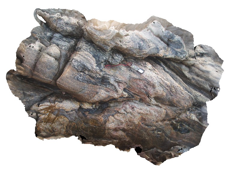
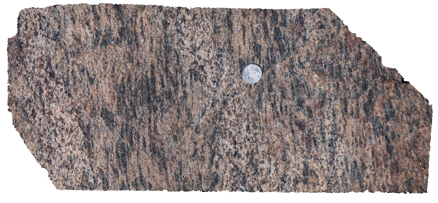
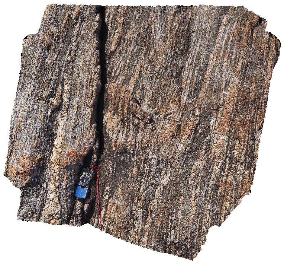
SugarloafRock1 Map
 |
0 |
05/15/2016 noon |
3D |
tightly folded, mixed gneiss and pegmatite. Sugarloaf Rock, Cape Naturaliste. W.A. This unit may also be known as Neoproterozoic granites 76645. |
2.00 |
-33.56073000000 |
115.00566000000 |
-9999.000 |
tight folding, metamorphics |
gneiss |
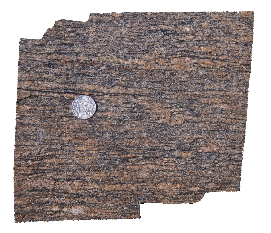
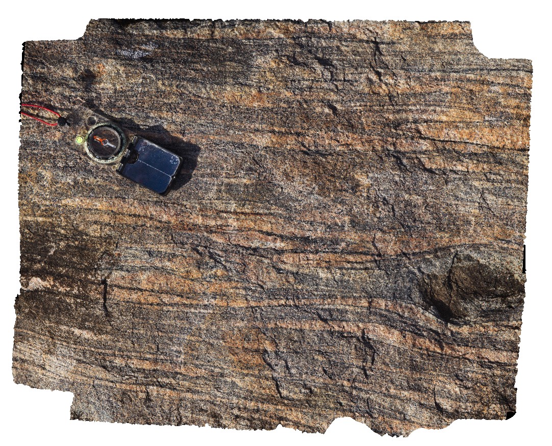
BunkerBay1 Map
 |
5 |
05/15/2016 noon |
3D |
folded foliation in gneiss with mineral stretching lineation on foliation surface at the east end of outcrop. Bunker Bay, Cape Naturaliste. W.A. This unit may also be known as high grade metamorphic rocks 74341 |
5.00 |
-33.53685000000 |
115.03130000000 |
-9999.000 |
fold, foliation, gneiss, structure, mineral lineation |
gneiss |
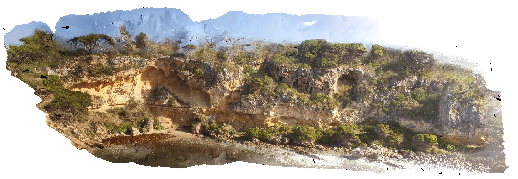
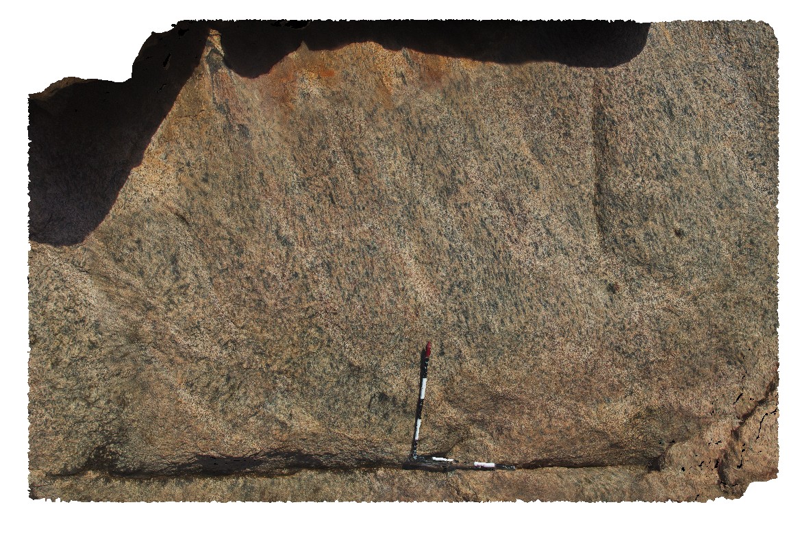
BunkerBayUAV1 Map
 |
0 |
05/15/2016 noon |
UAV |
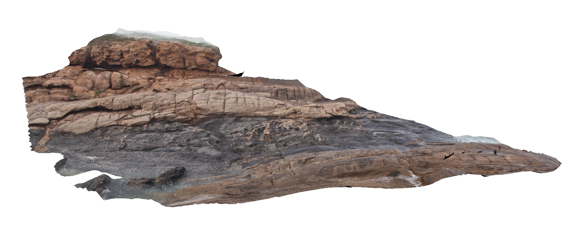
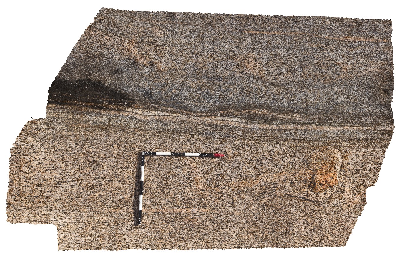
unconformity between basement gneiss and Tamala Limestone. Bunker Bay, Cape Naturaliste. W.A. gneiss unit may also be known as high grade metamorphic rocks 74341 |
50.00 |
-33.53685000000 |
115.03130000000 |
-9999.000 |
geological unconformity, gneiss, Tamala Limestone |
gneiss, limestone |
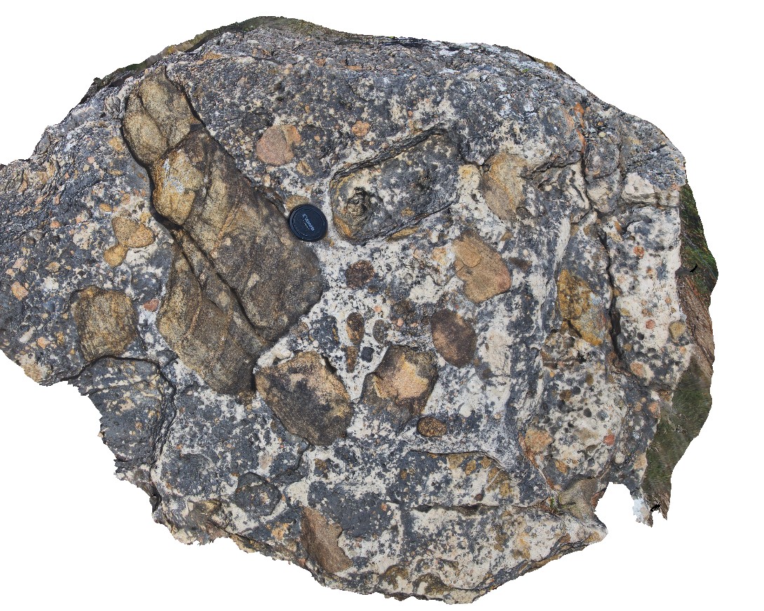
BunkerBay2 Map
 |
5 |
05/15/2016 noon |
3D |
boulder of carbonate-cemented conglomerate / breccia from Tamala Limestone / gneiss basement unconformity with gneiss clasts. Bunker Bay, Cape Naturaliste. W.A. This unit may also be known as high grade metamorphic rocks 74341 |
1.20 |
-33.53728000000 |
115.03139000000 |
-9999.000 |
geological unconformity, Tamala Limestone, gneiss basement, conglomerate |
conglomerate |
BunkerBay4 Map
 |
0 |
05/15/2016 noon |
3D |
detailed view of mineral stretching lineation from site Bunkerbay3, showing aligned mafic minerals. Bunker Bay, Cape Naturaliste. W.A. This unit may also be known as high grade metamorphic rocks 74341 |
0.60 |
-33.53747000000 |
115.03257000000 |
-9999.000 |
mineral stretching lineation, structure, foliation, gneiss |
gneiss |
BunkerBay3 Map
 |
0 |
05/15/2016 noon |
3D |
mineral stretching lineation on irregular north-dipping foliation surface in gneiss. Bunker Bay, Cape Naturaliste. W.A. This unit may also be known as high grade metamorphic rocks 74341 |
3.50 |
-33.53747000000 |
115.03257000000 |
-9999.000 |
mineral stretching lineation, foliation, gneiss, structure |
gneiss |
BunkerBay5 Map
 |
0 |
05/15/2016 noon |
3D |
detailed view of foliation in gneiss showing sheared augen. Bunker Bay, Cape Naturaliste. W.A. This unit may also be known as high grade metamorphic rocks 74341 |
0.25 |
-33.53761000000 |
115.03266000000 |
-9999.000 |
augen, gneiss, shearing, structure |
gneiss |
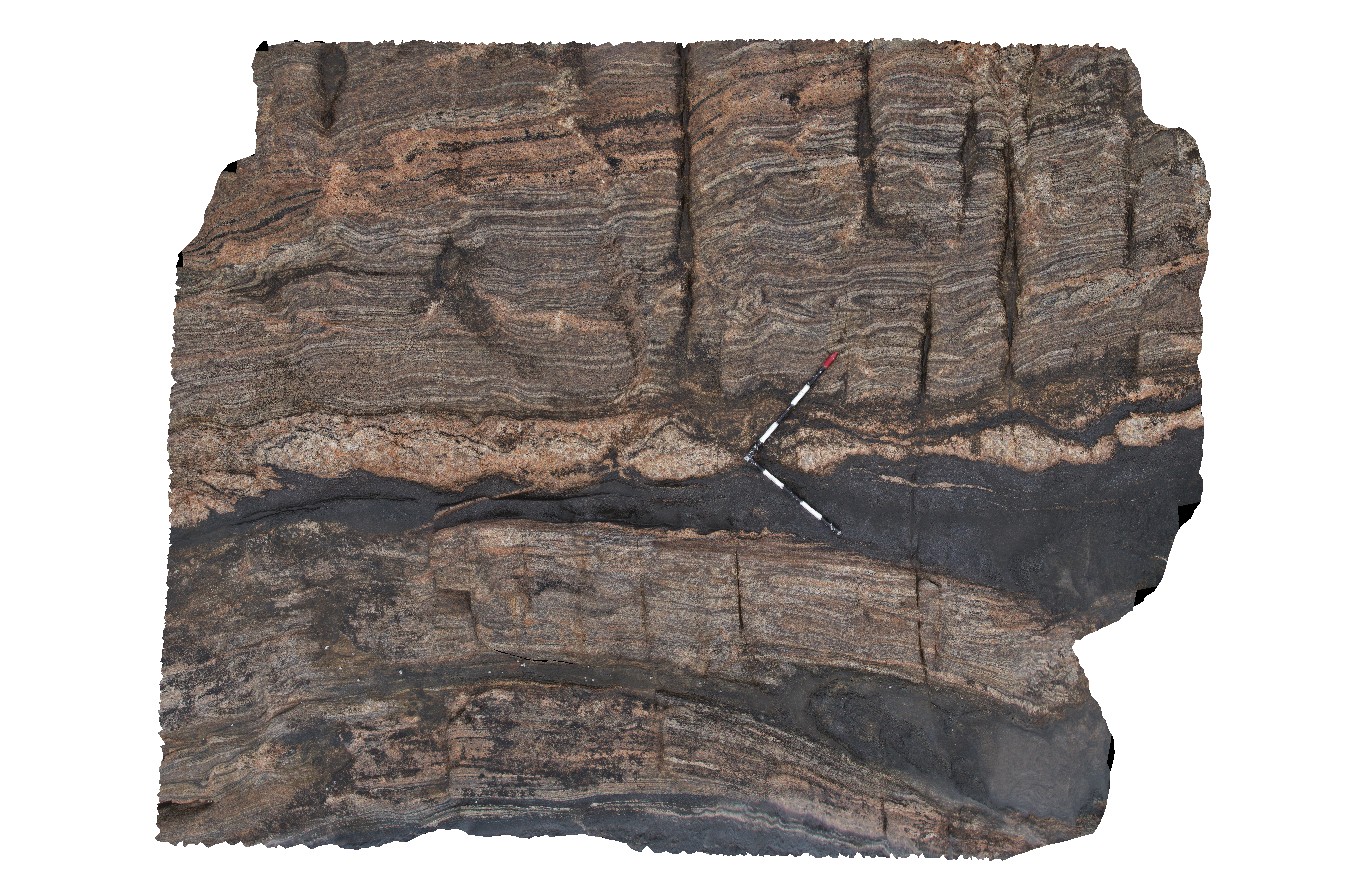
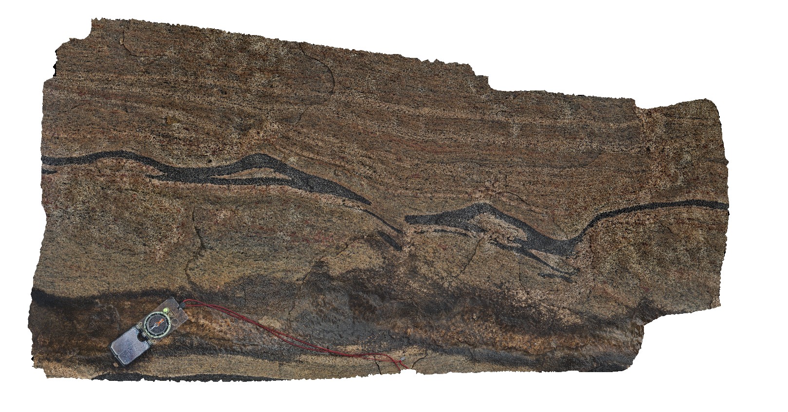
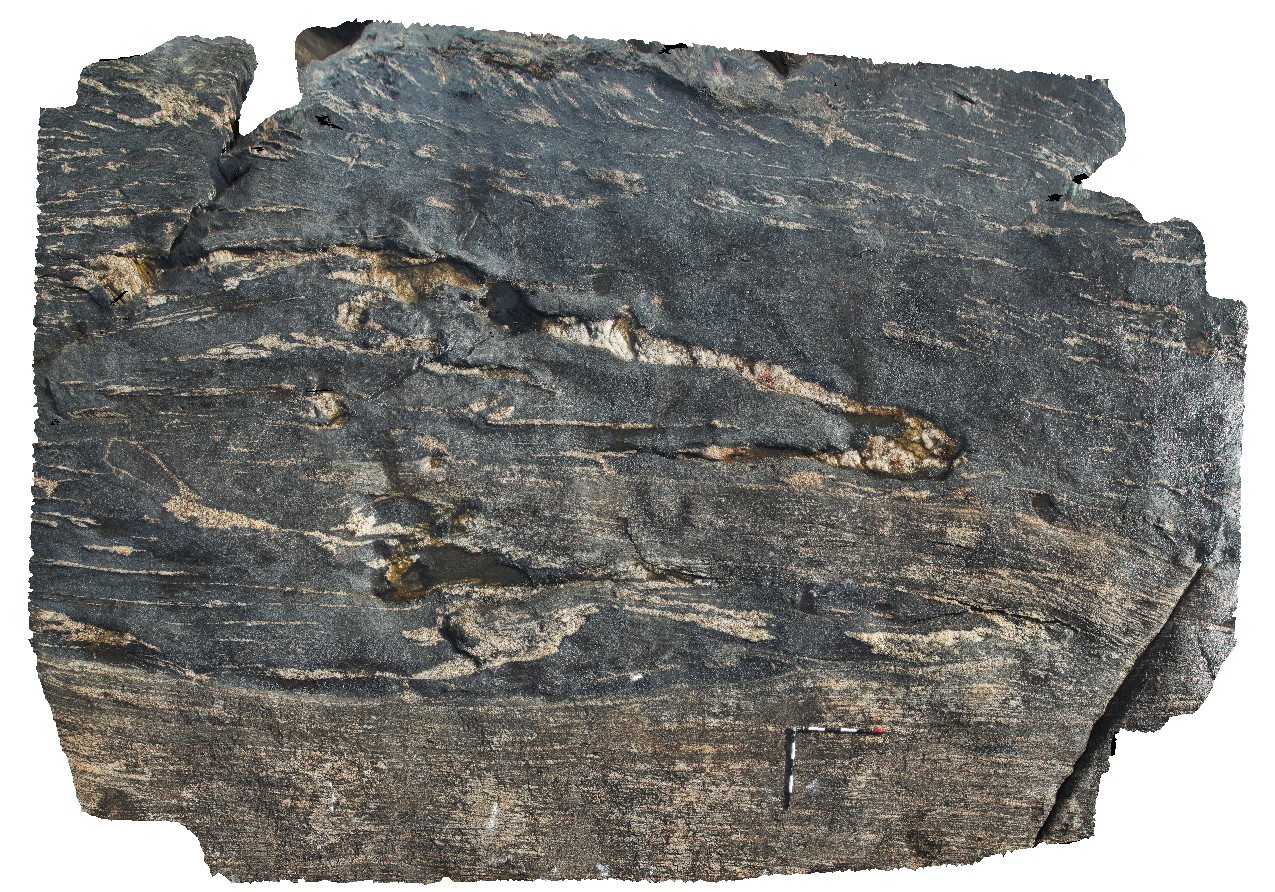
ElephantRock1 Map
 |
0 |
05/15/2016 noon |
3D |
isoclinal folded gneiss with boudinaged pegmatite and amphibolite bands. Elephant Rock, W.A. |
5.00 |
-34.26623000000 |
115.03390000000 |
-9999.000 |
boudinage, gneiss, isoclinal fold |
gneiss, pegmatite |
ElephantRock2 Map
 |
0 |
05/15/2016 noon |
3D |
overview of thick amphibolite layer in gneiss, Elephant Rock, W.A. |
6.00 |
-34.26623000000 |
115.03390000000 |
-9999.000 |
amphibolite gneiss, metamorphic |
amphibolite gneiss, pegmatite |
ElephantRock3 Map
 |
0 |
05/15/2016 noon |
3D |
tight to isoclinal folds in thin amphibolite layers in gneiss. Elephant Rock, W.A. |
4.00 |
-34.26566000000 |
115.03399000000 |
-9999.000 |
isoclinal folding, gneiss, metamorphic |
gneiss |
ElephantRock4 Map
 |
0 |
05/15/2016 noon |
3D |
fold interference patterns in amphibolite layer in gneiss. Elephant Rock, W.A. |
1.40 |
-34.26561000000 |
115.03404000000 |
-9999.000 |
fold interference pattern, gneiss, structure |
gneiss |
ElephantRock5 Map
 |
0 |
05/15/2016 noon |
3D |
amphibolite layer that has been boudinaged and intruded by pegmatite and then shortened and folded. Elephant Rock, W.A. |
3.80 |
-34.27082000000 |
115.03548000000 |
-9999.000 |
structure, folding, boudinage |
gneiss |
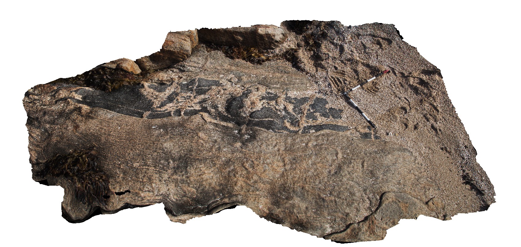
Cervantes4 Map
 |
0 |
05/18/2016 noon |
3D |
detail of large stromatolite at Lake Thetis, Cervantes, W.A. |
2.20 |
-30.50755000000 |
115.08070000000 |
-9999.000 |
stromatolites |
limestone |
CervantesFSP2 Map
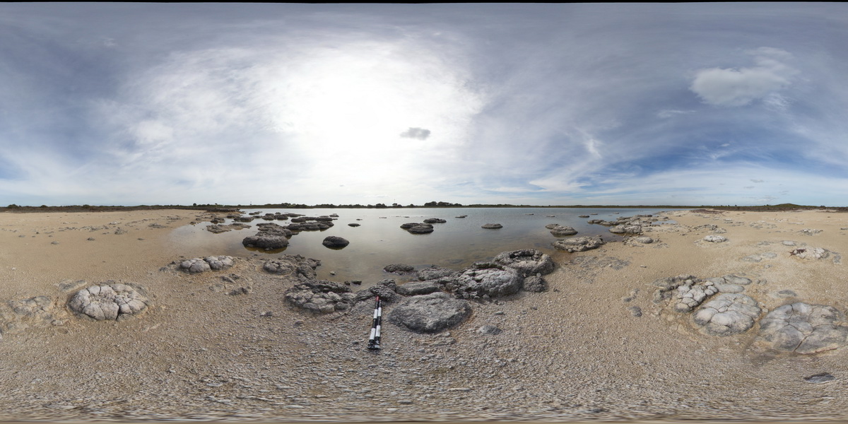 |
0 |
05/18/2016 noon |
FSP |
stromatolite at Lake Thetis, Cervantes, W.A. |
200.00 |
-30.50752000000 |
115.08070000000 |
-9999.000 |
stromatolite |
limestone |
CervantesUAV4 Map
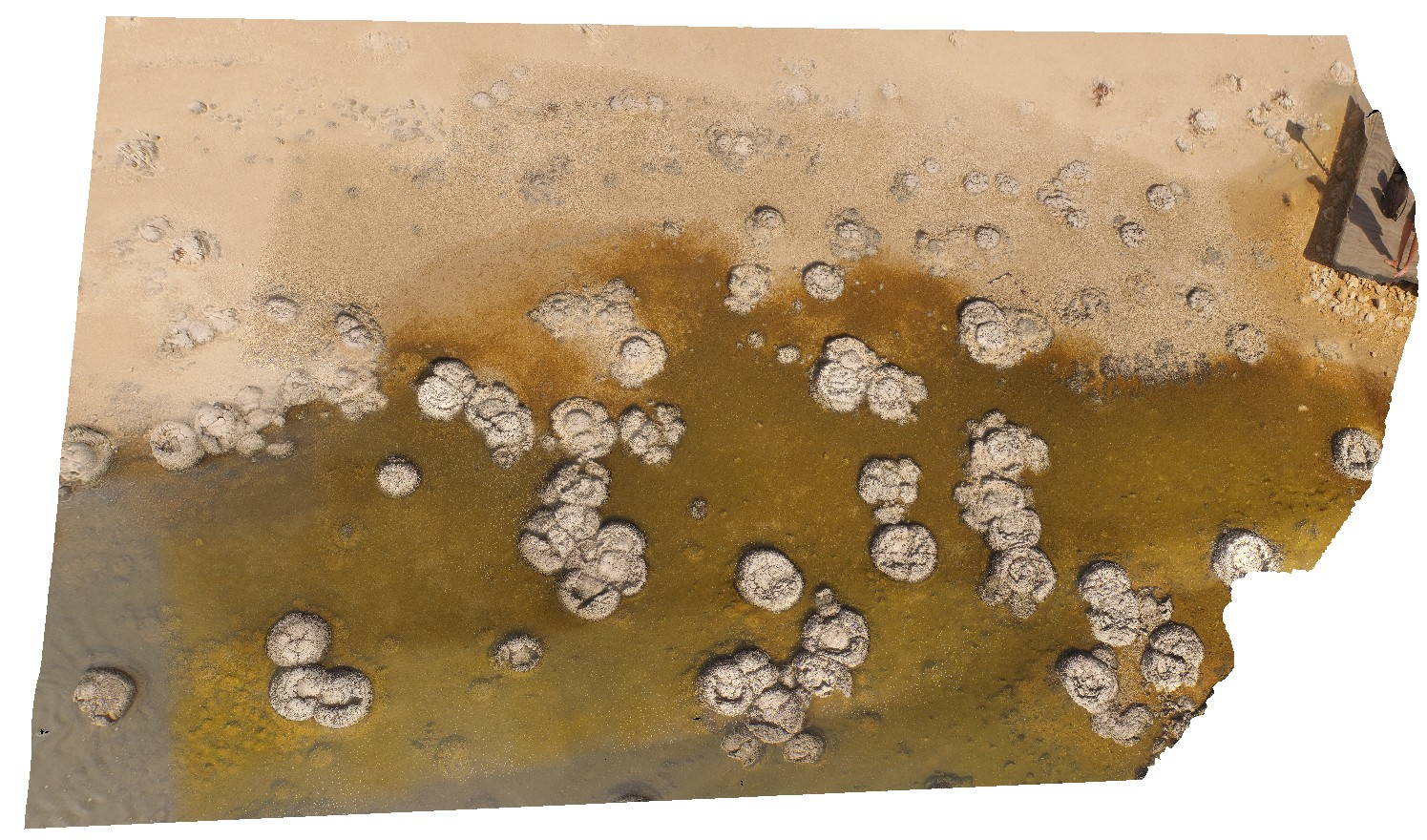 |
0 |
05/18/2016 noon |
UAV |
detail of stromatolites in Lake Thetis, Cervantes, W.A. |
50.00 |
-30.50759200000 |
115.08074200000 |
-9999.000 |
stromatolites |
limestone |
CervantesFSP1 Map
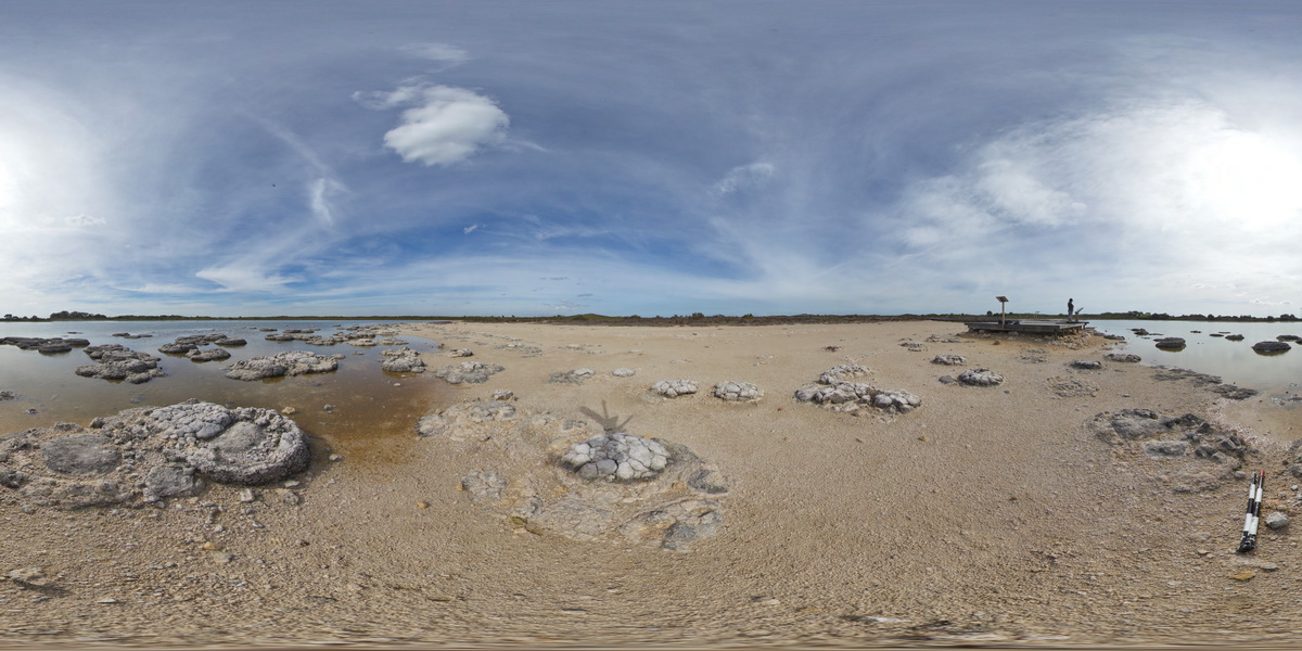 |
0 |
05/18/2016 noon |
FSP |
stromatolite at Lake Thetis, Cervantes, W.A. |
200.00 |
-30.50755000000 |
115.08086000000 |
-9999.000 |
stromatolite |
limestone |
Cervantes5 Map
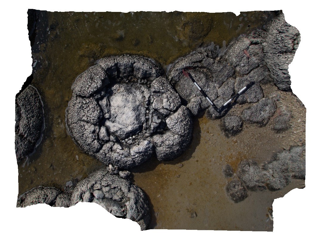 |
0 |
05/18/2016 noon |
3D |
view of large domed stromatolite at Lake Thetis, Cervantes, W.A. |
2.60 |
-30.50760000000 |
115.08094000000 |
-9999.000 |
stromatolite |
limestone |
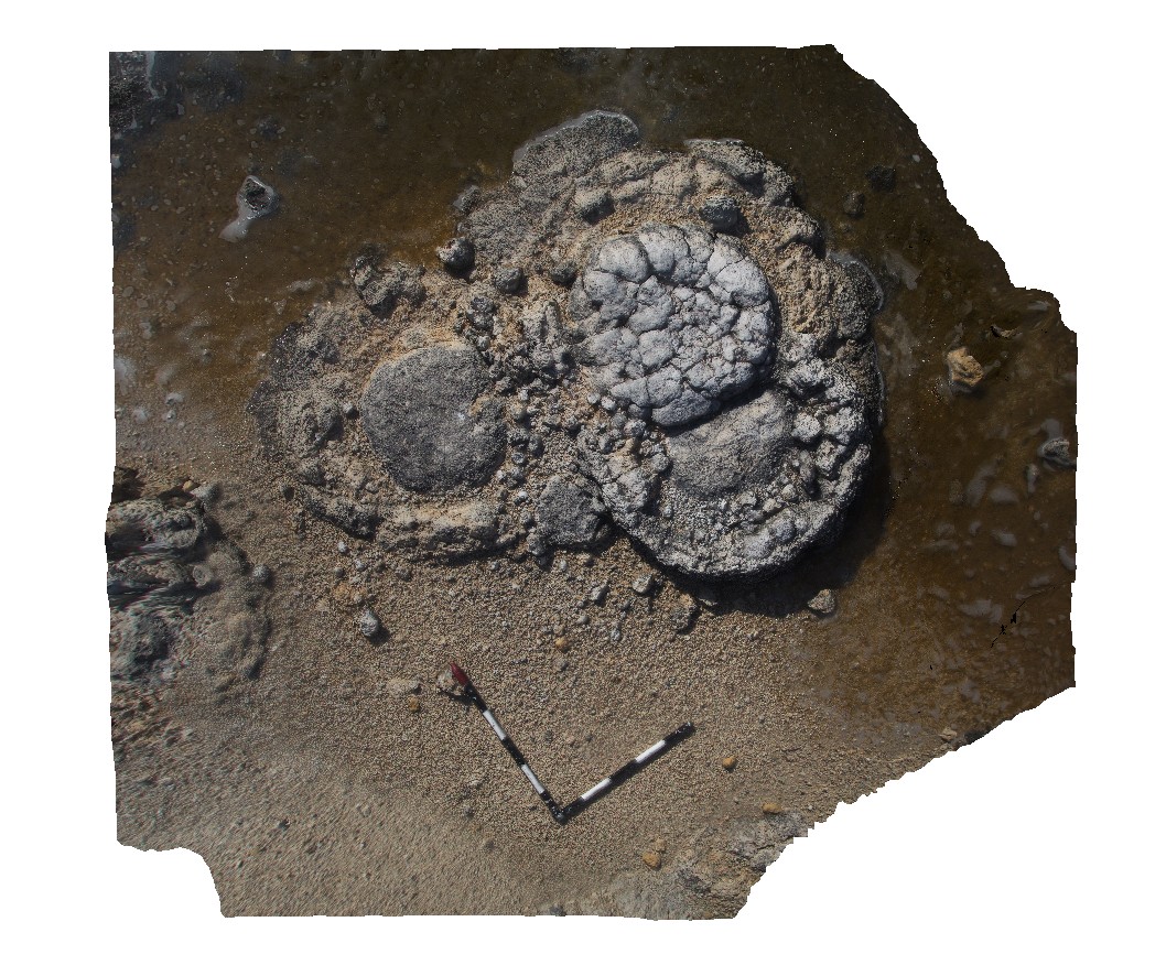
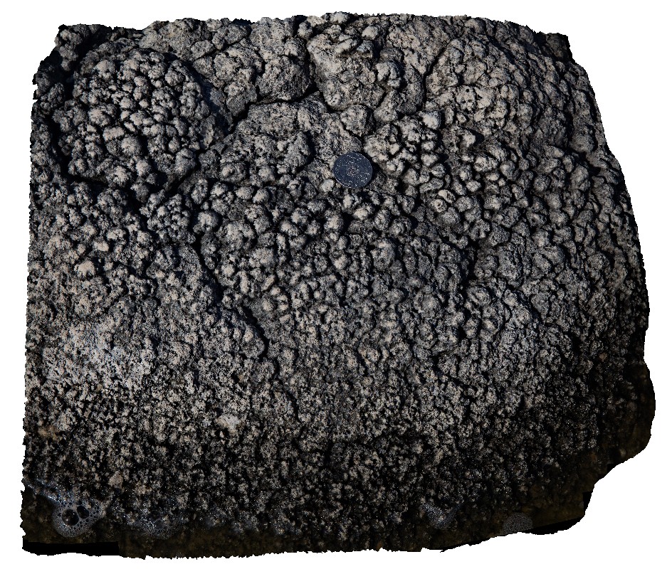
Cervantes7 Map
 |
0 |
05/18/2016 noon |
3D |
detail of nodular texture on flat surface of stromatolite at Lake Thetis, Cervantes, W.A. |
0.45 |
-30.50757000000 |
115.08096000000 |
-9999.000 |
stromatolite, nodular texture |
limestone |
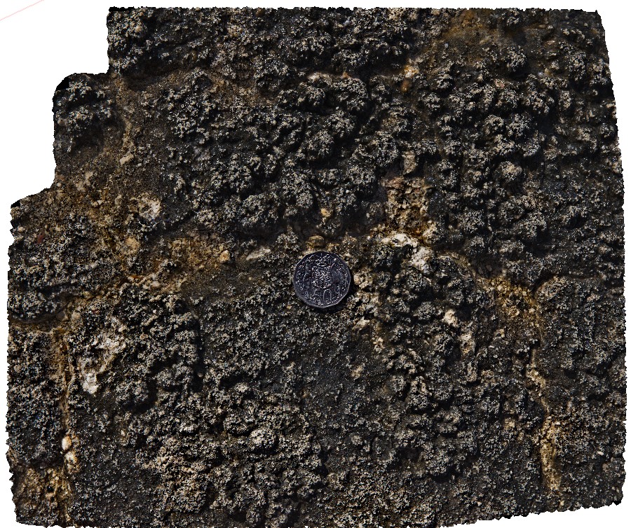
Cervantes6 Map
 |
0 |
05/18/2016 noon |
3D |
detail of nodular texture on flat surface of stromatolite at Lake Thetis, Cervantes, W.A. |
0.60 |
-30.50757000000 |
115.08096000000 |
-9999.000 |
stromatolite, nodular texture |
limestone |
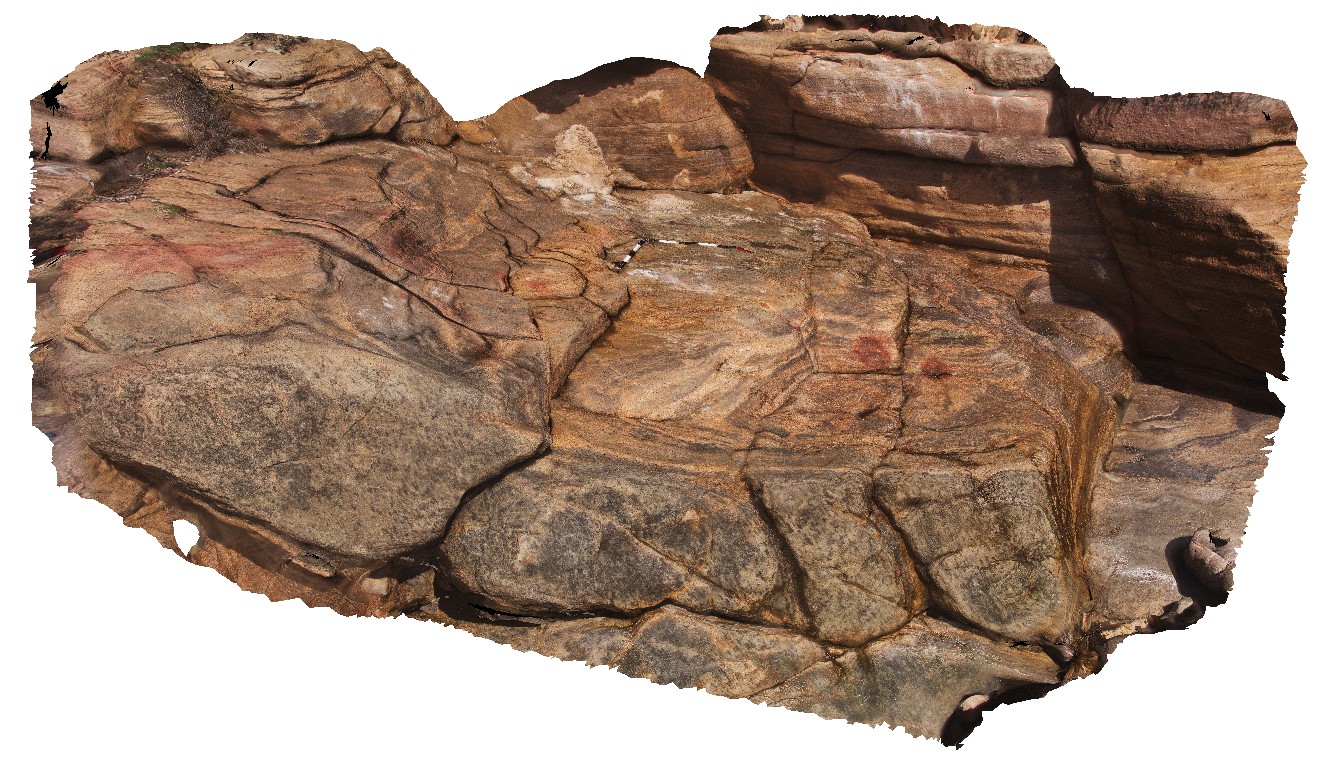
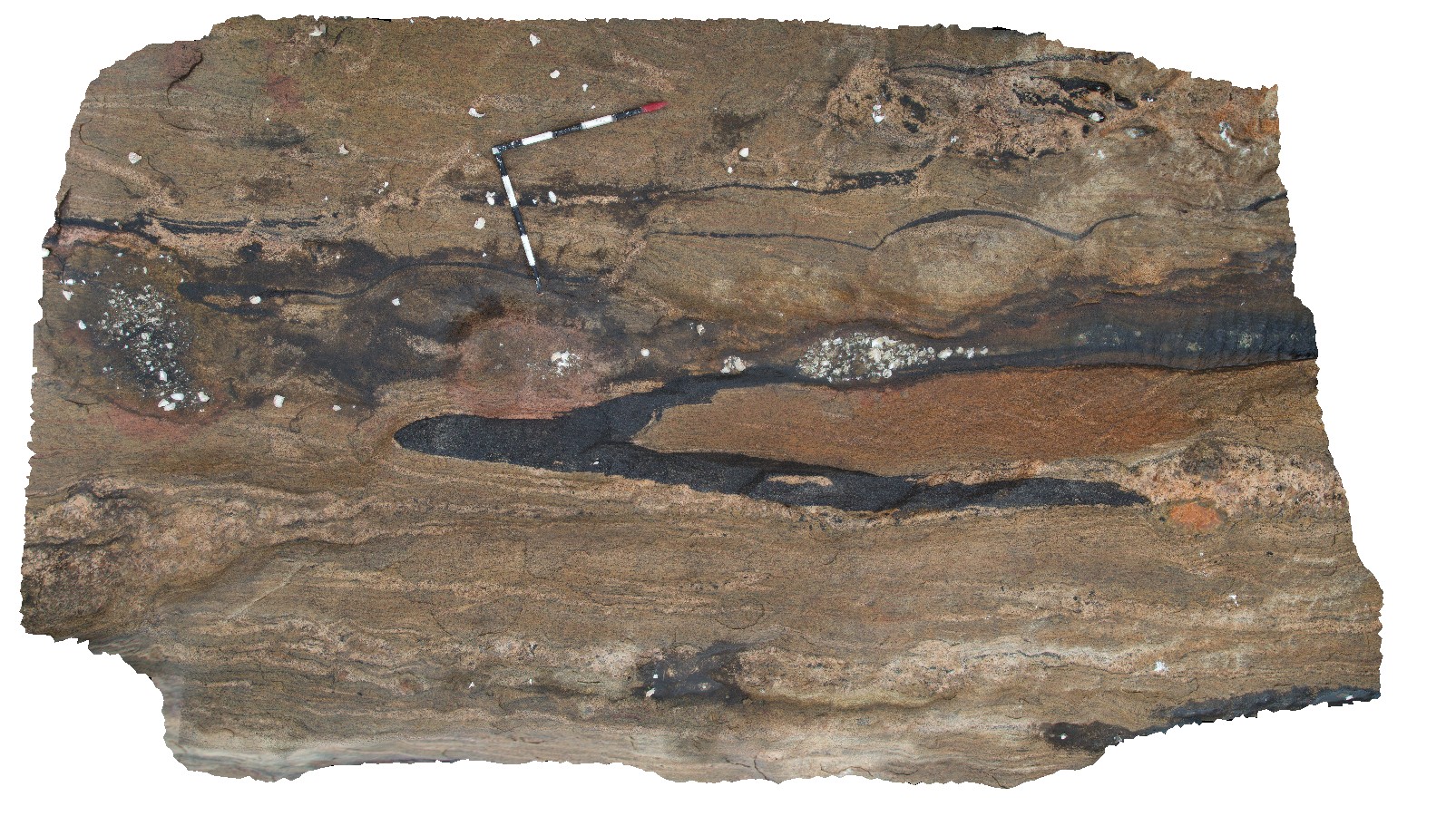
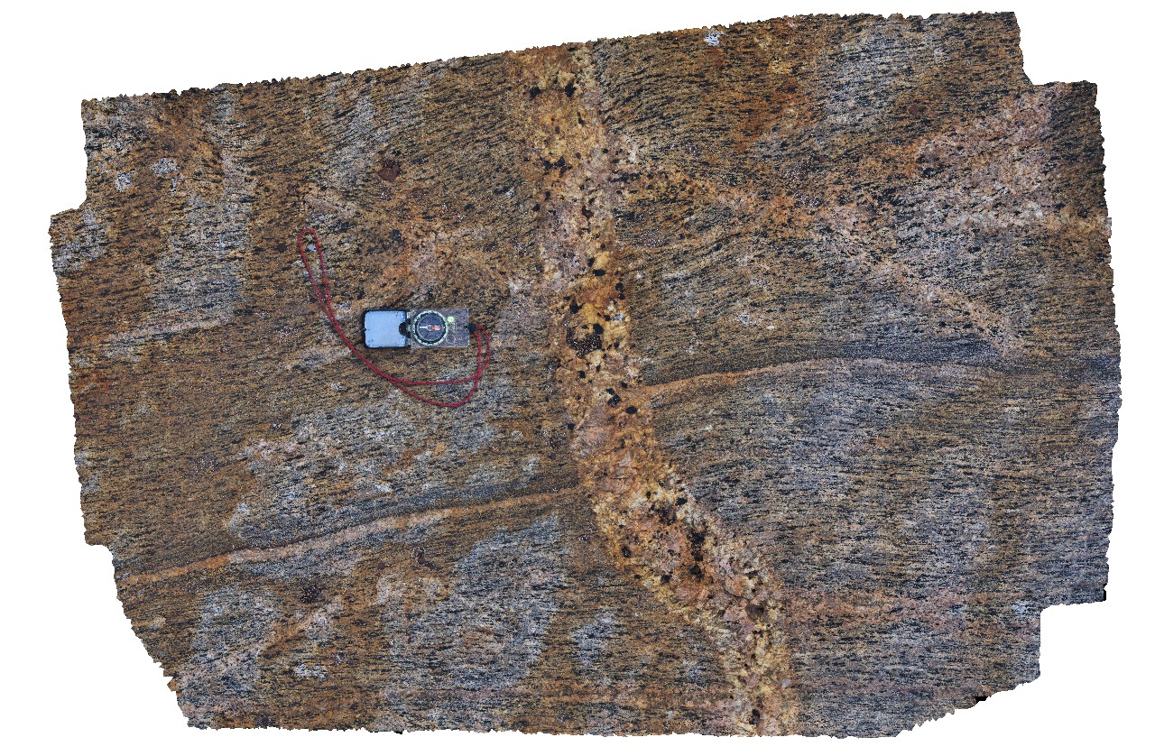
CapeLeeuwin6 Map
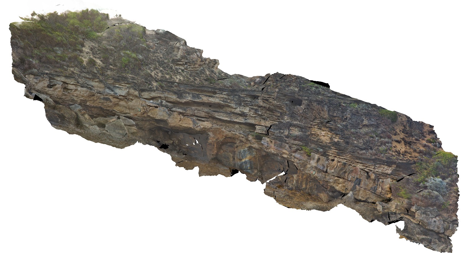 |
0 |
05/14/2016 noon |
3D |
unconformity between gneiss and overlying Quaternary aeolian, bedded beach? Deposits. Cape Leeuwin, W.A. |
24.00 |
-34.35586000000 |
115.12827000000 |
-9999.000 |
geological unconformity, aeolian deposit, gneiss |
gneiss, limestone |
CapeLeeuwin4 Map
 |
0 |
05/14/2016 noon |
3D |
tightly / isoclinal folded leucosomes in coarsely banded gneiss. Cape Leeuwin, W.A. |
1.30 |
-34.35671000000 |
115.12875000000 |
-9999.000 |
isoclinal fold, leucosome, banded gneiss |
gneiss |
CapeLeeuwin5 Map
 |
0 |
05/14/2016 noon |
3D |
detailed view of isoclinal folded leucosomes in coarsely banded gneiss. Cape Leeuwin, W.A. |
0.80 |
-34.35674000000 |
115.12876000000 |
-9999.000 |
isoclinal fold, leucosome, gneiss, structure |
gneiss |
CapeLeeuwin3 Map
 |
0 |
05/14/2016 noon |
3D |
Tightly folded contact between mafic and felsic gneiss, Cape Leeuwin, W.A. |
6.50 |
-34.35695000000 |
115.12878000000 |
-9999.000 |
geological contact, gneiss, fold |
gneiss |
CapeLeeuwin1 Map
 |
0 |
05/14/2016 noon |
3D |
granitic gneiss cut by pegmatite dyke. Cape Leeuwin, W.A. |
1.50 |
-34.37218000000 |
115.13711000000 |
-9999.000 |
banded gneiss, pegmatite dyke |
gneiss, pegmatite |
CapeLeeuwin2 Map
 |
0 |
05/14/2016 noon |
3D |
banded granitic gneiss, with boudinaged gneissic layering. Cape Leeuwin, W.A. |
2.50 |
-34.37584000000 |
115.13730000000 |
-9999.000 |
banded gneiss, boudinage, structure |
gneiss |