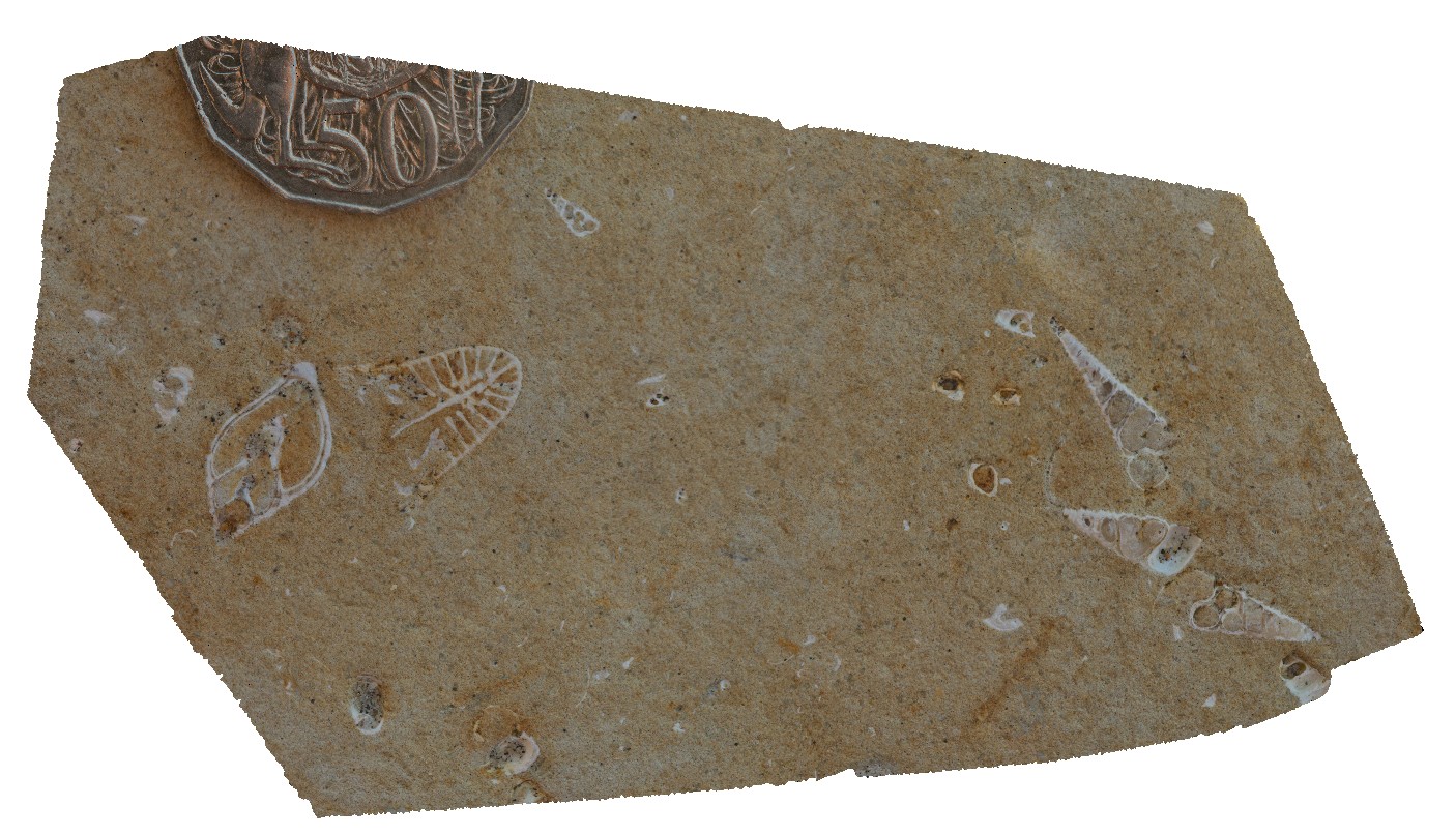
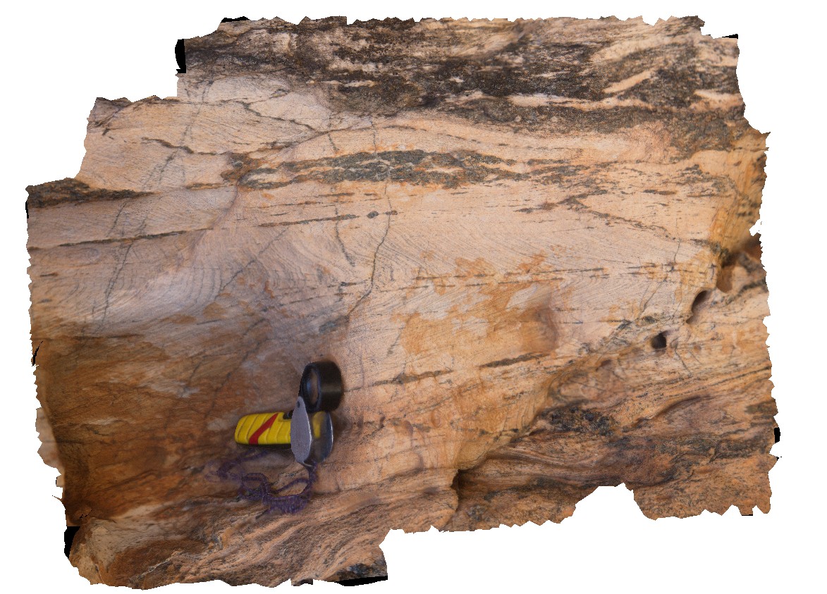
NTas13 Map
 |
5 |
01/01/9999 midnight |
3D |
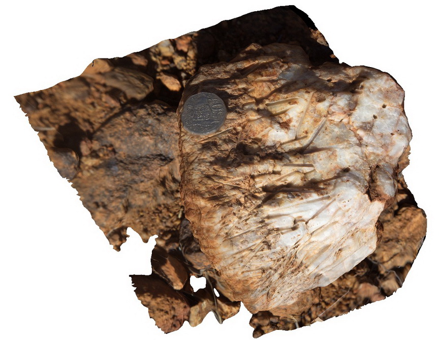
detailed view of gastropod fossils exposed in cross section. Fossil Bluff Conservation Area, Wynyard. North Tasmania. |
0.10 |
-40.98050000000 |
145.73151000000 |
-9999.000 |
gastropod, fossil, fossiliferous, Palaeontology |
sandstone |
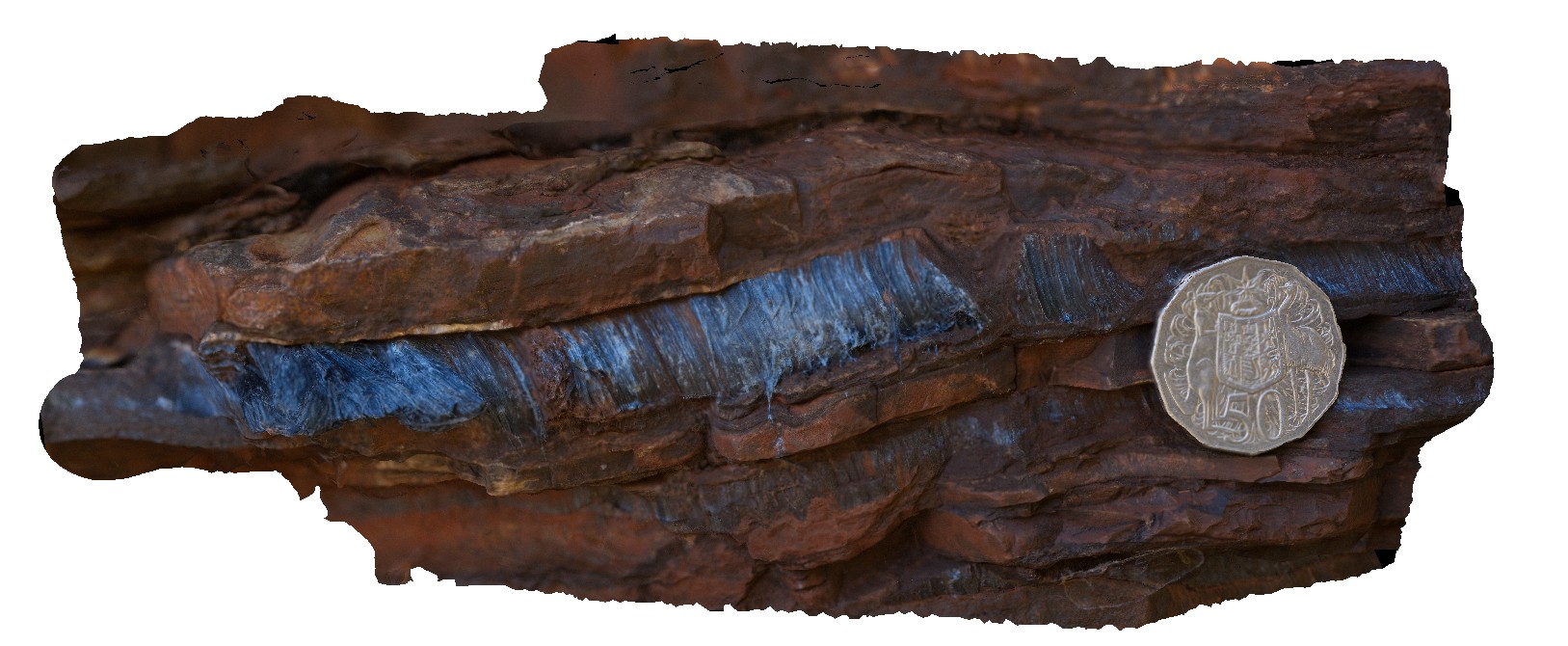
Karijini15 Map
 |
0 |
05/29/2016 noon |
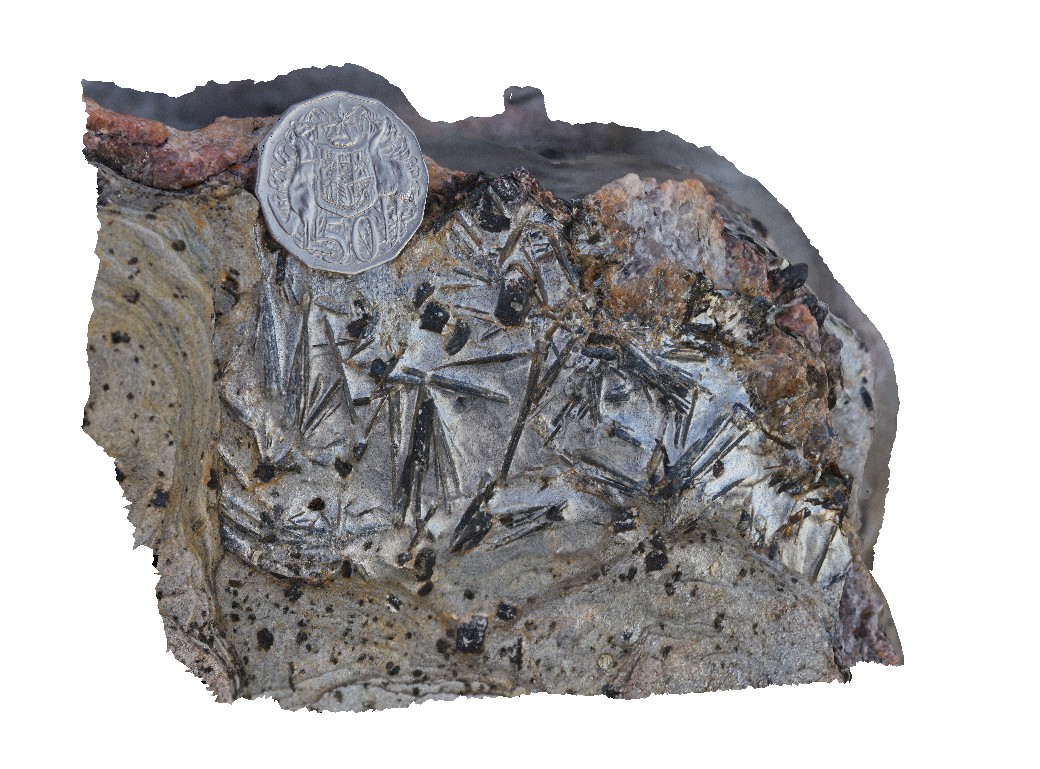
3D |
macro view of 1cm wide seam of radiating crocidolite in Brockman Iron Formation. Dales Gorge, Karijini National Park. W.A. |
0.10 |
-22.47611000000 |
118.56268000000 |
-9999.000 |
crocidolite, banded iron formation, mineral |
BIF |
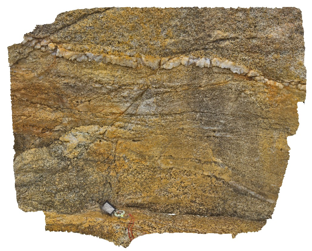
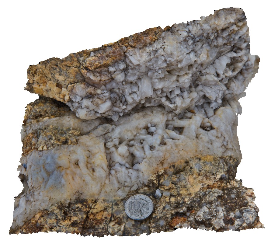
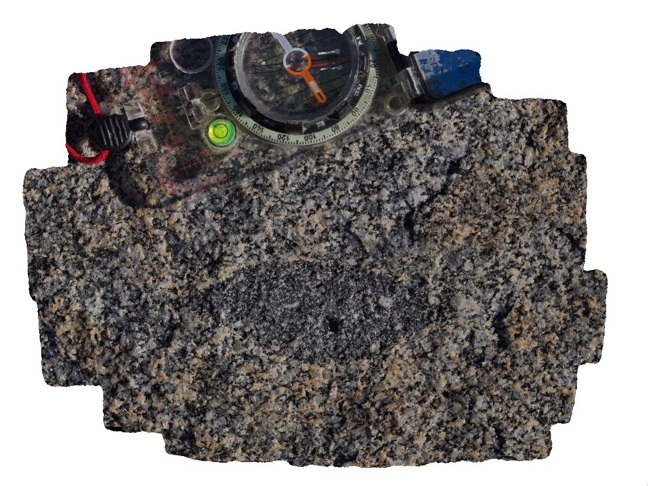
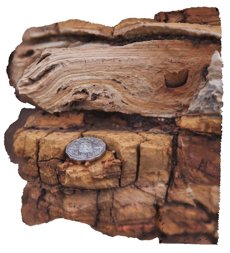
Trial13 Map
 |
0 |
08/11/2016 noon |
3D |
view containing site Trial12,, showing multiple thin UST layers in Aplite and underlying 'white' granite. Trial Harbour, West Coast Tas. |
0.10 |
-41.92319000000 |
145.15849000000 |
-9999.000 |
aplite, UST texture, granite, granite phases, intrusive contact |
granite, granite |
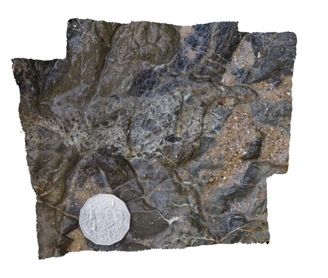
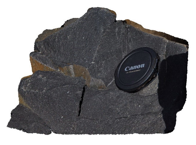
Blackhead7 Map
 |
5 |
07/08/2015 9:32 a.m. |
3D |
Detail of fault breccia in very fine sandstone. Black Head, N.S.W. |
0.10 |
-32.07087000000 |
152.54707000000 |
0.000 |
sandstone, fault breccia, structure |
sandstone, breccia |
WestBeach8 Map
 |
0 |
06/05/2016 10:35 a.m. |
3D |
radiating needles of kyanite in schist. West Beach, W.A. |
0.10 |
-33.95360000000 |
119.97449000000 |
-9999.000 |
kyanite, schist, metamorphic |
kyanite schist |
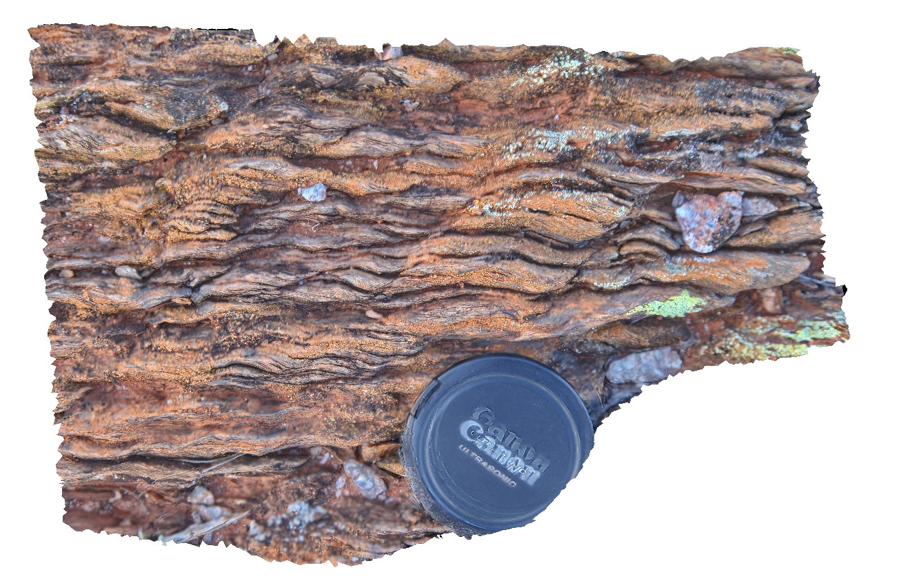
Valla3 Map
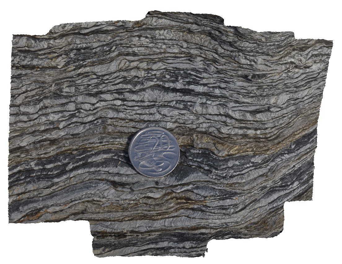 |
1 |
06/16/2015 5:43 p.m. |
3D |
'phyllite' of the Permo-Carboniferous Nambucca Beds. Layering is defined by alternating mica-rich and quartz rich domains that are tectonic in origin. Prominent crenulation cleavage and development of new microlithons. Valla Beach, N.S.W. |
0.14 |
-30.59363000000 |
153.01398000000 |
2.000 |
microlithon, structure, crenulation cleavage |
phyllite |
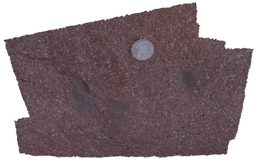
DeepBay2 Map
 |
0 |
02/29/2016 9:29 a.m. |
3D |
brachiopod Permian fossils in Deep Bay Formation. Ables Bay Road, Tasmania. |
0.15 |
-43.21928000000 |
147.09190000000 |
-9999.000 |
fossil, brachiopods, palaeontology |
siltstone |
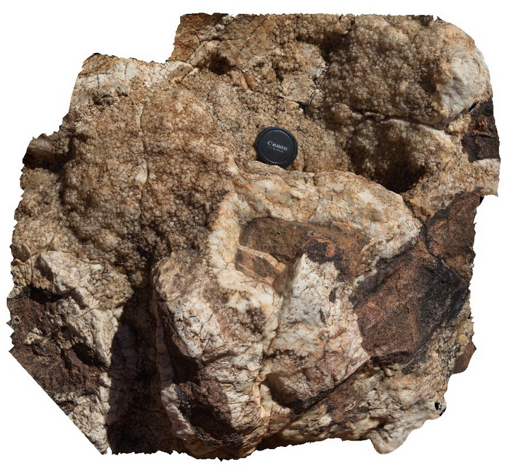
Litchfield4 Map
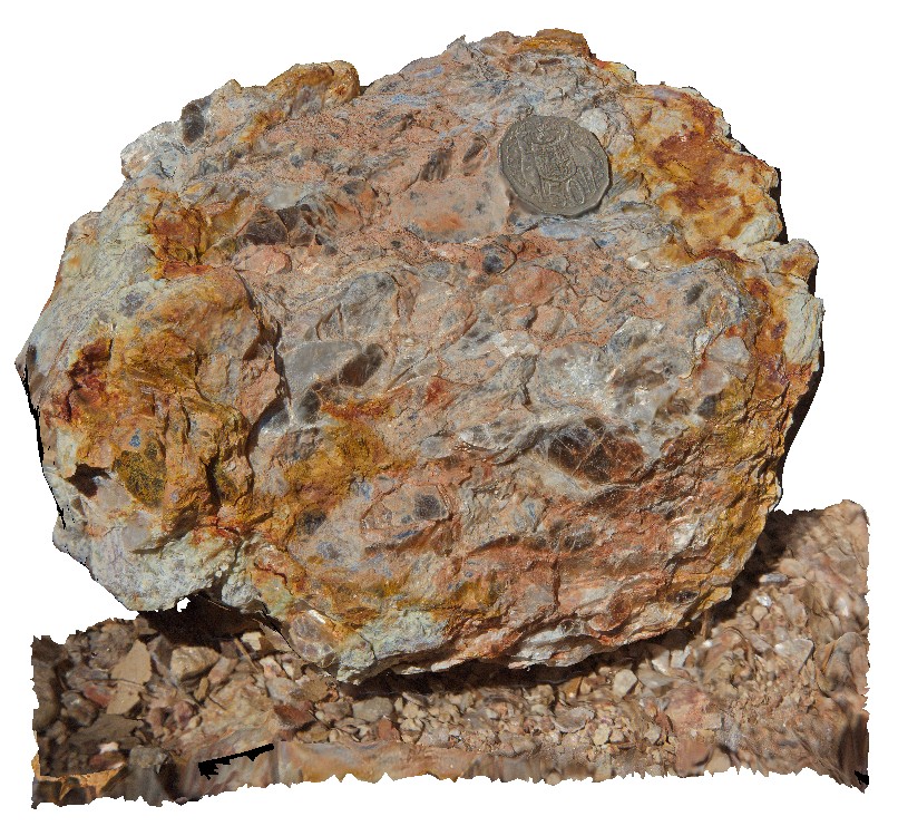 |
0 |
06/23/2016 noon |
3D |
quartz-muscovite pegmatite float near Litchfield Park Road, Litchfield National Park. N.T. |
0.15 |
-13.06886000000 |
130.71255000000 |
-9999.000 |
quartz-muscovite pegmatite, igneous, two sisters granite |
pegmatite |
Brachina24 Map
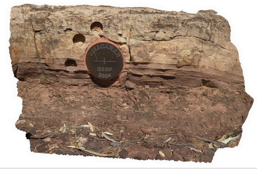 |
5 |
11/17/2015 9:45 a.m. |
3D |
Locality of the Golden Spike of the Ediacaran Period, showing the contact between diamictite of the Elatina Formation and the dolomite of the Nuccaleena Formation. Pictures also shows sampling holes. Trezona Loop walk, Brachina. S.A. |
0.15 |
-31.33156000000 |
138.63342000000 |
-9999.000 |
Golden Spike, Ediacaran Period, stratigraphy |
diamictite, dolomite |
BHill99 Map
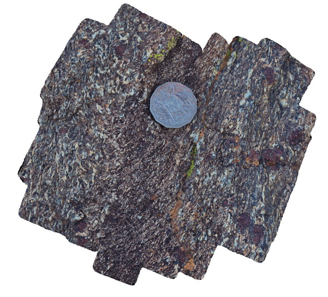 |
5 |
09/18/2015 11:12 a.m. |
3D |
detail of foliation texture in garnet-sillimanite-gneiss from site BHill97. Broken Hill. N.S.W. |
0.15 |
-31.83472000000 |
141.42847000000 |
-9999.000 |
structure, foliation, garnet sillimanite gneiss |
gneiss |
Corny7 Map
 |
0 |
11/17/2015 12:24 p.m. |
3D |
detail of rotated augens in augen gneiss. Point Corny. S.A. |
0.15 |
-34.92134000000 |
137.01105000000 |
-9999.000 |
rotated augen, gneiss |
augen gneiss |
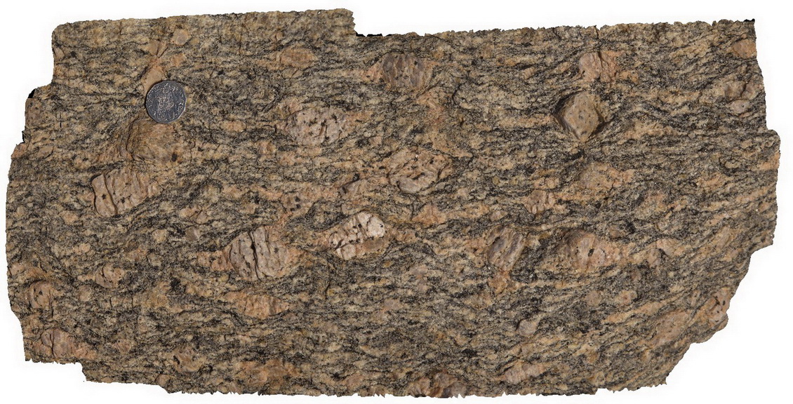
BH2014n7 Map
 |
20 |
03/17/2015 2:10 p.m. |
3D |
well developed S-C fabric in metasediment. Broken Hill, N.S.W. |
0.15 |
-31.61297855000 |
141.53056219000 |
-9999.000 |
S-C fabric, structure, metasediment |
psammite |
Bicheno17 Map
 |
20 |
03/13/2015 9:02 a.m. |
3D |
Late stage quartz veins with euhedral crystals displaying open fill texture, within porphyritic Bicheno Granite of the Boobyalla Suite. Tas. |
0.15 |
-41.88048383000 |
148.30850316000 |
1.000 |
igneous, open fill texture, vein, granite |
Granite, Quartz |
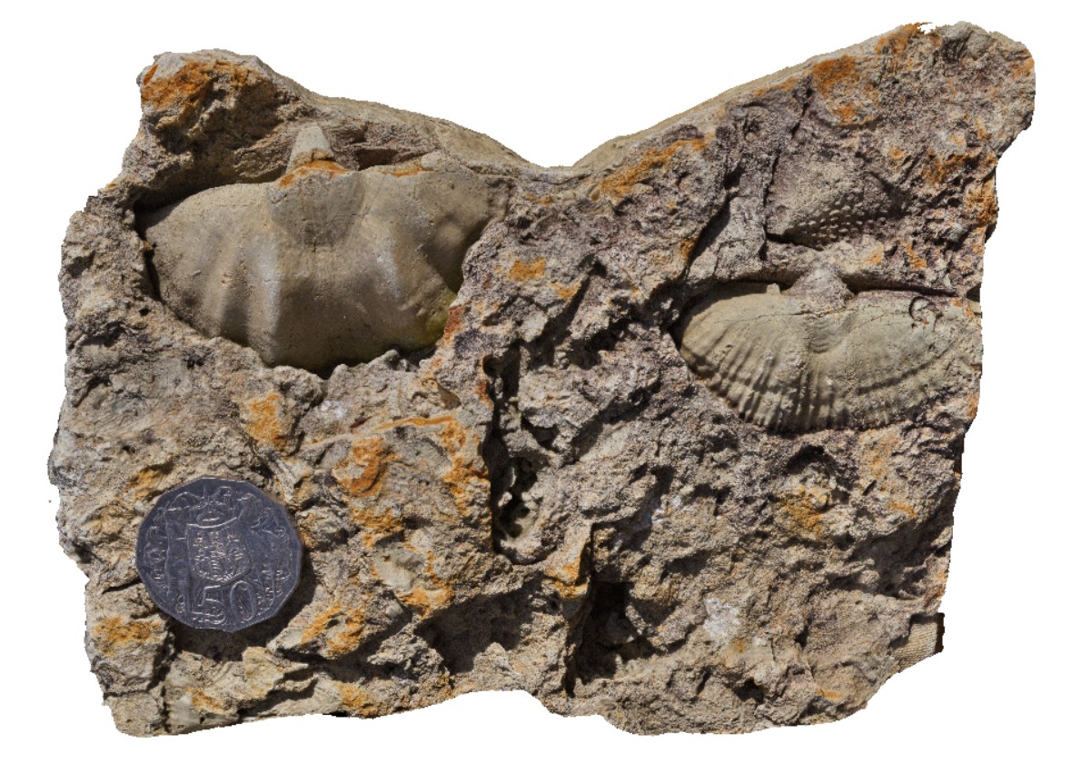
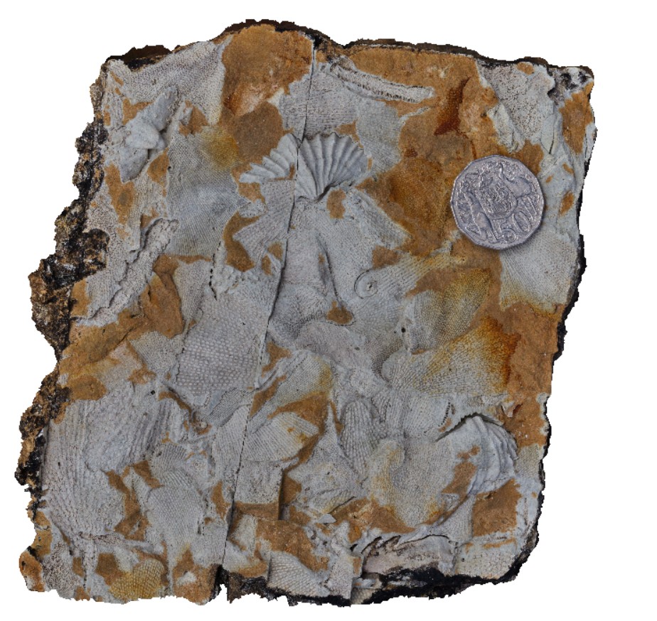
DeepBay3 Map
 |
0 |
02/29/2016 9:31 a.m. |
3D |
Permian fossils in Deep Bay Formation, including bryozoa and brachiopods. Ables Bay Road, Tasmania. |
0.20 |
-43.21928000000 |
147.09190000000 |
-9999.000 |
fossil, bryozoa, brachiopods, palaeontology |
siltstone |
PtStephens3 Map
 |
5 |
06/16/2015 5:32 p.m. |
3D |
Detailed view of the texture of ignimbrite from the Nerong Volcanics. Port Stephens, N.S.W. |
0.20 |
-32.78760000000 |
152.11960000000 |
5.000 |
igneous |
ignimbrite |
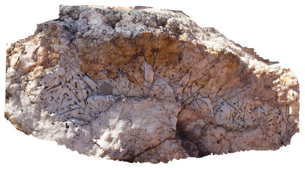
Arkaroola27 Map
 |
5 |
11/06/2015 1:51 p.m. |
3D |
detail of nail hole quartz texture vein infill, Radium Ridge, Arkaroola. Northern Flinders Ranges, S.A. |
0.20 |
-30.22875000000 |
139.34589000000 |
-9999.000 |
nail hole quartz |
quartz |
Olary40 Map
 |
0 |
09/27/2015 6:21 p.m. |
3D |
view of folded layering or foliation cut by axial planar amphiboles / dark mineral veins. Cathedral Rock. Olary, S.A. |
0.20 |
-32.09106000000 |
140.31787000000 |
-9999.000 |
fold, axial plane, structure |
metasediments |
Bingi13 Map
 |
5 |
07/28/2015 11:03 a.m. |
3D |
Detail of Devonian granodiorite with ellipsoidal mafic enclave. Bingi, N.S.W. |
0.20 |
-36.01262000000 |
150.16396000000 |
2.000 |
granodiorite, diorite, enclave, igneous |
granodiorite, diorite |
Gawler8 Map
 |
0 |
11/17/2015 10:34 a.m. |
3D |
detail of xenoliths and phenocrysts in dacite. Mt Fairview, Gawler Ranges. |
0.20 |
-32.56333000000 |
135.57602000000 |
-9999.000 |
xenolith, dacite, phenocryst |
dacite |
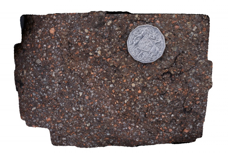
MountNyulasy3 Map
 |
0 |
01/01/9999 midnight |
3D |
macro view of weathered surface of rapakivi textured granite. Near Mount Nyulasy. Great Northern Highway, W.A. |
0.20 |
-16.74403000000 |
128.28270000000 |
-9999.000 |
rapakivi texture, Mount Nyulasy Granite |
granite |
Mulbring1 Map
 |
1 |
06/17/2015 9:20 a.m. |
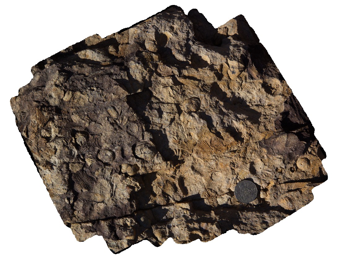
3D |
Fenestellids and brachiopods in the Permian Branxton Formation, Mulbring, N.S.W. |
0.20 |
-32.89854000000 |
151.46556000000 |
65.000 |
brachiopods, fenestella, fossil, palaeontology |
sandstone |
Arkaroola23 Map
 |
5 |
11/06/2015 1:46 p.m. |
3D |
detailed cross section through 'nail hole' quartz texture, showing radiating structure and long 'nail' cavity. Arkaroola. Northern Flinders Ranges, S.A. |
0.20 |
-30.22062000000 |
139.36400000000 |
-9999.000 |
nail hole quartz, mineral texture |
quartz |
Arkaroola29 Map
 |
5 |
11/06/2015 1:52 p.m. |
3D |
detail of breccia vugh, showing terminating quartz crystals and cross sections of nail hole texture. Radium Hill Breccia, Arkaroola. Northern Flinders Ranges, S.A. |
0.20 |
-30.22877000000 |
139.34573000000 |
-9999.000 |
terminating quartz crystals, nail hole quartz |
quartz |
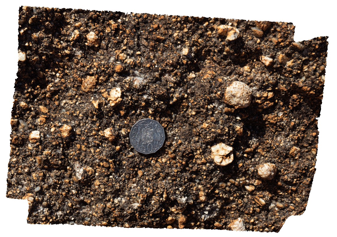
Pingandy8 Map
 |
0 |
05/28/2016 noon |
3D |
possible stromatolite in dolomite. Ashburton Downs - Meekatharra Road, W.A. |
0.20 |
-24.00592000000 |
117.91161000000 |
-9999.000 |
stromatolite, fossil, palaeontology |
dolostone |
Bingi5 Map
 |
5 |
07/27/2015 12:17 p.m. |
3D |
Detailed view of 'red' , fine grained 'dolerite' dyke shown in Bingi4 model. Bingi, N.S.W. |
0.20 |
-36.01318000000 |
150.16370000000 |
3.000 |
dolerite, igneous |
dolerite |