Ironstone1 Map
 |
5 |
01/01/9999 midnight |
3D |
contact between basalt and overlying pyroclastic with bombs up to 0.3m across. Ironstone Point, Tas. |
0.00 |
-42.97108000000 |
147.73396000000 |
-9999.000 |
basalt, pyroclastics, volcanics |
basalt |
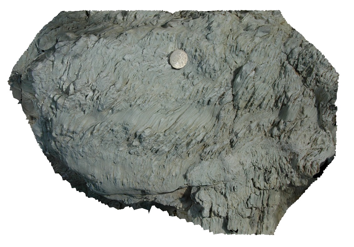
Ironstone7 Map
 |
5 |
01/01/9999 midnight |
3D |
large, flow-banded bombs in pyroclastics. Ironstone Point, Tas. |
0.00 |
-42.97071000000 |
147.73529000000 |
-9999.000 |
flow-banded, bomb, pyroclastics, basalt, volcanic |
basalt |
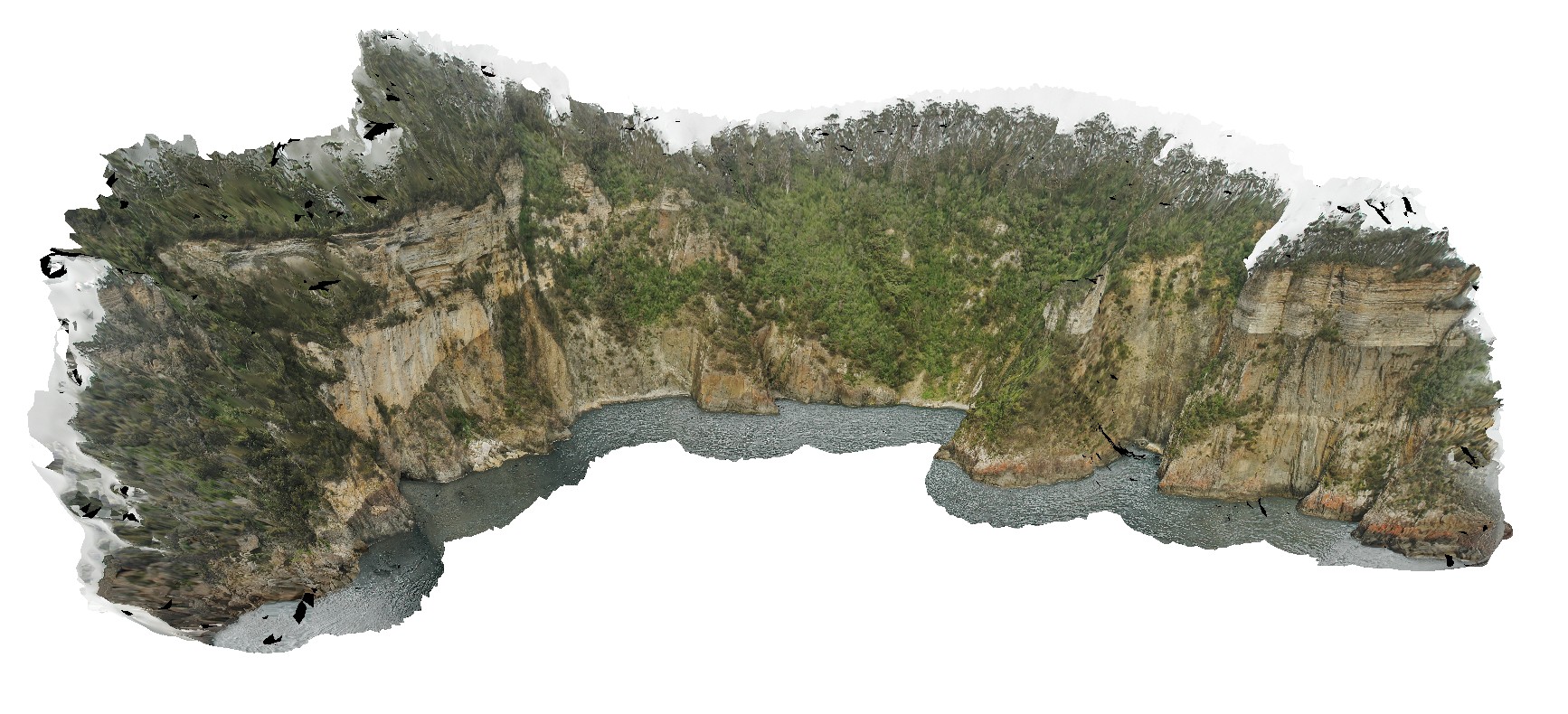
Surville5 Map
 |
50 |
03/16/2015 2:22 p.m. |
3D |
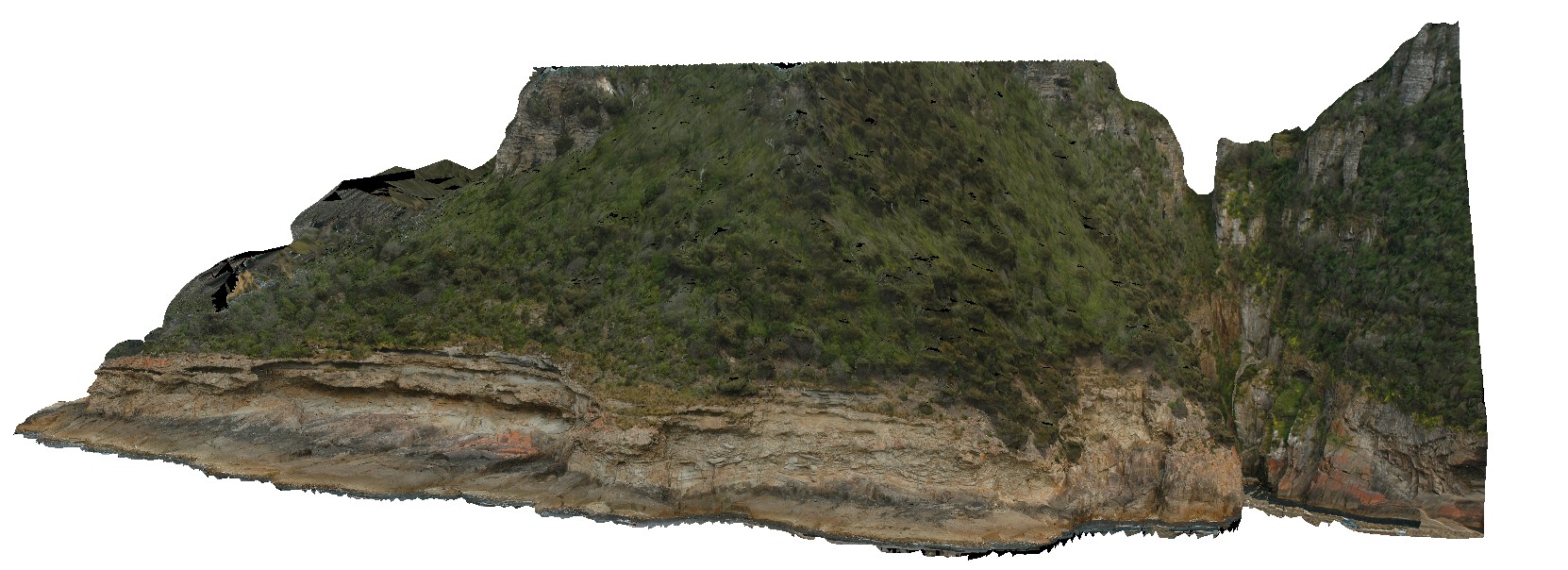
view form off-shore of cliff exposure, showing basement unconformable contact between Devonian Granite and the overlying sedimentary Parmeener Supergroup. Cape Surville, Tasman Peninsula. Tasmania. |
250.00 |
-42.97067641000 |
147.99550099000 |
0.500 |
unconformity, contact, basement unconformity |
granite, siltstone |
Ironstone3 Map
 |
5 |
01/01/9999 midnight |
3D |
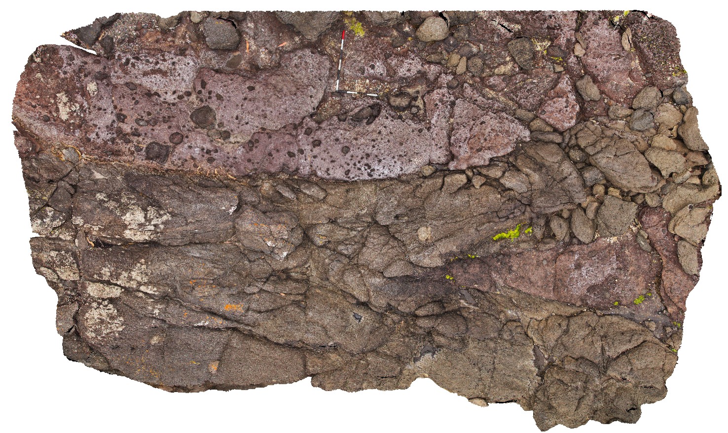
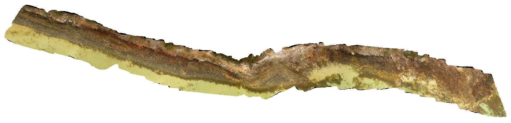
contact between basalt and underlying volcanic breccia. Ironstone Point, Tas. |
0.00 |
-42.97063000000 |
147.73338000000 |
-9999.000 |
basalt lava, volcanic breccia, volcanics |
basalt |
Ironstone4 Map
 |
5 |
01/01/9999 midnight |
3D |
detail of contact between basalt and underlying volcanic breccia from site IronstonePt3. Ironstone Point, Tas. |
0.00 |
-42.97063000000 |
147.73338000000 |
-9999.000 |
basalt, lava, volcanics, Tertiary basalt, geological contact |
basalt |
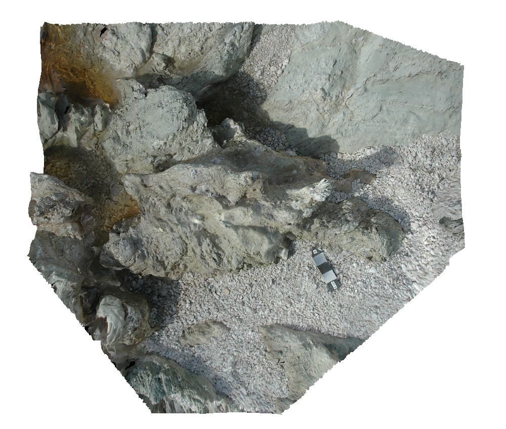
IronstonePtUAV1 Map
 |
20 |
01/01/9999 midnight |
UAV |
aerial view around Ironstone Point and basaltic flows and associated volcanics. Ironstone Point. Tasmania. |
200.00 |
-42.97061200000 |
147.73363000000 |
35.300 |
basalt flow, basalt, volcanics |
basalt |
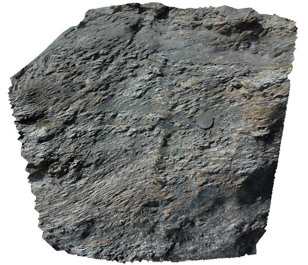
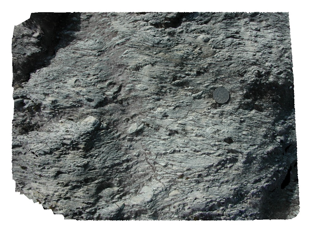
Ironstone5 Map
 |
5 |
01/01/9999 midnight |
3D |
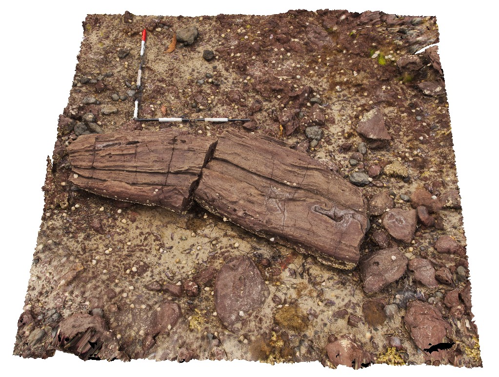
giant bomb in pyroclastic deposits. Ironstone Point, Tas. |
0.00 |
-42.97054000000 |
147.73294000000 |
-9999.000 |
pyroclastic, basalt, volcanics, bomb, Tertiary basalt |
basalt |
Ironstone6 Map
 |
5 |
01/01/9999 midnight |
3D |
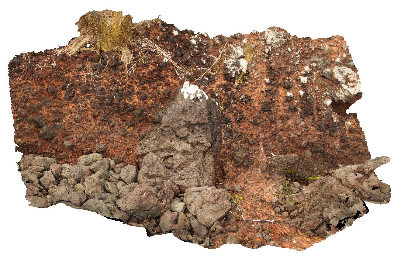
breccia with coated clasts of dolerite and Triassic sandstone. Ironstone Point, Tas. |
0.00 |
-42.97052000000 |
147.73407000000 |
-9999.000 |
breccia, country rock, xenoliths |
basalt |
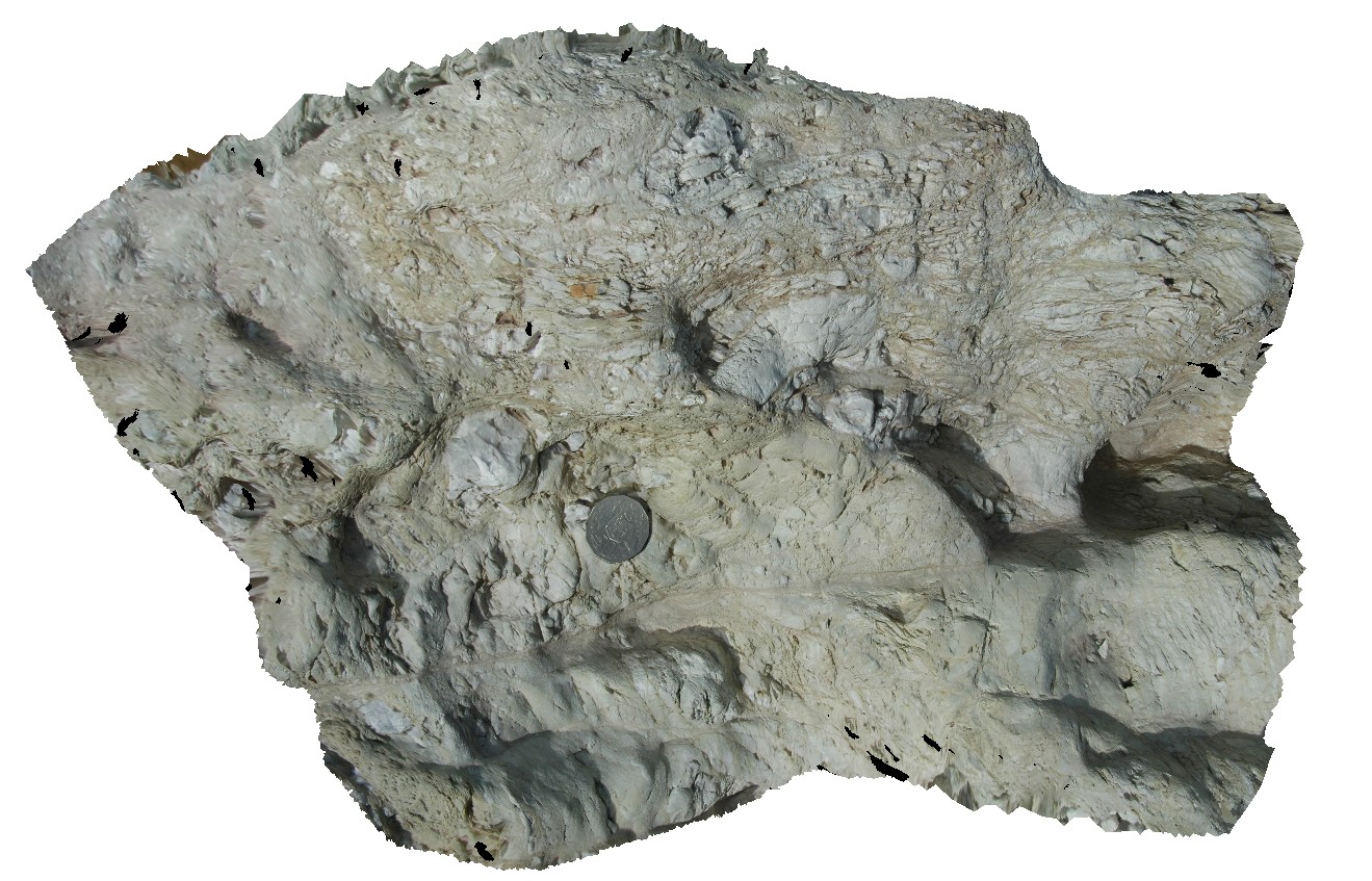
Pedder20 Map
 |
5 |
03/16/2015 2:28 p.m. |
3D |
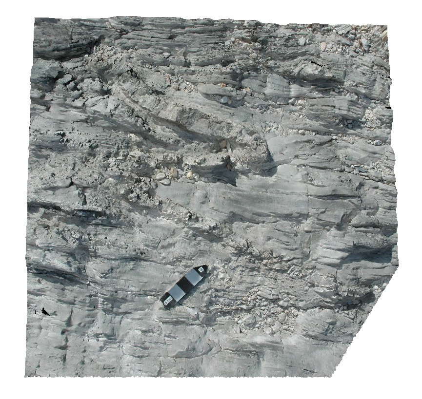
tight folding in quartzites. Lake Pedder, south west Tasmania. |
0.20 |
-42.95960454000 |
146.13608791000 |
-9999.000 |
tight fold, fold, structure |
quartzite |
Pedder21 Map
 |
5 |
03/16/2015 2:28 p.m. |
3D |
finely layered metasediments with fold kink-bands. Lake Pedder, south west Tasmania. |
0.50 |
-42.95944082000 |
146.13525103000 |
-9999.000 |
kink band, fold, structure |
quartzite |
Pedder26 Map
 |
5 |
03/16/2015 2:28 p.m. |
3D |
quartzite beds in metamudstone. Lake Pedder, south west Tasmania. |
0.40 |
-42.95900682000 |
146.13441873000 |
-9999.000 |
sedimentology |
mudstone |
Pedder27 Map
 |
5 |
03/16/2015 2:29 p.m. |
3D |
quartzite beds in metamudstone, with stretched, folded and boudinaged layers. Lake Pedder, south west Tasmania. |
0.50 |
-42.95898711000 |
146.13431346000 |
-9999.000 |
boudinage, fold, structure, sedimentology |
mudstone |
Pedder25 Map
 |
5 |
03/16/2015 2:28 p.m. |
3D |
fault contact with surrounding sediments, showing cataclasite and shear structures. Lake Pedder, south west Tasmania. |
0.00 |
-42.95896997000 |
146.13457732000 |
-9999.000 |
shear, fault, cataclasite |
mudstone |
Pedder22 Map
 |
5 |
03/16/2015 2:28 p.m. |
3D |
quartzite clasts in conglomerate with strong foliation and folding. Lake Pedder, south west Tasmania. |
0.50 |
-42.95896681000 |
146.13472805000 |
-9999.000 |
conglomerate, foliation, folding, structure |
conglomerate |
Pedder23 Map
 |
5 |
03/16/2015 2:28 p.m. |
3D |
fault zone with cataclasite/ quartzite pebble conglomerate. Lake Pedder, south west Tasmania. |
0.50 |
-42.95895720000 |
146.13461196000 |
-9999.000 |
cataclasite, fault |
conglomerate |
Pedder24 Map
 |
5 |
03/16/2015 2:28 p.m. |
3D |
small kink bands in clay-rich finely laminated metasediments. Lake Pedder, south west Tasmania. |
0.40 |
-42.95895228000 |
146.13448718000 |
-9999.000 |
mudstone, kink band, fold, structure |
mudstone |
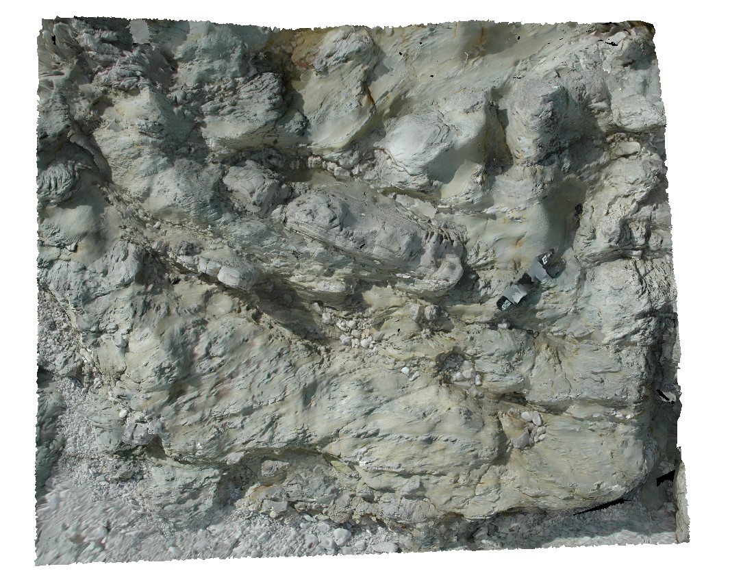
Surville2 Map
 |
50 |
03/16/2015 2:21 p.m. |
3D |
view form off-shore of cliff exposure, showing basement unconformable contact between Devonian Granite and the overlying sedimentary Parmeener Supergroup with intrusive Jurassic dolerite contact (darker rock). Cape Surville, Tasman Peninsula. Tasmania. |
500.00 |
-42.95779432000 |
147.99290997000 |
0.500 |
basement unconformity, unconformity, intrusive contact, igneous intrusion |
granite, siltstone, dolerite |
Limebay1 Map
 |
5 |
01/01/9999 midnight |
3D |
ripple marks and cross bedding in Triassic sandstone. Lime Bay, Tas. |
0.00 |
-42.94673000000 |
147.70013000000 |
-9999.000 |
sandstone, ripple marks, sedimentological |
sandstone |
Limebay2 Map
 |
5 |
01/01/9999 midnight |
3D |
close-up of ripple marks and cross bedding in Triassic sandstone from site Limebay1. Lime Bay, Tas. |
0.00 |
-42.94673000000 |
147.70013000000 |
-9999.000 |
ripple marks, cross bedding, Triassic sandstone, sedimentological |
sandstone |
Limebay3 Map
 |
5 |
01/01/9999 midnight |
3D |
close-up of ripple marks and cross bedding in Triassic sandstone from site Limebay1. Lime Bay, Tas. |
0.00 |
-42.94668000000 |
147.70016000000 |
-9999.000 |
Triassic sandstone, ripple marks, cross bedding, sedimentological |
sandstone |
Limebay4 Map
 |
5 |
01/01/9999 midnight |
3D |
overturned cross beds in Triassic Sandstone. Lime Bay, Tas. |
0.00 |
-42.94368000000 |
147.69635000000 |
-9999.000 |
Triassic sandstone, overturned bedding, cross bedding |
sandstone |
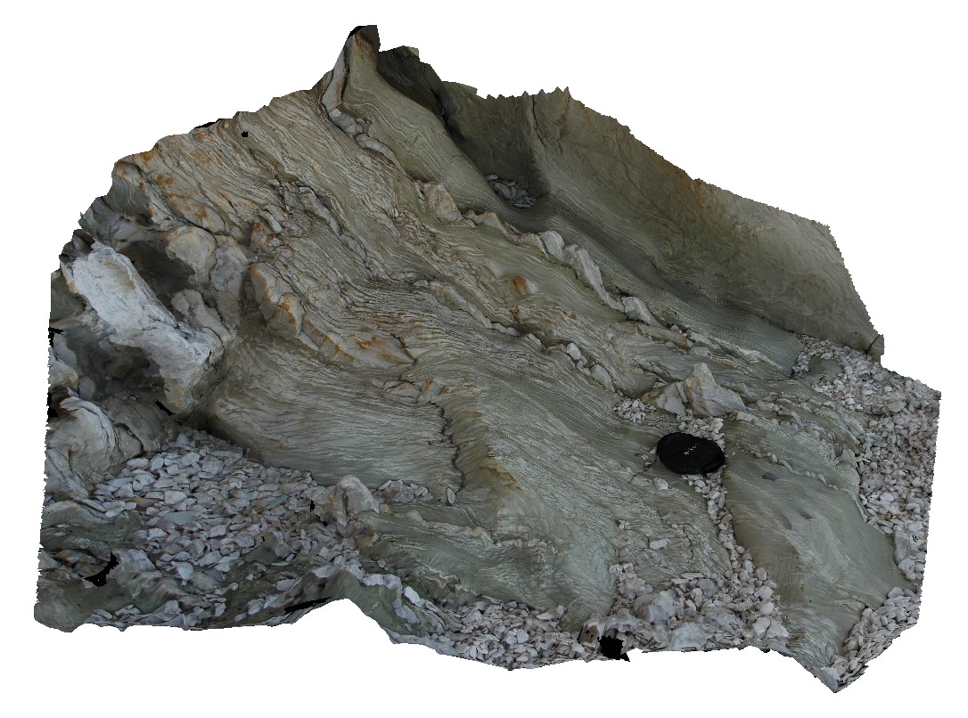
Limebay5 Map
 |
5 |
01/01/9999 midnight |
3D |
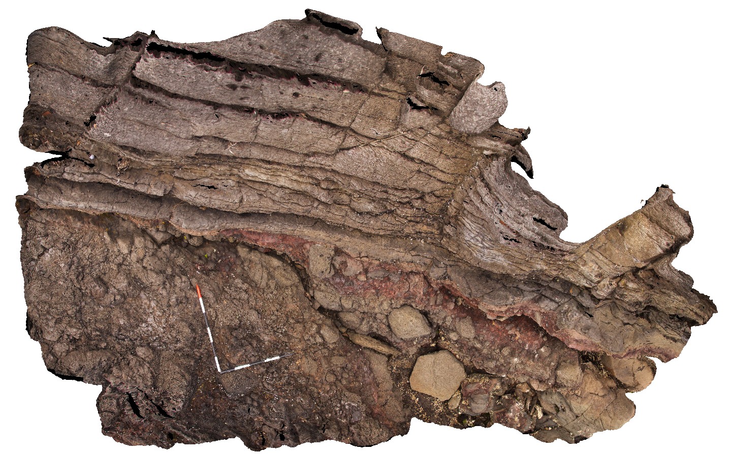
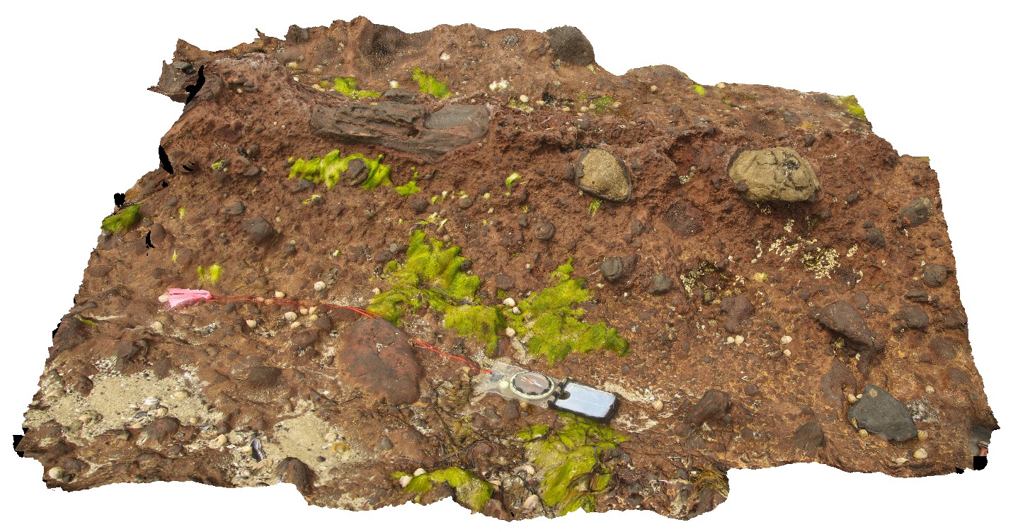
laminated tuff and bomb beds , including sandstone lithic bombs in Tertiary Basalt units. Lime Bay, Tas. |
0.00 |
-42.94318000000 |
147.69609000000 |
-9999.000 |
bomb, tuff, laminated, volcaniclastic, volcanic |
basalt |
Limebay6 Map
 |
5 |
01/01/9999 midnight |
3D |
laminated tuff and bomb beds , including sandstone lithic bombs in contact with Tertiary Basalt lava flows? Lime Bay, Tas. |
0.00 |
-42.94311000000 |
147.69608000000 |
-9999.000 |
geological contact, basalt lava, bomb, volcanics, volcaniclastic, tuff |
basalt |
ParkersUAV3 Map
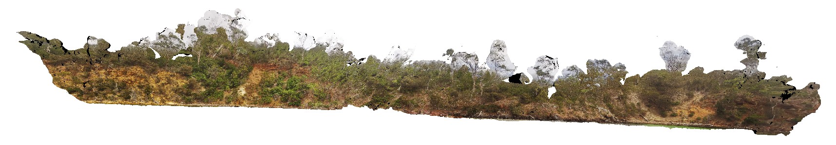 |
20 |
01/01/9999 midnight |
UAV |
aerial view of entire Parkers Beach outcrop of fluvial and flood plain Triassic sediments. Parkers Beach, Nubeena Tasmania. |
385.00 |
-42.94254100000 |
147.69614700000 |
19.000 |
fluvial, floodplain, sedimentology, Triassic |
sandstone |
Limebay7 Map
 |
5 |
01/01/9999 midnight |
3D |
bombs, scoria and agglutinated lava flow. Lime Bay, Tas. |
0.00 |
-42.94200000000 |
147.69533000000 |
-9999.000 |
basalt lava, agglutinated, bomb, scoria, volcanic |
basalt |