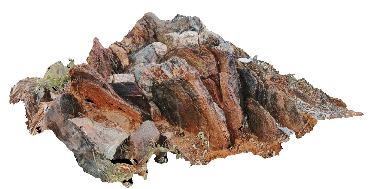
Splitpoint6 Map
 |
10 |
06/17/2015 10:56 a.m. |
3D |
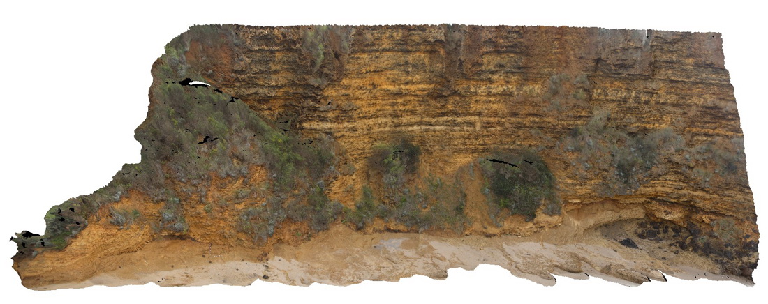
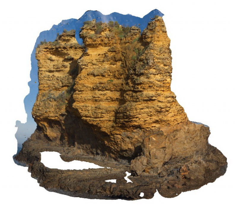
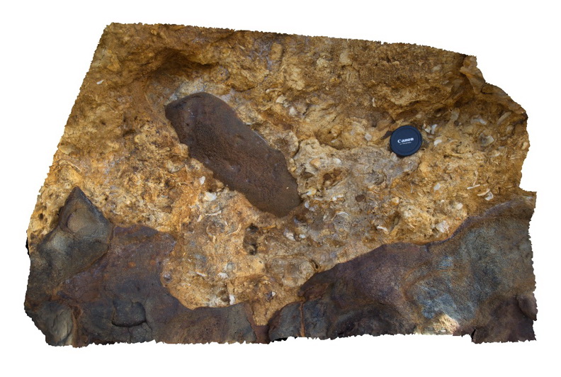
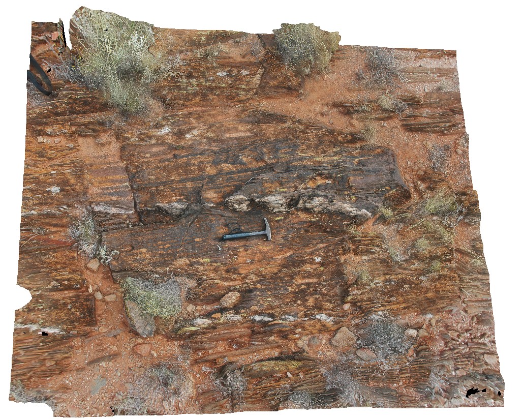
Bedded limestone of the Torquay Group disconformably overlying pyroclastic rocks of the Oligocene Angahook Formation. Split Point, Vic. |
30.00 |
-38.46460000000 |
144.10770000000 |
-9999.000 |
disconformity, carbonate sedimentology, pyroclastic, volcanology |
limestone, tuff |
BHill62 Map
 |
5 |
09/15/2015 4:56 p.m. |
3D |
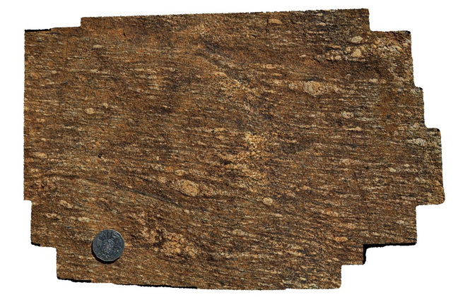
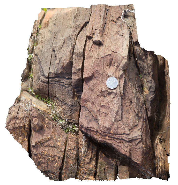
Detail of feldspar porphyroblasts in Rasp Ridge Gneiss. Broken Hill. N.S.W. |
0.40 |
-31.96737000000 |
141.44806000000 |
-9999.000 |
porphyroblast, gneiss |
gneiss |
CrescentFSP1 Map
 |
5 |
08/27/2015 11:07 a.m. |
FSP |
View of dipping sandstone layers in the Permian Crescent Head Formation. Crescent Head, N.S.W. |
50.00 |
-31.18674000000 |
152.98433000000 |
-9999.000 |
bedding, sedimentology |
sandstone |
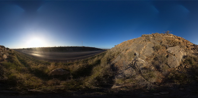
Splitpoint17 Map
 |
20 |
06/17/2015 10:49 a.m. |
3D |
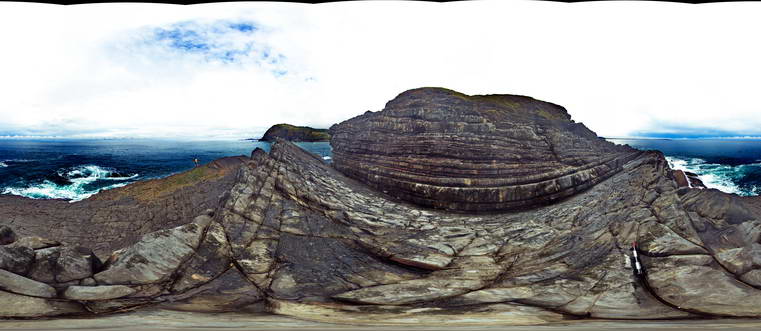
sea stack showing bedded limestone of the Torquay Group disconformably overlying basalt of the Oligocene Angahook Formation. Split Point, Vic. |
30.00 |
-38.46854000000 |
144.10675000000 |
-9999.000 |
disconformity, volcanology, sedimentology |
limestone, basalt |
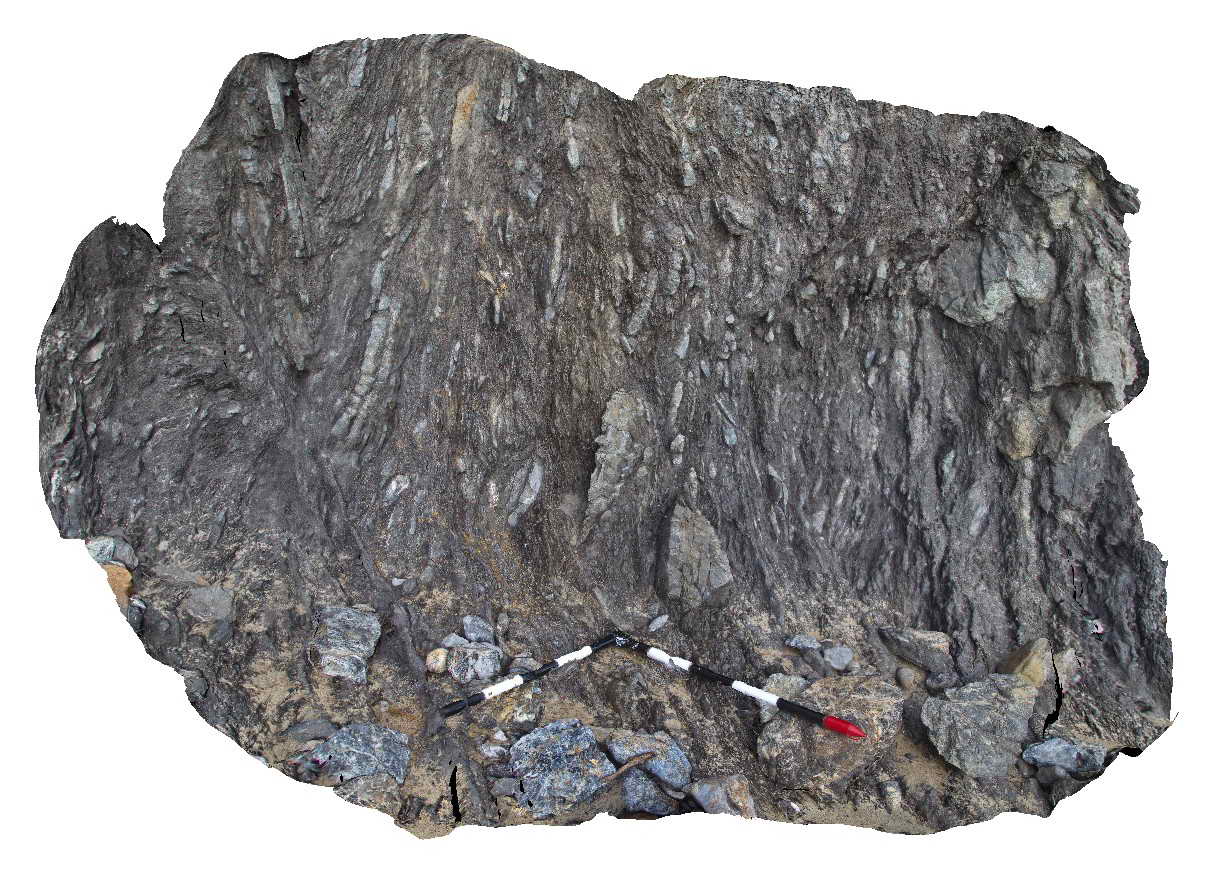
Splitpoint16 Map
 |
5 |
06/17/2015 10:49 a.m. |
3D |
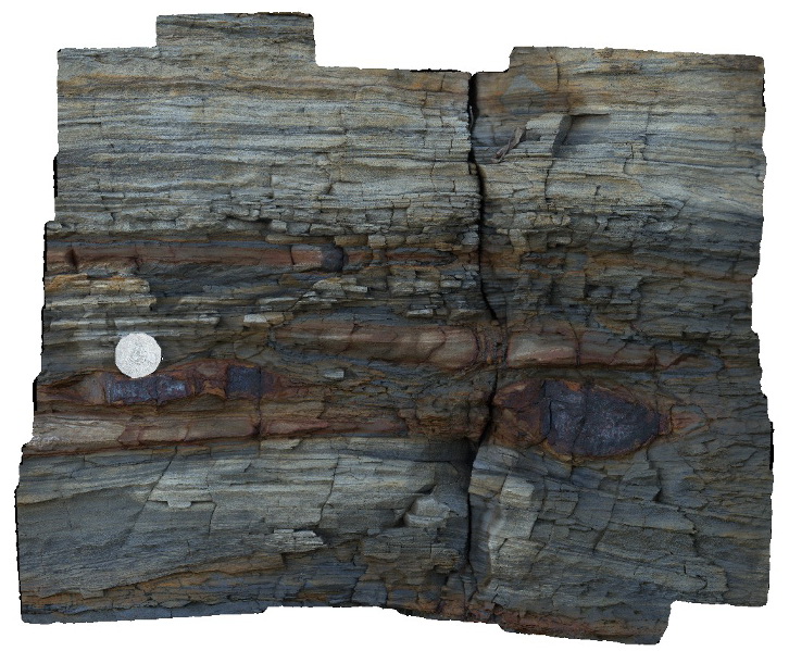
Detailed view of the disconformable contact between basalt of the Oligocene Angahook Formation and bioclastic limestone of the Oligocene-Miocene Torquay Group. Split Point, Vic. |
0.00 |
-38.46855000000 |
144.10698000000 |
-9999.000 |
palaeontology, disconformity, volcanology, sedimentology |
basalt, limestone |
BHill66 Map
 |
5 |
09/16/2015 11:08 a.m. |
3D |
tight, 'S' shaped, plunging folds in psammopelitic metasediments. Next to sample location BHill65. Allens Tank area, Broken Hill. N.S.W. |
2.50 |
-31.61754000000 |
141.48846000000 |
-9999.000 |
psammopelitic metasediments, S fold |
psammopelitic |
DaisyBanksPit4 Map
 |
20 |
03/17/2015 1:45 p.m. |
3D |
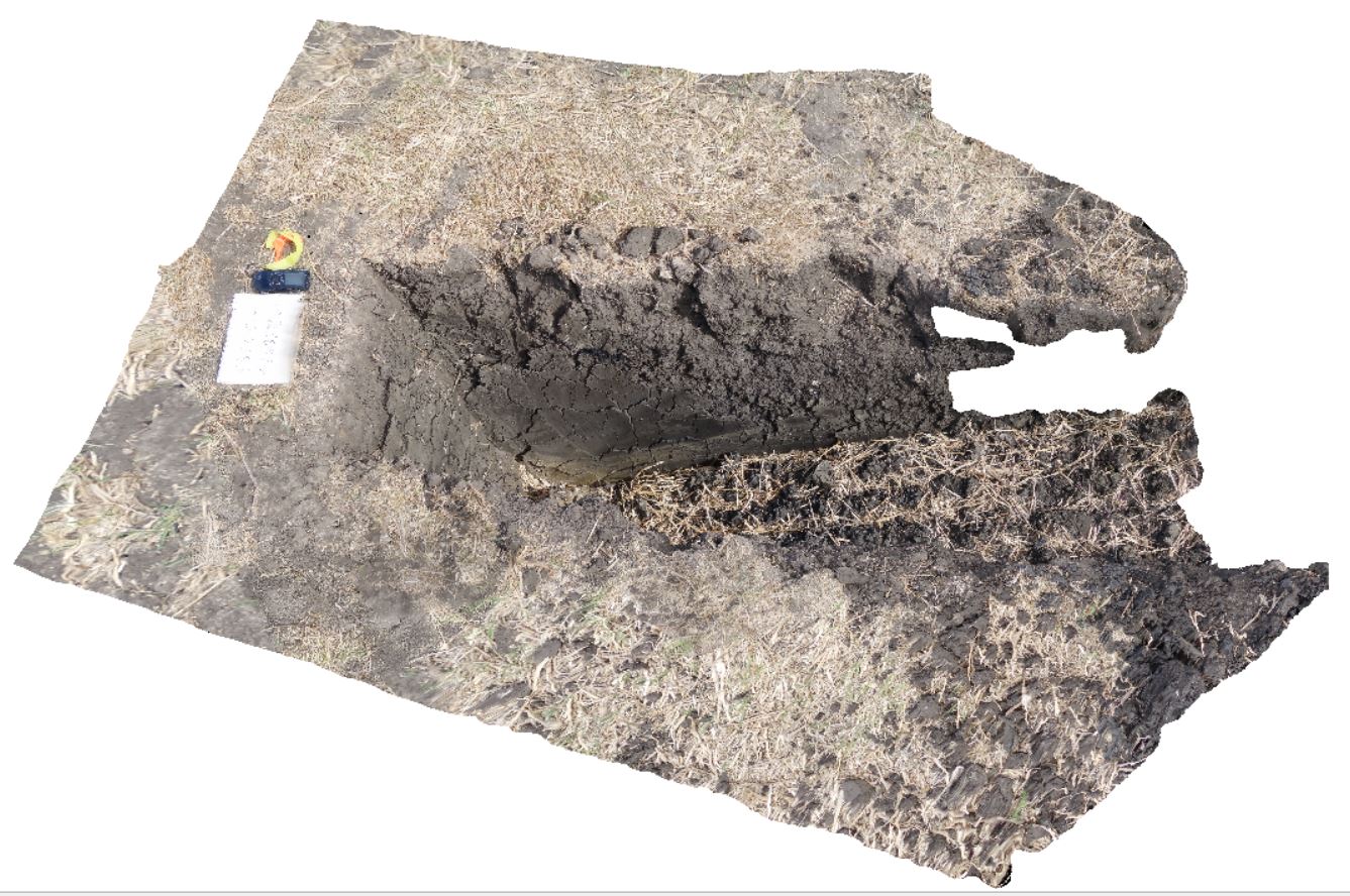
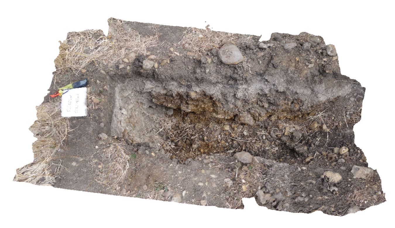
~80cm deep pit into soil and clays overlying Quaternary alluvial and marsh deposits of modern flood plains; of gravel, sand, silt and clay. Richmond, Tas. |
2.00 |
-42.73176200000 |
147.42817100000 |
-9999.000 |
Clay, alluvium, regolith |
Clay |
SmokyCape2 Map
 |
1 |
06/16/2015 5:39 p.m. |
3D |
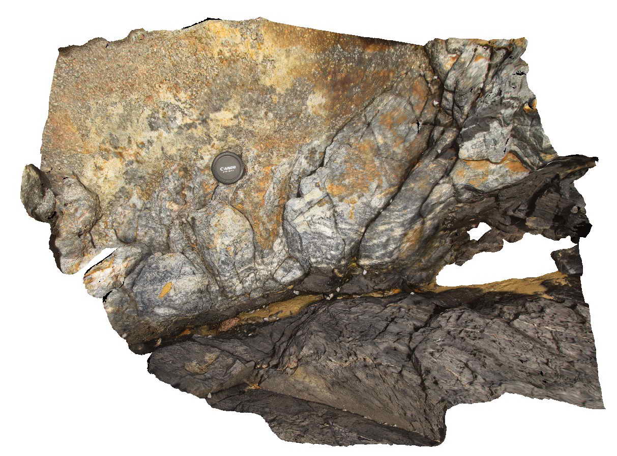
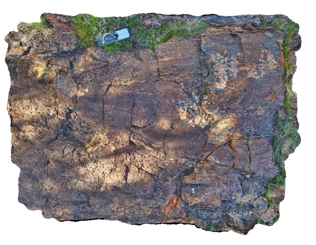
Detail of contact between the Triassic Smokey Cape Monzogranite and Permo-Carboniferous Kempsey Beds showing the chilled margin of the granite and migmatised country rocks. Smoky Cape, N.S.W |
1.00 |
-30.92401000000 |
153.08894000000 |
-9999.000 |
intrusive contact, chilled margin, migmatite, igneous |
monzogranite, sandstone |
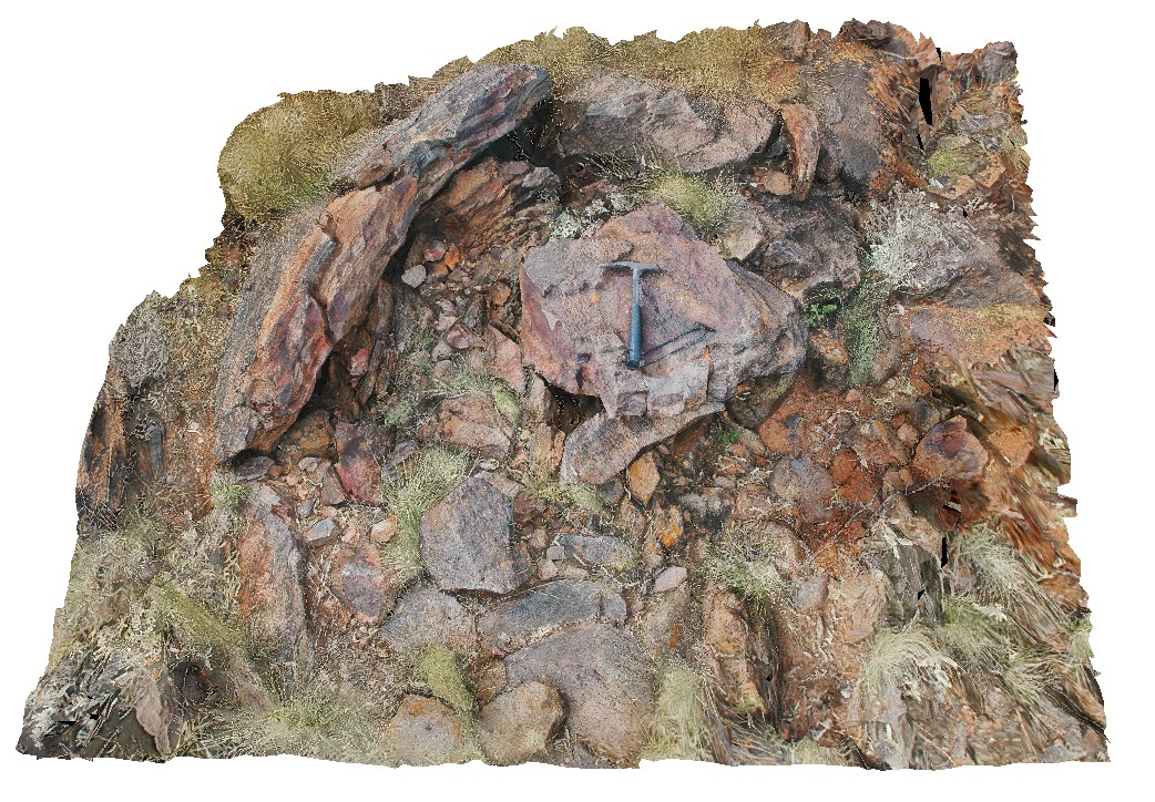
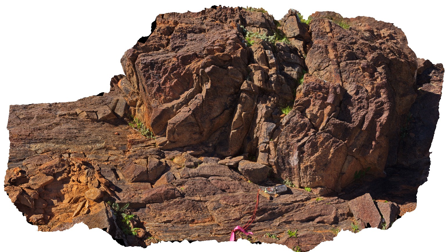
BHillFSP19 Map
 |
0 |
10/19/2015 11:06 a.m. |
FSP |
road cutting, showing joint surfaces and small scale folding in gneiss. Broken Hill. N.S.W. |
200.00 |
-32.00626000000 |
141.28963000000 |
-9999.000 |
fold, joint surface |
gneiss |
Walkerville3 Map
 |
1 |
05/18/2015 2:24 p.m. |
3D |
Detail of fault zone textures in Liptrap Sandstone. Walkerville South, Vic. |
2.00 |
-38.85549500000 |
145.99678000000 |
-9999.000 |
fault, melange |
Melange |
BH2011n1 Map
 |
20 |
03/16/2015 2:53 p.m. |
3D |
tightly folded and moderately plunging folds in Hores Gneiss. Broken Hill, N.S.W. |
0.80 |
-31.63547118000 |
141.53853471000 |
-9999.000 |
gneiss, tight fold, fold, structure |
gneiss |
BH2011n10 Map
 |
20 |
03/16/2015 2:53 p.m. |
3D |
view of preserved dome in metasediments. Broken Hill, N.S.W. |
3.00 |
-31.64098561000 |
141.54132199000 |
-9999.000 |
dome, fold, metasediment, structure |
metasediment |
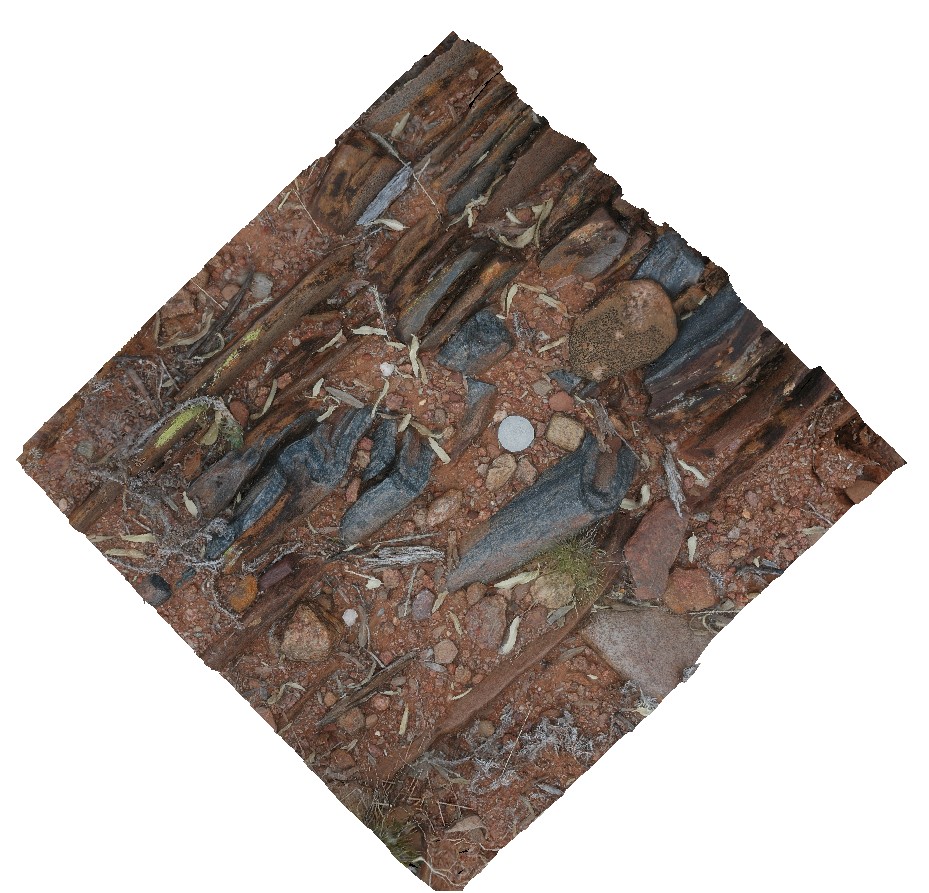
BH2013Adelaidean2 Map
 |
20 |
03/24/2015 5:49 p.m. |
3D |
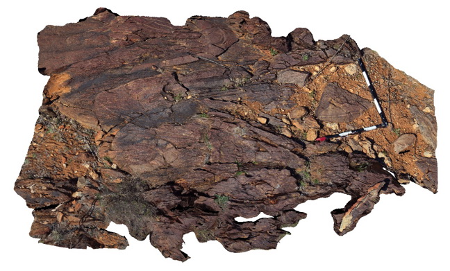
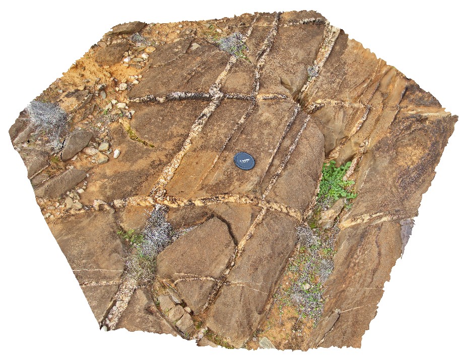
cross bedded sandstone pavement with sheeted vein sets. First set of bucky quartz veins are off-set by second set, with apparent sinistral movement direction and growth of quartz within the veins. Broken Hill, N.S.W. |
0.50 |
-31.59924614000 |
141.59926357000 |
-9999.000 |
sinistral movement, quartz vein, direction indicators, structure, sheeted veins |
sandstone |
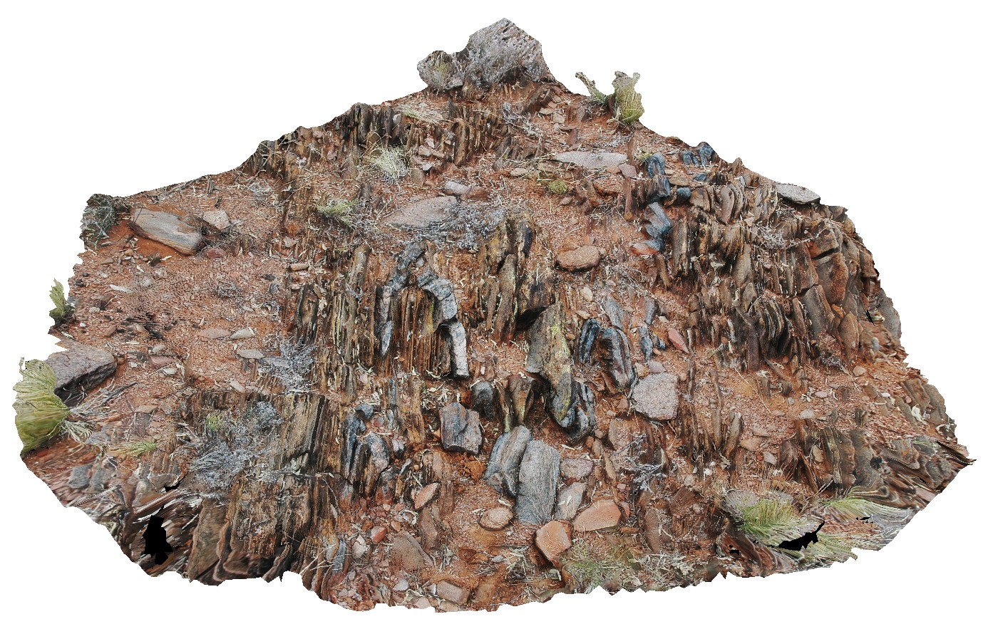
BHill73 Map
 |
5 |
09/16/2015 11:12 a.m. |
3D |
view of shear zone, showing sheared psammitic layers in metasediments. Allans Bore Area, Broken Hill. N.S.W. |
0.90 |
-31.61191000000 |
141.49387000000 |
-9999.000 |
shear zone, psammite |
psammite |
BH2011n14 Map
 |
20 |
03/16/2015 2:54 p.m. |
3D |
view of metasediment with strongly developed S-C fabric. Broken Hill, N.S.W. |
2.00 |
-31.63442634000 |
141.54044540000 |
-9999.000 |
S - C fabric, structure, metasediment |
metasediment |
BH2011n7 Map
 |
20 |
03/16/2015 2:55 p.m. |
3D |
mica rich schist, with small folds and cross cutting cleavage. Broken Hill, N.S.W. |
0.30 |
-31.63596042000 |
141.53388023000 |
-9999.000 |
cleavage, fold, structure |
schist |
BH2011n11 Map
 |
20 |
09/14/2015 10:35 a.m. |
3D |
view of metadacite / fine-grained gneiss. Broken Hill, N.S.W. |
3.00 |
-31.64335967000 |
141.54101707000 |
-9999.000 |
metadacite |
gneiss |
BH2011n12 Map
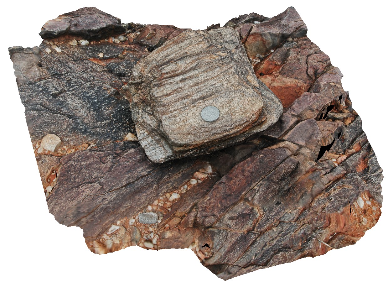
 |
20 |
03/16/2015 2:53 p.m. |
3D |
boudinaged quartz veins in metasediments. Broken Hill, N.S.W. |
2.50 |
-31.63409414000 |
141.54039789000 |
-9999.000 |
boudinage, metasediment, structure |
metasediment |
BH2011n2 Map
 |
20 |
03/16/2015 2:54 p.m. |
3D |
moderately plunging, tight folds in thinly bedded quartzite and mudstones metasediments. Strong cleavage also evident. Broken Hill. N.S.W. |
1.00 |
-31.63628271000 |
141.53839687000 |
-9999.000 |
fold plunge, tight fold, fold, structure, metasediments, cleavage |
metasediments |
BH2011n3 Map
 |
20 |
03/16/2015 2:54 p.m. |
3D |
moderately plunging parasitic folds in quartzite layer. Broken Hill, N.S.W. |
0.50 |
-31.63595890000 |
141.53825045000 |
-9999.000 |
fold plunge, parasitic fold, metasediments, structure |
metasediment |
MtGipps42 Map
 |
0 |
06/30/2016 noon |
3D |
metasediments, Mount Gipps, N.S.W. |
2.00 |
-31.61704000000 |
141.50061000000 |
-9999.000 |
metasediments |
metasediments |
Crowdy6 Map
 |
1 |
07/08/2015 10:37 a.m. |
3D |
Detail of tessellated pavement in sandstone. Crowdy Head Cliffs, N.S.W. |
6.00 |
-31.84576000000 |
152.75128000000 |
-9999.000 |
tessellated pavement, jointing |
sandstone |
DaisyBanksPit5 Map
 |
20 |
03/17/2015 1:50 p.m. |
3D |
~80cm wide pit into recent sediments overlying Quaternary alluvial and marsh deposits of modern flood plains; of gravel, sand, silt and clay. Richmond, Tas. |
2.00 |
-42.73253700000 |
147.42790800000 |
-9999.000 |
palaeochannel, alluvial, regolith |
Gravel |
BH2013Adelaidean1 Map
 |
20 |
03/16/2015 2:55 p.m. |
3D |
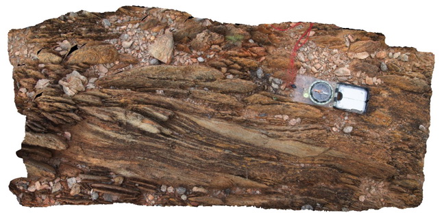
moderately dipping, finely banded sandstones with spaced cleavage. Broken Hill, N.S.W. |
0.20 |
-31.59715313000 |
141.59824227000 |
-9999.000 |
spaced cleavage, structure, metasediments |
sandstone |
BHill83 Map
 |
5 |
09/18/2015 11:02 a.m. |
3D |
fold with axial plane sillimanite in banded garnet, sillimanite gneiss. Broken Hill. N.S.W. |
0.20 |
-31.93103000000 |
141.51883000000 |
-9999.000 |
axial planar cleavage, sillimanite, garnet sillimanite gneiss |
gneiss |