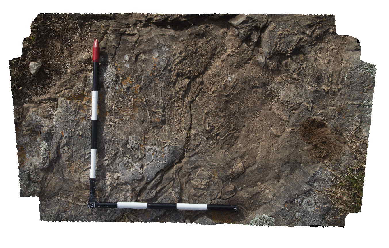
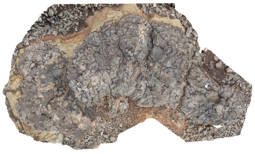
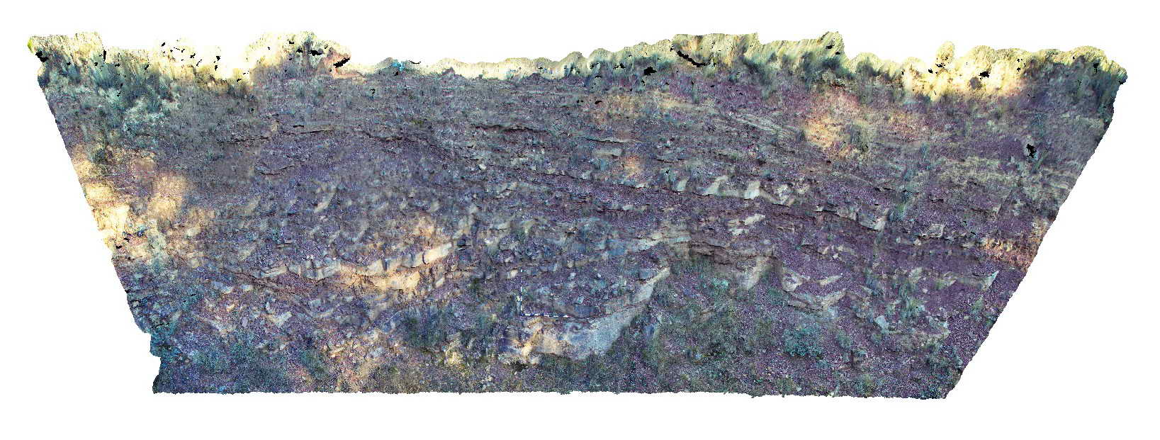
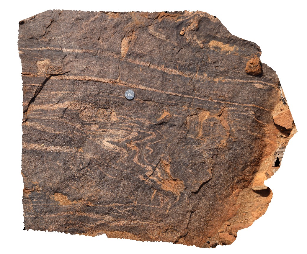
Wongwibinda5 Map
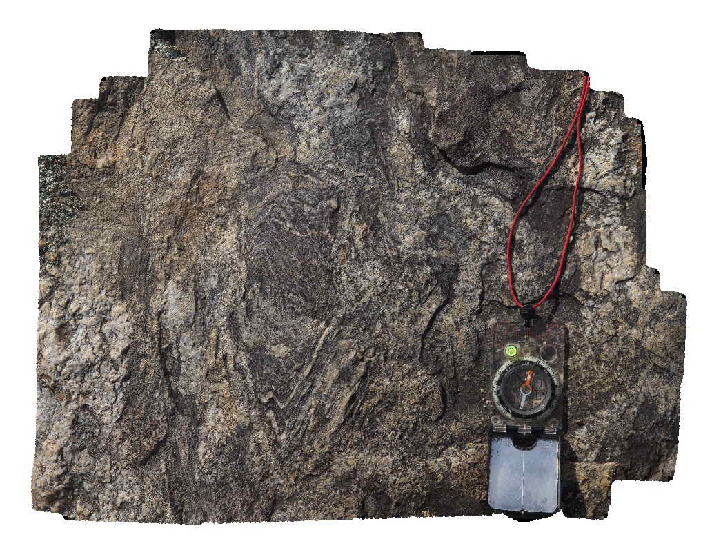 |
5 |
06/16/2015 5:47 p.m. |
3D |
Detail of migmatite outcrop showing pervasive folded leucosomes. Carboniferous Wongwibinda Complex. Guyra Road, N.S.W. |
0.60 |
-30.27561000000 |
152.10387000000 |
1260.000 |
migmatite, leucosomes, folds, high temperature metamorphism, structure |
migmatite |
Wongwibinda4 Map
 |
5 |
06/16/2015 5:46 p.m. |
3D |
Pavement of migmatite in the Carboniferous Wongwibinda Complex. Guyra Road, N.S.W. |
5.00 |
-30.27561000000 |
152.10387000000 |
1260.000 |
migmatite, high temperature metamorphism |
migmatite |
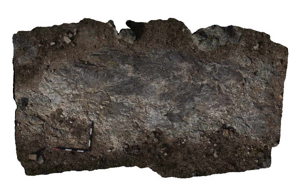
Wongwibinda2 Map
 |
5 |
06/16/2015 5:45 p.m. |
3D |
Detailed view of folded leucosomes in a pavement of migmatised metasedimentary rocks of the Carboniferous Wongwibinda Complex. Guyra Road, N.S.W. |
1.00 |
-30.27490000000 |
152.10399000000 |
1260.000 |
migmatite, metamorphism, igneous, fold, structure, high temperature |
migmatite |
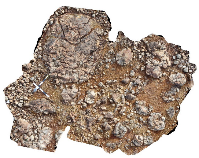
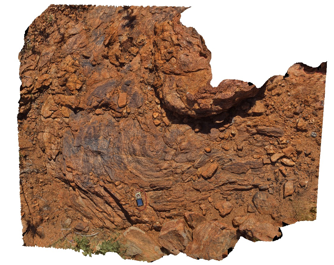
Wongwibinda1 Map
 |
5 |
06/16/2015 5:43 p.m. |
3D |
Pavement of migmatised metasedimentary rocks of the Carboniferous Wongwibinda Complex. Guyra Road, N.S.W. |
5.00 |
-30.27490000000 |
152.10399000000 |
1260.000 |
migmatite, metamorphic, high temperature |
migmatite |
Wongwibinda6 Map
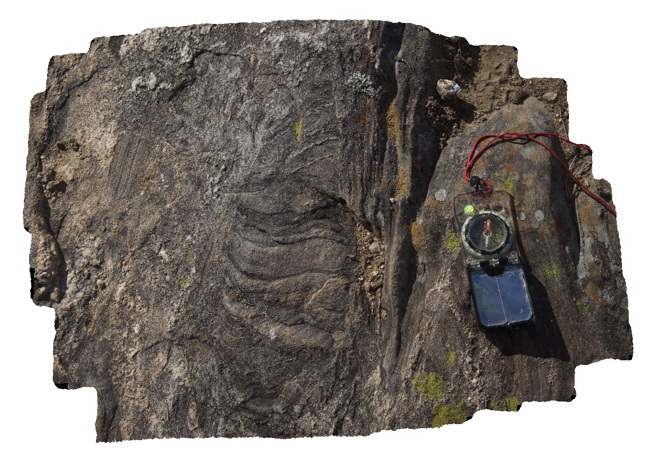 |
5 |
06/16/2015 5:48 p.m. |
3D |
Detailed view of migmatite outcrop. Carboniferous Wongwibinda Complex. Guyra Road, N.S.W. |
0.60 |
-30.27561000000 |
152.10387000000 |
1260.000 |
migmatite, leucosomes, high temperature metamorphism, structure |
migmatite |
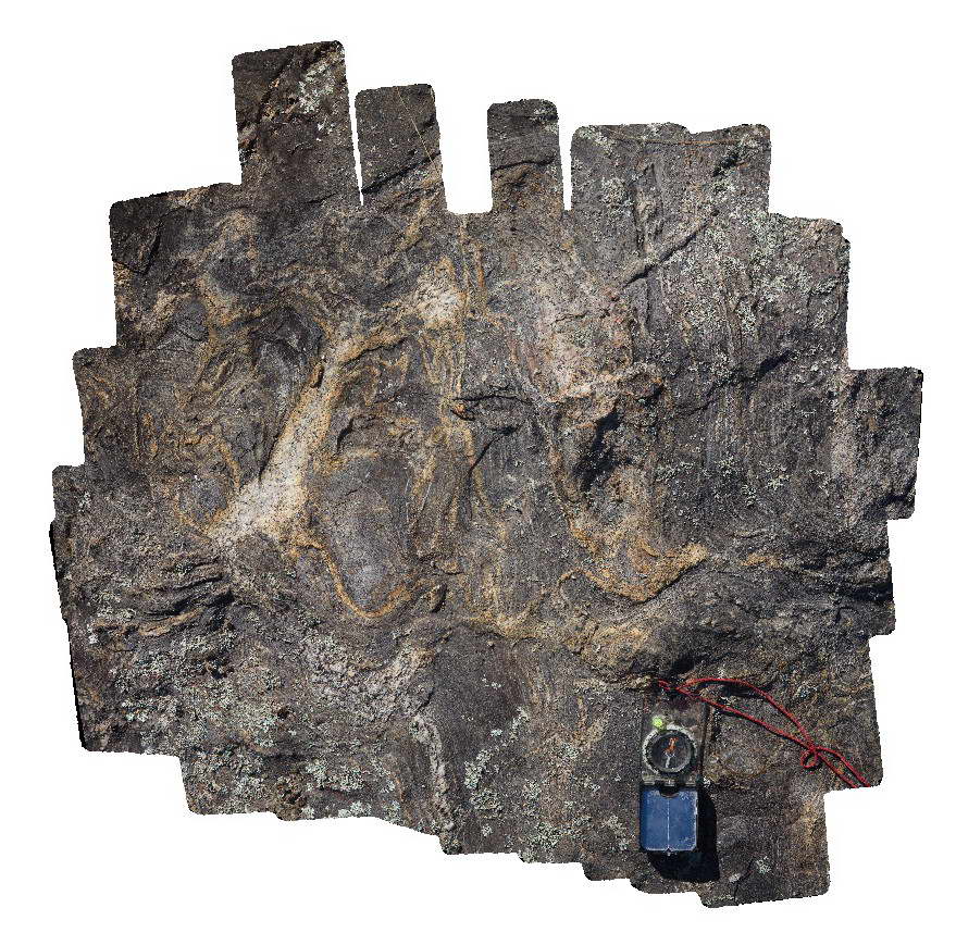
Wongwibinda7 Map
 |
5 |
06/16/2015 5:48 p.m. |
3D |
Migmatite outcrop with abundant folded leucosomes. Carboniferous Wongwibinda Complex. Guyra Road, N.S.W. |
1.00 |
-30.28173000000 |
152.15536000000 |
1240.000 |
migmatite, leucosomes, structure, folds, high temperature metamorphism |
migmatite |
Ebor1 Map
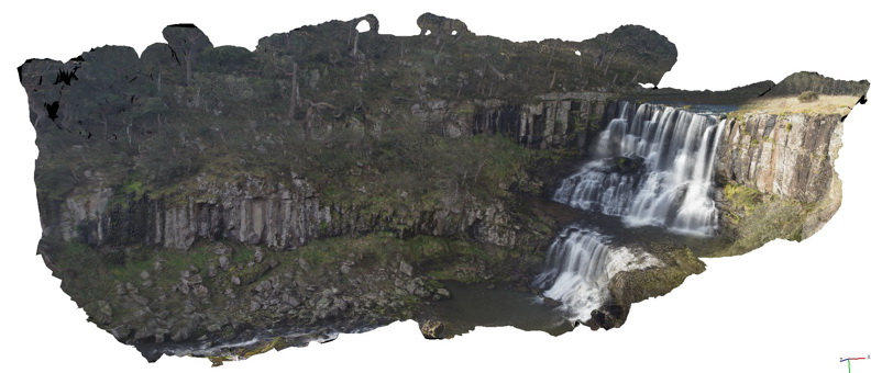 |
20 |
06/16/2015 5:35 p.m. |
3D |
Basalt columns forming the escarpment at Ebor falls. Ebor Falls, N.S.W. |
80.00 |
-30.40222000000 |
152.34140000000 |
1238.000 |
columnar basalt, igneous, geomorphology |
basalt |
GreatLake5 Map
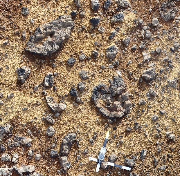 |
5 |
01/01/9999 midnight |
3D |
image of basalt pillow lava fragments, Great Lake, Tasmania. |
4.50 |
-41.90014200000 |
146.71294900000 |
1035.000 |
basalt, pillow basalt, lava fragments, lava, volcanic |
basalt |
GreatLake1 Map
 |
5 |
01/01/9999 midnight |
3D |
Basalt lobe with polygonal jointing, Great Lake, Tasmania. |
7.00 |
-41.85873600000 |
146.71590600000 |
1035.000 |
basalt, pillow basalt, flow, polygonal jointing, volcanic |
basalt |
GreatLake3 Map
 |
5 |
01/01/9999 midnight |
3D |
image of basalt pillow lava fragments, Great Lake, Tasmania. |
7.00 |
-41.89947600000 |
146.71338600000 |
1035.000 |
basalt, pillow lava, volcanic, lava fragments |
basalt |
GreatLake4 Map
 |
5 |
01/01/9999 midnight |
3D |
image of basalt pillow lava fragments, Great Lake, Tasmania. |
7.00 |
-41.89987200000 |
146.71320400000 |
1035.000 |
basalt, pillow lava, lava fragments, volcanic |
basalt` |
GreatLake2 Map
 |
5 |
01/01/9999 midnight |
3D |
image of basalt pillow lava fragments, Great Lake, Tasmania. |
7.00 |
-41.89943200000 |
146.71350700000 |
1035.000 |
pillow basalt, flow, lava fragments, basalt, volcanic |
basalt |
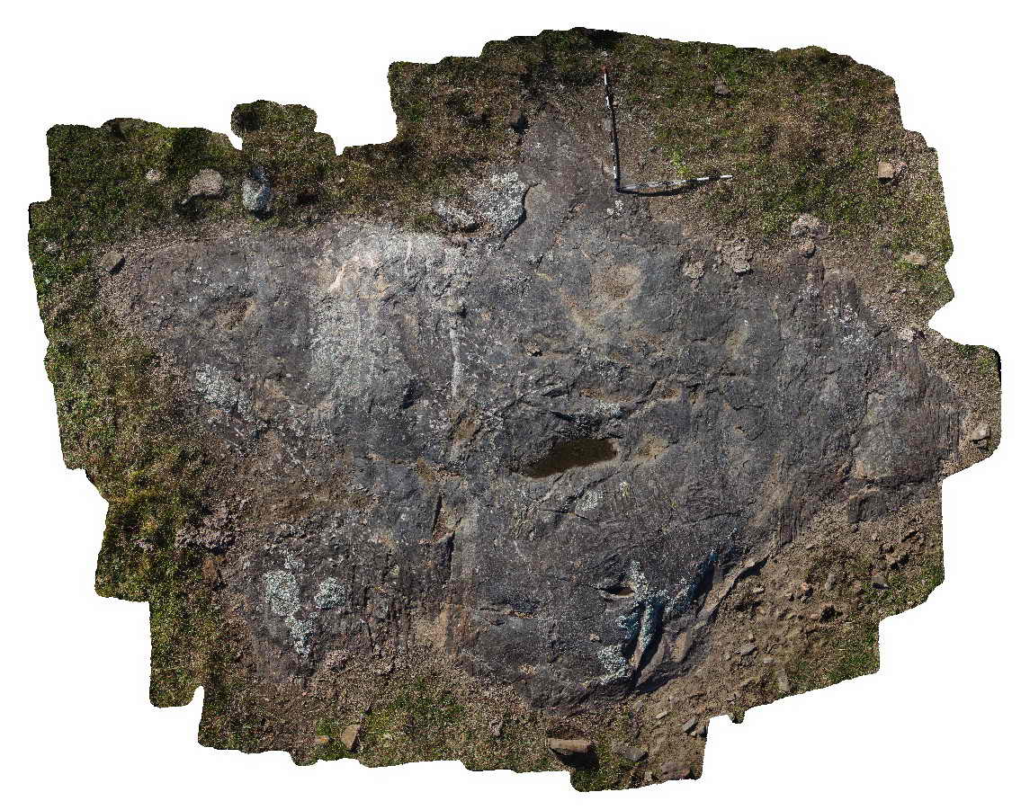
GreatLake6 Map
 |
5 |
01/01/9999 midnight |
3D |
basalt lava flow sitting on top of sediments with a single basalt pillow within the sediments. Great Lake, Tasmania. |
7.00 |
-41.85947600000 |
146.71672200000 |
1035.000 |
basalt, lava flow, subaqueous, volcanic, pillow basalt, inter-pillow sediments, pillow lava |
basalt |
Yarrowyck1 Map
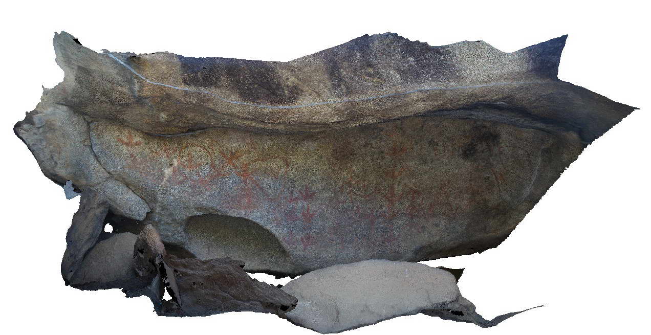 |
5 |
06/16/2015 5:50 p.m. |
3D |
Yarrowick rock art site in granite of the Permo-Triassic Gwydir River Monzogranite. Mount Yarrowick, N.S.W. |
3.00 |
-30.45472000000 |
151.37651000000 |
900.000 |
rock art |
granite |
Yarrowyck2 Map
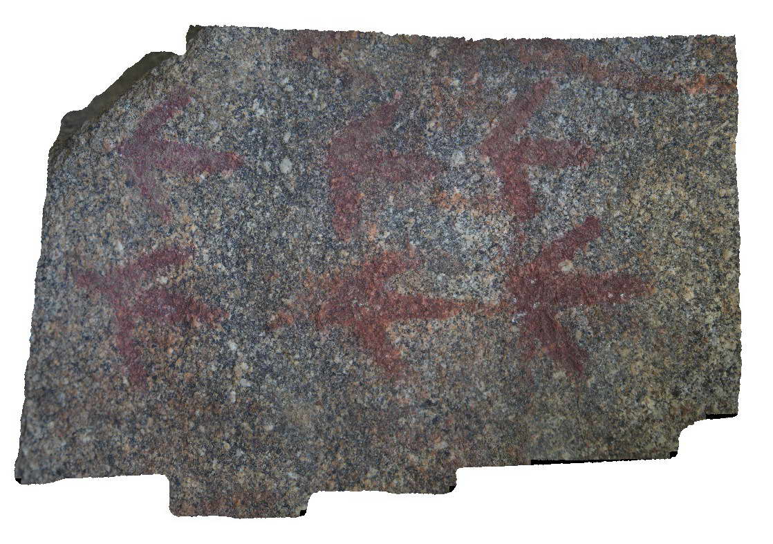 |
5 |
06/16/2015 5:51 p.m. |
3D |
Detail of Yarrowick rock art site in granite of the Permo-Triassic Gwydir River Monzogranite. Mount Yarrowick, N.S.W. |
0.50 |
-30.45472000000 |
151.37651000000 |
900.000 |
rock art |
granite |
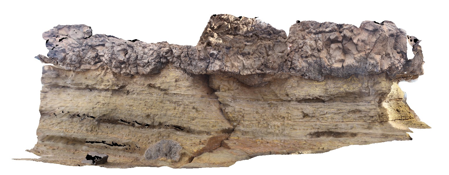
MansfieldRd2 Map
 |
5 |
06/17/2015 10:25 a.m. |
3D |
Large scale cross stratification in interbedded sandstone and mudstone of the Devonian-Carboniferous Snowy Plains Formation. Mansfield Road, Vic. |
20.00 |
-36.93927000000 |
146.20639000000 |
900.000 |
cross stratification, sedimentology |
mudstone, sandstone |
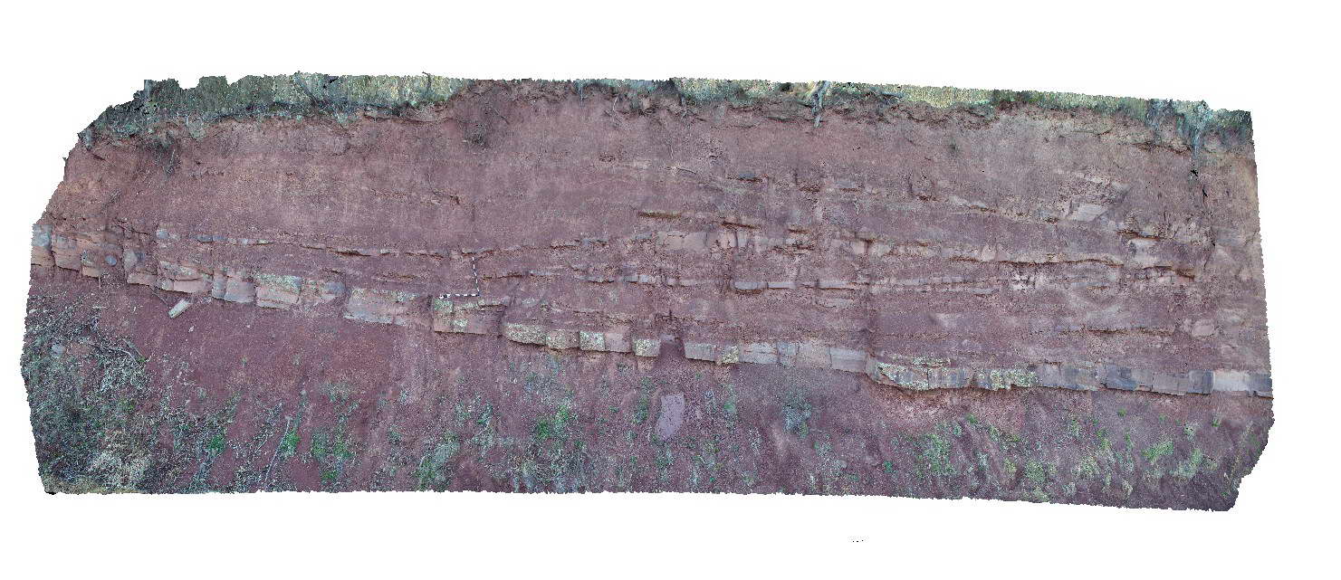
MansfieldRd1 Map
 |
5 |
06/17/2015 10:24 a.m. |
3D |
low angle fault in bedded sandstone and mudstone of the Devonian to Carboniferous Snowy Plains Formation. Mansfield Road, Vic. |
15.00 |
-36.88522000000 |
146.30833000000 |
900.000 |
fault, structure, sedimentology |
sandstone, mudstone |
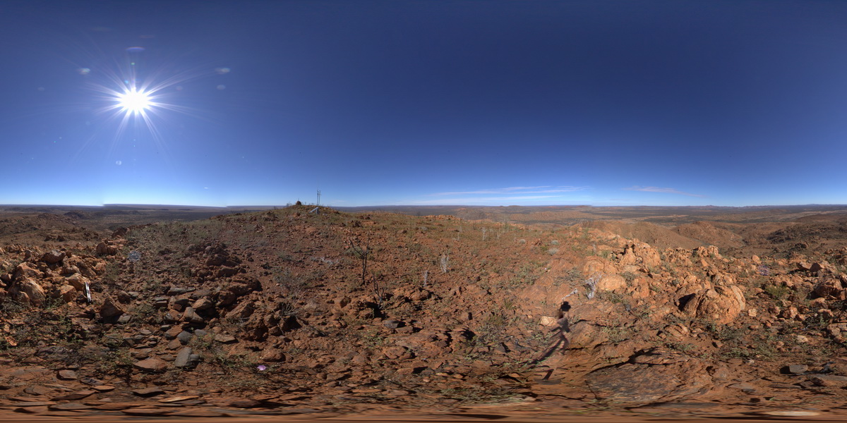
REYNFSP2 Map
 |
0 |
07/24/2016 11:43 a.m. |
FSP |
view from west side of Mount Boothby, showing gneiss (foreground) and surrounding landscape. Reynolds Range. Next to Stuart Highway. N.T. |
3000.00 |
-22.57917700000 |
133.29637600000 |
887.075 |
Aileron Metamorphics, Boothby Orthogneiss, metamorphics |
gneiss, gneiss |
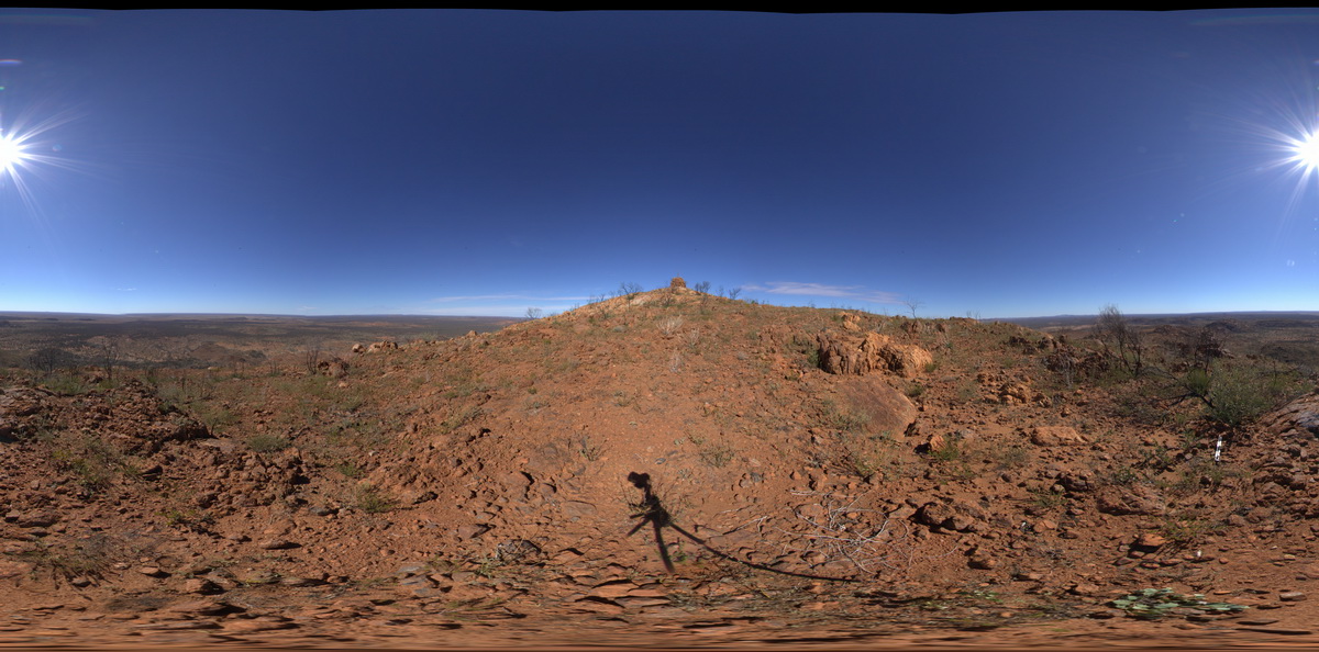
REYNFSP3 Map
 |
0 |
07/24/2016 11:51 a.m. |
FSP |
view from North East side of Mount Boothby, showing gneiss (foreground) and surrounding landscape. Reynolds Range. Next to Stuart Highway. N.T. |
0.00 |
-22.57900900000 |
133.29726800000 |
882.999 |
metamorphic, gneiss, Boothby Orthogneiss, Aileron Metamorphics |
gneiss, gneiss |
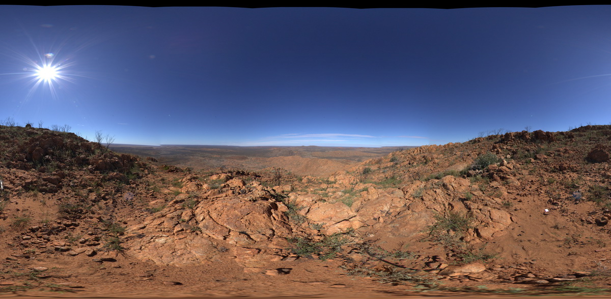
REYNFSP1 Map
 |
0 |
07/24/2016 11:35 a.m. |
FSP |
view from south side of Mount Boothby, showing felsic ortho gneiss on the ground and surrounding landscape. Reynolds Range. Next to Stuart Highway. N.T. |
3000.00 |
-22.57954400000 |
133.29694100000 |
881.272 |
gneiss, Aileron Provence, metamorphic |
orthogneiss |
REYN1 Map
 |
0 |
07/24/2016 12:07 p.m. |
3D |
large re-folded fold in intermingled mafic/felsic orthogneiss. Mount Boothby, Reynolds Range. Next to Stuart Highway. N.T. |
3.00 |
-22.57866600000 |
133.29625800000 |
870.747 |
orthogneiss, metamorphic, refolded fold, structure, fold |
orthogneiss |
REYN3 Map
 |
0 |
07/24/2016 12:55 p.m. |
3D |
parasitic folds in mafic granulite, Mount Boothby, Reynolds Range. Next to Stuart Highway. N.T. |
0.70 |
-22.57826100000 |
133.29663600000 |
863.448 |
parasitic fold, fold, structure, granulate, metamorphic |
granulite |
REYNUAV1 Map
 |
0 |
07/24/2016 12:20 p.m. |
UAV |
aerial view of folded migmatitic ortho gneiss with parasitic, isoclinal folds. North West side of Mount Boothby, Reynolds Range. Next to Stuart Highway. N.T. |
20.00 |
-22.57896100000 |
133.29551700000 |
848.040 |
metamorphic, gneiss, fold, structure |
gneiss, gneiss |
AmadFSP5 Map
 |
5 |
08/01/2016 12:07 p.m. |
FSP |
panorama view from western end of Mac Donnell Range from Taylors Pass. Gosse Bluff to the south. N.T. |
0.00 |
-23.67139200000 |
132.36578700000 |
832.751 |
conglomerate |
conglomerate |
AilerFSP1 Map
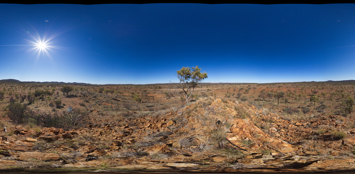 |
0 |
08/04/2016 10:54 a.m. |
FSP |
panoramic view from small hill of gneisses forming the Western and Hartz Ranges. The Garden Road, North of Alice Springs. N.T. |
5000.00 |
-23.23560700000 |
134.03837800000 |
809.222 |
gneiss, metamorphic |
gneiss |