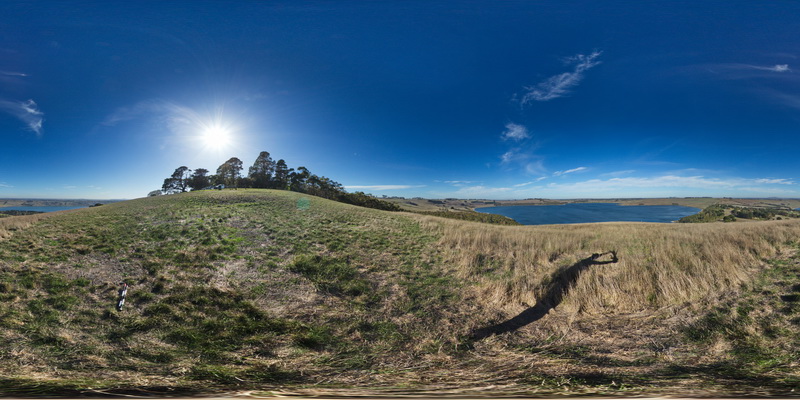
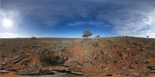
CamperdownFSP1 Map
 |
0 |
06/05/2016 10:37 a.m. |
FSP |
view from hill of volcanic landscape, showing lakes in the craters of extinct Maar volcanos. Camperdown, Vic. |
3000.00 |
-38.23573000000 |
143.09209000000 |
-9999.000 |
Maar volcano, volcanics |
pyroclastic |
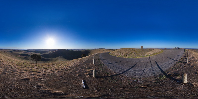
AlvieFSP4 Map
 |
0 |
06/05/2016 10:33 a.m. |
FSP |
view from Red Rocks carpark of old maar volcano and cinder cones. Alvie, Vic. |
3000.00 |
-38.25128000000 |
143.50841000000 |
-9999.000 |
maar volcano, cinder cone, volcanic topography |
volcanics |
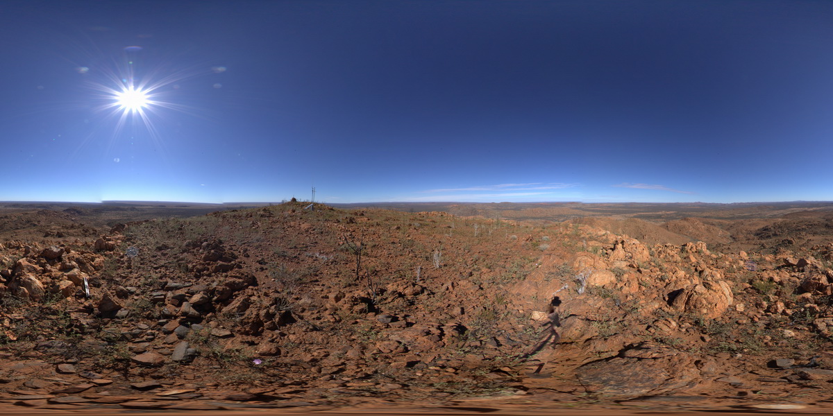
BHillFSP8 Map
 |
0 |
10/19/2015 9:47 a.m. |
FSP |
overview of outcropping folded Sundown Group Metasediments and distant hills. Broken Hill. N.S.W. |
3000.00 |
-31.83298000000 |
141.42821000000 |
-9999.000 |
Sundown Group, metasediments, fold |
metasediments |
BHillFSP4 Map
 |
0 |
10/19/2015 9:19 a.m. |
FSP |
overview of outcropping and graded? / bedded Sundown Group Metasediments and distant hills. Broken Hill. N.S.W. |
3000.00 |
-31.83373000000 |
141.42775000000 |
-9999.000 |
Sundown Group, metasediments |
metasediment |
REYNFSP1 Map
 |
0 |
07/24/2016 11:35 a.m. |
FSP |
view from south side of Mount Boothby, showing felsic ortho gneiss on the ground and surrounding landscape. Reynolds Range. Next to Stuart Highway. N.T. |
3000.00 |
-22.57954400000 |
133.29694100000 |
881.272 |
gneiss, Aileron Provence, metamorphic |
orthogneiss |
BHillFSP11 Map
 |
0 |
10/19/2015 10:29 a.m. |
FSP |
overview of outcropping folded Sundown Group Metasediments and pegmatite? (pale coloured) Broken Hill. N.S.W. |
3000.00 |
-31.83339000000 |
141.42923000000 |
-9999.000 |
Sundown Group, metasediments, pegmatite |
metasediment, Pegmatite |
BHillFSP6 Map
 |
0 |
10/19/2015 9:39 a.m. |
FSP |
overview of outcropping folded and crenulated Sundown Group Metasediments and distant hills. Broken Hill. N.S.W. |
3000.00 |
-31.83335000000 |
141.42799000000 |
-9999.000 |
Sundown Group, crenulation cleavage |
metasediment |
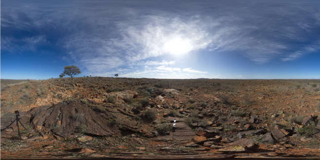
PurnululuFSP15 Map
 |
0 |
06/12/2016 noon |
FSP |
calcite-cemented breccia in red (hematitic) and buff coloured dolostone. Knife-edge ridge, Purnululu National Park, W.A. |
3000.00 |
-17.40892000000 |
128.20384000000 |
-9999.000 |
dolostone, breccia, structure, sedimentology |
dolostone |
BHillFSP10 Map
 |
0 |
10/19/2015 9:55 a.m. |
FSP |
overview of outcropping folded and bedded / graded Sundown Group Metasediments and distant hills. Broken Hill. N.S.W. |
3000.00 |
-31.83354000000 |
141.42888000000 |
-9999.000 |
Sundown Group, metasediments |
metasediments |
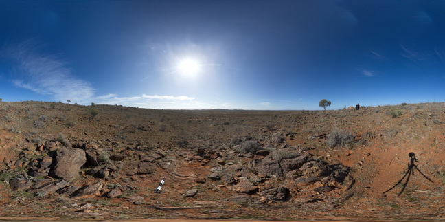
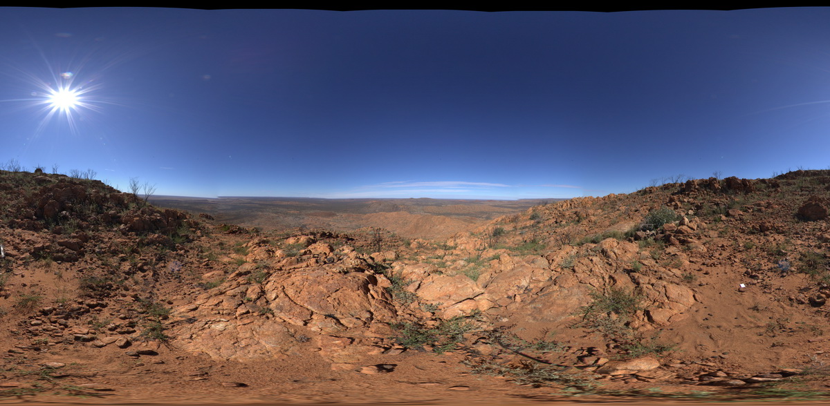
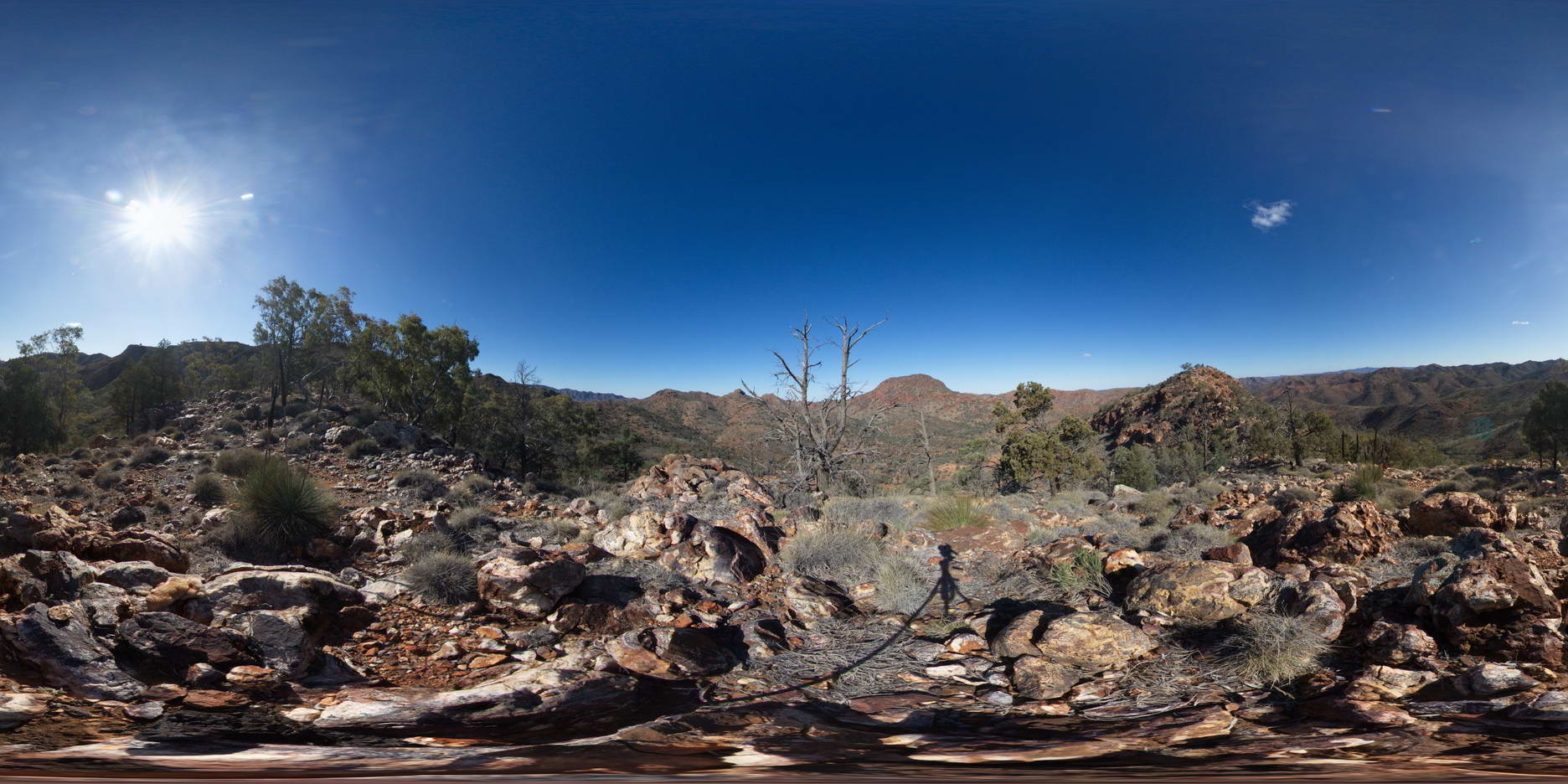
ArkaroolaFSP12 Map
 |
5 |
11/26/2015 3:15 p.m. |
FSP |
view from Mt Gee looking over the surrounding area. Outcrop of Mt Gee Sinter in the foreground. Arkaroola. Northern Flinders Ranges, S.A. |
3000.00 |
-30.22729000000 |
139.34213000000 |
-9999.000 |
sinter |
sinter |
PurnululuFSP16 Map
 |
0 |
06/12/2016 noon |
FSP |
finely banded red (hematitic) and buff coloured dolostone of knife-edge ridge, Purnululu National Park, W.A. |
3000.00 |
-17.40900000000 |
128.20374000000 |
-9999.000 |
Purnululu National Park, dolostone, sedimentology |
dolostone |
REYNFSP2 Map
 |
0 |
07/24/2016 11:43 a.m. |
FSP |
view from west side of Mount Boothby, showing gneiss (foreground) and surrounding landscape. Reynolds Range. Next to Stuart Highway. N.T. |
3000.00 |
-22.57917700000 |
133.29637600000 |
887.075 |
Aileron Metamorphics, Boothby Orthogneiss, metamorphics |
gneiss, gneiss |
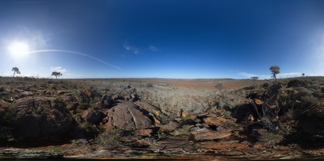
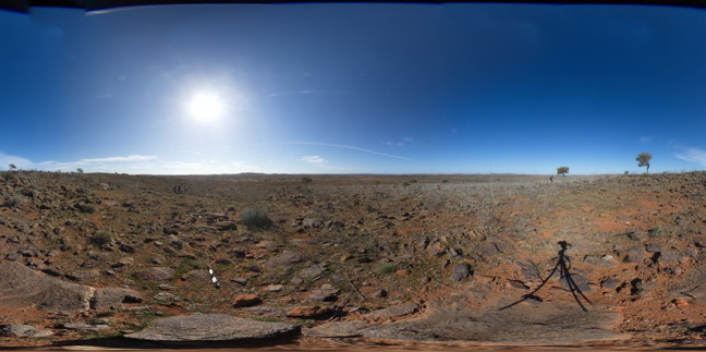
ArkaroolaFSP11 Map
 |
5 |
11/26/2015 3:14 p.m. |
FSP |
view from ridge, looking south to Mt Gee and south east to Mt Painter. Outcrop of Mt Gee Sinter in the foreground. Arkaroola. Northern Flinders Ranges, S.A. |
3000.00 |
-30.22390000000 |
139.34218000000 |
-9999.000 |
sinter |
sinter |
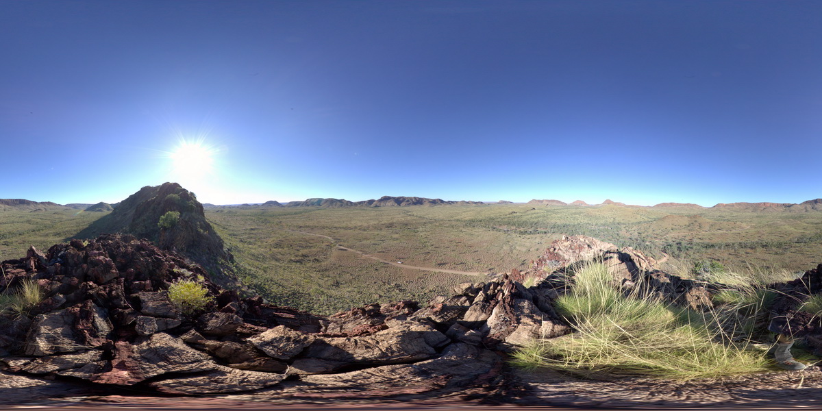
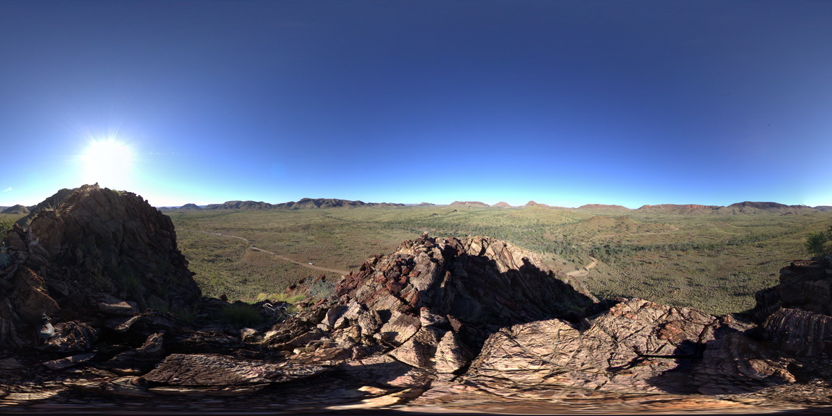
TomPriceFSP2 Map
 |
0 |
05/29/2016 noon |
FSP |
360 degree view from near the summit of Mount Nameless, showing surrounding ridge dominated landscape of sedimentary geology. Tom Price, W.A. |
5000.00 |
-22.71666000000 |
117.76108000000 |
-9999.000 |
Brockman Iron Formation, Pilbara, Hamersley Basin |
BIF |
GibbRiverFSP1 Map
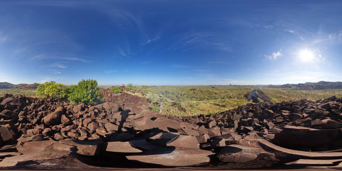 |
0 |
06/06/2016 noon |
FSP |
view from gabbroic knoll of surrounding granite country. Gibb River Road, near Mount Amy. W.A. |
5000.00 |
-17.20575000000 |
124.91619000000 |
-9999.000 |
gabbro, granite |
gabbro |
TomPriceFSP1 Map
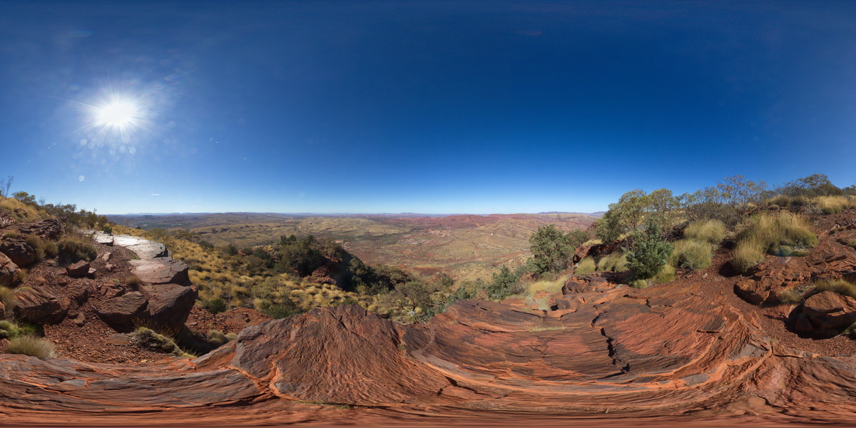 |
0 |
05/29/2016 noon |
FSP |
360 degree view from near the summat of Mount Nameless, showing Mount Tom Price mine operations and surrounding country. Tom Price, W.A. |
5000.00 |
-22.71881000000 |
117.76555000000 |
-9999.000 |
Brockman Iron Formation, Tom Price |
BIF |
TomPriceGIGa1 Map
 |
0 |
05/29/2016 noon |
GIGA |
360 degree view from near the summit of Mount Nameless, showing Mount Tom Price mine operations and surrounding country. Tom Price, W.A. |
5000.00 |
-22.71881000000 |
117.76555000000 |
-9999.000 |
banded iron formation, chert |
BIF |
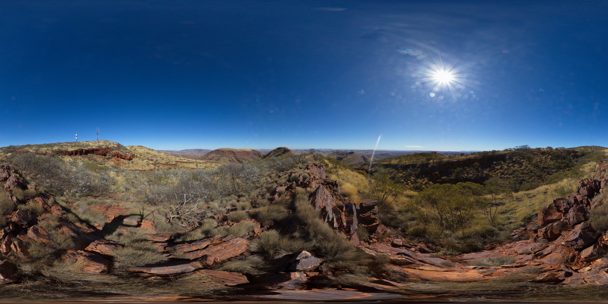
AilerFSP1 Map
 |
0 |
08/04/2016 10:54 a.m. |
FSP |
panoramic view from small hill of gneisses forming the Western and Hartz Ranges. The Garden Road, North of Alice Springs. N.T. |
5000.00 |
-23.23560700000 |
134.03837800000 |
809.222 |
gneiss, metamorphic |
gneiss |
GibbRiverFSP2 Map
 |
0 |
06/06/2016 noon |
FSP |
view from gabbroic knoll of surrounding granite country. Gibb River Road, near Mount Amy. W.A. |
5000.00 |
-17.20631000000 |
124.91576000000 |
-9999.000 |
gabbro, granite |
gabbro |
EPilbaraFSP1 Map
 |
0 |
06/01/2016 noon |
FSP |
view of granite outcrops and surrounding area. Woodstock - Rocky Island Road, East Pilbara, W.A. |
5000.00 |
-21.60411000000 |
119.02820000000 |
-9999.000 |
granite outcrop |
granite |
EPilbaraFSP9 Map
 |
0 |
06/01/2016 noon |
FSP |
view from small gabbroic? Knoll looking to N and W. Also showing large black dolerite? Dyke 'wall' to the SE. Woodstock - Rocky Island Road, East Pilbara, W.A. |
5000.00 |
-21.53850000000 |
119.33490000000 |
-9999.000 |
mafic dyke, structural weakness |
dolerite |