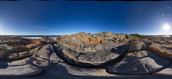
BingiFSP3 Map
 |
5 |
01/01/9999 midnight |
FSP |
View of granodiorite with multiple Xenoliths and the cross-cutting aplite dyke. Bingi, N.S.W. |
50.00 |
-36.01263000000 |
150.16399000000 |
3.000 |
dyke, igneous, xenolith |
granodiorite, aplite |
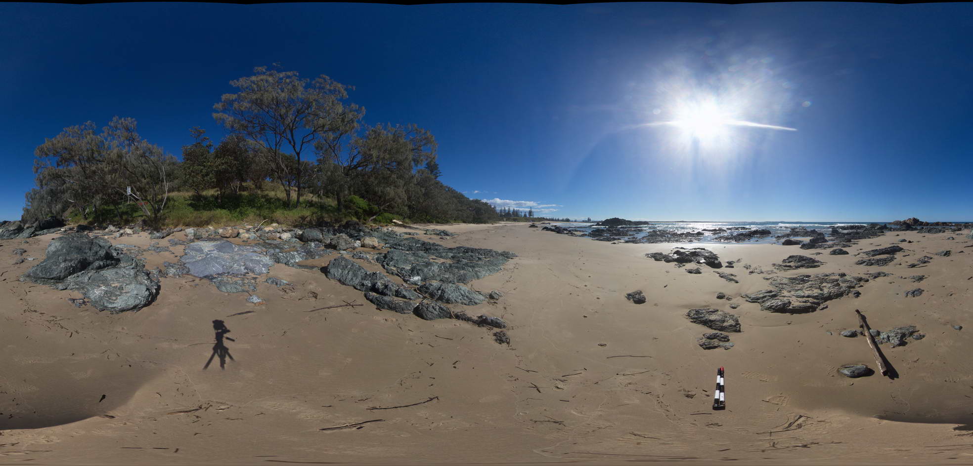
BingiFSP1 Map
 |
5 |
01/01/9999 midnight |
FSP |
View of granodiorite with cross-cutting 'dolerite' dyke. Bingi, N.S.W. |
50.00 |
-36.01247000000 |
150.16364000000 |
2.000 |
dyke, igneous, structure |
granodiorite, dolerite |
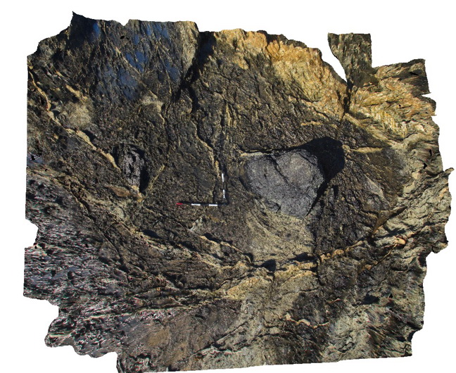
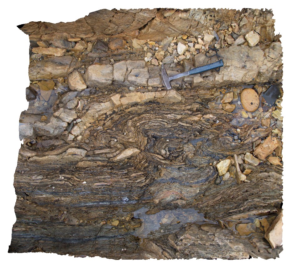
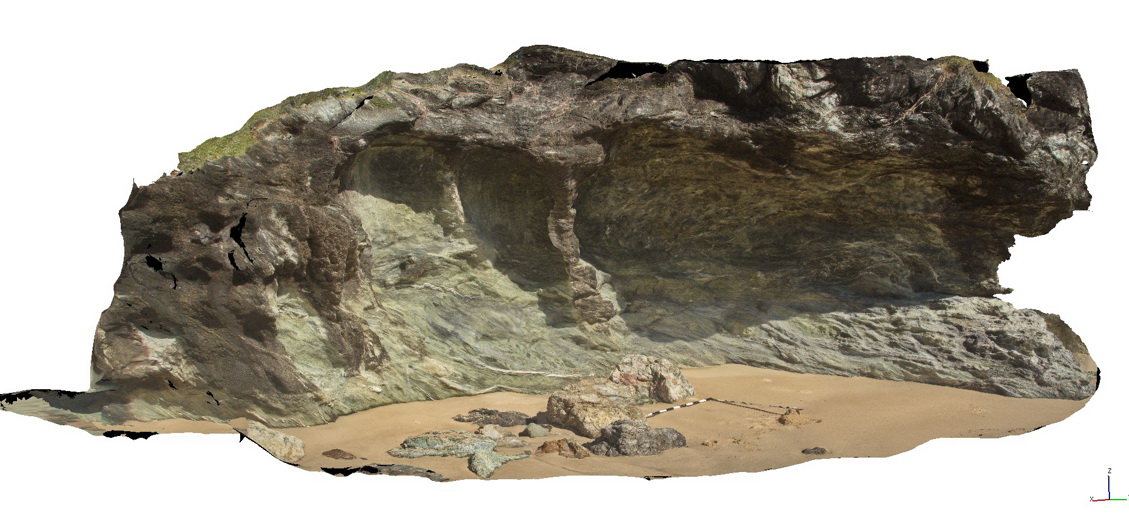
PtMacquarie20 Map
 |
5 |
01/01/9999 midnight |
3D |
fault breccia in a chert block within the Cambrian Port Macquarie Serpentinite melange |
1.00 |
-31.46360000000 |
152.93472000000 |
1.000 |
fault breccia, structure |
chert |
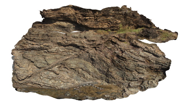
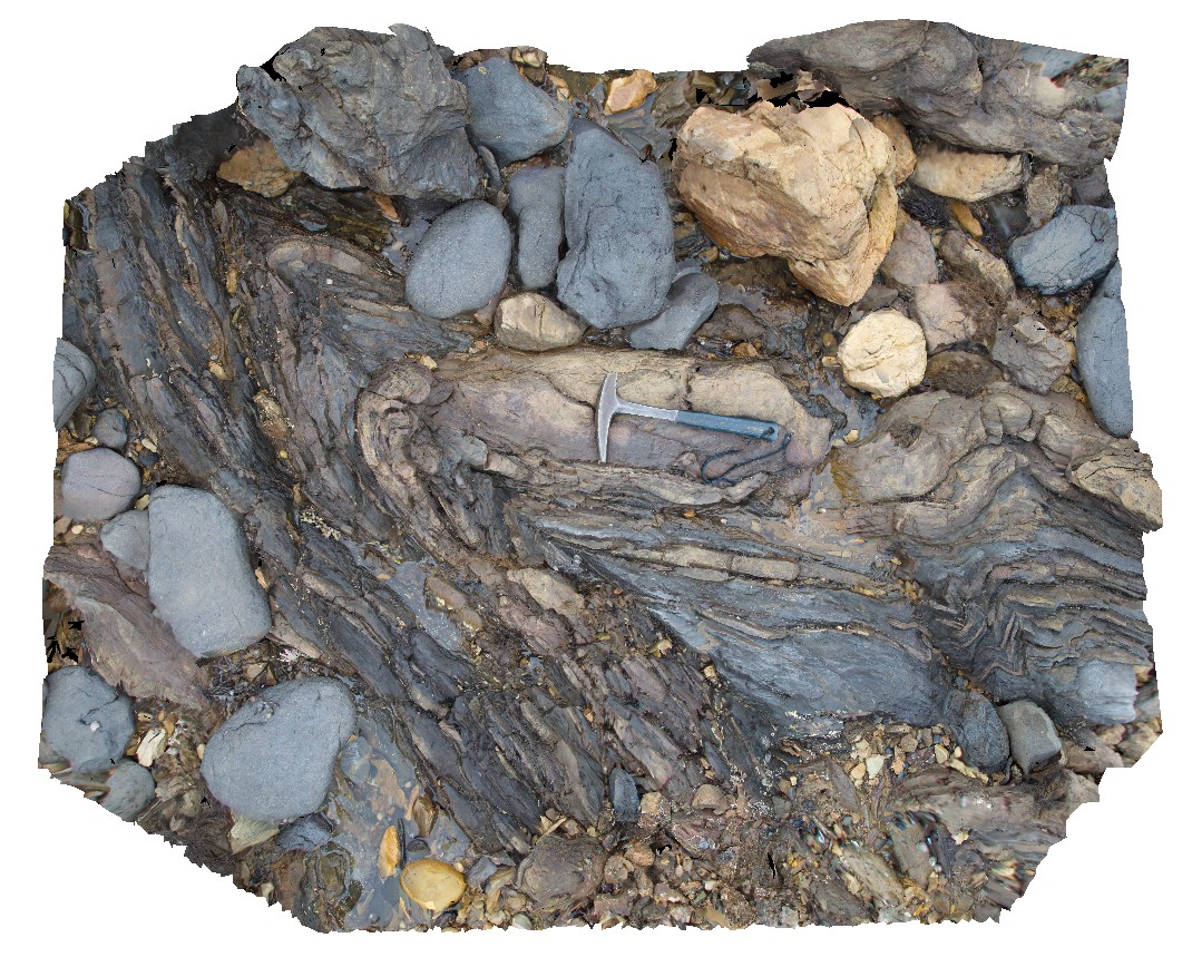
PtMacquarieFSP7 Map
 |
5 |
01/01/9999 midnight |
FSP |
View of folded and faulted chert unit within the Cambrian Port Macquarie Serpentinite melange |
50.00 |
-31.43009000000 |
152.92384000000 |
2.000 |
fault, melange |
chert |
PtMacquarie1 Map
 |
5 |
01/01/9999 midnight |
3D |
Mafic dyke cross-cutting layered cherts within the Port Macquarie Serpentinite melange |
8.00 |
-31.43030000000 |
152.92386000000 |
1.000 |
dyke, structure |
chert, dolerite |
PtMacquarie2 Map
 |
5 |
01/01/9999 midnight |
3D |
Fault cutting bedded chert within the Port Macquarie Melange |
8.00 |
-31.43015000000 |
152.92377000000 |
1.000 |
fault, structure |
chert |
PtMacquarie12 Map
 |
5 |
01/01/9999 midnight |
3D |
Ultramafic blocks in a matrix of totally serpentinised ultramafic material within the Cambrian Port Macquarie Serpentinite |
5.00 |
-31.43662000000 |
152.92607000000 |
1.000 |
melange, ultramafic, igneous, structure |
melange |
TheCrags5 Map
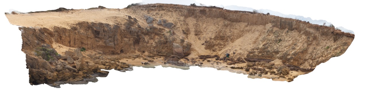 |
20 |
01/01/9999 midnight |
3D |
overview of aeolian calcareous sandstone overlain by brown sand with solution tubes. The Crags, Vic. |
30.00 |
-38.37184000000 |
142.11092000000 |
2.000 |
unconformity, solution tubes |
sandstone |
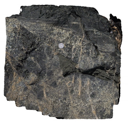
PtMacquarie8 Map
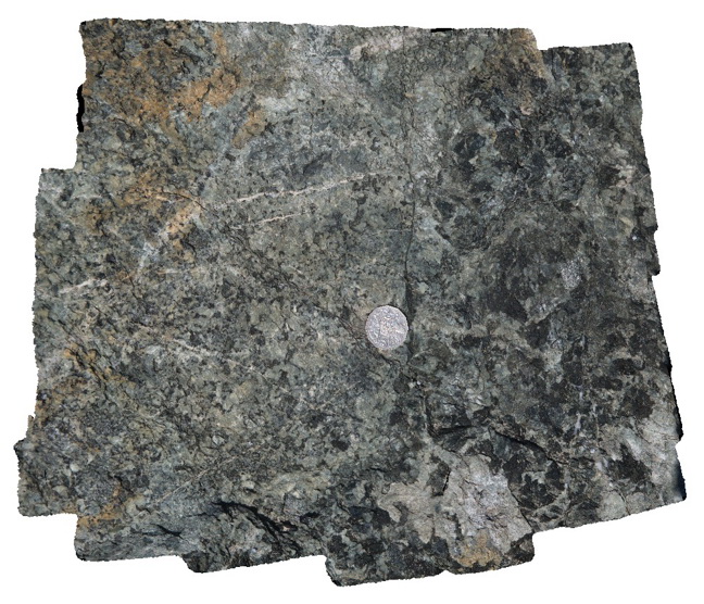 |
5 |
01/01/9999 midnight |
3D |
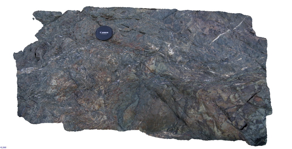
Detail of relatively unaltered 'plagio granite' material within the Port Macquarie Serpentinite |
0.50 |
-31.42991000000 |
152.92242000000 |
0.000 |
plagiogranite, melange |
plagiogranite |
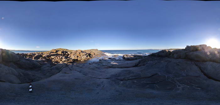
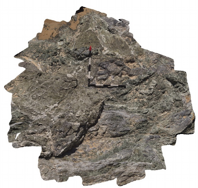
PtMacquarieFSP3 Map
 |
5 |
01/01/9999 midnight |
FSP |
View of outcrops of the Cambrian Port Macquarie Serpentinite melange |
50.00 |
-31.42994000000 |
152.92215000000 |
0.000 |
melange, ultramafic, igneous |
melange |
PtMacquarie14 Map
 |
5 |
01/01/9999 midnight |
3D |
Exotic blocks of gneiss in serpentinite melange within the Cambrian Port Macquarie Serpentinite |
1.50 |
-31.43690000000 |
152.92567000000 |
1.000 |
melange, exotic block |
melange |
PtMacquarie17 Map
 |
5 |
01/01/9999 midnight |
3D |
Large exotic block of folded eclogite within the Cambrian Port Macquarie Serpentinite melange |
2.00 |
-31.43724000000 |
152.92532000000 |
1.000 |
eclogite, exotic block |
eclogite |
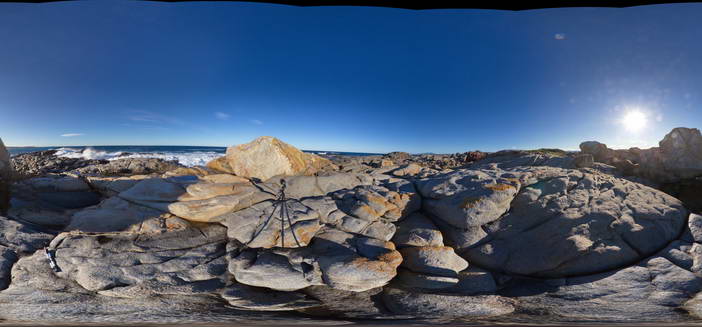
BingiFSP9 Map
 |
5 |
01/01/9999 midnight |
FSP |
View of zone of 'magma mingling' between granodiorite and diorite/gabbro. Bingi, N.S.W. |
50.00 |
-36.01310000000 |
150.16245000000 |
3.000 |
magma mingling, igneous, enclave, xenolith |
granodiorite |
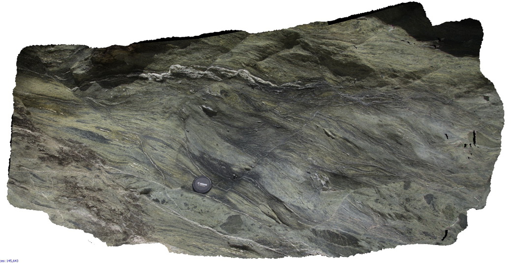
PtMacquarie6 Map
 |
5 |
01/01/9999 midnight |
3D |
Melange consisting of variably serpentinised ultramafic rocks in a serpentine matrix. Cambrian Port Macquarie Serpentinite |
2.00 |
-31.43003000000 |
152.92261000000 |
0.000 |
melange, structure, igneous, ultramafic |
melange |
Nugnug1 Map
 |
5 |
01/01/9999 midnight |
3D |
tectonic melange in Ordovician Pinnak Sandstone within the Nug Nug Shear Zone. Nugnug, Vic. |
1.00 |
-36.68114000000 |
146.67752000000 |
240.000 |
melange, mylonite, shear zone, structure |
melange |
BoatHarbour10 Map
 |
20 |
01/01/9999 midnight |
3D |
Fold hinge within Rocky Cape Group Orthoquartzite. Boat Harbour, Tas. |
2.00 |
-40.92640600000 |
145.60971200000 |
1.000 |
quartzite, fold hinge |
quartzite |
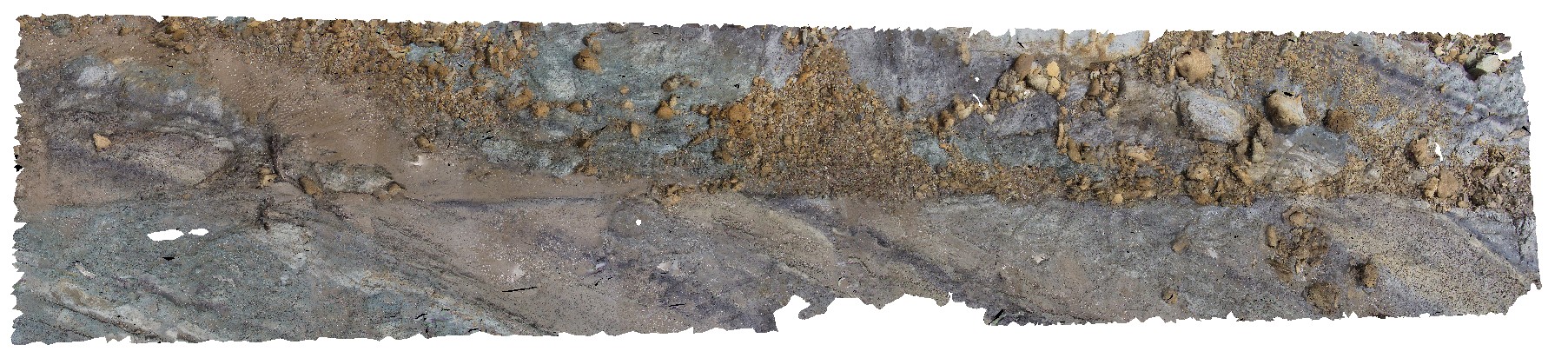
PtMacquarie11 Map
 |
5 |
01/01/9999 midnight |
3D |
Detailed view of the mafic and ultramafic rocks displayed in PtMac10. Cambrian Port Macquarie Serpentinite |
1.00 |
-31.42979000000 |
152.92174000000 |
0.000 |
ultramafic, igneous, veins, structure |
ultramafic |
BoatHarbour8 Map
 |
20 |
01/01/9999 midnight |
3D |
Folded Rocky Cape Group Orthoquartzite. Boat Harbour, Tas. |
1.00 |
-40.92640900000 |
145.60991100000 |
1.000 |
quartzite, bedding, folded, structure |
quartzite, siltstone |
PtMacquarie7 Map
 |
5 |
01/01/9999 midnight |
3D |
Contact between 'plagio-granite' and basalt. Cambrian Port Macquarie Serpentinite |
3.00 |
-31.42991000000 |
152.92242000000 |
0.000 |
melange, structure, igneous |
melange, basalt |
BingiFSP6 Map
 |
5 |
01/01/9999 midnight |
FSP |
View of Jointed granodiorite cut by a 'red' mafic dyke. Bingi, N.S.W. |
50.00 |
-36.01323000000 |
150.16356000000 |
2.000 |
dyke, igneous, joints, structure |
granodiorite, dolerite |
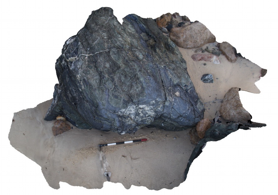
PtMacquarie4 Map
 |
5 |
01/01/9999 midnight |
3D |
Detail of textures within serpentinite melange of the Cambrian Port Macquarie Serpentinite |
2.00 |
-31.43026000000 |
152.92297000000 |
1.000 |
melange, structure, serpentinite |
serpentinite |
BoatHarbour6 Map
 |
20 |
01/01/9999 midnight |
3D |
Folded Rocky Cape Group siltstones and orthoquartzite. Boat Harbour, Tas. |
4.00 |
-40.92629500000 |
145.60992700000 |
1.000 |
quartzite, bedding, folded, structure |
quartzite |
PtMacquarie5 Map
 |
5 |
01/01/9999 midnight |
3D |
Detail of serpentinite melange with blocks of serpentinised ultramafic rock in a sheared matrix of serpentine. Cambrian Port Macquarie Serpentinite |
2.00 |
-31.43026000000 |
152.92297000000 |
1.000 |
melange, igneous, structure, ultramafic |
melange |
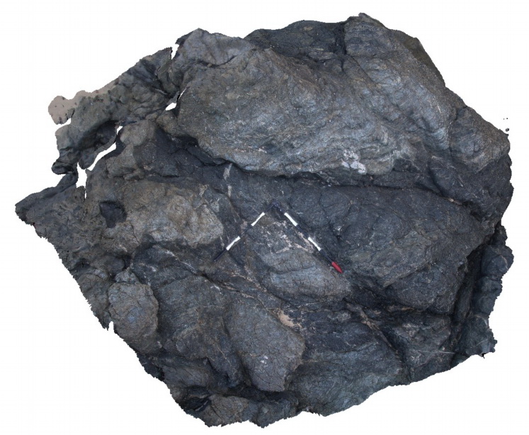
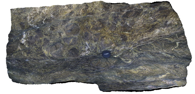
PtMacquarie3 Map
 |
5 |
01/01/9999 midnight |
3D |
Highly sheared and blocky serpentinite in the Cambrian Port Macquarie Serpentinite |
7.00 |
-31.43026000000 |
152.92297000000 |
1.000 |
shearing, melange, structure |
serpentinite |
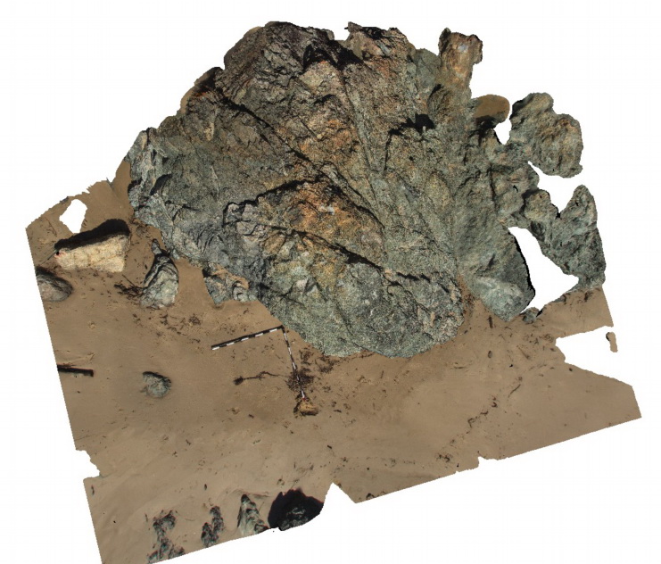
Koonya1 Map
 |
50 |
01/01/9999 midnight |
3D |
fault cutting bedded siltstone Impression Bay, Tasman Peninsula. Tasmania. |
1.00 |
-43.05406380000 |
147.77316110000 |
0.000 |
fault, structure, sedimentology |
siltstone |