Wilka1 Map
 |
0 |
09/27/2015 5:06 p.m. |
3D |
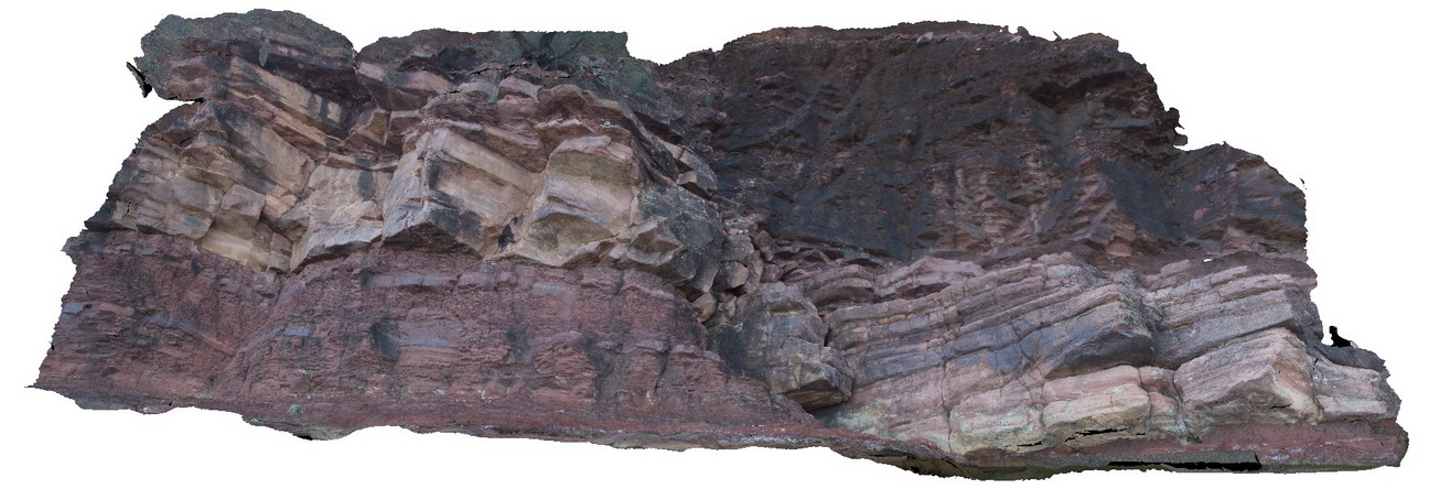
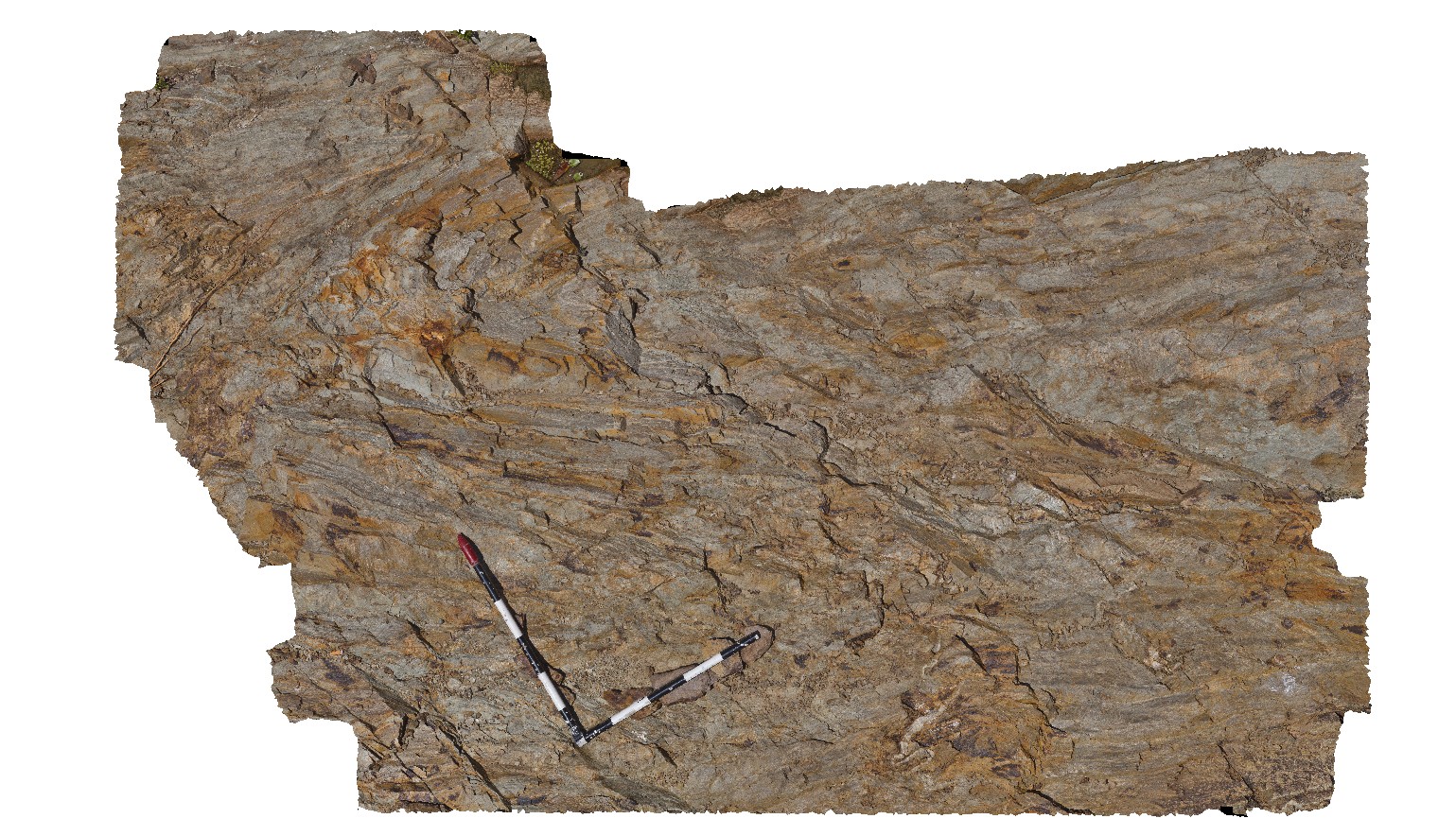
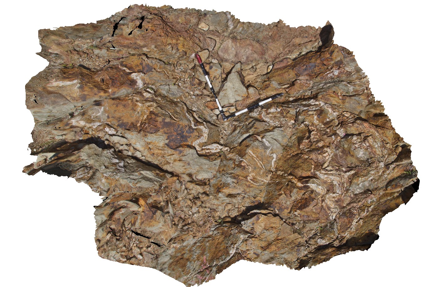
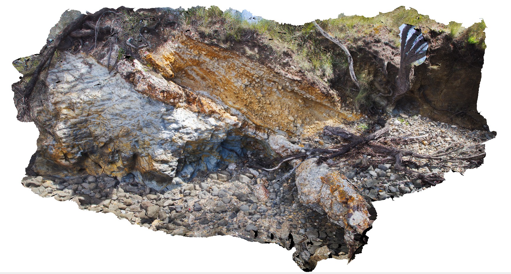
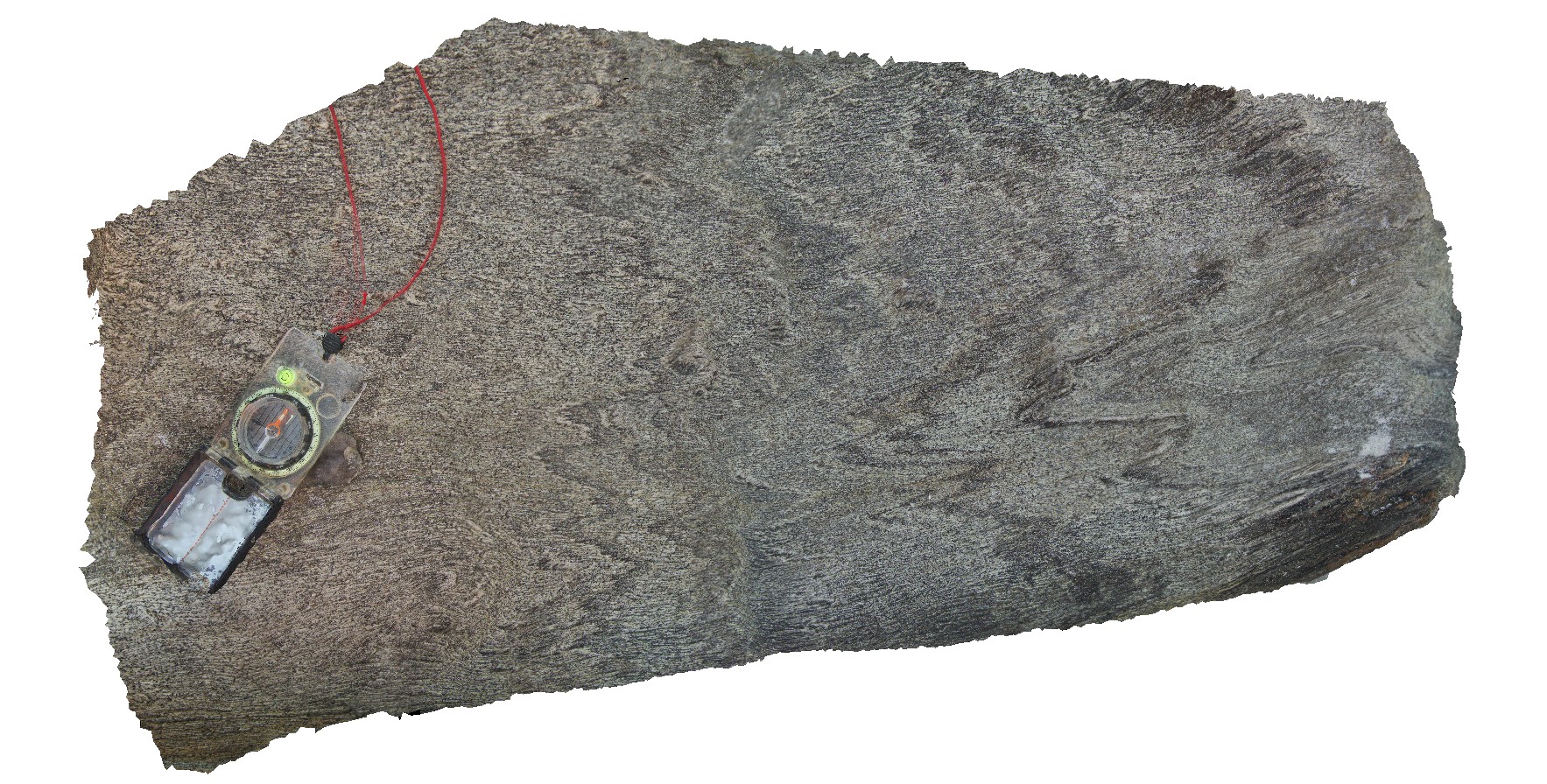
Clean, thickly bedded, cross bedded channel sandstone and red, thinly bedded sandstone and siltstone of the Bonney Sandstone. Cut by high angle fault. Wilkawillna Trail. Flinders Ranges. |
12.00 |
-31.29364000000 |
138.88297000000 |
-9999.000 |
bedding, fault, structure |
sandstone |
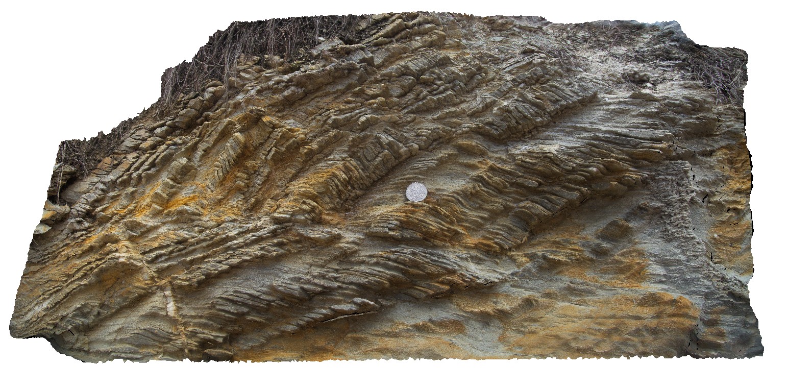
WildWaveTrib1 Map
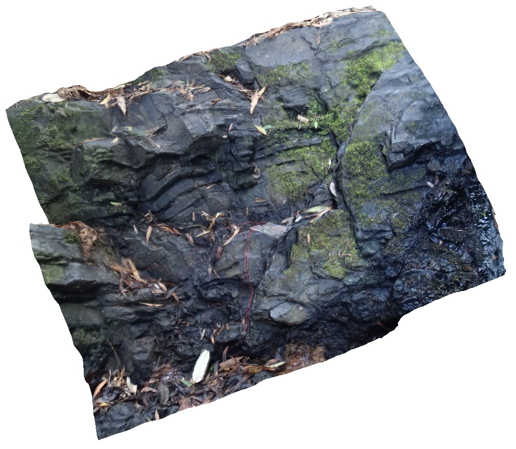 |
5 |
01/01/9999 midnight |
3D |
jointing in fine-grained siltstone. West Tasmania. |
0.60 |
-41.36105200000 |
144.79656700000 |
-9999.000 |
bedding plane |
siltstone |
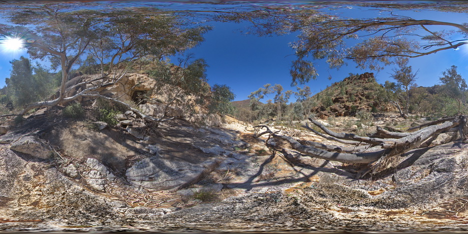
WhitesideUAV1 Map
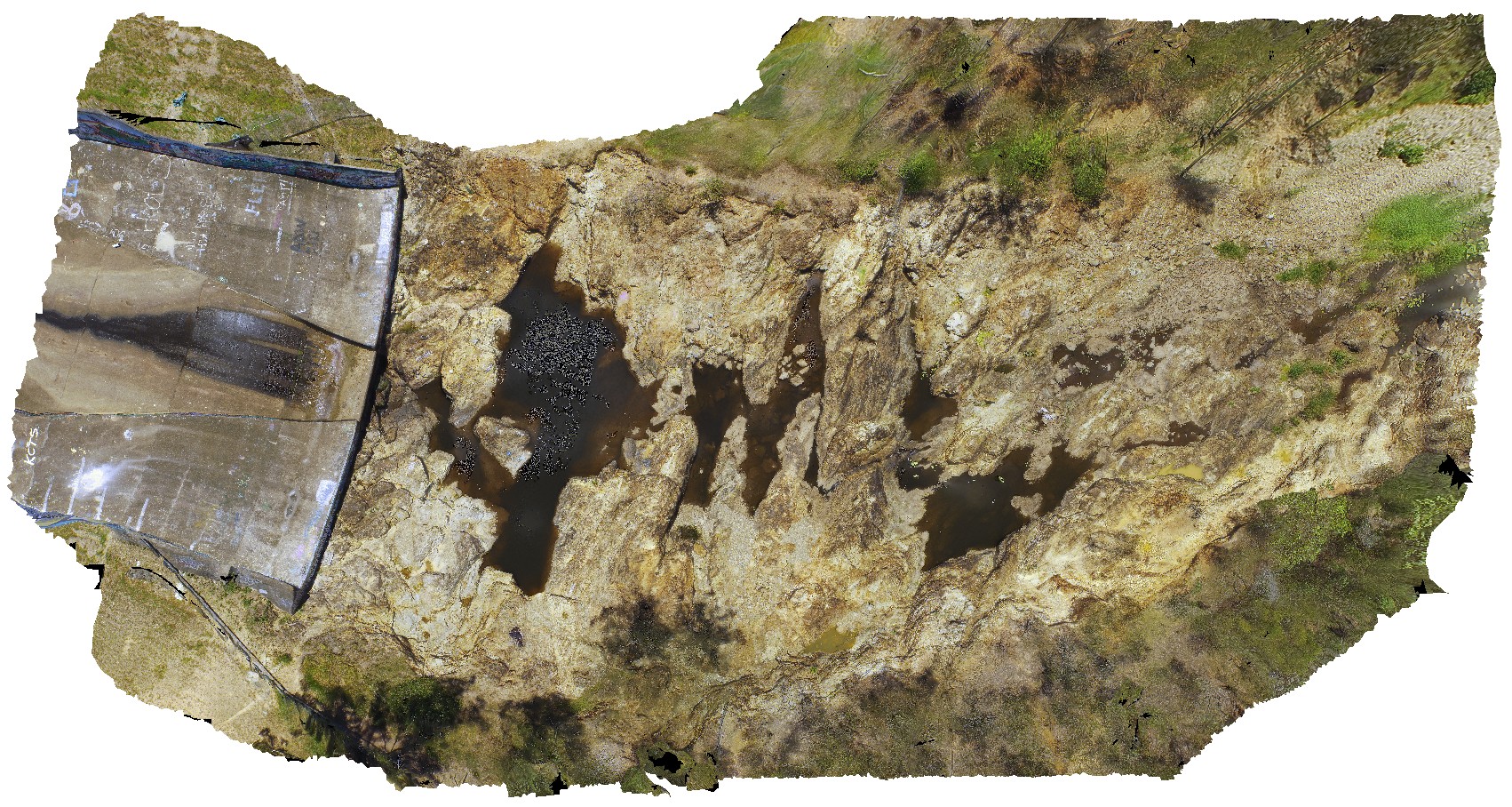 |
0 |
04/13/2016 3:37 p.m. |
UAV |
exposed river channel and spill-way, showing the metavolcanics of the Kurwongbah beds. Lake Kurwongbah, QLD. |
60.00 |
-27.25759700000 |
152.95734300000 |
-9999.000 |
metavolcanics |
phyllite |
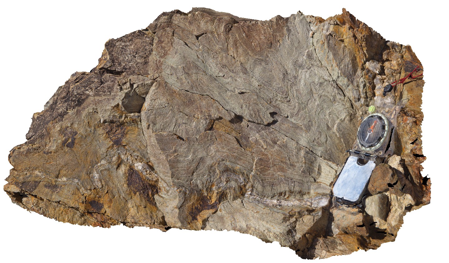
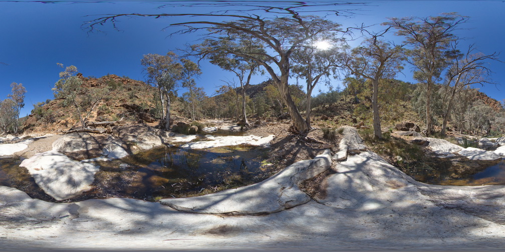
Whiteside6 Map
 |
0 |
02/23/2016 12:37 p.m. |
3D |
detail of bedding and cleavage relationships in folded metasediment. Lake Kurwongbah, QLD. |
0.30 |
-27.25844000000 |
152.95766000000 |
-9999.000 |
cleavage, bedding, structure, folding |
metasediment |
Whiteside5 Map
 |
0 |
02/23/2016 12:36 p.m. |
3D |
large ~m scale fold hinge in metasediments / phyllites. With folded crenulation cleavages. Lake Kurwongbah, QLD. |
3.00 |
-27.25800000000 |
152.95735000000 |
-9999.000 |
fold hinge, metasediments, crenulation cleavage |
metasediments |
Whiteside4 Map
 |
0 |
02/23/2016 12:35 p.m. |
3D |
asymmetric folding and quartz veining in metasediments, Lake Kurwongbah, QLD. |
0.70 |
-27.25775000000 |
152.95721000000 |
-9999.000 |
asymmetric folding, quartz vein, metasediments, structure |
metasediments |
Whiteside3 Map
 |
0 |
02/23/2016 12:35 p.m. |
3D |
open fold and fold cleavage in phyllites, Lake Kurwongbah, QLD. |
2.50 |
-27.25773000000 |
152.95738000000 |
-9999.000 |
open fold, cleavage, phyllite, structure |
phyllite |
Whiteside2 Map
 |
0 |
02/23/2016 12:35 p.m. |
3D |
crenulated metasediments, Lake Kurwongbah, QLD. |
0.30 |
-27.25765000000 |
152.95741000000 |
-9999.000 |
open fold, cleavage, structure, phyllite |
phyllite |
Whiteside1 Map
 |
0 |
02/23/2016 12:34 p.m. |
3D |
folded quartz veins in cleaved metasediments. Lake Kurwongbah, QLD. |
2.00 |
-27.25964000000 |
152.95740000000 |
-9999.000 |
phyllite, quartz veins, folded, structure |
phyllite |
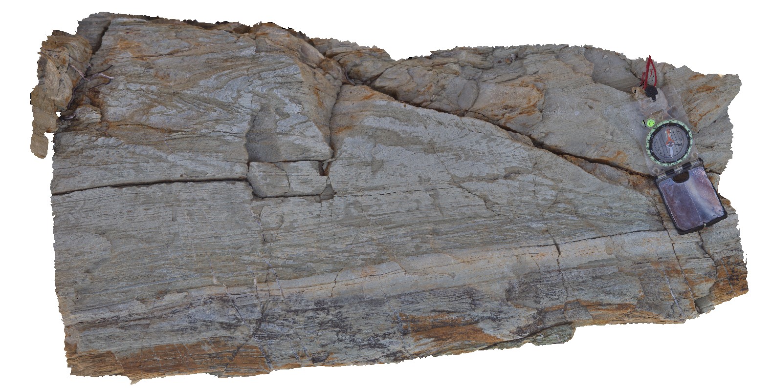
Weymouth4 Map
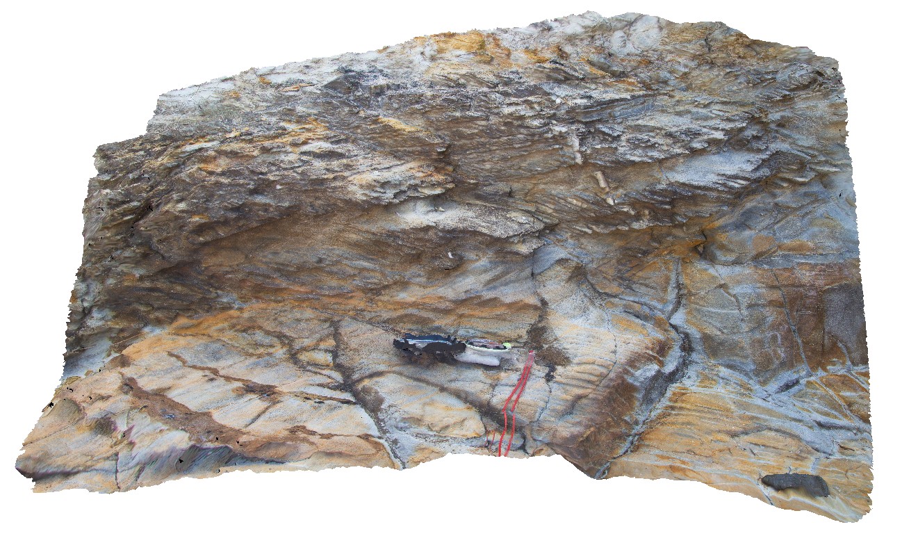 |
5 |
01/01/9999 midnight |
3D |
S0, S1 and S2 in Mathinna Supergroup sandstone. Weymouth, north-east Tasmania |
0.00 |
-41.01249000000 |
147.14728000000 |
-9999.000 |
S0, S1, S2, structure, bedding |
sandstone |
Weymouth3 Map
 |
5 |
01/01/9999 midnight |
3D |
bedding and flat-lying S1 cleavage in Ordovician metasediments of the Mathinna Supergroup. Weymouth, north-east Tasmania |
0.00 |
-41.01250000000 |
147.14734000000 |
-9999.000 |
Mathinna Supergroup, S1 cleavage, bedding |
|
Weymouth2 Map
 |
5 |
01/01/9999 midnight |
3D |
detail od silicified quartz lag at unconformity between Mathinna Supergroup sediments and Tertiary basalts. Weymouth, north-east Tasmania |
0.00 |
-41.01236000000 |
147.14732000000 |
-9999.000 |
quartz lag, unconformity |
|
Weymouth1 Map
 |
5 |
01/01/9999 midnight |
3D |
unconformity between Ordovician Mathinna Supergroup and Tertiary Basalts with silicified quartz lag deposit at unconformity surface. Weymouth, north-east Tasmania |
0.00 |
-41.01239000000 |
147.14732000000 |
-9999.000 |
un
conformity, basalt |
|
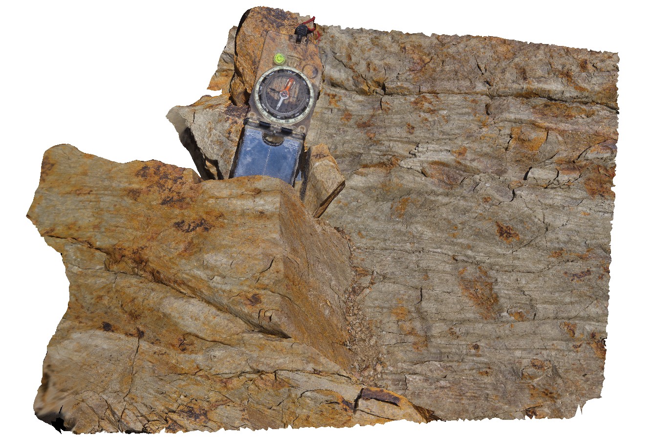
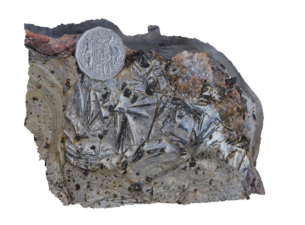
WestBeach9 Map
 |
0 |
06/05/2016 10:51 a.m. |
3D |
radiating kyanite aggregates on schistosity surface. West Beach, W.A. |
0.30 |
-33.95360000000 |
119.97449000000 |
-9999.000 |
kyanite aggregates, schist |
kyanite schist |
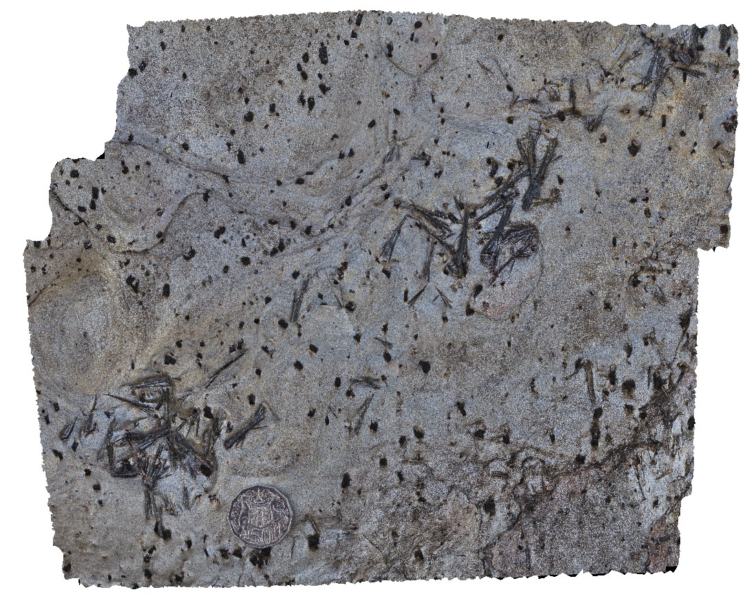
WestBeach8 Map
 |
0 |
06/05/2016 10:35 a.m. |
3D |
radiating needles of kyanite in schist. West Beach, W.A. |
0.10 |
-33.95360000000 |
119.97449000000 |
-9999.000 |
kyanite, schist, metamorphic |
kyanite schist |
WestBeach7 Map
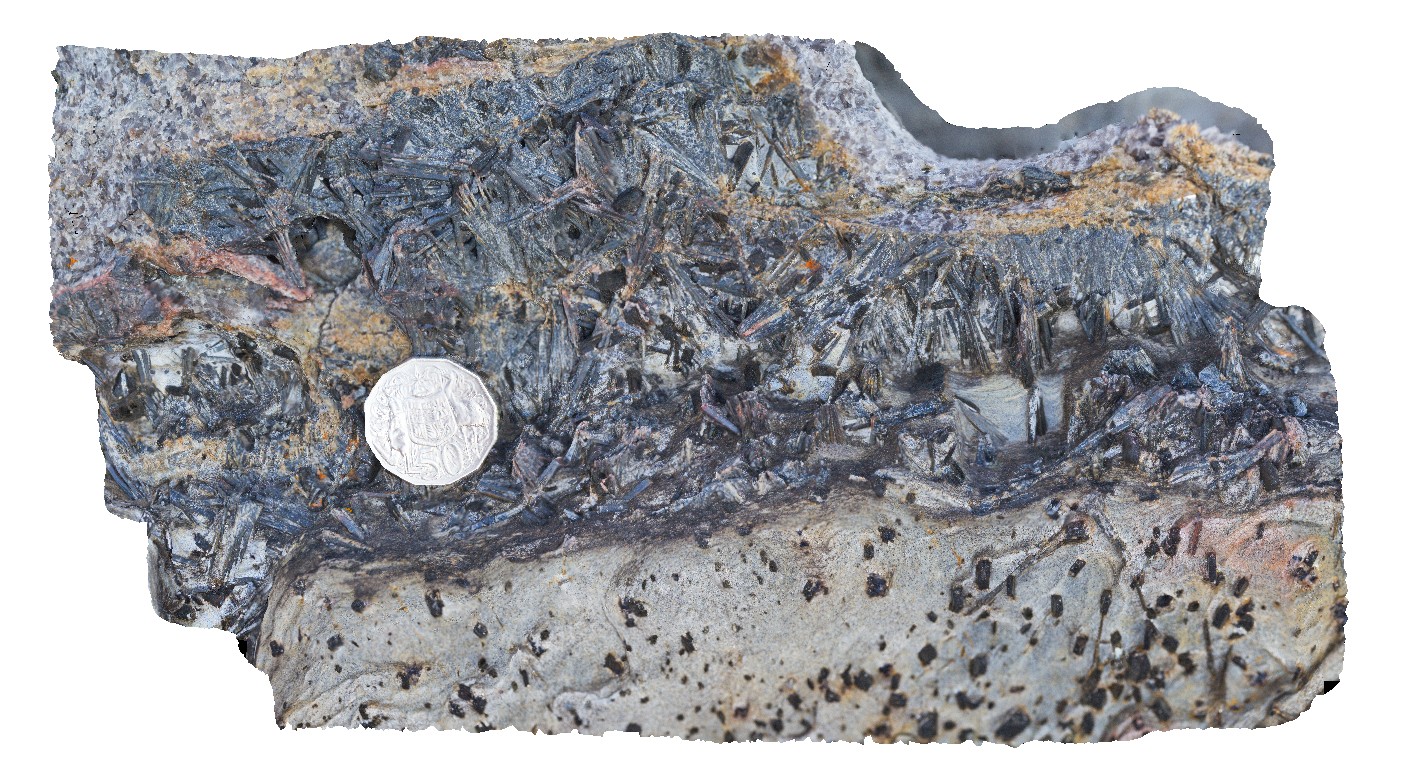 |
0 |
06/05/2016 10:49 a.m. |
3D |
aggregates of black kyanite crystals in band of schist. West Beach, W.A. |
0.20 |
-33.95360000000 |
119.97449000000 |
-9999.000 |
kyanite, schist, metamorphic |
schist |
WestBeach6 Map
 |
0 |
06/05/2016 10:42 a.m. |
3D |
steeply plunging, tight to open folds in finely laminated schist. West Beach, W.A. |
0.50 |
-33.95350000000 |
119.97487000000 |
-9999.000 |
folding, schist, structure |
schist |
WestBeach5 Map
 |
0 |
06/05/2016 10:50 a.m. |
3D |
'M' folding in garnet schist, West Beach, W.A. |
0.00 |
-33.95352000000 |
119.97489000000 |
-9999.000 |
M folds, structure, garnet schist |
garnet schist |
WestBeach4 Map
 |
0 |
06/05/2016 10:34 a.m. |
3D |
close-up view of fold in garnet-bearing schist, West Beach. W.A. |
0.30 |
-33.95349000000 |
119.97489000000 |
-9999.000 |
fold, structure |
garnet schist |
WestBeach3 Map
 |
0 |
06/05/2016 10:50 a.m. |
3D |
detailed view of 'M' folding in garnet schist from site WestBeach1. West Beach, W.A. |
0.30 |
-33.95340000000 |
119.97511000000 |
-9999.000 |
M fold geometry, folding, structure |
garnet schist |
WestBeach2 Map
 |
0 |
06/05/2016 10:34 a.m. |
3D |
folded layering, showing fold vergence in schist. West Beach, W.A. |
0.80 |
-33.95340000000 |
119.97511000000 |
-9999.000 |
fold vergence, structure |
schist |
WestBeach10 Map
 |
0 |
06/05/2016 10:35 a.m. |
3D |
Biotite and kyanite crystals growing on quartz vein selvage. West Beach, W.A. |
0.35 |
-33.95360000000 |
119.97449000000 |
-9999.000 |
biotite vein selvage, kyanite vein selvage |
schist |
WestBeach1 Map
 |
0 |
06/05/2016 10:47 a.m. |
3D |
M geometry folds with penetrative cleavage in garnet schist. West Beach, W.A. |
1.00 |
-33.95337000000 |
119.97512000000 |
-9999.000 |
penetrative cleavage, M folding, garnet schist |
garnet schist |
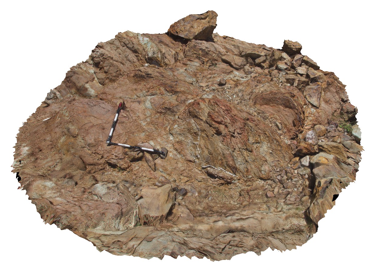
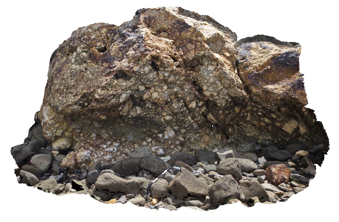
WeetootlaFSP9 Map
 |
0 |
09/27/2015 4:38 p.m. |
FSP |
view of mega-boudins in folded carbonate mudstone. Weetootla gorge. |
0.00 |
-30.47988000000 |
139.23091000000 |
-9999.000 |
sedimentology, boudin, structure |
carbonate |
WeetootlaFSP8 Map
 |
0 |
09/27/2015 4:38 p.m. |
FSP |
view of massive, homogeneous carbonate crop in creek bed. Weetootla gorge. |
0.00 |
-30.47953000000 |
139.23003000000 |
-9999.000 |
sedimentology |
carbonate |