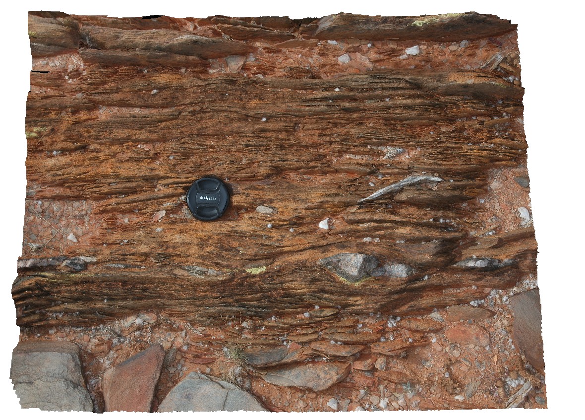
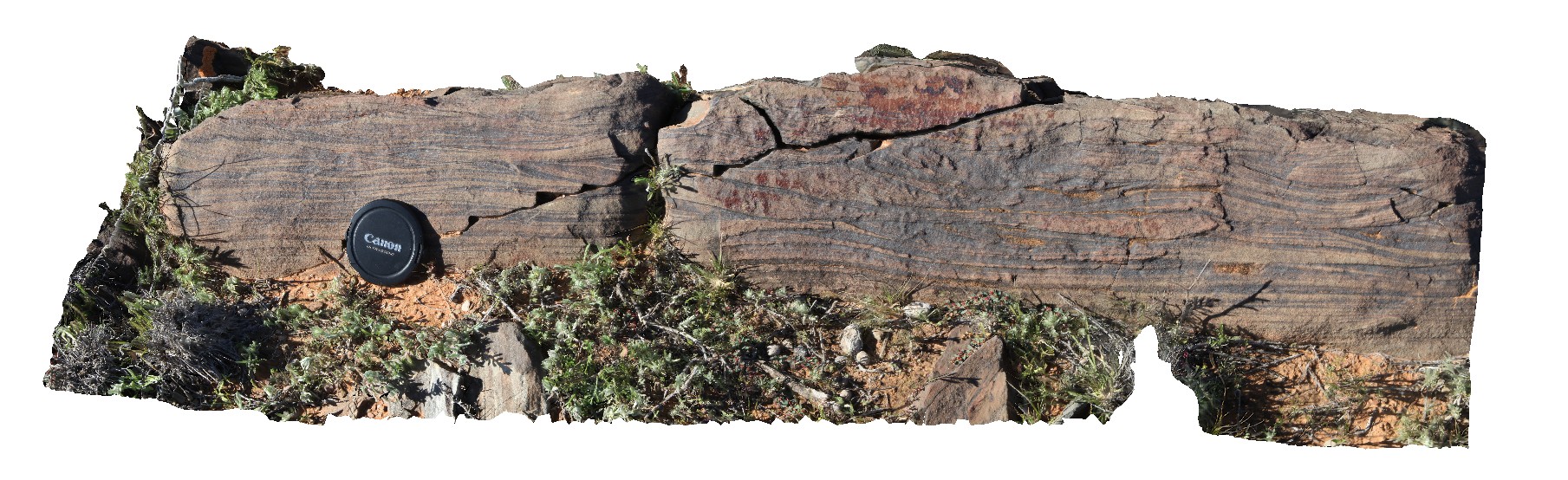
LordHowe8 Map
 |
20 |
03/16/2015 2:53 p.m. |
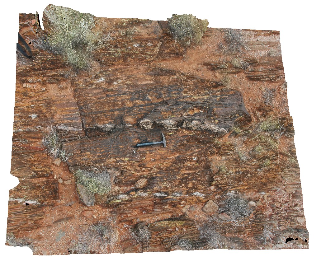
3D |
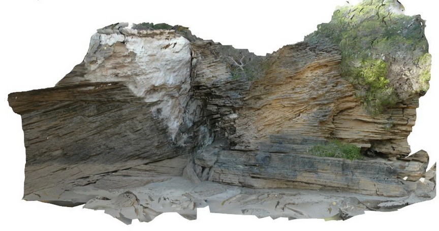
cross bedding in calcareous sands, showing multiple cross bedding layers. Lord Howe Island. |
3.00 |
-31.54793721000 |
159.07464631000 |
0.000 |
cross bedding, sedimentology |
sand |
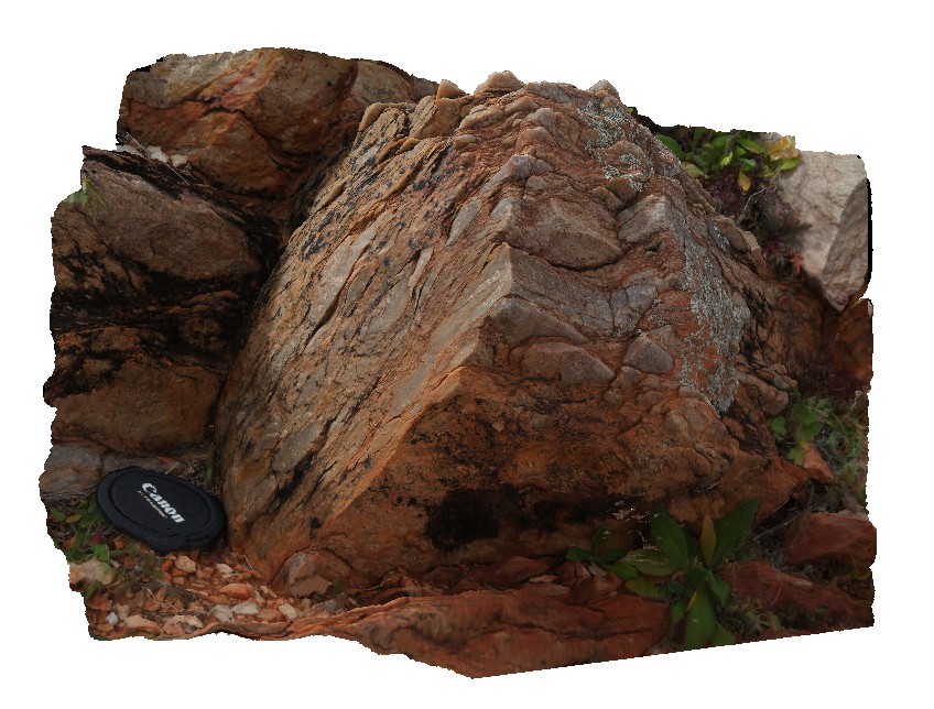
LordHowe9 Map
 |
20 |
03/16/2015 2:53 p.m. |
3D |
irregular dyke cross cutting basalt and scoria. Lord Howe Island. |
3.00 |
-31.52041332000 |
159.05301019000 |
0.000 |
basalt, dyke |
basalt |
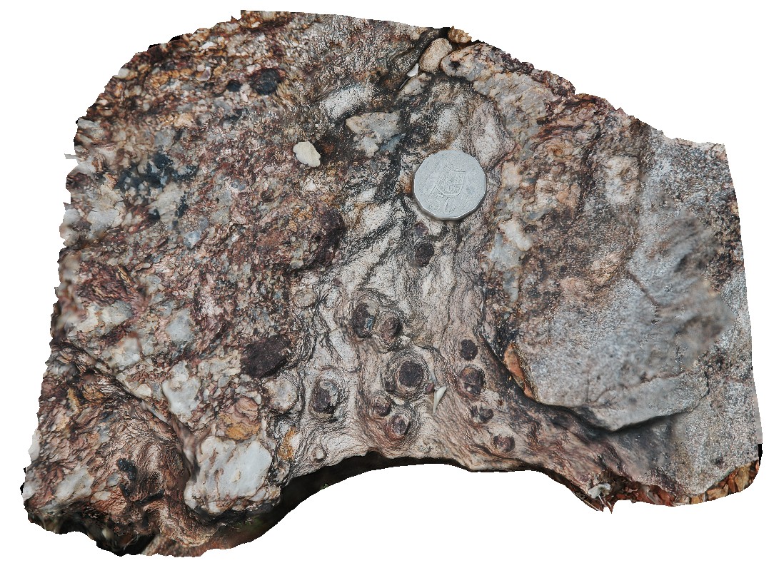
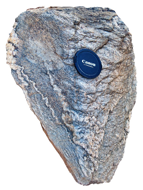
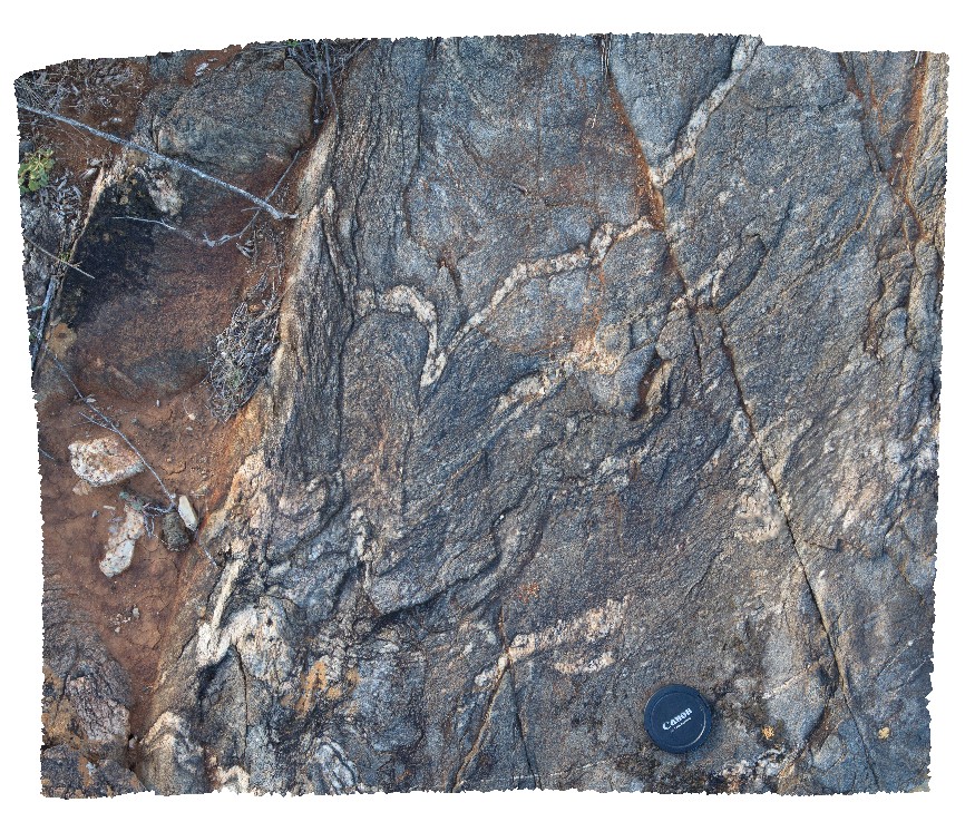
BH2011n1 Map
 |
20 |
03/16/2015 2:53 p.m. |
3D |
tightly folded and moderately plunging folds in Hores Gneiss. Broken Hill, N.S.W. |
0.80 |
-31.63547118000 |
141.53853471000 |
-9999.000 |
gneiss, tight fold, fold, structure |
gneiss |
BH2011n10 Map
 |
20 |
03/16/2015 2:53 p.m. |
3D |
view of preserved dome in metasediments. Broken Hill, N.S.W. |
3.00 |
-31.64098561000 |
141.54132199000 |
-9999.000 |
dome, fold, metasediment, structure |
metasediment |
BH2011n12 Map
 |
20 |
03/16/2015 2:53 p.m. |
3D |
boudinaged quartz veins in metasediments. Broken Hill, N.S.W. |
2.50 |
-31.63409414000 |
141.54039789000 |
-9999.000 |
boudinage, metasediment, structure |
metasediment |
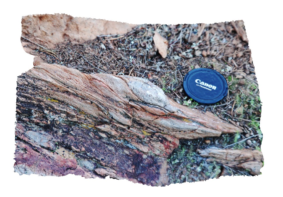
BH2011n13 Map
 |
20 |
03/16/2015 2:54 p.m. |
3D |
tight to isoclinal, inclined and steeply plunging fold in psammites. Broken Hill, N.S.W. |
5.00 |
-31.64525745000 |
141.53586586000 |
-9999.000 |
fold hinge, tight fold, isoclinal fold, fold plunge, structure, psammite, inclined fold |
psammite |
BH2011n14 Map
 |
20 |
03/16/2015 2:54 p.m. |
3D |
view of metasediment with strongly developed S-C fabric. Broken Hill, N.S.W. |
2.00 |
-31.63442634000 |
141.54044540000 |
-9999.000 |
S - C fabric, structure, metasediment |
metasediment |
BH2011n2 Map
 |
20 |
03/16/2015 2:54 p.m. |
3D |
moderately plunging, tight folds in thinly bedded quartzite and mudstones metasediments. Strong cleavage also evident. Broken Hill. N.S.W. |
1.00 |
-31.63628271000 |
141.53839687000 |
-9999.000 |
fold plunge, tight fold, fold, structure, metasediments, cleavage |
metasediments |
BH2011n3 Map
 |
20 |
03/16/2015 2:54 p.m. |
3D |
moderately plunging parasitic folds in quartzite layer. Broken Hill, N.S.W. |
0.50 |
-31.63595890000 |
141.53825045000 |
-9999.000 |
fold plunge, parasitic fold, metasediments, structure |
metasediment |
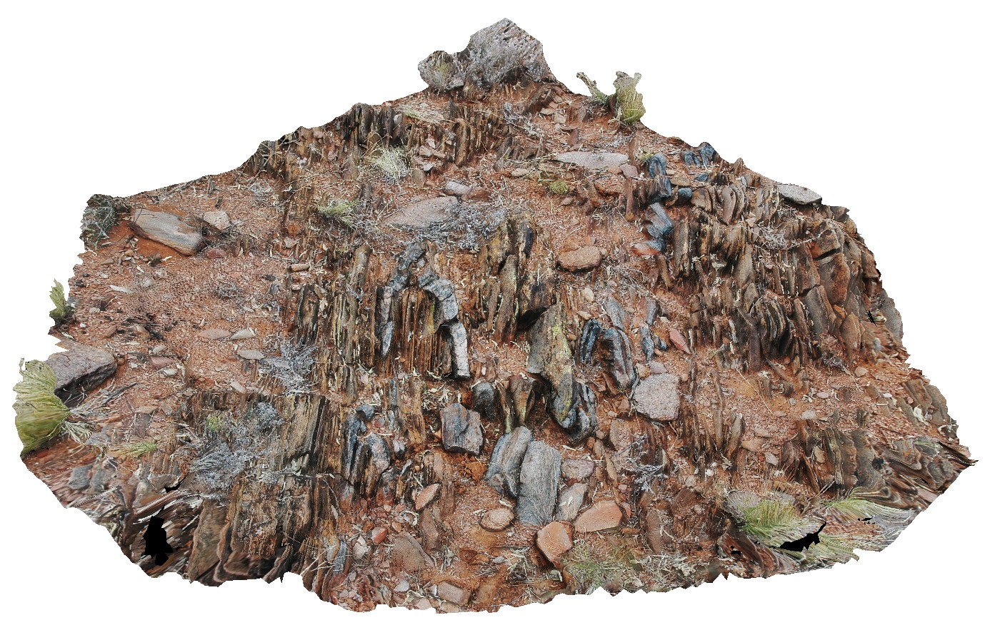
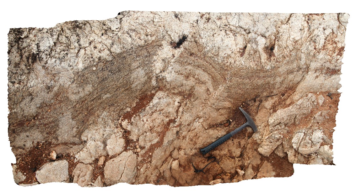
BH2011n7 Map
 |
20 |
03/16/2015 2:55 p.m. |
3D |
mica rich schist, with small folds and cross cutting cleavage. Broken Hill, N.S.W. |
0.30 |
-31.63596042000 |
141.53388023000 |
-9999.000 |
cleavage, fold, structure |
schist |
BH2011n8 Map
 |
20 |
03/16/2015 2:55 p.m. |
3D |
garnet porphyroblasts in coarse-grained gneiss. Broken Hill, N.S.W. |
0.20 |
-31.63599051000 |
141.53385479000 |
-9999.000 |
garnet porphyroblast, gneiss |
gneiss |
BH2011n9 Map
 |
20 |
03/16/2015 2:55 p.m. |
3D |
highly attenuated pelites with preserved fold hinges and boudinaged psammite bands. Cleavage is subparallel. Broken Hill, N.S.W. |
0.50 |
-31.63248004000 |
141.53808544000 |
-9999.000 |
fold hinge, cleavage, boudinage, structure, stretching, metasediments |
pelite |
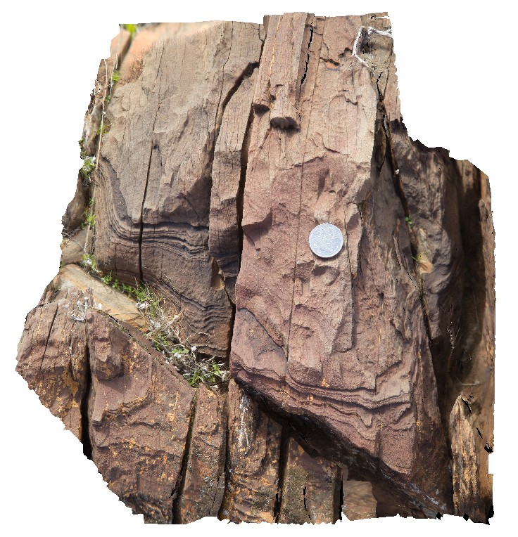
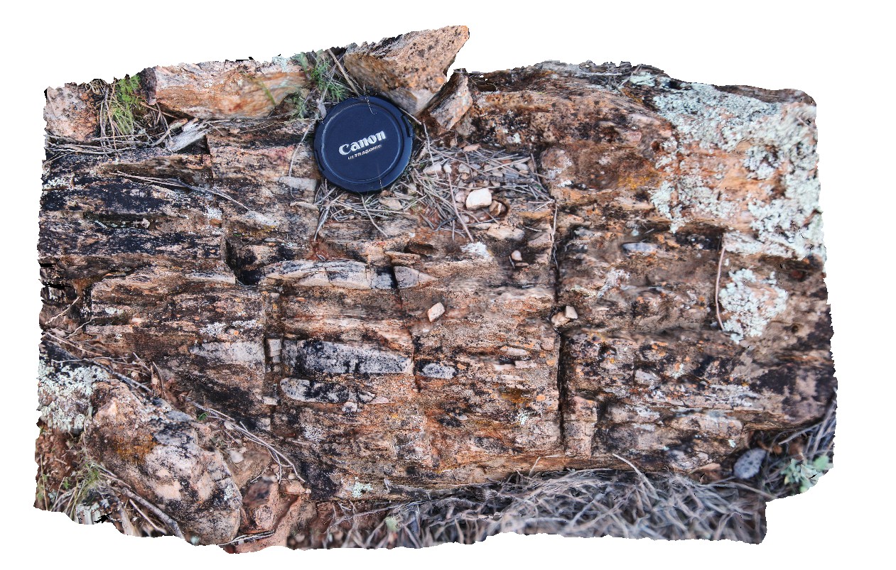
BH2013Adelaidean1 Map
 |
20 |
03/16/2015 2:55 p.m. |
3D |
moderately dipping, finely banded sandstones with spaced cleavage. Broken Hill, N.S.W. |
0.20 |
-31.59715313000 |
141.59824227000 |
-9999.000 |
spaced cleavage, structure, metasediments |
sandstone |
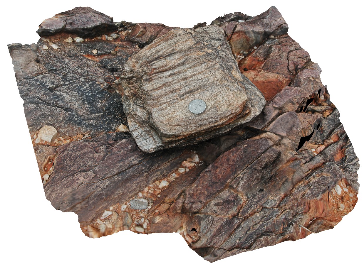
BH2014n4 Map
 |
20 |
03/16/2015 3:02 p.m. |
3D |
S-C fabric developed in steeply dipping quartz conglomerate layer in metasediments. Broken Hill, N.S.W. |
0.50 |
-31.61251976000 |
141.53012009000 |
-9999.000 |
S-C fabric, structure, conglomerate, flattening |
conglomerate |
BH2014n1 Map
 |
20 |
03/16/2015 3:03 p.m. |
3D |
well preserved small cross beds in sandstone. Broken Hill, N.S.W. |
1.00 |
-31.61947252000 |
141.56534702000 |
-9999.000 |
cross bedding, sedimentology |
sandstone |
BH2014n2 Map
 |
20 |
03/16/2015 3:03 p.m. |
3D |
view of S-C fabric developed around flattened cobbles in conglomerate layer in sediments. Broken Hill, N.S.W. |
0.20 |
-31.61237439000 |
141.52996952000 |
-9999.000 |
S-C fabric`, structure, conglomerate, flattening |
conglomerate |
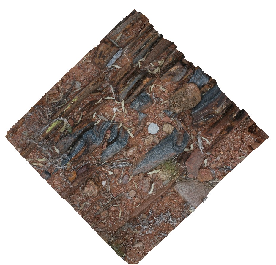
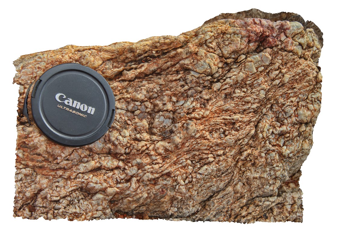
BH2014n3 Map
 |
20 |
03/16/2015 3:03 p.m. |
3D |
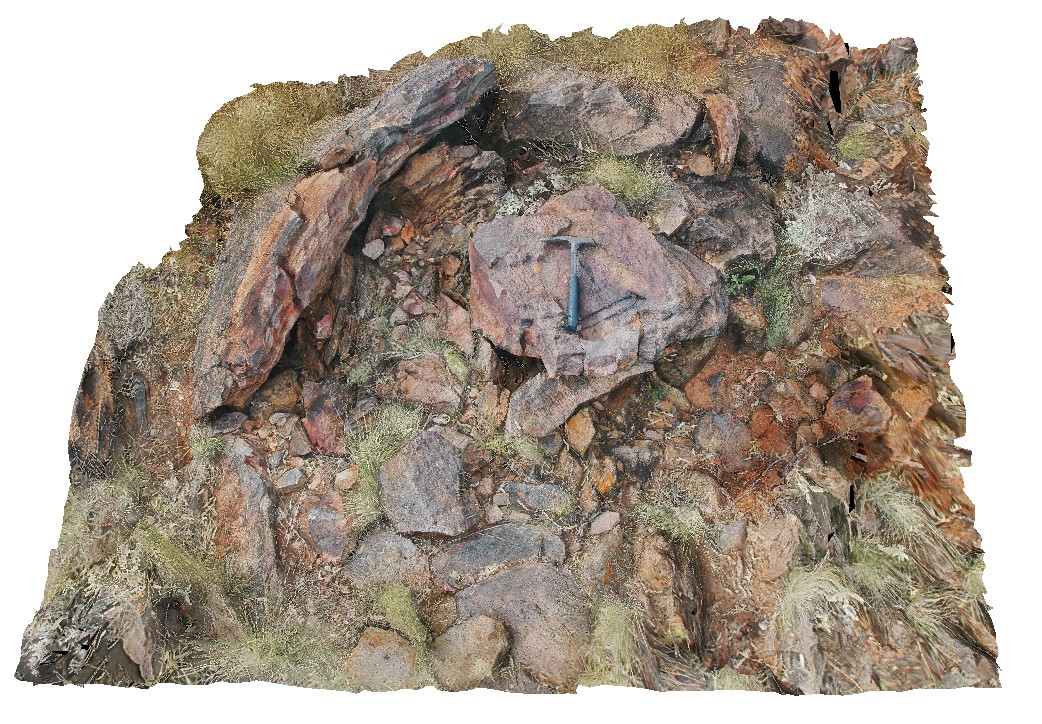
view of flattened quartz pebbles / cobbles in pebble layer of metasediments. Broken Hill, N.S.W. |
0.50 |
-31.61278094000 |
141.53035524000 |
-9999.000 |
conglomerate, metasediment, stretching, structure |
conglomerate |
BH2014n18 Map
 |
20 |
03/16/2015 3:04 p.m. |
3D |
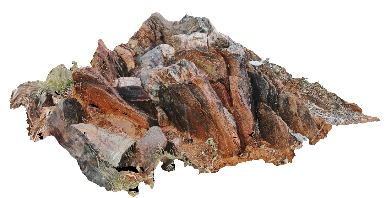
ptygmatic folding of quartz veins in gneiss. Broken Hill, N.S.W. |
0.25 |
-31.61361432000 |
141.49636511000 |
-9999.000 |
ptygmatic folding, fold, gneiss, structure, metamorphic |
gneiss |
BH2014n19 Map
 |
20 |
03/16/2015 3:05 p.m. |
3D |
folding in gneiss and quartz veins. Broken Hill, N.S.W. |
1.00 |
-31.61365513000 |
141.49653115000 |
-9999.000 |
fold, structure, gneiss, metamorphic |
gneiss |
BH2014n10 Map
 |
20 |
03/16/2015 3:06 p.m. |
3D |
fold with cleavage in gneiss after metasediments. Broken Hill, N.S.W. |
1.00 |
-31.62016291000 |
141.49263415000 |
-9999.000 |
fold, cleavage, structure, gneiss |
gneiss |
BH2014n11 Map
 |
20 |
03/17/2015 11:06 a.m. |
3D |
folded shear in quartz pegmatite. Broken Hill, N.S.W. |
2.00 |
-31.61754962000 |
141.49437202000 |
-9999.000 |
pegmatite, fold, structure, shear |
pegmatite |
BH2014n13 Map
 |
20 |
03/17/2015 11:29 a.m. |
3D |
S-C fabric developed in quartz pegmatite. Broken Hill, N.S.W. |
0.20 |
-31.61759888000 |
141.49437438000 |
-9999.000 |
S-C fabric, quartz pegmatite |
pegmatite |
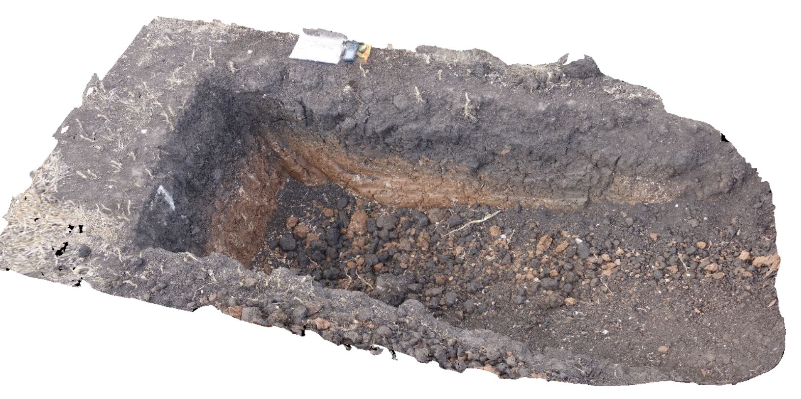
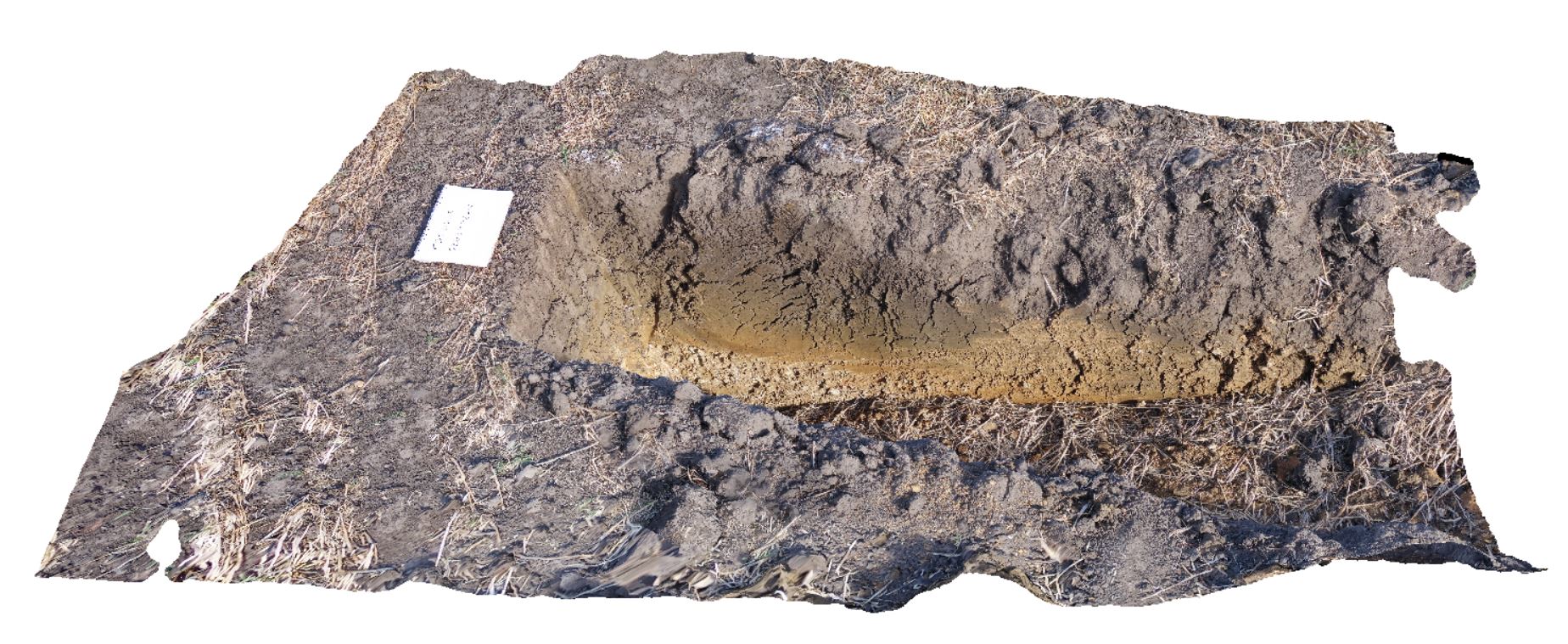
DaisyBanksPit9 Map
 |
20 |
03/17/2015 12:49 p.m. |
3D |
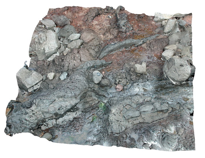
~80cm deep pit into soil and clays overlying late Cenozoic alluvial terrace deposits. Richmond, Tas. |
2.00 |
-42.72983600000 |
147.42554400000 |
-9999.000 |
clay, alluvial, regolith |
Clay |
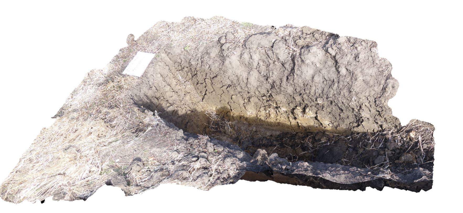
DaisyBanksPit1 Map
 |
20 |
03/17/2015 1:18 p.m. |
3D |
Undifferentiated alluvial soils and clays developed on Quaternary alluvial terrace gravel deposits predominantly derived from Parmeener and Palaeogene-Neogene units with clasts commonly of basalt and in places dolerite. Richmond, Tas. |
2.00 |
-42.73095300000 |
147.43018100000 |
-9999.000 |
clay, alluvium, regolith |
clay |
DaisyBanksPit2 Map
 |
20 |
03/17/2015 1:33 p.m. |
3D |
~80cm deep pit into soil and clays overlying quaternary alluvial deposits. Richmond, Tas. |
2.00 |
-42.73141700000 |
147.43138200000 |
-9999.000 |
clay, alluvium, regolith |
clay |