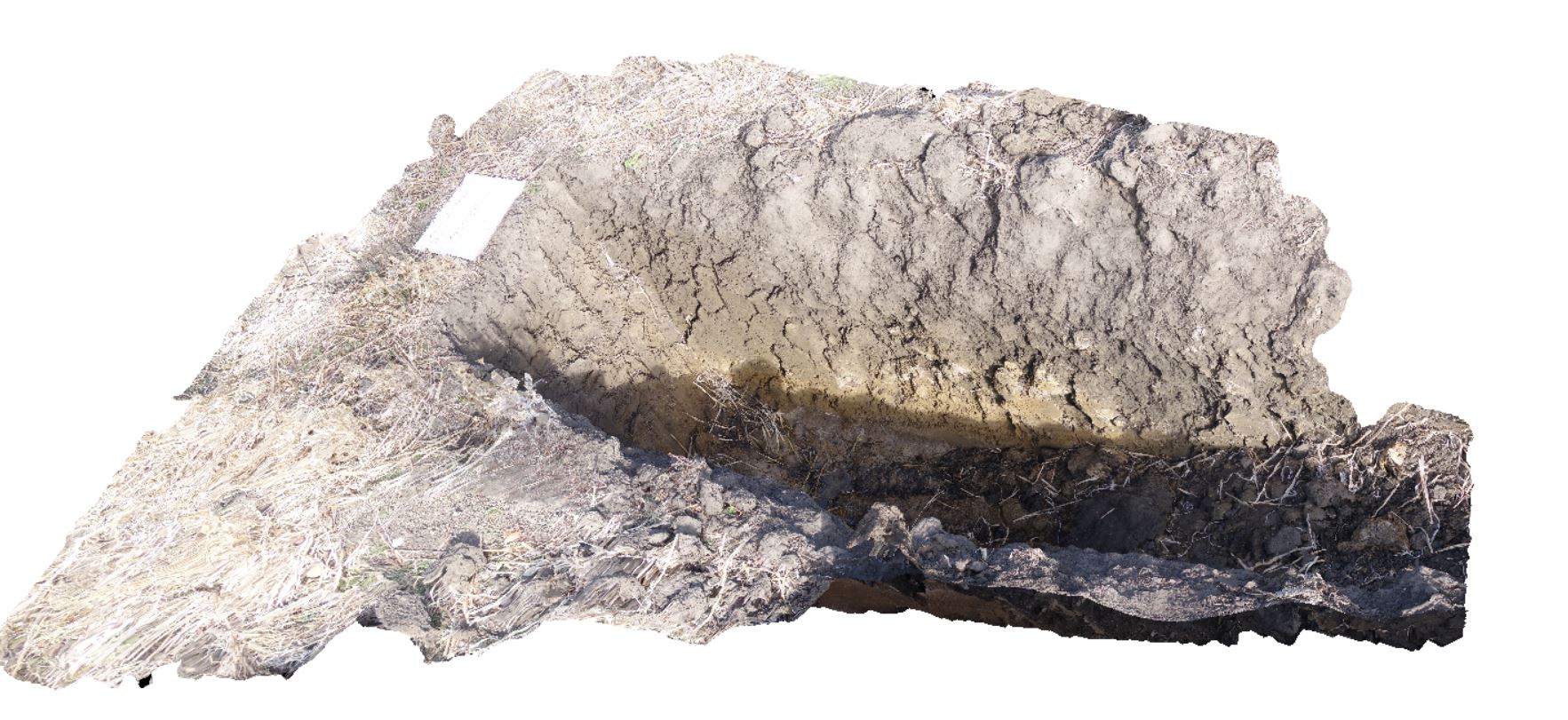
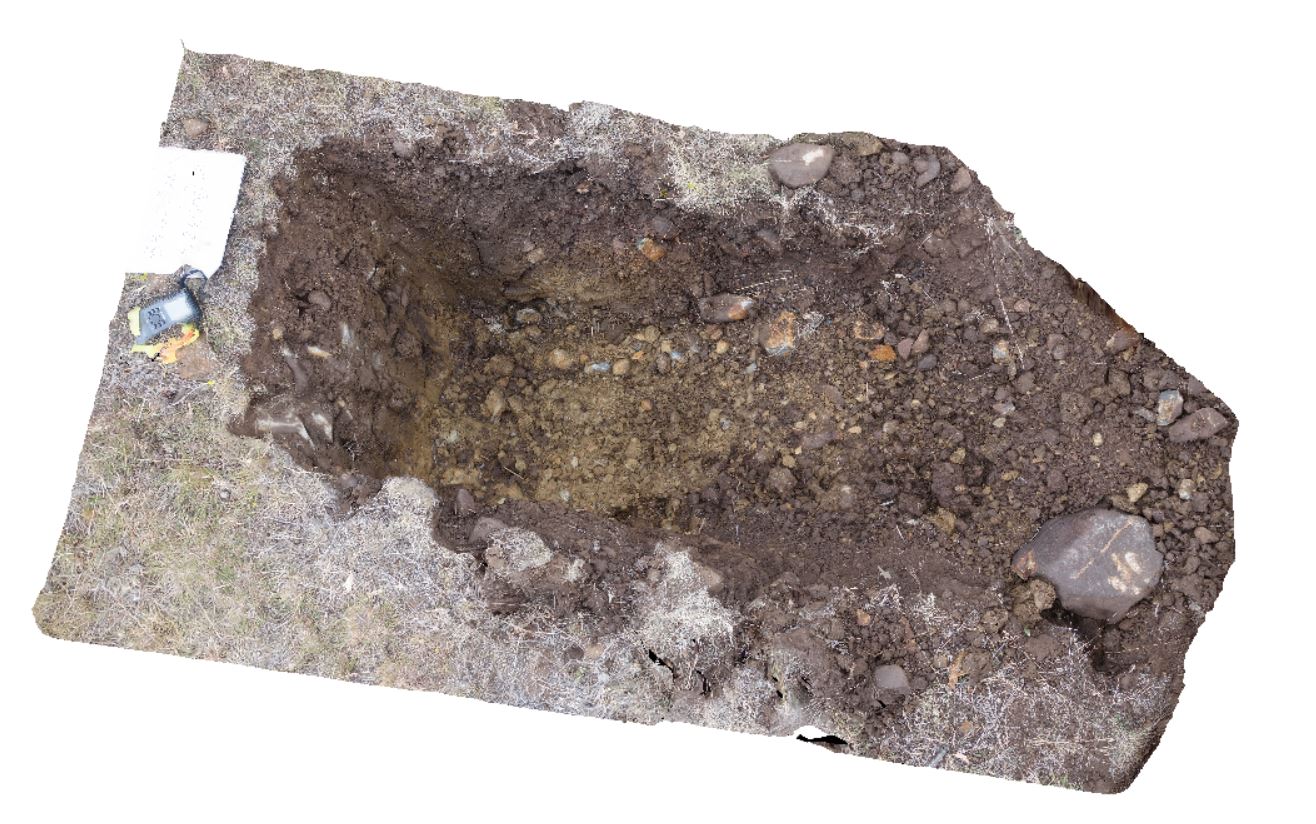
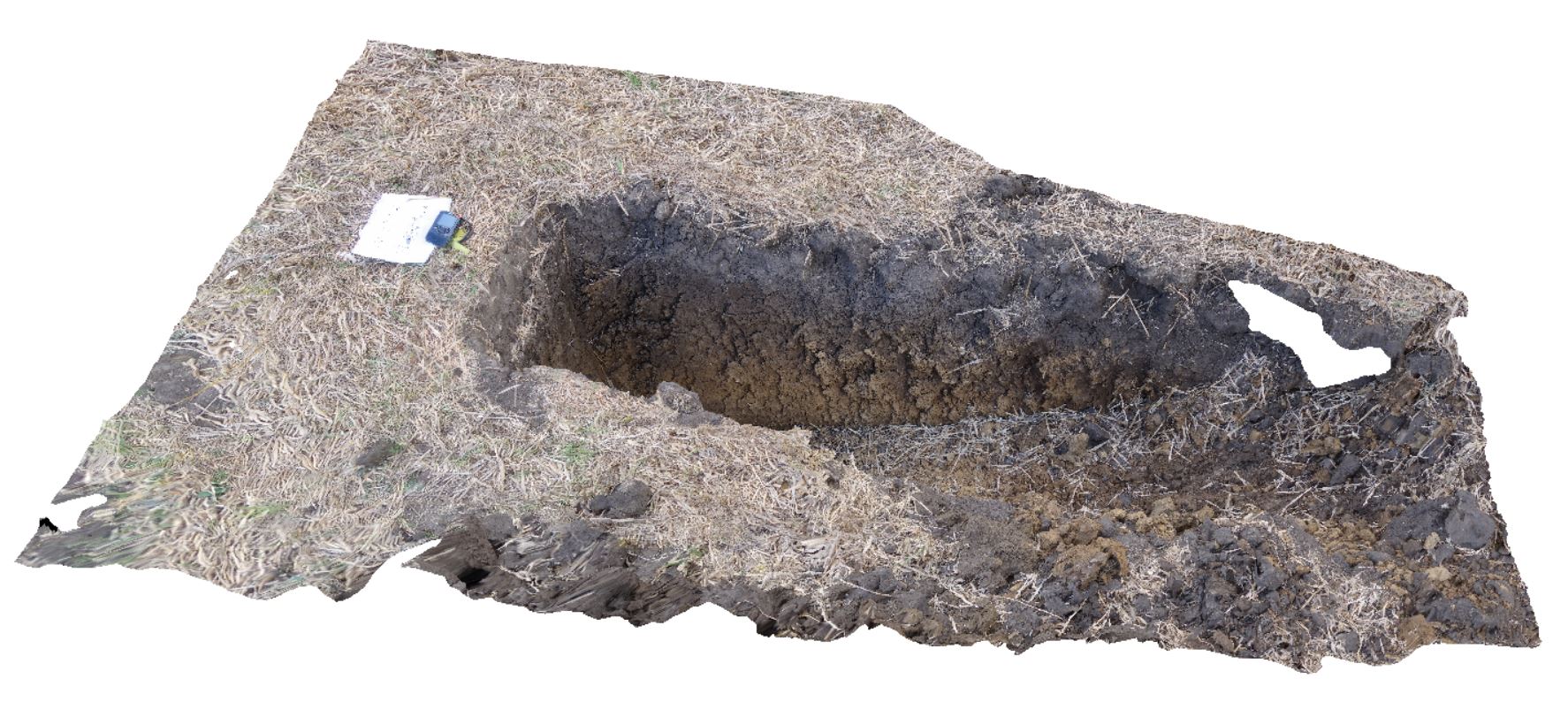
DaisyBanksPit2 Map
 |
20 |
03/17/2015 1:33 p.m. |
3D |
~80cm deep pit into soil and clays overlying quaternary alluvial deposits. Richmond, Tas. |
2.00 |
-42.73141700000 |
147.43138200000 |
-9999.000 |
clay, alluvium, regolith |
clay |
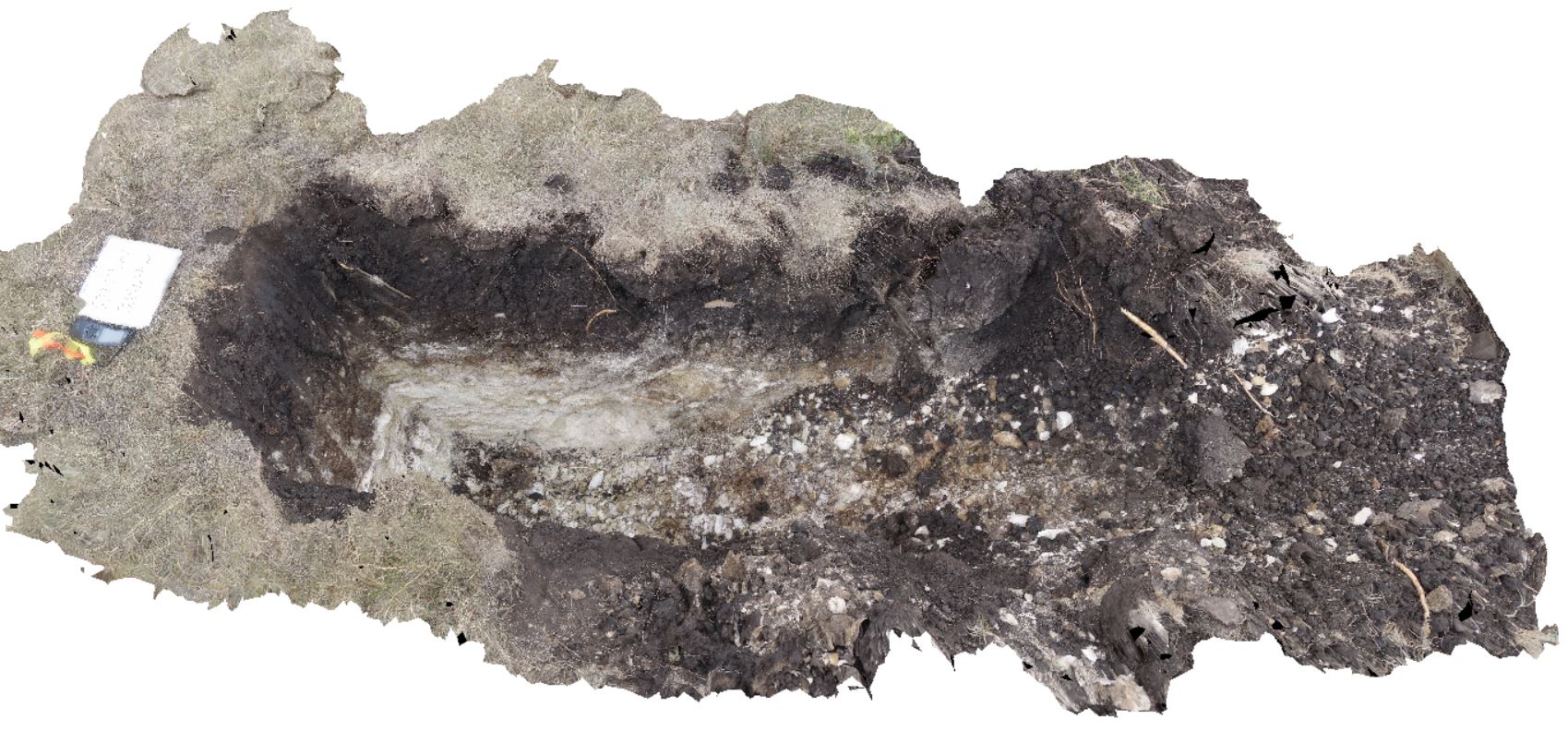
DaisyBanksPit13 Map
 |
20 |
03/23/2015 12:07 p.m. |
3D |
~80cm pit into dark grey sandy soils and white-brown sandy clay overlying Jurassic Dolerite. Richmond, Tas. |
2.00 |
-42.72961200000 |
147.42258600000 |
-9999.000 |
clay, Jurassic Dolerite, regolith |
clay |
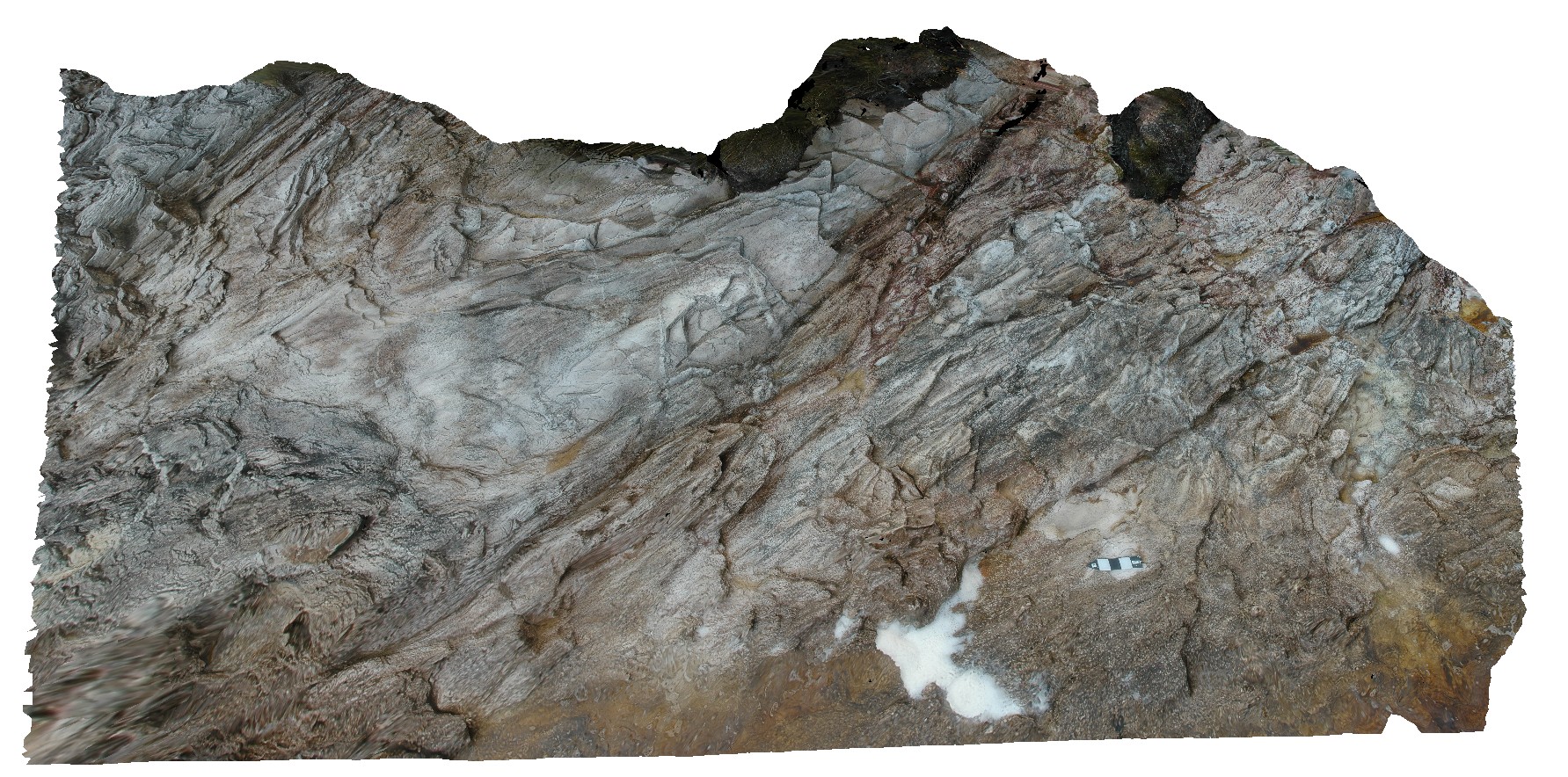
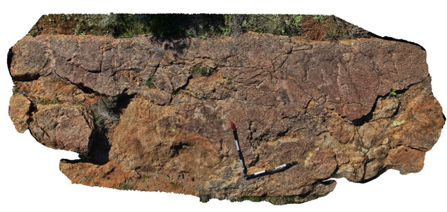
Pedder15 Map
 |
5 |
05/05/2016 1:01 p.m. |
3D |
open parasitic folds in quartzite. Lake Pedder, south west Tasmania. |
1.20 |
-42.84895071000 |
146.10478655000 |
-9999.000 |
open fold, fold, structure, quartzite |
quartzite |
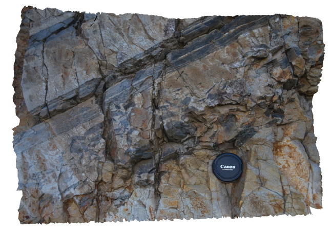
Thomson2 Map
 |
5 |
05/18/2015 2:17 p.m. |
3D |
Detail of mudstone rip up clasts in sandstone matrix - same exposure as Thomson1. Thomson Dam, Walhalla, Vic. |
0.50 |
-37.84397000000 |
146.39761000000 |
-9999.000 |
sandstone, siltstone, turbidite, rip-up clasts, sedimentology |
sandstone |
Pedder17 Map
 |
5 |
05/05/2016 1:35 p.m. |
3D |
plunging, asymmetric parasitic folds in phyllite, with kink folds. Lake Pedder, south west Tasmania. |
0.60 |
-42.89055298000 |
146.04779245000 |
-9999.000 |
fold plunge, asymmetric folds, fold, parasitic fold, phyllite, structure, kink fold |
phyllite |
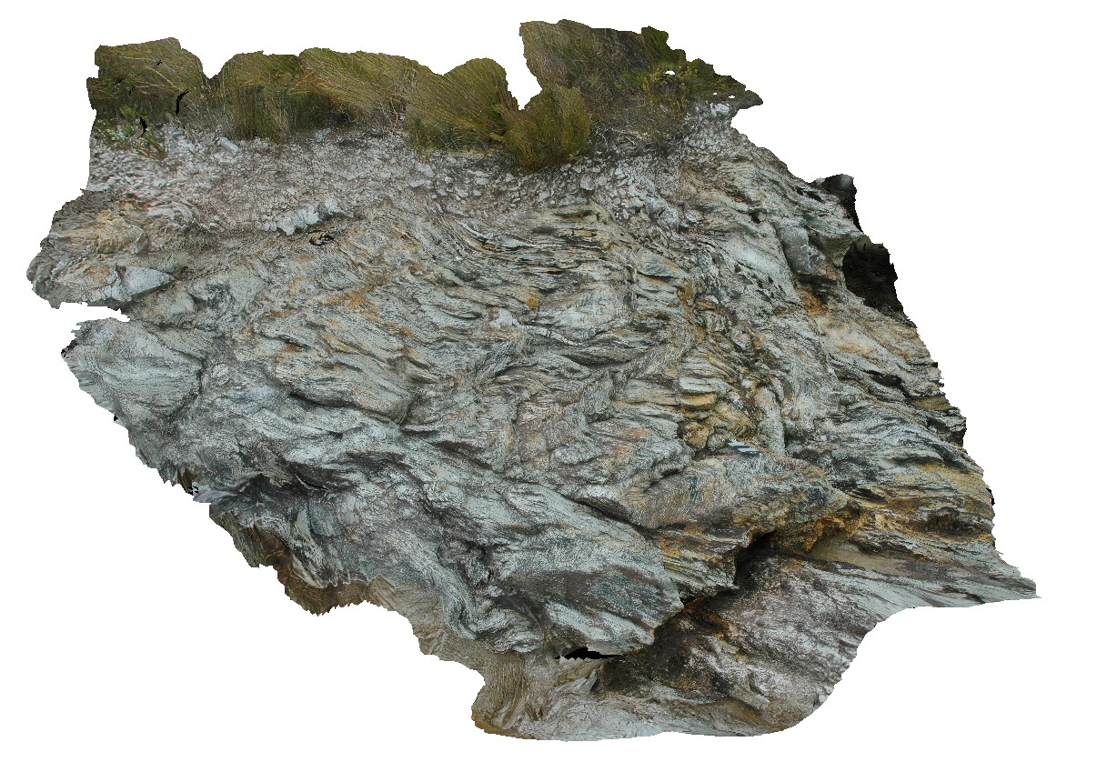
Pedder19 Map
 |
5 |
05/05/2016 2:03 p.m. |
3D |
series of gently plunging synforms and antiforms in thinly bedded quartzite. Lake Pedder, south west Tasmania. |
2.00 |
-42.88984702000 |
146.04808130000 |
-9999.000 |
plunge, fold, structure, synforms, antiform |
quartzite |
Pedder2 Map
 |
5 |
04/29/2016 11:49 a.m. |
3D |
gently plunging open fold in Precambrian quartzite. Lake Pedder, south west Tasmania. |
0.55 |
-42.84874629000 |
146.11562709000 |
-9999.000 |
Precambrian, fold, open fold, structure |
quartzite |
Thomson3 Map
 |
5 |
05/18/2015 2:18 p.m. |
3D |
Faults cutting turbiditic sediments of the Devonian Norton Gully Sandstone - main fault zone up to 1m thick. Thomson Dam, Walhalla, Vic. |
10.00 |
-37.84430000000 |
146.39732000000 |
-9999.000 |
turbidite, fault, sedimentology, structure |
turbidite |
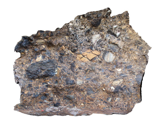
Dudley11 Map
 |
1 |
01/18/2016 11:11 a.m. |
3D |
detail of cross bedded pebbly sandstone in a boulder derived from above the Victoria Tunnel Coal seam. . Dudley Beach, N.S.W. |
1.00 |
-32.96896000000 |
151.73647000000 |
-9999.000 |
sandstone, laminated, fluvial sediments, sedimentology |
sandstone |
DaisyBanksPit14 Map
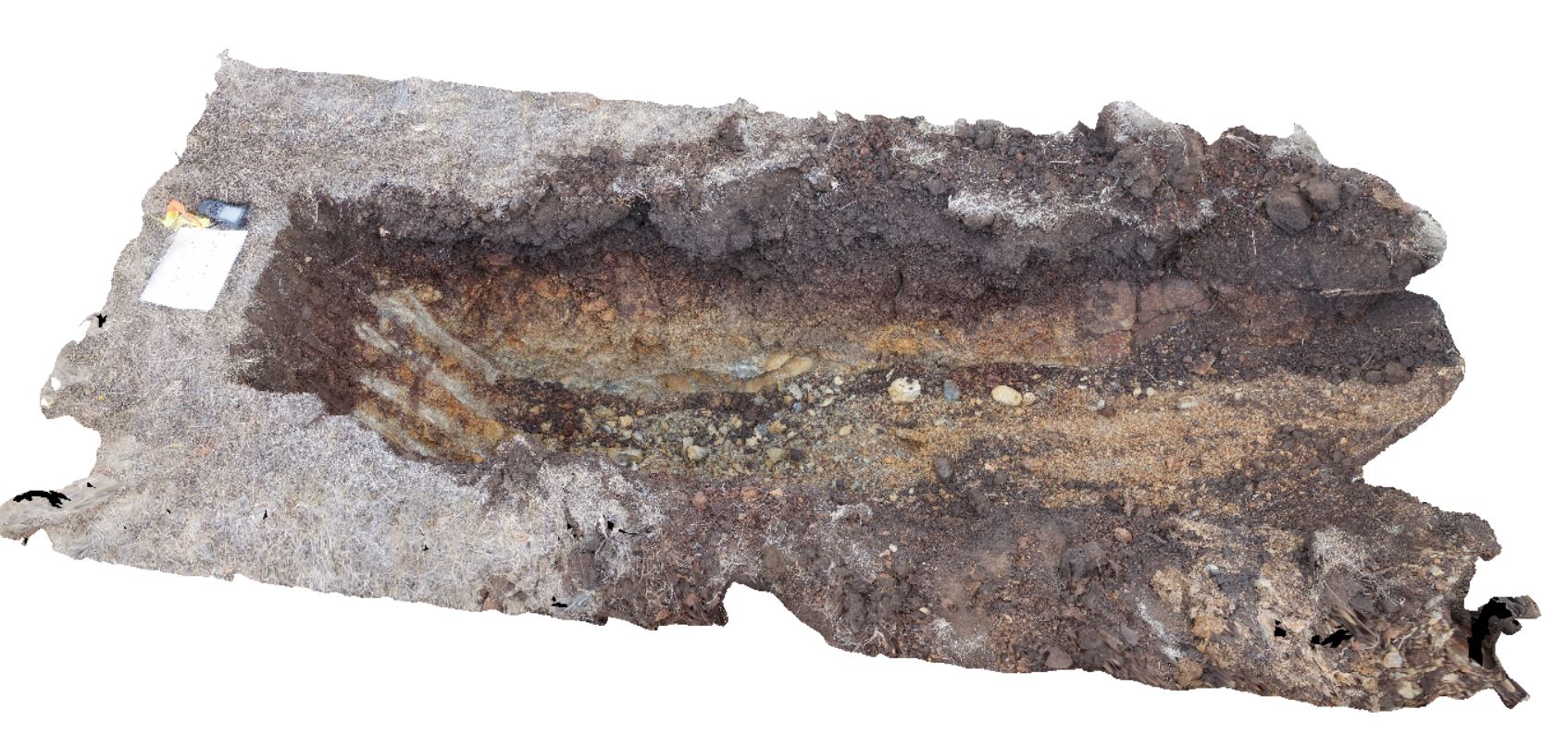 |
20 |
03/24/2015 10:06 a.m. |
3D |
~80cm pit into dark grey sandy soils and white-brown sandy clay overlying Jurassic Dolerite. Richmond, Tas. |
2.00 |
-42.73006300000 |
147.42246700000 |
-9999.000 |
Clay, Jurassic Dolerite, regolith |
Clay |
Pedder24 Map
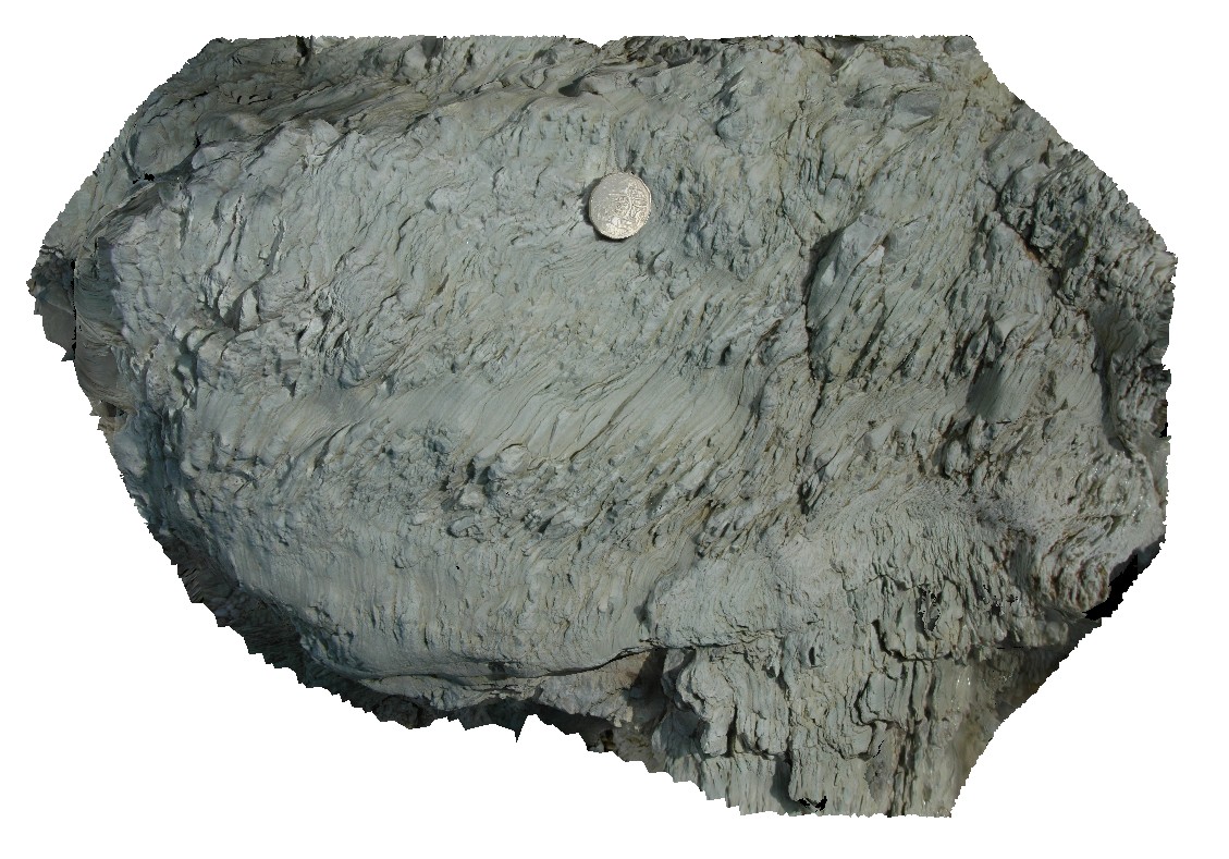 |
5 |
03/16/2015 2:28 p.m. |
3D |
small kink bands in clay-rich finely laminated metasediments. Lake Pedder, south west Tasmania. |
0.40 |
-42.95895228000 |
146.13448718000 |
-9999.000 |
mudstone, kink band, fold, structure |
mudstone |
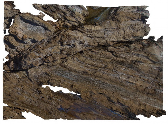
Thomson4 Map
 |
5 |
05/18/2015 2:19 p.m. |
3D |
Detail of the fault zone in Devonian Norton Gully Sandstone depicted in Thomson3 - possible drag of layers? Suggesting that the fault may have a reverse sense of movement. Thomson Dam, Walhalla, Vic. |
2.00 |
-37.84430000000 |
146.39732000000 |
-9999.000 |
turbidite, fault zone, structure |
turbidite |
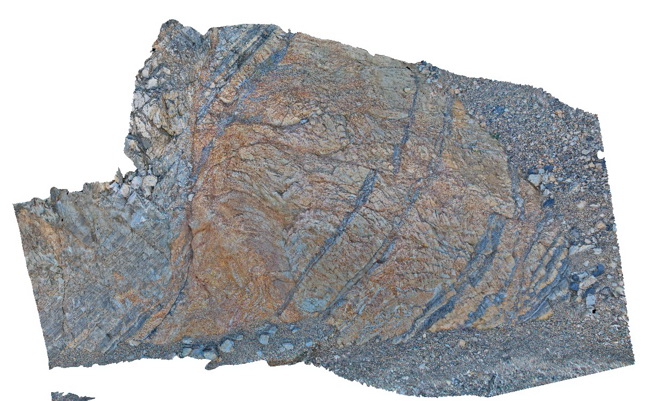
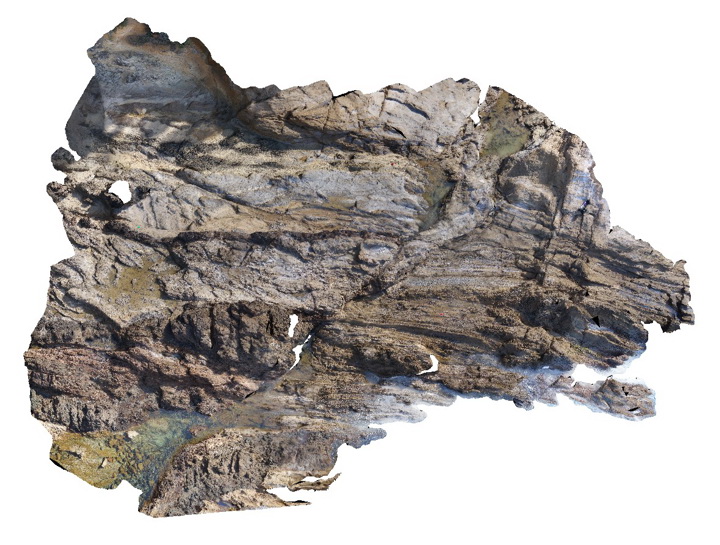
Pedder27 Map
 |
5 |
03/16/2015 2:29 p.m. |
3D |
quartzite beds in metamudstone, with stretched, folded and boudinaged layers. Lake Pedder, south west Tasmania. |
0.50 |
-42.95898711000 |
146.13431346000 |
-9999.000 |
boudinage, fold, structure, sedimentology |
mudstone |
CanberraGiga3 Map
 |
1 |
06/17/2015 10:30 a.m. |
GIGA |
— |
0.00 |
-35.30408000000 |
149.12651000000 |
-9999.000 |
|
|
CanberraGiga2 Map
 |
0 |
06/17/2015 10:29 a.m. |
GIGA |
— |
0.00 |
-35.30408000000 |
149.12651000000 |
-9999.000 |
|
|
Thomson5 Map
 |
5 |
05/18/2015 2:19 p.m. |
3D |
Kink bands in turbiditic sediments of the Devonian Norton Gully Sandstone. Thomson Dam, Walhalla, Vic. |
1.00 |
-37.84430000000 |
146.39732000000 |
-9999.000 |
kink band, turbidite, structure |
turbidite |
DarkBch1 Map
 |
5 |
07/08/2015 11:22 a.m. |
3D |
mega breccia in Permian Snapper Point Formation immediately above Permian unconformity. Dark Beach, N.S.W. |
4.00 |
-35.67775000000 |
150.30070000000 |
-9999.000 |
mega breccia, sedimentology |
breccia |
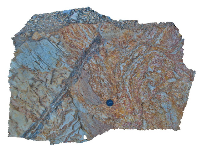
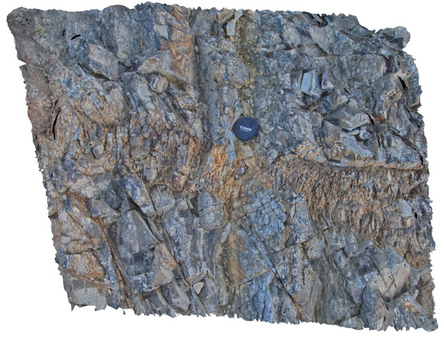
Bermagui3 Map
 |
5 |
05/18/2015 12:58 p.m. |
3D |
Fault zone cross-cutting steeply dipping sandstone beds of the Ordovician Abercrombie Formation. Visualisation is approximately 8-10m across. Bermagui, N.S.W. |
9.00 |
-36.42400000000 |
150.08278000000 |
-9999.000 |
fault zone, sandstone, structure |
sandstone |
DaisyBanksPit15 Map
 |
20 |
03/24/2015 9:47 a.m. |
3D |
~80cm pit into dark grey sandy soils and white-brown sandy clay overlying Jurassic Dolerite. Richmond, Tas. |
2.00 |
-42.73051200000 |
147.42269000000 |
-9999.000 |
Clay, Jurassic Dolerite, regolith |
clay |
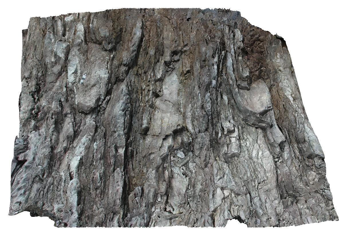
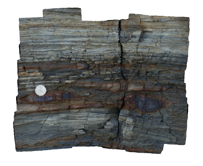
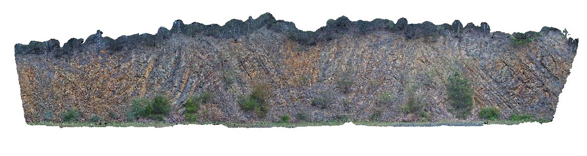
Thomson6 Map
 |
5 |
05/18/2015 2:19 p.m. |
3D |
Chevron style synclines and anticlines in turbiditic metasediments of the Devonian Norton Gully Sandstone. Thomson Dam, Walhalla, Vic. |
25.00 |
-37.85546000000 |
146.39876000000 |
-9999.000 |
turbidite, chevron fold, anticline, syncline, structure |
turbidite |
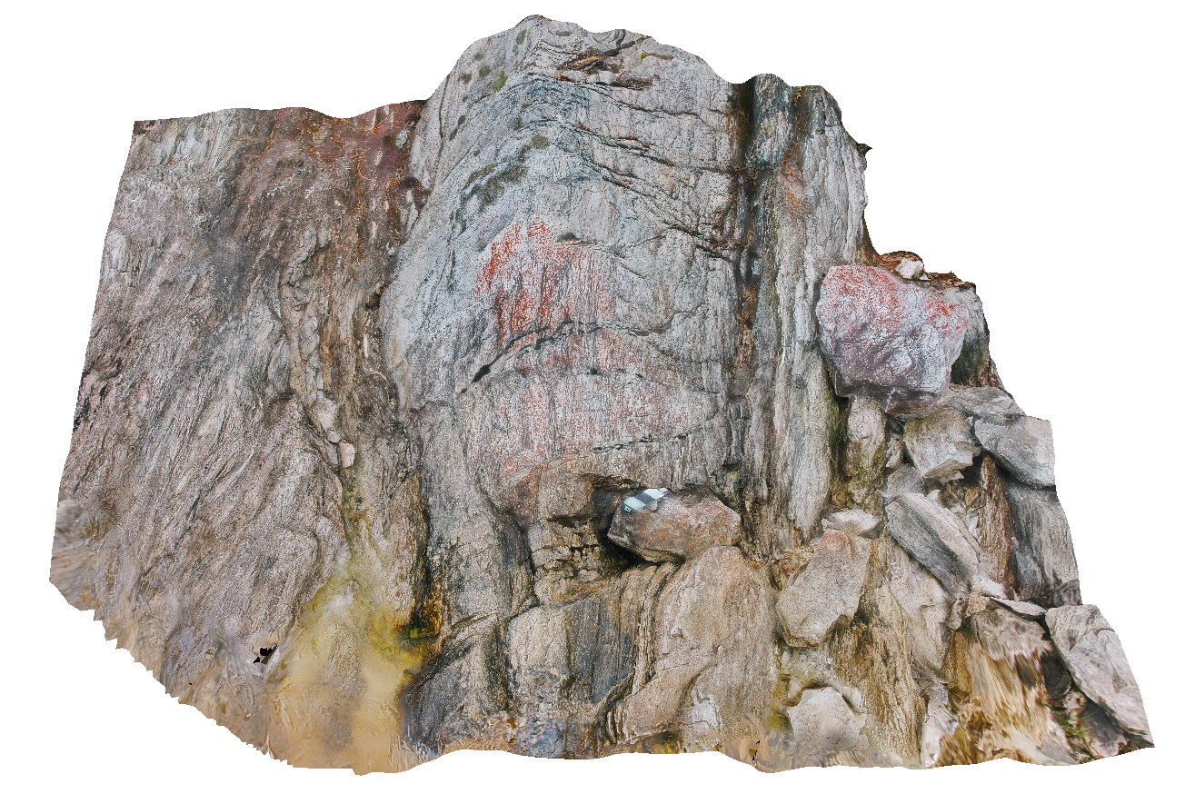
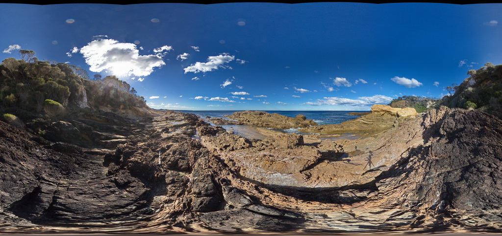
BermaguiPole2 Map
 |
5 |
10/06/2015 12:57 p.m. |
3D |
overall view of rock platform showing folded turbiditic metasediments offset by a fault zone. Bermagui, N.S.W. |
60.00 |
-36.42450000000 |
150.08278000000 |
-9999.000 |
fault, structure |
turbidite |
BermaguiFSP1 Map
 |
5 |
08/21/2015 11:38 a.m. |
FSP |
thickly bedded, folded and faulted turbiditic metasediments of the Ordovician Adaminaby Group. Bermagui, N.S.W. |
50.00 |
-36.42449000000 |
150.08263000000 |
-9999.000 |
structure, sedimentology, turbidite |
turbidite |
Pedder9 Map
 |
5 |
05/04/2016 11:34 a.m. |
3D |
asymmetric, overturned parasitic folds in green layered phyllite. Lake Pedder, south west Tasmania. |
0.35 |
-42.84937897000 |
146.10428257000 |
-9999.000 |
phyllite, folding, structure, asymmetric fold |
phyllite |
DaisyBanksPit3 Map
 |
20 |
03/17/2015 1:37 p.m. |
3D |
~80cm deep pit into soil and clays overlying Quaternary alluvial and marsh deposits of modern flood plains; of gravel, sand, silt and clay. Richmond, Tas. |
2.00 |
-42.73071600000 |
147.42842100000 |
-9999.000 |
clay, alluvium, regolith |
Clay |
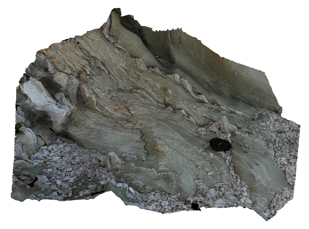
BHill58 Map
 |
5 |
09/15/2015 3:06 p.m. |
3D |
view of folded gneissic fabric in the Rasp Range Gneiss. Broken Hill. N.S.W. |
4.00 |
-31.96838000000 |
141.44791000000 |
-9999.000 |
fold, gneiss, metamorphic |
gneiss |