Pingandy14 Map
 |
0 |
05/28/2016 noon |
3D |
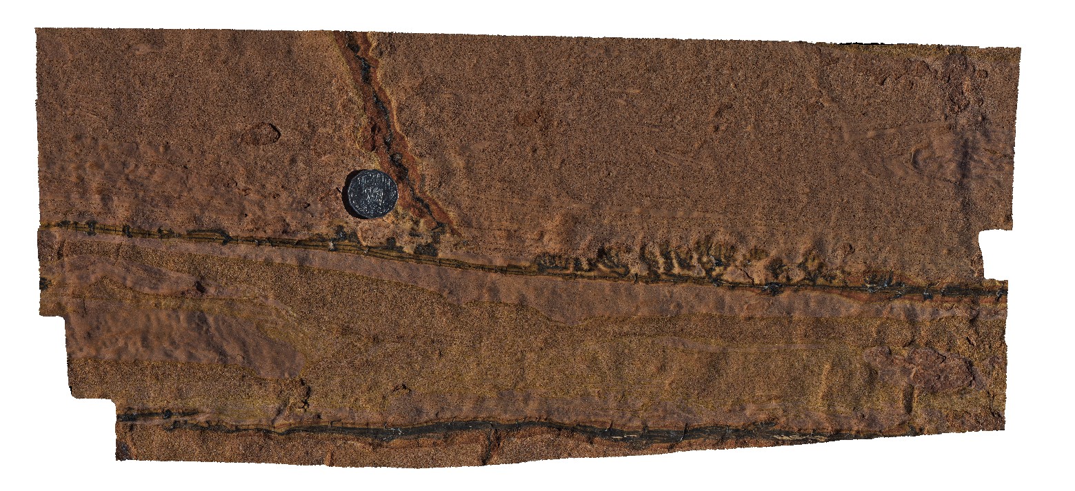
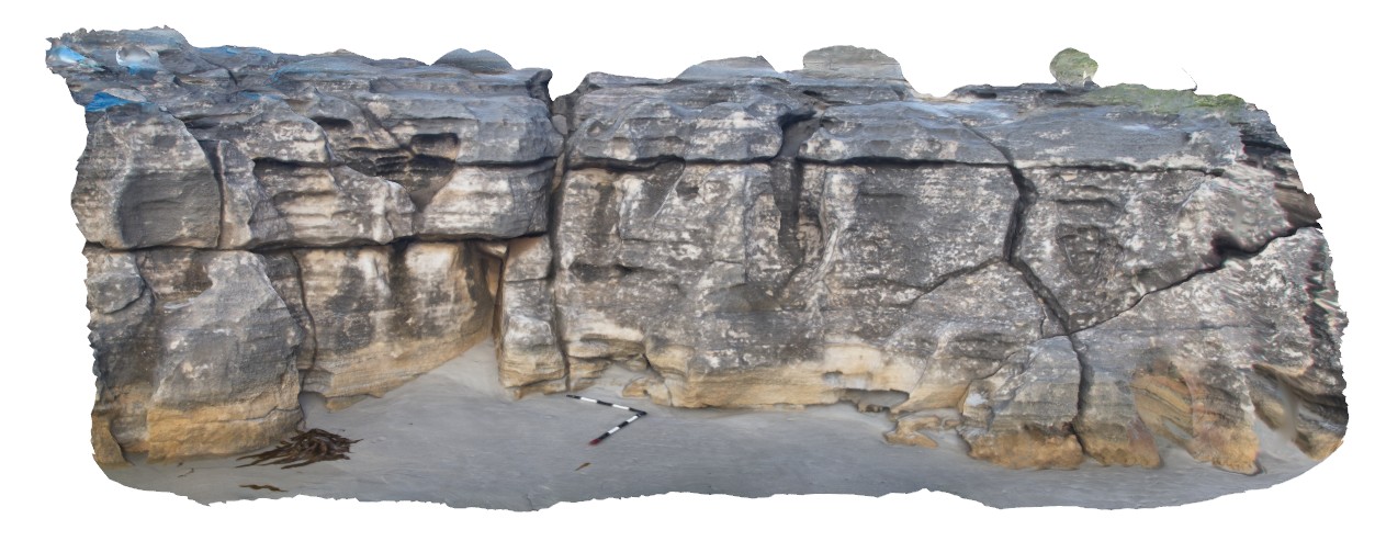
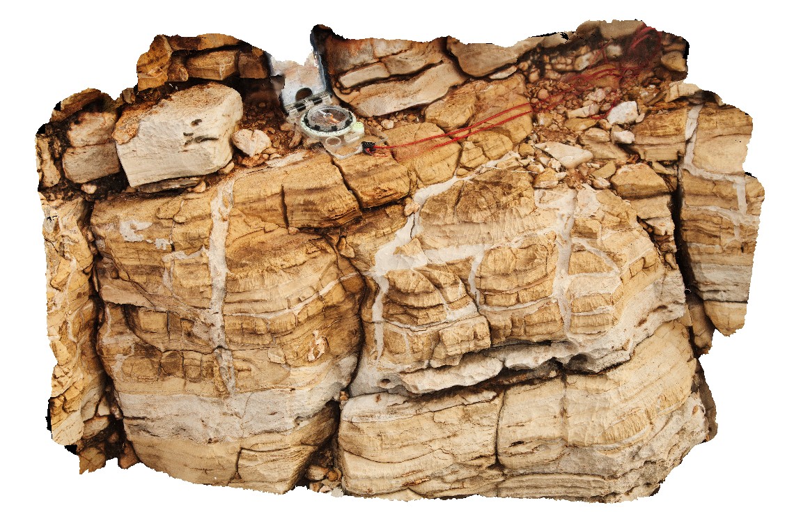
sedimentary structures; rip up clasts, flame structures in pavement of Ashburton sandstone and siltstone. Pingandy, Ashburton Downs - Meekatharra Road, W.A. |
0.00 |
-23.86936000000 |
117.79319000000 |
-9999.000 |
flame structure, rip up clast, sedimentology |
sandstone |
Pingandy15 Map
 |
0 |
05/28/2016 noon |
3D |
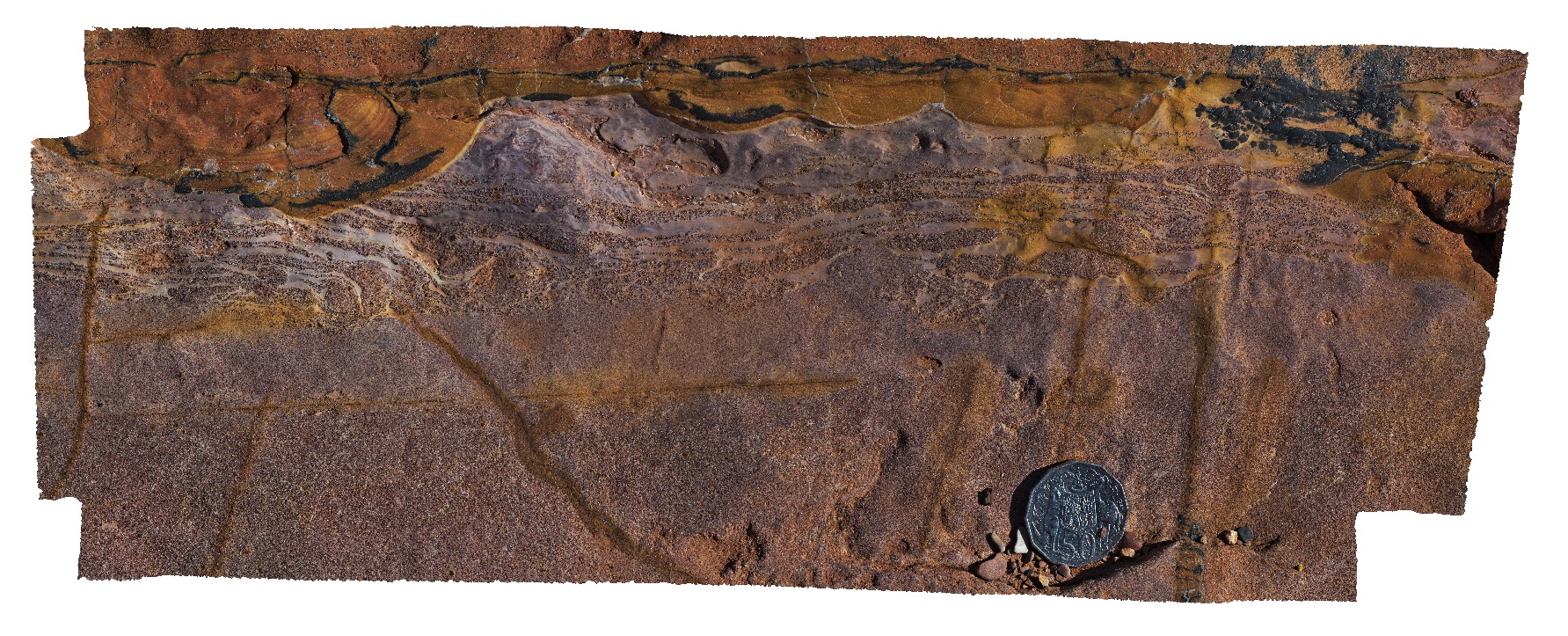
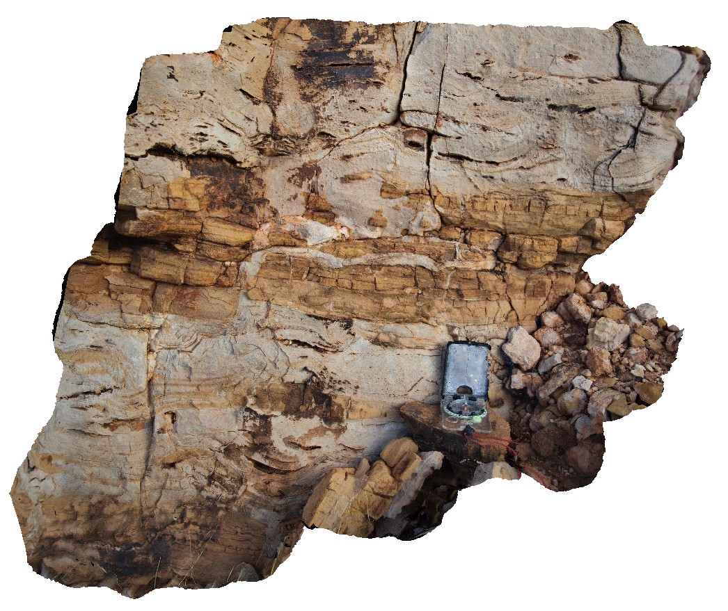
detail of soft sediment deformation in Ashburton Basin rocks. Pingandy, Ashburton Downs - Meekatharra Road, W.A. |
0.00 |
-23.86935000000 |
117.79321000000 |
-9999.000 |
soft sediment deformation, sedimentology |
sandstone |
Pingandy16 Map
 |
0 |
05/28/2016 noon |
3D |
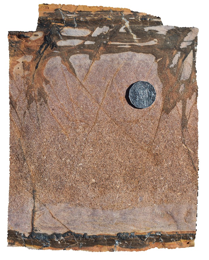
detail of a graded bed in sandy unit. Pingandy, Ashburton Downs - Meekatharra Road, W.A. |
0.00 |
-23.86932000000 |
117.79322000000 |
-9999.000 |
graded bedding, sedimentology |
sandstone |
Albany15 Map
 |
0 |
06/05/2016 10:39 a.m. |
3D |
flat-lying granodiorite sheet cross-cutting gneissic fabric. Albany, W.A. |
4.00 |
-35.11834000000 |
117.89297000000 |
-9999.000 |
granodiorite, igneous intrusion |
granite gneiss, granodiorite |
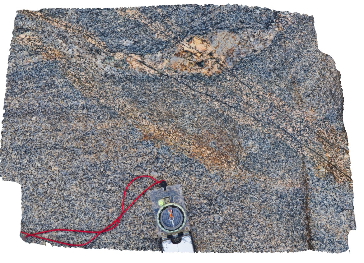
Albany13 Map
 |
0 |
06/05/2016 10:38 a.m. |
3D |
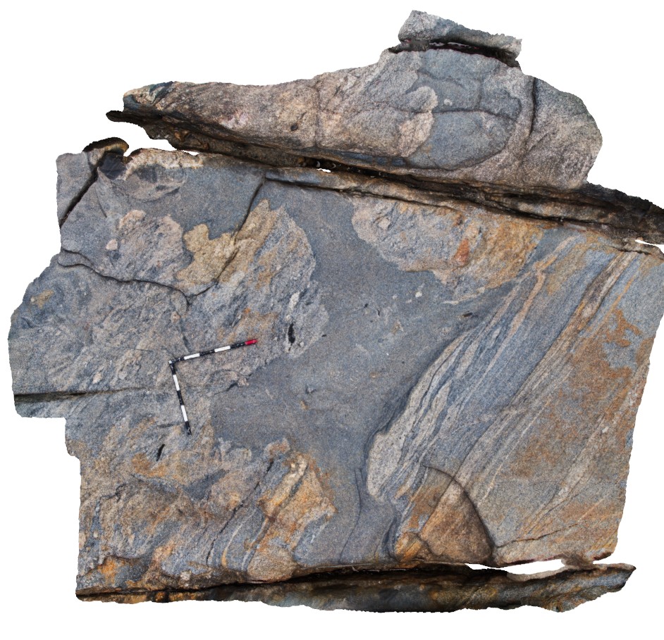
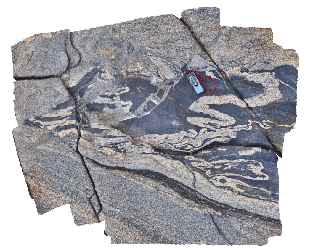
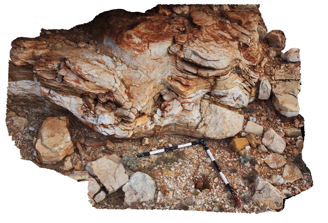
mafic enclave with tightly folded leucosomes cut by late granodiorite. Albany, W.A. |
1.60 |
-35.11836000000 |
117.89299000000 |
-9999.000 |
leucosome, granodiorite |
granitic gneiss, granodiorite |
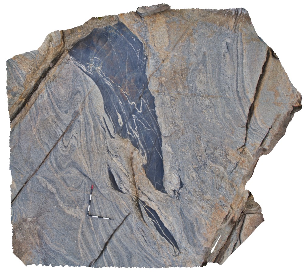
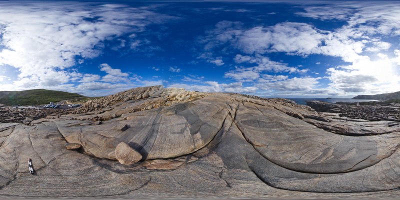
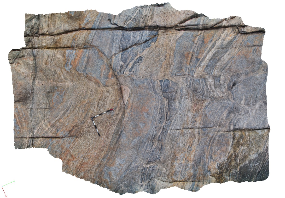
AlbanyFSP6 Map
 |
0 |
06/05/2016 10:40 a.m. |
FSP |
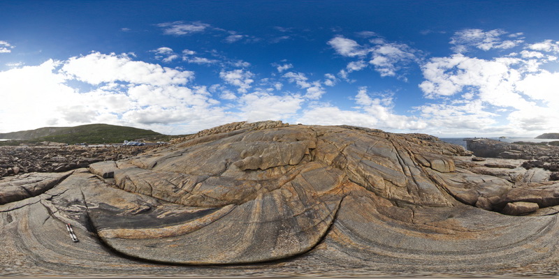
overview of the shore exposure at 'The Gap', showing granodiorite intruding banded granitic gneiss with disaggregated mafic dykes. Albany |
100.00 |
-35.11838000000 |
117.89299000000 |
-9999.000 |
mafic dyke, banded gneiss, structure, folding |
gneiss, granodiorite |
AlbanyFSP5 Map
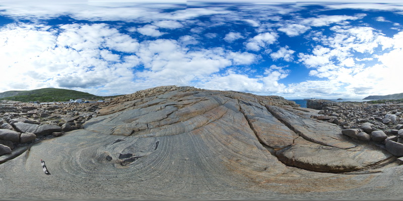 |
0 |
06/05/2016 10:40 a.m. |
FSP |
overview of the shore exposure at 'The Gap', showing granodiorite intruding banded granitic gneiss with disaggregated mafic dykes. Albany |
100.00 |
-35.11831000000 |
117.89301000000 |
-9999.000 |
granitic gneiss, mafic dyke, igneous intrusion |
granitic gneiss, granodiorite |
Albany17 Map
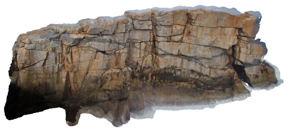 |
0 |
01/01/9999 midnight |
3D |
view of the cliff at 'The Gap', Albany, showing granodiorite intrusion in granitic gneiss. |
20.00 |
-35.11831000000 |
117.89301000000 |
-9999.000 |
granodiorite, cliff, igneous intrusion |
granitic gneiss, granodiorite |
Albany16 Map
 |
0 |
06/05/2016 10:39 a.m. |
3D |
disaggregated dyke fragment in the core of synformal fold in gneiss. Albany, W.A. |
4.00 |
-35.11829000000 |
117.89302000000 |
-9999.000 |
disaggregated dyke, synformal fold |
granitic gneiss, mafic |
Albany11 Map
 |
0 |
06/05/2016 10:37 a.m. |
3D |
mafic zone in folded granite gneiss with late stage K-feldspar alteration on fractures. Albany, W.A. |
4.00 |
-35.11831000000 |
117.89304000000 |
-9999.000 |
mafic dyke, granite, granodiorite, intrusive contact, K-feldspar alteration |
granite gneiss, granodiorite, mafic |
AlbanyUAV2 Map
 |
20 |
01/01/9999 midnight |
UAV |
aerial view of granitic rocks with mafic pods intruded by granodiorite at 'The Gap, Albany, W.A. |
50.00 |
-35.11831000000 |
117.89304000000 |
-9999.000 |
granitic gneiss, granodiorite, mafic dyke, igneous intrusion |
granitic gneiss, granodiorite |
AlbanyFSP7 Map
 |
0 |
01/01/9999 midnight |
FSP |
Overall view of the shore exposure at 'The Gap', showing banded granitic gneiss intruded by grey granodiorite. Albany. W.A. |
100.00 |
-35.11848000000 |
117.89305000000 |
-9999.000 |
granodiorite, banded gneiss, igneous contract |
granite gneiss, granodiorite |
Albany12 Map
 |
0 |
06/05/2016 10:38 a.m. |
3D |
detail of K-feldspar alteration on late-stage fractures in folded gneiss. Albany, W.A. |
0.45 |
-35.11828000000 |
117.89307000000 |
-9999.000 |
K-feldspar alteration, granitic gneiss, fracture |
granitic gneiss |
AlbanyFSP8 Map
 |
0 |
01/01/9999 midnight |
FSP |
Overall view of the shore exposure at 'The Gap', showing banded granitic gneiss intruded by grey granodiorite. Albany. W.A. |
100.00 |
-35.11839000000 |
117.89310000000 |
-9999.000 |
granitic gneiss, granodiorite |
granite gneiss, granodiorite |
Albany14 Map
 |
0 |
06/05/2016 10:38 a.m. |
3D |
shear zone / fault off setting stratigraphy in gneissic units. |
5.00 |
-35.11846000000 |
117.89311000000 |
-9999.000 |
gneiss, fault, shear, structure |
gneiss |
Albany10 Map
 |
0 |
06/05/2016 10:37 a.m. |
3D |
disrupted mafic dyke in granitic gneiss. Albany, W.A. |
4.70 |
-35.11731000000 |
117.89973000000 |
-9999.000 |
mafic dyke, granitic gneiss |
granite gneiss |
Albany9 Map
 |
0 |
01/01/9999 midnight |
3D |
disrupted and deformed mafic dyke with internal folded granitic dykes / leucosomes. Albany, W.A. |
4.50 |
-35.11731000000 |
117.89973000000 |
-9999.000 |
mafic dyke, deformation, granite, leucosome |
granite, mafic |
Albany8 Map
 |
0 |
06/05/2016 10:36 a.m. |
3D |
erosional features in Quaternary calcareous beach sediments. Albany, W.A. |
6.50 |
-35.11587000000 |
117.90143000000 |
-9999.000 |
Quaternary calcareous beach sediments, limestone |
limestone |
Albany7 Map
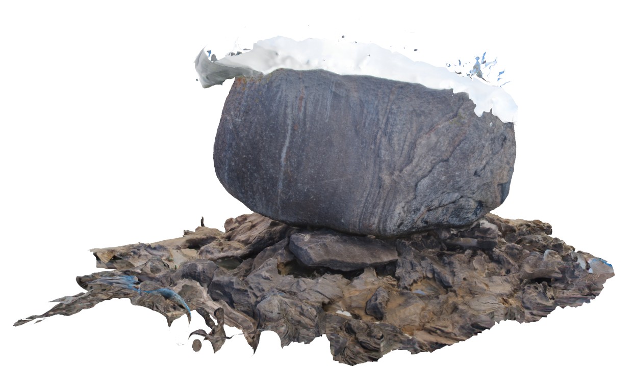 |
0 |
06/05/2016 10:36 a.m. |
3D |
large Tor of folded and banded granitic gneiss sitting on Quaternary eolian beach sediments. Albany, W.A. |
6.00 |
-35.11580000000 |
117.90178000000 |
-9999.000 |
tor, granitic gneiss, aeolian sediments |
granitic gneiss, limestone |
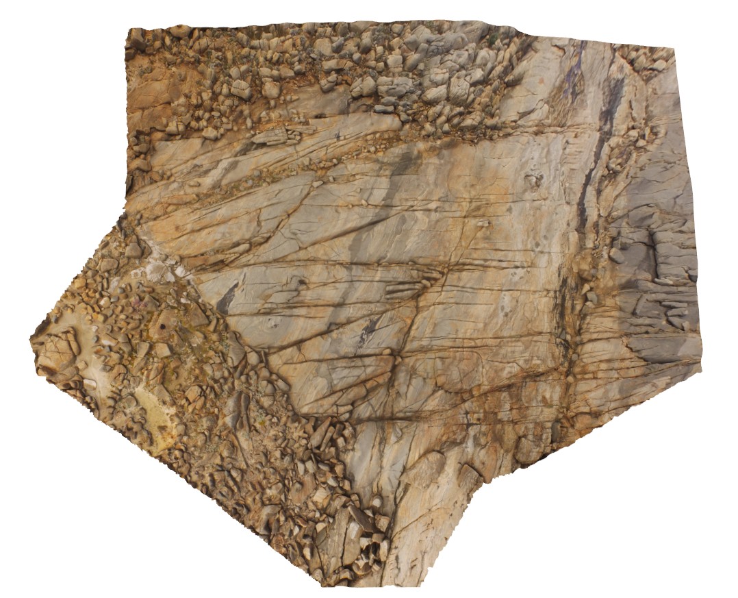
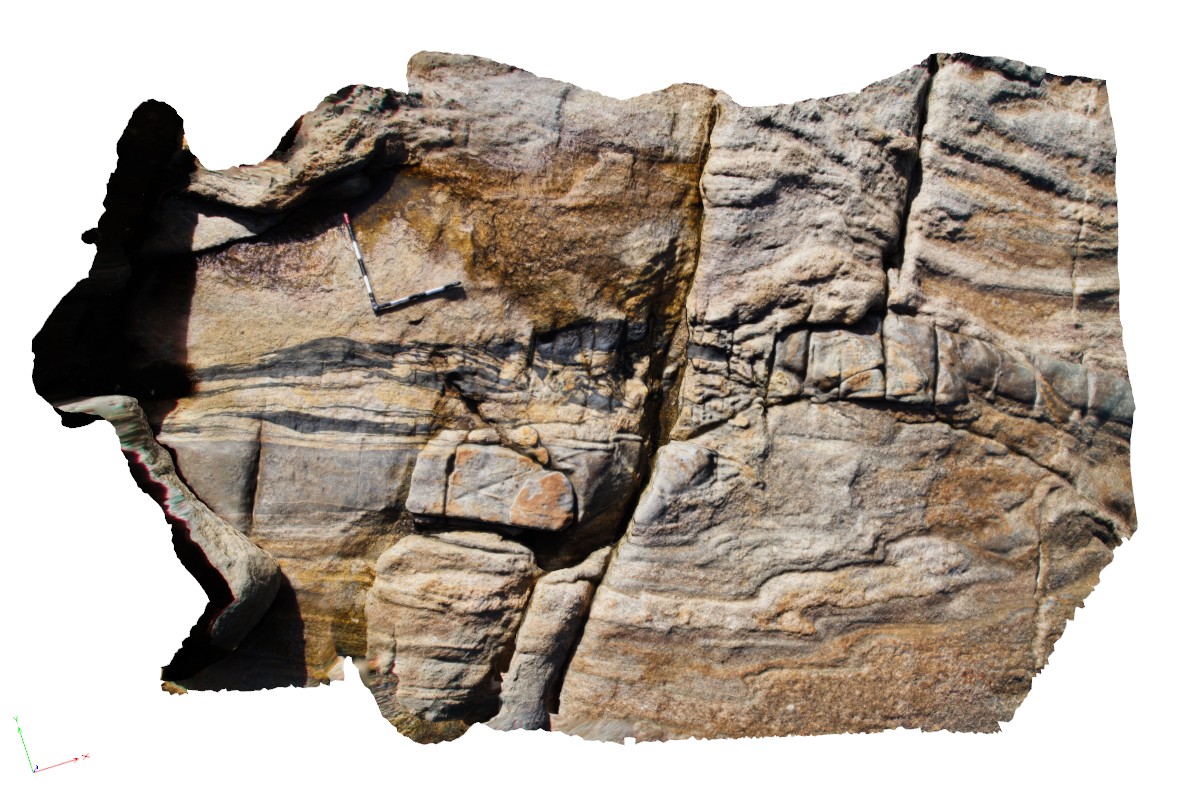
Pingandy5 Map
 |
0 |
05/27/2016 noon |
3D |
breccia in dolostone. Ashburton Downs - Meekatharra Road, W.A. |
0.50 |
-24.00579000000 |
117.91142000000 |
-9999.000 |
clastic breccia |
dolostone |
Pingandy3 Map
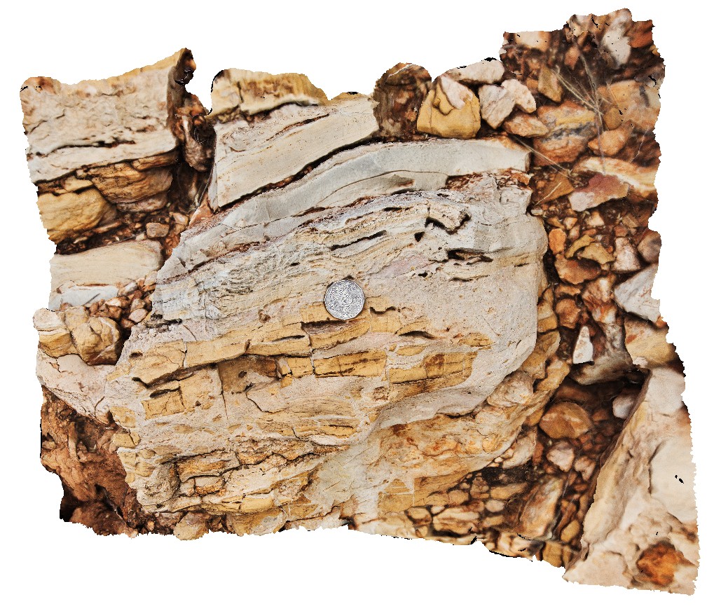
 |
5 |
05/27/2016 noon |
3D |
detail of chert nodule and disrupted bedding carbonates. Ashburton Downs - Meekatharra Road, W.A. |
0.60 |
-24.00582000000 |
117.91148000000 |
-9999.000 |
disrupted bedding, chert, nodule |
dolostone |
Pingandy4 Map
 |
5 |
05/27/2016 noon |
3D |
detail of clastic dykes in carbonates. Ashburton Downs - Meekatharra Road, W.A. |
0.55 |
-24.00582000000 |
117.91148000000 |
-9999.000 |
clastic dykes, dolostone |
dolostone |
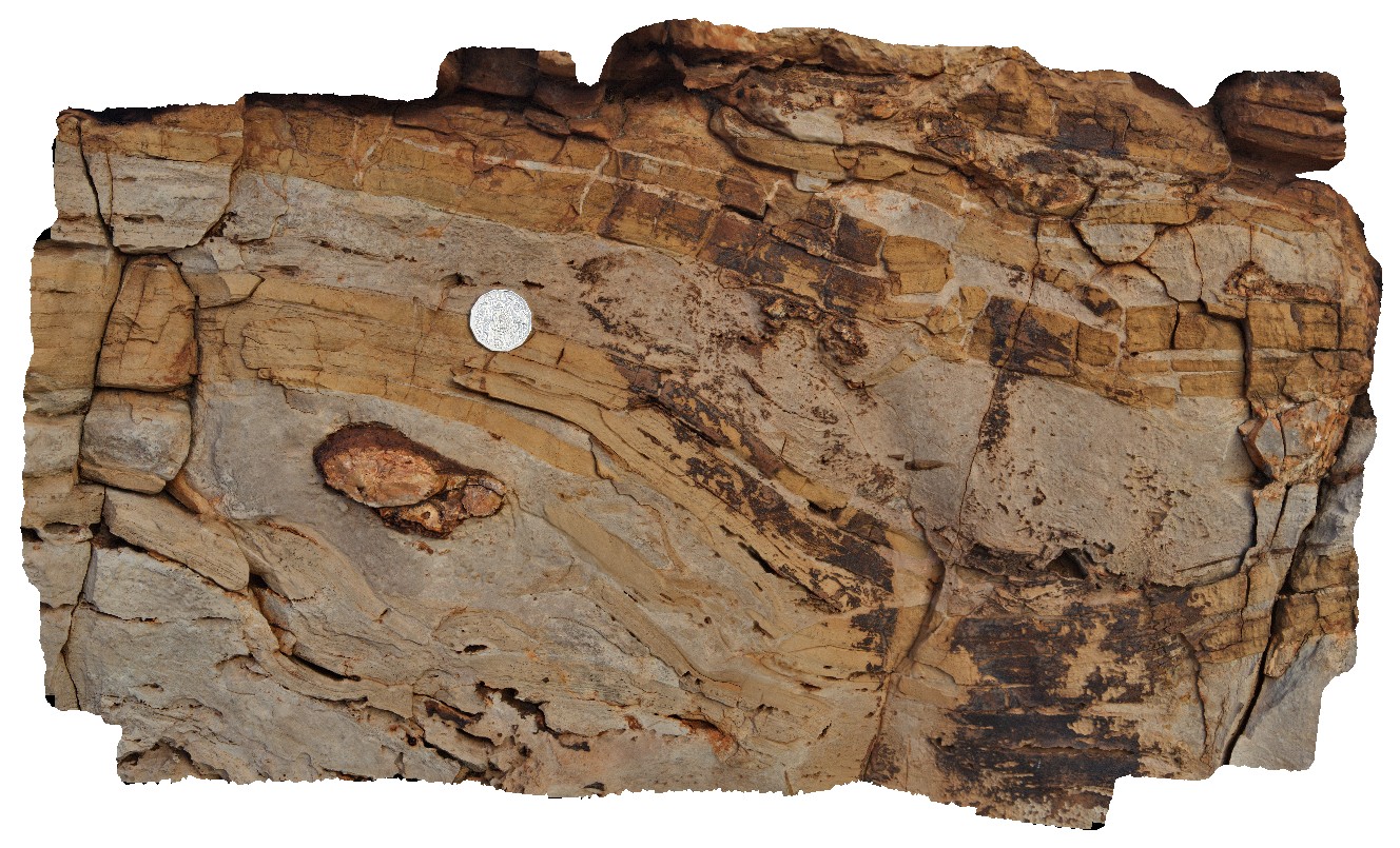
Pingandy1 Map
 |
0 |
05/27/2016 noon |
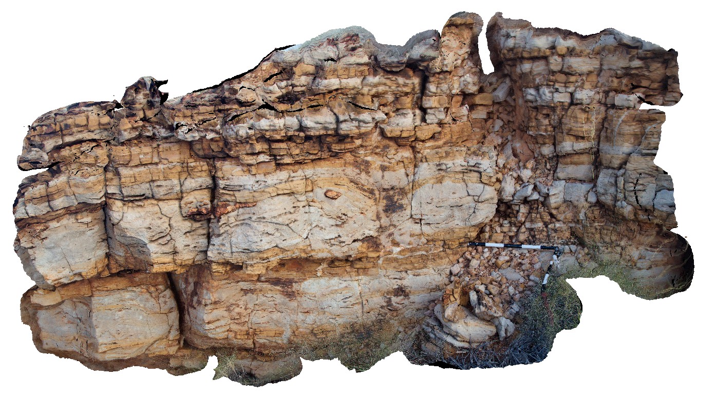
3D |
thickly bedded carbonate unit near the base of the Bangemall Basin, showing irregular and disrupted bedding, chert nodules and clastic dykes. Ashburton Downs - Meekatharra Road, W.A. |
0.00 |
-24.00582000000 |
117.91148000000 |
-9999.000 |
carbonate, limestone, sedimentology, disrupted bedding, chert nodules |
limestone |
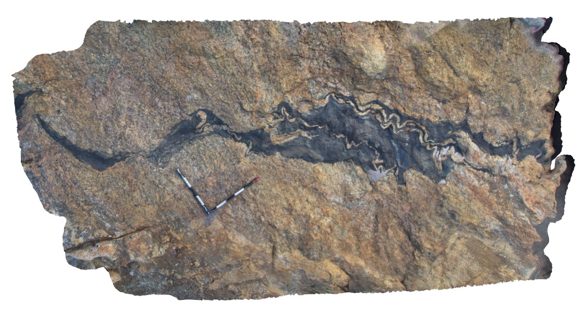
Pingandy6 Map
 |
0 |
05/27/2016 noon |
3D |
soft sediment deformation in dolostone. Ashburton Downs - Meekatharra Road, W.A. |
2.20 |
-24.00585000000 |
117.91148000000 |
-9999.000 |
|
dolostone |
Pingandy2 Map
 |
0 |
05/27/2016 noon |
3D |
detail of clastic dyke from exposed carbonate unite at site Pingandy1. Ashburton Downs - Meekatharra Road, W.A. |
0.00 |
-24.00582000000 |
117.91148000000 |
-9999.000 |
clastic dyke, sedimentology |
limestone |