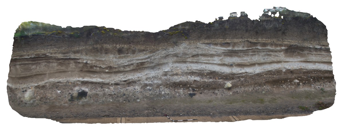
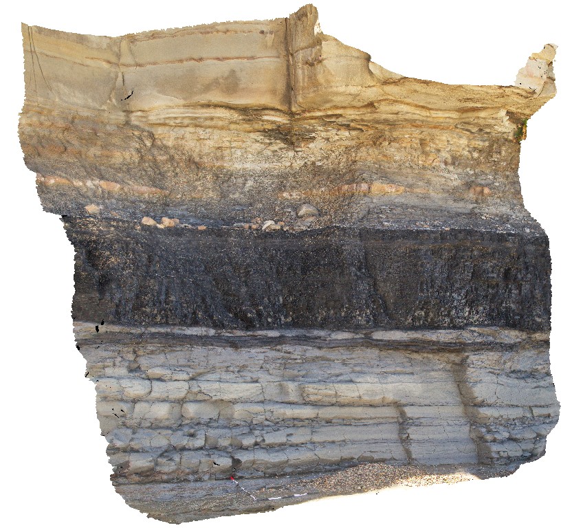
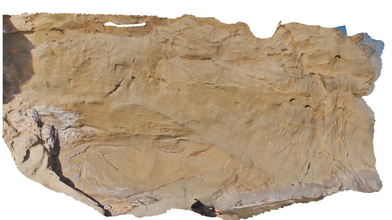
MtGambier3 Map
 |
0 |
06/05/2016 10:47 a.m. |
3D |
view of tuff deposit layering and overlying soil profile. Mount Gambier, S.A. |
5.00 |
-37.85133000000 |
140.77747000000 |
-9999.000 |
tuff, soil horizon |
tuff, soil |
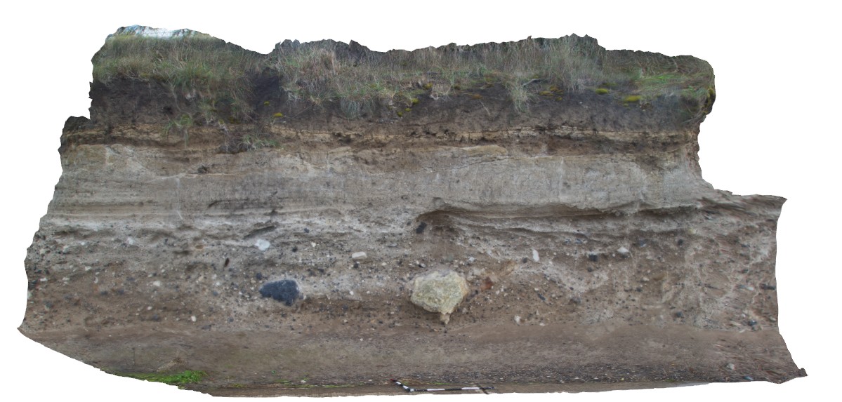
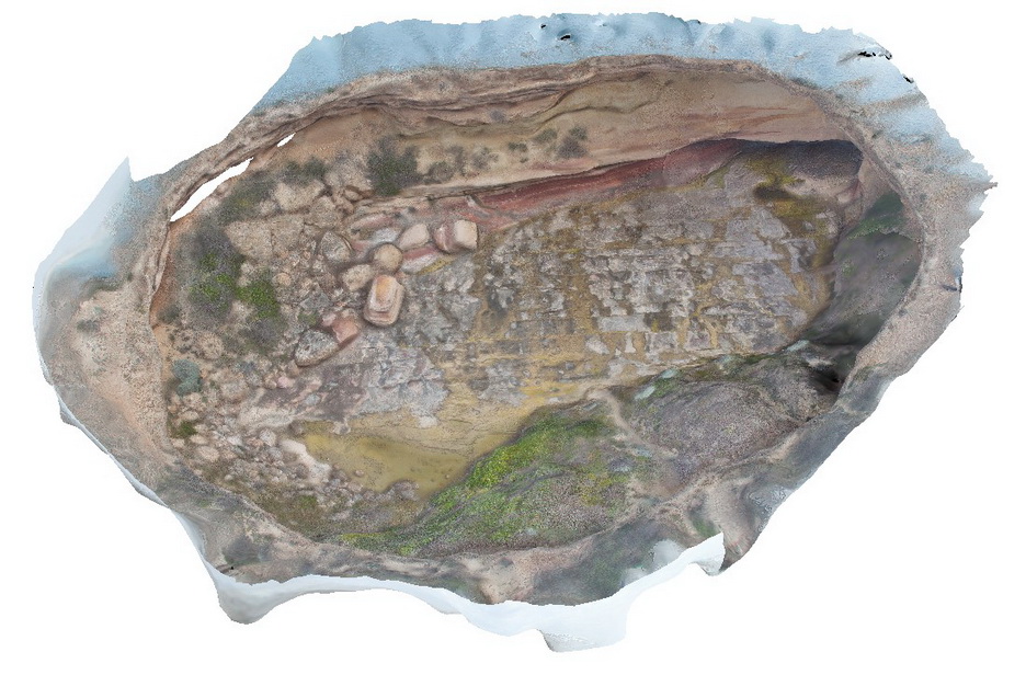
MtGambier4 Map
 |
0 |
06/05/2016 10:48 a.m. |
3D |
view of tuff beds, with finer tuff overlying coarse-grained layer with volcanic bombs of limestone and basalt. Mount Gambier, S.A. |
4.00 |
-37.85136000000 |
140.77776000000 |
-9999.000 |
tuff, volcanic bomb |
tuff |
SwanseaFSP9 Map
 |
5 |
06/17/2015 10:04 a.m. |
FSP |
View of tuffaceous rocks of the Permian Boolaroo Formation. The underlying Lower Pilot Seam crops out in the water. In-situ petrified tree stumps up to 0.3m in diameter. Swansea, N.S.W. |
50.00 |
-33.08834000000 |
151.66476000000 |
0.000 |
volcanology |
tuff |
SwanseaFSP10 Map
 |
5 |
06/17/2015 10 a.m. |
FSP |
View of tuffaceous rocks of the Permian Boolaroo Formation. The underlying Lower Pilot Seam crops out in the water. In-situ petrified tree stumps up to 0.3m in diameter. Swansea, N.S.W. |
50.00 |
-33.08834000000 |
151.66476000000 |
0.000 |
volcanology, palaeontology, petrified stumps |
tuff |
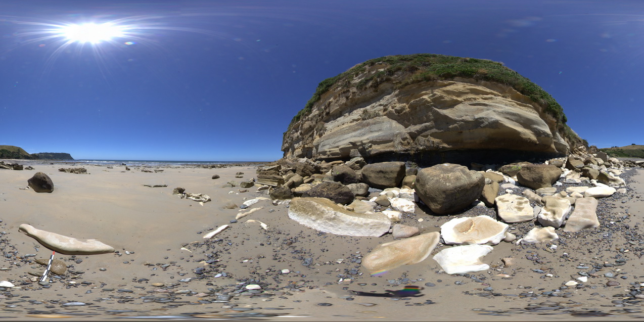
SwanseaFSP8 Map
 |
5 |
06/17/2015 10:03 a.m. |
FSP |
View of tuffaceous rocks of the Permian Boolaroo Formation. The underlying Lower Pilot Seam crops out in the water. In-situ petrified tree stumps up to 0.3m in diameter. Swansea, N.S.W. |
50.00 |
-33.08834000000 |
151.66476000000 |
0.000 |
volcanology, petrified stump, palaeontology |
tuff |
SwanseaFSP7 Map
 |
5 |
06/17/2015 10:03 a.m. |
FSP |
View of tuffaceous rocks of the Permian Boolaroo Formation. The underlying Lower Pilot Seam crops out in the water. Horizontal petrified/coalified trees are apparent on a bedding surface as well as an in-situ petrified tree stump. Swansea, N.S.W. |
50.00 |
-33.08834000000 |
151.66476000000 |
0.000 |
Dadoxylon, palaeontology, volcanology, petrified log, coalified log |
tuff |
SwanseaFSP6 Map
 |
5 |
06/17/2015 10:02 a.m. |
FSP |
View of tuffaceous rocks of the Permian Boolaroo Formation and blocks of coal from the underlying Lower Pilot Seam (which crops out in the water). Horizontal petrified/coalified trees are apparent on a bedding surface. Swansea, N.S.W. |
50.00 |
-33.08834000000 |
151.66476000000 |
0.000 |
coalified log, petrified log, palaeontology, volcanology |
tuff |
SwanseaFSP3 Map
 |
5 |
06/17/2015 10:01 a.m. |
FSP |
View of tuffaceous rocks of the Permian Boolaroo Formation and blocks of coal from the underlying Lower Pilot Seam. Swansea, N.S.W. |
50.00 |
-33.08854000000 |
151.66481000000 |
0.000 |
volcanology, coal |
tuff |
SwanseaFSP1 Map
 |
5 |
06/17/2015 9:59 a.m. |
FSP |
View of tuffaceous rocks of the Permian Boolaroo Formation and blocks of coal from the underlying Lower Pilot Seam. Swansea, N.S.W. |
50.00 |
-33.08901000000 |
151.66493000000 |
0.000 |
volcanology, coal, surge |
tuff |
SwanseaFSP5 Map
 |
5 |
06/17/2015 10:02 a.m. |
FSP |
View of tuffaceous rocks of the Permian Boolaroo Formation and blocks of coal from the underlying Lower Pilot Seam. Linear feature is concrete covering a pipe. Swansea, N.S.W. |
50.00 |
-33.08834000000 |
151.66476000000 |
0.000 |
volcanology, sedimentology |
tuff |
SwanseaFSP4 Map
 |
5 |
06/17/2015 10:01 a.m. |
FSP |
View of tuffaceous rocks of the Permian Boolaroo Formation and blocks of coal from the underlying Lower Pilot Seam. Linear feature is concrete covering a pipe. Swansea, N.S.W. |
50.00 |
-33.08834000000 |
151.66476000000 |
0.000 |
volcanology, coal |
tuff |
Swansea15 Map
 |
5 |
01/01/9999 midnight |
3D |
view of tree stump in tuff rock pool. Swansea, N.S.W. |
0.00 |
-33.08747000000 |
151.66487000000 |
-9999.000 |
tree stump, fossil, tuff, sedimentology |
tuff |
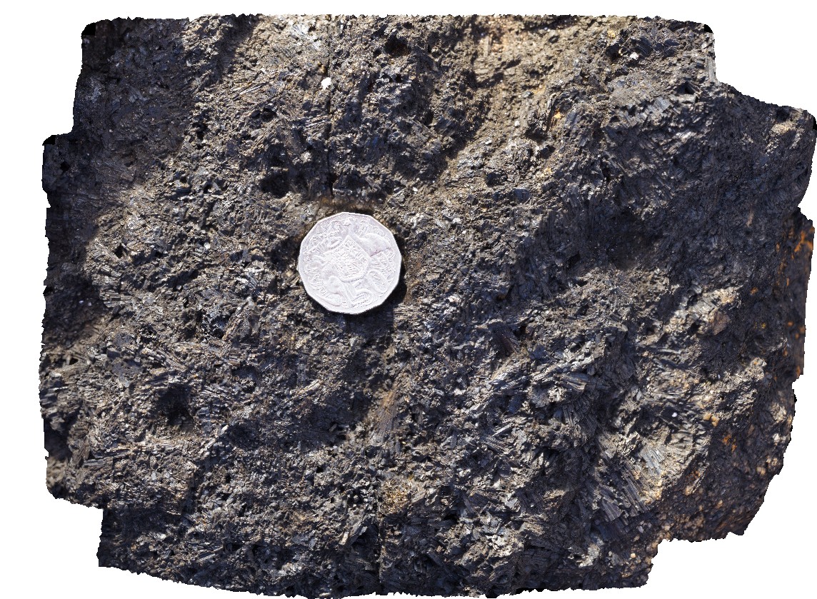
Granville4 Map
 |
0 |
08/09/2016 noon |
3D |
view of tourmaline crystals in cavity in granite. Granville Harbour, West Coast Tasmania. |
0.20 |
-41.81020000000 |
145.02740000000 |
-9999.000 |
tourmaline, crystal, granite |
granite |
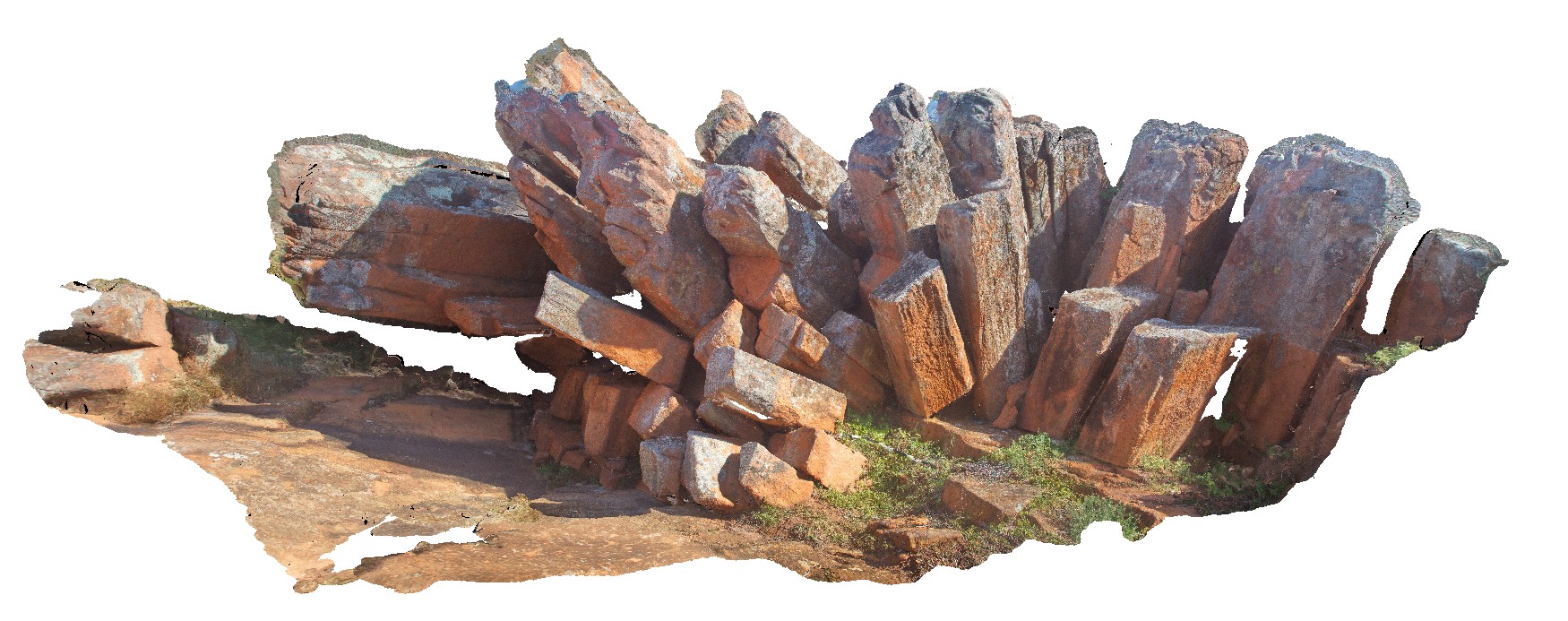
Gawler2 Map
 |
0 |
02/22/2016 9:27 a.m. |
3D |
view of toppling dacite columns, Organ pipe Gorge, Gawler Ranges. |
9.00 |
-32.53836000000 |
135.29599000000 |
-9999.000 |
columnar, dacite, joint |
dacite |
SulphurCreekFSP3 Map
 |
5 |
01/01/9999 midnight |
FSP |
view of thinly layered mudstones with kink bands. Sulphur Creek, north Tas. |
500.00 |
-41.09081000000 |
146.07003000000 |
1.000 |
kink band, fold, structure |
mudstone |
WeetootlaFSP11 Map
 |
0 |
09/27/2015 4:37 p.m. |
FSP |
view of thinly bedded carbonate mudstone pavement, showing folding. Weetootla Creek. |
0.00 |
-30.47598000000 |
139.24332000000 |
-9999.000 |
fold, structure |
mudstone |
Newcastle6 Map
 |
5 |
01/01/9999 midnight |
3D |
view of the Yard coal seam and associated sediments. Newcastle, N.S.W. |
0.00 |
-32.93870000000 |
151.77386000000 |
-9999.000 |
coal seam, coal, sedimentology |
coal |
Talia3 Map
 |
0 |
10/20/2015 4:51 p.m. |
3D |
view of 'The Tub' sinkhole at Talia Caves locality. Showing an unconformity with the older Blue Range Beds overlain by the Bridgewater Formation. Talia. |
50.00 |
-33.32420000000 |
134.79155000000 |
-9999.000 |
sink hole, unconformity |
sandstone, sandstone |
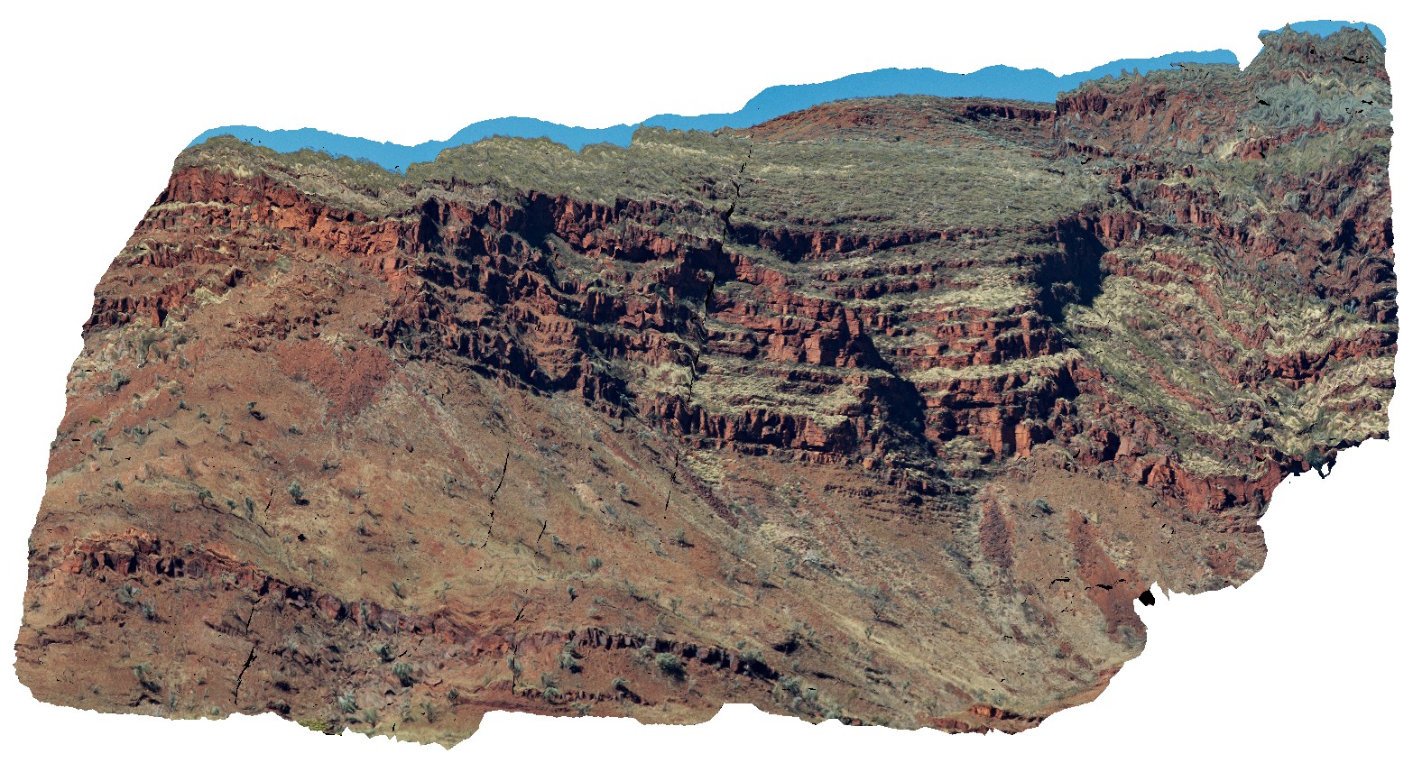
MtBruce2 Map
 |
0 |
05/29/2016 noon |
3D |
view of the stratigraphy of Mount Bruce. Exposed core of synform with the Brockman Iron Formation and Mount McRae Shale and Mount Sylvia Formations. Openly folded, gently dipping stratigraphy. Mount Bruce, Pilbara, W.A. |
1000.00 |
-22.57421700000 |
118.13826800000 |
-9999.000 |
Mount Bruce, open folds, monocline, structure, stratigraphy |
BIF, shale |
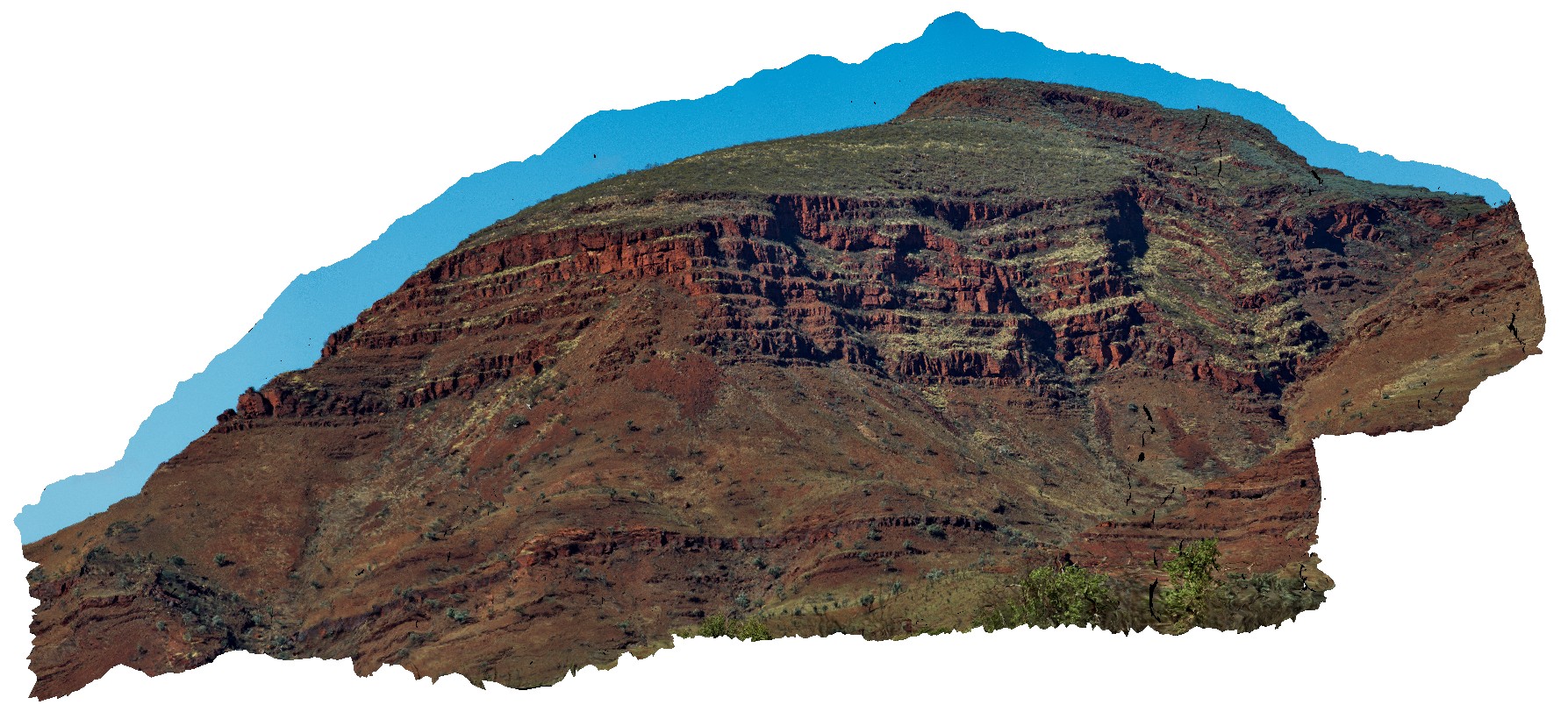
MtBruce1 Map
 |
0 |
05/29/2016 noon |
3D |
view of the stratigraphy of Mount Bruce. Exposed core of synform with the Brockman Iron Formation and Mount McRae Shale and Mount Sylvia Formations. Openly folded, gently dipping stratigraphy. Mount Bruce, Pilbara, W.A. |
1000.00 |
-22.57421700000 |
118.13826800000 |
-9999.000 |
Mount Bruce, Pilbara, fold, open fold |
BIF, shale |
NTasFSP8 Map
 |
5 |
01/01/9999 midnight |
FSP |
view of the stratigraphy of fossil bluff from the shore line. Fossil Bluff Conservation Area, Wynyard. North Tasmania. |
500.00 |
-40.98046000000 |
145.73158000000 |
-9999.000 |
stratigraphy, Fossil Bluff Sandstone |
sandstone |
WreckBeach13 Map
 |
0 |
06/14/2016 2:42 p.m. |
3D |
view of the side of a deep channel, showing cross-section through thick cross-beds in sandstone. Wreck Beach. Vic. |
6.50 |
-38.75755000000 |
143.21515000000 |
-9999.000 |
cross-bedding, sedimentology |
sandstone |
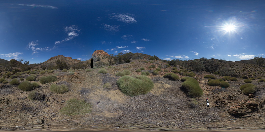
Arkaroola3 Map
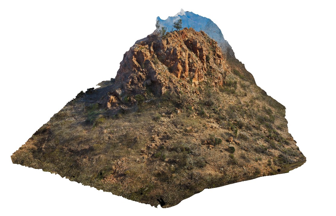 |
5 |
09/27/2015 5:34 p.m. |
3D |
view of 'The Pinnacles' showing massive leucogranite, Arkaroola. Northern Flinders Ranges, S.A. |
75.00 |
-30.29702400000 |
139.31017400000 |
-9999.000 |
leucogranite, pegmatite |
granite |
ArkaroolaUAV1 Map
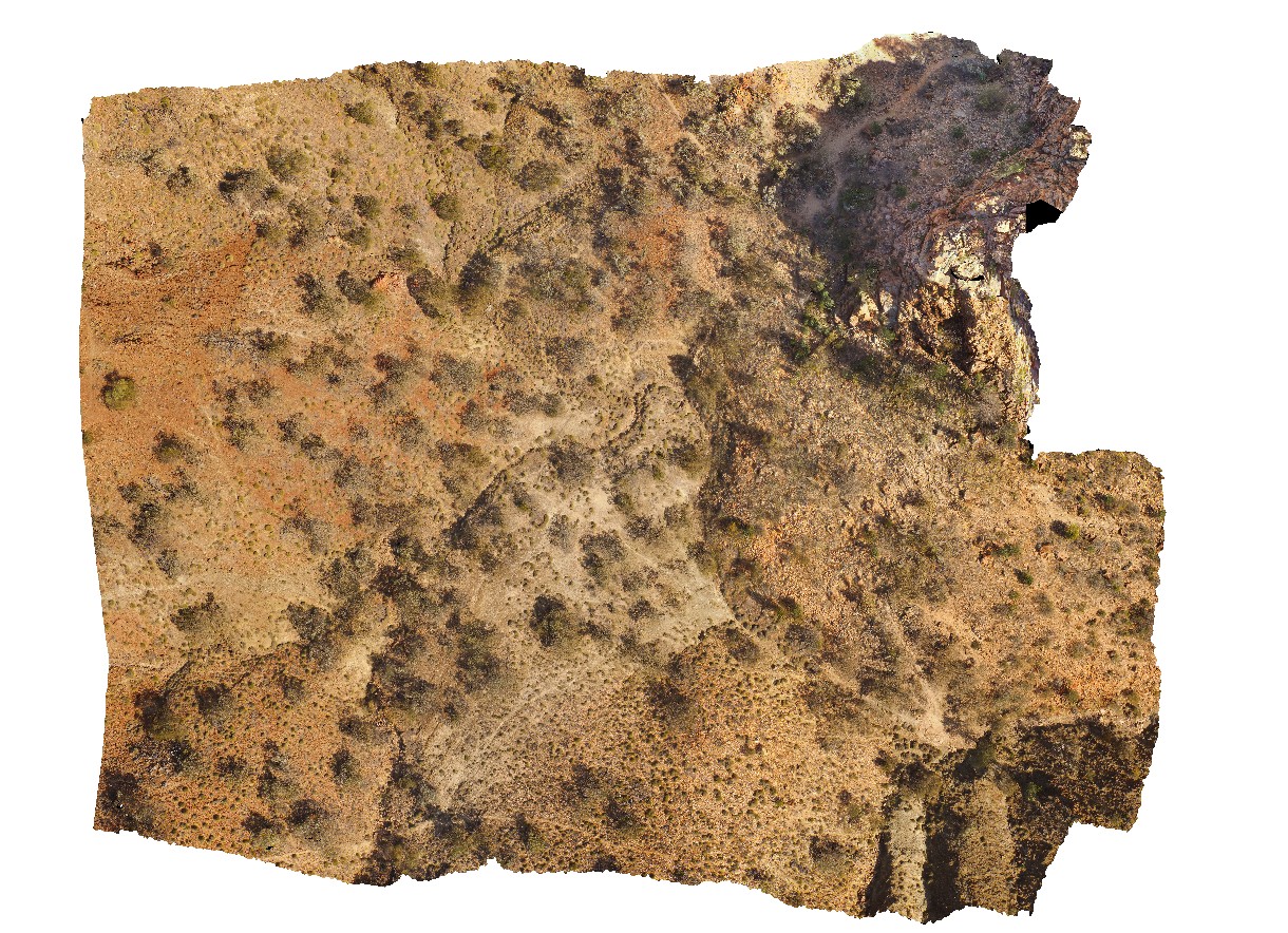 |
20 |
04/19/2016 12:27 p.m. |
UAV |
view of 'The Pinnacles' showing massive leucogranite, Arkaroola. Northern Flinders Ranges, S.A. |
0.00 |
-30.22888000000 |
139.34544000000 |
-9999.000 |
leucogranite |
granite |
ArkaroolaFSP2 Map
 |
5 |
11/26/2015 2:07 p.m. |
FSP |
View of the Pinnacles outcrop, Arkaroola. Northern Flinders Ranges, S.A. |
0.00 |
-30.29601000000 |
139.31133000000 |
-9999.000 |
granite |
granite |