PortcampbellFSP1 Map
 |
0 |
01/01/9999 midnight |
FSP |
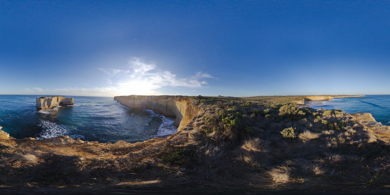
view along south coast of Victoria, showing bedded sediments. Near Port Campbell, Vic. |
1000.00 |
-38.64003000000 |
143.04898000000 |
-9999.000 |
|
|
WBunglesUAV1 Map
 |
0 |
02/23/2016 12:25 p.m. |
UAV |
location inferred from google earth |
0.00 |
-31.33049800000 |
148.99571900000 |
-9999.000 |
|
|
CapeWickham6 Map
 |
5 |
04/28/2016 9:10 a.m. |
3D |
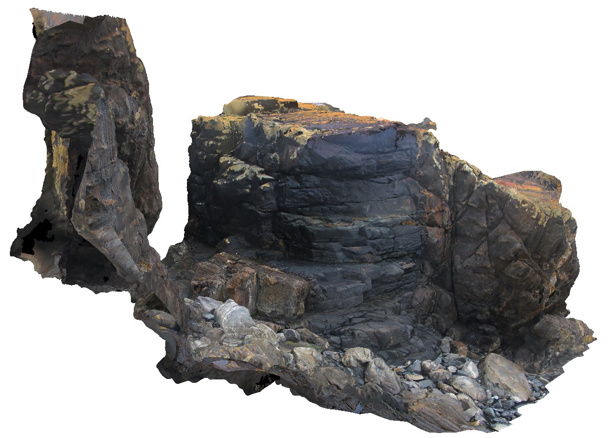
intrusive contact between sub vertically dipping metasediments of the Surprise Bay Formation and a dolerite dyke. Cape Wickham, King Island. Tasmania. |
5.00 |
-39.59209477000 |
143.92795761000 |
5.000 |
dip, intrusive contact, contact, structure |
|
MunjinaGiga1 Map
 |
0 |
05/31/2016 noon |
GIGA |
— |
0.00 |
-22.41183000000 |
118.68569000000 |
-9999.000 |
|
|
BoyaPole2 Map
 |
0 |
03/13/2015 9:27 a.m. |
3D |
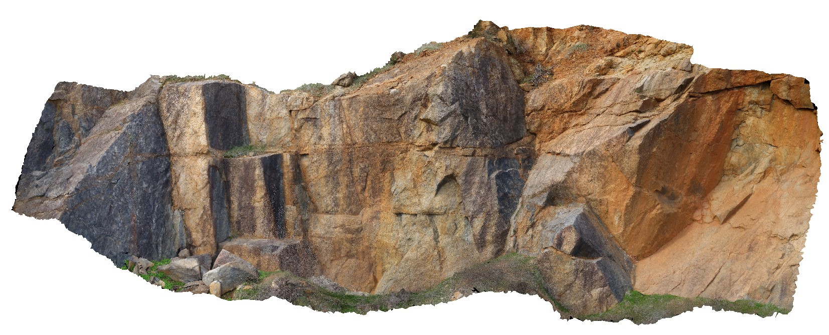
Boya quarry, Boya, Western Australia. |
0.00 |
-31.91484580000 |
116.06239402000 |
-9999.000 |
|
|
Tooborac1 Map
 |
5 |
06/17/2015 11:11 a.m. |
3D |
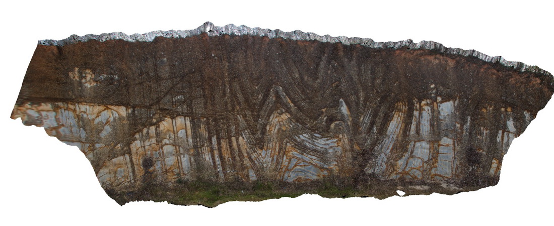
view of folding in sandstone. Toobarac, Vic. |
300.00 |
-37.02139000000 |
144.88989000000 |
-9999.000 |
fold, fault, structure |
sandstone |
SugarloafRock6a Map
 |
10 |
01/01/9999 midnight |
3D |
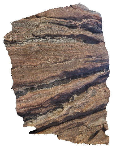
folded and boudinaged amphibolite and leucosomes in banded granitic gneiss. Sugarloaf Rock, Cape Naturaliste. W.A. This unit may also be known as Neoproterozoic granites 76645. |
5.00 |
-33.56067000000 |
115.00493000000 |
-9999.000 |
boudinage, migmatite, pytigmatic fold |
gneiss |
StokesUAV1 Map
 |
20 |
01/01/9999 midnight |
UAV |
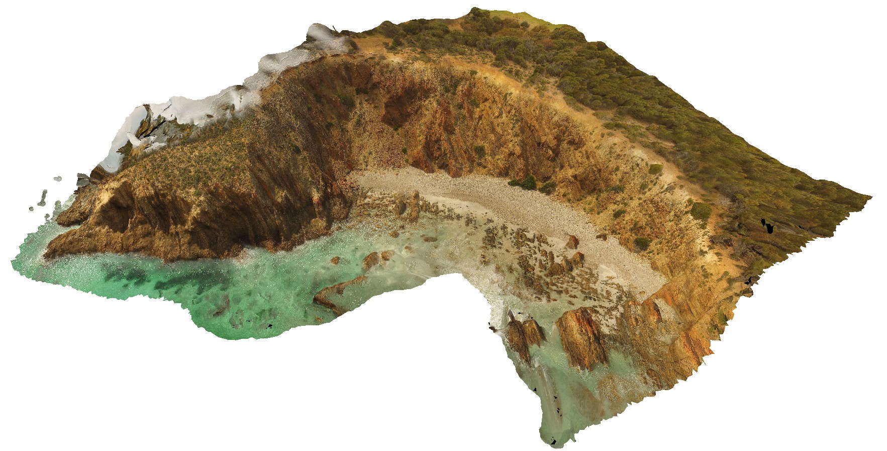
aerial view of bedded sandstone, showing very open folding / kinks in steeply dipping beds. King George Bay, Kangaroo Island. |
200.00 |
-35.65456700000 |
137.11588900000 |
-9999.000 |
bedding, fold, kink fold, structure |
sandstone |
Surville4 Map
 |
50 |
01/01/9999 midnight |
3D |
view of cliff exposure, showing basement unconformable contact between Devonian Granite, metasediments and the overlying sedimentary Parmeener Supergroup with intrusive Jurassic dolerite contact (darker rock). Cape Surville, Tasman Peninsula. Tasmania. |
500.00 |
-37.66467900000 |
144.77204400000 |
1.000 |
unconformity, intrusion |
granite, metasediments, siltstone, dolerite |
Surville4 Map
 |
50 |
01/01/9999 midnight |
3D |
view of cliff exposure, showing basement unconformable contact between Devonian Granite, metasediments and the overlying sedimentary Parmeener Supergroup with intrusive Jurassic dolerite contact (darker rock). Cape Surville, Tasman Peninsula. Tasmania. |
500.00 |
-37.66467900000 |
144.77204400000 |
1.000 |
unconformity, intrusion |
granite, metasediments, siltstone, dolerite |
Surville4 Map
 |
50 |
01/01/9999 midnight |
3D |
view of cliff exposure, showing basement unconformable contact between Devonian Granite, metasediments and the overlying sedimentary Parmeener Supergroup with intrusive Jurassic dolerite contact (darker rock). Cape Surville, Tasman Peninsula. Tasmania. |
500.00 |
-37.66467900000 |
144.77204400000 |
1.000 |
unconformity, intrusion |
granite, metasediments, siltstone, dolerite |
Surville4 Map
 |
50 |
01/01/9999 midnight |
3D |
view of cliff exposure, showing basement unconformable contact between Devonian Granite, metasediments and the overlying sedimentary Parmeener Supergroup with intrusive Jurassic dolerite contact (darker rock). Cape Surville, Tasman Peninsula. Tasmania. |
500.00 |
-37.66467900000 |
144.77204400000 |
1.000 |
unconformity, intrusion |
granite, metasediments, siltstone, dolerite |
Surville3 Map
 |
50 |
01/01/9999 midnight |
3D |
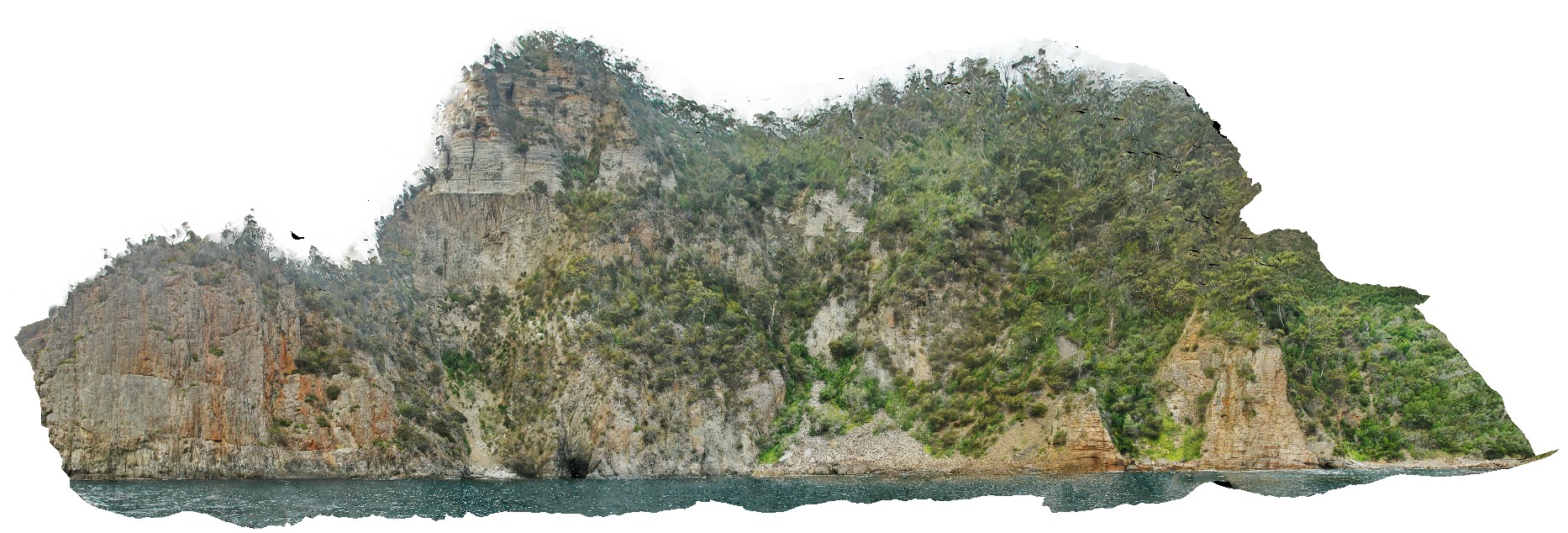
view form off-shore of cliff exposure, showing basement unconformable contact between Devonian Granite and the overlying sedimentary Parmeener Supergroup with intrusive Jurassic dolerite contact (darker rock). Cape Surville, Tasman Peninsula. Tasmania. |
200.00 |
-37.66467900000 |
144.77204400000 |
1.000 |
contact |
granite, siltstone, dolerite |
Surville3 Map
 |
50 |
01/01/9999 midnight |
3D |
view form off-shore of cliff exposure, showing basement unconformable contact between Devonian Granite and the overlying sedimentary Parmeener Supergroup with intrusive Jurassic dolerite contact (darker rock). Cape Surville, Tasman Peninsula. Tasmania. |
200.00 |
-37.66467900000 |
144.77204400000 |
1.000 |
contact |
granite, siltstone, dolerite |
Surville3 Map
 |
50 |
01/01/9999 midnight |
3D |
view form off-shore of cliff exposure, showing basement unconformable contact between Devonian Granite and the overlying sedimentary Parmeener Supergroup with intrusive Jurassic dolerite contact (darker rock). Cape Surville, Tasman Peninsula. Tasmania. |
200.00 |
-37.66467900000 |
144.77204400000 |
1.000 |
contact |
granite, siltstone, dolerite |
OrganPipes3 Map
 |
5 |
01/01/9999 midnight |
3D |
lava flows with well developed columnar jointing. Organ Pipes National Park, Keilor North. Vic. |
200.00 |
-37.66467900000 |
144.77204400000 |
1.000 |
Tullamarine Basalt, Newer Volcanics, basalt, columnar joints, lava |
baslat |
OrganPipes2 Map
 |
5 |
01/01/9999 midnight |
3D |
lava flows with well developed columnar jointing. Organ Pipes National Park, Keilor North. Vic. |
200.00 |
-37.66467900000 |
144.77204400000 |
-9999.000 |
Tullamarine Basalt, Newer Volcanics, columnar joints, basalt, lava |
basalt |
OrganPipes1 Map
 |
5 |
01/01/9999 midnight |
3D |
lava flows with well developed columnar jointing. Organ Pipes National Park, Keilor North. Vic. |
200.00 |
-37.66467900000 |
144.77204400000 |
-9999.000 |
Tullamarine Basalt, Newer Volcanics, basalt, columnar joints, lava |
basalt |
OrganPipes5 Map
 |
5 |
01/01/9999 midnight |
3D |
lava flows with well developed columnar jointing. Organ Pipes National Park, Keilor North. Vic. |
30.00 |
-37.66560200000 |
144.76513500000 |
-9999.000 |
Tullamarine Basalt, Newer Volcanics, basalt, columnar joints, lava |
basalt |
OrganPipes4 Map
 |
5 |
01/01/9999 midnight |
3D |
lava flows with well developed columnar jointing. Organ Pipes National Park, Keilor North. Vic. |
20.00 |
-37.66434400000 |
144.76721400000 |
-9999.000 |
Tullamarine Basalt, Newer Volcanics, basalt, columnar joints, lava |
basalt |
Blackjack12 Map
 |
20 |
01/01/9999 midnight |
3D |
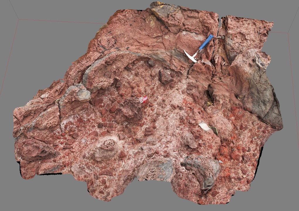
contact between volcanic breccia and a basalt lava flow. Black Jack Hills, Tas. |
0.50 |
-42.99270000000 |
147.65276000000 |
-9999.000 |
contact, basaltic flow, breccia, volocanics |
basalt |
Blackjack11 Map
 |
20 |
01/01/9999 midnight |
3D |
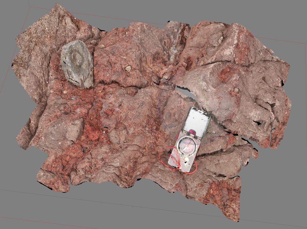
volcanic breccia with basaltic vesicular clasts on shore line. Black Jack Hills, Tas. |
0.60 |
-42.99269000000 |
147.65282000000 |
-9999.000 |
volcanic breccia, volcanics, bomb |
basalt |
Blackjack10 Map
 |
20 |
01/01/9999 midnight |
3D |
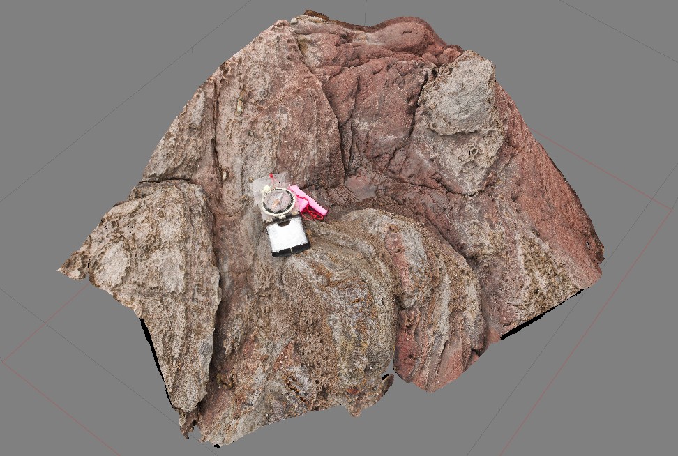
contact between volcanic breccia and a basalt lava flow. Black Jack Hills, Tas. |
0.60 |
-42.99270000000 |
147.65276000000 |
-9999.000 |
lava, basalt, flow |
basalt |
Blackjack9 Map
 |
10 |
01/01/9999 midnight |
3D |
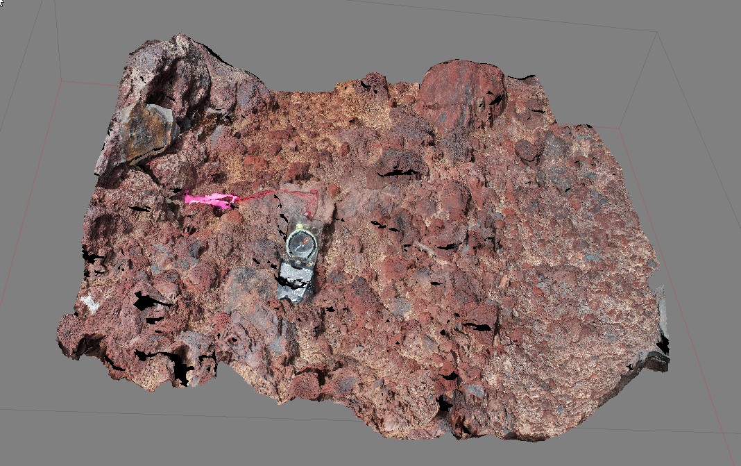
detail of scoria / volcaniclastic deposit. Black Jack Hills, Tas. |
1.00 |
-42.99269000000 |
147.65282000000 |
-9999.000 |
volcanics, basalt, scoria |
basalt |
Blackjack8 Map
 |
10 |
01/01/9999 midnight |
3D |
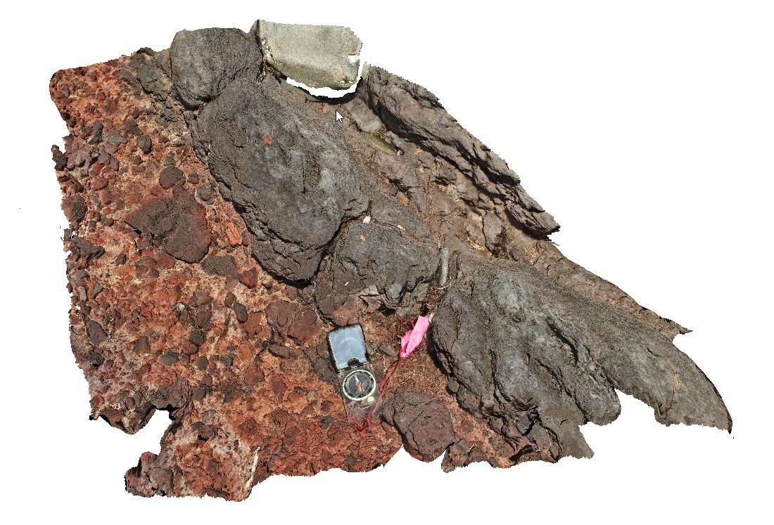
lava overlying volcanic breccia, including very large basaltic bombs. Black Jack Hills, Tas. |
1.00 |
-42.99270000000 |
147.65276000000 |
-9999.000 |
lava, breccia, volcanic, basalt |
basalt |


