AlbanyFSP5 Map
 |
0 |
06/05/2016 10:40 a.m. |
FSP |
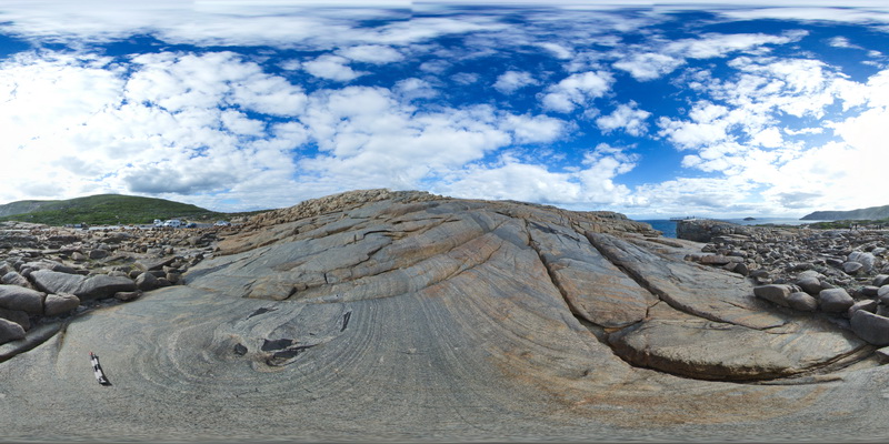
overview of the shore exposure at 'The Gap', showing granodiorite intruding banded granitic gneiss with disaggregated mafic dykes. Albany |
100.00 |
-35.11831000000 |
117.89301000000 |
-9999.000 |
granitic gneiss, mafic dyke, igneous intrusion |
granitic gneiss, granodiorite |
AlbanyFSP6 Map
 |
0 |
06/05/2016 10:40 a.m. |
FSP |
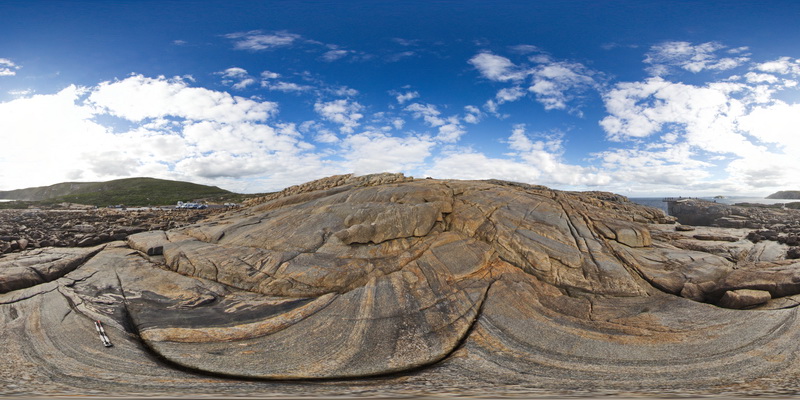
overview of the shore exposure at 'The Gap', showing granodiorite intruding banded granitic gneiss with disaggregated mafic dykes. Albany |
100.00 |
-35.11838000000 |
117.89299000000 |
-9999.000 |
mafic dyke, banded gneiss, structure, folding |
gneiss, granodiorite |
AlbanyUAV1 Map
 |
0 |
01/01/9999 midnight |
UAV |
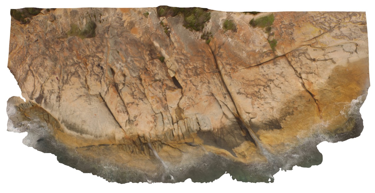
aerial view, showing complex relationships in granite. Porphyritic granite with 'quartzite' xenoliths intruded by grey 'granodiorite' all cut by thin pegmatite dykes. Albany, W.A. |
50.00 |
-35.08986000000 |
117.95056000000 |
-9999.000 |
granite, intrusive contact, xenolith |
granite, granodiorite, porphyry |
Albany8 Map
 |
0 |
06/05/2016 10:36 a.m. |
3D |
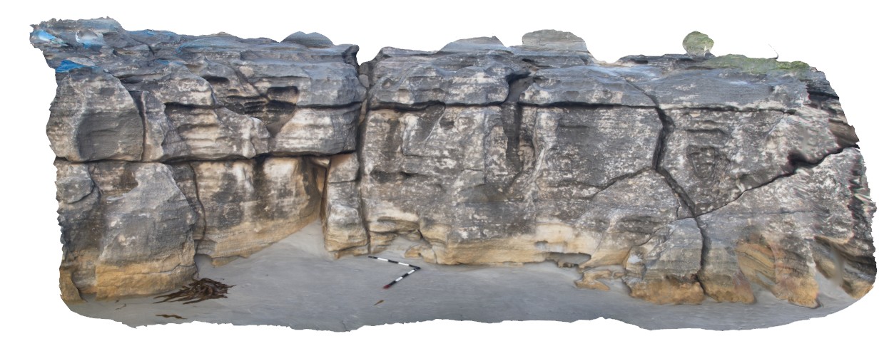
erosional features in Quaternary calcareous beach sediments. Albany, W.A. |
6.50 |
-35.11587000000 |
117.90143000000 |
-9999.000 |
Quaternary calcareous beach sediments, limestone |
limestone |
Albany7 Map
 |
0 |
06/05/2016 10:36 a.m. |
3D |
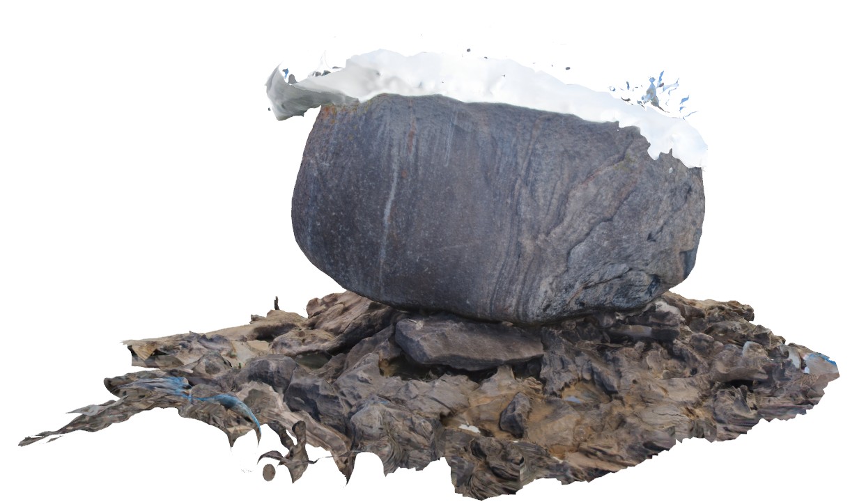
large Tor of folded and banded granitic gneiss sitting on Quaternary eolian beach sediments. Albany, W.A. |
6.00 |
-35.11580000000 |
117.90178000000 |
-9999.000 |
tor, granitic gneiss, aeolian sediments |
granitic gneiss, limestone |
Albany6 Map
 |
0 |
06/05/2016 10:36 a.m. |
3D |
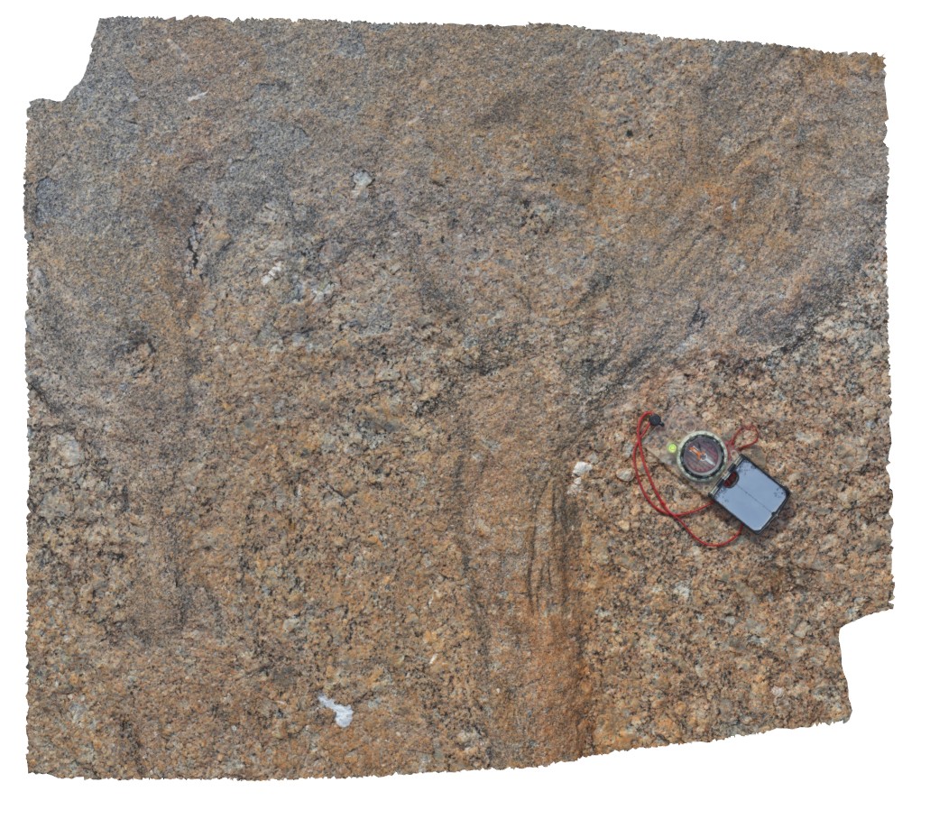
detail of 'wispy' contact between porphyritic granite and grey granodiorite, Albany, W.A. |
0.70 |
-35.08973000000 |
117.95635000000 |
-9999.000 |
igneous contact, granodiorite |
granite, granodiorite |
AlvieFSP1 Map
 |
0 |
06/05/2016 10:33 a.m. |
FSP |
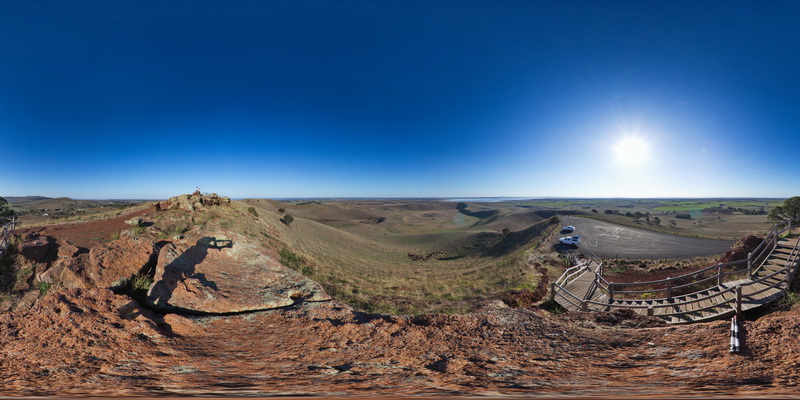
view from Red Rocks carpark of old maar volcano and cinder cones. Alvie, Vic. |
3000.00 |
-38.24793000000 |
143.50452000000 |
-9999.000 |
maar volcano, cinder cone, volcanics |
volcanics |
AlvieFSP2 Map
 |
0 |
06/05/2016 10:33 a.m. |
FSP |
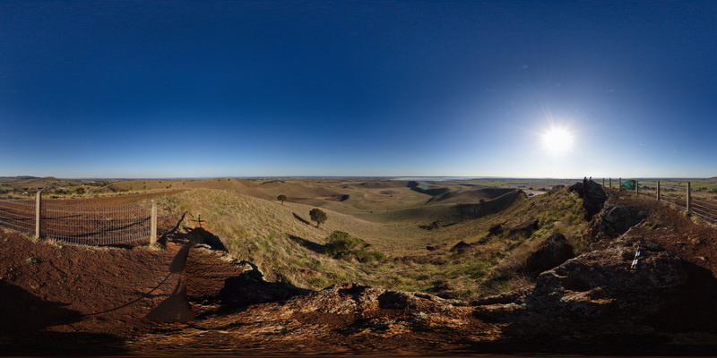
view from Red Rocks lookout of surrounding volcanic topography of old maar volcanos and cinder cones. Foreground shows the Red Rocks scoria deposits. Alvie, Vic. |
3000.00 |
-38.24814000000 |
143.50490000000 |
-9999.000 |
scoria, maar volcano, cinder cone, volcanics |
scoria |
AlvieFSP3 Map
 |
0 |
06/05/2016 10:33 a.m. |
FSP |
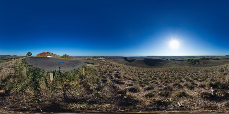
view from Red Rocks carpark of old maar volcano and cinder cones. Alvie, Vic. |
3000.00 |
-38.24778000000 |
143.50368000000 |
-9999.000 |
maar volcano, cinder cone |
volcanics |
AlvieFSP4 Map
 |
0 |
06/05/2016 10:33 a.m. |
FSP |
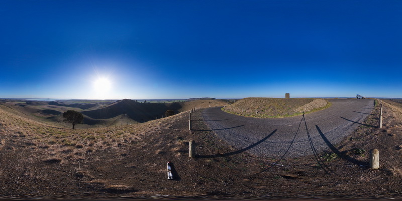
view from Red Rocks carpark of old maar volcano and cinder cones. Alvie, Vic. |
3000.00 |
-38.25128000000 |
143.50841000000 |
-9999.000 |
maar volcano, cinder cone, volcanic topography |
volcanics |
Ballarat1 Map
 |
0 |
06/05/2016 10:33 a.m. |
3D |
folded and faulted metasediments of the Castlemain Group, Norman Street road cut. South side. Ballarat, Vic. |
25.00 |
-37.53779000000 |
143.87029000000 |
-9999.000 |
fold, fault, structure |
metasediments |
Ballarat10 Map
 |
0 |
06/05/2016 10:36 a.m. |
3D |
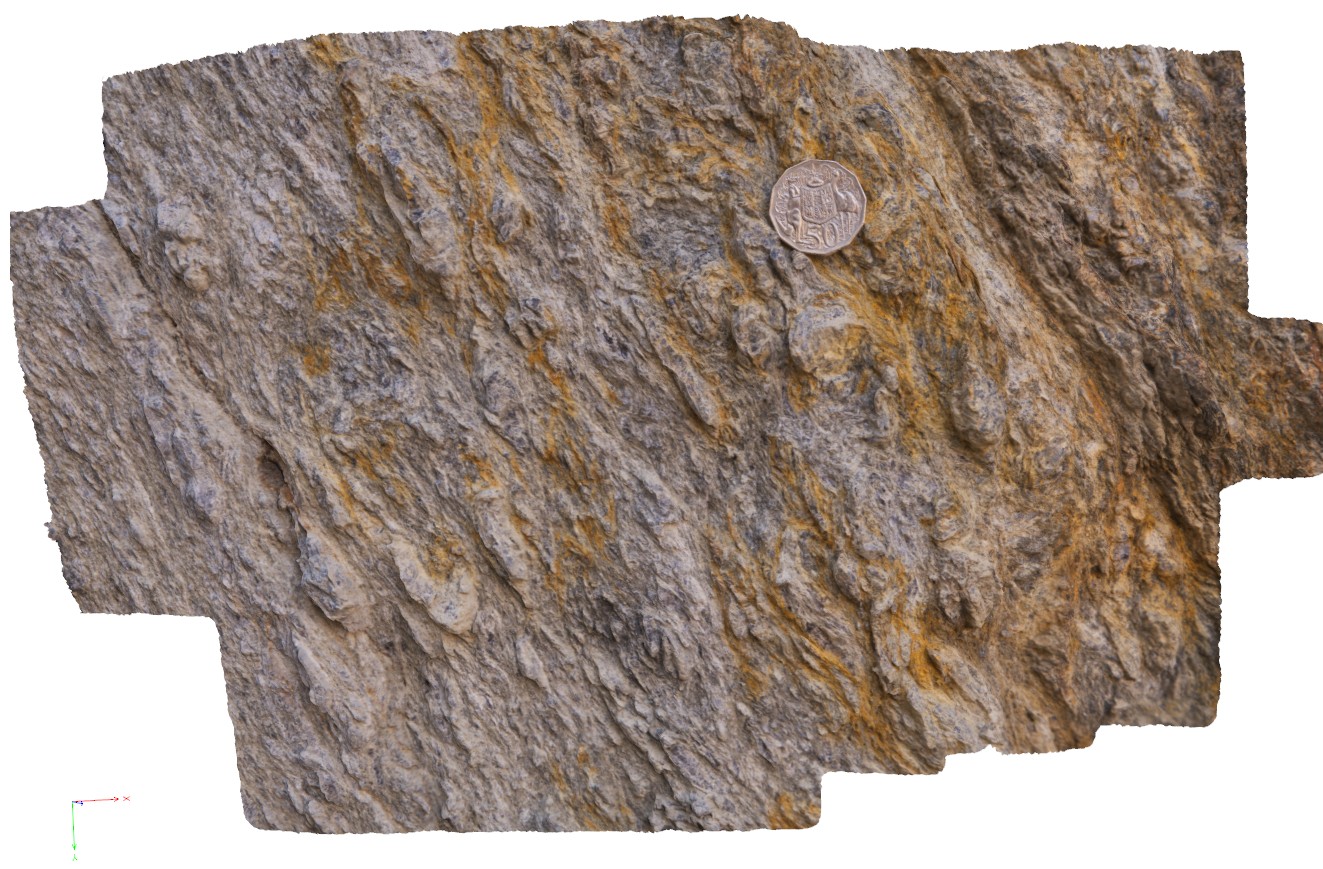
detail of deformation in the footwall of the Avoca Fault, showing development of coarse mica. Ballarat, Vic. |
0.40 |
-37.72817000000 |
143.62782000000 |
-9999.000 |
fault zone, deformation |
schist |
Ballarat11 Map
 |
0 |
06/05/2016 10:36 a.m. |
3D |
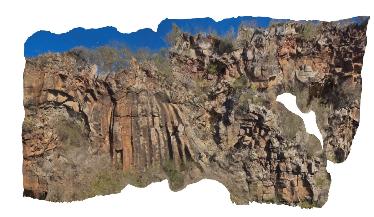
outcrop of columnar jointed plug in layered basalt. Devils Kitchen Geological Reserve. Ballarat. Vic. |
25.00 |
-37.72890000000 |
143.62309000000 |
-9999.000 |
basalt plug, columnar jointed basalt |
basalt |
Ballarat2 Map
 |
0 |
06/05/2016 10:33 a.m. |
3D |
folded and faulted metasediments of the Castlemain Group, Norman Street road cut. North side. Ballarat, Vic. |
21.00 |
-37.53761000000 |
143.87025000000 |
-9999.000 |
fault, fold |
metasediment |
Ballarat3 Map
 |
0 |
06/05/2016 10:34 a.m. |
3D |
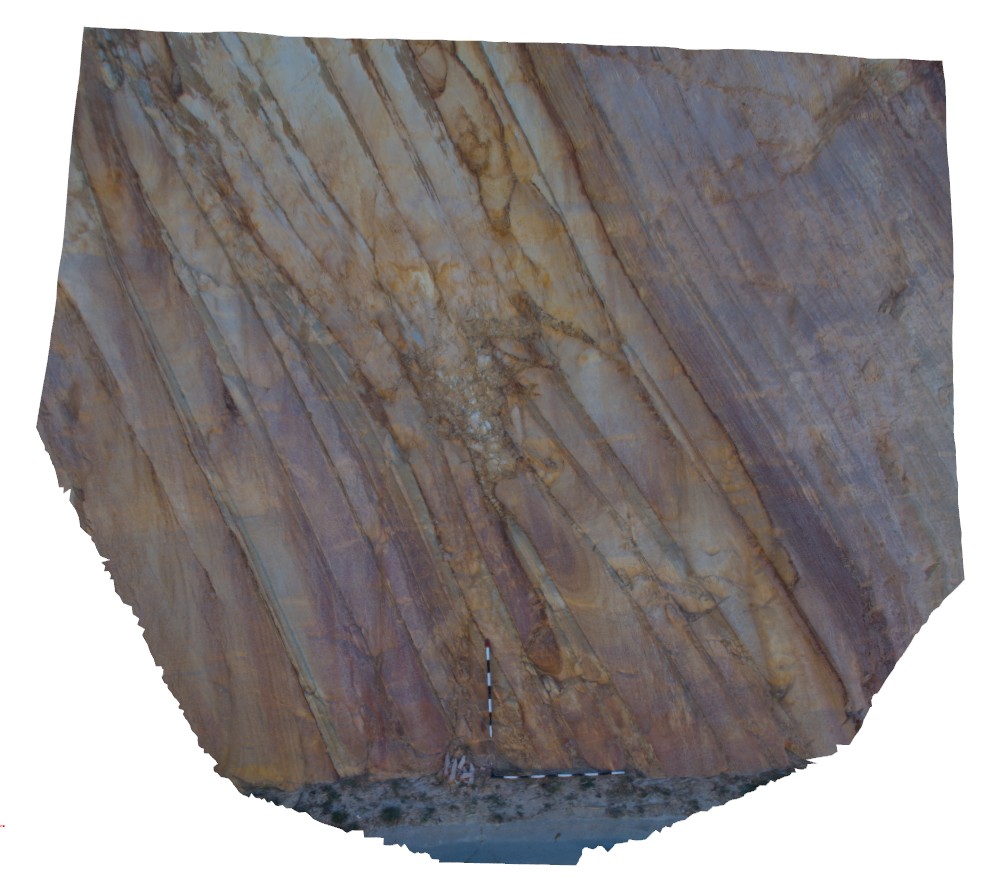
detail of bedding, liesegang banding and quartz veins in sandstone layers of road cut from sites Ballarat1 and 2. Norman Street road cut. North side. Ballarat, Vic. |
2.50 |
-37.53766000000 |
143.87071000000 |
-9999.000 |
liesegang banding, quartz vein, bedding, turbidite |
sandstone |
Ballarat4 Map
 |
0 |
06/05/2016 10:34 a.m. |
3D |
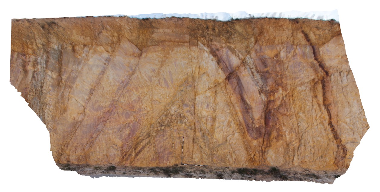
detail of antiform on north side of road cut. Norman Street road cut. North side. Ballarat, Vic. |
6.50 |
-37.53758000000 |
143.87032000000 |
-9999.000 |
antiform, bedding, folding, structure, turbidite |
turbidite |
Albany5 Map
 |
0 |
06/05/2016 10:36 a.m. |
3D |
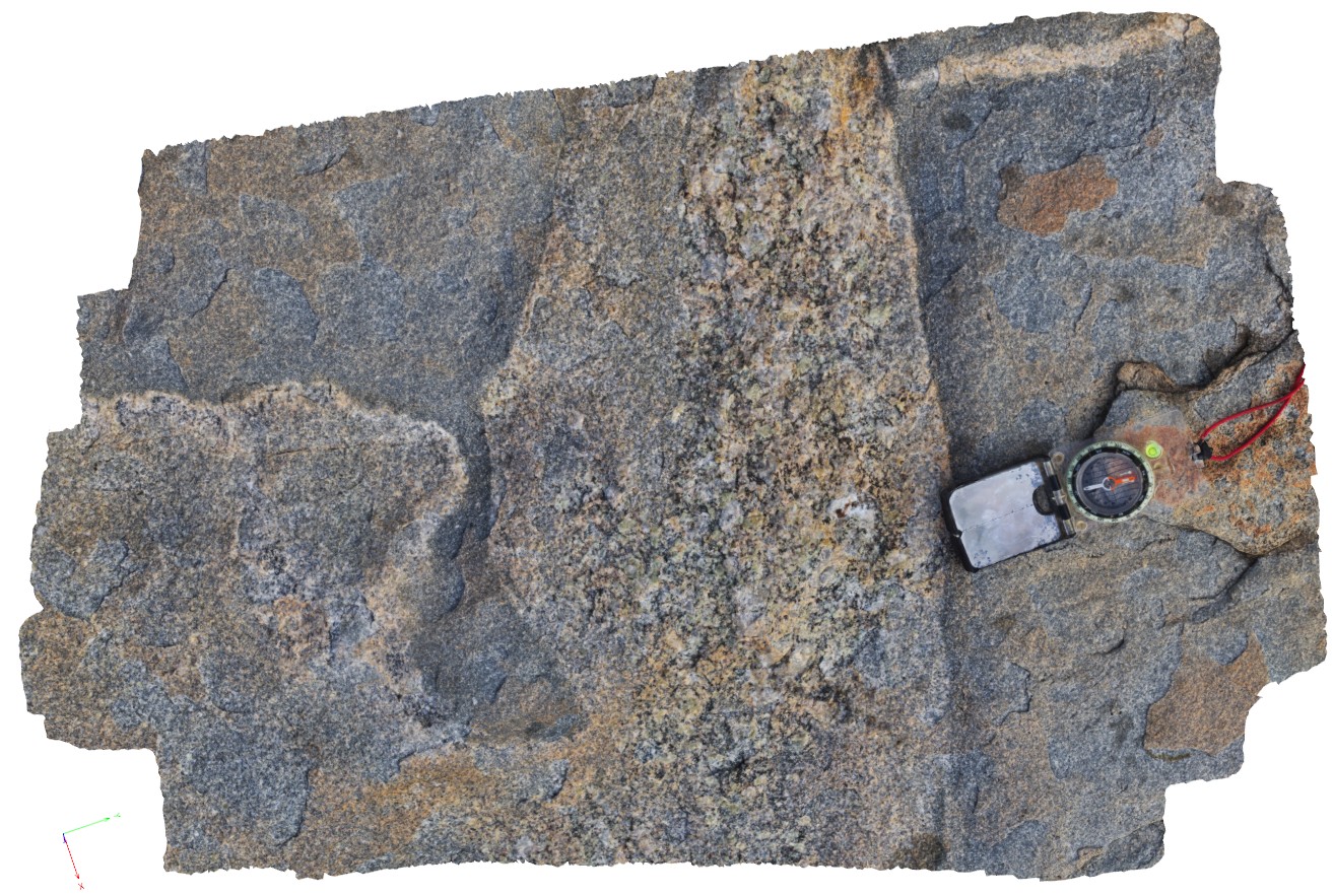
detail of grey granodiorite intruding 'quartzite' xenolith with pegmatitic segregations. Albany, W.A. |
0.80 |
-35.08971000000 |
117.95038000000 |
-9999.000 |
granodiorite, xenolith, igneous intrusion, intrusive contact |
granodiorite |
Ballarat5 Map
 |
0 |
06/05/2016 10:34 a.m. |
3D |
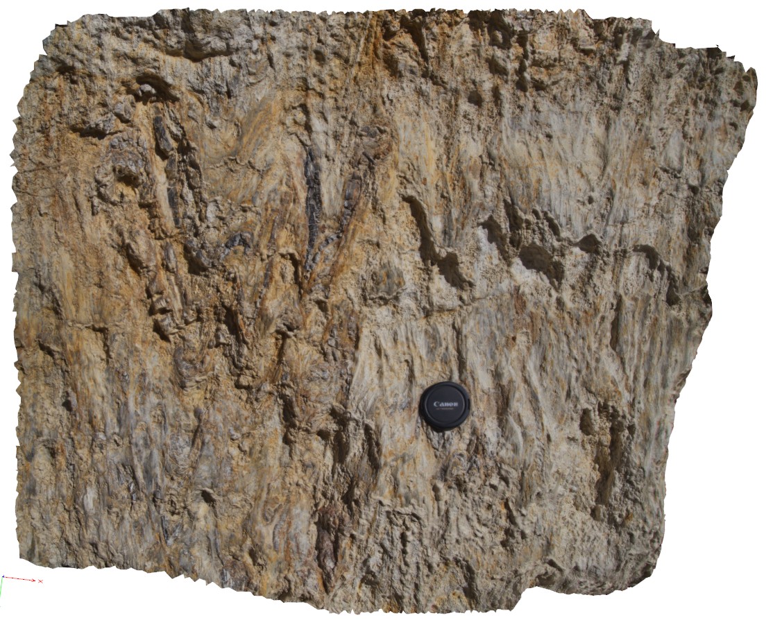
polydeformed / folded and faulted rocks near the Avoca Fault, Linton-Piggoreet Road. Ballarat. Vic. |
1.00 |
-37.72517000000 |
143.62535000000 |
-9999.000 |
deformation, fault zone |
metasediments |
Ballarat6 Map
 |
0 |
06/05/2016 10:34 a.m. |
3D |
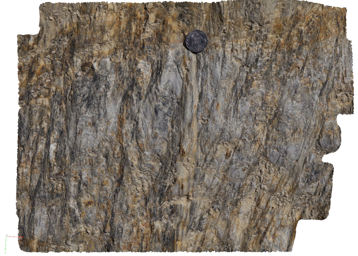
polydeformed / folded and faulted rocks and quartz veins near the Avoca Fault, Linton-Piggoreet Road. Ballarat. Vic. |
0.50 |
-37.52512000000 |
143.62543000000 |
-9999.000 |
fold, shear, quartz vein |
metasediments |
Ballarat7 Map
 |
0 |
06/05/2016 10:35 a.m. |
3D |
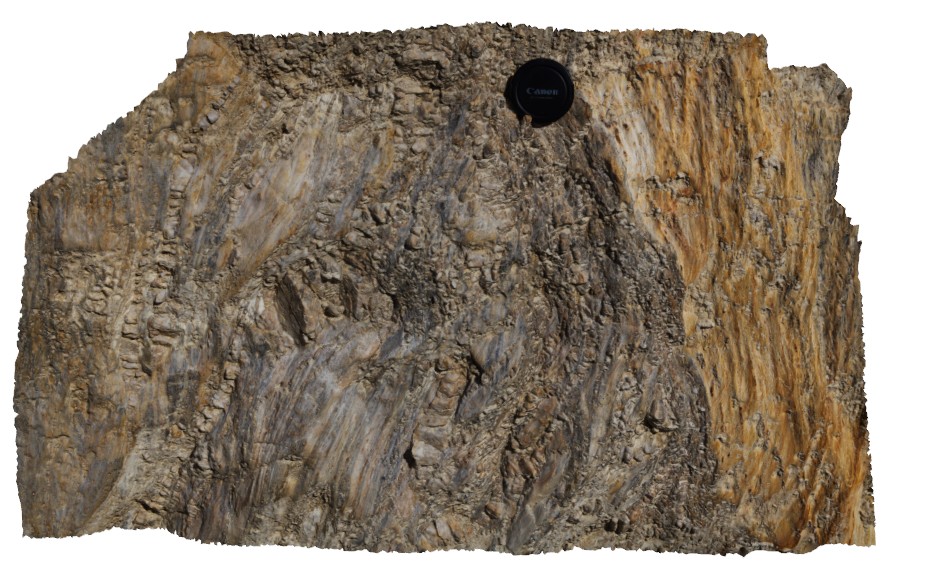
polydeformed / folded and faulted rocks and quartz veins near the Avoca Fault, Linton-Piggoreet Road. Ballarat. Vic. |
0.70 |
-37.72512000000 |
143.62545000000 |
-9999.000 |
fault zone, shear zone, deformation, quartz vein |
metasediment |
Ballarat8 Map
 |
0 |
06/05/2016 10:35 a.m. |
3D |
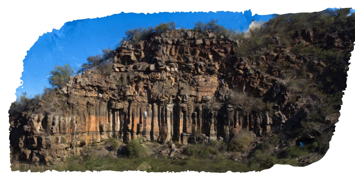
columnar, jointed basalt and flow with residual vesicular top. Devils Kitchen Geological Reserve. Ballarat. Vic. |
40.00 |
-37.72656000000 |
143.62198000000 |
-9999.000 |
columnar basalt, vesicular basalt, columnar jointing |
basalt |


