Liptrap7 Map
 |
20 |
03/13/2015 9:23 a.m. |
3D |
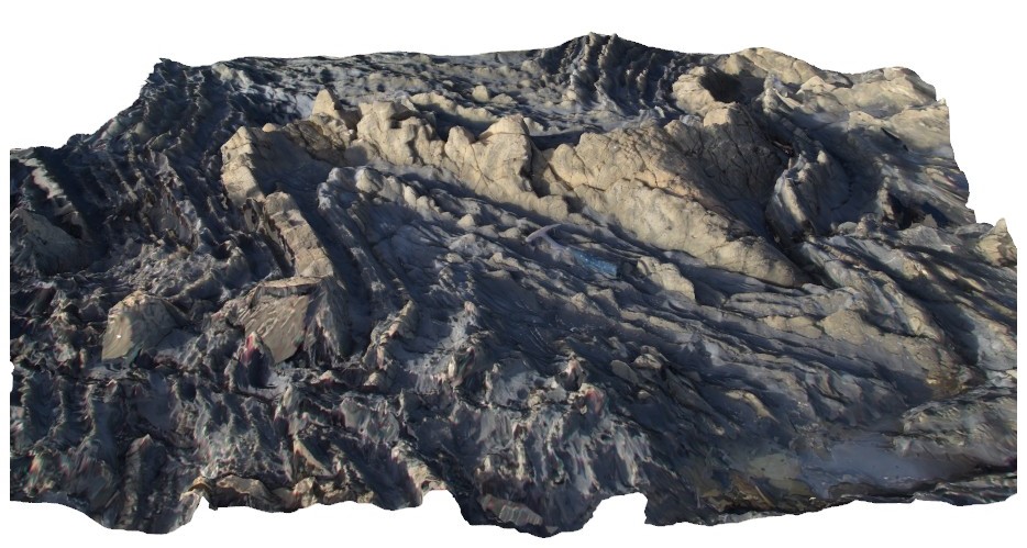
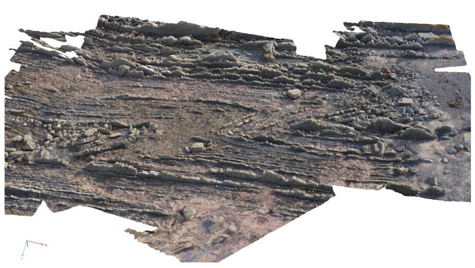
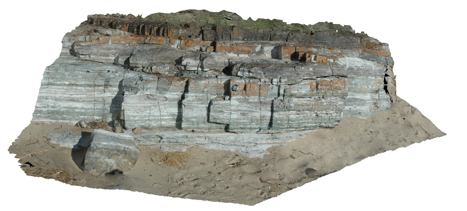
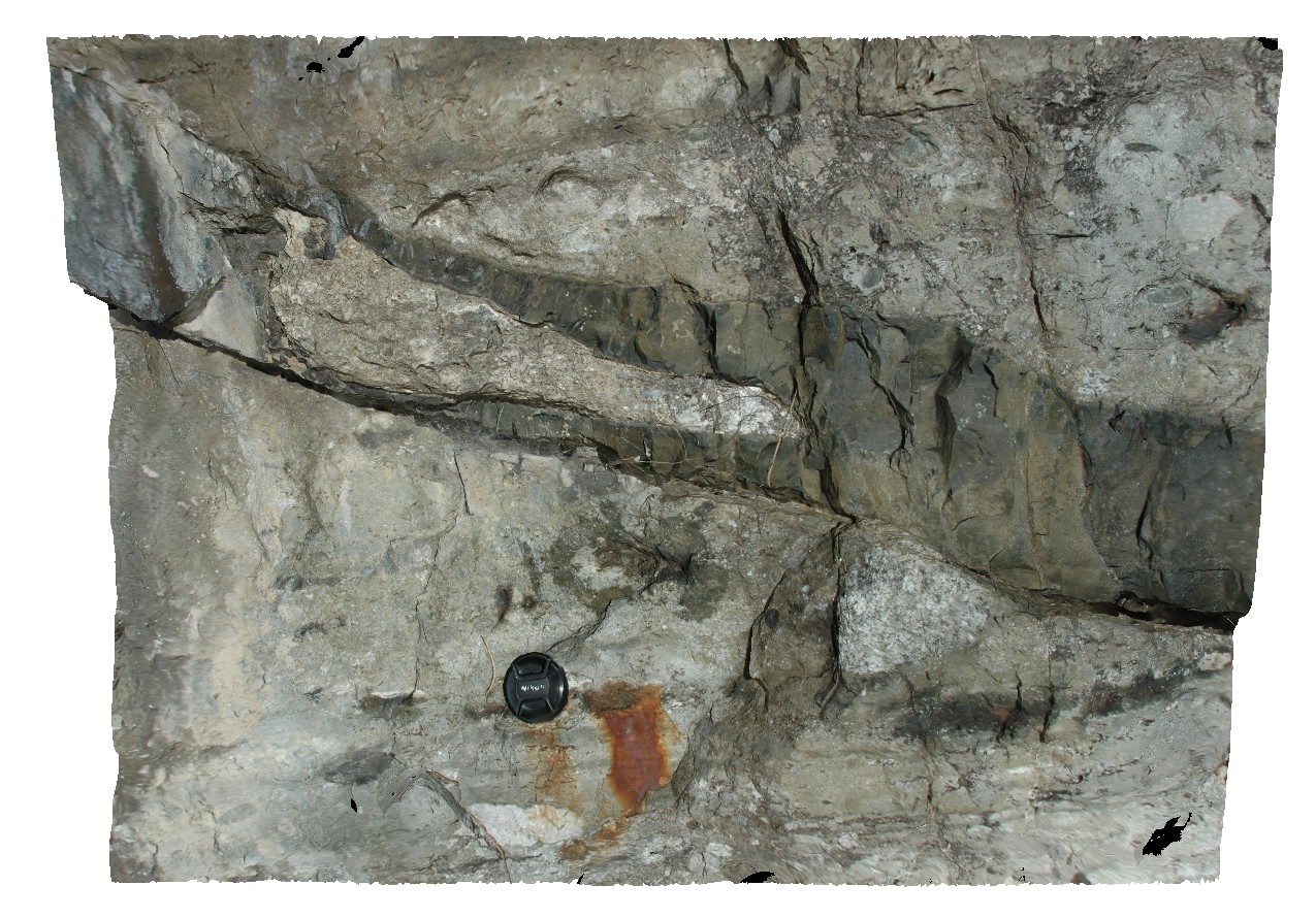
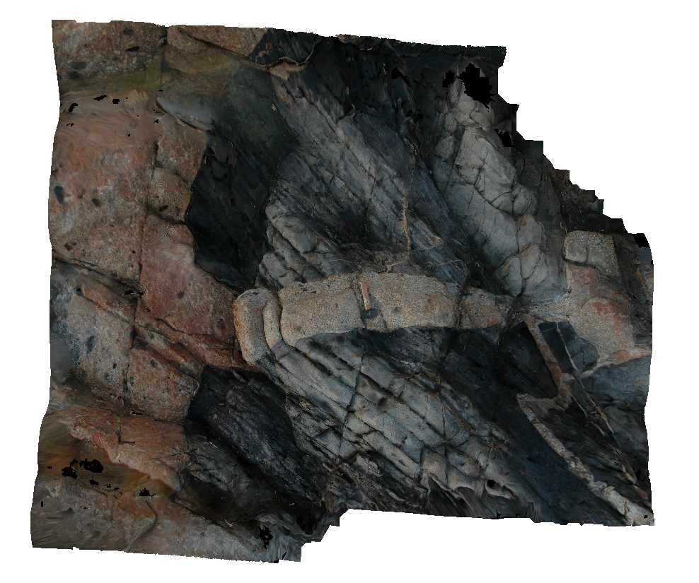
deformed and folded bedded distal turbidite. Cape Liptrap, Vic. |
3.50 |
-38.90403776000 |
145.91718063000 |
0.000 |
turbidite, fold, sedimentology |
turbidite |
Liptrap8 Map
 |
20 |
03/13/2015 9:24 a.m. |
3D |
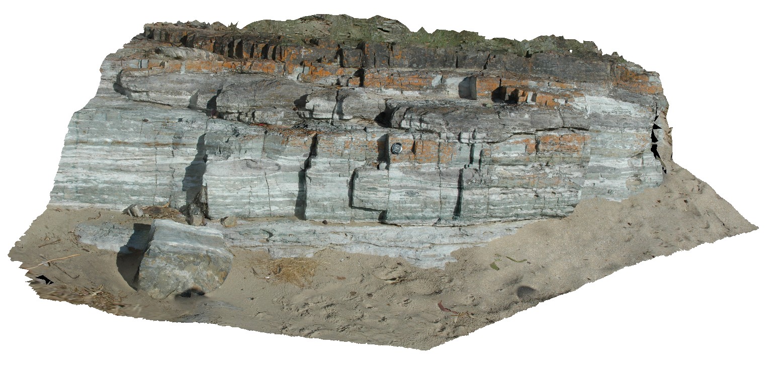
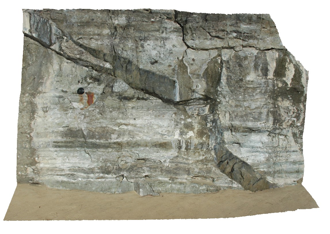
zone of deformation, quartz veining and folding, showing asymmetrical folding in finely bedded distal turbidites. Cape Liptrap, Vic. |
3.00 |
-38.90412340000 |
145.91723000000 |
0.000 |
fold, turbidite, sedimentology |
turbidite |
Liptrap9 Map
 |
20 |
03/13/2015 9:24 a.m. |
3D |
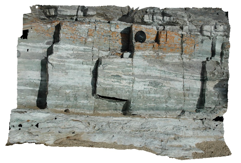
moderately plunging folds in distal turbidite sequence. Cape Liptrap, Vic. |
2.00 |
-38.90401762000 |
145.91706274000 |
0.000 |
sedimentology, fold, structure, turbidite |
turbidite |
LiptrapPole1 Map
 |
20 |
03/13/2015 9:25 a.m. |
3D |
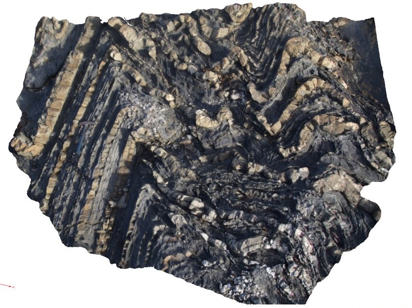
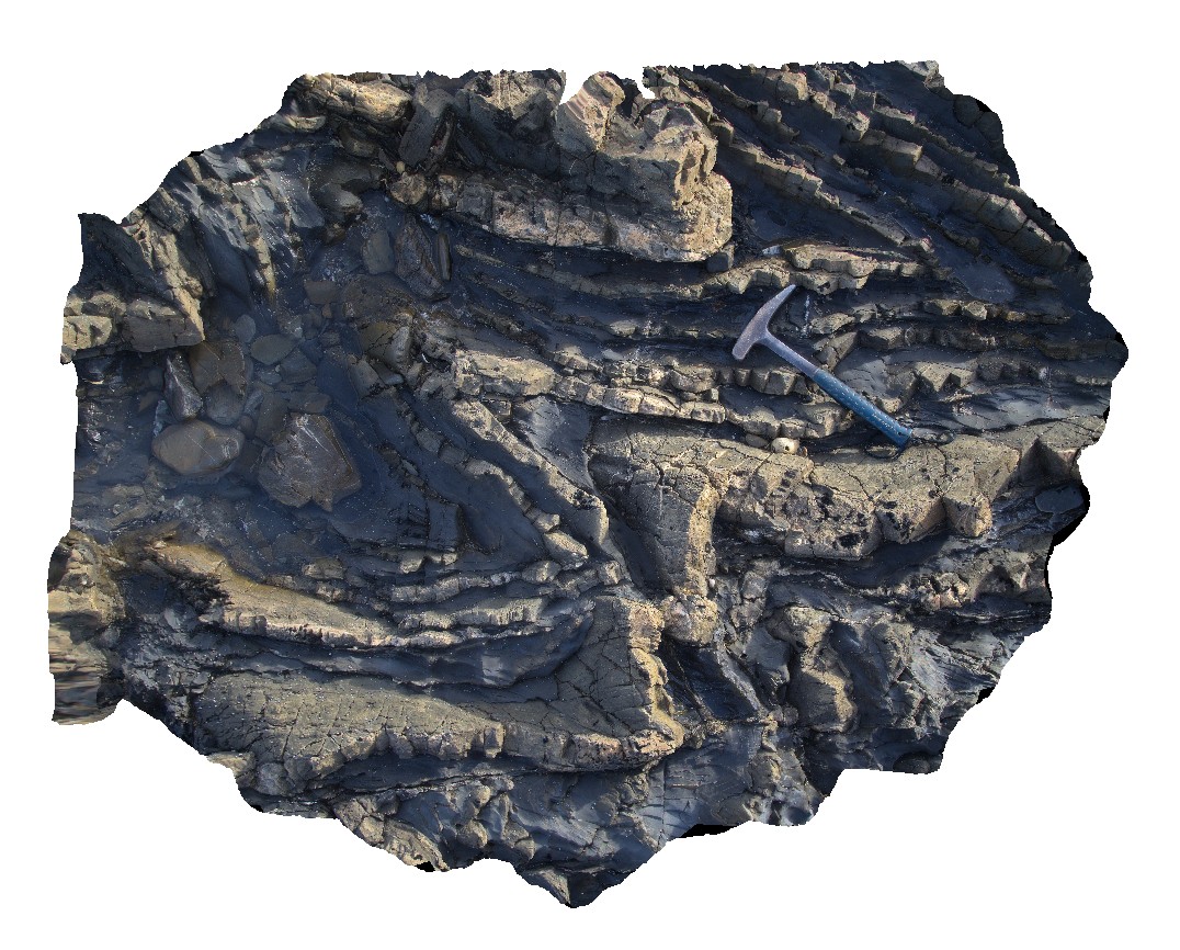
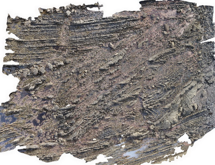
wave cut platform showing chevron folding and cross cutting faults in finely bedded turbidites. Cape Liptrap, Vic. |
0.00 |
-38.90406232000 |
145.91729772000 |
0.000 |
turbidite, chevron folds, structure |
turbidite |
LiptrapPole2 Map
 |
20 |
03/13/2015 9:25 a.m. |
3D |
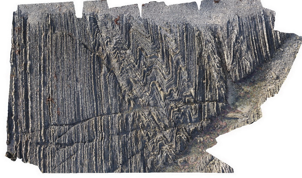
wave cut platform showing steeply plunging chevron folding in finely bedded turbiditic sequence. Cape Liptrap, Vic. |
0.00 |
-38.90414711000 |
145.91743374000 |
0.000 |
structure, chevron folds |
turbidite |
LiptrapPole3 Map
 |
20 |
03/13/2015 9:25 a.m. |
3D |
steeply dipping Asymmetrical and chevron folding with cross cutting faults in finely bedded turbidites. Cape Liptrap, Vic. |
0.00 |
-38.90395783000 |
145.91709577000 |
0.000 |
folding, structure, fault |
turbidite |
Boya5 Map
 |
0 |
03/13/2015 9:26 a.m. |
PANO |
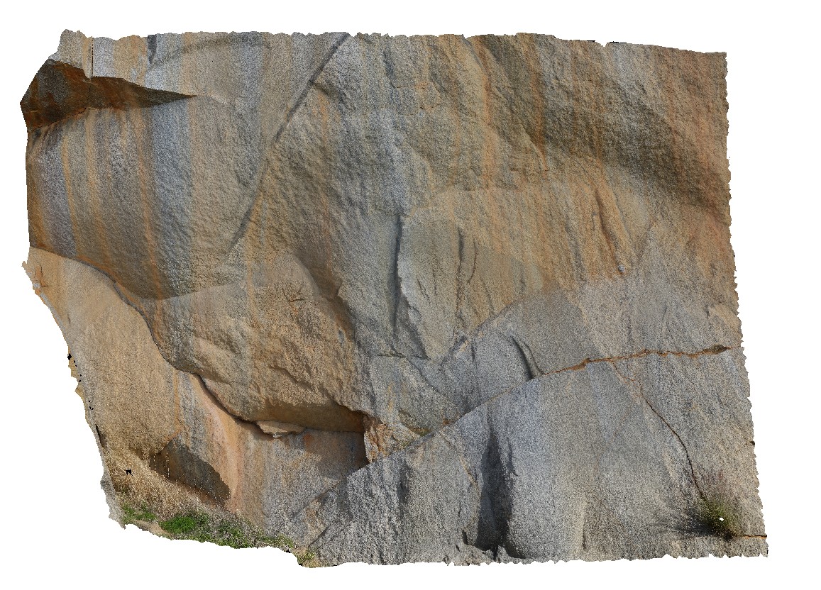
Boya quarry, Boya, Western Australia. |
0.00 |
-31.91484580000 |
116.06239402000 |
-9999.000 |
|
|
Boya1 Map
 |
5 |
03/13/2015 9:26 a.m. |
3D |
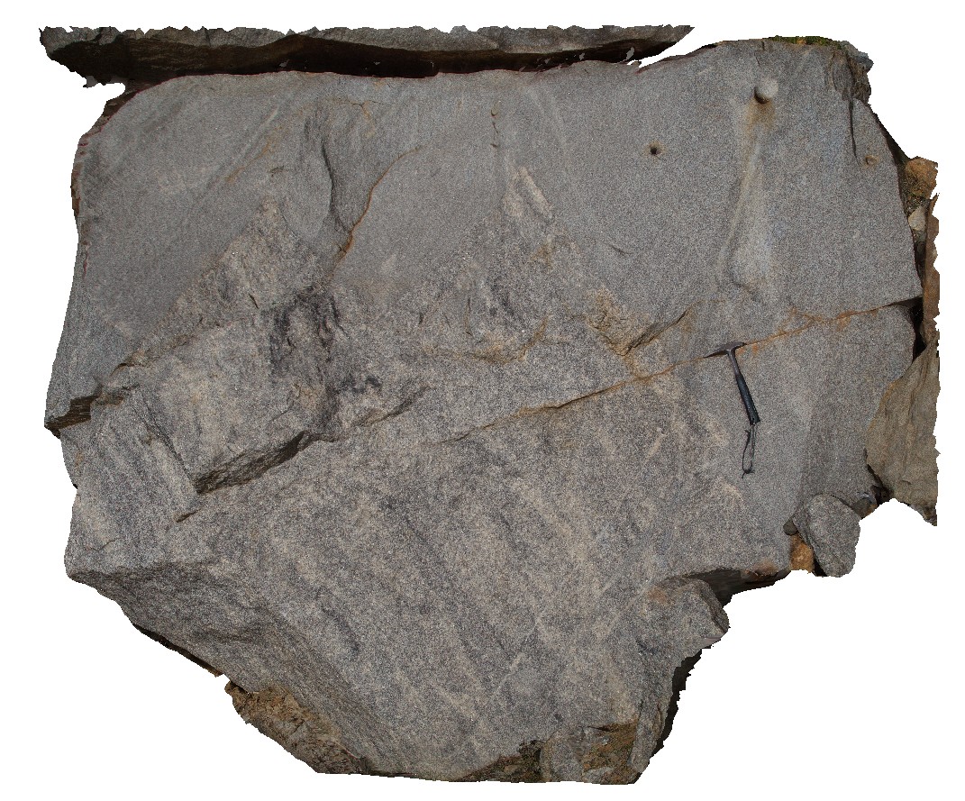
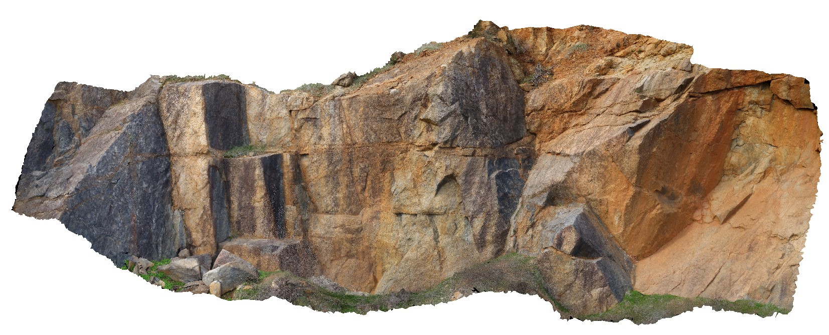
view of contact between granite and granitic? Gneiss. Boya quarry, Boya, Western Australia. |
5.00 |
-31.91516117000 |
116.06258702000 |
-9999.000 |
contact, granite, gneiss, metamorphic |
granite, gneiss |
Boya2 Map
 |
10 |
03/13/2015 9:27 a.m. |
3D |
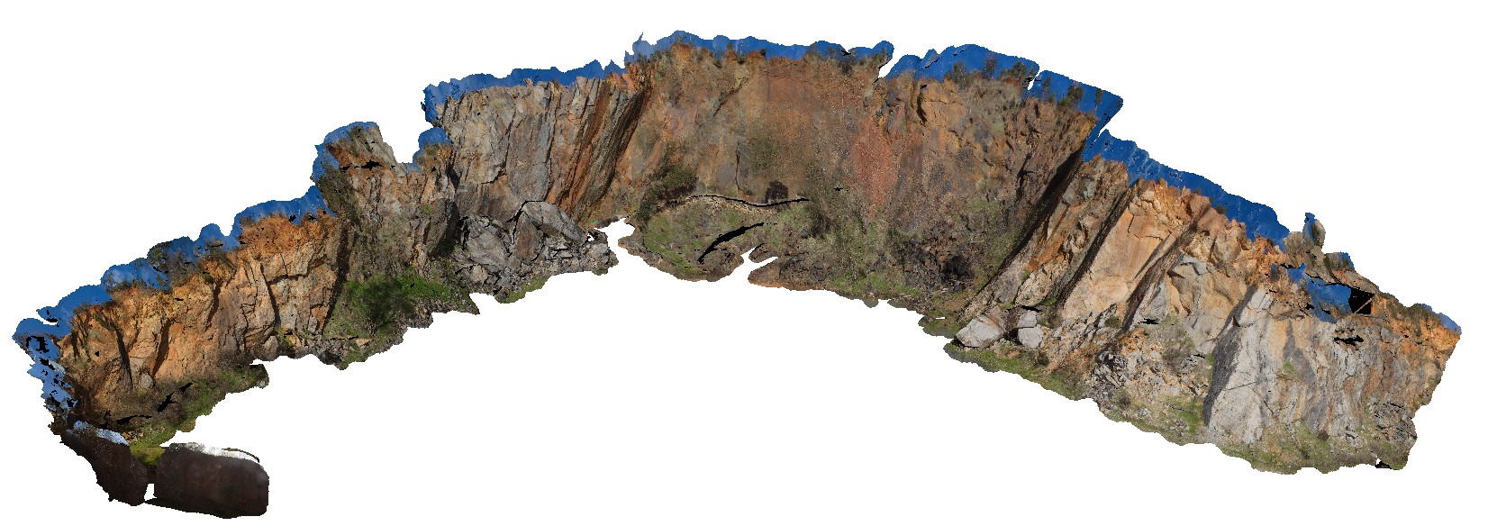
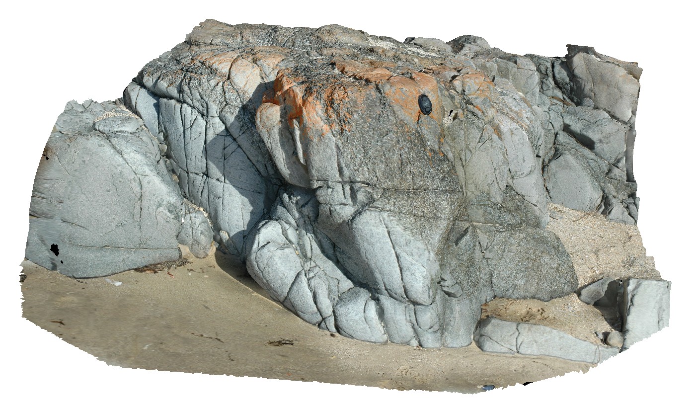
view of quarry walls, showing weathering and jointing patterns in granite and gneiss. Boya quarry, Boya, Western Australia. |
50.00 |
-31.91484580000 |
116.06239402000 |
-9999.000 |
quarry, granite, gneiss, Boya |
granite, gneiss |
BoyaPole2 Map
 |
0 |
03/13/2015 9:27 a.m. |
3D |
Boya quarry, Boya, Western Australia. |
0.00 |
-31.91484580000 |
116.06239402000 |
-9999.000 |
|
|
BoyaPole1 Map
 |
0 |
03/13/2015 9:27 a.m. |
3D |
Boya quarry, Boya, Western Australia. |
0.00 |
-31.91484580000 |
116.06239402000 |
-9999.000 |
|
|
BH2014n5 Map
 |
20 |
03/13/2015 9:59 a.m. |
3D |
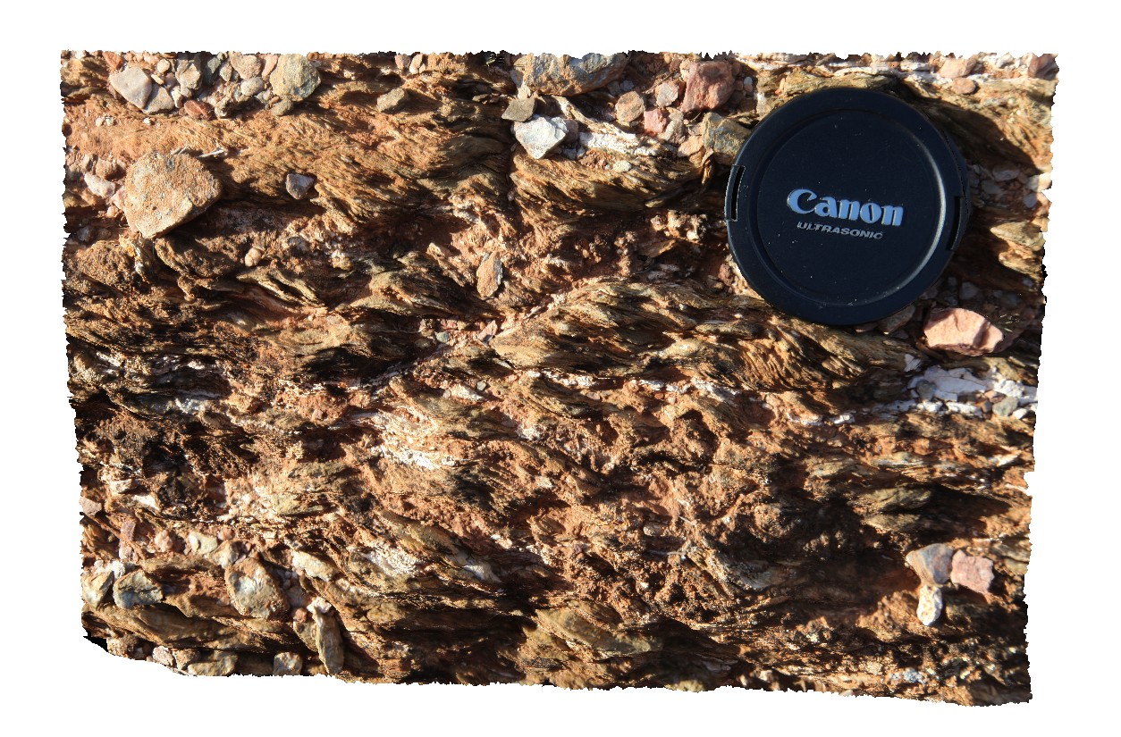
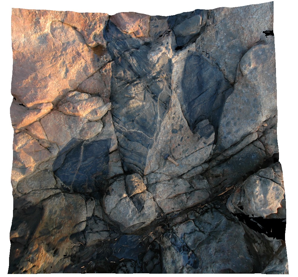
S-C fabric developed in metasediment. Broken Hill, N.S.W. |
0.20 |
-31.61294092000 |
141.53049184000 |
-9999.000 |
S-C fabric, structure, metasediment |
metasediment |
Roches1 Map
 |
5 |
03/16/2015 2:20 p.m. |
3D |
view of Jurassic dolerite intrusive contact with Permian siltstones. Siltstones have been hornfelsed. Roches Beach, Tasmania. |
10.00 |
-42.88390378000 |
147.50548658000 |
2.000 |
igneous intrusion, hornfels |
siltstone, dolerite |
Roches2 Map
 |
5 |
03/16/2015 2:21 p.m. |
3D |
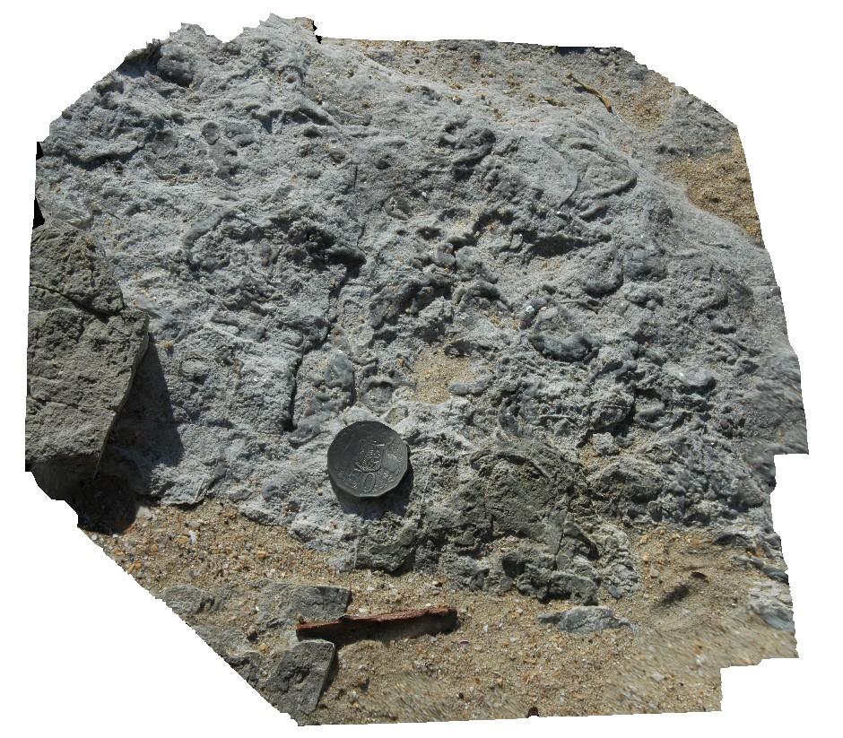
view of Permian siltstone beds with concretions and disrupted bedding. Roches Beach, Tasmania. |
5.00 |
-42.88365826000 |
147.50552434000 |
5.000 |
disrupted bedding, hornfels, sedimentology |
siltstone |
Roches3 Map
 |
5 |
03/16/2015 2:21 p.m. |
3D |
view of Permian siltstone beds with concretions and disrupted bedding. Roches Beach, Tasmania. |
1.50 |
-42.88367544000 |
147.50554050000 |
-9999.000 |
disrupted bedding, sedimentology, concretion |
siltstone |
Roches4 Map
 |
5 |
03/16/2015 2:21 p.m. |
3D |
detail of bioturbation and possible fossil casts on bedding plane in Permian siltstones. Roches Beach, Tasmania. |
0.25 |
-42.88366922000 |
147.50549163000 |
5.000 |
bioturbation, sedimentology, siltstone |
siltstone |
Roches5 Map
 |
5 |
03/16/2015 2:21 p.m. |
3D |
view of bifurcating dolerite dyke intruding Permian siltstone. Roches Beach, Tasmania. |
0.00 |
-42.88362383000 |
147.50543178000 |
5.000 |
dyke, intrusive contact, igneous |
siltstone, dolerite |
Roches6 Map
 |
5 |
03/16/2015 2:21 p.m. |
3D |
close-up view of bifurcating dolerite dyke, showing metamorphic aureole / hornfelse in hosting siltstone. Roches Beach, Tasmania. |
0.60 |
-42.88362259000 |
147.50542203000 |
5.000 |
metamorphic aureole, hornfels, igneous intrusion, dyke |
siltstone, dolerite |
Roches7 Map
 |
5 |
03/16/2015 2:21 p.m. |
3D |
dolerite outcrop, showing coarse and fine-grained segregations / zones and blocky jointing. Roches Beach, Tasmania. |
1.00 |
-42.88414512000 |
147.50540867000 |
2.000 |
grain size, dolerite |
dolerite |
Roches8 Map
 |
5 |
03/16/2015 2:21 p.m. |
3D |
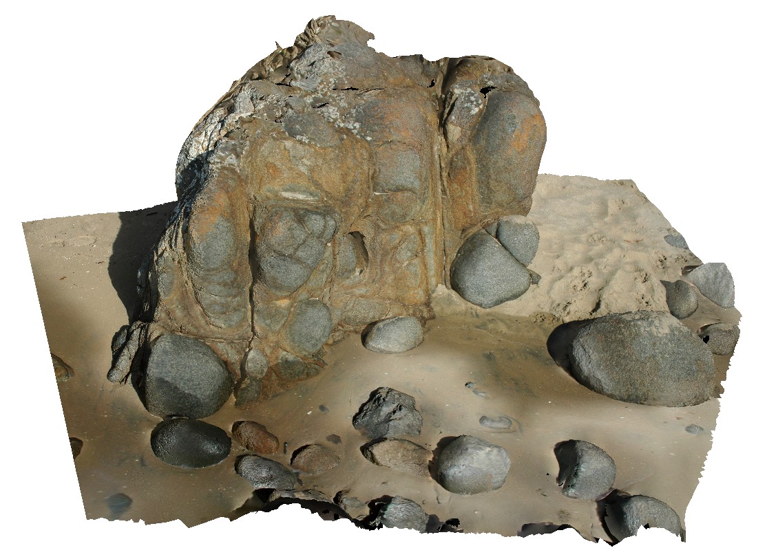
spheroidal weathering of dolerite. Roches Beach, Tasmania. |
1.00 |
-42.88418779000 |
147.50532785000 |
1.000 |
spheroidal weathering, dolerite |
dolerite |
Surville1 Map
 |
50 |
03/16/2015 2:21 p.m. |
3D |
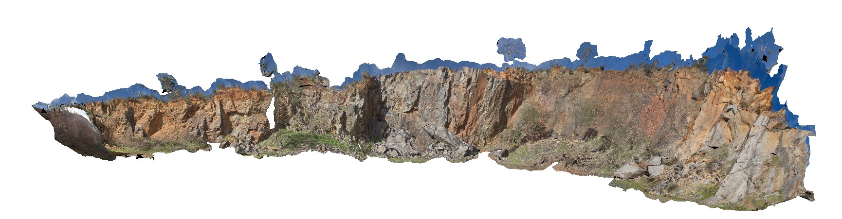
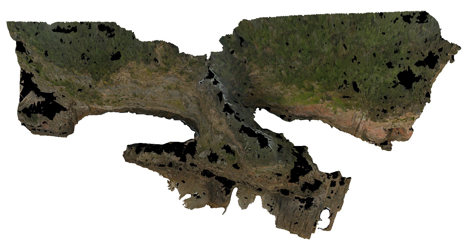
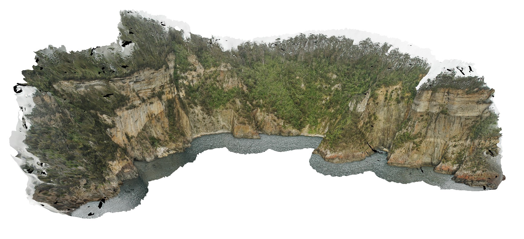
view form off-shore of cliff exposure, showing basement unconformable contact between Devonian Granite and the overlying sedimentary Parmeener Supergroup. Cape Surville, Tasman Peninsula. Tasmania. |
500.00 |
-42.97529481000 |
147.98872815000 |
0.500 |
basement unconformity, Devonian granite, Parmeener Supergroup, basement geology |
granite, siltstone |
Surville2 Map
 |
50 |
03/16/2015 2:21 p.m. |
3D |
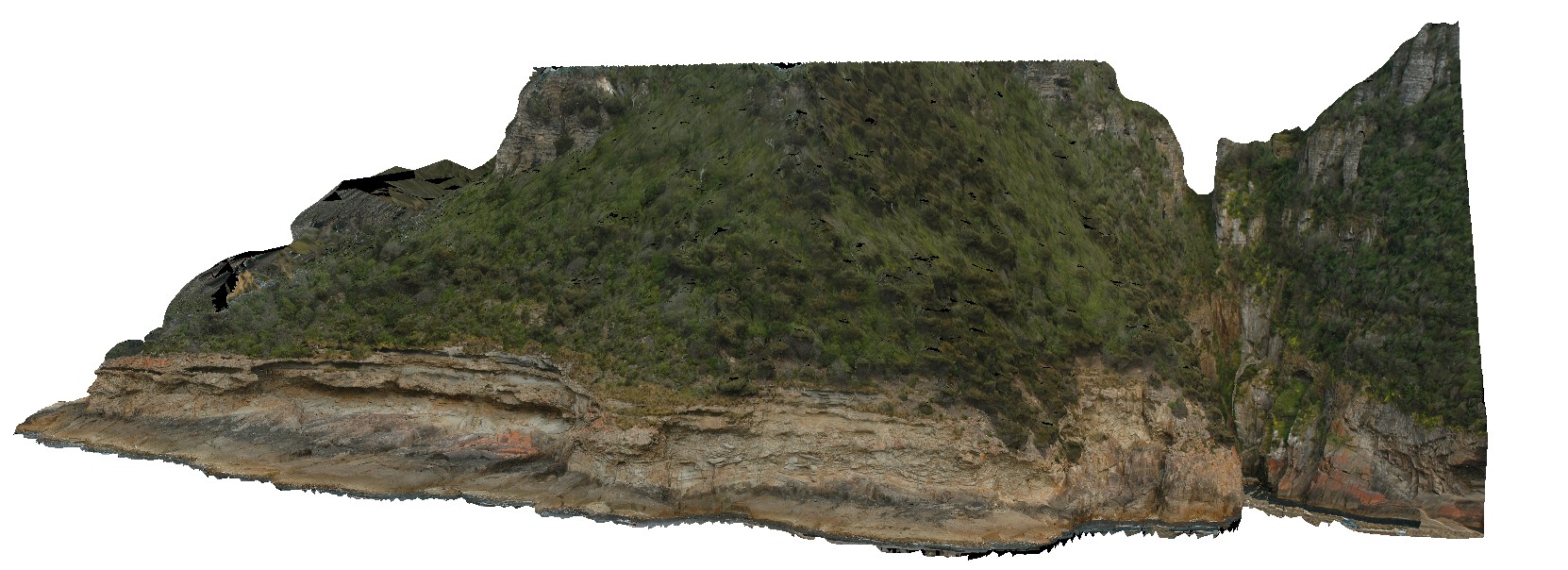
view form off-shore of cliff exposure, showing basement unconformable contact between Devonian Granite and the overlying sedimentary Parmeener Supergroup with intrusive Jurassic dolerite contact (darker rock). Cape Surville, Tasman Peninsula. Tasmania. |
500.00 |
-42.95779432000 |
147.99290997000 |
0.500 |
basement unconformity, unconformity, intrusive contact, igneous intrusion |
granite, siltstone, dolerite |
Surville5 Map
 |
50 |
03/16/2015 2:22 p.m. |
3D |
view form off-shore of cliff exposure, showing basement unconformable contact between Devonian Granite and the overlying sedimentary Parmeener Supergroup. Cape Surville, Tasman Peninsula. Tasmania. |
250.00 |
-42.97067641000 |
147.99550099000 |
0.500 |
unconformity, contact, basement unconformity |
granite, siltstone |
Flinders1 Map
 |
20 |
03/16/2015 2:22 p.m. |
3D |
S-type biotite-garnet alkali-feldspar granite. Porphyritic, with feldspar phenocrysts. Xenoliths of sedimentary Mathinna Supergroup. |
4.00 |
-40.23921489000 |
148.04245729000 |
0.000 |
granite, xenoliths, Porphyritic |
turbidite, granite |
Flinders2 Map
 |
20 |
03/16/2015 2:23 p.m. |
3D |
intrusive contact between Boobyalla Granite and Mathinna Supergroup with irregular dyke |
3.00 |
-40.23923968000 |
148.04241391000 |
0.000 |
Intrusive contact, dyke |
Granite, Turbidite |