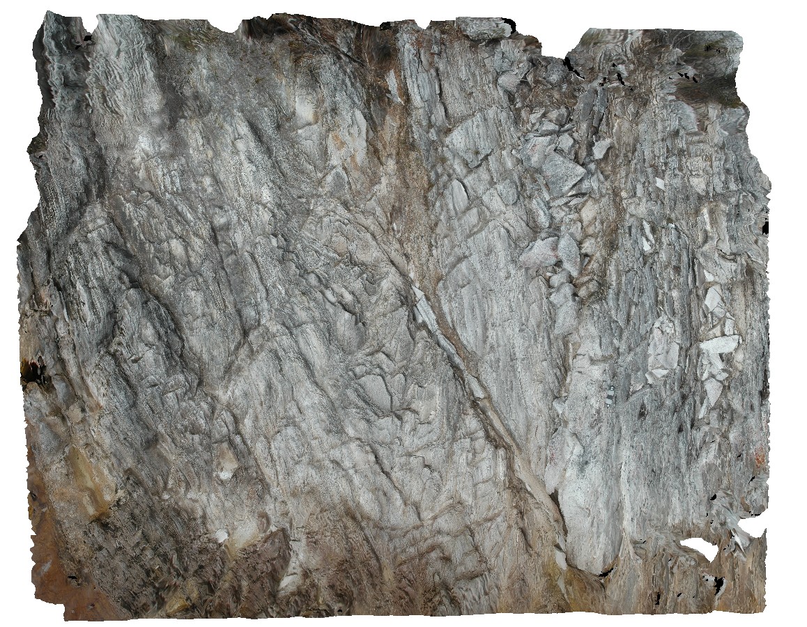
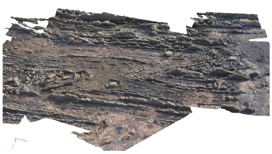
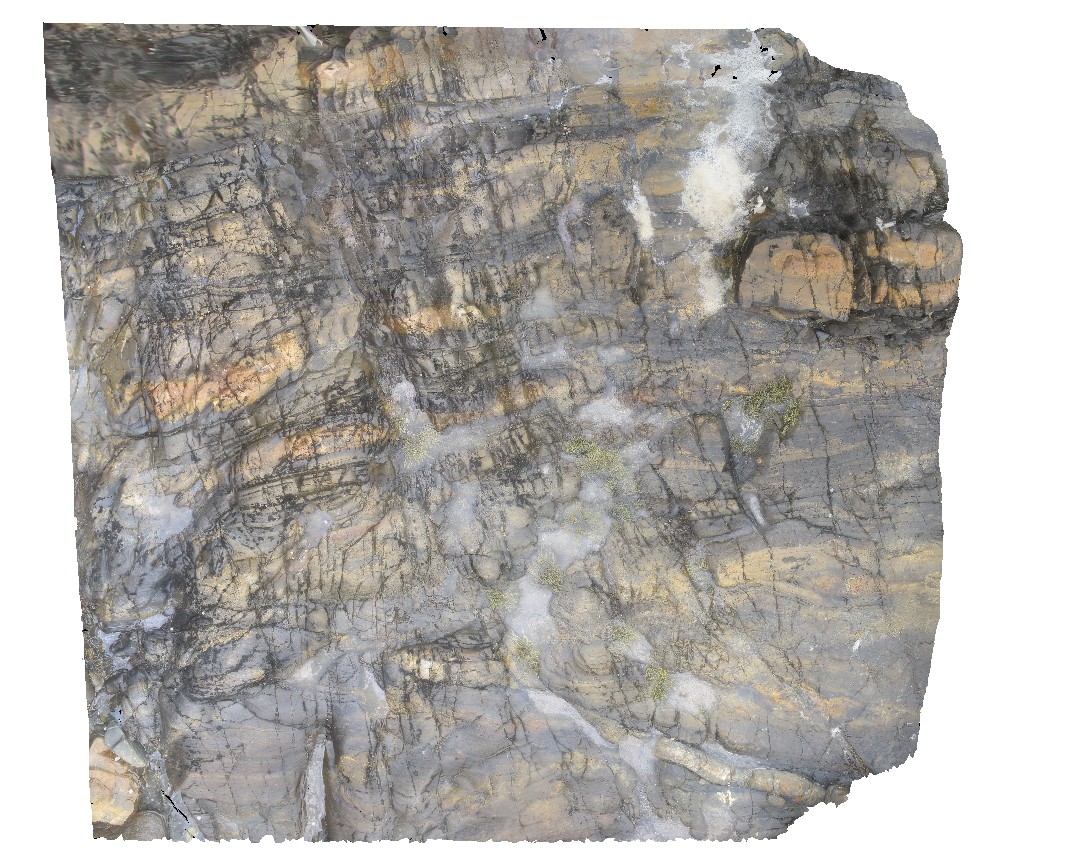
Pedder13 Map
 |
5 |
03/16/2015 2:26 p.m. |
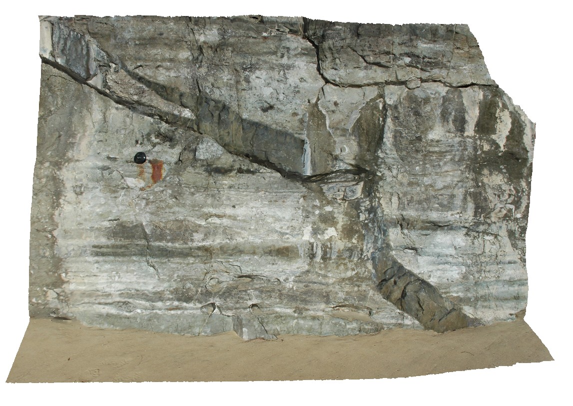
3D |
fault cutting folded quartzite. Lake Pedder, south west Tasmania. |
0.00 |
-42.84890616000 |
146.10493121000 |
-9999.000 |
fault, fold, structure, quartzite |
quartzite |
MallacootaGiga1 Map
 |
0 |
05/18/2015 2:01 p.m. |
GIGA |
location inferred from nearby images. Mallacoota, Vic. |
0.00 |
-37.57225000000 |
149.76472000000 |
-9999.000 |
|
|
LordHowe10 Map
 |
20 |
03/16/2015 2:50 p.m. |
3D |
basalts intruded by dykes. Lord Howe Island. |
0.00 |
-31.52197862000 |
159.05226474000 |
0.000 |
dyke, intrusion |
basalt |
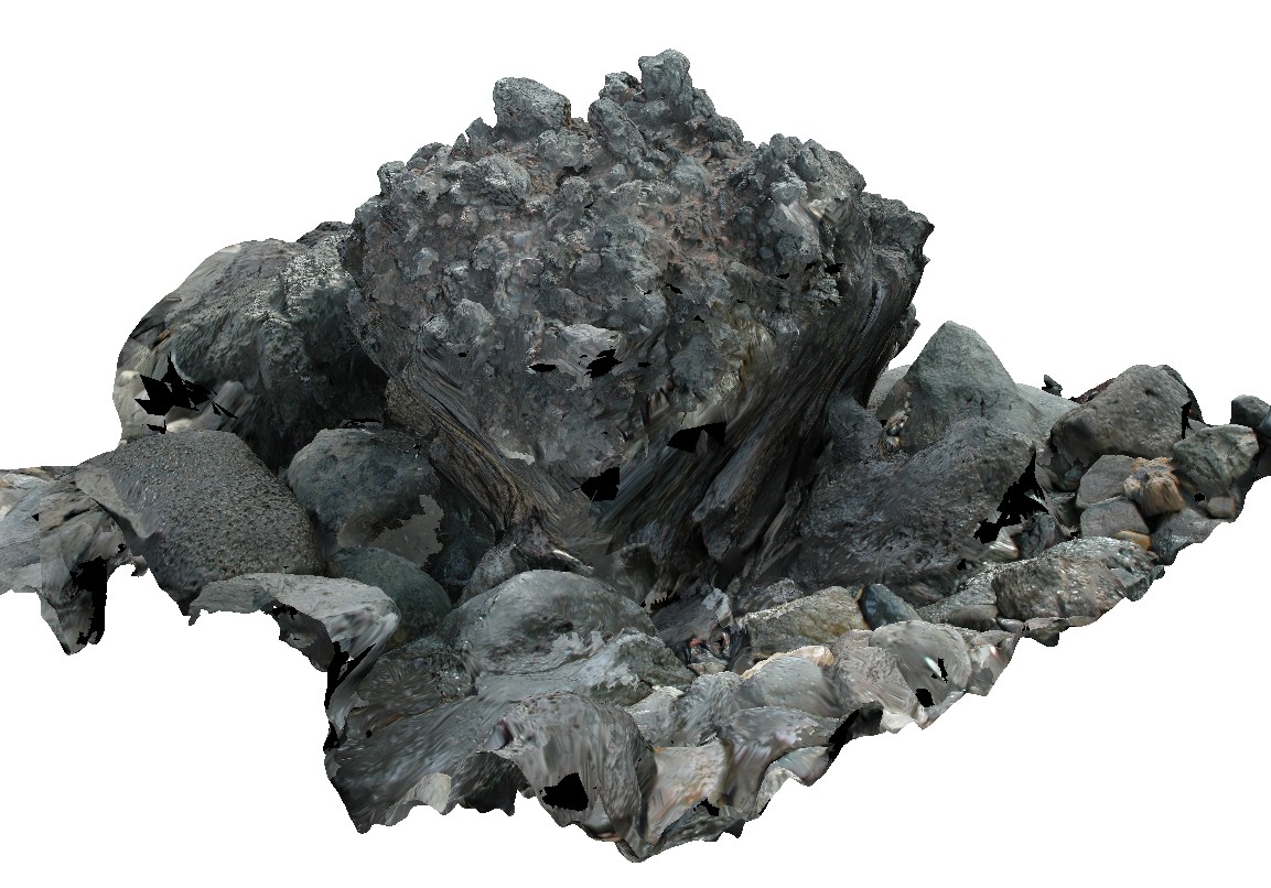
LordHowe13 Map
 |
20 |
03/16/2015 2:51 p.m. |
3D |
welded scoria. Lord Howe Island. |
0.00 |
-31.51990632000 |
159.05360757000 |
0.000 |
|
basalt |
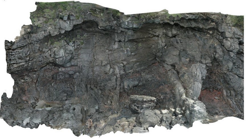
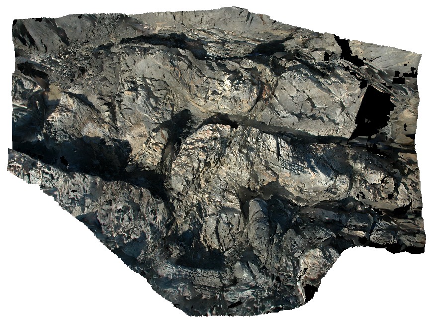
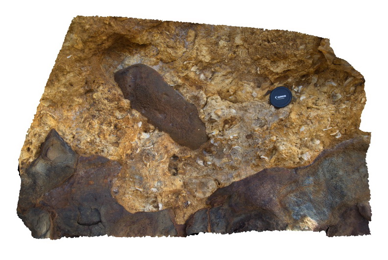
Pedder25 Map
 |
5 |
03/16/2015 2:28 p.m. |
3D |
fault contact with surrounding sediments, showing cataclasite and shear structures. Lake Pedder, south west Tasmania. |
0.00 |
-42.95896997000 |
146.13457732000 |
-9999.000 |
shear, fault, cataclasite |
mudstone |
Roches5 Map
 |
5 |
03/16/2015 2:21 p.m. |
3D |
view of bifurcating dolerite dyke intruding Permian siltstone. Roches Beach, Tasmania. |
0.00 |
-42.88362383000 |
147.50543178000 |
5.000 |
dyke, intrusive contact, igneous |
siltstone, dolerite |
Liptrap14 Map
 |
20 |
03/13/2015 9:19 a.m. |
3D |
tightly folded distal turbidites. Cape Liptrap, Vic. |
0.00 |
-38.90333045000 |
145.91635312000 |
0.000 |
structure, folding |
turbidite |
MyrtleBch2 Map
 |
1 |
06/17/2015 9:23 a.m. |
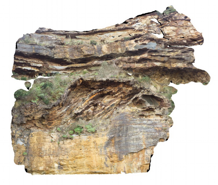
3D |
Large (~6m) megaclast of folded Wagonga Group rocks within cliff of Permian Snapper Point Formation. Poor image due to limited vantage points. No scale. Myrtle Beach, N.S.W. |
0.00 |
-35.68269000000 |
150.30045800000 |
-9999.000 |
megaclast, sedimentology |
sandstone |
NambuccaGiga3 Map
 |
0 |
01/01/9999 midnight |
GIGA |
Nambucca, N.S.W. |
0.00 |
-30.64876000000 |
153.01909000000 |
-9999.000 |
|
|
LiptrapPole3 Map
 |
20 |
03/13/2015 9:25 a.m. |
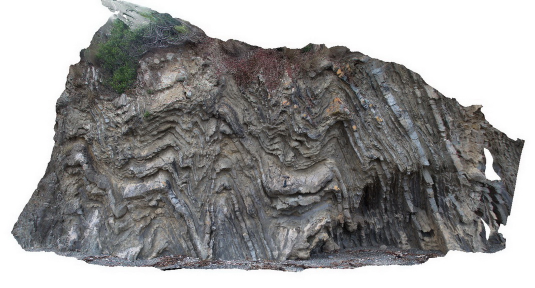
3D |
steeply dipping Asymmetrical and chevron folding with cross cutting faults in finely bedded turbidites. Cape Liptrap, Vic. |
0.00 |
-38.90395783000 |
145.91709577000 |
0.000 |
folding, structure, fault |
turbidite |
CapeWickham9 Map
 |
5 |
04/25/2015 11:52 a.m. |
3D |
steeply plunging fold hinge in quartzite and pelites. Cape Wickham, King Island. Tasmania. |
0.00 |
-39.59211212000 |
143.92782848000 |
2.000 |
fold hinge, fold, structure, metamorphic |
quartzite |
LiptrapPole2 Map
 |
20 |
03/13/2015 9:25 a.m. |
3D |
wave cut platform showing steeply plunging chevron folding in finely bedded turbiditic sequence. Cape Liptrap, Vic. |
0.00 |
-38.90414711000 |
145.91743374000 |
0.000 |
structure, chevron folds |
turbidite |
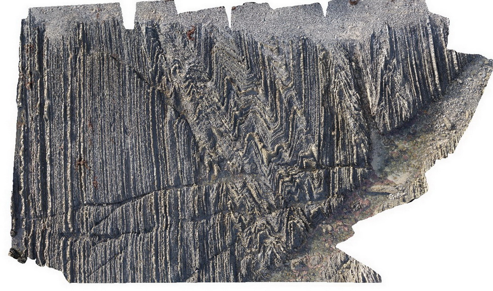
LiptrapPole1 Map
 |
20 |
03/13/2015 9:25 a.m. |
3D |
wave cut platform showing chevron folding and cross cutting faults in finely bedded turbidites. Cape Liptrap, Vic. |
0.00 |
-38.90406232000 |
145.91729772000 |
0.000 |
turbidite, chevron folds, structure |
turbidite |
ESCape14 Map
 |
20 |
03/16/2015 2:33 p.m. |
3D |
steeply plunging, folded turbiditic sandstone and siltstone beds of the Mathinna Supergroup. Sandy Point, Tas. |
0.00 |
-40.95007594000 |
147.35335474000 |
0.000 |
fold, turbidite, structure |
turbidite |
WestBeach5 Map
 |
0 |
06/05/2016 10:50 a.m. |
3D |
'M' folding in garnet schist, West Beach, W.A. |
0.00 |
-33.95352000000 |
119.97489000000 |
-9999.000 |
M folds, structure, garnet schist |
garnet schist |
CanberraGiga1 Map
 |
1 |
06/17/2015 10:27 a.m. |
GIGA |
— |
0.00 |
-35.30408000000 |
149.12651000000 |
-9999.000 |
|
|
CanberraGiga2 Map
 |
0 |
06/17/2015 10:29 a.m. |
GIGA |
— |
0.00 |
-35.30408000000 |
149.12651000000 |
-9999.000 |
|
|
CanberraGiga3 Map
 |
1 |
06/17/2015 10:30 a.m. |
GIGA |
— |
0.00 |
-35.30408000000 |
149.12651000000 |
-9999.000 |
|
|
NambuccaGiga1 Map
 |
0 |
01/01/9999 midnight |
GIGA |
Nambucca, N.S.W. |
0.00 |
-30.64660000000 |
153.01932000000 |
-9999.000 |
|
|
NambuccaGiga2 Map
 |
0 |
01/01/9999 midnight |
GIGA |
Nambucca, N.S.W. |
0.00 |
-30.64857000000 |
153.01886000000 |
-9999.000 |
|
|
Splitpoint16 Map
 |
5 |
06/17/2015 10:49 a.m. |
3D |
Detailed view of the disconformable contact between basalt of the Oligocene Angahook Formation and bioclastic limestone of the Oligocene-Miocene Torquay Group. Split Point, Vic. |
0.00 |
-38.46855000000 |
144.10698000000 |
-9999.000 |
palaeontology, disconformity, volcanology, sedimentology |
basalt, limestone |
TowerHillGIGA1 Map
 |
10 |
01/01/9999 midnight |
GIGA |
— |
0.00 |
-38.32723000000 |
142.36790000000 |
-9999.000 |
|
tuff |
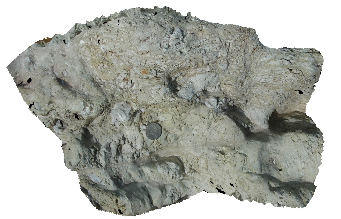
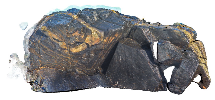
CapeWickham8 Map
 |
5 |
04/22/2016 12:22 p.m. |
3D |
view of bedded, quartzite dominant metasediments. Cape Wickham, King Island. Tasmania. |
0.00 |
-39.59224515000 |
143.92791342000 |
0.500 |
metasediments |
|
HastingsPt2 Map
 |
1 |
07/09/2015 4:27 p.m. |
3D |
fold in metasediments in offshore rock - approximately 2.5m across. Devonian - Carboniferous Neranleigh-Fernvale Beds. Hastings Point, QLD. |
0.00 |
-28.33676000000 |
153.57729000000 |
-9999.000 |
fold, structure |
sandstone |
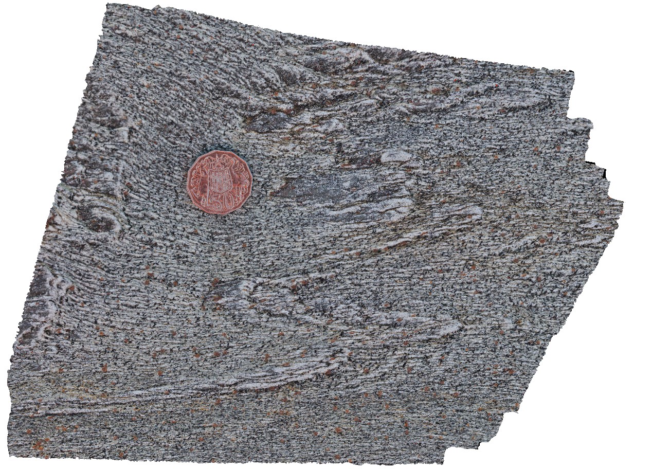
BHillGiga1 Map
 |
0 |
07/14/2015 12:24 p.m. |
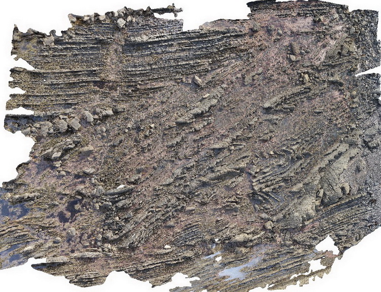
GIGA |
Browns Shaft, Junction Mine, image of gossan. Broken Hill. N.S.W. |
0.00 |
-31.95463000000 |
141.47885000000 |
-9999.000 |
gneiss |
gneiss |