Peron2 Map
 |
0 |
05/23/2016 noon |
3D |
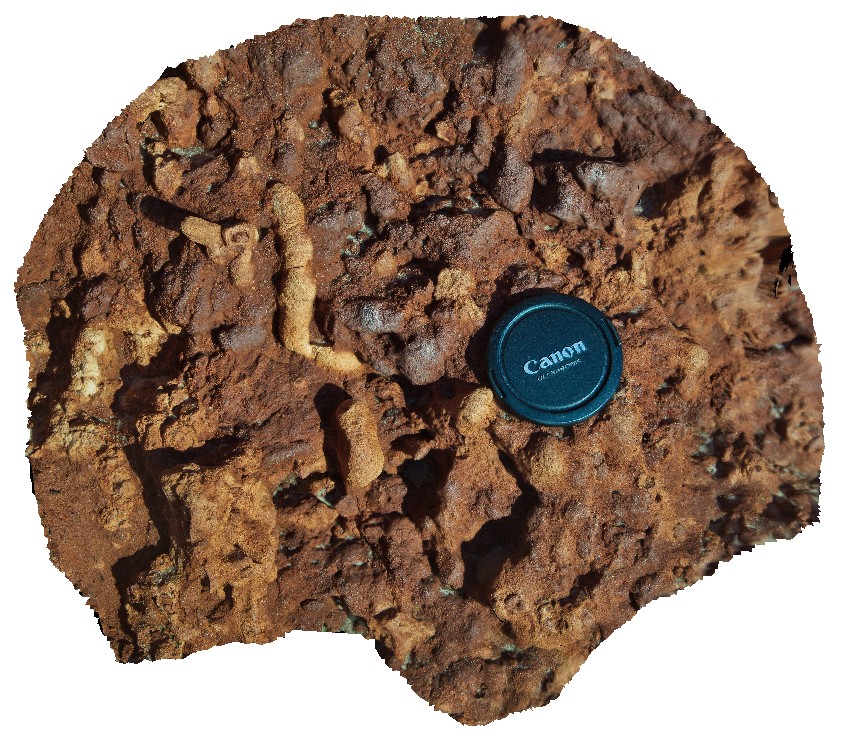
detail of carbonate 'tubes / roots' in sandstone. Possible bioturbation. Cape Peron, Shark Bay, W.A. |
0.40 |
-25.51383800000 |
113.51588500000 |
-9999.000 |
root structures, bioturbation, red sandstone |
sandstone |
PeronUAV1 Map
 |
0 |
05/23/2016 noon |
UAV |
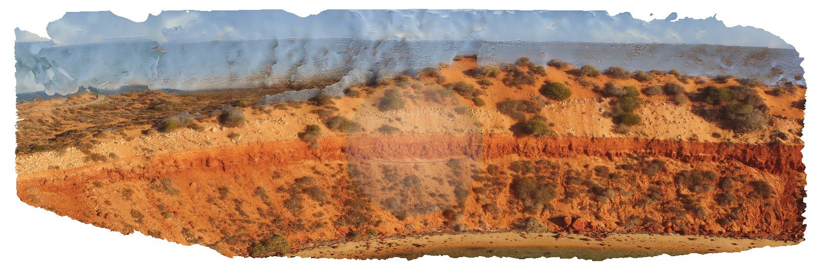
flat lying, bedded sandstone cliff with overlaying aeolian sand containing rhizomes. Cape Peron, Shark Bay, W.A. |
10.00 |
-25.51383800000 |
113.51588500000 |
-9999.000 |
red sandstone, root structures, soil concretions, unconformity |
sandstone, sand |
Peron3 Map
 |
0 |
05/23/2016 noon |
3D |
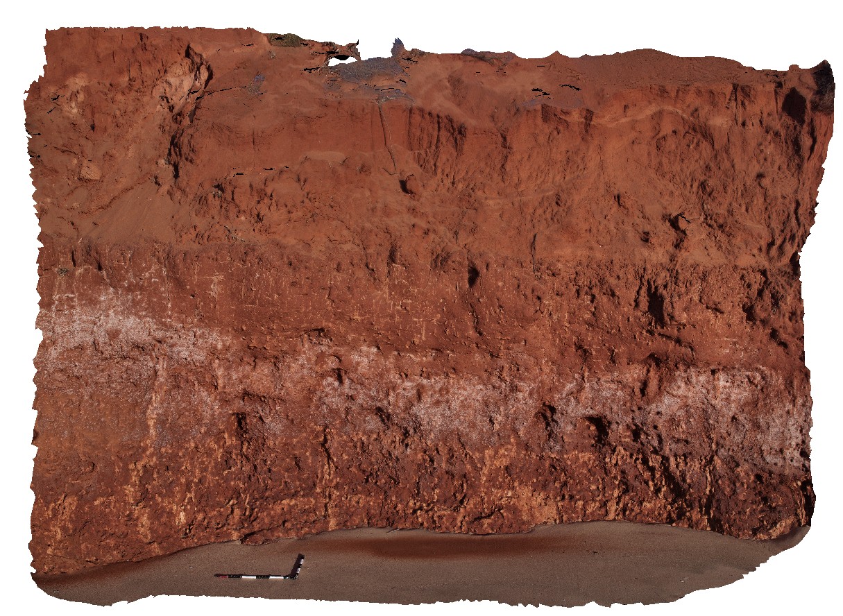
low cliff of bedded Peron sandstone, overlain by aeolian sand and calcrete capping. Cape Peron, Shark Bay, W.A. |
10.00 |
-25.51383800000 |
113.51588500000 |
-9999.000 |
unconformity, red sandstone, aeolian sand |
sandstone, sand |
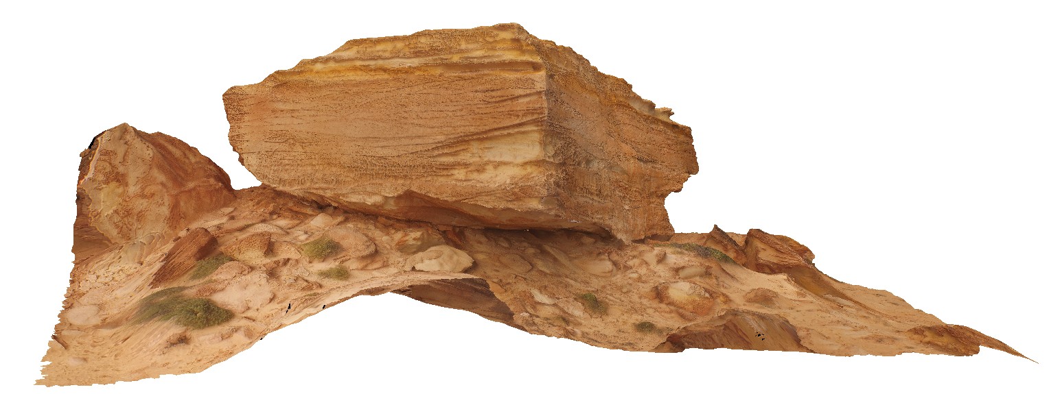
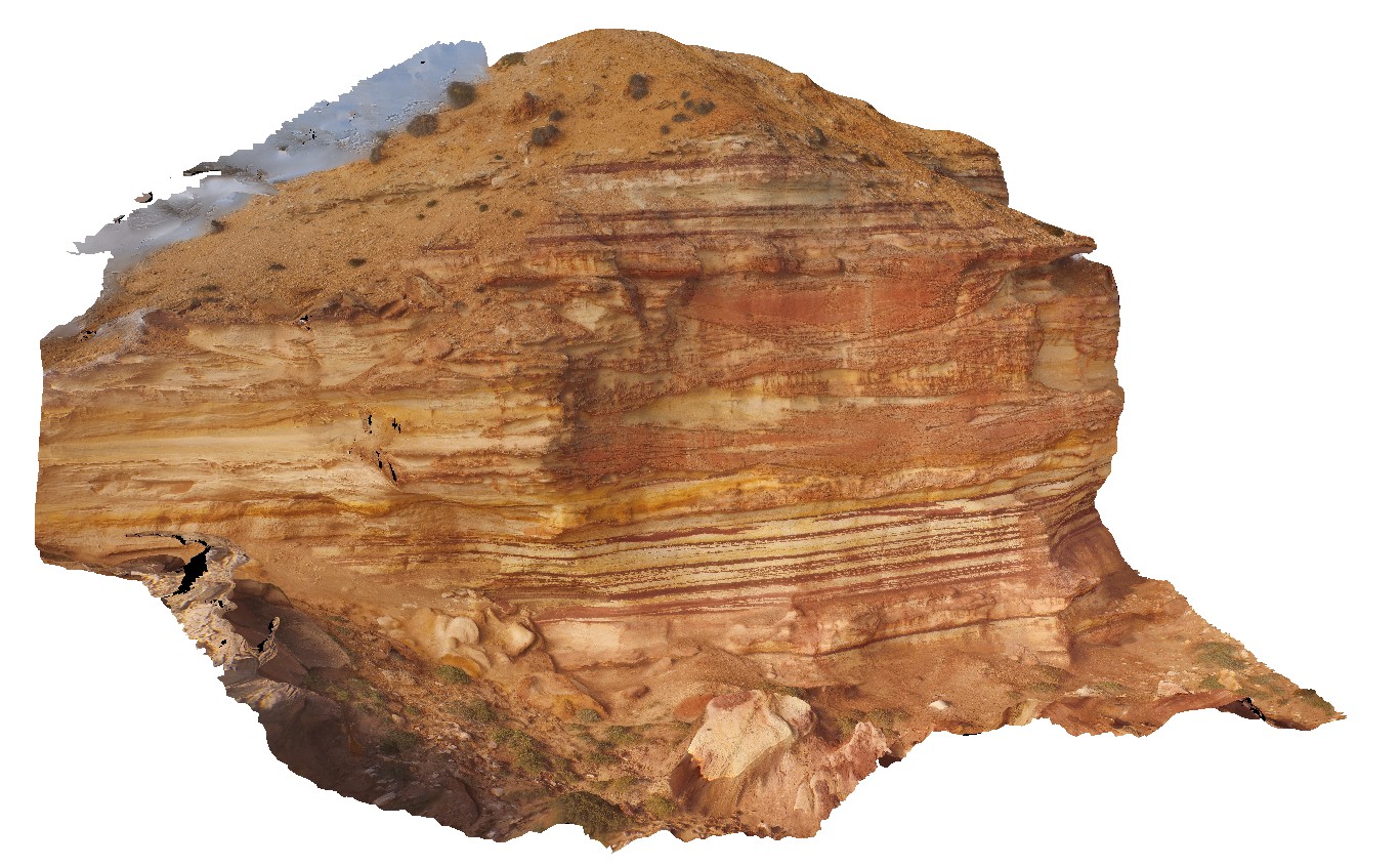
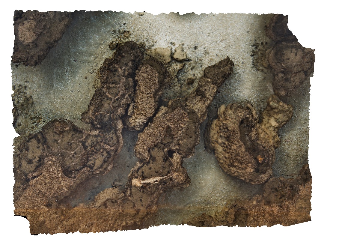
Peron1 Map
 |
0 |
05/23/2016 noon |
3D |
low cliff of Peron Sandstone overlain by aeolian sand. Peron sandstone has carbonate 'tubes' and possible rhizomes. Cape Peron, Shark Bay, W.A. |
3.00 |
-25.51383800000 |
113.51588500000 |
-9999.000 |
unconformity, root structures, red sandstone |
sandstone |
Denham1 Map
 |
0 |
05/23/2016 noon |
3D |
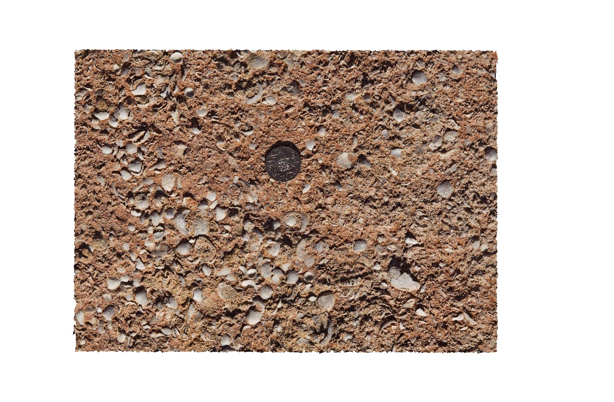
detail of shells and texture within the Pleistocene to Holocene Denham limestone. Shark Bay, W.A. |
0.40 |
-26.19567000000 |
113.72114000000 |
-9999.000 |
limey sand, Fragum erugatum, fossil, palaeontology |
limestone |
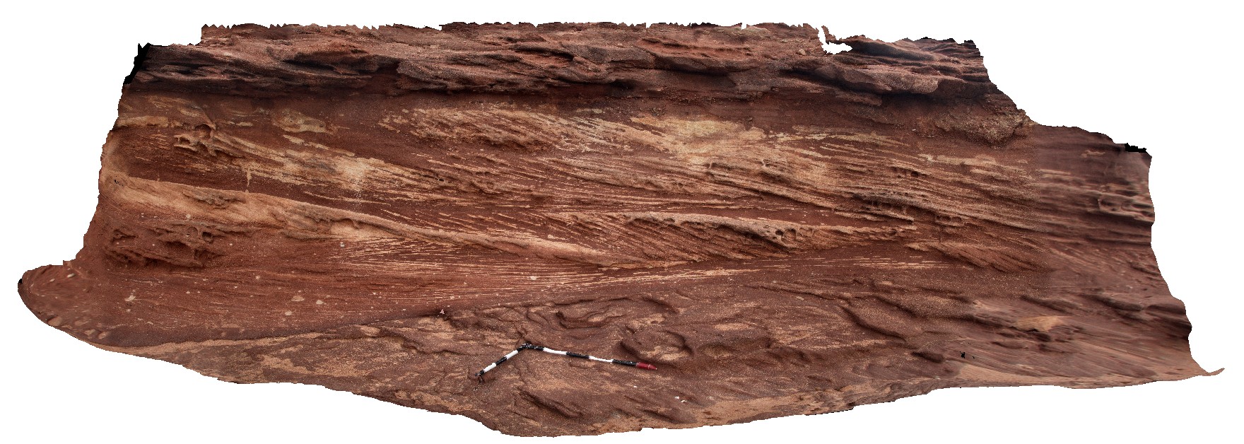
KalbarriUAV5 Map
 |
0 |
05/20/2016 noon |
UAV |
large overturned block with cross bedding and vertical burrows. Red Bluff, Kalbarri, W.A. |
20.00 |
-27.74547600000 |
114.13947200000 |
-9999.000 |
sandstone, bioturbation |
sandstone |
Kalbarri18 Map
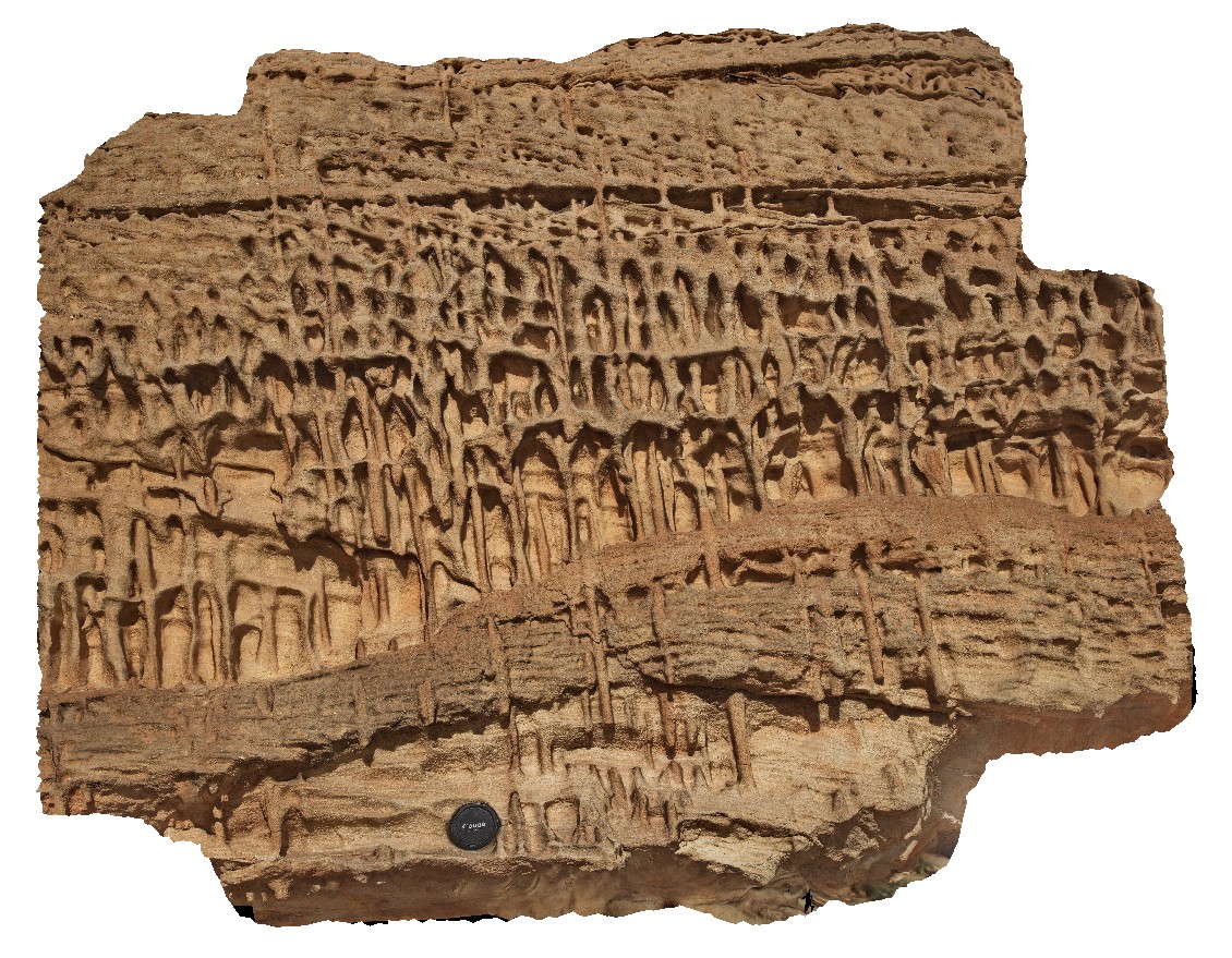 |
0 |
05/20/2016 noon |
3D |
vertical burrows in overturned block of Tumblagooda Sandstone. Detail of site KalbarriUAV5. Red Bluff, Kalbarri, W.A. |
1.20 |
-27.74526000000 |
114.13950000000 |
-9999.000 |
bioturbation, burrows, sandstone, sedimentology, fossil, palaeontology |
sandstone |
Kalbarri20 Map
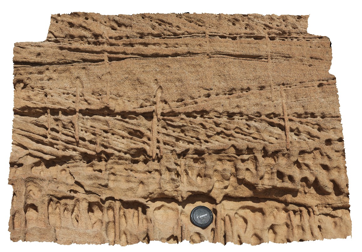 |
0 |
05/20/2016 noon |
3D |
detail of bioturbation burrows cutting cross beds in the Tumblagooda Sandstone. Red Bluff, Kalbarri, W.A. |
1.00 |
-27.74553000000 |
114.13950000000 |
-9999.000 |
bioturbation, burrows, cross bedded, Tumblagooda Sandstone, fossil, palaeontology |
sandstone |
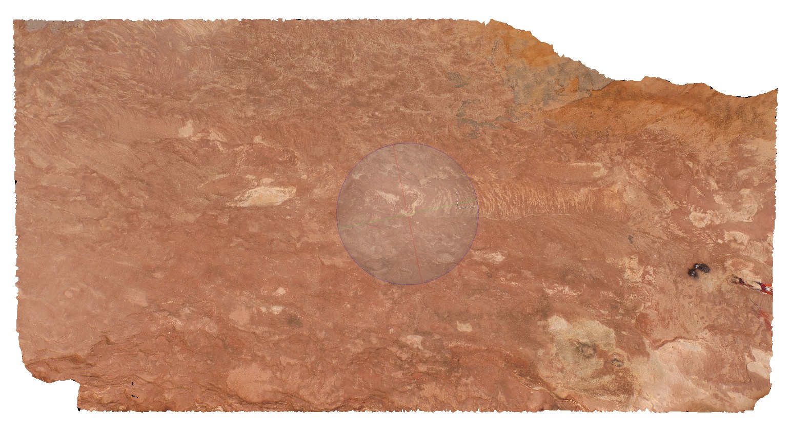
Kalbarri19 Map
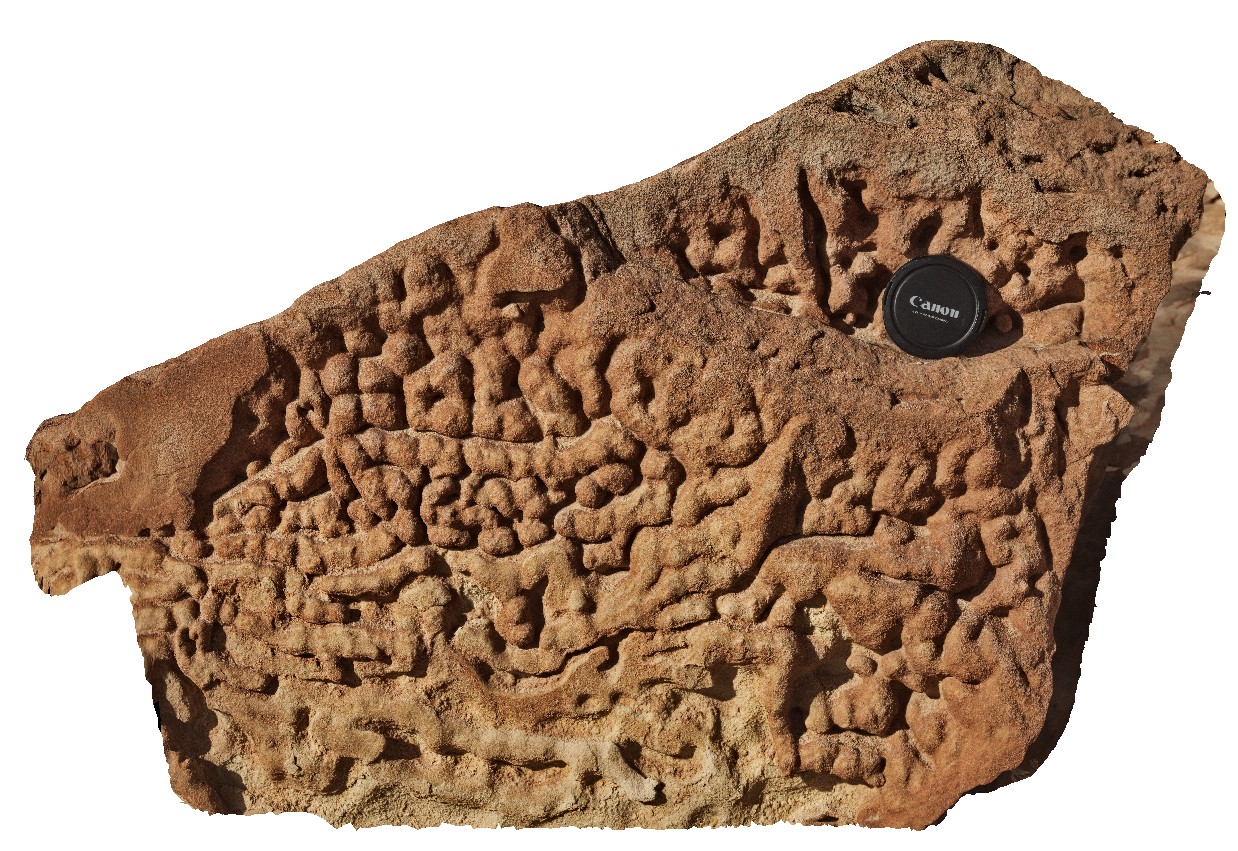 |
0 |
05/20/2016 noon |
3D |
bioturbation in sandstone viewed perpendicular to bedding. Red Bluff, Kalbarri, W.A. |
0.70 |
-27.74548000000 |
114.13952000000 |
-9999.000 |
bioturbation, sandstone, Tumblagooda Sandstone, fossil, palaeontology |
sandstone |
KalbarriUAV6 Map
 |
0 |
01/01/9999 midnight |
UAV |
main cliff at Red Bluff, showing flat lying, thinly bedded or cross bedded sandstone of the Tumblagooda Sandstone. Kalbarri, W.A. |
28.00 |
-27.74557200000 |
114.13969200000 |
-9999.000 |
Tumblagooda Sandstone, cross beds, sedimentology |
sandstone |
Kalbarri17 Map
 |
0 |
05/20/2016 noon |
3D |
cross beds in pebbly sandstone delineated by differential oxidation. Red Bluff, Kalbarri, W.A. |
4.50 |
-27.74431000000 |
114.14072000000 |
-9999.000 |
cross bedding, pebbly sandstone |
sandstone |
Kalbarri21 Map
 |
0 |
05/20/2016 noon |
3D |
steeply dipping sandstone cross beds, truncated by flat lying pebbly sandstone. Red Bluff, Kalbarri, W.A. |
9.00 |
-27.74457000000 |
114.14263000000 |
-9999.000 |
cross bedding, truncated bedding, pebbly sandstone, sedimentology |
sandstone |
KalbarriUAV4 Map
 |
0 |
05/20/2016 noon |
UAV |
Cross bedded red sandstone in horizontal exposure. location at Red Bluff carpark, Kalbarri, W.A. |
20.00 |
-27.74398000000 |
114.14342000000 |
-9999.000 |
cross bedding, Tumblagooda Sandstone |
sandstone |
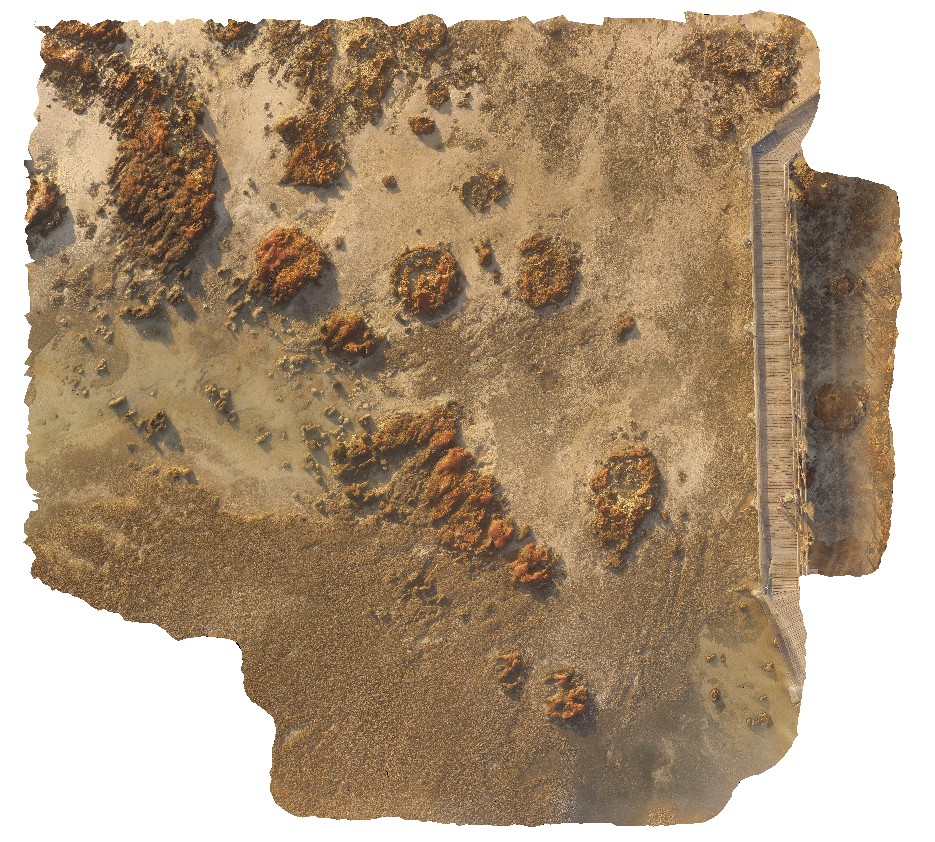
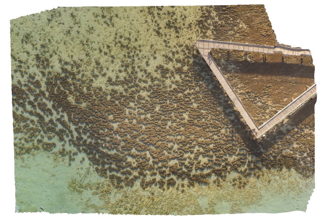
HamelinUAV4 Map
 |
0 |
05/23/2016 noon |
UAV |
aerial view of large stromatolite mounds - supra-tidal. Hamelin Pool. Shark Bay, W.A. |
50.00 |
-26.40053100000 |
114.15087300000 |
-9999.000 |
tidal flat deposits, stromatolites |
tidal flat deposits |
HamelinUAV2 Map
 |
0 |
05/23/2016 noon |
UAV |
aerial view of submerged stromatolite colony. Hamelin Pool. Shark Bay, W.A. |
100.00 |
-26.40027700000 |
114.15869900000 |
-9999.000 |
tidal flat deposits, stromatolite |
tidal flat deposits |
HamelinUAV5 Map
 |
0 |
05/23/2016 noon |
UAV |
aerial view of submerged stromatolites. Hamelin Pool. Shark Bay, W.A. |
50.00 |
-26.40031000000 |
114.15875100000 |
-9999.000 |
tidal flat deposits, stromatolite |
tidal flat deposits |
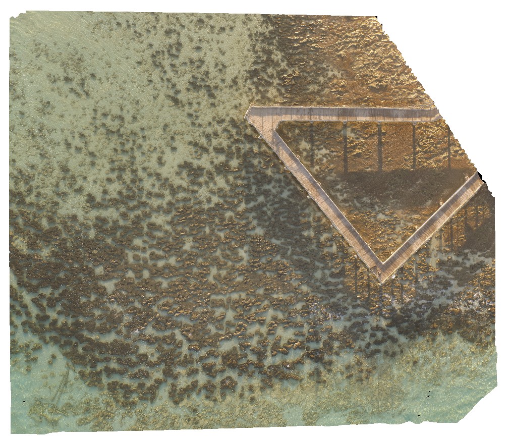
HamelinUAV1 Map
 |
0 |
05/23/2016 noon |
UAV |
aerial view of submerged stromatolite colony. Hamelin Pool. Shark Bay, W.A. |
50.00 |
-26.40043900000 |
114.15878700000 |
-9999.000 |
tidal flat deposits, stromatolite |
tidal flat deposits |
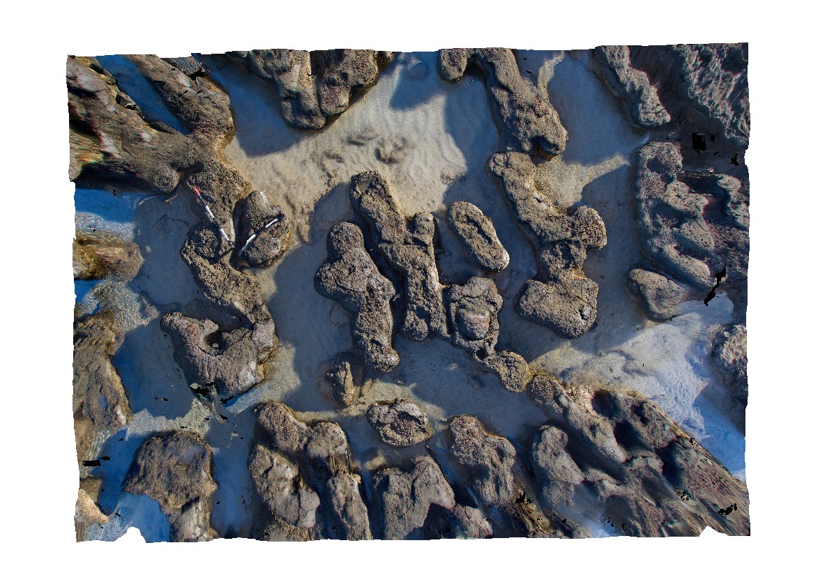
Hamelin5 Map
 |
0 |
05/23/2016 noon |
3D |
detail of submerged stromatolites at tourist landing, Hamelin Pool. Shark Bay, W.A. |
3.50 |
-26.40043000000 |
114.15889000000 |
-9999.000 |
stromatolite, algal mat, tidal flat deposits |
tidal flat deposits |
Hamelin4 Map
 |
0 |
05/23/2016 noon |
3D |
submerged stromatolites at tourist landing, Hamelin Pool. Shark Bay, W.A. |
7.00 |
-26.40043000000 |
114.15889000000 |
-9999.000 |
tidal flat deposits, stromatolites |
tidal flat deposits |
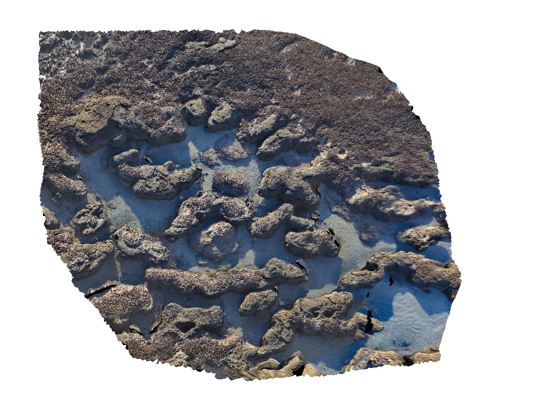
Hamelin3 Map
 |
0 |
05/23/2016 noon |
3D |
submerged stromatolites at tourist landing, Hamelin Pool. Shark Bay, W.A. |
1.00 |
-26.40045000000 |
114.15891000000 |
-9999.000 |
stromatolite, microbial mat, tidal flat deposits |
tidal flat deposits |
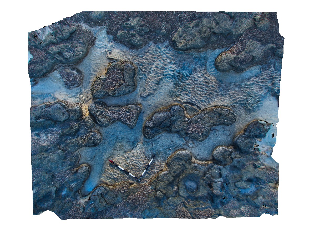
HamelinUAV6 Map
 |
0 |
05/23/2016 noon |
UAV |
aerial view of submerged stromatolites. Hamelin Pool. Shark Bay, W.A. |
100.00 |
-26.40043000000 |
114.15891500000 |
-9999.000 |
tidal flat deposits, stromatolite |
tidal flat deposits |
Hamelin6 Map
 |
0 |
05/23/2016 noon |
3D |
view from tourist landing of submerged stromatolites and interspaced fine sediment. Hamelin Pool. Shark Bay, W.A. |
10.00 |
-26.40045000000 |
114.15893000000 |
-9999.000 |
tidal flat deposits, stromatolites |
tidal flat deposits |
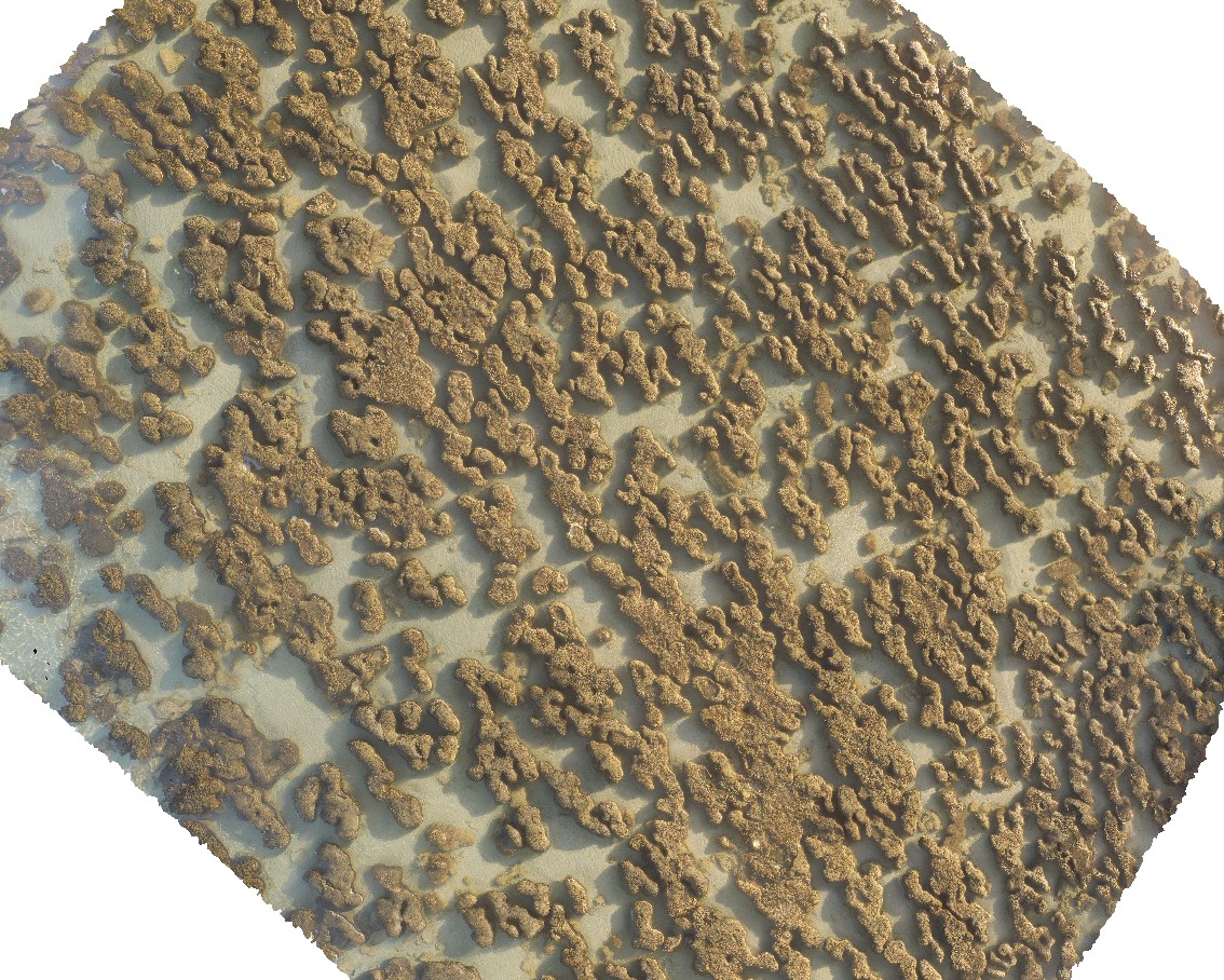
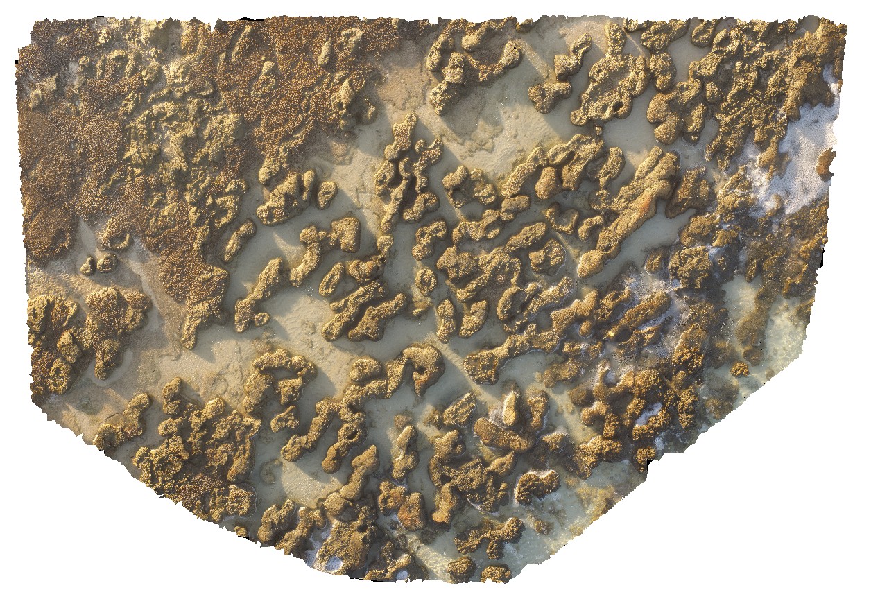
HamelinUAV3 Map
 |
0 |
05/23/2016 noon |
UAV |
aerial view of stromatolites and fine interstitial sediments. Hamelin Pool. Shark Bay, W.A. |
25.00 |
-26.40072100000 |
114.15898800000 |
-9999.000 |
tidal flat deposits, stromatolite |
tidal flat deposits |
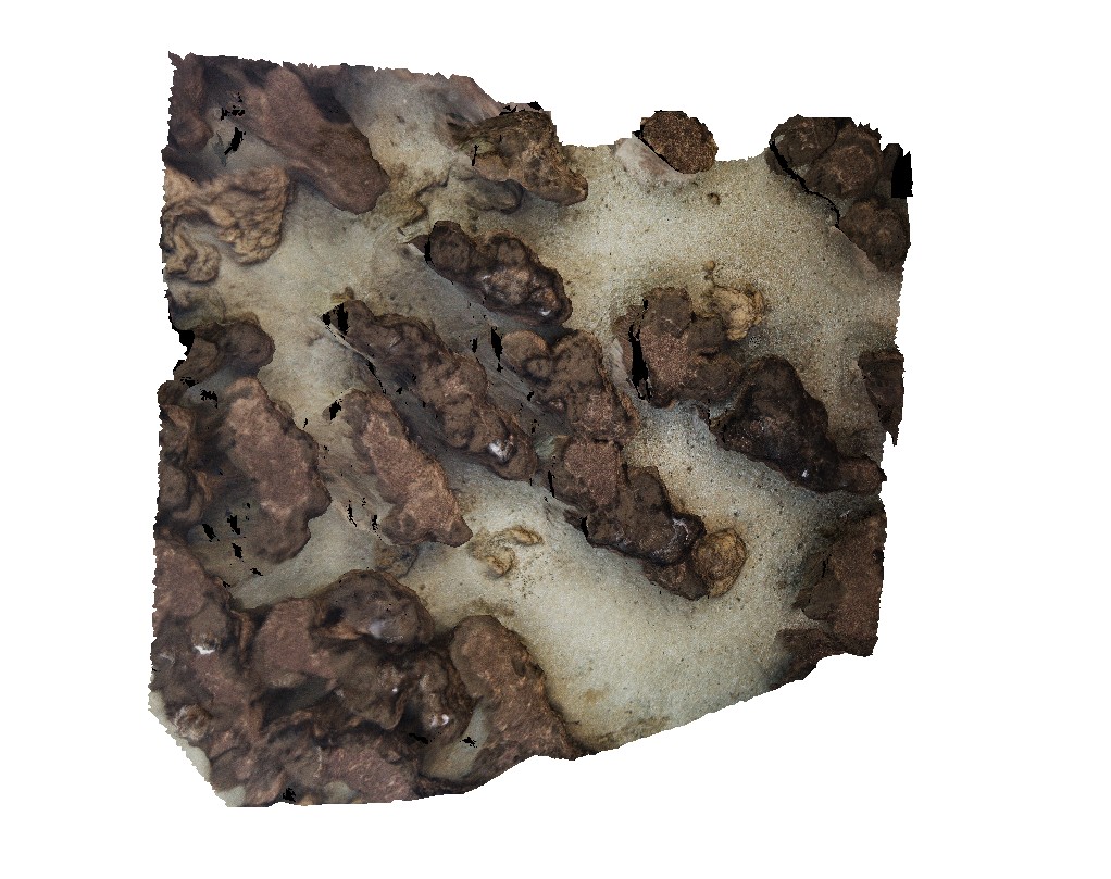
Hamelin8 Map
 |
0 |
05/23/2016 noon |
3D |
view of submerged stromatolite colony and interspaced fine sediment. Hamelin Pool. Shark Bay, W.A. |
3.90 |
-24.40056000000 |
114.15903000000 |
-9999.000 |
tidal flat deposits, stromatolites |
tidal flat deposits |
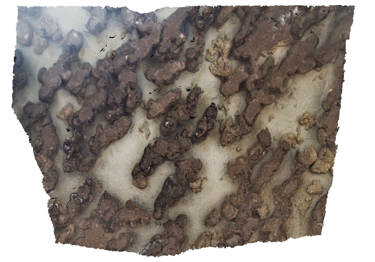
Hamelin7 Map
 |
0 |
05/23/2016 noon |
3D |
view of submerged stromatolite colony and interspaced fine sediment. Hamelin Pool. Shark Bay, W.A. |
3.20 |
-24.40056000000 |
114.15903000000 |
-9999.000 |
tidal flat deposits, stromatolites |
tidal flat deposits |