Prices3 Map
 |
20 |
06/20/2016 3:22 p.m. |
3D |
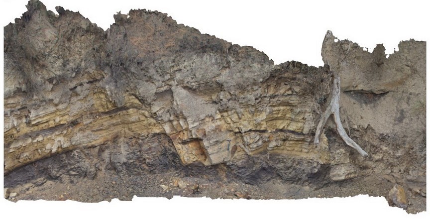
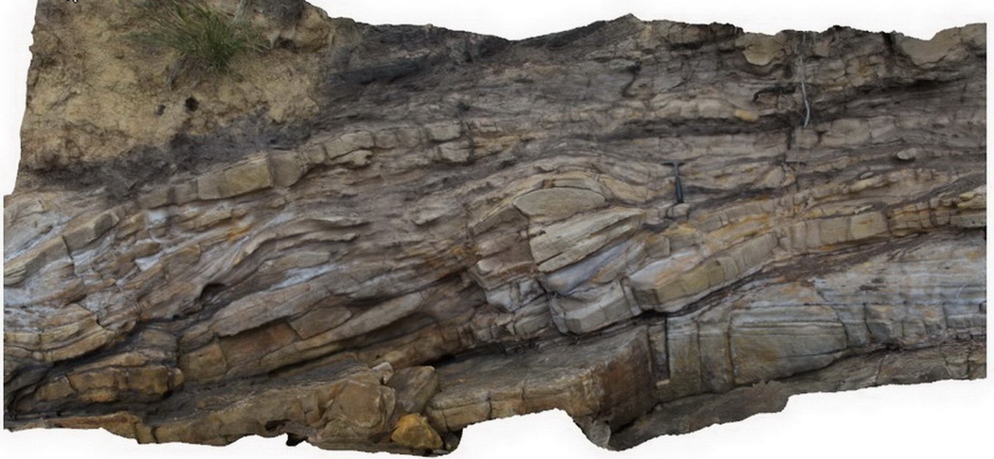
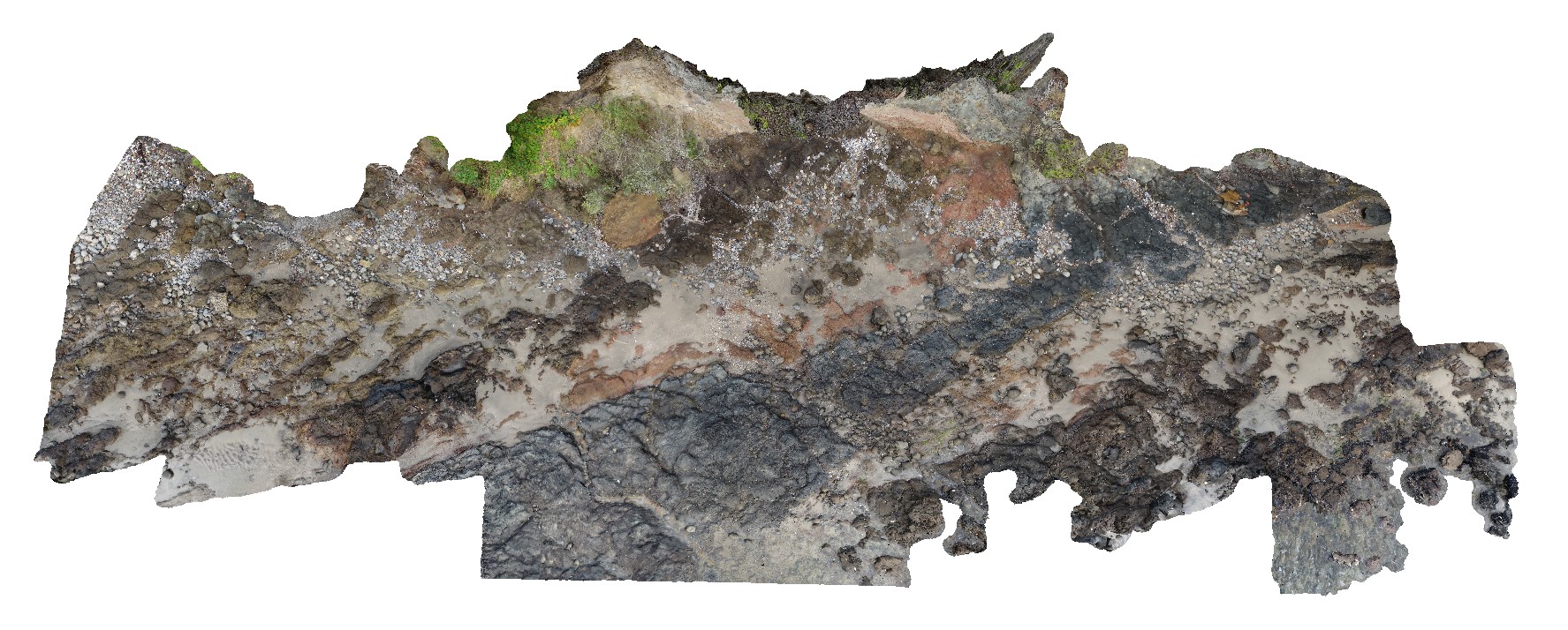
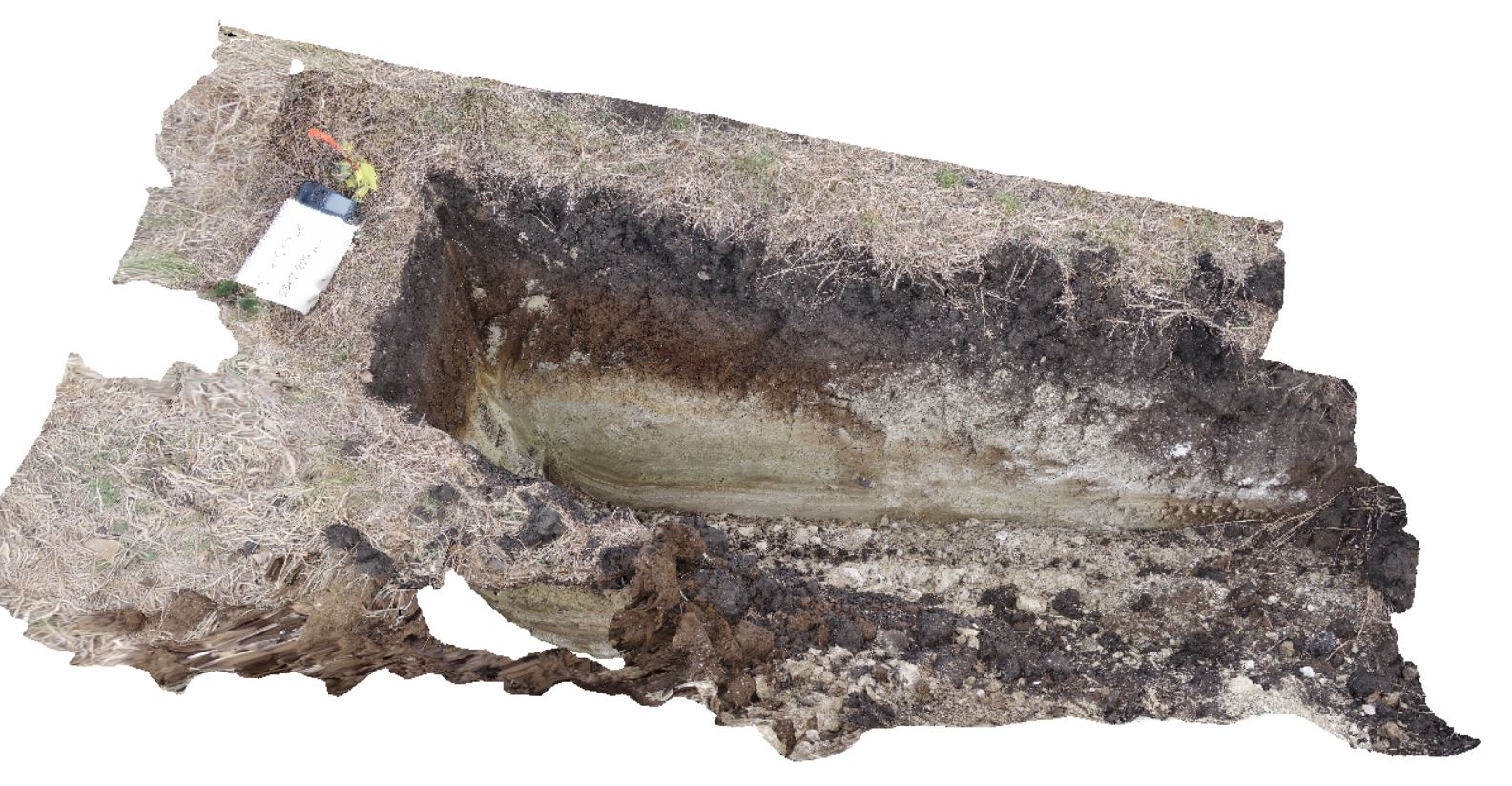
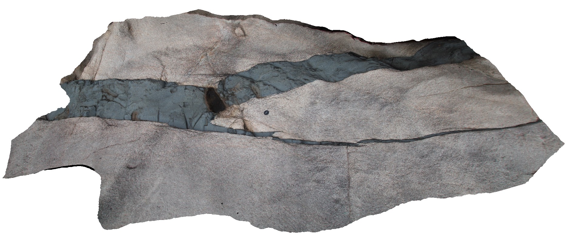
Normal faults disrupting Triassic sandstone and carbonaceous siltstone layers. Prices Point, Tasman Peninsula, Tasmania. |
13.00 |
-43.03491300000 |
147.74760800000 |
0.500 |
fluvial sediments, normal fault, sandstone, siltstone, structure, sedimentology |
sandstone, siltstone |
Prices4 Map
 |
20 |
03/13/2015 9:13 a.m. |
3D |
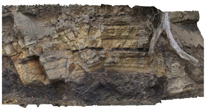
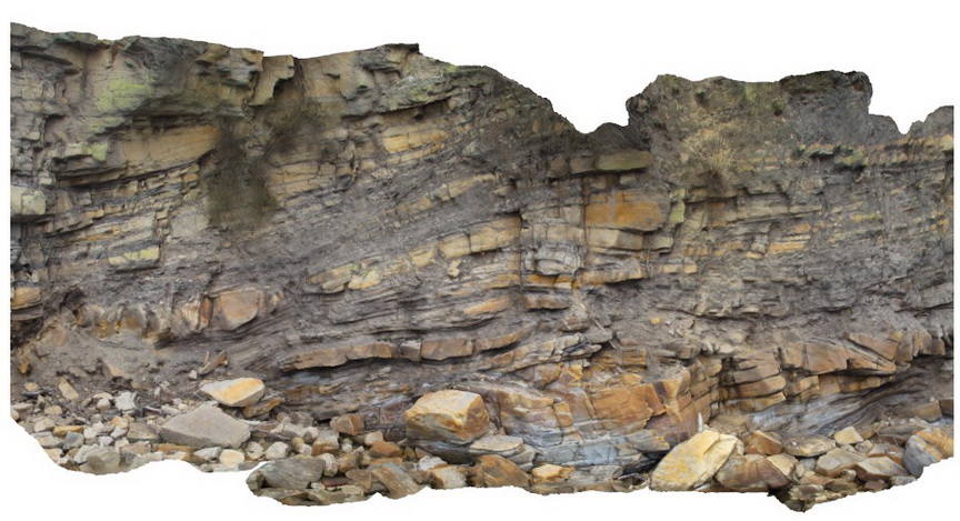
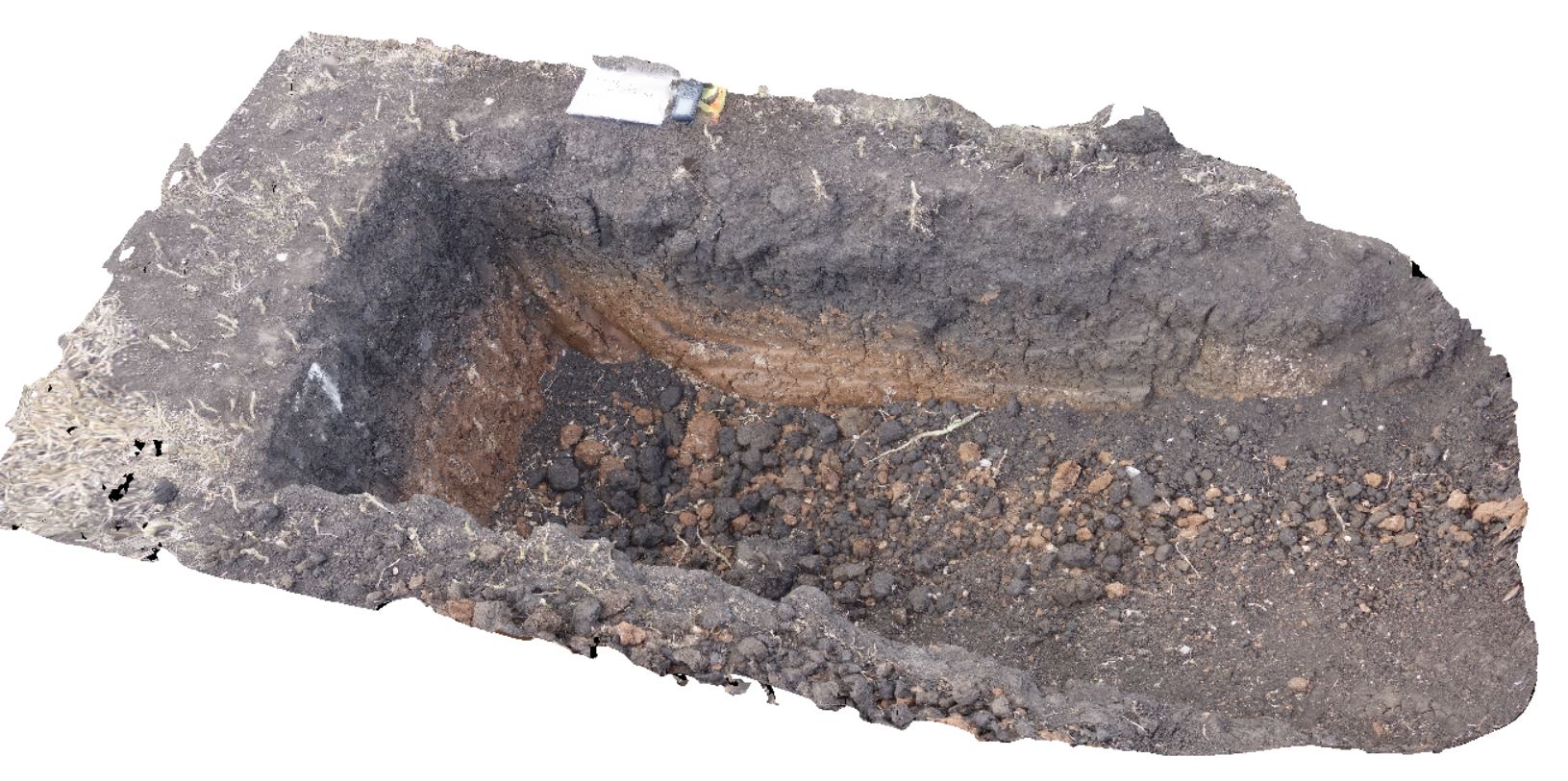
Normal faults disrupting Triassic sandstone and siltstone layers - detail view of Prices3. Prices Point, Tasman Peninsula, Tasmania. |
7.00 |
-43.03492200000 |
147.74760300000 |
0.500 |
normal fault, sandstone, siltstone, fluvial sediments, structure, sedimentology |
sandstone, siltstone |
Prices5 Map
 |
20 |
03/13/2015 9:13 a.m. |
3D |
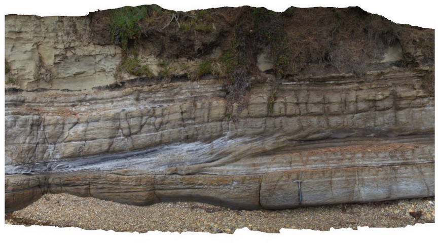
Cross bedded 'prograding' Triassic sandstone unit with clear erosional truncation. Prices Point, Tasman Peninsula, Tasmania. |
8.00 |
-43.03478900000 |
147.74734900000 |
0.500 |
cross bedding, sandstone, fluvial, sedimentology |
sandstone |
Prices6 Map
 |
20 |
03/13/2015 9:13 a.m. |
3D |
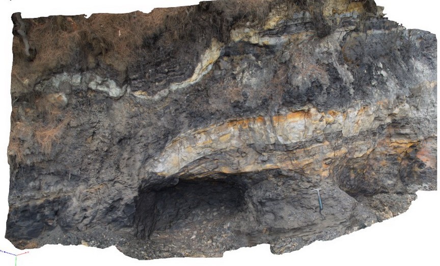
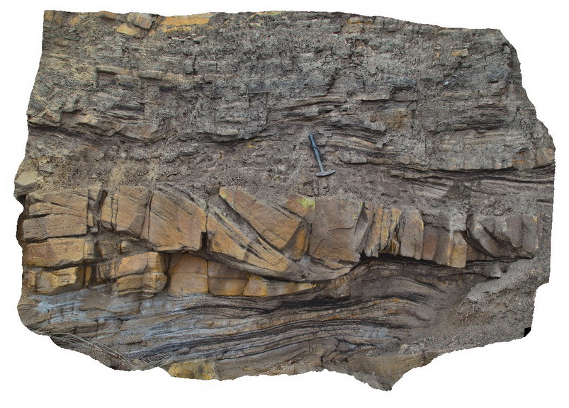
Thrust? Fault cross cutting Triassic carbonaceous siltstone and sandstone. Prices Point, Tasman Peninsula, Tasmania. |
10.00 |
-43.03390900000 |
147.74637700000 |
0.500 |
thrust fault, siltstone, sandstone, fluvial, structure |
siltstone, sandstone |
Prices7 Map
 |
20 |
03/13/2015 9:13 a.m. |
3D |
Cross beds and channels in Triassic fluvial sediments. Prices Point, Tasman Peninsula, Tasmania. |
10.00 |
-43.03379200000 |
147.74610800000 |
0.500 |
sandstone, cross beds, fluvial, channel, sedimentology |
sandstone |
Prices8 Map
 |
20 |
03/13/2015 9:13 a.m. |
3D |
Triassic fluvial/floodplain sediments. Prices Point, Tasman Peninsula, Tasmania. |
10.00 |
-43.03366100000 |
147.74592300000 |
0.500 |
fluvial, floodplain, sedimentology |
sandstone |
Prices9 Map
 |
20 |
03/13/2015 9:13 a.m. |
3D |
Cross bedded channel sandstone body in fine grained carbonaceous floodplain sediments. Prices Point, Tasman Peninsula, Tasmania. |
5.00 |
-43.03359100000 |
147.74572400000 |
0.500 |
channel, cross bed, fluvial, floodplain, sedimentology |
sandstone, siltstone |
Prices10 Map
 |
20 |
03/13/2015 9:12 a.m. |
3D |
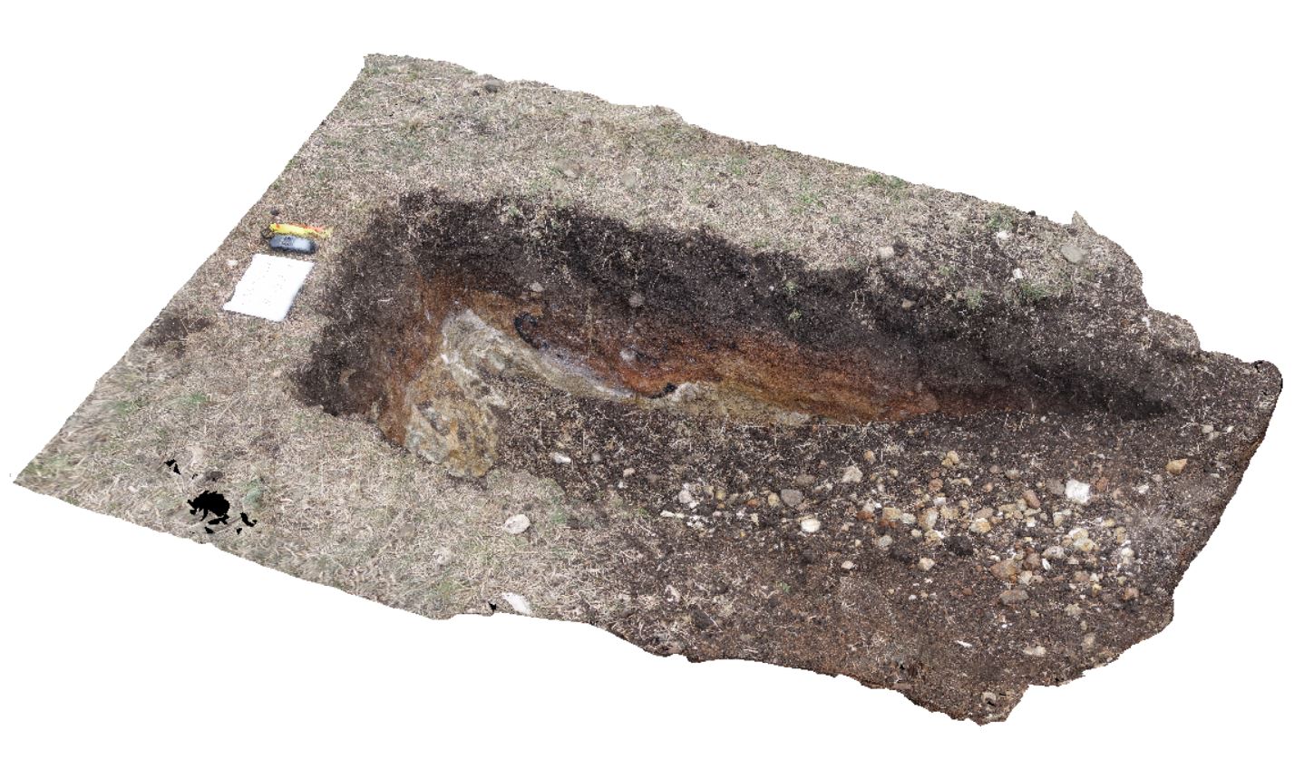
Fault contact in the shore platform between steeply dipping carbonaceous siltstone and horizontal siltstone - thrust fault? Prices Point, Tasman Peninsula, Tasmania. |
10.00 |
-43.03404100000 |
147.74658500000 |
0.500 |
fault, structure |
siltstone |
SBay1 Map
 |
20 |
03/13/2015 9:17 a.m. |
3D |
Pole photography of the Charles Darwin Cliff at Sandy Bay. Tertiary basaltic lava flows and pyroclastic material deposited from a small volcanic vent approximately 200m to the west |
25.00 |
-42.91649600000 |
147.36026000000 |
-9999.000 |
basalt, tuff, agglomerate, volcanology, igneous |
basalt, tuff |
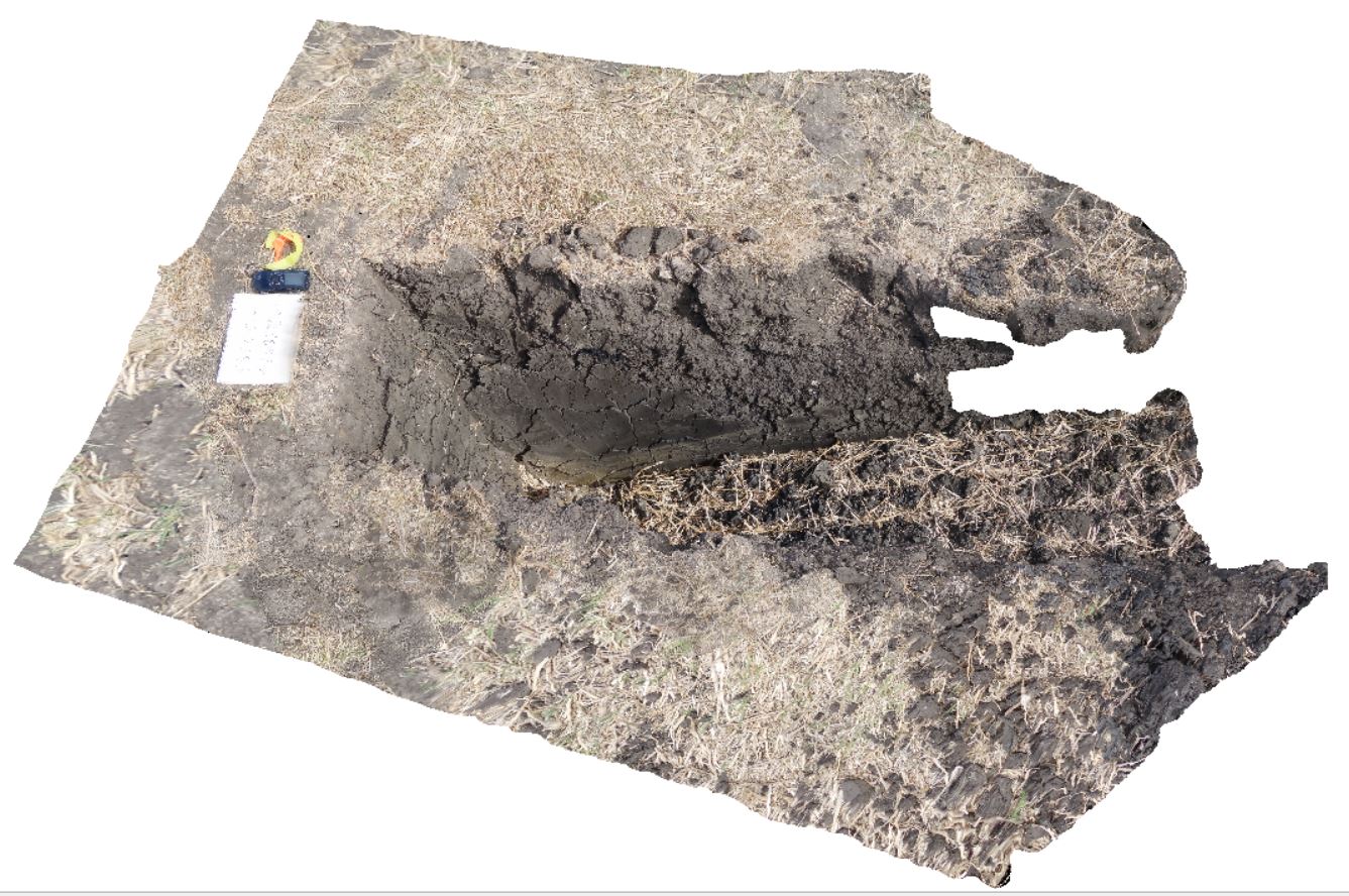
DaisyBanksPit1 Map
 |
20 |
03/17/2015 1:18 p.m. |
3D |
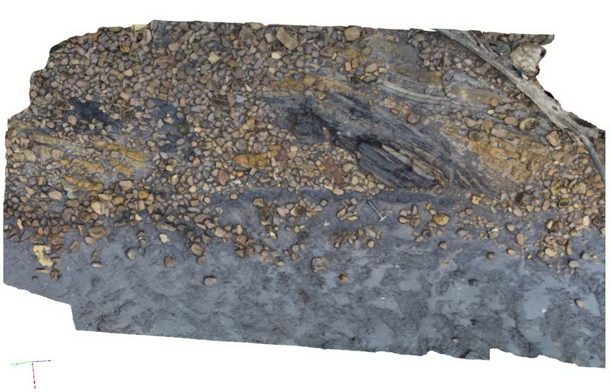
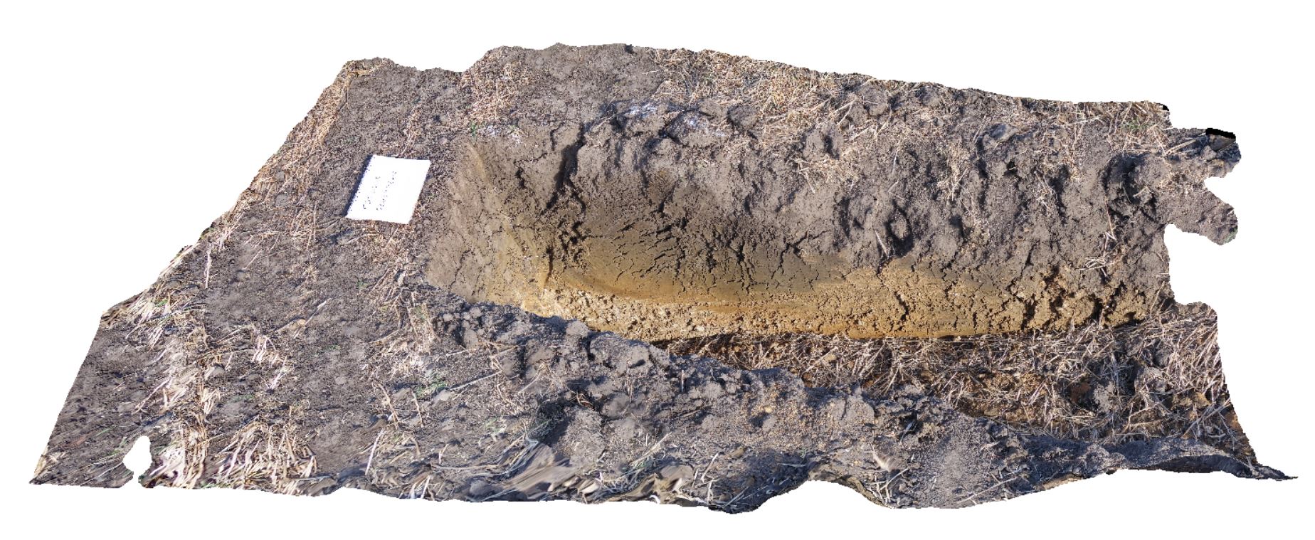
Undifferentiated alluvial soils and clays developed on Quaternary alluvial terrace gravel deposits predominantly derived from Parmeener and Palaeogene-Neogene units with clasts commonly of basalt and in places dolerite. Richmond, Tas. |
2.00 |
-42.73095300000 |
147.43018100000 |
-9999.000 |
clay, alluvium, regolith |
clay |
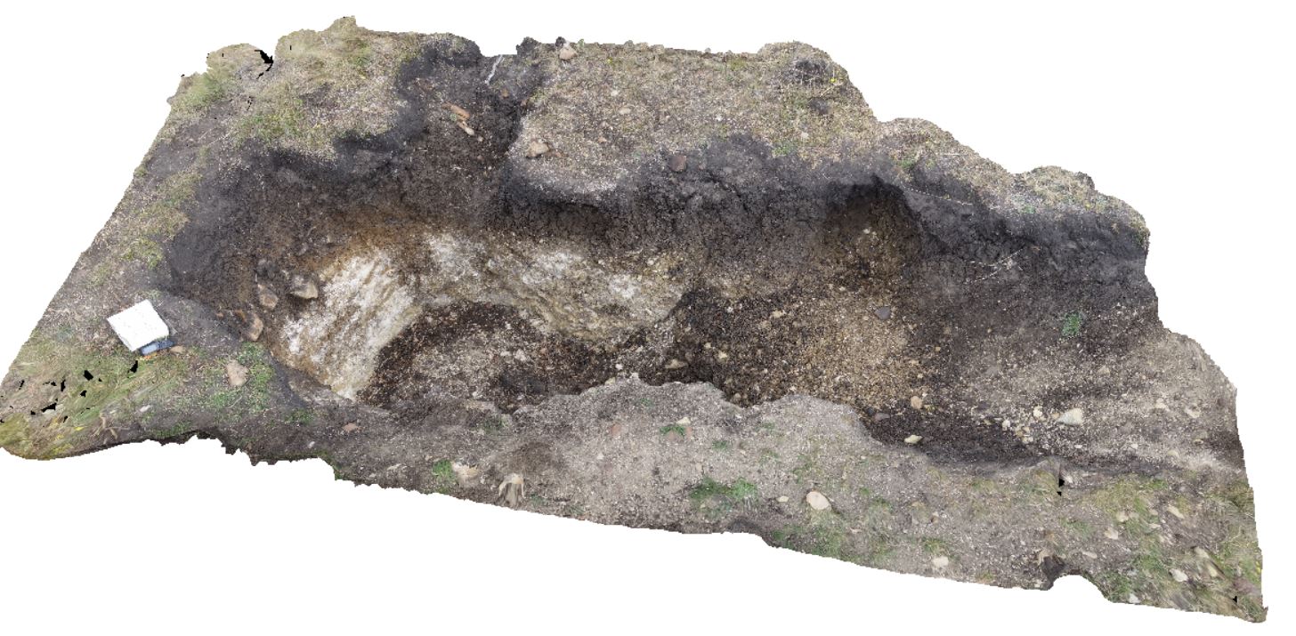
DaisyBanksPit2 Map
 |
20 |
03/17/2015 1:33 p.m. |
3D |
~80cm deep pit into soil and clays overlying quaternary alluvial deposits. Richmond, Tas. |
2.00 |
-42.73141700000 |
147.43138200000 |
-9999.000 |
clay, alluvium, regolith |
clay |
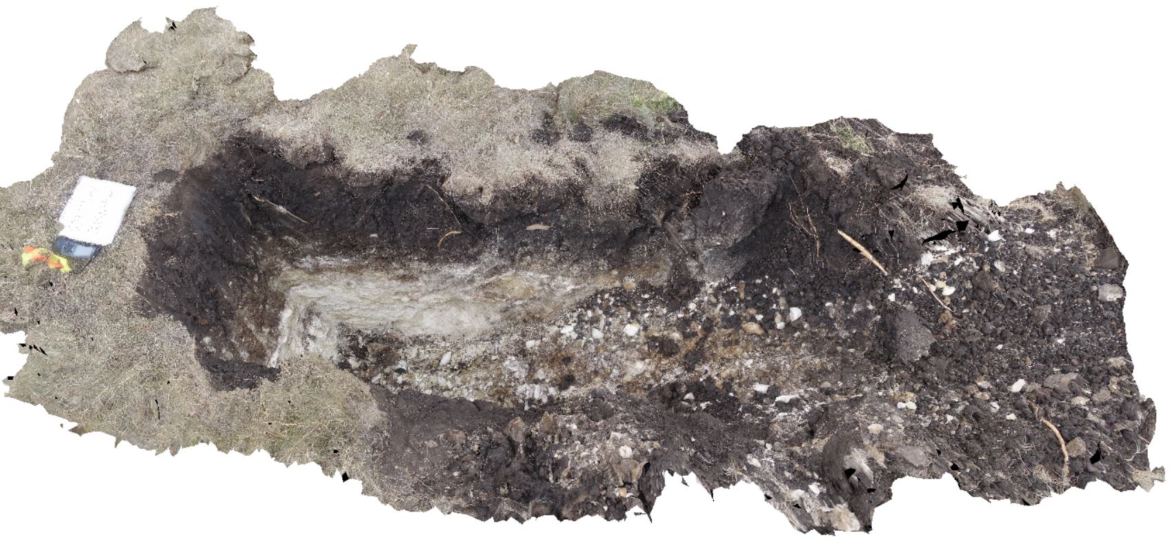
DaisyBanksPit3 Map
 |
20 |
03/17/2015 1:37 p.m. |
3D |
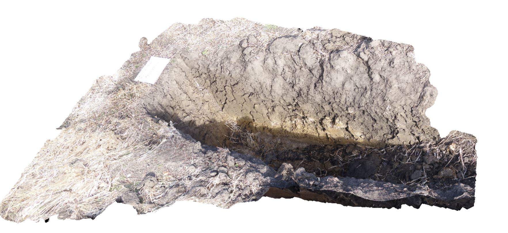
~80cm deep pit into soil and clays overlying Quaternary alluvial and marsh deposits of modern flood plains; of gravel, sand, silt and clay. Richmond, Tas. |
2.00 |
-42.73071600000 |
147.42842100000 |
-9999.000 |
clay, alluvium, regolith |
Clay |
DaisyBanksPit4 Map
 |
20 |
03/17/2015 1:45 p.m. |
3D |
~80cm deep pit into soil and clays overlying Quaternary alluvial and marsh deposits of modern flood plains; of gravel, sand, silt and clay. Richmond, Tas. |
2.00 |
-42.73176200000 |
147.42817100000 |
-9999.000 |
Clay, alluvium, regolith |
Clay |
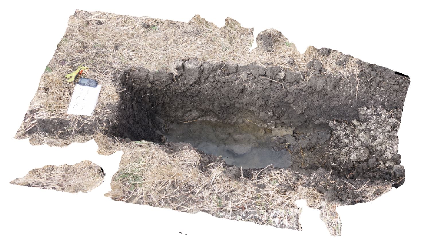
DaisyBanksPit5 Map
 |
20 |
03/17/2015 1:50 p.m. |
3D |
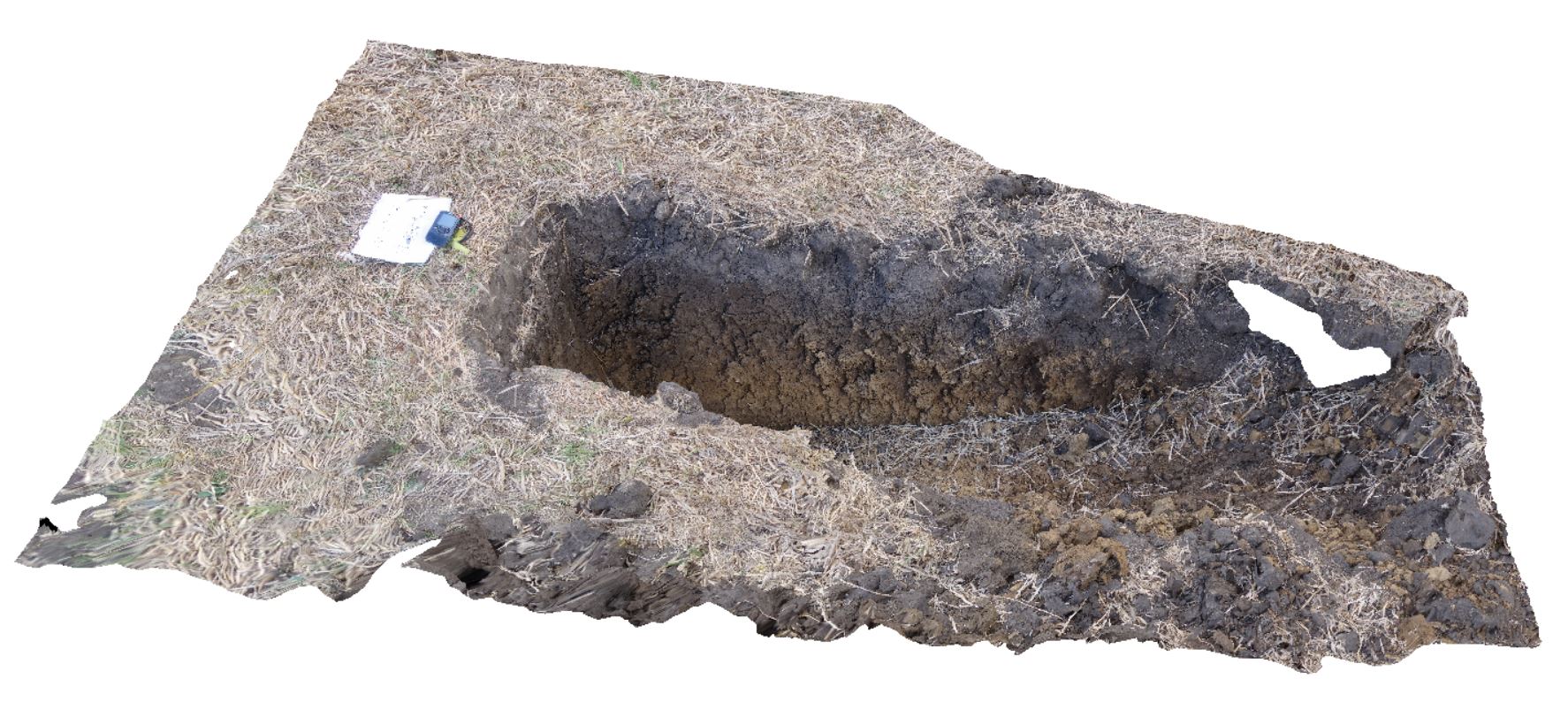
~80cm wide pit into recent sediments overlying Quaternary alluvial and marsh deposits of modern flood plains; of gravel, sand, silt and clay. Richmond, Tas. |
2.00 |
-42.73253700000 |
147.42790800000 |
-9999.000 |
palaeochannel, alluvial, regolith |
Gravel |
DaisyBanksPit6 Map
 |
20 |
03/17/2015 1:54 p.m. |
3D |
~80cm deep pit into soil and clays overlying Quaternary alluvial and marsh deposits of modern flood plains; of gravel, sand, silt and clay. Richmond, Tas. |
2.00 |
-42.73310300000 |
147.43077000000 |
-9999.000 |
clay, alluvial, regolith |
clay |
DaisyBanksPit7 Map
 |
20 |
03/17/2015 2 p.m. |
3D |
Undifferentiated alluvial soils and clays developed on Quaternary alluvial terrace gravel deposits predominantly derived from Parmeener and Palaeogene-Neogene units with clasts commonly of basalt and in places dolerite. Richmond, Tas. |
2.00 |
-42.73247900000 |
147.42657600000 |
-9999.000 |
clay, alluvial, regolith |
clay |
DaisyBanksPit8 Map
 |
20 |
03/17/2015 2:03 p.m. |
3D |
~80cm deep pit into soil and clays overlying Paleogene-Neogene silicified rock. Richmond, Tas. |
2.00 |
-42.73246200000 |
147.42641700000 |
-9999.000 |
clay, alluvial, regolith |
clay |
DaisyBanksPit9 Map
 |
20 |
03/17/2015 12:49 p.m. |
3D |
~80cm deep pit into soil and clays overlying late Cenozoic alluvial terrace deposits. Richmond, Tas. |
2.00 |
-42.72983600000 |
147.42554400000 |
-9999.000 |
clay, alluvial, regolith |
Clay |
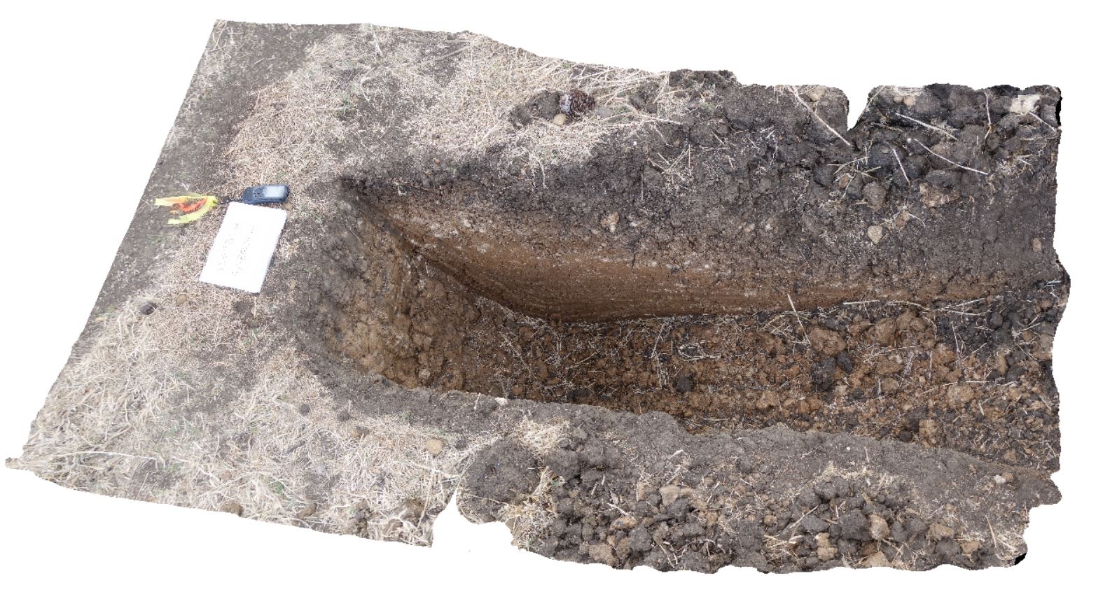
DaisyBanksPit10 Map
 |
20 |
03/23/2015 11:20 a.m. |
3D |
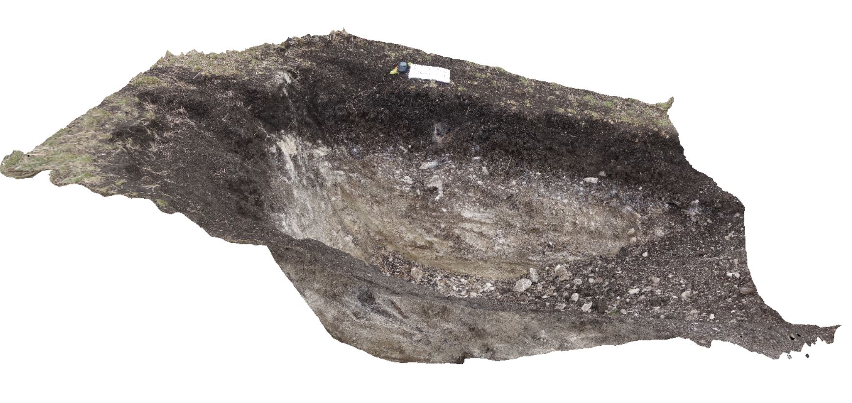
~80cm deep pit into Cenozoic soil and clays overlying (inferred) Jurassic Dolerite. Richmond, Tas. |
2.00 |
-42.73042400000 |
147.42464400000 |
-9999.000 |
Jurassic Dolerite, Clay, Alluvial, regolith |
Clay |
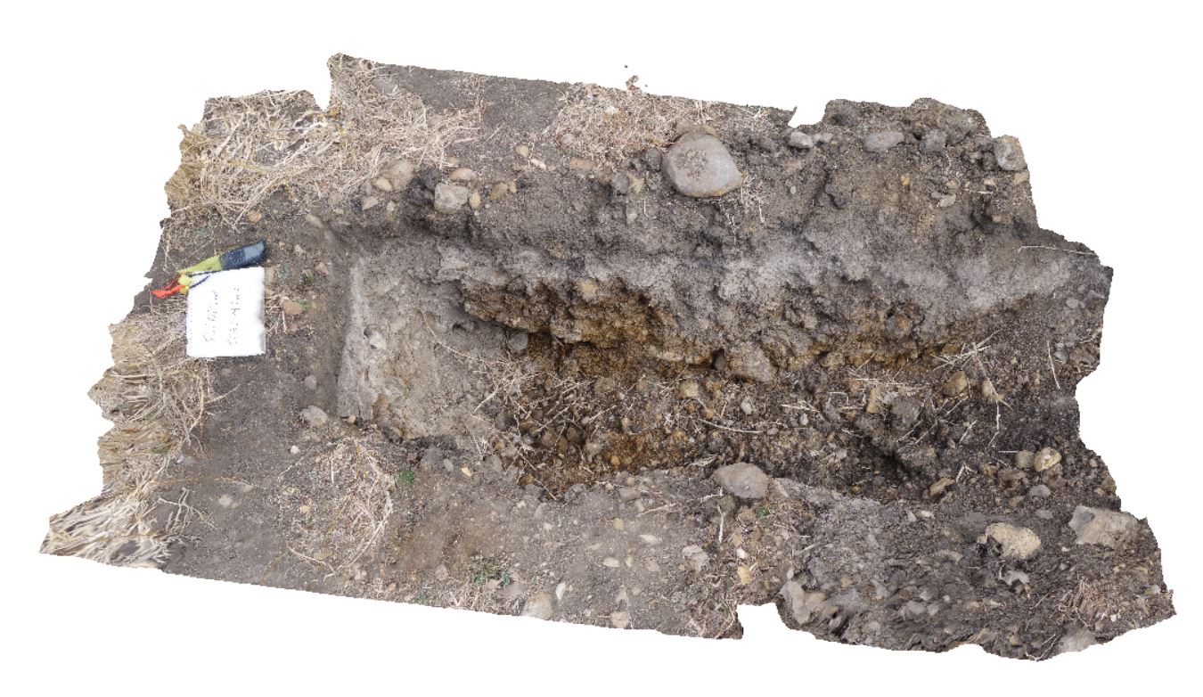
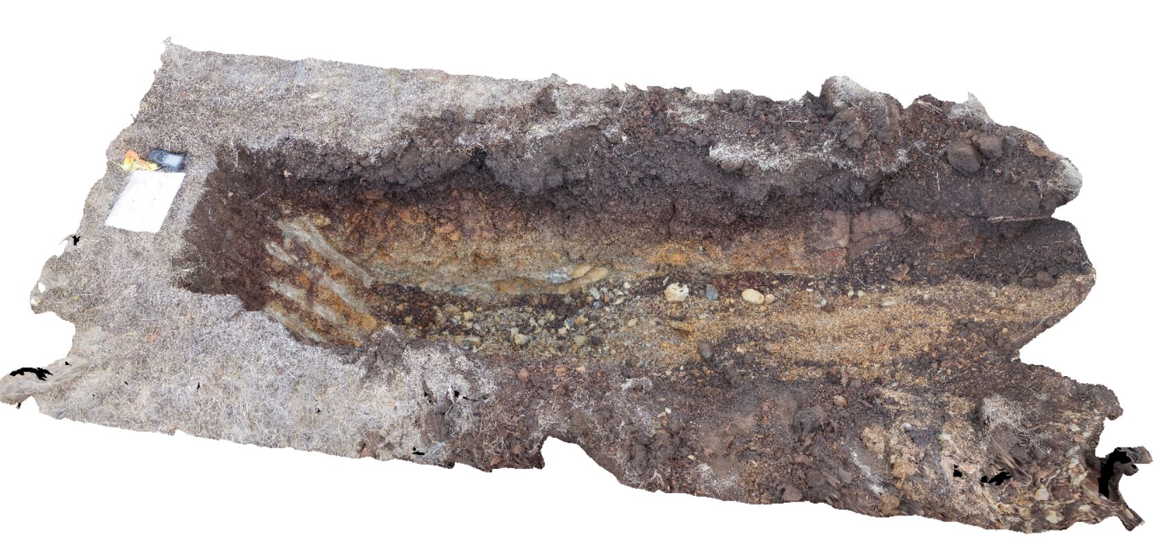
DaisyBanksPit11 Map
 |
20 |
03/23/2015 11:25 a.m. |
3D |
~80cm pit into dark grey sandy soils and white-brown sandy clay overlying Triassic interbedded micaceous brown, red-purple, green and grey carbonaceous siltstone, shale, mudstone and sandstone. Richmond, Tas. |
2.00 |
-42.72936200000 |
147.42457600000 |
-9999.000 |
clay, regolith |
clay |
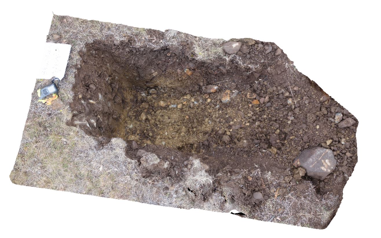
DaisyBanksPit12 Map
 |
20 |
03/23/2015 12:11 p.m. |
3D |
~80cm pit into dark grey sandy soils and white-brown sandy clay overlying Jurassic Dolerite. Richmond, Tas. |
2.00 |
-42.72939600000 |
147.42269500000 |
-9999.000 |
clay, Jurassic Dolerite, regolith |
clay |
DaisyBanksPit13 Map
 |
20 |
03/23/2015 12:07 p.m. |
3D |
~80cm pit into dark grey sandy soils and white-brown sandy clay overlying Jurassic Dolerite. Richmond, Tas. |
2.00 |
-42.72961200000 |
147.42258600000 |
-9999.000 |
clay, Jurassic Dolerite, regolith |
clay |
DaisyBanksPit14 Map
 |
20 |
03/24/2015 10:06 a.m. |
3D |
~80cm pit into dark grey sandy soils and white-brown sandy clay overlying Jurassic Dolerite. Richmond, Tas. |
2.00 |
-42.73006300000 |
147.42246700000 |
-9999.000 |
Clay, Jurassic Dolerite, regolith |
Clay |
DaisyBanksPit15 Map
 |
20 |
03/24/2015 9:47 a.m. |
3D |
~80cm pit into dark grey sandy soils and white-brown sandy clay overlying Jurassic Dolerite. Richmond, Tas. |
2.00 |
-42.73051200000 |
147.42269000000 |
-9999.000 |
Clay, Jurassic Dolerite, regolith |
clay |
Jourama5 Map
 |
20 |
04/28/2016 3:34 p.m. |
3D |
Dolerite dykes intruding granite with aplite veins. Clear examples of small scale intrusive structures. Jourama Falls, QLD. |
5.00 |
-18.86580100000 |
146.12719000000 |
120.000 |
Granite, dolerite dyke swarm, cross cutting relationships, igneous |
Granite, dolerite |