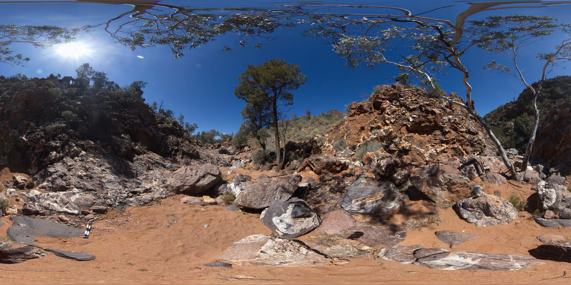
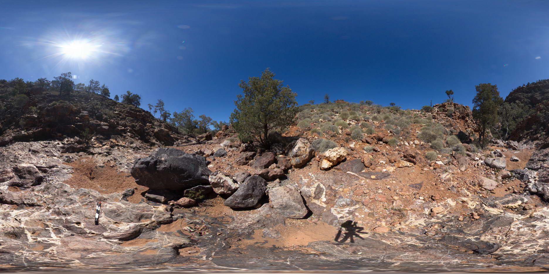
TowerHillGIGA1 Map
 |
10 |
01/01/9999 midnight |
GIGA |
— |
0.00 |
-38.32723000000 |
142.36790000000 |
-9999.000 |
|
tuff |
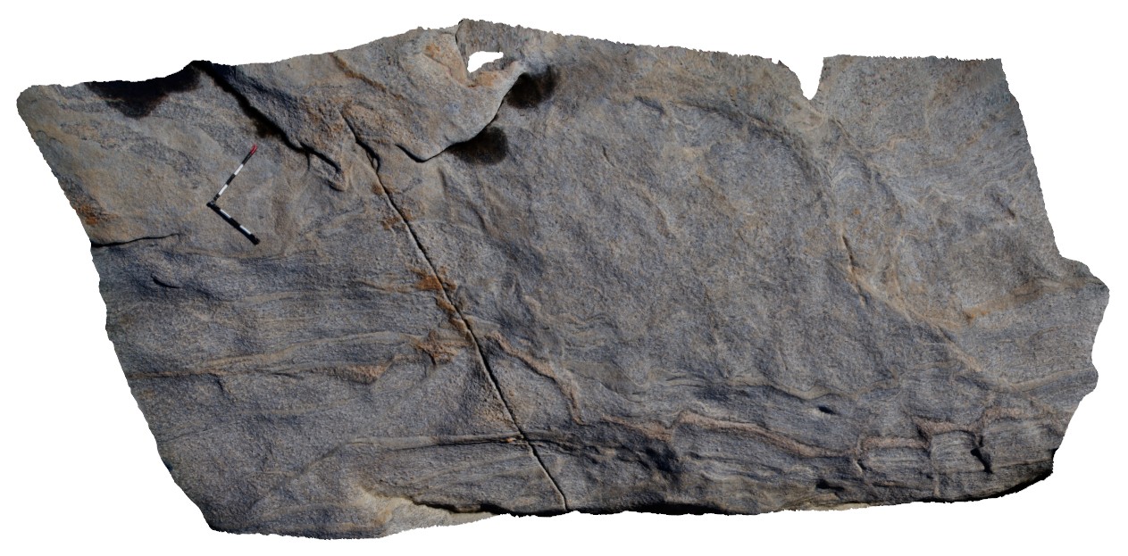
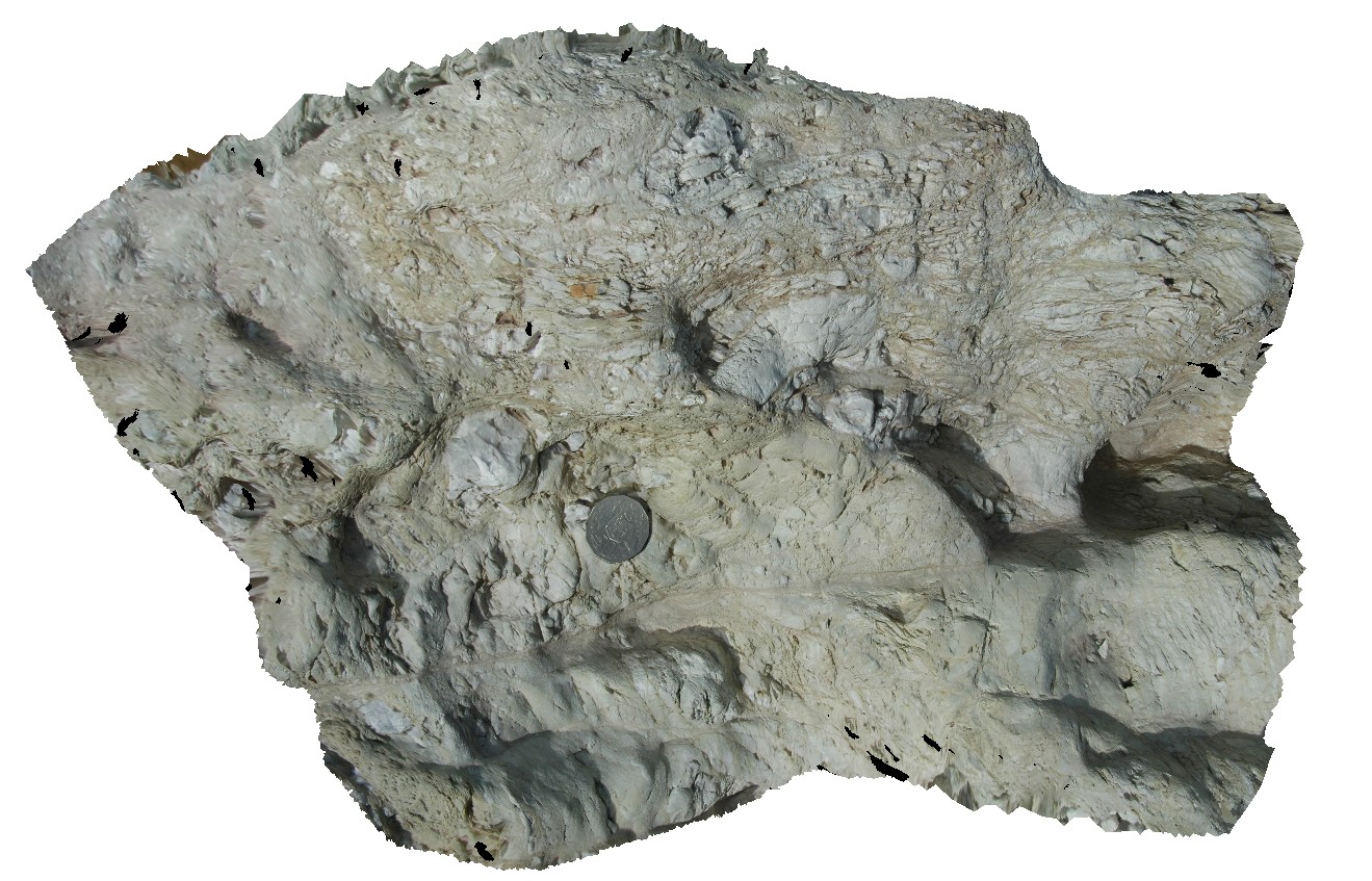
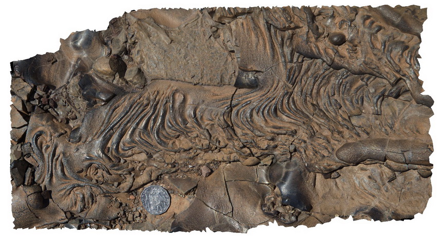
Weetootla8 Map
 |
0 |
09/27/2015 4:34 p.m. |
3D |
detail of carbonate breccia within bedding. Weetootla gorge. |
0.00 |
-30.48112000000 |
139.22684000000 |
-9999.000 |
breccia, sedimentology |
carbonate |
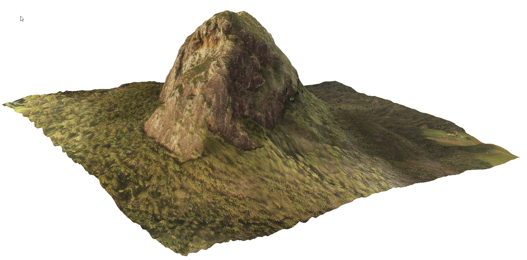
CapeWickham9 Map
 |
5 |
04/25/2015 11:52 a.m. |
3D |
steeply plunging fold hinge in quartzite and pelites. Cape Wickham, King Island. Tasmania. |
0.00 |
-39.59211212000 |
143.92782848000 |
2.000 |
fold hinge, fold, structure, metamorphic |
quartzite |
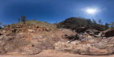
ArkaroolaFSP6 Map
 |
5 |
11/26/2015 2:08 p.m. |
FSP |
Outcrop on edge of creek bed showing granitic and hematitic breccias cross cut by quartz veining. Creek below Mt Gee, Arkaroola. Northern Flinders Ranges, S.A. |
0.00 |
-30.22874000000 |
139.34581000000 |
-9999.000 |
rebrecciated breccia, quartz veins |
Sinter |
Blinman14 Map
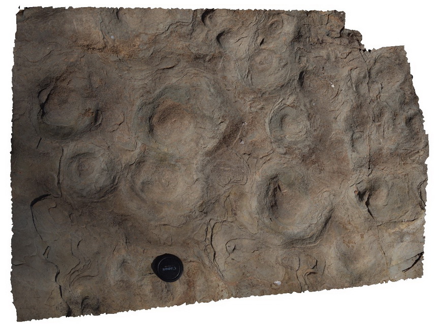 |
0 |
11/12/2015 10:16 a.m. |
3D |
Stromatolites. A view of domes and bedding surface, Blinman pools walking trail. Blinman, S.A. |
0.00 |
-31.12909000000 |
138.57231000000 |
-9999.000 |
stromatolites, palaeontology |
carbonate |
Bluestone15 Map
 |
0 |
04/07/2016 10:18 a.m. |
3D |
crosscutting relationships in aplite dykes through granodiorite. Bluestone Bay, Tasmania. |
0.00 |
-42.10278000000 |
148.33778000000 |
-9999.000 |
aplite, dyke, crosscutting |
granodiorite, aplite |
ArkaroolaFSP3 Map
 |
5 |
11/26/2015 2:08 p.m. |
FSP |
aerial view of the Pinnacles, pegmatitic intrusions and surrounding sediments, Arkaroola. Northern Flinders Ranges, S.A. |
0.00 |
-30.29877000000 |
139.30951000000 |
-9999.000 |
leucogranite |
granite |
ArkaroolaFSP1 Map
 |
5 |
11/26/2015 2:04 p.m. |
FSP |
view from 'the pinnacle', Arkaroola. Northern Flinders Ranges, S.A. |
0.00 |
-30.29705000000 |
139.31039000000 |
-9999.000 |
leucogranite |
granite |
WestBeach5 Map
 |
0 |
06/05/2016 10:50 a.m. |
3D |
'M' folding in garnet schist, West Beach, W.A. |
0.00 |
-33.95352000000 |
119.97489000000 |
-9999.000 |
M folds, structure, garnet schist |
garnet schist |
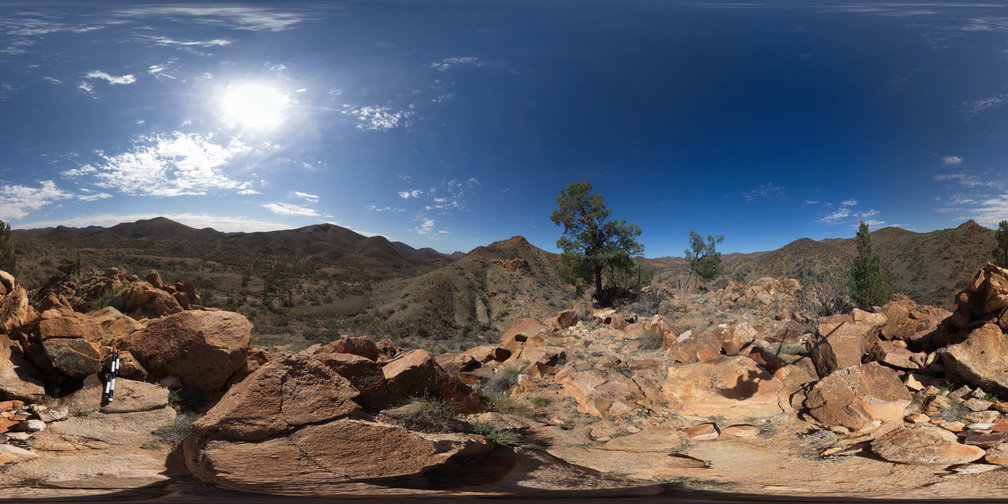
TibrogargunUAV1 Map
 |
0 |
04/18/2016 10:22 a.m. |
UAV |
location inferred from Google Earth |
0.00 |
-26.92724900000 |
152.94669600000 |
-9999.000 |
|
|
MtGipps4 Map
 |
0 |
06/25/2016 noon |
3D |
Adelaidean diamictite. Mount Gipps, N.S.W. |
0.00 |
-31.60959000000 |
141.52582000000 |
-9999.000 |
diamictite, Adelaidean, structure |
diamictite |
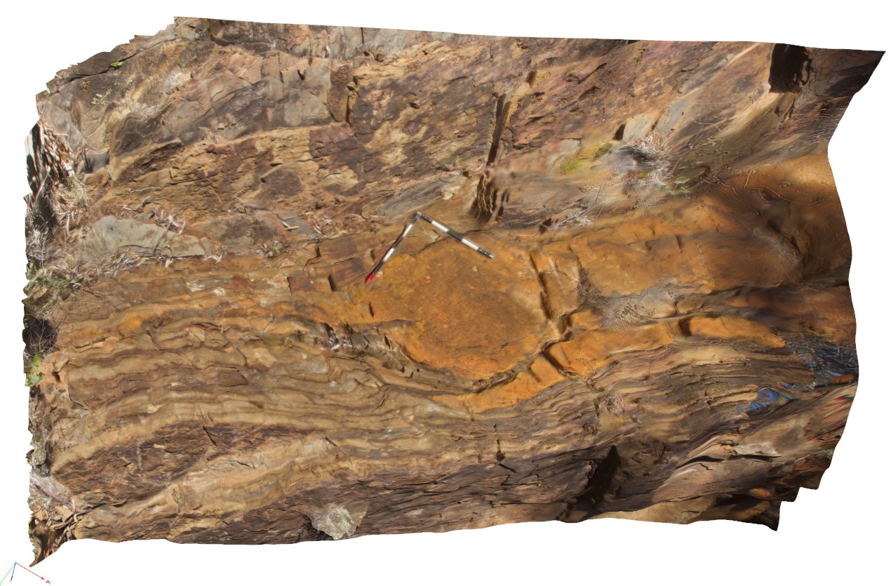
Weetootla19 Map
 |
0 |
09/27/2015 4:23 p.m. |
3D |
finely bedded mudstone and carbonate exhibiting parasitic folding. Fold vergence relationships around a large fold hinge. Weetootla Creek. |
0.00 |
-30.47623000000 |
139.24344000000 |
-9999.000 |
parasitic fold, structure |
carbonate |
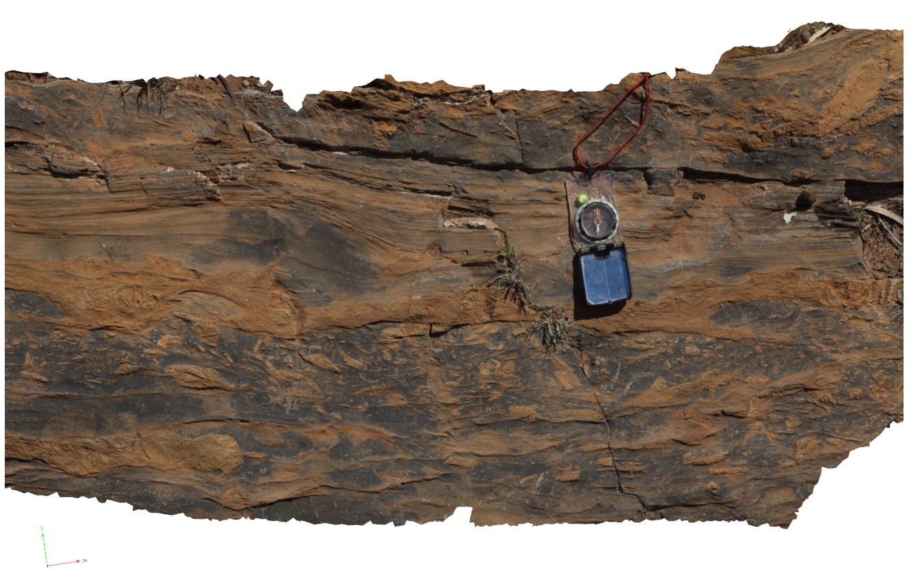
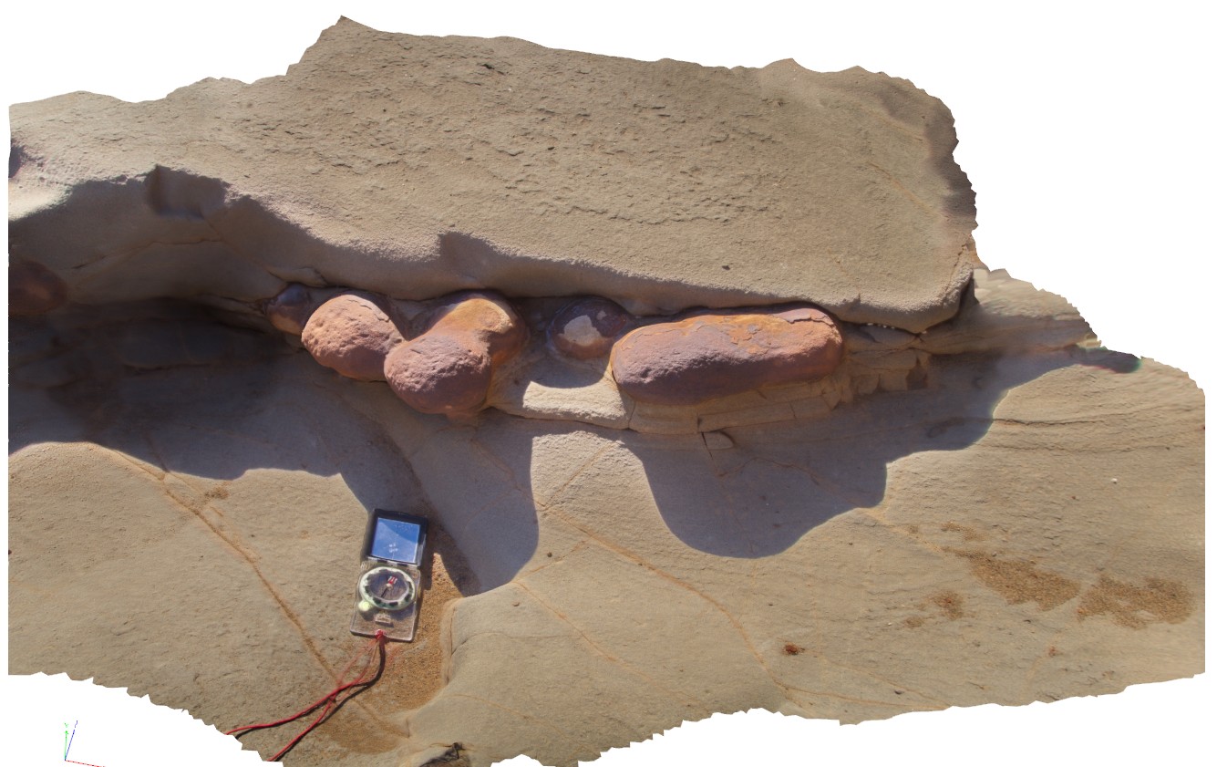
Weetootla1 Map
 |
0 |
09/27/2015 4:15 p.m. |
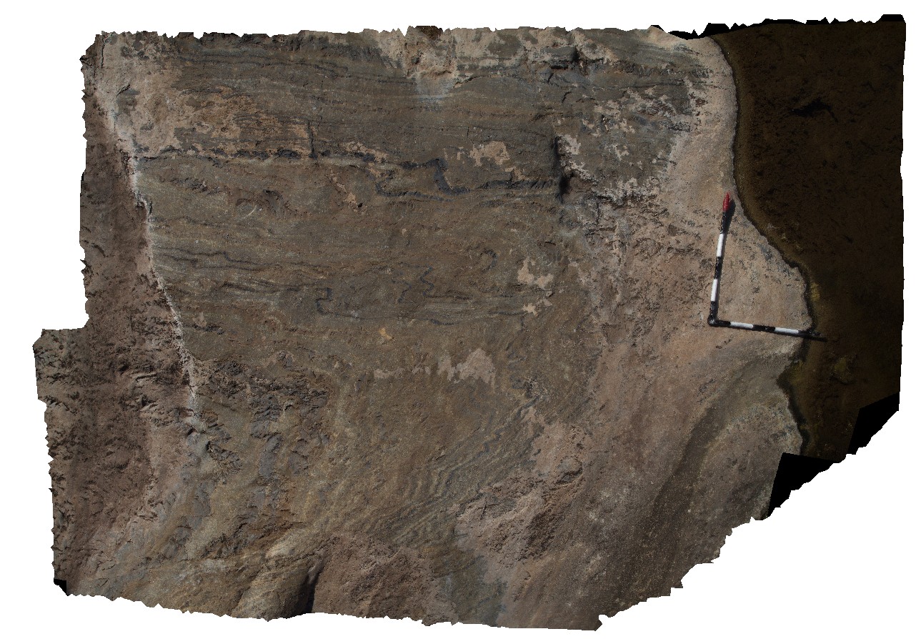
3D |
bedded carbonate / dolomite and mudstone of the Balcanoona Formation. Layered units are gently folded around large LS clasts with discordant bedding. Balcanoona Creek. Weetootla. |
0.00 |
-30.48160000000 |
139.22211000000 |
-9999.000 |
discordant bedding |
carbonate |
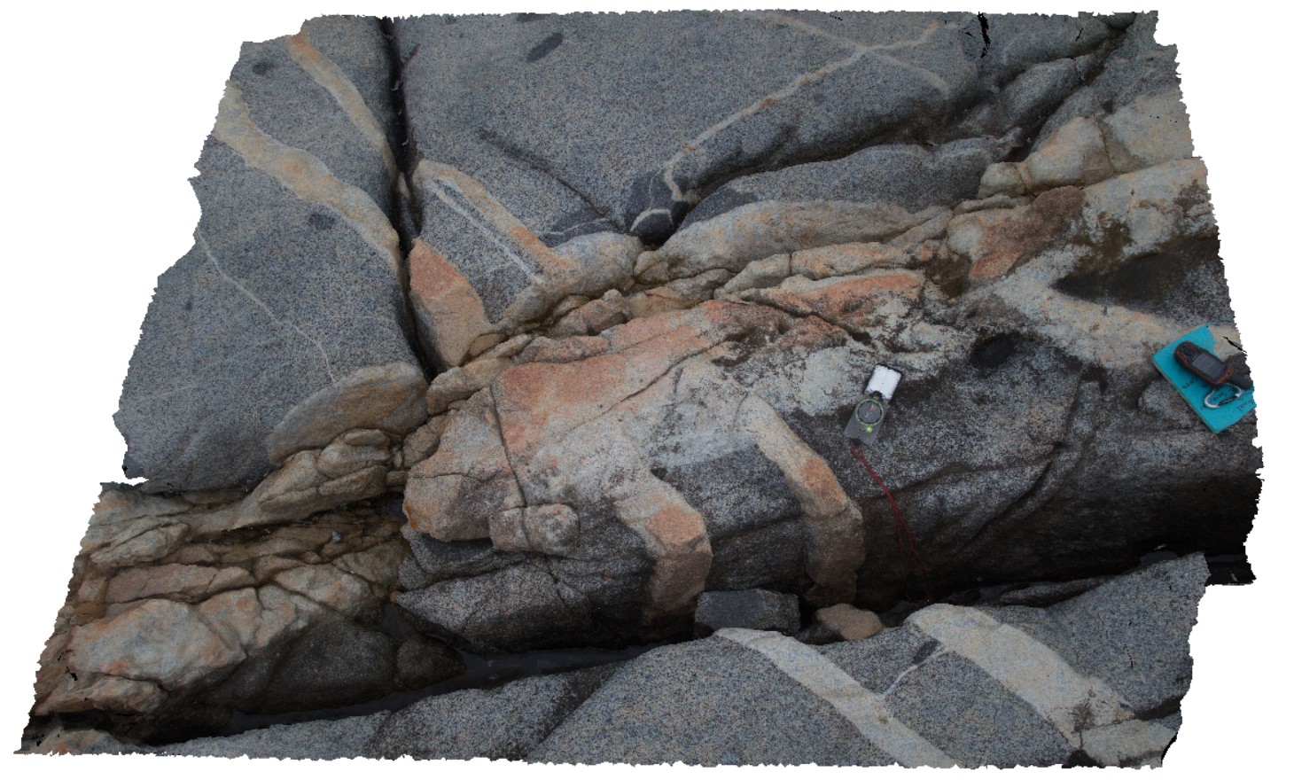
CapeArid8 Map
 |
0 |
06/05/2016 10:34 a.m. |
3D |
folded and sheared gneissic layering and leucosomes. Cape Arid. W.A. |
0.00 |
-33.90670000000 |
123.35329000000 |
-9999.000 |
shear, fold, leucosomes, gneissic layering |
gneiss |
CapeAridUAV1 Map
 |
0 |
06/05/2016 10:37 a.m. |
UAV |
aerial view of gneissic rocks with thick compositional layering and shears. Cape Arid, W.A. |
0.00 |
-33.90596000000 |
123.35376000000 |
-9999.000 |
gneiss, shear, compositional layering |
gneiss |
WreckBeach12 Map
 |
0 |
06/14/2016 2:38 p.m. |
3D |
view of concretion horizons in cross-bedded sandstone. Wreck Beach, Vic. |
0.00 |
-38.75724000000 |
143.21513000000 |
-9999.000 |
concretions, cross-beds, sedimentology |
sandstone |
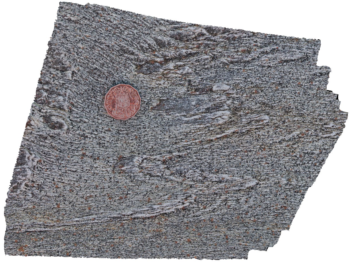
AmadFSP5 Map
 |
5 |
08/01/2016 12:07 p.m. |
FSP |
panorama view from western end of Mac Donnell Range from Taylors Pass. Gosse Bluff to the south. N.T. |
0.00 |
-23.67139200000 |
132.36578700000 |
832.751 |
conglomerate |
conglomerate |
HastingsPt2 Map
 |
1 |
07/09/2015 4:27 p.m. |
3D |
fold in metasediments in offshore rock - approximately 2.5m across. Devonian - Carboniferous Neranleigh-Fernvale Beds. Hastings Point, QLD. |
0.00 |
-28.33676000000 |
153.57729000000 |
-9999.000 |
fold, structure |
sandstone |
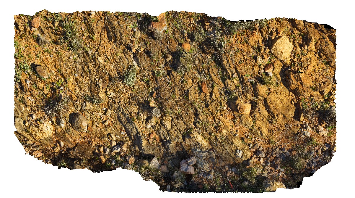
Pedder25 Map
 |
5 |
03/16/2015 2:28 p.m. |
3D |
fault contact with surrounding sediments, showing cataclasite and shear structures. Lake Pedder, south west Tasmania. |
0.00 |
-42.95896997000 |
146.13457732000 |
-9999.000 |
shear, fault, cataclasite |
mudstone |
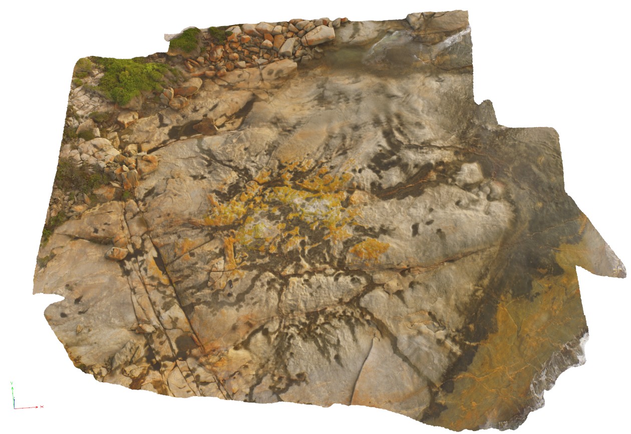
ArkaroolaFSP7 Map
 |
5 |
11/26/2015 2:14 p.m. |
FSP |
pavement exposure of breccia cross cut by quartz veining in creek bed, Arkaroola. Northern Flinders Ranges, S.A. |
0.00 |
-30.22880000000 |
139.34572000000 |
-9999.000 |
breccia, quartz veining |
breccia |
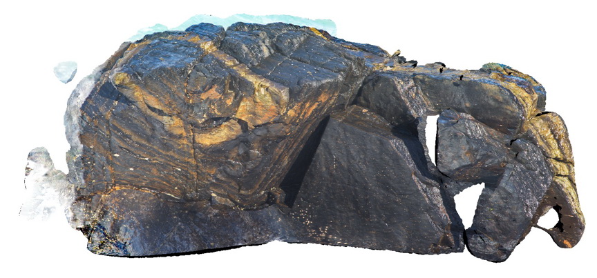
Blinman6 Map
 |
0 |
11/12/2015 10:13 a.m. |
3D |
Detail of ropy, flow textures in slag. Blinman Mine. Blinman, S.A. |
0.00 |
-31.08684000000 |
138.67450000000 |
-9999.000 |
slag, ropy flow banking |
Slag |
ArkaroolaFSP9 Map
 |
5 |
11/26/2015 3:14 p.m. |
FSP |
hematitic and granitic brecciated boulders and outcrop exposed in creek bed. Quartz veins cross-cut and also host breccia clasts. Arkaroola. Northern Flinders Ranges, S.A. |
0.00 |
-30.22888000000 |
139.34544000000 |
-9999.000 |
breccia, quartz veining |
breccia |
ArkaroolaFSP10 Map
 |
5 |
11/26/2015 3:14 p.m. |
FSP |
haematitic and granitic brecciated boulders and outcrop exposed in creek bed. Quartz veins cross-cut and also host breccia clasts. Arkaroola. Northern Flinders Ranges, S.A. |
0.00 |
-30.22888000000 |
139.34531000000 |
-9999.000 |
breccia, quartz veining |
breccia |
ArkaroolaFSP8 Map
 |
5 |
11/26/2015 3:14 p.m. |
FSP |
creek bed exposure of granitic and hematitic breccia cross-cut by quartz veining. Quartz veins host breccia clasts in some instances. Arkaroola. Northern Flinders Ranges, S.A. |
0.00 |
-30.22882000000 |
139.34558000000 |
-9999.000 |
breccia, quartz veining |
breccia |
Seaham1 Map
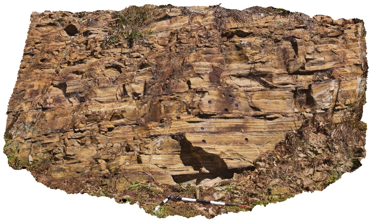 |
5 |
01/01/9999 midnight |
3D |
varved shales of the Seaham Formation with paleomag holes. Seaham, N.S.W. |
0.00 |
-32.66433000000 |
151.72768000000 |
-9999.000 |
varved, annual sediments, sedimentology, paleomagnetic dating |
shale |