Piccaninny10 Map
 |
50 |
01/01/9999 midnight |
3D |
granodiorite dyke with irregular intrusive contact with host turbidite package. Folding is present in the outcrop and in small dykelets. Piccaninny Point, eastern Tasmania. |
2.00 |
-41.69446100000 |
148.29395280000 |
5.000 |
dyke, intrusive contact, fold, structure |
turbidite, granodiorite |
Koonya1 Map
 |
50 |
01/01/9999 midnight |
3D |
fault cutting bedded siltstone Impression Bay, Tasman Peninsula. Tasmania. |
1.00 |
-43.05406380000 |
147.77316110000 |
0.000 |
fault, structure, sedimentology |
siltstone |
WeeJasper1 Map
 |
50 |
06/17/2015 9:28 a.m. |
3D |
Dipping limestone beds of the Devonian Cavan Bluff Limestone intersecting topography to create a circular outcrop. Wee Jasper, N.S.W. |
150.00 |
-35.02699000000 |
148.82231000000 |
430.000 |
dipping beds, structure |
limestone |
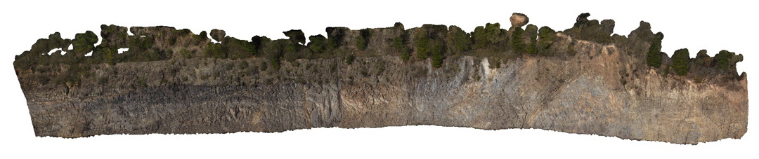
Piccaninny1 Map
 |
50 |
01/01/9999 midnight |
3D |
grey granodiorite dyke intruding bedded turbidite sequences of the Mathinna Supergroup with small contact metamorphic halo and offset by small faults. Piccaninny Point, eastern Tasmania. |
5.00 |
-41.69446100000 |
148.29395280000 |
5.000 |
intrusive contact, dyke, turbidite, contact metamorphic aureole, fault |
turbidite, granodiorite |
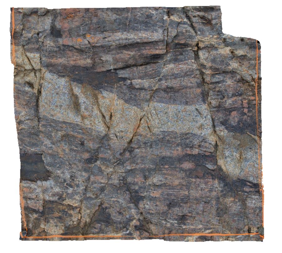
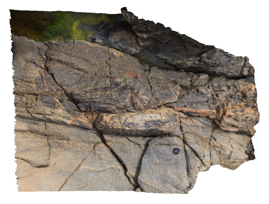
Piccaninny3 Map
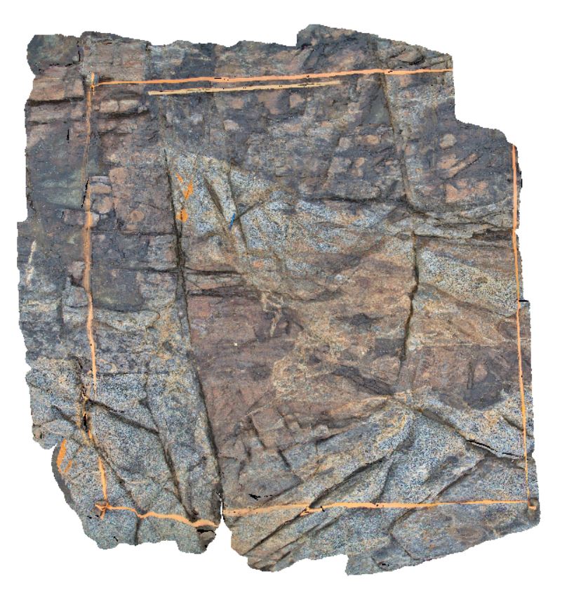 |
50 |
01/01/9999 midnight |
3D |
irregular intrusive contact between the grey granodiorite dyke and hosting Mathinna Supergroup sediments. Piccaninny Point, eastern Tasmania. |
5.00 |
-41.69446100000 |
148.29395280000 |
5.000 |
intrusive contact, turbidite |
turbidite, granodiorite |
Piccaninny9 Map
 |
50 |
01/01/9999 midnight |
3D |
granodiorite with xenoliths of Mathinna Supergroup turbidites. Piccaninny Point, eastern Tasmania. |
2.00 |
-41.69446100000 |
148.29395280000 |
2.000 |
xenolith, granodiorite |
granodiorite |
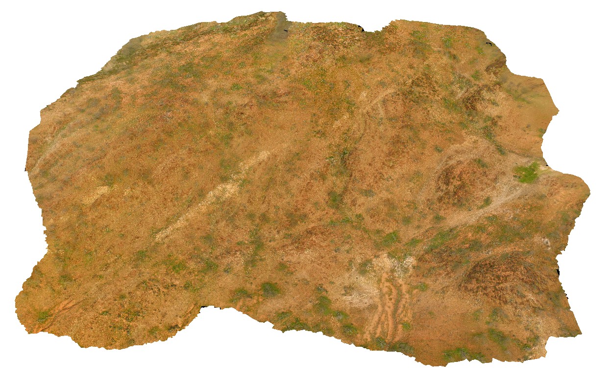
BellthorpeUAV1 Map
 |
50 |
01/01/9999 midnight |
UAV |
Aerial view of granodiorite with multiple intrusive phases and metasediment xenoliths. Bellthorpe, QLD. |
100.00 |
-26.82770700000 |
152.62270000000 |
2.000 |
granodiorite, intrusive contact |
granodiorite |
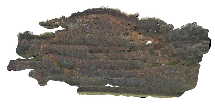
MtGippsUAV2 Map
 |
50 |
06/27/2016 noon |
UAV |
metasediments, Mount Gipps, N.S.W. |
470.00 |
-31.61700110000 |
141.50016650000 |
-9999.000 |
metasediments, structure, metamorphic |
metasediments |
MtGippsUAV3 Map
 |
50 |
06/27/2016 noon |
UAV |
metasediments, Mount Gipps, N.S.W. |
420.00 |
-31.61280890000 |
141.49239520000 |
-9999.000 |
metasediments, metamorphic |
metasediments |
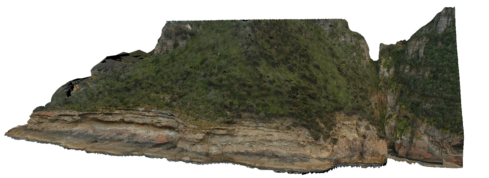
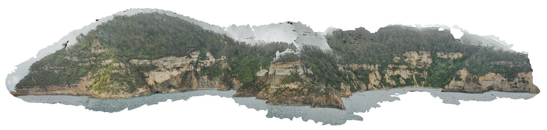
Surville5 Map
 |
50 |
03/16/2015 2:22 p.m. |
3D |
view form off-shore of cliff exposure, showing basement unconformable contact between Devonian Granite and the overlying sedimentary Parmeener Supergroup. Cape Surville, Tasman Peninsula. Tasmania. |
250.00 |
-42.97067641000 |
147.99550099000 |
0.500 |
unconformity, contact, basement unconformity |
granite, siltstone |
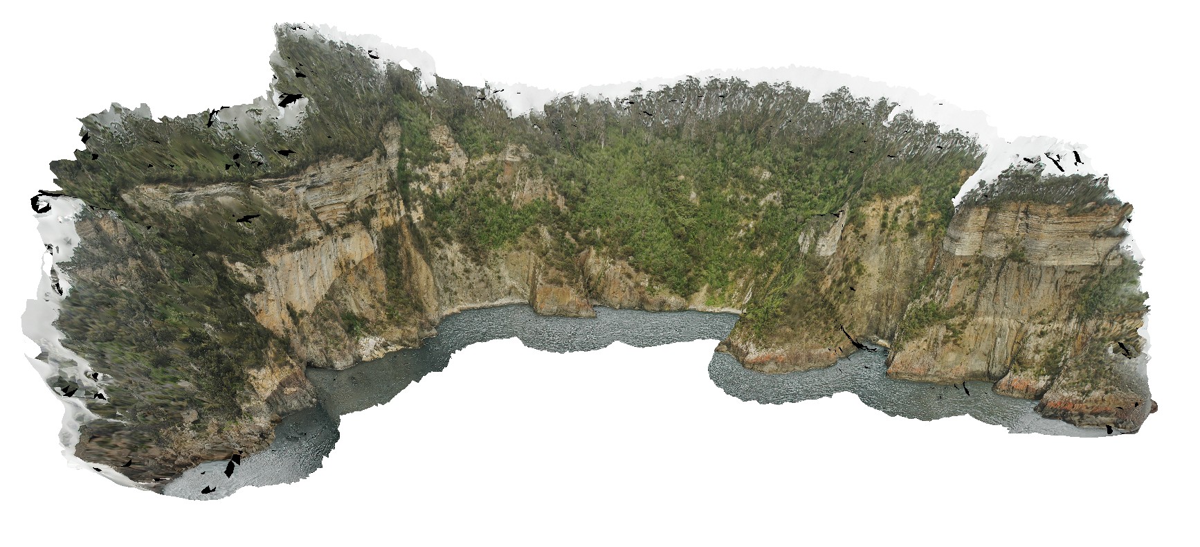
Surville2 Map
 |
50 |
03/16/2015 2:21 p.m. |
3D |
view form off-shore of cliff exposure, showing basement unconformable contact between Devonian Granite and the overlying sedimentary Parmeener Supergroup with intrusive Jurassic dolerite contact (darker rock). Cape Surville, Tasman Peninsula. Tasmania. |
500.00 |
-42.95779432000 |
147.99290997000 |
0.500 |
basement unconformity, unconformity, intrusive contact, igneous intrusion |
granite, siltstone, dolerite |
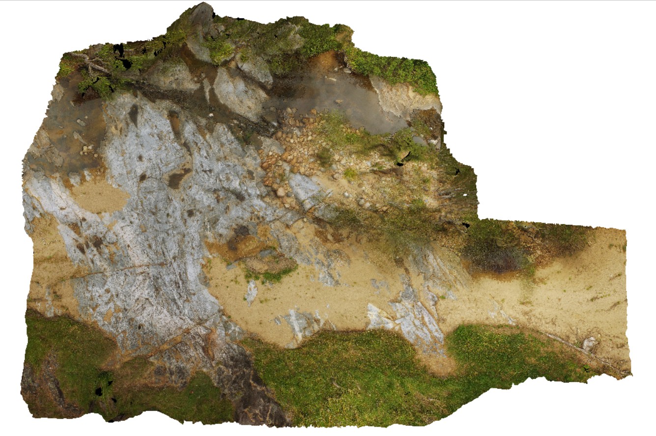
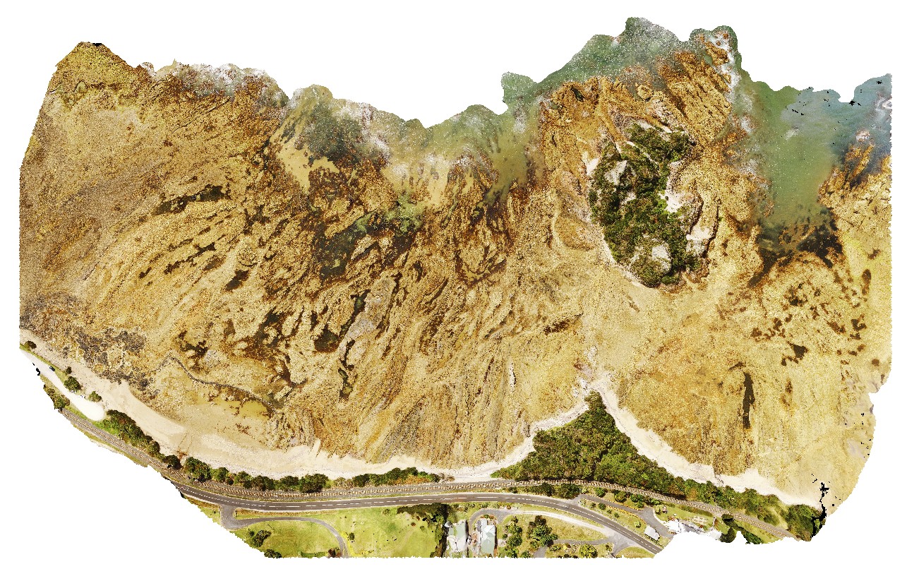
GoatIslandUAV1 Map
 |
50 |
01/01/9999 midnight |
UAV |
aerial over view of folded metamorphic sediments of the Burnie Formation (Oonah Formation) and Ulverstone Metamorphics, which includes the Goat Island Conglomerate. Goat Island, Ulverstone. North Tasmania. |
680.00 |
-41.13575600000 |
146.13587000000 |
55.000 |
metasediments, Burnie Formation, Ulverstone Metamorphics, geological contact |
metasediments, metasediments |
Eildon6 Map
 |
50 |
11/03/2015 2:39 p.m. |
3D |
folded and faulted sandstone of the Siluro-Devonian Jordon River Group. Eildon, Vic. |
200.00 |
-37.22475000000 |
145.93300000000 |
296.000 |
faults, folds, structure |
sandstone |
Eildon5 Map
 |
50 |
07/18/2015 3:28 p.m. |
3D |
Large anticline in sandstone units of the Devonian Eildon Sandstone. Poor visualisation due to limited vantage points. Eildon, Vic. |
150.00 |
-37.21855000000 |
145.91957000000 |
335.000 |
anticline, fold, structure |
sandstone |
Surville4 Map
 |
50 |
01/01/9999 midnight |
3D |
view of cliff exposure, showing basement unconformable contact between Devonian Granite, metasediments and the overlying sedimentary Parmeener Supergroup with intrusive Jurassic dolerite contact (darker rock). Cape Surville, Tasman Peninsula. Tasmania. |
500.00 |
-37.66467900000 |
144.77204400000 |
1.000 |
unconformity, intrusion |
granite, metasediments, siltstone, dolerite |
Splitpoint13 Map
 |
58 |
06/17/2015 10:45 a.m. |
3D |
Basalt of the Oligocene Angahook Formation disconformably overlain by bedded sandy limestone of the Torquay Group. Irregularities/fissures in the upper surface of the basalt have been infilled by the overlying limestone. Split Point, Vic. |
13.00 |
-38.46855000000 |
144.10698000000 |
1.000 |
volcanology, fissures |
basalt, limestone |
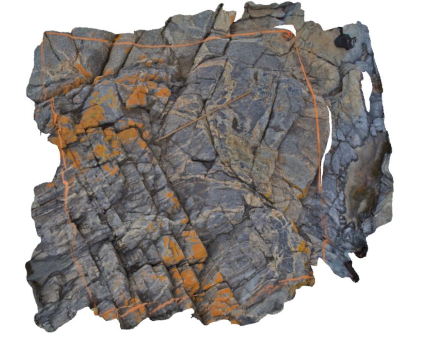
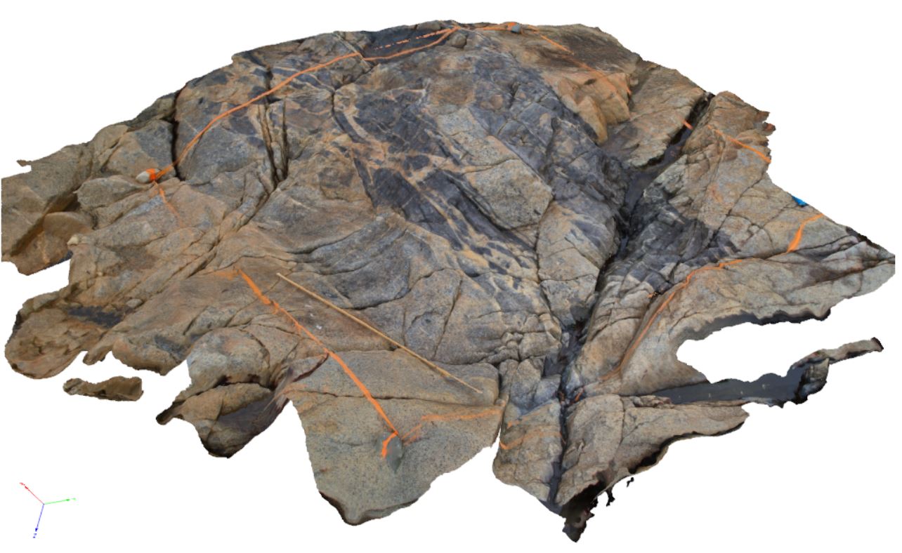
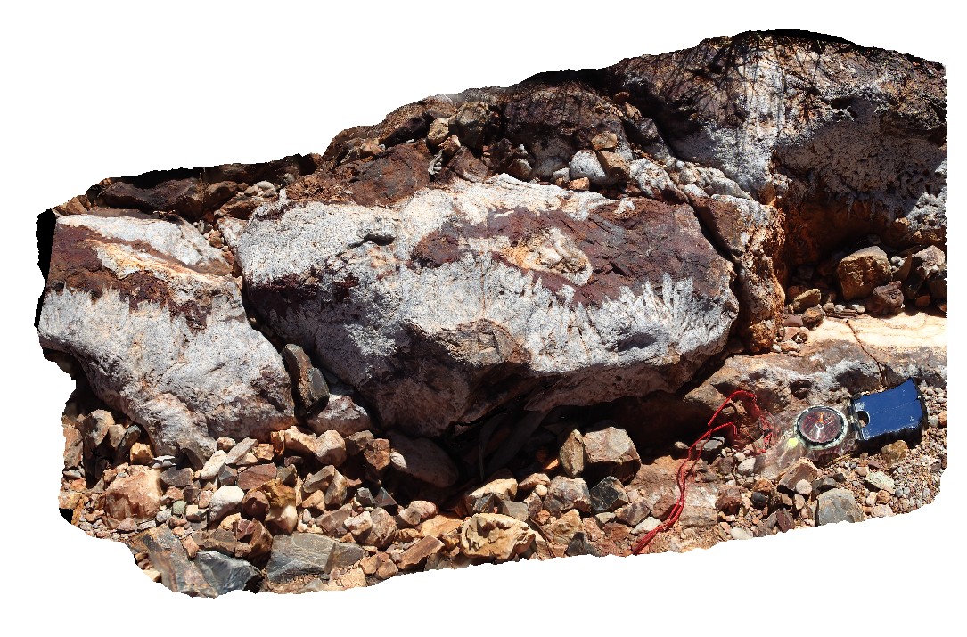
Piccaninny32 Map
 |
80 |
03/13/2015 9:07 a.m. |
3D |
Contact between Mathinna Supergroup and Long Point Granodiorite, very good example of ductile deformation within Mathinna at contact, and late melt veining. Piccaninny Point, eastern Tasmania. |
2.00 |
-41.69427300000 |
148.29452500000 |
4.000 |
Mathinna Supergroup, Long Point Granodiorite, ductile deformation |
Turbidite, Granodiorite |
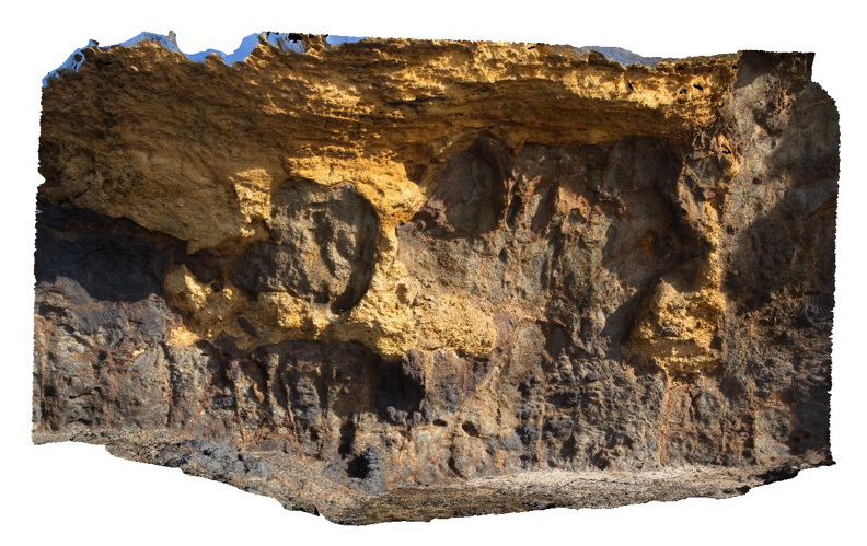
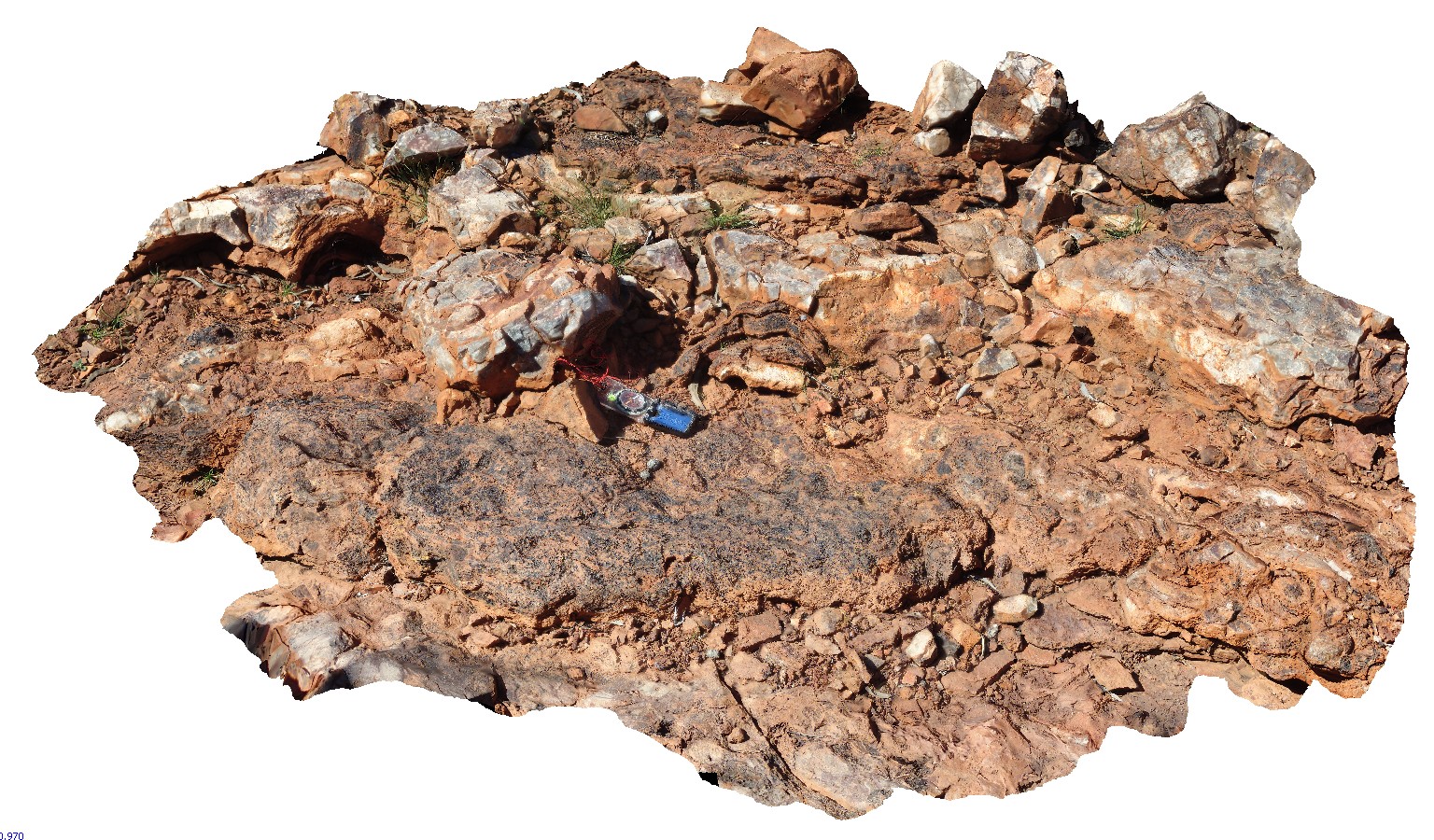
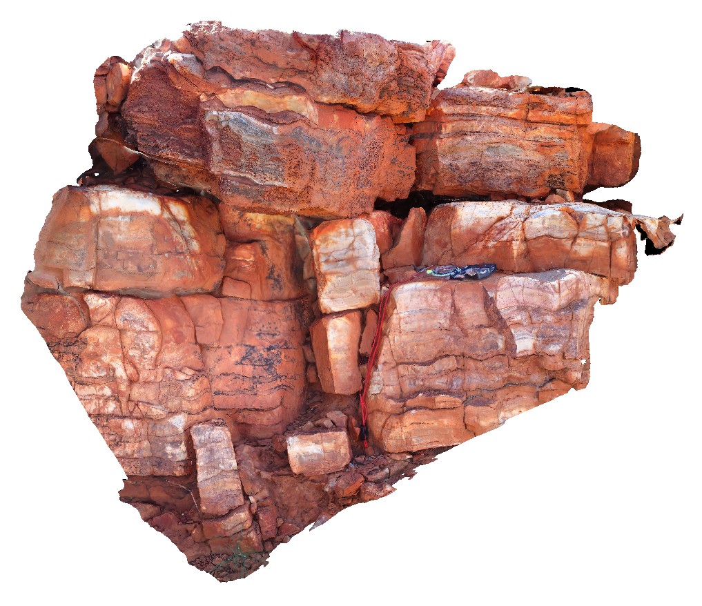
NorthPole1 Map
 |
10000 |
08/02/2016 noon |
3D |
Epithermal crystalline barite-silica vein with radiating crystals. Iron-oxides in vein centre result from oxidation of pyrite. Marble Bar Rd, near Coppin Gap, W.A. |
1.00 |
-20.72168000000 |
119.35366400000 |
-9999.000 |
epithermal, barite, vein |
sediments |
NorthPole2 Map
 |
10000 |
08/02/2016 noon |
3D |
3.49Ga stromatolite beds in the Dresser Formation. Marble Bar Rd, near Coppin Gap, W.A. |
2.50 |
-20.72168000000 |
119.35366400000 |
-9999.000 |
stromatolite, fossil, palaeontology |
limestone |
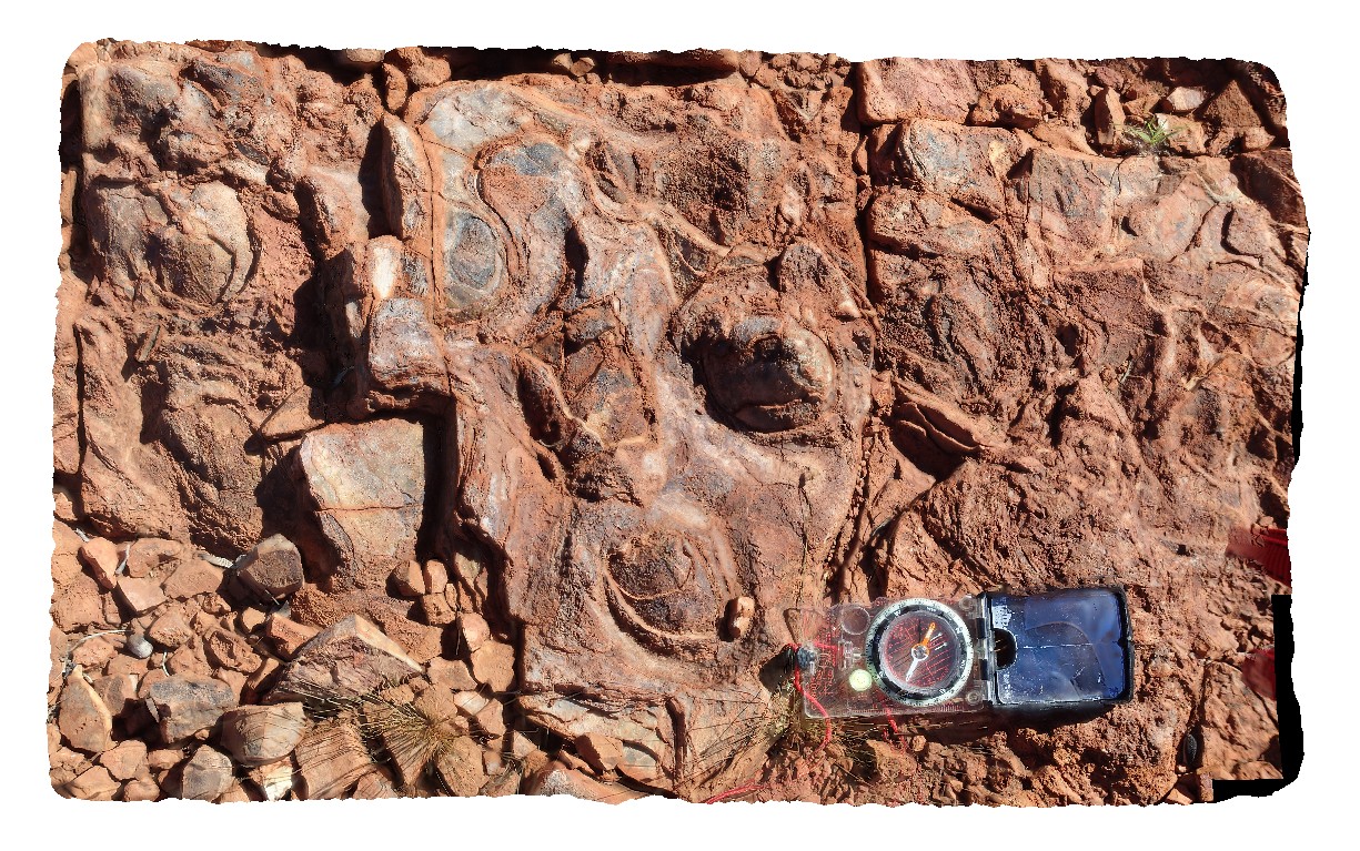
NorthPole3 Map
 |
10000 |
08/02/2016 noon |
3D |
3.49Ga conical stromatolites in the Dresser Formation. Marble Bar Rd, near Coppin Gap, W.A. |
0.80 |
-20.72168000000 |
119.35366400000 |
-9999.000 |
stromatolite, chert, palaeontology, fossil |
limestone |
NorthPole4 Map
 |
10000 |
08/02/2016 noon |
3D |
Section through 3.49Ga Ga stromatolites (top layer) in the Dresser Formation. Marble Bar Rd, near Coppin Gap, W.A. |
1.50 |
-20.72168000000 |
119.35366400000 |
-9999.000 |
stromatolite, fossil, sedimentology, palaeontology |
limestone |