MUDTK1 Map
 |
0 |
07/25/2016 10:11 a.m. |
3D |
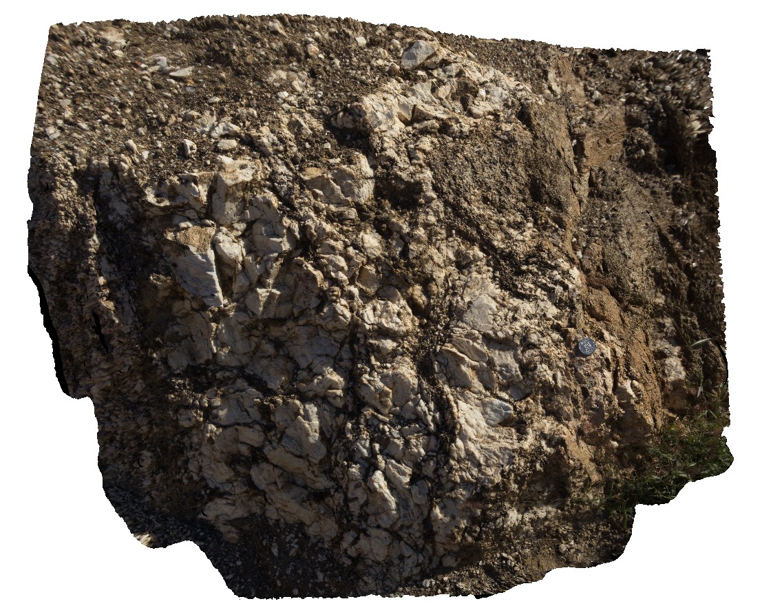
Coarse-grained feldspar-biotite schists in Mud Tank open pit. Near Plenty Highway, Zircon Field Access road, N.T. |
1.80 |
-23.01363600000 |
134.27639200000 |
658.853 |
schist, metamorphic |
schist |
MUDTK2 Map
 |
0 |
07/25/2016 11:13 a.m. |
3D |
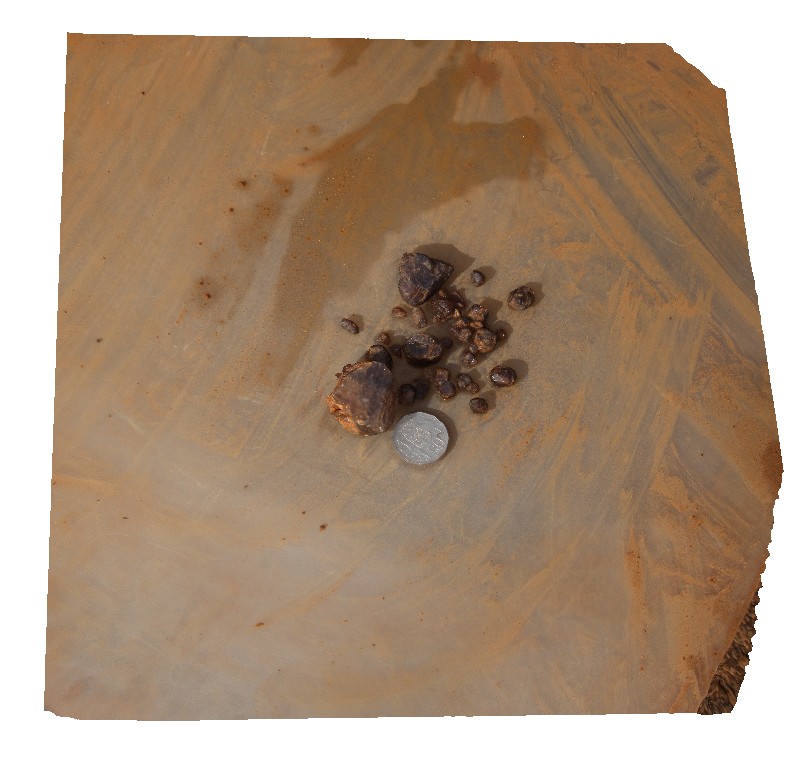
Mud Tank zircon crystal, Mud Tank open pit. Near Plenty Highway, Zircon Field Access road, N.T. |
0.40 |
-23.01338000000 |
134.27826600000 |
672.556 |
zircon crystal, metamorphic, mine, Mud Tank |
carbonate |
Mulbring1 Map
 |
1 |
06/17/2015 9:20 a.m. |
3D |
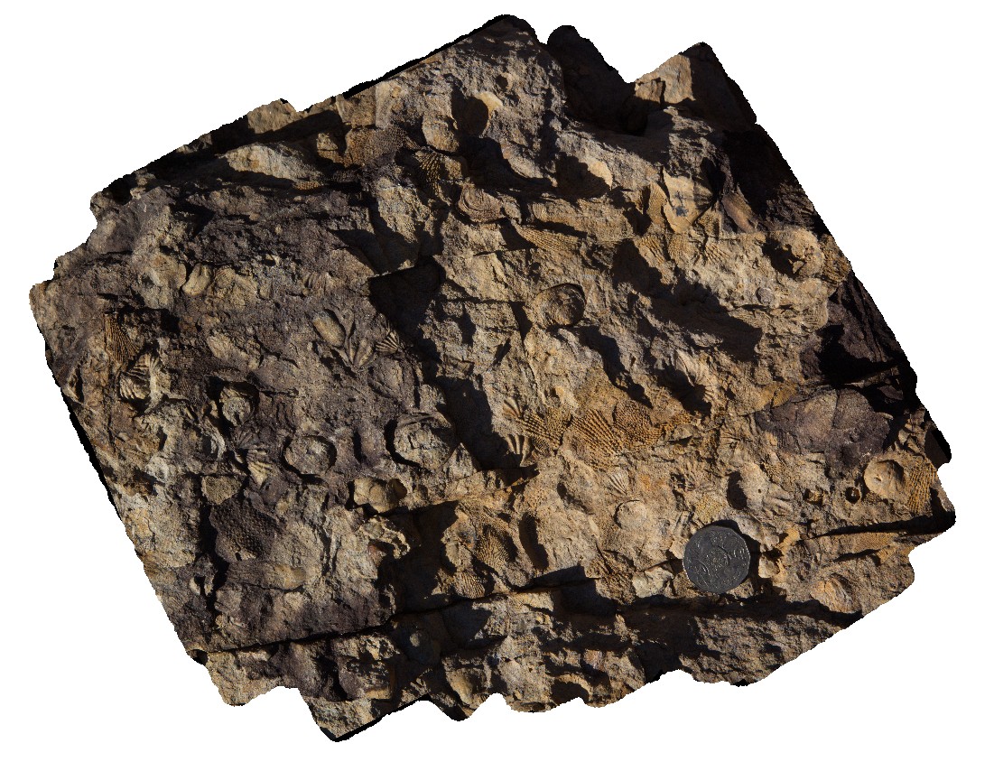
Fenestellids and brachiopods in the Permian Branxton Formation, Mulbring, N.S.W. |
0.20 |
-32.89854000000 |
151.46556000000 |
65.000 |
brachiopods, fenestella, fossil, palaeontology |
sandstone |
Mulbring2 Map
 |
5 |
06/17/2015 9:27 a.m. |
3D |
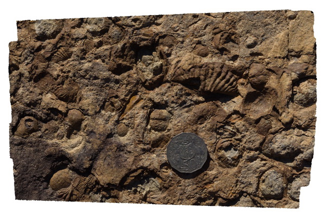
Fenestella bryozoans and brachiopods in the Permian Branxton Formation. Mulbring, N.S.W. |
0.20 |
-32.89854000000 |
151.46562000000 |
65.000 |
brachiopod, fenestella, bryozoan, palaeontology, fossil |
sandstone |
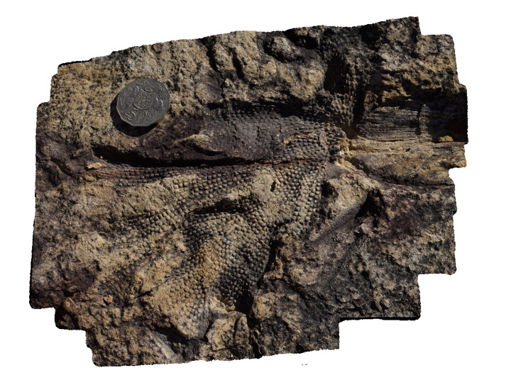
Mulbring3 Map
 |
5 |
06/17/2015 9:35 a.m. |
3D |
fenestellid bryozoan in the Permian Branxton Formation. Mulbring, N.S.W. |
0.20 |
-32.89849000000 |
151.46556000000 |
65.000 |
Fenestella bryozoan, palaeontology, fossil |
sandstone |
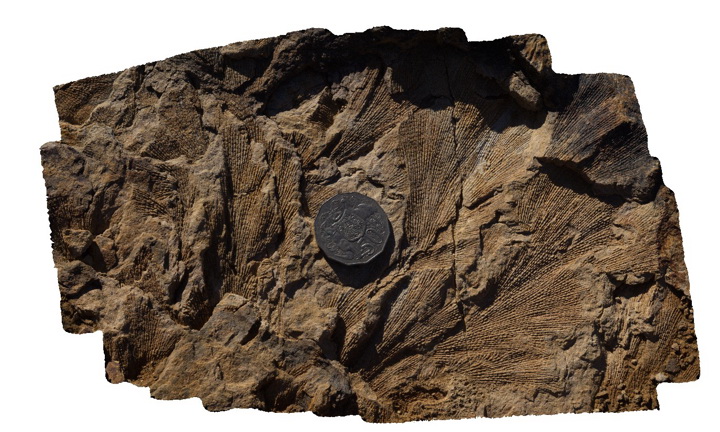
Mulbring4 Map
 |
5 |
06/17/2015 9:43 a.m. |
3D |
Fenestellid bryozoans in the Permian Branxton Formation. Mulbring, N.S.W. |
0.30 |
-32.89844000000 |
151.46541000000 |
65.000 |
fenestella, bryozoans, palaeontology, fossil |
sandstone |
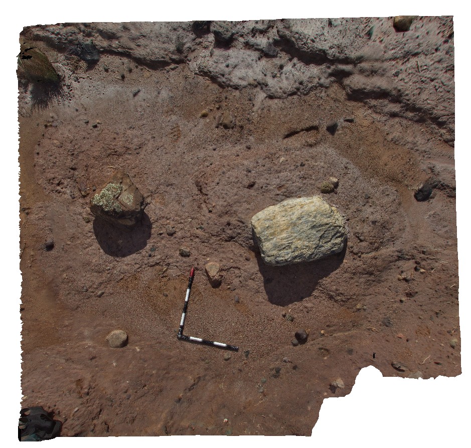
Mullewa1 Map
 |
5 |
05/19/2016 noon |
3D |
matrix supported diamictite with large clasts of silicified, stretched conglomerate and sandstone. Yuna-Tenindewa Road, Mullewa, W.A. |
3.00 |
-28.55555000000 |
115.25302000000 |
-9999.000 |
diamictite, sedimentology, poorly sorted |
diamictite |
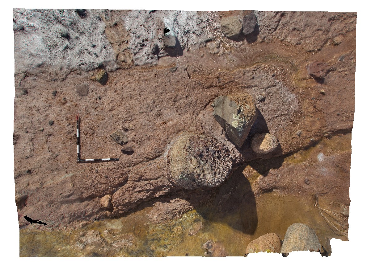
Mullewa2 Map
 |
0 |
05/19/2016 noon |
3D |
diamictite pavement, with large clasts of granite, sandstone and conglomerate. Yuna-Tenindewa Road, Mullewa, W.A. |
4.00 |
-28.55558000000 |
115.25301000000 |
-9999.000 |
polymict diamictite, poorly sorted, sedimentology |
diamictite |
MullewaUAV1 Map
 |
0 |
05/19/2016 noon |
UAV |
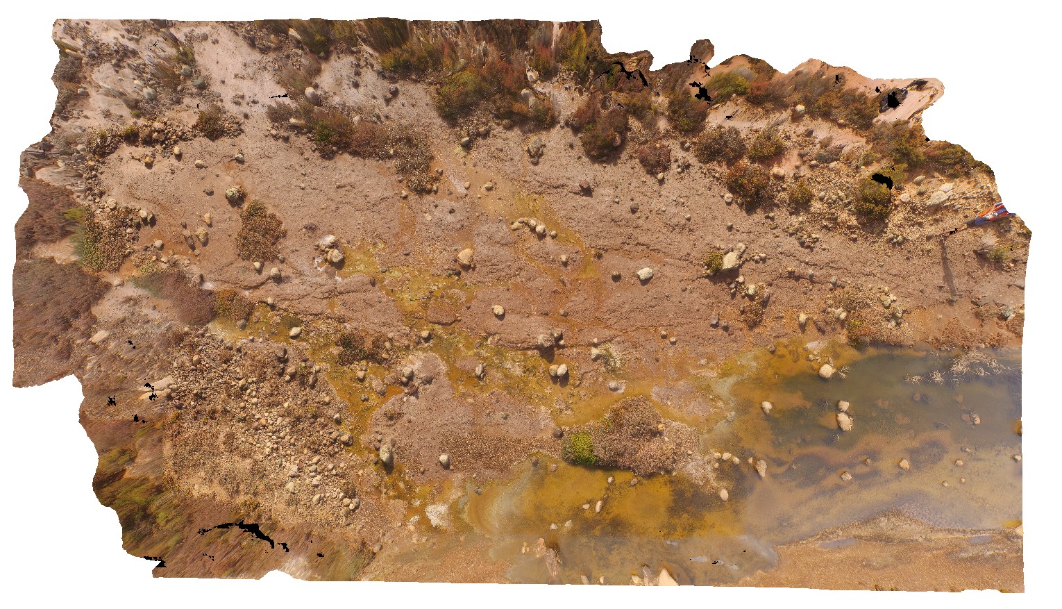
pavement of matrix supported, polymict Permo-Triassic glacial diamictite with poorly sorted sub angular clasts. Yuna-Tenindewa Road, Mullewa, W.A. |
50.00 |
-28.55554200000 |
115.25380300000 |
-9999.000 |
diamictite, sedimentology |
diamictite |
Munjina1 Map
 |
5 |
05/31/2016 noon |
3D |
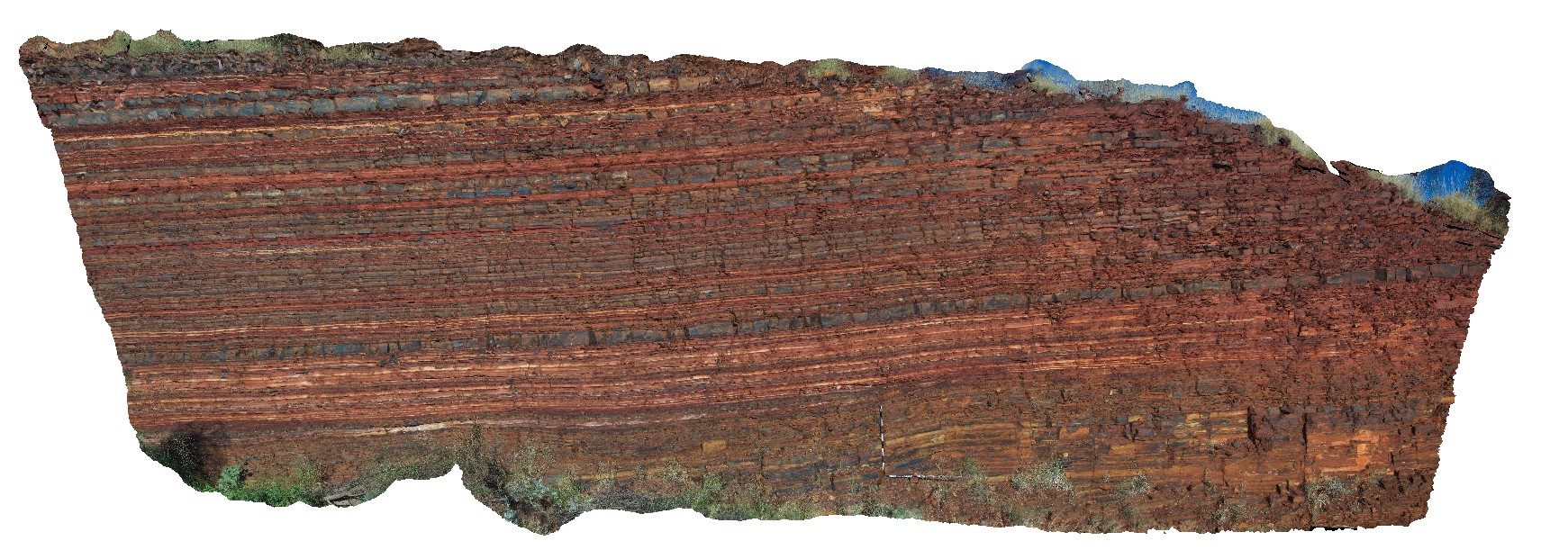
finely layered banded iron formation of the Wittenoom Formation exposed in outcrop east of Mount George, Karijini, W.A. |
7.30 |
-22.45249000000 |
118.70341000000 |
-9999.000 |
banded iron formation, Wittenoom Formation |
BIF |
Munjina2 Map
 |
5 |
05/31/2016 noon |
3D |
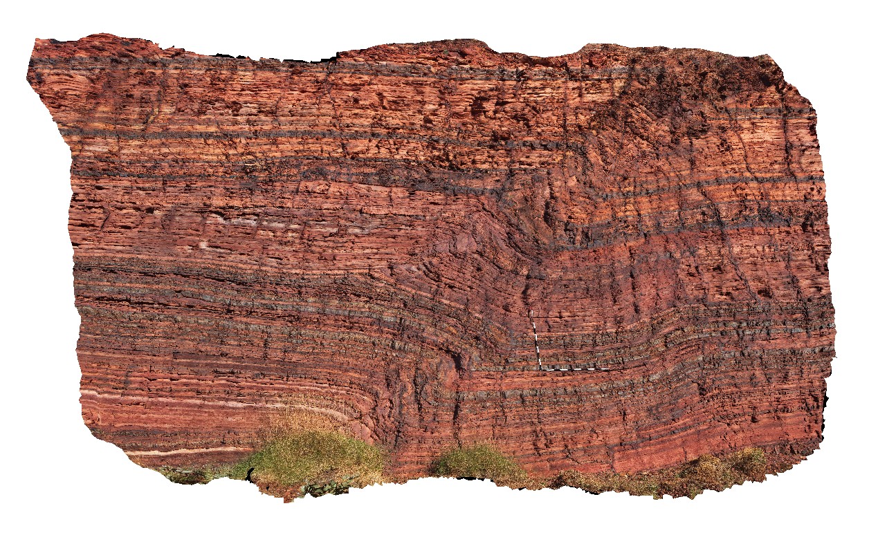
open fold in finely layered banded iron formation of the Wittenoom Formation, East of Mount George, Karijini. W.A. |
4.50 |
-22.41183000000 |
118.68569000000 |
-9999.000 |
Wittenoom Formation, banded iron formation, fold, structure, sedimentology |
BIF |
MunjinaGiga1 Map
 |
0 |
05/31/2016 noon |
GIGA |
— |
0.00 |
-22.41183000000 |
118.68569000000 |
-9999.000 |
|
|
MunjinaGiga2 Map
 |
0 |
05/31/2016 noon |
GIGA |
— |
0.00 |
-22.41183000000 |
118.68569000000 |
-9999.000 |
|
|
Murchison1 Map
 |
0 |
01/01/9999 midnight |
3D |
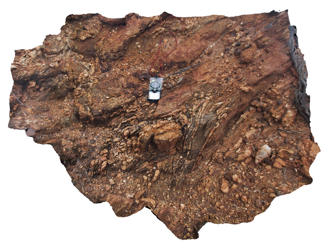
Tightly folded quartz veins in mafic gneiss of the Yilgarn Craton. Carnarvon-Mullewa Road, Murchison WA. |
6.00 |
-26.83411000000 |
115.94106000000 |
-9999.000 |
fold, gneiss |
gneiss |
Murchison2 Map
 |
0 |
01/01/9999 midnight |
3D |
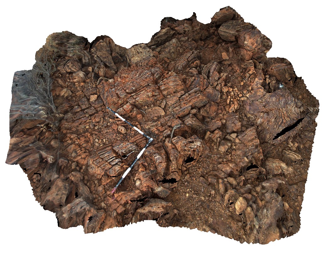
tightly folded and finely layered, banded iron formation. Carnarvon-Mullewa Road, Murchison WA. |
3.00 |
-26.83409000000 |
115.94122000000 |
-9999.000 |
banded iron formation, fold, structure |
BIF |
MyrtleBch1 Map
 |
5 |
06/17/2015 9:19 a.m. |
3D |
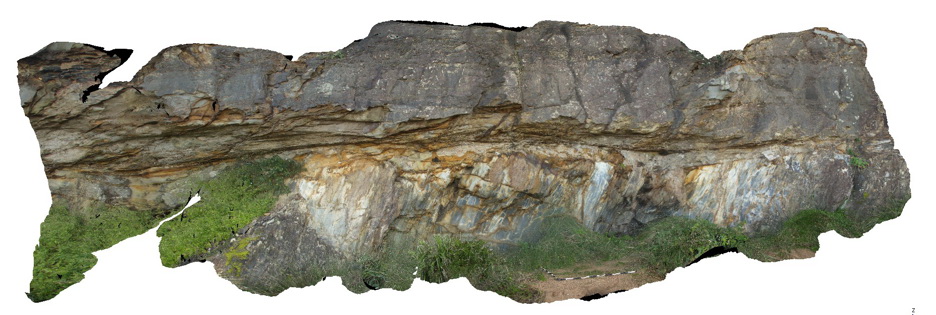
Basal Permian unconformity with steeply dipping silty sandstone of the Cambro-Silurian Wagonga Formation overlain by sandstone with large erratic clasts of the Permian Snapper Point Formation. Myrtle Beach, N.S.W. |
8.00 |
-35.68271000000 |
150.29996000000 |
2.000 |
unconformity, structure |
sandstone, sandstone |
MyrtleBch2 Map
 |
1 |
06/17/2015 9:23 a.m. |
3D |
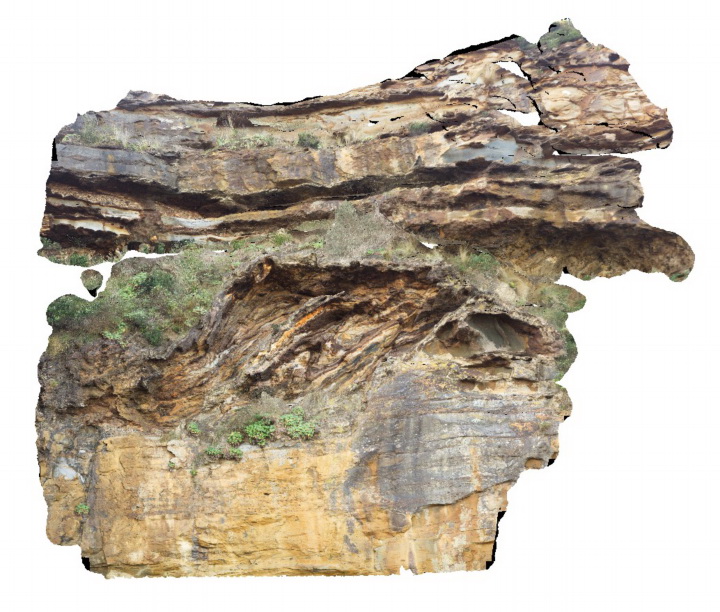
Large (~6m) megaclast of folded Wagonga Group rocks within cliff of Permian Snapper Point Formation. Poor image due to limited vantage points. No scale. Myrtle Beach, N.S.W. |
0.00 |
-35.68269000000 |
150.30045800000 |
-9999.000 |
megaclast, sedimentology |
sandstone |
MyrtleBch3 Map
 |
5 |
06/17/2015 9:30 a.m. |
3D |
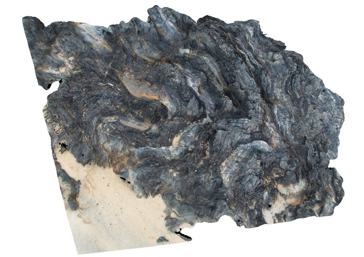
folds developed in fine grained metasediments of the Cambro-Silurian Wagonga Group. Myrtle Beach, N.S.W. |
2.00 |
-35.68435000000 |
150.29822000000 |
0.000 |
folds, structure |
siltstone |
MyrtleBch4 Map
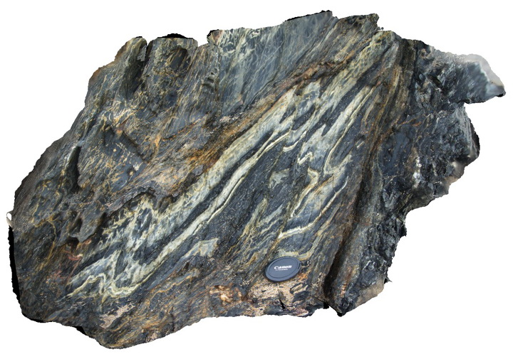 |
5 |
06/17/2015 9:42 a.m. |
3D |
detail of folds and faults in fine grained metasediments of the Cambro-Silurian Wagonga Group. Myrtle Beach, N.S.W. |
1.00 |
-35.68481000000 |
150.29784000000 |
1.000 |
folds, faults, structure |
mudstone |
MyrtleBchFSP1 Map
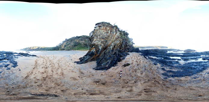 |
5 |
06/17/2015 9:44 a.m. |
FSP |
View of folded Cambro-Silurian metasediments of the Wagonga Group. Myrtle Beach, N.S.W. |
50.00 |
-35.68479000000 |
150.29781000000 |
0.000 |
folds, structure |
mudstone |
MyrtleBchFSP2 Map
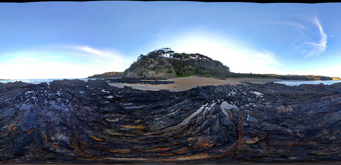 |
5 |
06/17/2015 9:45 a.m. |
FSP |
View of folded and faulted thinly bedded fine grained metasediments of the Cambro-Silurian Wagonga Group. Flat lying basal outcrops of the Sydney Basin are visible at the end of the beach to the north. Myrtle Beach, N.S.W. |
50.00 |
-35.68432000000 |
150.29828000000 |
0.000 |
folds, structure |
mudstone |
MyrtleBchFSP3 Map
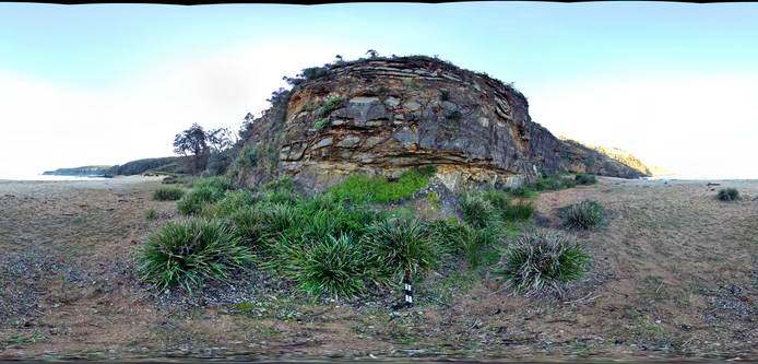 |
5 |
06/17/2015 9:46 a.m. |
FSP |
Basal Permian unconformity with steeply dipping metasediments of the Cambro-Silurian Wagonga Group overlain by flat-lying Permian sandstone and breccia of the Snapper Point Formation. Myrtle Beach, N.S.W. |
50.00 |
-35.68272000000 |
150.29979000000 |
1.000 |
unconformity, structure |
mudstone, sandstone |
MyrtleBchFSP4 Map
 |
5 |
06/17/2015 9:47 a.m. |
FSP |
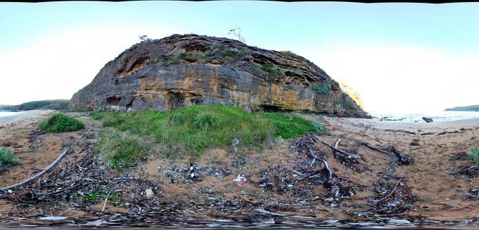
Cliff of Basal Permian Snapper Point Formation sandstone with megabreccia blocks (to ~6m) of folded Lachlan Orogen metasediments. Myrtle Beach, N.S.W. |
50.00 |
-35.68269000000 |
150.30042000000 |
1.000 |
megabreccia, sedimentology |
sandstone |
Nambucca1 Map
 |
5 |
06/16/2015 4:56 p.m. |
3D |
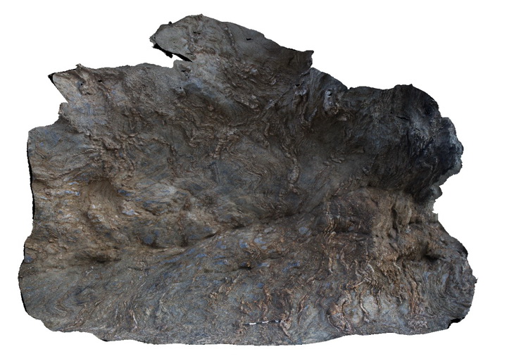
Multiply deformed 'phyllite' of the Permo-Carboniferous Nambucca Beds. Layering is defined by alternating mica-rich and quartz rich domains that are tectonic in origin. Nambucca, N.S.W. |
5.00 |
-30.64660000000 |
153.01932000000 |
1.000 |
folds, transposition, cleavage, structure |
phyllite |
Nambucca10 Map
 |
5 |
06/16/2015 4:59 p.m. |
3D |
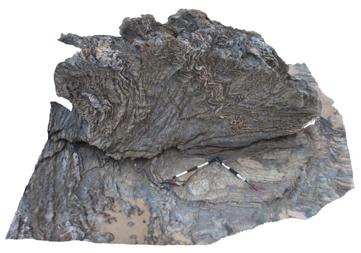
'phyllite' of the Permo-Carboniferous Nambucca Beds. Layering is defined by alternating mica-rich and quartz rich domains that are tectonic in origin. Prominent crenulation cleavage and development of microlithons. Nambucca, N.S.W. |
2.00 |
-30.64865000000 |
153.01872000000 |
1.000 |
folds, crenulation cleavage, structure |
phyllite |


