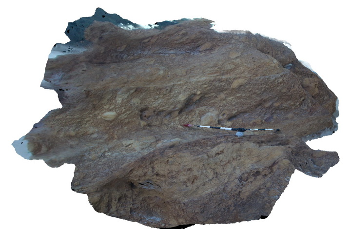
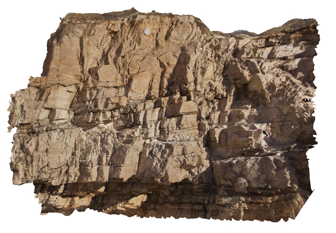
Narooma2 Map
 |
5 |
05/18/2015 1:27 p.m. |
3D |
imbricated clasts in Volcanic breccia. Narooma, N.S.W. |
3.00 |
-36.22093000000 |
150.14082000000 |
0.000 |
imbricated, breccia, volcanology |
breccia |
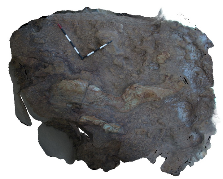
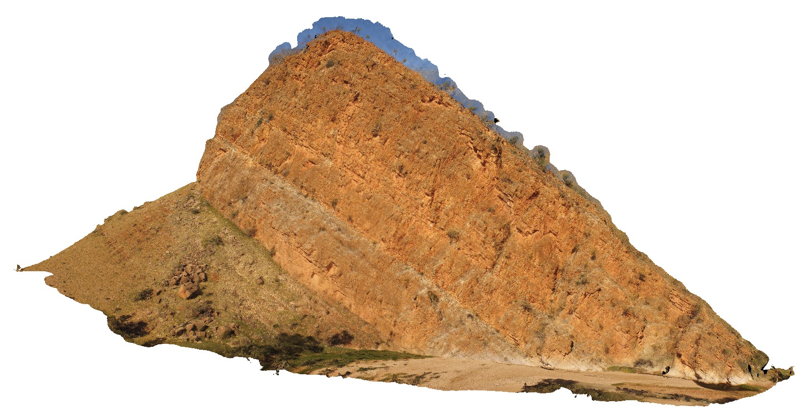
Narooma3 Map
 |
5 |
05/18/2015 1:27 p.m. |
3D |
elongate small pillows of altered basalt in volcanic breccia. Narooma, N.S.W. |
3.00 |
-36.22104000000 |
150.14082000000 |
0.000 |
pillow basalt, volcanology, igneous |
breccia, basalt |
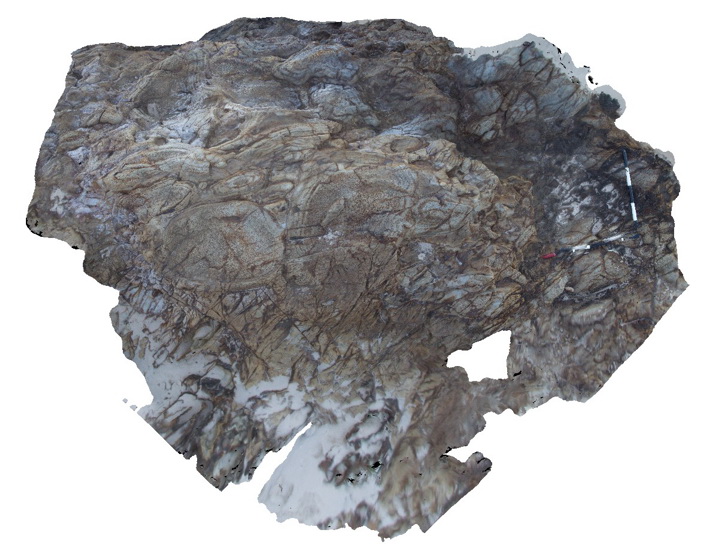
Narooma4 Map
 |
5 |
05/18/2015 1:28 p.m. |
3D |
altered pillow basalts with clearly defined chilled margins. Narooma, N.S.W. |
3.00 |
-36.22147000000 |
150.14070000000 |
0.000 |
pillow basalt, volcanology, igneous |
basalt |
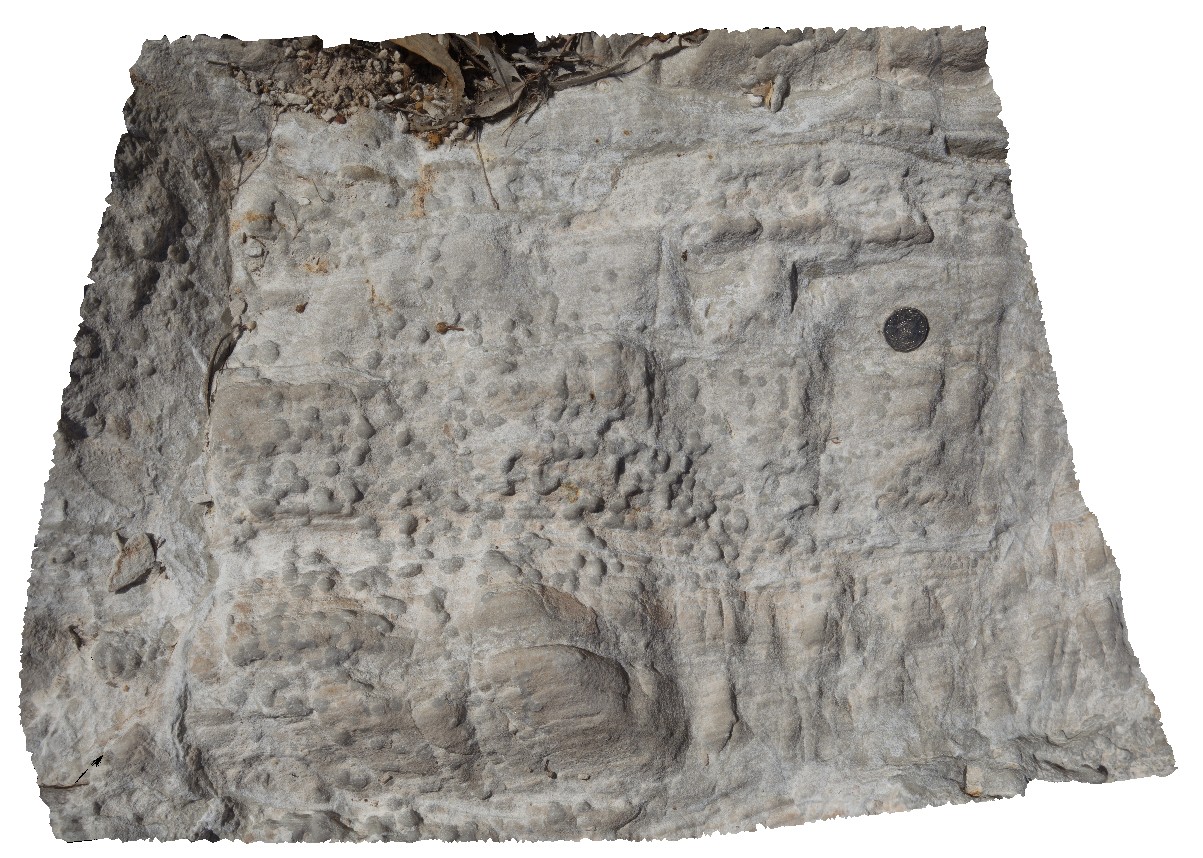
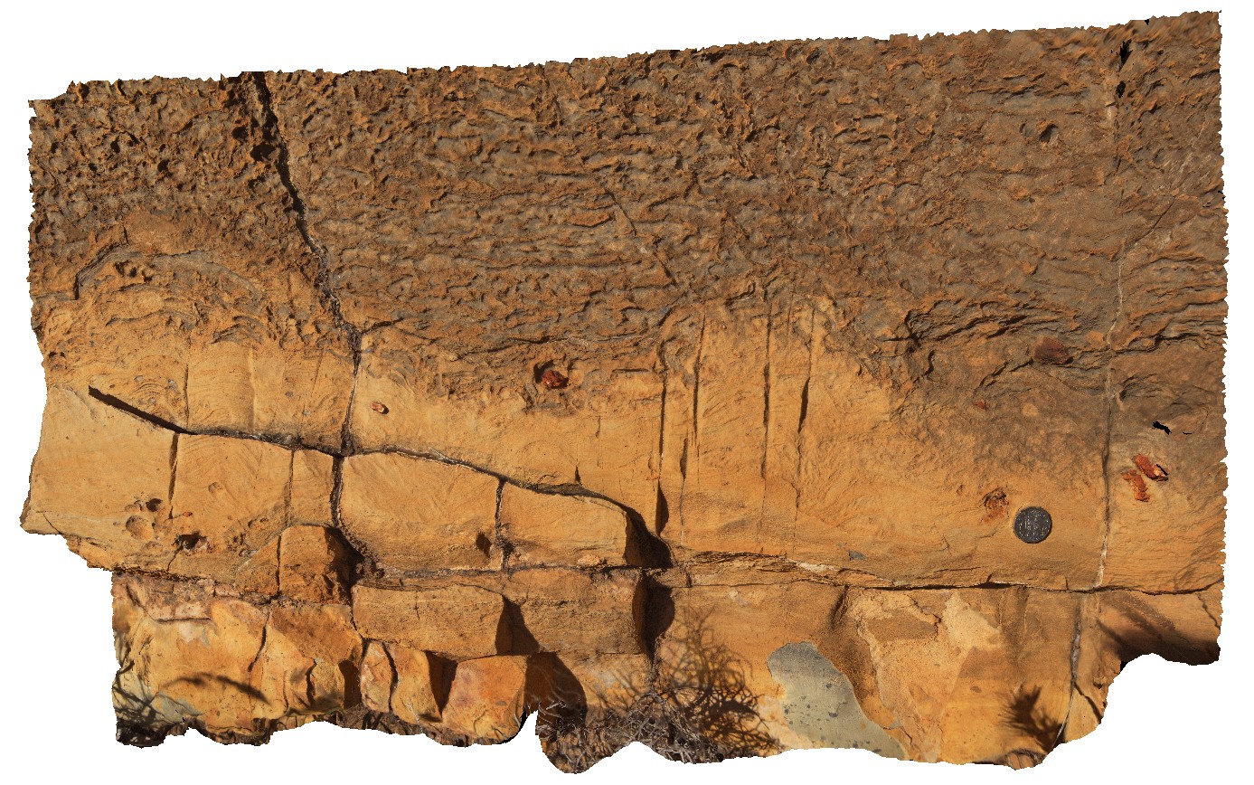
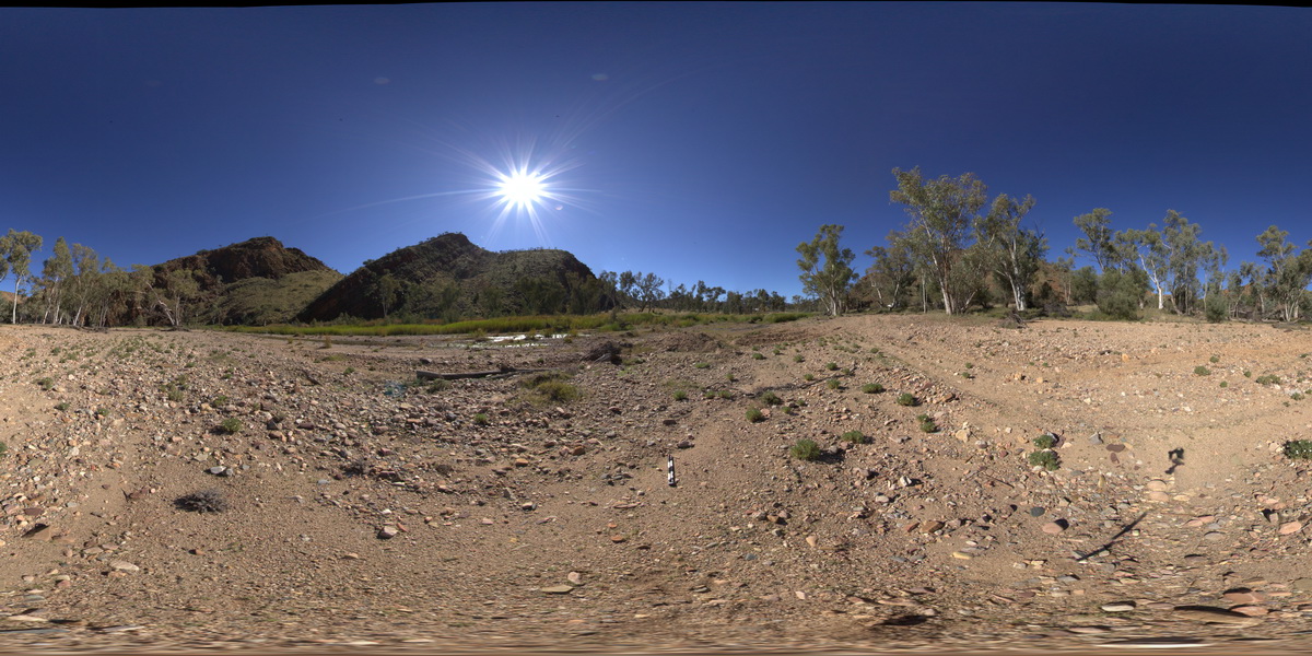
NDALA1 Map
 |
5 |
07/27/2016 1:06 p.m. |
3D |
dolostone with concretions in N'Dala Gorge. Near Ross River, N.T. |
0.70 |
-23.61792400000 |
134.48947200000 |
483.216 |
dolostone, sedimentology, concretions |
dolostone |
NDALA2 Map
 |
5 |
01/01/9999 midnight |
3D |
cross bed features and jointing in siltstone overlying dolostone. N'Dala Gorge. Near Ross River, N.T. |
1.10 |
-23.61792400000 |
134.48947200000 |
483.216 |
joint, structure, siltstone, sedimentology, cross bedding |
siltstone |
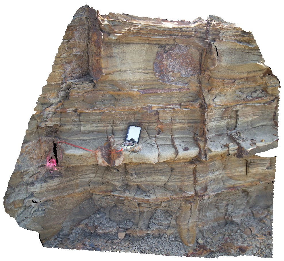
NDALA3 Map
 |
0 |
07/27/2016 2:02 p.m. |
3D |
stromatolitic layer in dolostone - sandstone. N'Dala Gorge. Near Ross River, N.T. |
1.00 |
-23.61033000000 |
134.49238900000 |
493.654 |
stromatolite, fossil, palaeontology, sedimentology |
dolostone |
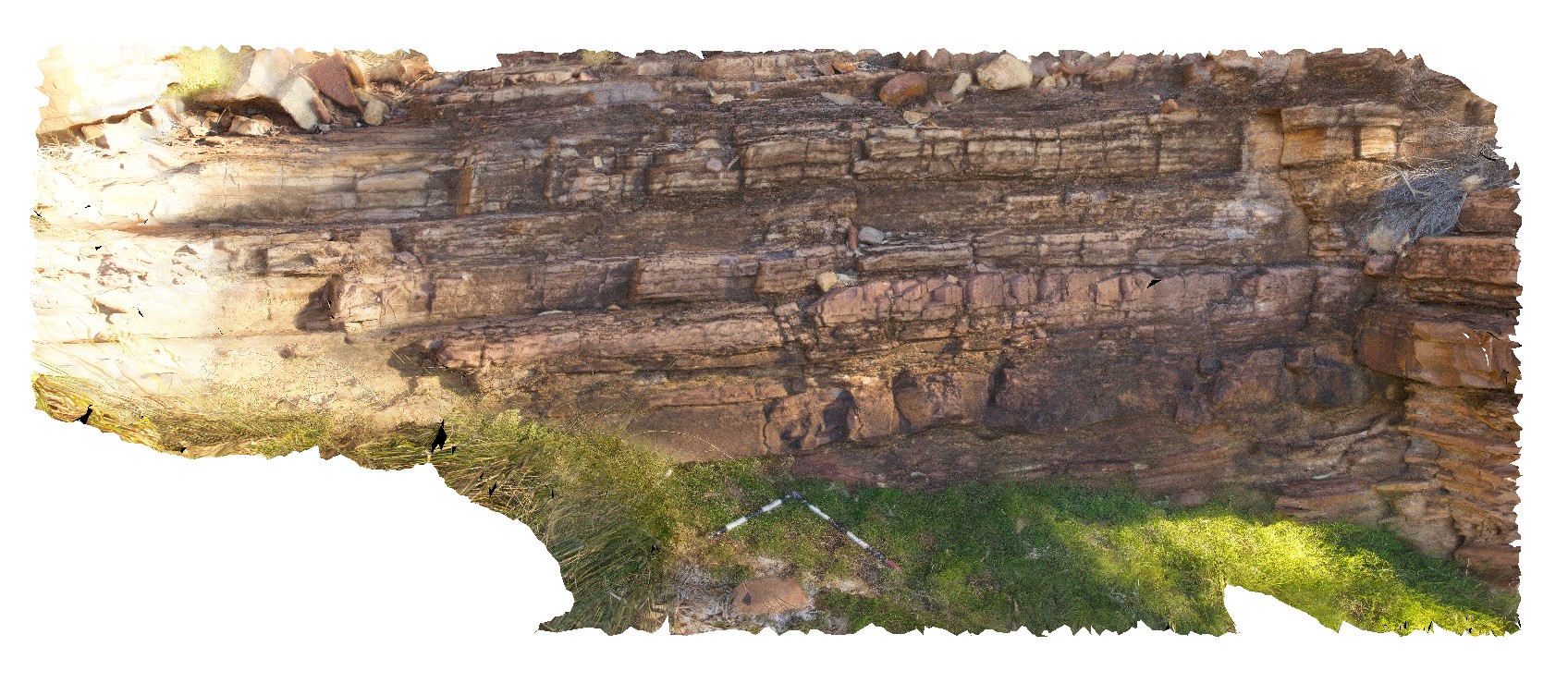
NDALA4 Map
 |
0 |
07/27/2016 2:57 p.m. |
3D |
finely layered siltstones and sandstones. N'Dala Gorge. Near Ross River, N.T. |
6.50 |
-23.60143800000 |
134.48589700000 |
492.013 |
layering, sandstone, siltstone, sedimentology |
dolomite |
NDALAFSP1 Map
 |
0 |
07/27/2016 12:21 p.m. |
FSP |
view of folded Amadeus Basin sediments in N'Dala Gorge, N.T. |
1000.00 |
-23.62980400000 |
134.49458800000 |
476.084 |
sediments, sedimentology, fold, structure |
sediments |
NDALAFSP2 Map
 |
0 |
07/27/2016 12:42 p.m. |
FSP |
view of Goyder Formation folded Amadeus Basin sediments in N'Dala Gorge, N.T. |
1000.00 |
-23.61934700000 |
134.49255400000 |
484.922 |
|
sediments |
NDALAFSP3 Map
 |
5 |
07/27/2016 3:21 p.m. |
FSP |
Hill to NW, showing contact between Cambrian - younger Pertaoorrta Group (left) and Neoproterozoic - Arumbera Sandstone (right) strata. N'Dala Gorge. Near Ross River, N.T. |
1000.00 |
-23.60026000000 |
134.48699700000 |
491.143 |
sedimentology, geological contact, Pertaoorrta Group |
sandstone, sediments |
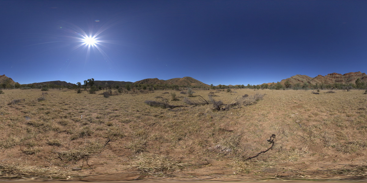
NDALAUAV1 Map
 |
0 |
07/27/2016 2:27 p.m. |
UAV |
large cliff with steeply dipping strata. N'Dala Gorge. Near Ross River, N.T. |
100.00 |
-23.60624600000 |
134.49336300000 |
491.971 |
sediments, dip, structure, fold |
sediments |
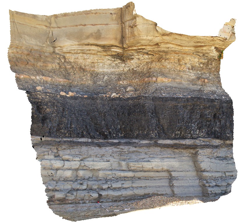
Newcastle1 Map
 |
5 |
01/01/9999 midnight |
3D |
fluvial / floodplain sediments at the 'Bogey Hole', 1.5m below coal seam. Newcastle, N.S.W. |
0.00 |
-32.93481000000 |
151.78169000000 |
-9999.000 |
tuff, tuffaceous sandstone, volcaniclastic, surge deposit |
tuffaceous sandstone |
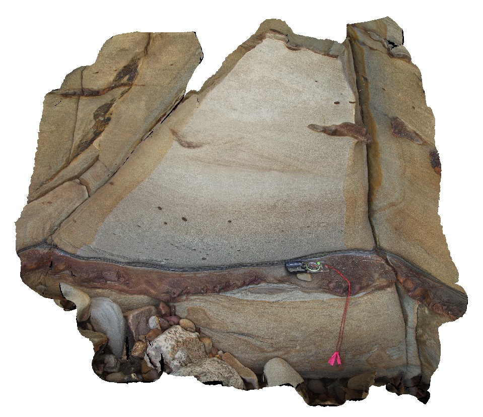
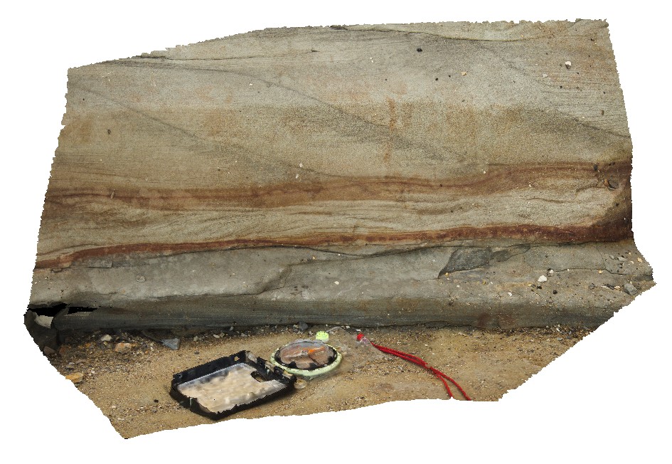
Newcastle2 Map
 |
5 |
01/01/9999 midnight |
3D |
Fluvial sediments with cross bedding and mudstone rip up clasts and coaly laminations. Newcastle, N.S.W. |
0.00 |
-32.94089000000 |
151.76968000000 |
-9999.000 |
sedimentology, coaly laminations, rip up clasts, fluvial sediments |
tuffaceous sandstone |
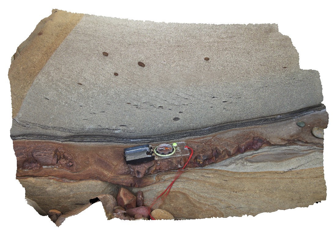
Newcastle3 Map
 |
5 |
01/01/9999 midnight |
3D |
detailed view of fluvial sediments from site Newcastle2, showing coaly laminations and rip up clasts. Newcastle, N.S.W. |
0.00 |
-32.94089000000 |
151.76968000000 |
-9999.000 |
rip up clasts, coaly laminations, tuffaceous sediments, tuff, sedimentology |
tuffaceous sandstone |
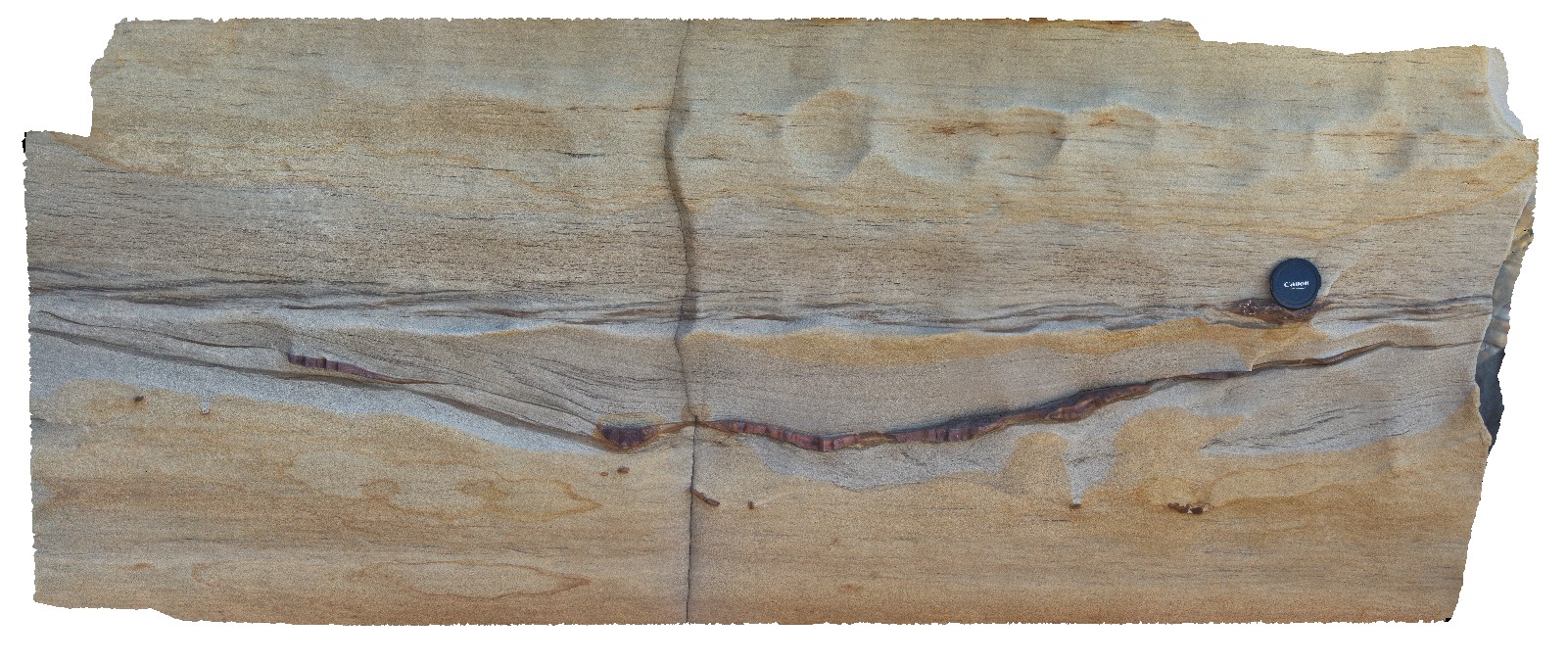
Newcastle4 Map
 |
5 |
01/01/9999 midnight |
3D |
view of channel with concretions at the base and ripple marked sandstone above. Newcastle, N.S.W. |
0.00 |
-32.94089000000 |
151.76968000000 |
-9999.000 |
concretions, channel, sedimentology, ripple marks, sandstone |
tuffaceous sandstone |
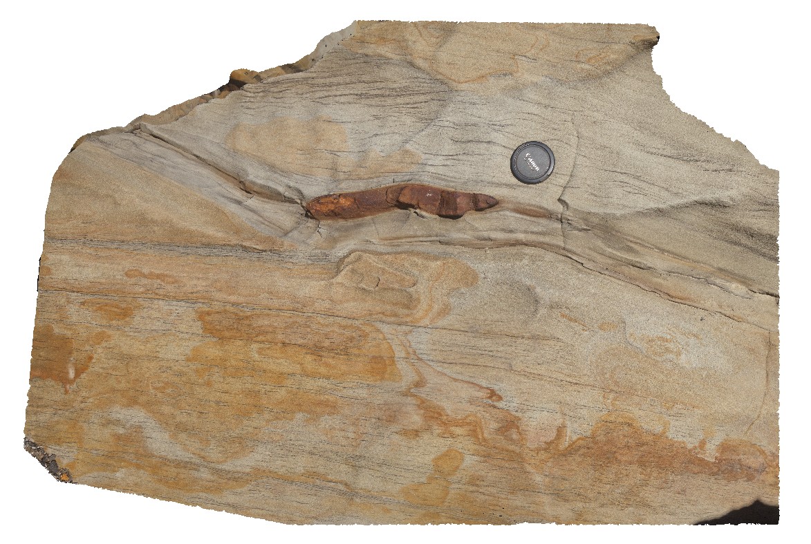
Newcastle5 Map
 |
5 |
01/01/9999 midnight |
3D |
fluvial sedimentology and concretions in unorientated boulder. Newcastle, N.S.W. |
0.00 |
-32.94069000000 |
151.76987000000 |
-9999.000 |
fluvial, sedimentology, concretions |
tuffaceous sandstone |
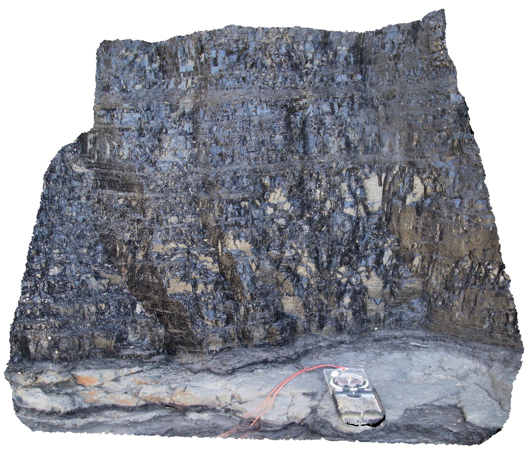
Newcastle6 Map
 |
5 |
01/01/9999 midnight |
3D |
view of the Yard coal seam and associated sediments. Newcastle, N.S.W. |
0.00 |
-32.93870000000 |
151.77386000000 |
-9999.000 |
coal seam, coal, sedimentology |
coal |
Newcastle7 Map
 |
5 |
01/01/9999 midnight |
3D |
detailed view of the Yard coal seam showing cleats in bituminous coal. Newcastle, N.S.W. |
0.00 |
-32.93870000000 |
151.77386000000 |
-9999.000 |
lignite coal, coal, chert, sedimentology |
coal |
Newcastle8 Map
 |
5 |
01/01/9999 midnight |
3D |
Climbing ripples in sandstone layer beneath the Yard coal seam. Newcastle, N.S.W. |
0.00 |
-32.93846000000 |
151.77351000000 |
-9999.000 |
ripple marks, sedimentology, coal |
sandstone |
Newcastle9 Map
 |
5 |
01/01/9999 midnight |
3D |
Climbing ripples in sandstone layer beneath the Yard coal seam. Newcastle, N.S.W. |
0.00 |
-32.93868000000 |
151.77341000000 |
-9999.000 |
coaly, ripple marks, sandstone, sedimentology |
sandstone |
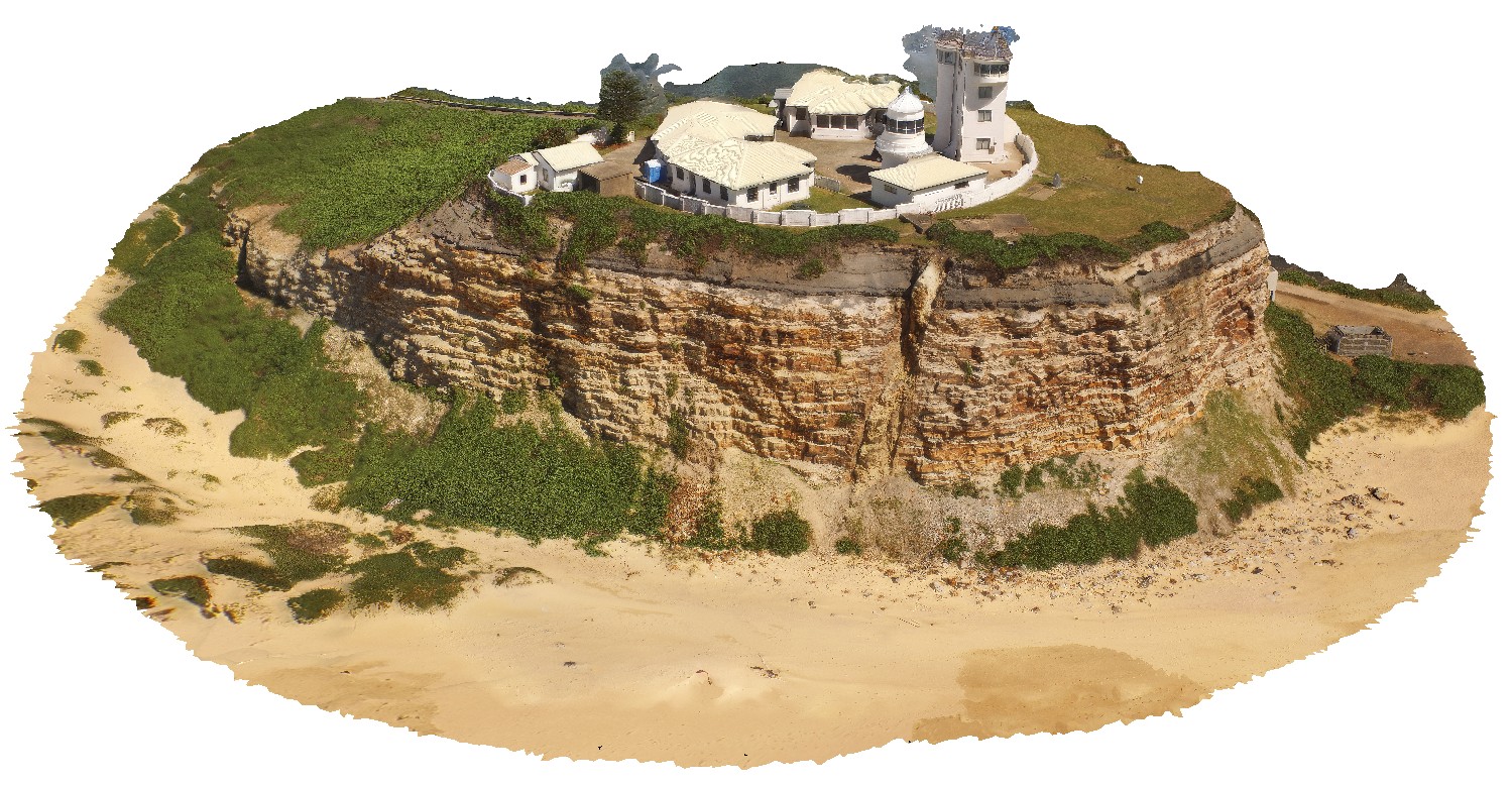
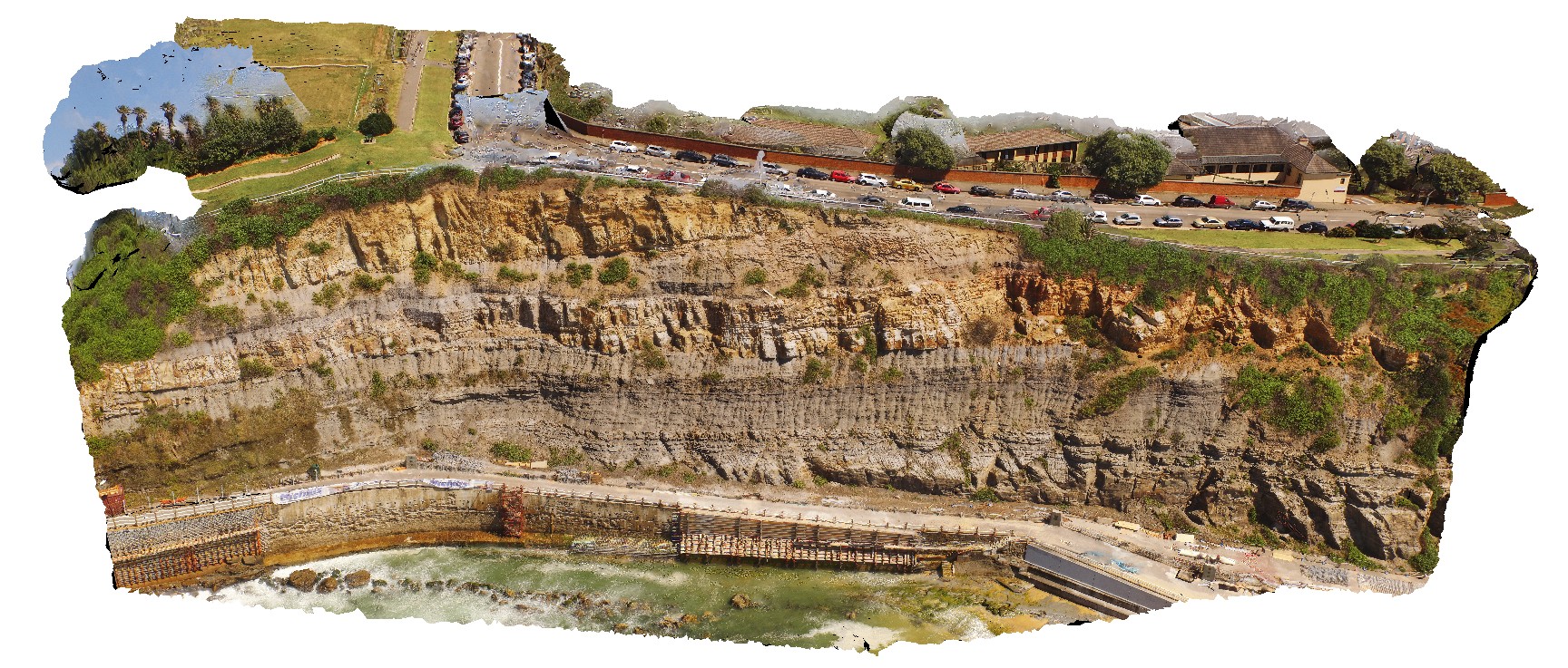
NewcastleUAV1 Map
 |
20 |
01/01/9999 midnight |
UAV |
Nobbys headland with dyke and Nobbys Tuff in cliff face. Newcastle, N.S.W. |
500.00 |
-32.91871800000 |
151.79890100000 |
42.300 |
tuff, dyke, sedimentology |
tuff, igneous rock |
NewcastleUAV2 Map
 |
20 |
01/01/9999 midnight |
UAV |
detail of dyke in Nobbys Headland, showing high to sub-vertical angle. Newcastle, N.S.W. |
35.00 |
-32.91876700000 |
151.79874000000 |
15.400 |
dyke, igneous |
igneous rock |
NewcastleUAV3 Map
 |
20 |
01/01/9999 midnight |
UAV |
dyke and fault at the south end of Newcastle Beach. Newcastle, N.S.W. |
35.00 |
-32.93110600000 |
151.78415800000 |
12.200 |
dyke, fault, structure, igneous rock |
igneous rock |
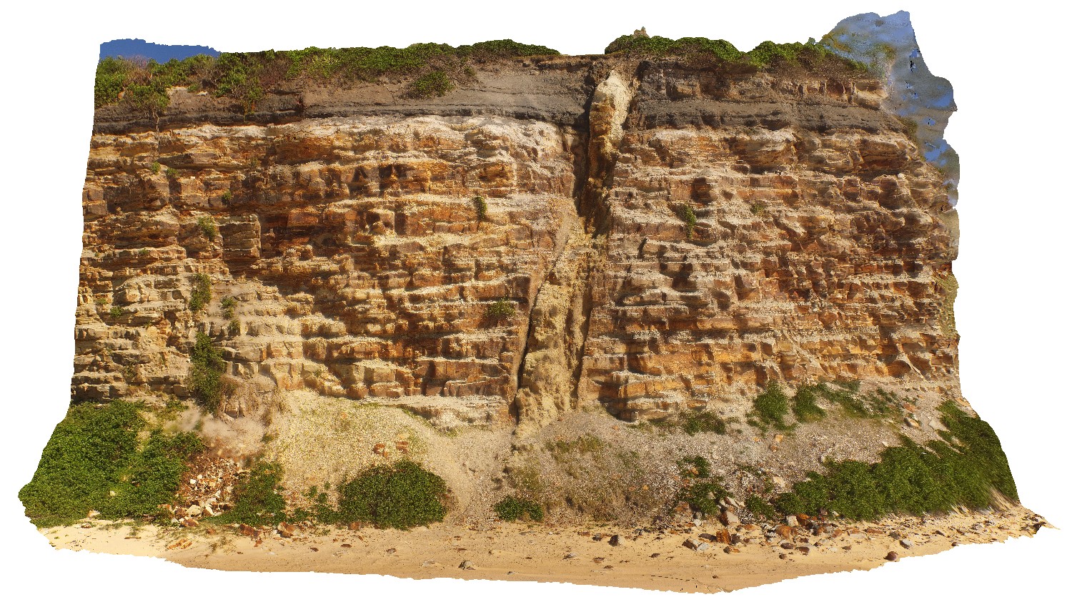
NewcastleUAV4 Map
 |
20 |
01/01/9999 midnight |
UAV |
coastal exposure south of Newcastle Beach showing bedded sediments. Newcastle, N.S.W. |
180.00 |
-32.93233200000 |
151.78328400000 |
38.000 |
sedimentology, sediments, coal measures |
sediments |
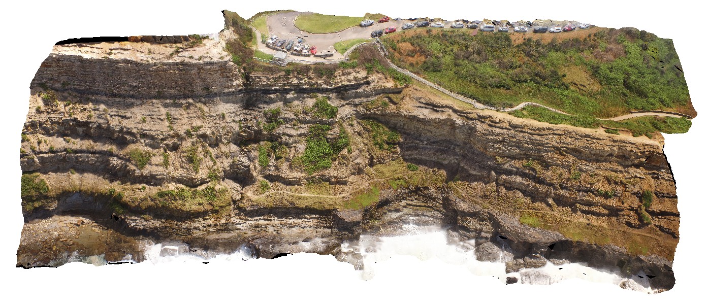
NewcastleUAV5 Map
 |
20 |
01/01/9999 midnight |
UAV |
coastal cliff, south of the Bogey Hole. Newcastle, N.S.W. |
210.00 |
-32.93545400000 |
151.78061500000 |
20.000 |
sedimentology, sediments, tuff, sandstone |
sediments |