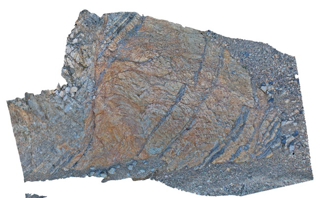
Walkerville1 Map
 |
5 |
05/18/2015 2:23 p.m. |
3D |
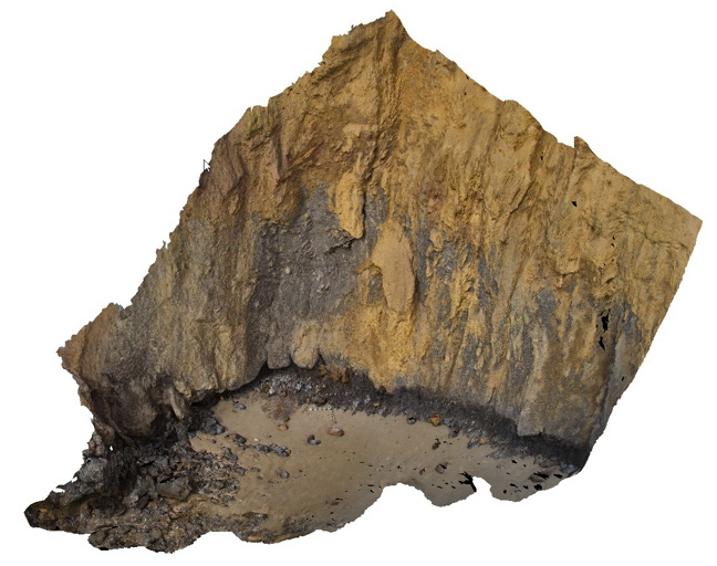
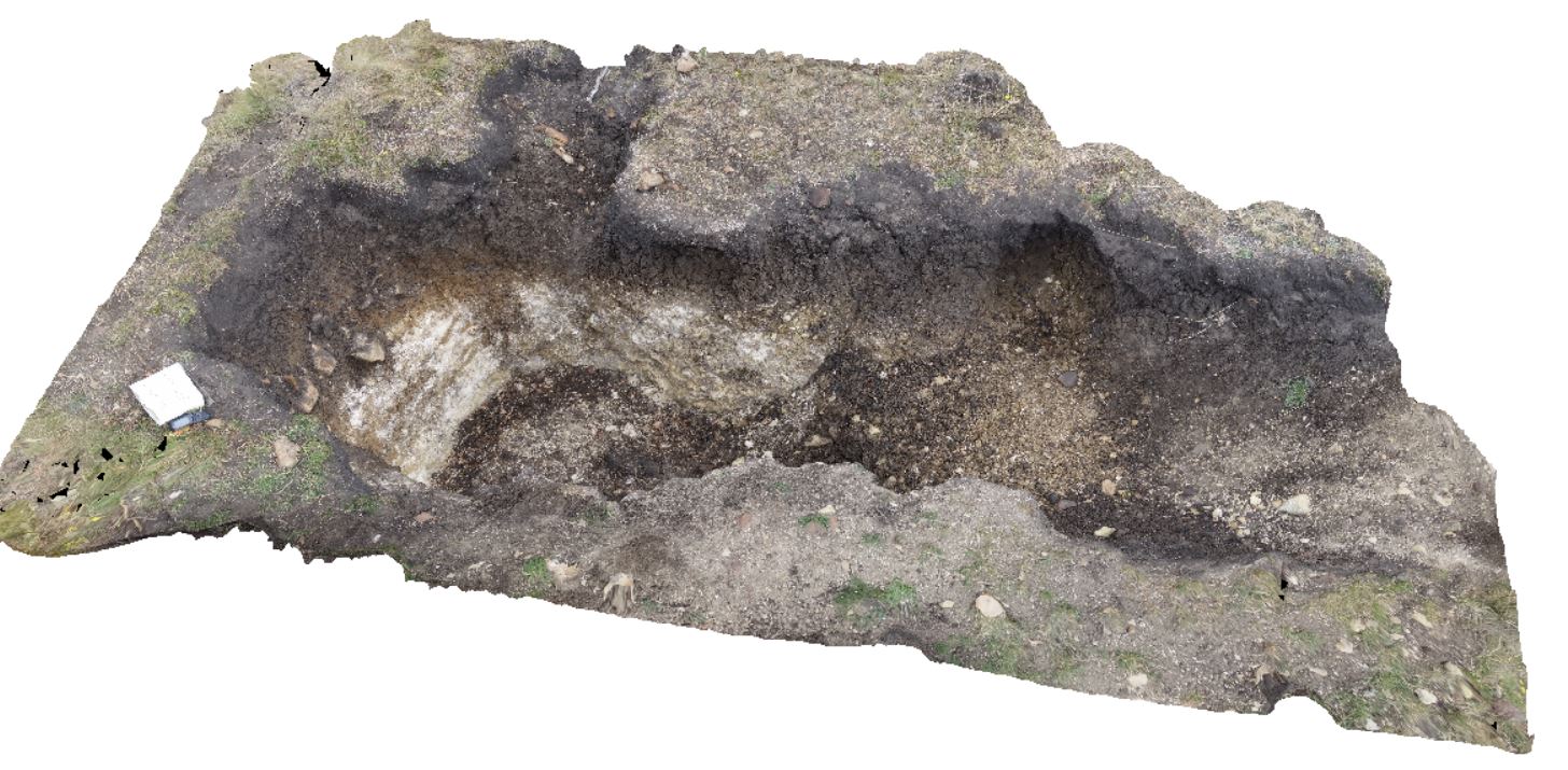
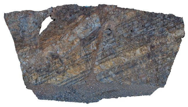
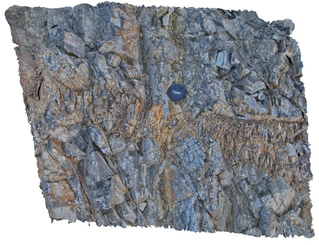
Contact between the Liptrap Formation sandstone and limestone. Contact is a fault melange. Walkerville South, Vic. |
15.00 |
-38.85546000000 |
145.99707000000 |
-9999.000 |
fault, structure, melange |
melange |
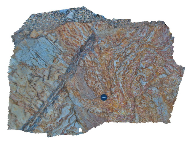
Walkerville2 Map
 |
5 |
05/18/2015 2:23 p.m. |
3D |
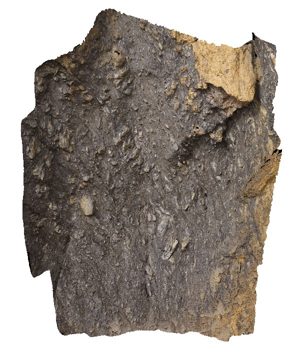
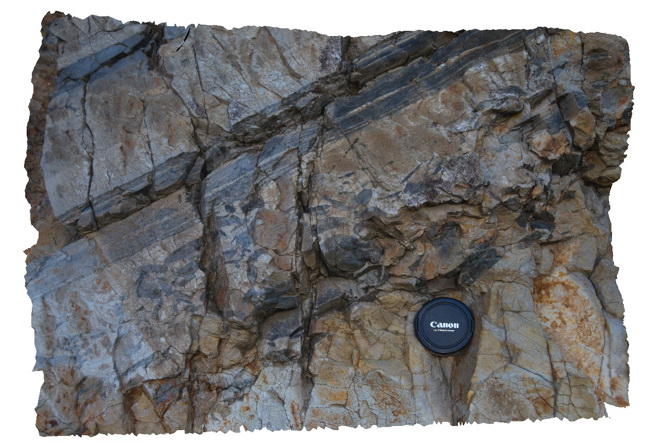
Detail of fault melange shown in Walkerville1. Exposure is 5-10 m up the cliff - maximum clast size is ~0.5m. Walkerville South, Vic. |
6.00 |
-38.85546000000 |
145.99707000000 |
-9999.000 |
fault, melange, structure |
melange |
TowerHillGIGA1 Map
 |
10 |
01/01/9999 midnight |
GIGA |
— |
0.00 |
-38.32723000000 |
142.36790000000 |
-9999.000 |
|
tuff |
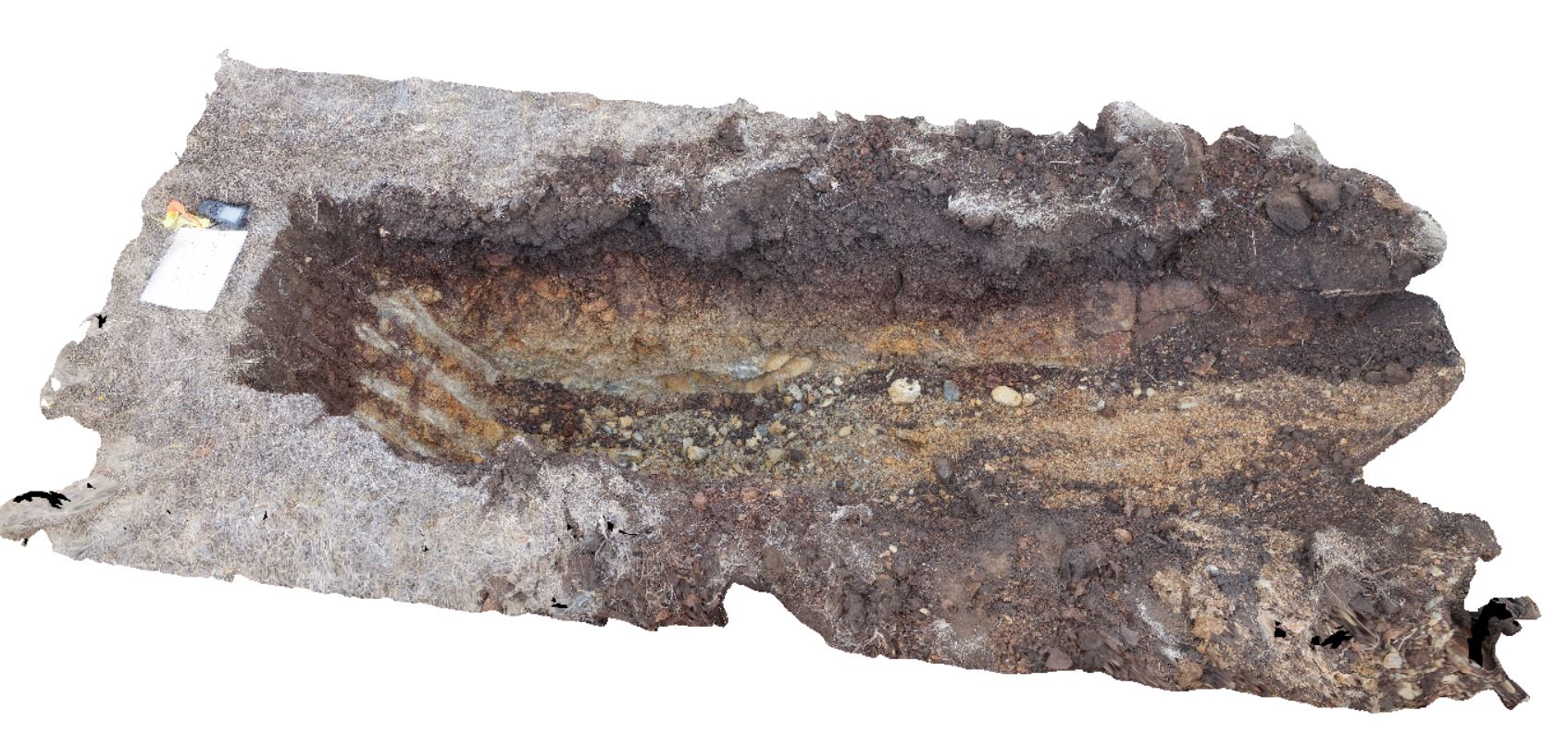
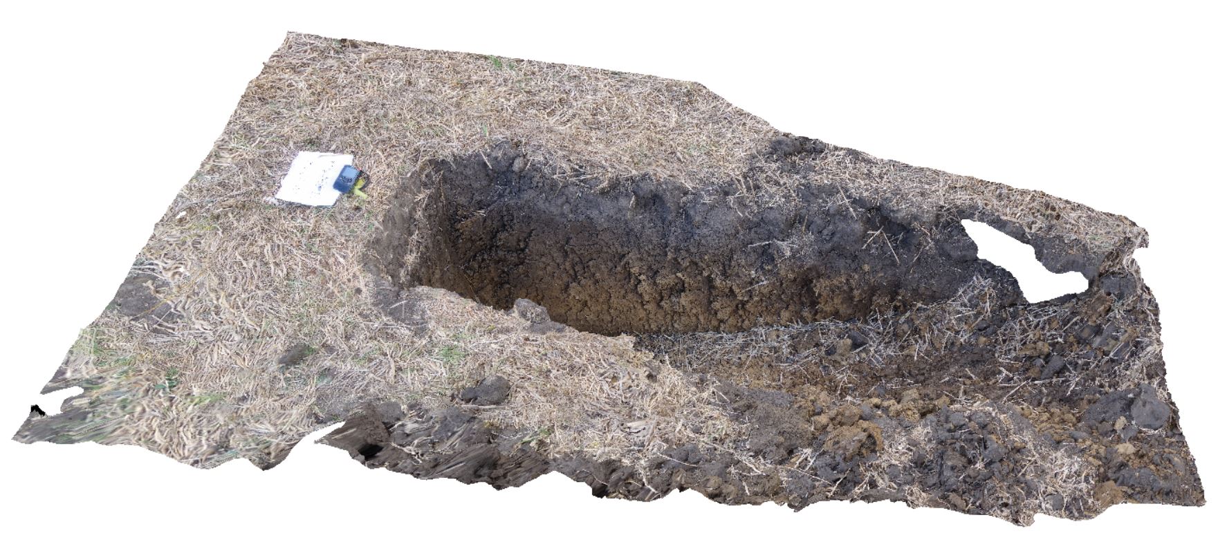
DaisyBanksPit11 Map
 |
20 |
03/23/2015 11:25 a.m. |
3D |
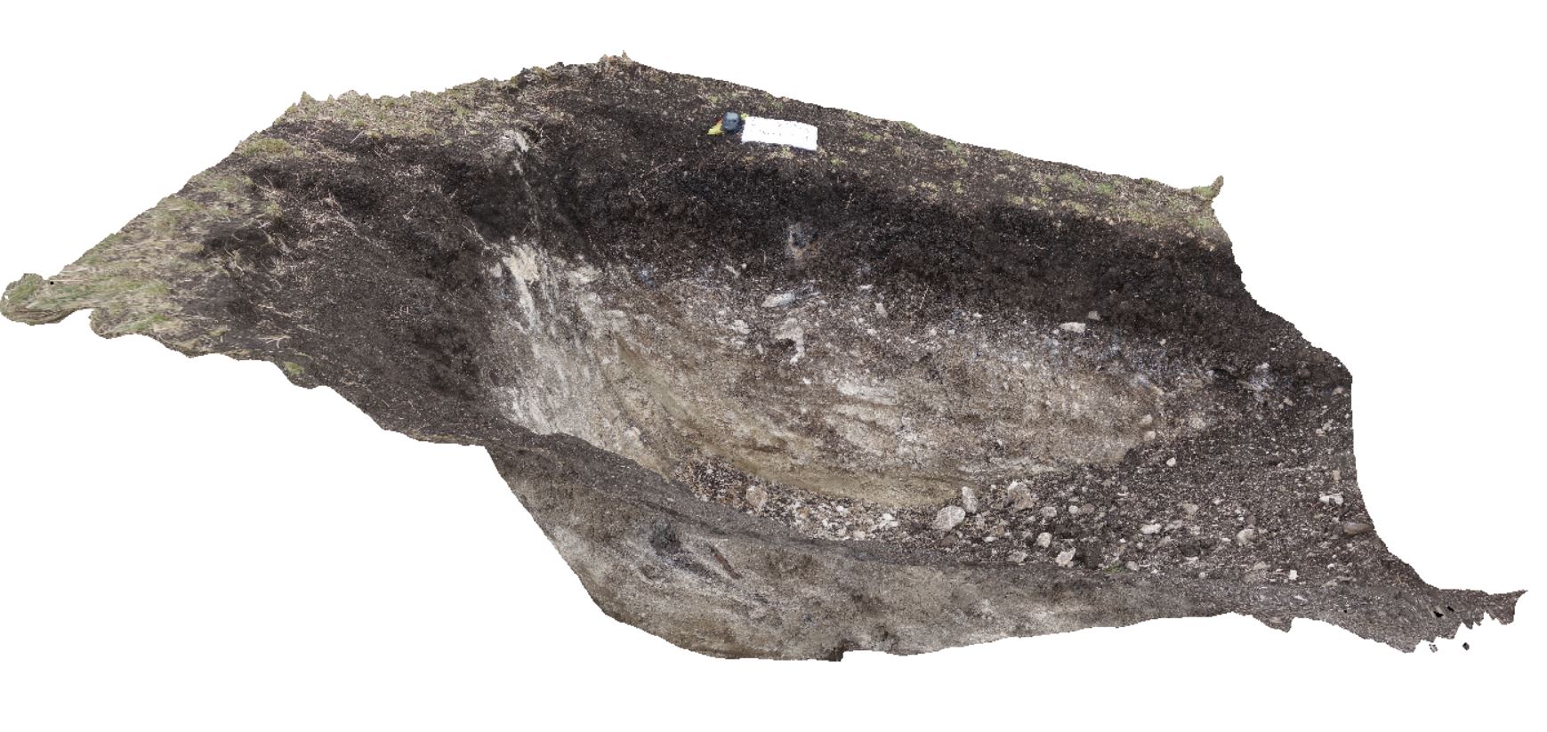
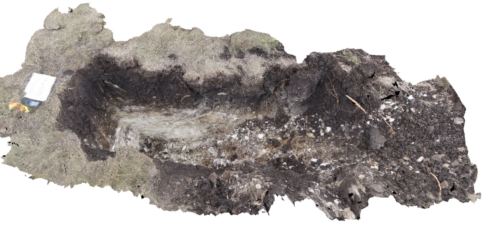
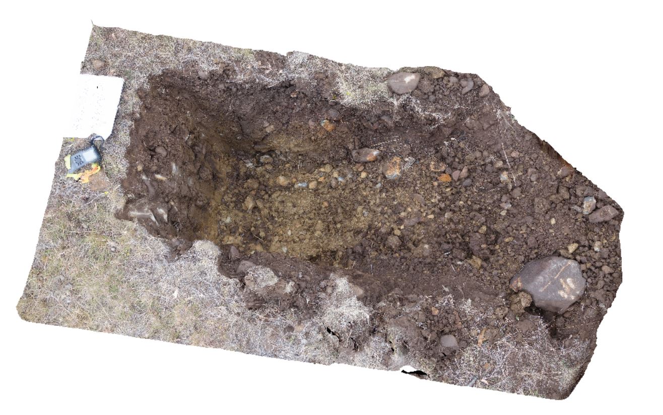
~80cm pit into dark grey sandy soils and white-brown sandy clay overlying Triassic interbedded micaceous brown, red-purple, green and grey carbonaceous siltstone, shale, mudstone and sandstone. Richmond, Tas. |
2.00 |
-42.72936200000 |
147.42457600000 |
-9999.000 |
clay, regolith |
clay |
TowerHill11 Map
 |
10 |
06/05/2016 10:44 a.m. |
3D |
detail of unfilled scour in tuff layer with wavy bedding. Tower Hill, Vic. |
1.20 |
-38.32692000000 |
142.36833000000 |
-9999.000 |
tuff, volcanics |
tuff |
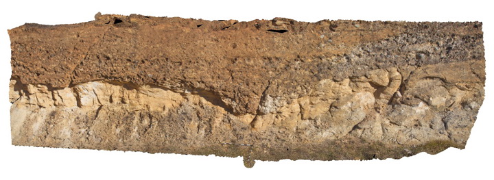
DaisyBanksPit1 Map
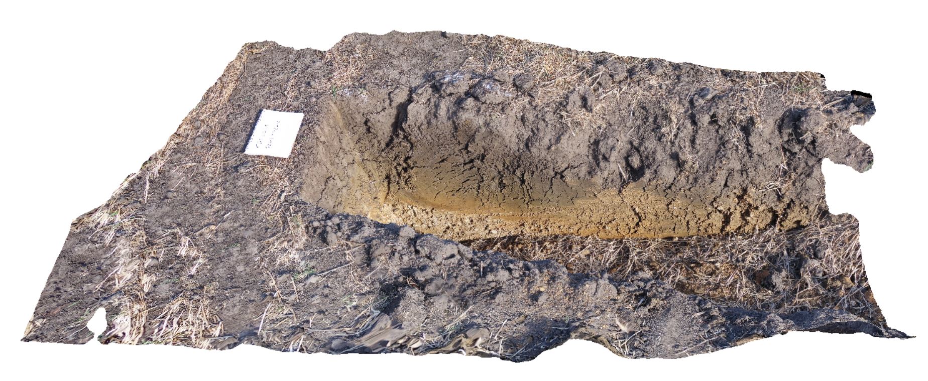 |
20 |
03/17/2015 1:18 p.m. |
3D |
Undifferentiated alluvial soils and clays developed on Quaternary alluvial terrace gravel deposits predominantly derived from Parmeener and Palaeogene-Neogene units with clasts commonly of basalt and in places dolerite. Richmond, Tas. |
2.00 |
-42.73095300000 |
147.43018100000 |
-9999.000 |
clay, alluvium, regolith |
clay |
WestBeach2 Map
 |
0 |
06/05/2016 10:34 a.m. |
3D |
folded layering, showing fold vergence in schist. West Beach, W.A. |
0.80 |
-33.95340000000 |
119.97511000000 |
-9999.000 |
fold vergence, structure |
schist |
DaisyBanksPit12 Map
 |
20 |
03/23/2015 12:11 p.m. |
3D |
~80cm pit into dark grey sandy soils and white-brown sandy clay overlying Jurassic Dolerite. Richmond, Tas. |
2.00 |
-42.72939600000 |
147.42269500000 |
-9999.000 |
clay, Jurassic Dolerite, regolith |
clay |
WestBeach5 Map
 |
0 |
06/05/2016 10:50 a.m. |
3D |
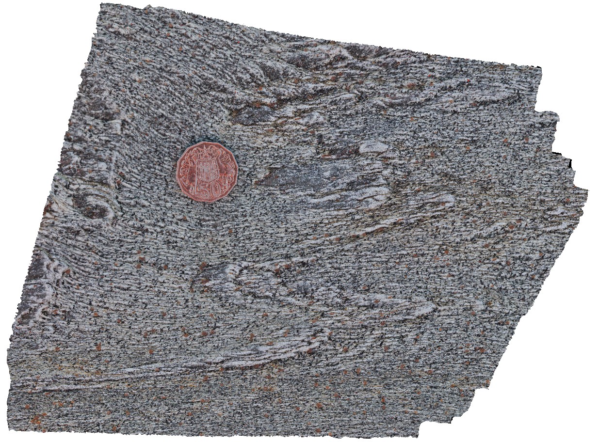
'M' folding in garnet schist, West Beach, W.A. |
0.00 |
-33.95352000000 |
119.97489000000 |
-9999.000 |
M folds, structure, garnet schist |
garnet schist |
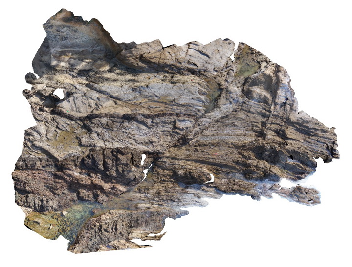
Walkerville7 Map
 |
5 |
05/18/2015 2:25 p.m. |
3D |
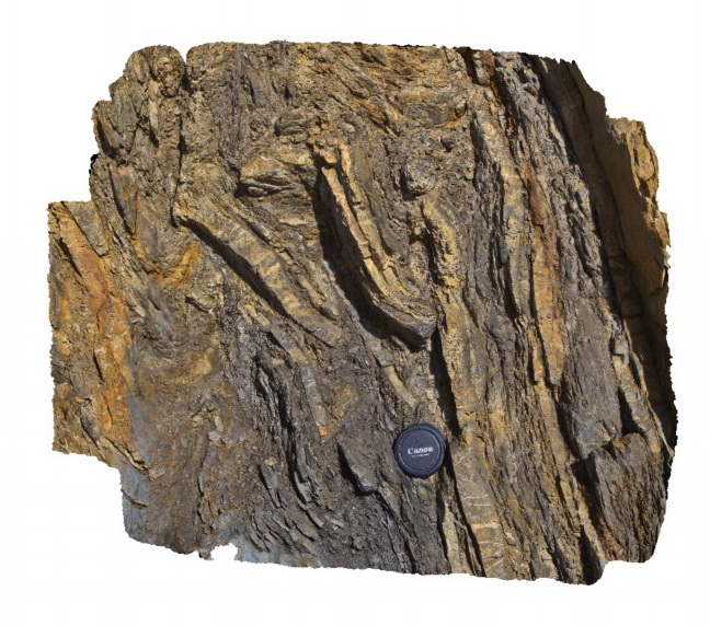
Detailed view of disrupted folds in turbidites of the Liptrap Formation - detail of Walkerville 6 visualisation. Walkerville South, Vic. |
1.00 |
-38.85467000000 |
145.99669000000 |
-9999.000 |
fold, fault, turbidite, structure |
turbidite |
WestBeach7 Map
 |
0 |
06/05/2016 10:49 a.m. |
3D |
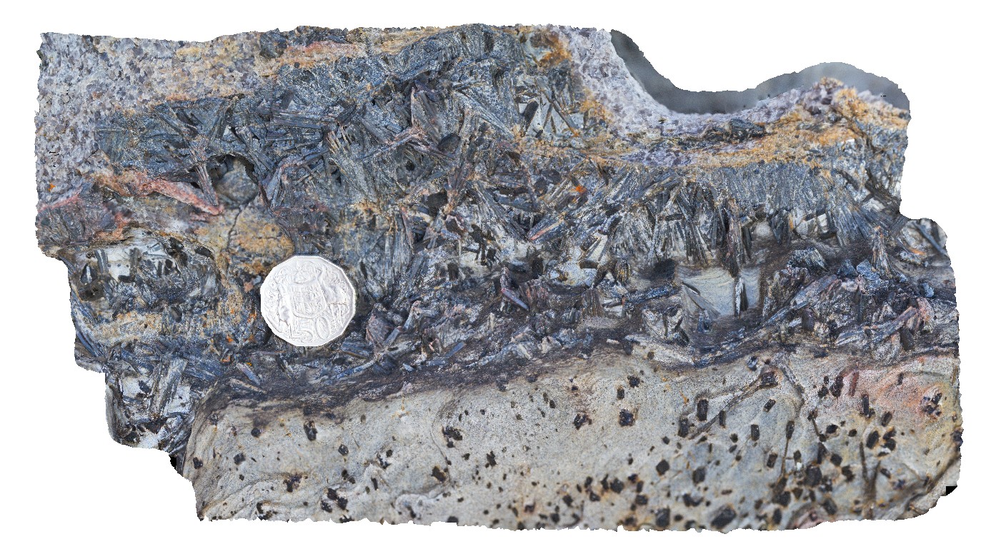
aggregates of black kyanite crystals in band of schist. West Beach, W.A. |
0.20 |
-33.95360000000 |
119.97449000000 |
-9999.000 |
kyanite, schist, metamorphic |
schist |
Thomson1 Map
 |
5 |
05/18/2015 2:17 p.m. |
3D |
normal? fault in dipping turbidites near the Thomson Dam - fault zone approx. 30 cm wide. Thomson Dam, Walhalla, Vic. |
8.00 |
-37.84397000000 |
146.39761000000 |
-9999.000 |
fault, turbidite, structure, sedimentology |
turbidite |
DaisyBanksPit13 Map
 |
20 |
03/23/2015 12:07 p.m. |
3D |
~80cm pit into dark grey sandy soils and white-brown sandy clay overlying Jurassic Dolerite. Richmond, Tas. |
2.00 |
-42.72961200000 |
147.42258600000 |
-9999.000 |
clay, Jurassic Dolerite, regolith |
clay |
Thomson2 Map
 |
5 |
05/18/2015 2:17 p.m. |
3D |
Detail of mudstone rip up clasts in sandstone matrix - same exposure as Thomson1. Thomson Dam, Walhalla, Vic. |
0.50 |
-37.84397000000 |
146.39761000000 |
-9999.000 |
sandstone, siltstone, turbidite, rip-up clasts, sedimentology |
sandstone |
Dudley6 Map
 |
1 |
09/09/2015 8:35 a.m. |
3D |
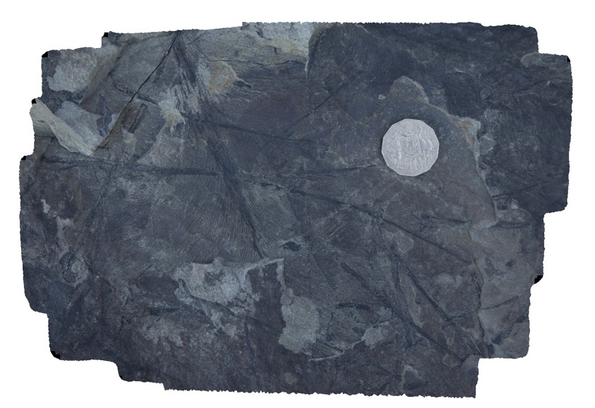
leaf fossils in fine grained sandstone. Dudley Beach, N.S.W. |
0.30 |
-32.96874000000 |
151.73665000000 |
-9999.000 |
leaf, fossil, palaeontology |
sandstone |
Thomson3 Map
 |
5 |
05/18/2015 2:18 p.m. |
3D |
Faults cutting turbiditic sediments of the Devonian Norton Gully Sandstone - main fault zone up to 1m thick. Thomson Dam, Walhalla, Vic. |
10.00 |
-37.84430000000 |
146.39732000000 |
-9999.000 |
turbidite, fault, sedimentology, structure |
turbidite |
DaisyBanksPit14 Map
 |
20 |
03/24/2015 10:06 a.m. |
3D |
~80cm pit into dark grey sandy soils and white-brown sandy clay overlying Jurassic Dolerite. Richmond, Tas. |
2.00 |
-42.73006300000 |
147.42246700000 |
-9999.000 |
Clay, Jurassic Dolerite, regolith |
Clay |
Thomson4 Map
 |
5 |
05/18/2015 2:19 p.m. |
3D |
Detail of the fault zone in Devonian Norton Gully Sandstone depicted in Thomson3 - possible drag of layers? Suggesting that the fault may have a reverse sense of movement. Thomson Dam, Walhalla, Vic. |
2.00 |
-37.84430000000 |
146.39732000000 |
-9999.000 |
turbidite, fault zone, structure |
turbidite |
BermaguiPole2 Map
 |
5 |
10/06/2015 12:57 p.m. |
3D |
overall view of rock platform showing folded turbiditic metasediments offset by a fault zone. Bermagui, N.S.W. |
60.00 |
-36.42450000000 |
150.08278000000 |
-9999.000 |
fault, structure |
turbidite |
Thomson5 Map
 |
5 |
05/18/2015 2:19 p.m. |
3D |
Kink bands in turbiditic sediments of the Devonian Norton Gully Sandstone. Thomson Dam, Walhalla, Vic. |
1.00 |
-37.84430000000 |
146.39732000000 |
-9999.000 |
kink band, turbidite, structure |
turbidite |
DaisyBanksPit15 Map
 |
20 |
03/24/2015 9:47 a.m. |
3D |
~80cm pit into dark grey sandy soils and white-brown sandy clay overlying Jurassic Dolerite. Richmond, Tas. |
2.00 |
-42.73051200000 |
147.42269000000 |
-9999.000 |
Clay, Jurassic Dolerite, regolith |
clay |
Thomson6 Map
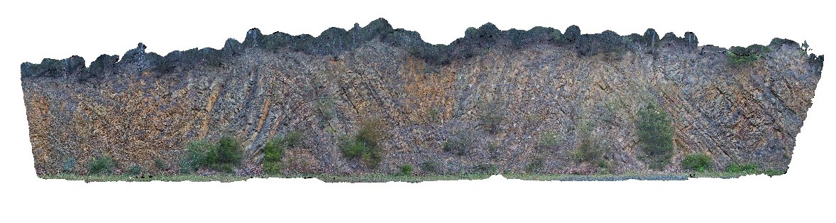 |
5 |
05/18/2015 2:19 p.m. |
3D |
Chevron style synclines and anticlines in turbiditic metasediments of the Devonian Norton Gully Sandstone. Thomson Dam, Walhalla, Vic. |
25.00 |
-37.85546000000 |
146.39876000000 |
-9999.000 |
turbidite, chevron fold, anticline, syncline, structure |
turbidite |
Armidale3 Map
 |
5 |
07/27/2015 10:33 a.m. |
3D |
Conglomerate channel cut into underlying sandstone in the Eocene-Oligocene Armidale beds. Armidale, N.S.W |
12.00 |
-30.49301000000 |
151.65099000000 |
-9999.000 |
conglomerate, sandstone, channel |
sandstone, conglomerate |
DaisyBanksPit3 Map
 |
20 |
03/17/2015 1:37 p.m. |
3D |
~80cm deep pit into soil and clays overlying Quaternary alluvial and marsh deposits of modern flood plains; of gravel, sand, silt and clay. Richmond, Tas. |
2.00 |
-42.73071600000 |
147.42842100000 |
-9999.000 |
clay, alluvium, regolith |
Clay |
BHillFSP19 Map
 |
0 |
10/19/2015 11:06 a.m. |
FSP |
road cutting, showing joint surfaces and small scale folding in gneiss. Broken Hill. N.S.W. |
200.00 |
-32.00626000000 |
141.28963000000 |
-9999.000 |
fold, joint surface |
gneiss |