Conran4 Map
 |
5 |
07/18/2015 3:10 p.m. |
3D |
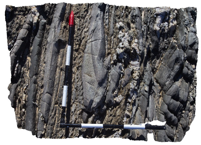
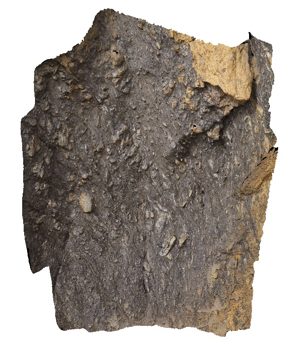
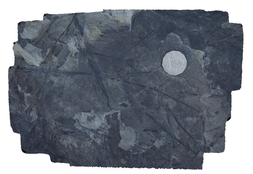
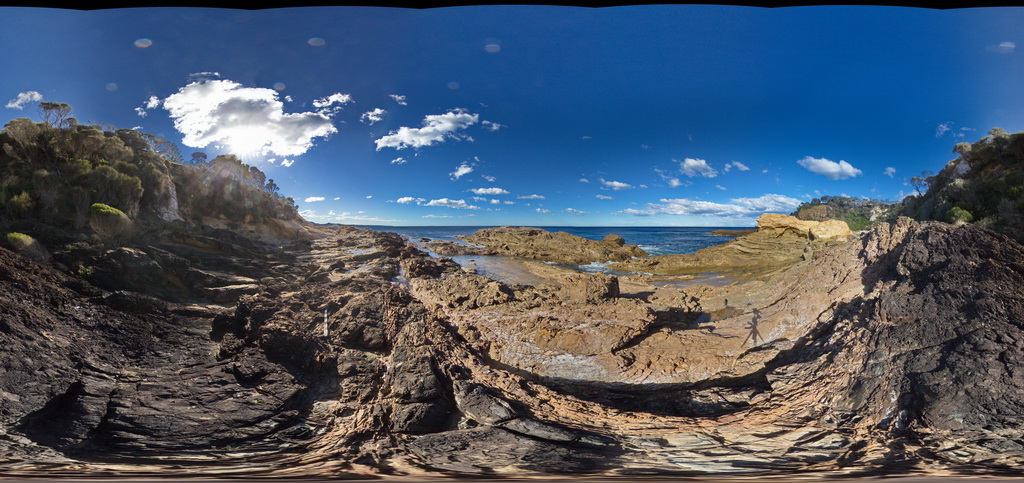
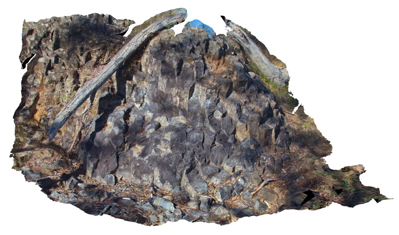
Disrupted isoclinal fold hinge in turbiditic metasediments of the Ordovician Pinnak Sandstone. Axial planar cleavage is well developed in the hinge of the fold. Cape Conran, Vic. |
0.90 |
-37.80046000000 |
148.74255000000 |
-9999.000 |
turbidite, isoclinal fold, cleavage, structure |
turbidite |
DaisyBanksPit10 Map
 |
20 |
03/23/2015 11:20 a.m. |
3D |
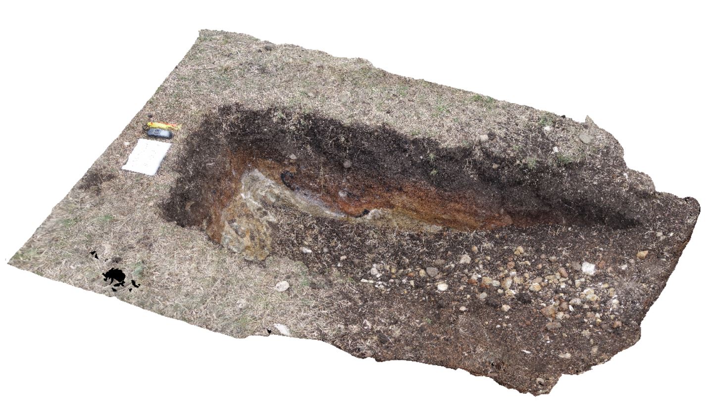
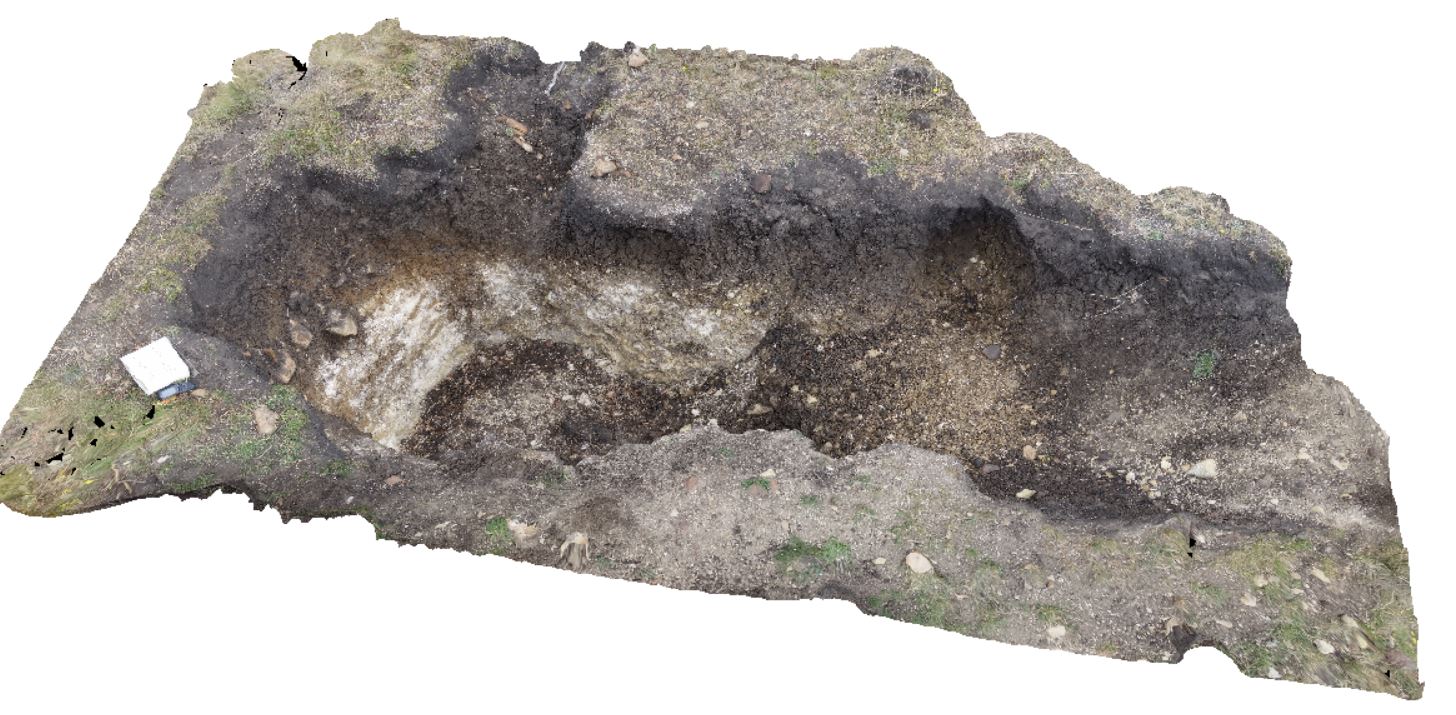
~80cm deep pit into Cenozoic soil and clays overlying (inferred) Jurassic Dolerite. Richmond, Tas. |
2.00 |
-42.73042400000 |
147.42464400000 |
-9999.000 |
Jurassic Dolerite, Clay, Alluvial, regolith |
Clay |
Walkerville1 Map
 |
5 |
05/18/2015 2:23 p.m. |
3D |
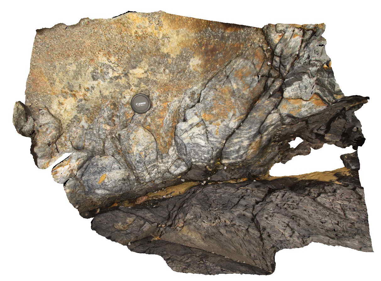
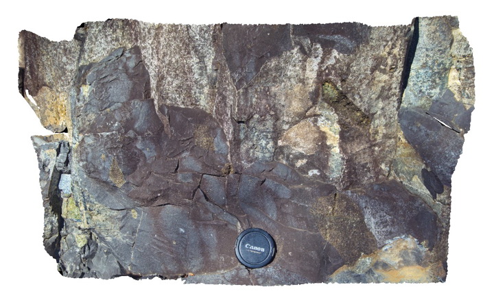
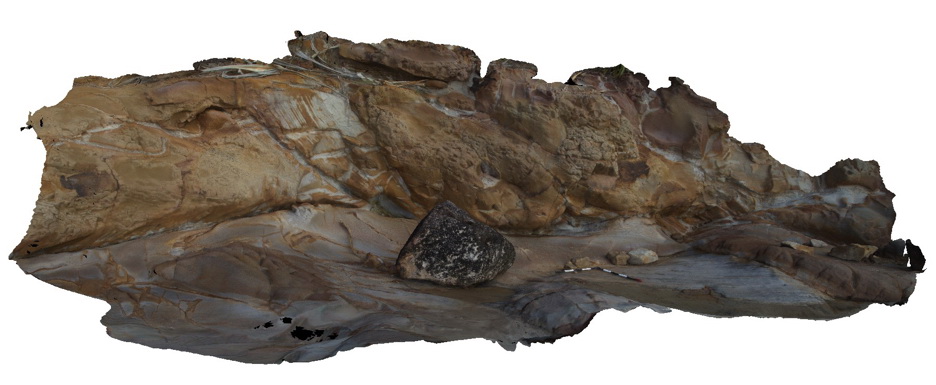
Contact between the Liptrap Formation sandstone and limestone. Contact is a fault melange. Walkerville South, Vic. |
15.00 |
-38.85546000000 |
145.99707000000 |
-9999.000 |
fault, structure, melange |
melange |
Bermagui3 Map
 |
5 |
05/18/2015 12:58 p.m. |
3D |
Fault zone cross-cutting steeply dipping sandstone beds of the Ordovician Abercrombie Formation. Visualisation is approximately 8-10m across. Bermagui, N.S.W. |
9.00 |
-36.42400000000 |
150.08278000000 |
-9999.000 |
fault zone, sandstone, structure |
sandstone |
Walkerville2 Map
 |
5 |
05/18/2015 2:23 p.m. |
3D |
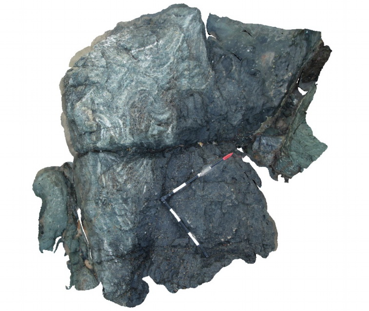
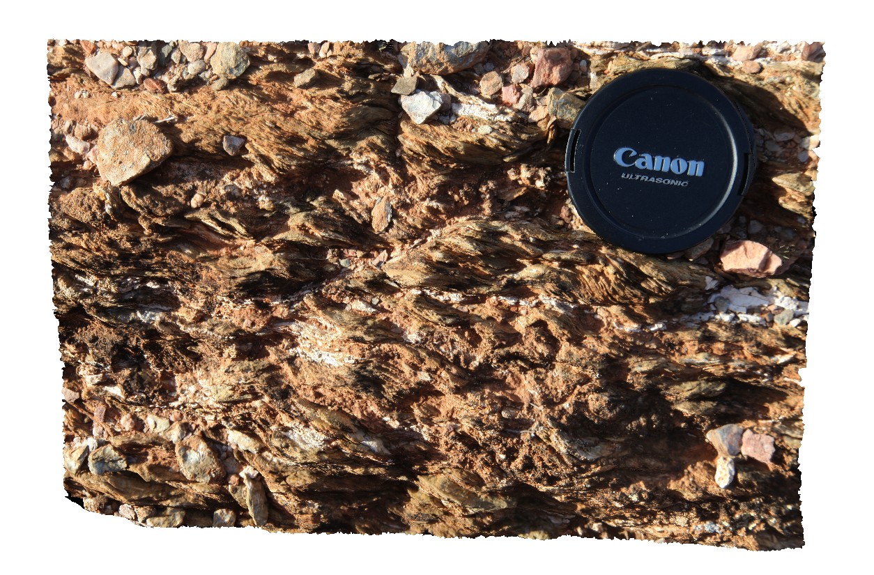
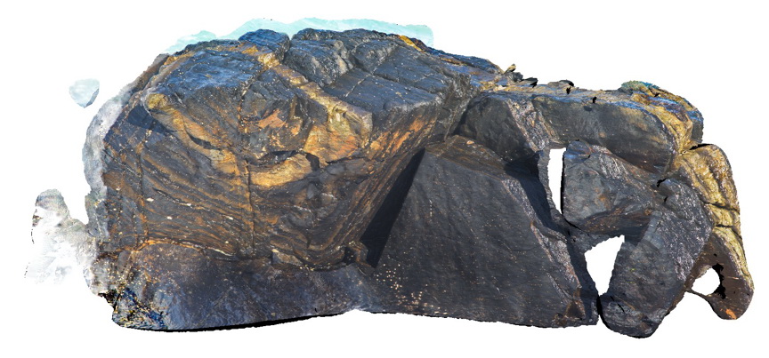
Detail of fault melange shown in Walkerville1. Exposure is 5-10 m up the cliff - maximum clast size is ~0.5m. Walkerville South, Vic. |
6.00 |
-38.85546000000 |
145.99707000000 |
-9999.000 |
fault, melange, structure |
melange |
PtMacquarie21 Map
 |
1 |
01/01/9999 midnight |
3D |
Contact between a basaltic dyke and folded chert within the Cambrian Port Macquarie Serpentinite melange |
2.00 |
-31.46372000000 |
152.93477000000 |
-9999.000 |
dyke, structure, folds, igneous |
dolerite, chert |
MtGipps41 Map
 |
0 |
06/30/2016 noon |
3D |
metasediments, Mount Gipps, N.S.W. |
1.80 |
-31.61732000000 |
141.50060000000 |
-9999.000 |
metasediments, structure |
metasediments |
BH2014n11 Map
 |
20 |
03/17/2015 11:06 a.m. |
3D |
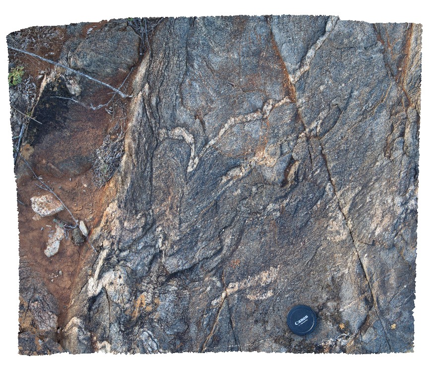
folded shear in quartz pegmatite. Broken Hill, N.S.W. |
2.00 |
-31.61754962000 |
141.49437202000 |
-9999.000 |
pegmatite, fold, structure, shear |
pegmatite |
DaisyBanksPit11 Map
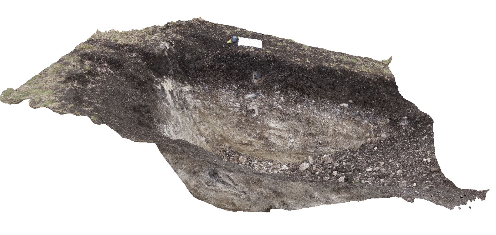 |
20 |
03/23/2015 11:25 a.m. |
3D |
~80cm pit into dark grey sandy soils and white-brown sandy clay overlying Triassic interbedded micaceous brown, red-purple, green and grey carbonaceous siltstone, shale, mudstone and sandstone. Richmond, Tas. |
2.00 |
-42.72936200000 |
147.42457600000 |
-9999.000 |
clay, regolith |
clay |
Valla1 Map
 |
1 |
06/16/2015 5:43 p.m. |
3D |
Phyllite in horizontal cleavage. Valla Beach, N.S.W. |
0.70 |
-30.59363000000 |
153.01398000000 |
-9999.000 |
cleavage |
phyllite |
CrescentFSP1 Map
 |
5 |
08/27/2015 11:07 a.m. |
FSP |
View of dipping sandstone layers in the Permian Crescent Head Formation. Crescent Head, N.S.W. |
50.00 |
-31.18674000000 |
152.98433000000 |
-9999.000 |
bedding, sedimentology |
sandstone |
CanberraGiga1 Map
 |
1 |
06/17/2015 10:27 a.m. |
GIGA |
— |
0.00 |
-35.30408000000 |
149.12651000000 |
-9999.000 |
|
|
DaisyBanksPit1 Map
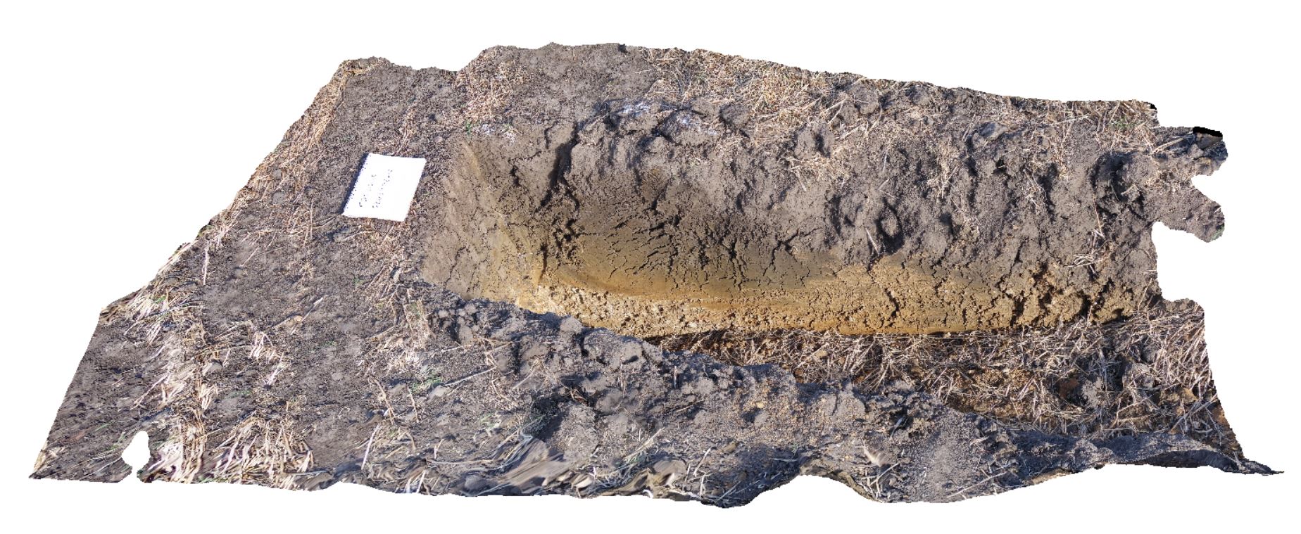 |
20 |
03/17/2015 1:18 p.m. |
3D |
Undifferentiated alluvial soils and clays developed on Quaternary alluvial terrace gravel deposits predominantly derived from Parmeener and Palaeogene-Neogene units with clasts commonly of basalt and in places dolerite. Richmond, Tas. |
2.00 |
-42.73095300000 |
147.43018100000 |
-9999.000 |
clay, alluvium, regolith |
clay |
Dudley6 Map
 |
1 |
09/09/2015 8:35 a.m. |
3D |
leaf fossils in fine grained sandstone. Dudley Beach, N.S.W. |
0.30 |
-32.96874000000 |
151.73665000000 |
-9999.000 |
leaf, fossil, palaeontology |
sandstone |
SmokyCape2 Map
 |
1 |
06/16/2015 5:39 p.m. |
3D |
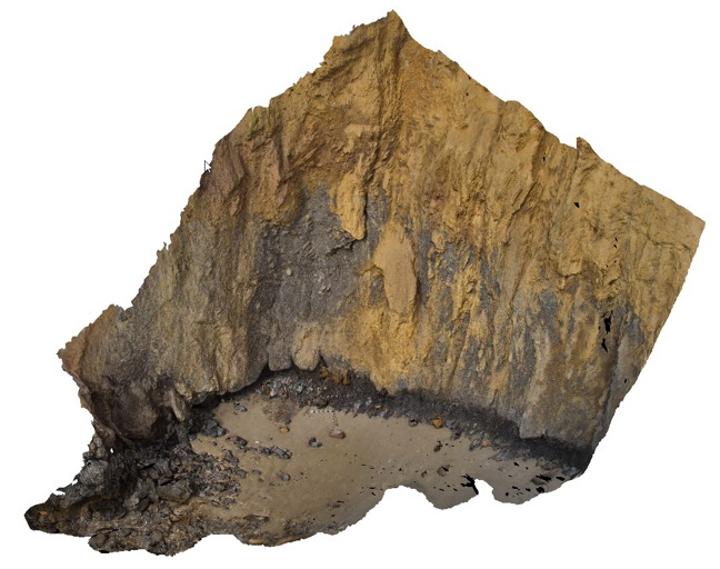
Detail of contact between the Triassic Smokey Cape Monzogranite and Permo-Carboniferous Kempsey Beds showing the chilled margin of the granite and migmatised country rocks. Smoky Cape, N.S.W |
1.00 |
-30.92401000000 |
153.08894000000 |
-9999.000 |
intrusive contact, chilled margin, migmatite, igneous |
monzogranite, sandstone |
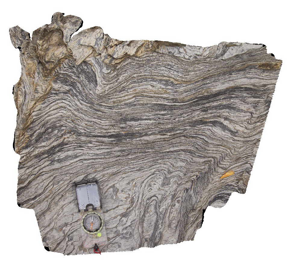
BH2014n19 Map
 |
20 |
03/16/2015 3:05 p.m. |
3D |
folding in gneiss and quartz veins. Broken Hill, N.S.W. |
1.00 |
-31.61365513000 |
141.49653115000 |
-9999.000 |
fold, structure, gneiss, metamorphic |
gneiss |
DaisyBanksPit12 Map
 |
20 |
03/23/2015 12:11 p.m. |
3D |
~80cm pit into dark grey sandy soils and white-brown sandy clay overlying Jurassic Dolerite. Richmond, Tas. |
2.00 |
-42.72939600000 |
147.42269500000 |
-9999.000 |
clay, Jurassic Dolerite, regolith |
clay |
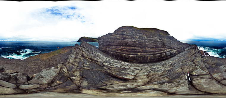
BermaguiFSP1 Map
 |
5 |
08/21/2015 11:38 a.m. |
FSP |
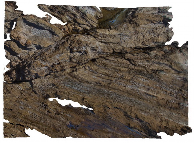
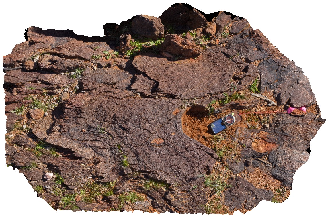
thickly bedded, folded and faulted turbiditic metasediments of the Ordovician Adaminaby Group. Bermagui, N.S.W. |
50.00 |
-36.42449000000 |
150.08263000000 |
-9999.000 |
structure, sedimentology, turbidite |
turbidite |
Armidale2 Map
 |
5 |
07/27/2015 10:20 a.m. |
3D |
Detail of mantle xenoliths in Tertiary basalt at site of Armidale1. Armidale, N.S.W |
0.50 |
-30.48196000000 |
151.63914000000 |
-9999.000 |
basalt, xenolith |
basalt |
BH2014n5 Map
 |
20 |
03/13/2015 9:59 a.m. |
3D |
S-C fabric developed in metasediment. Broken Hill, N.S.W. |
0.20 |
-31.61294092000 |
141.53049184000 |
-9999.000 |
S-C fabric, structure, metasediment |
metasediment |
Walkerville7 Map
 |
5 |
05/18/2015 2:25 p.m. |
3D |
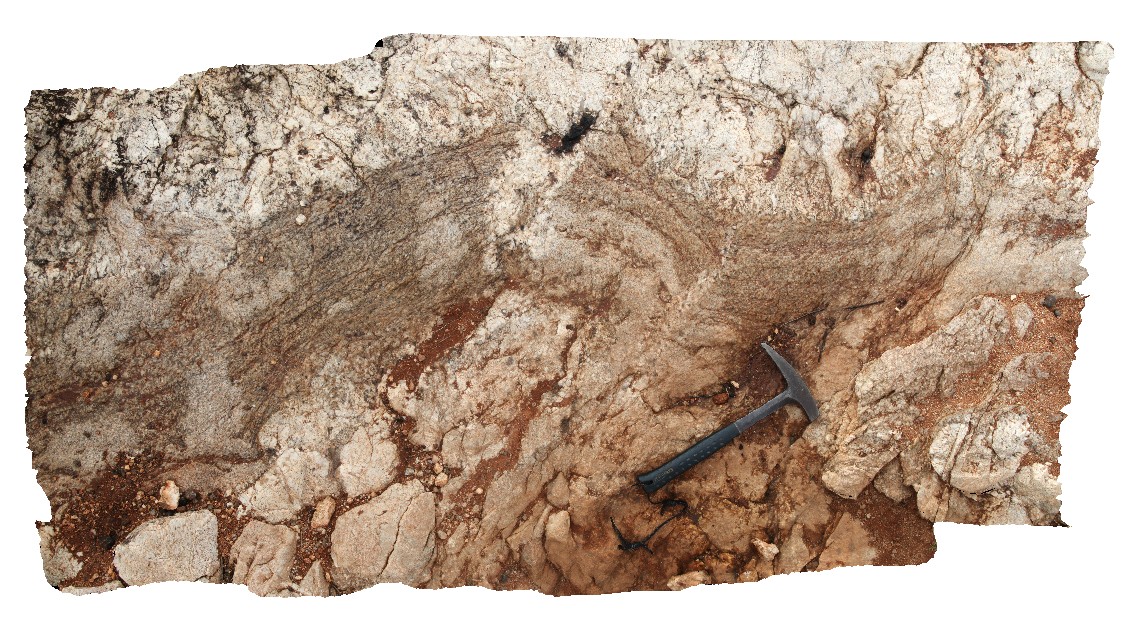
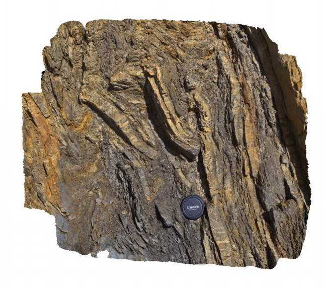
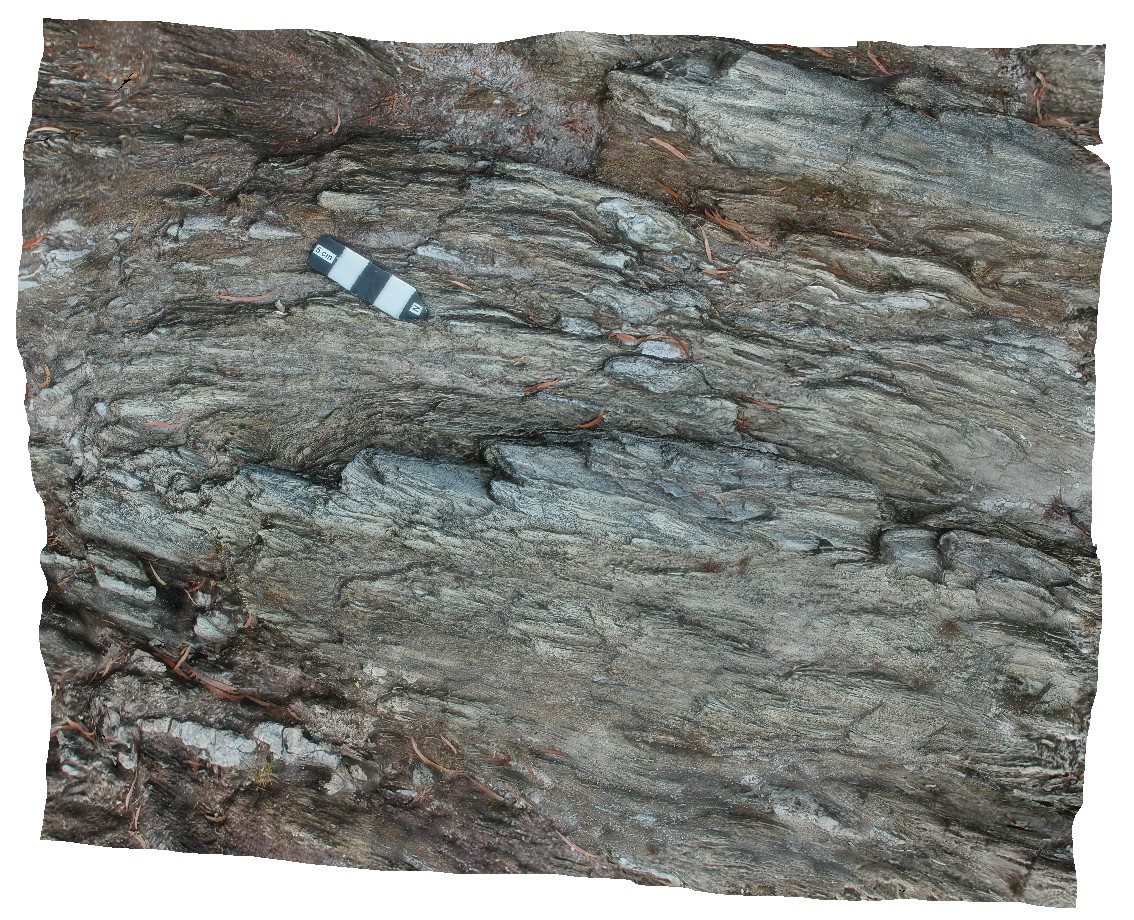
Detailed view of disrupted folds in turbidites of the Liptrap Formation - detail of Walkerville 6 visualisation. Walkerville South, Vic. |
1.00 |
-38.85467000000 |
145.99669000000 |
-9999.000 |
fold, fault, turbidite, structure |
turbidite |
Armidale1 Map
 |
5 |
10/06/2015 11:03 a.m. |
3D |
Tertiary columnar basalt with mantle xenoliths. Armidale, N.S.W |
5.00 |
-30.48196000000 |
151.63914000000 |
-9999.000 |
basalt, columnar jointing, igneous |
basalt |
Evans3 Map
 |
1 |
07/09/2015 9:15 a.m. |
3D |
Fine grained (silty) laminated sediments overlain by medium to coarse grained quartz sandstone. The contact is irregular and erosional. Evens Head, N.S.W. |
10.00 |
-29.11441000000 |
153.43889000000 |
-9999.000 |
channel, sedimentology, erosional contact |
sandstone |
HastingsPt2 Map
 |
1 |
07/09/2015 4:27 p.m. |
3D |
fold in metasediments in offshore rock - approximately 2.5m across. Devonian - Carboniferous Neranleigh-Fernvale Beds. Hastings Point, QLD. |
0.00 |
-28.33676000000 |
153.57729000000 |
-9999.000 |
fold, structure |
sandstone |
Pedder4 Map
 |
5 |
05/04/2016 10:29 a.m. |
3D |
gently plunging, upright to overturned parasitic folds in quartzite with stretched and deformed quartz vein. Lake Pedder, south west Tasmania. |
0.25 |
-42.84854550000 |
146.11601940000 |
-9999.000 |
parasitic fold, fold, structure |
quartzite |