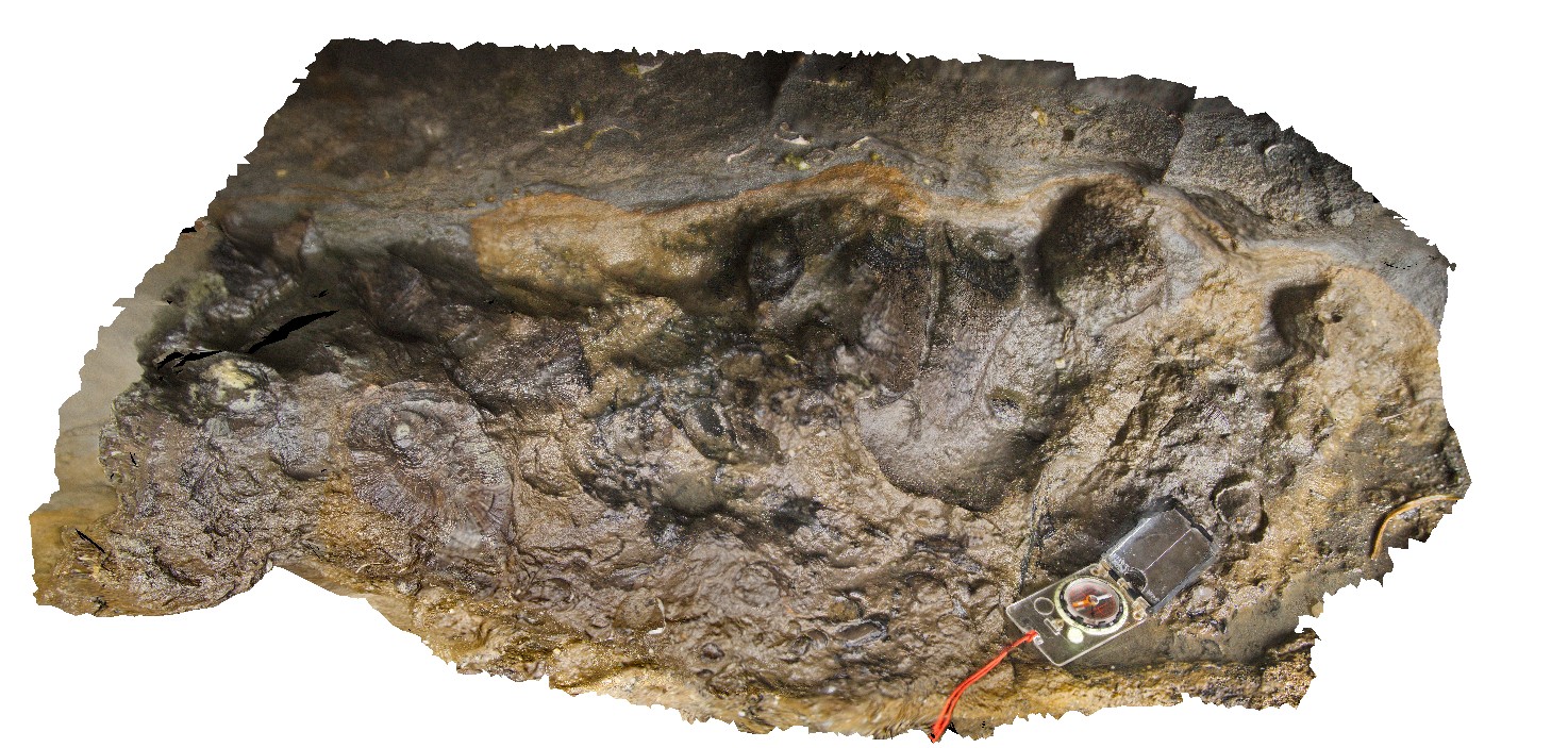
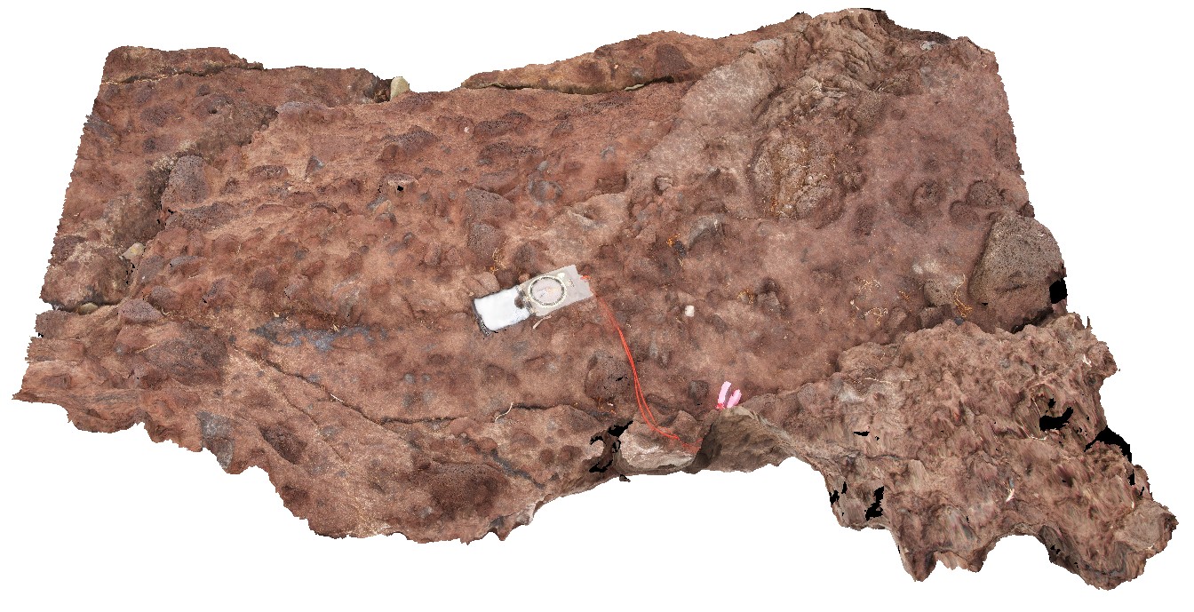
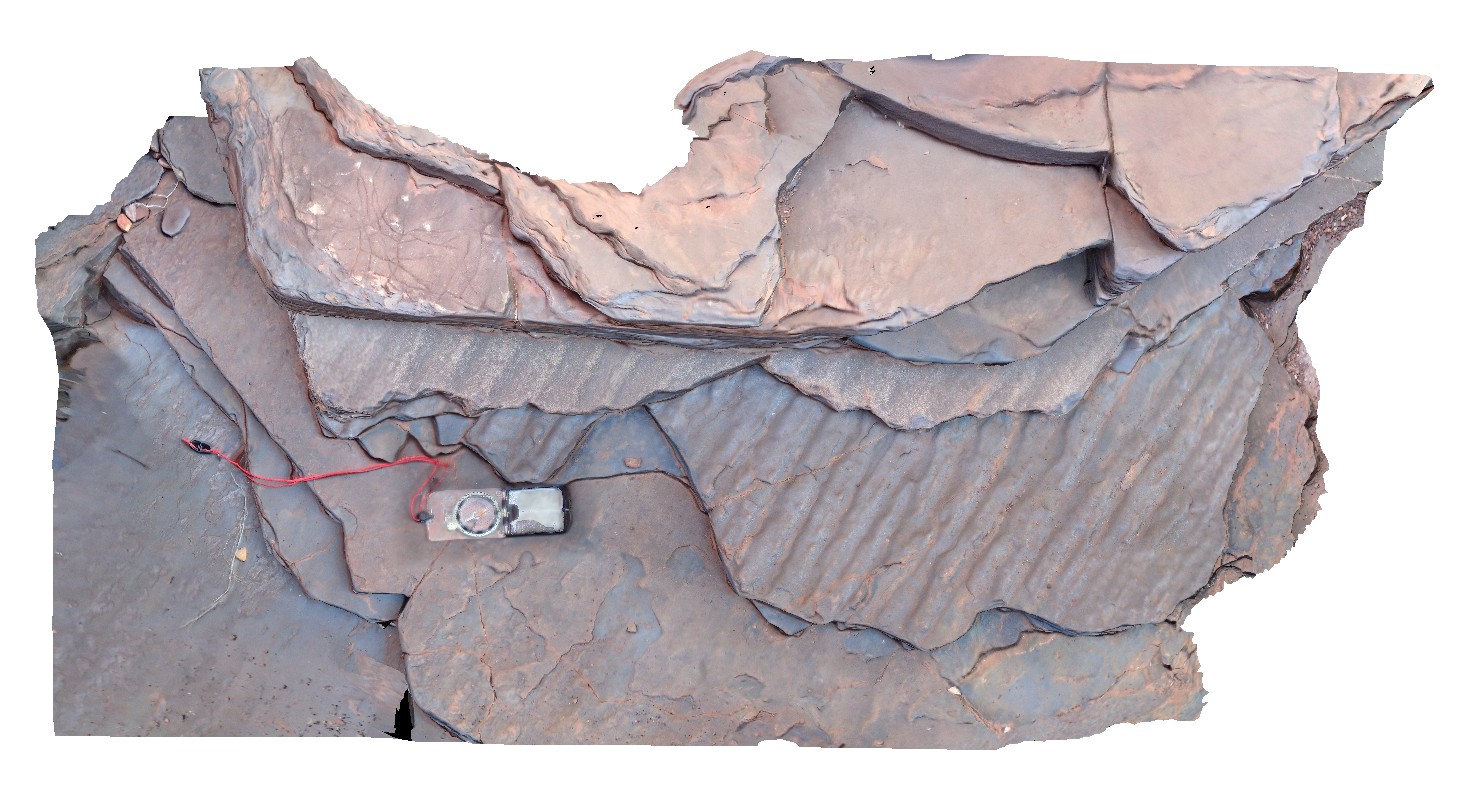
Eaglehawk9 Map
 |
5 |
01/01/9999 midnight |
3D |
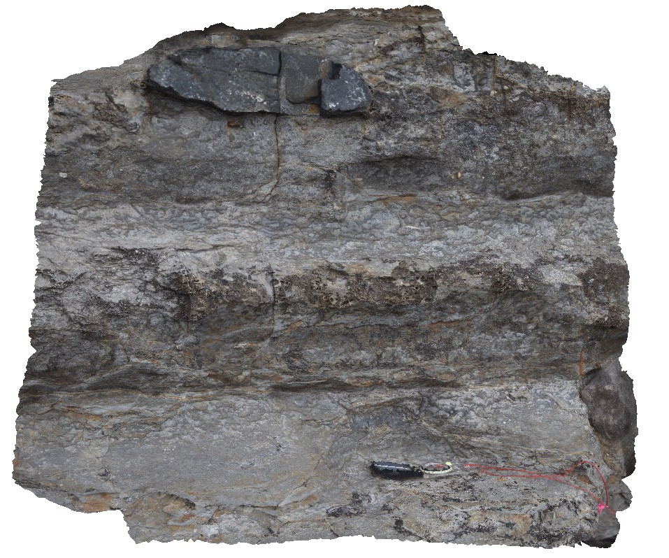
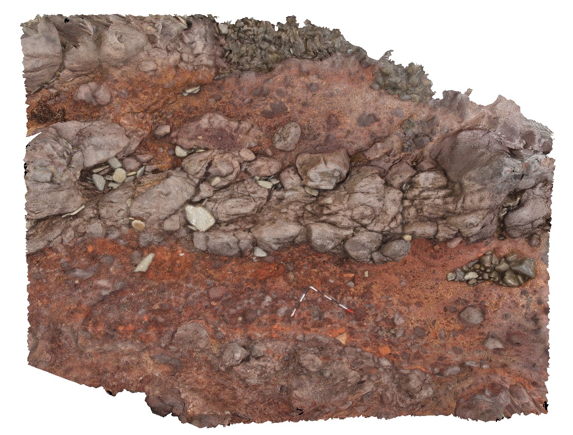
concretion and pebbly siltstone overlaying bioturbated Permian sediments with occasional thick shell fossils. Eaglehawk Neck, Tasmania. |
1.20 |
-43.03357000000 |
147.94931000000 |
-9999.000 |
concretion, bioturbation, Permian sediment, sedimentology, fossil, palaeontology |
siltstone |
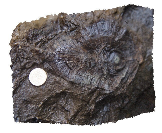
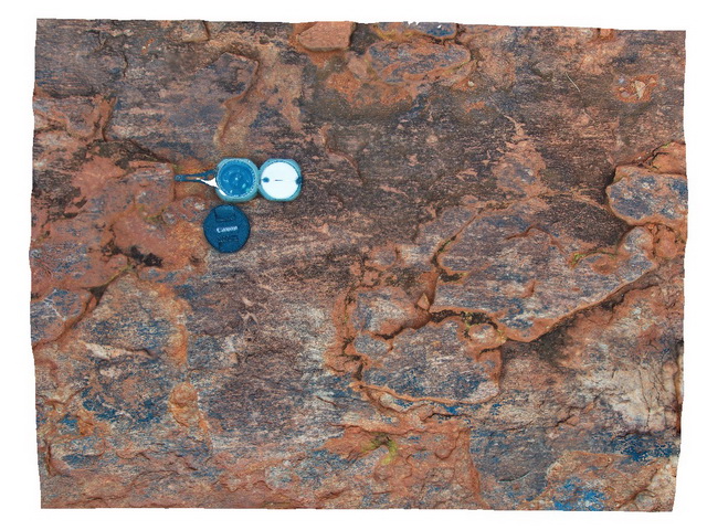
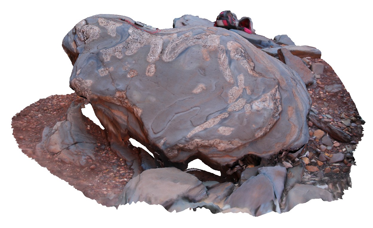
Eaglehawk10 Map
 |
5 |
01/01/9999 midnight |
3D |
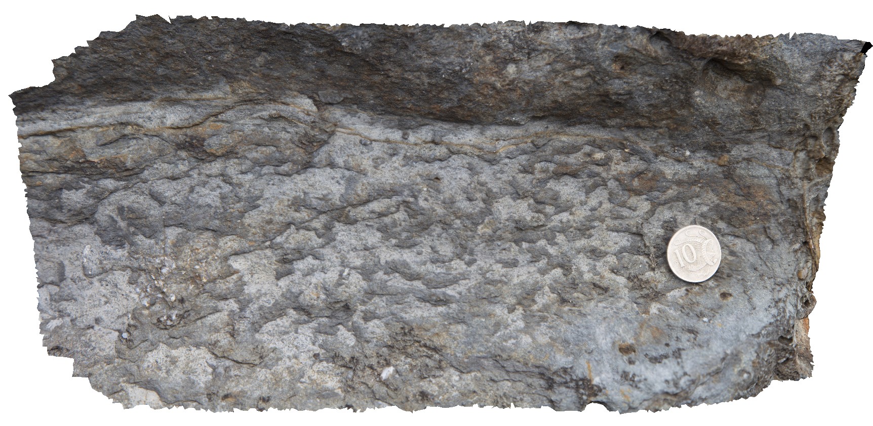
detail of bioturbation from site Eaglehawk9 in Permian sedimentary rocks. Eaglehawk Neck, Tasmania. |
0.30 |
-43.03357000000 |
147.94931000000 |
-9999.000 |
bioturbation, Permian sediments, fossil, palaeontology |
siltstone |
Eaglehawk11 Map
 |
5 |
01/01/9999 midnight |
3D |
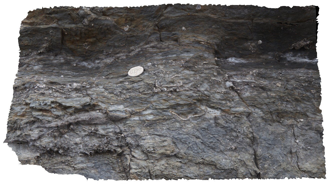
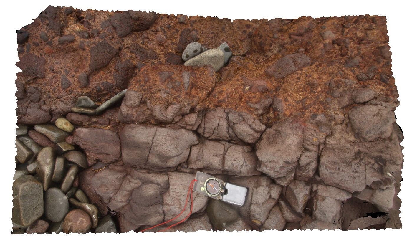
layer of broken shell material in Permian siltstone. Eaglehawk Neck, Tasmania. |
0.60 |
-43.03355000000 |
147.94917000000 |
-9999.000 |
shells, fossil, fossiliferous, palaeontology, Permian |
siltstone |
Eaglehawk12 Map
 |
5 |
01/01/9999 midnight |
3D |
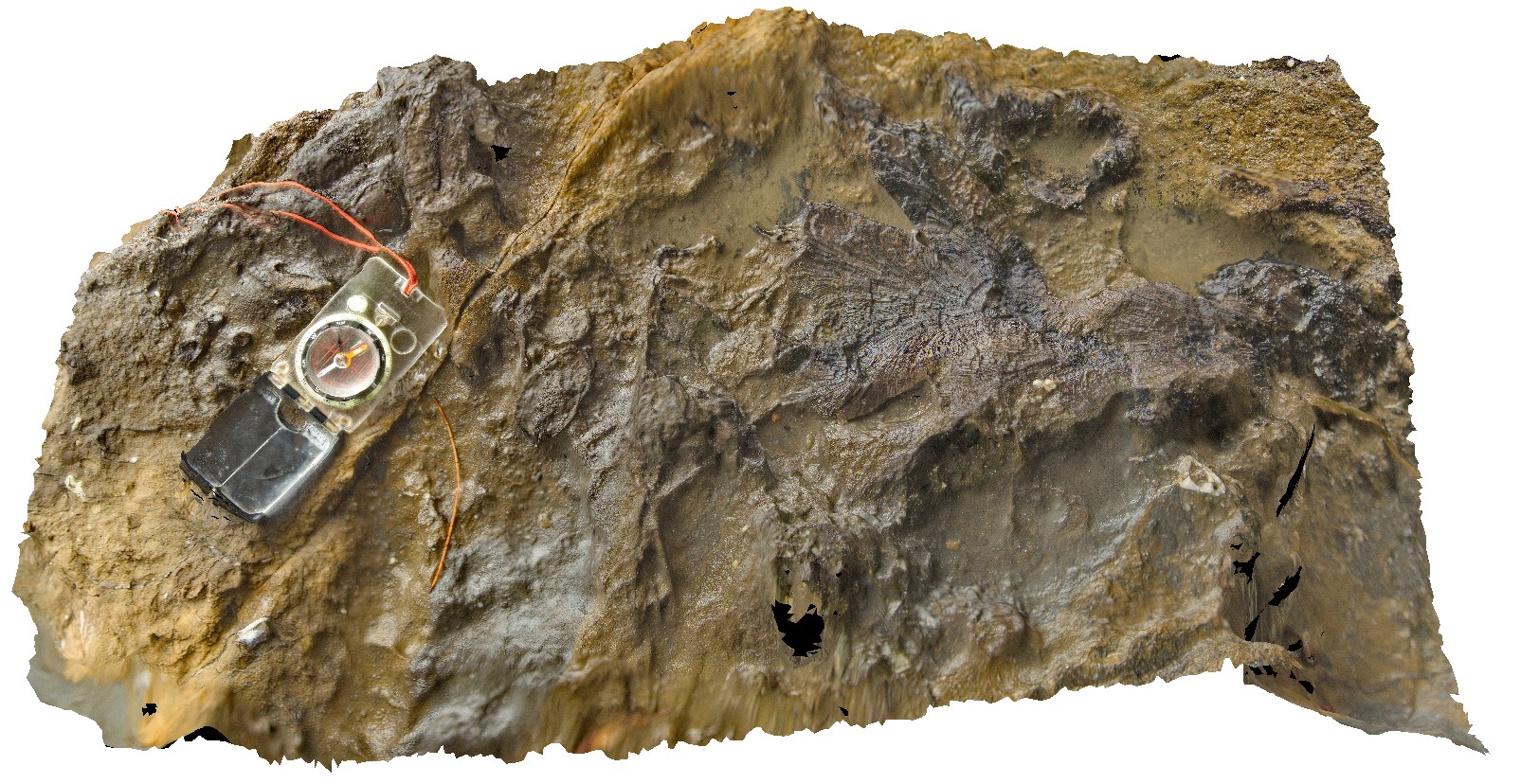
detail of stenoporid bryozoans in Permian siltstone and fine-grained sandstone. Eaglehawk Neck, Tasmania. |
0.70 |
-43.03321000000 |
147.94772000000 |
-9999.000 |
stenoporid, Bryozoans, fossil, palaeontology, Permian |
siltstone |
Eaglehawk13 Map
 |
5 |
01/01/9999 midnight |
3D |
detail of stenoporid bryozoans in Permian sediments. Eaglehawk Neck, Tasmania. |
1.00 |
-43.03321000000 |
147.94772000000 |
-9999.000 |
stenoporid, Bryozoans, Permian sediments, fossil, palaeontology |
siltstone |
Eaglehawk14 Map
 |
5 |
01/01/9999 midnight |
3D |
cross-section detail of stenoporid bryozoans in Permian siltstone. Eaglehawk Neck, Tasmania. |
0.20 |
-43.03321000000 |
147.94772000000 |
-9999.000 |
stenoporid, Bryozoans, Permian sediments, fossil, palaeontology |
siltstone |
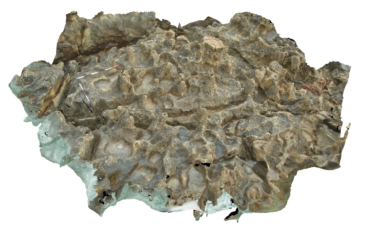
Eaglehawk15 Map
 |
5 |
01/01/9999 midnight |
3D |
rillenkarren weathering in calcareous Permian sandstone. Eaglehawk Neck, Tasmania. |
4.00 |
-43.03517000000 |
147.94751000000 |
-9999.000 |
rillenkarren, weathering, calcareous |
sandstone |
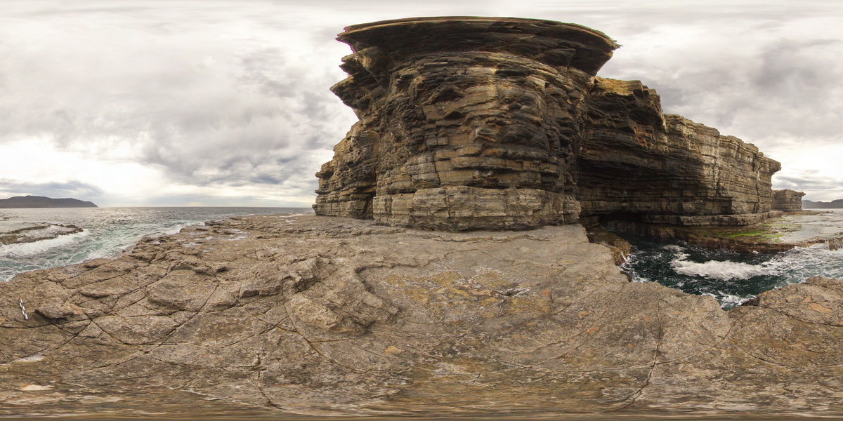
EaglehawkFSP1 Map
 |
5 |
01/01/9999 midnight |
FSP |
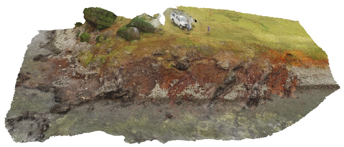
view from sea level platform of Permian pavement and layered buttress (Fossil Island). Eaglehawk Neck, Tasmania. |
1000.00 |
-43.03342000000 |
147.94910000000 |
-9999.000 |
Permian sediments, sedimentology |
siltstone |
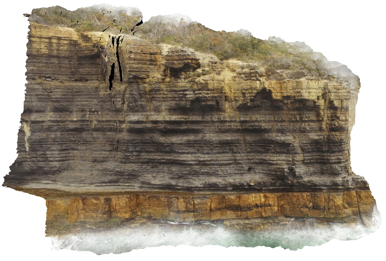
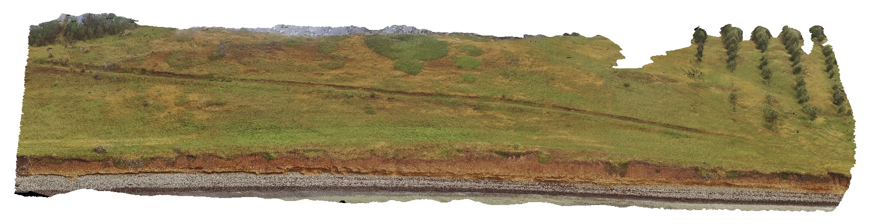
EaglehawkUAV1 Map
 |
20 |
01/01/9999 midnight |
UAV |
aerial view of Permian sea cliffs at Eaglehawk Neck, Tasmania. |
500.00 |
-43.03373200000 |
147.94973000000 |
94.070 |
sea cliff, Permian sediments |
sediments |
EaglehawkUAV2 Map
 |
20 |
01/01/9999 midnight |
UAV |
aerial view from the water of cliff, showing finely layered fine-grained mudstones / siltstones overlying blocky silt / sandstone beds. Eaglehawk Neck, Tasmania. |
120.00 |
-43.03425300000 |
147.94985100000 |
41.000 |
sedimentology, sediments, Parmeener Supergroup |
sediments |
WaterfallbayUAV1 Map
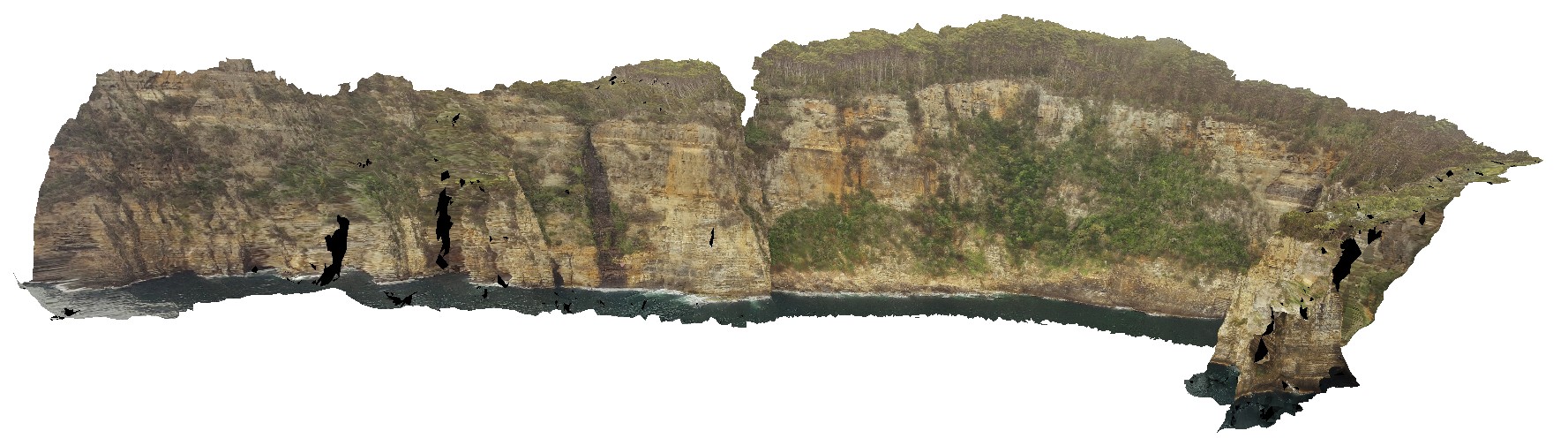 |
20 |
01/01/9999 midnight |
UAV |
extensive aerial view of 'clean' Permian sediment cliffs. Waterfall Bay, Tasmania. |
500.00 |
-43.05168000000 |
147.94986900000 |
170.448 |
Permian sediments, dolerite dyke, faults, sedimentology |
sediments |
Blackjack1 Map
 |
5 |
01/01/9999 midnight |
3D |
volcanic breccia with basaltic vesicular clasts on shore line. Black Jack Hills, Tas. |
1.00 |
-42.99269000000 |
147.65282000000 |
-9999.000 |
volcanic breccia, basalt, volcanic |
basalt |
Blackjack2 Map
 |
5 |
01/01/9999 midnight |
3D |
lava and volcanic breccia, including very large basaltic bombs. Black Jack Hills, Tas. |
4.20 |
-42.99270000000 |
147.65276000000 |
-9999.000 |
basalt, volcanic, bomb |
basalt, basalt |
Blackjack3 Map
 |
5 |
01/01/9999 midnight |
3D |
Tertiary basalt with two layers of breccia and lava. Black Jack Hills, Tas. |
8.00 |
-42.99283000000 |
147.65251000000 |
-9999.000 |
lava, basalt, breccia, volcanics |
basalt |
Blackjack4 Map
 |
5 |
01/01/9999 midnight |
3D |
contact between volcanic breccia and a basalt lava flow with 'strung out' vesicles in the flow. Black Jack Hills, Tas. |
1.00 |
-42.99283000000 |
147.65256000000 |
-9999.000 |
lava flow, volcanic breccia, basalt flow, basalt, contact |
basalt, breccia |
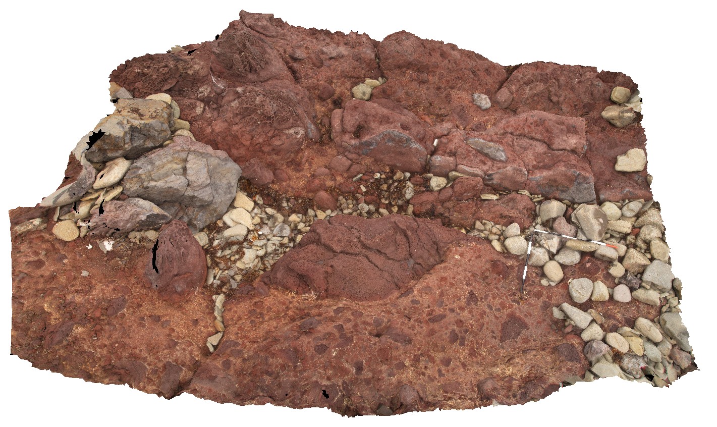
Blackjack5 Map
 |
5 |
01/01/9999 midnight |
3D |
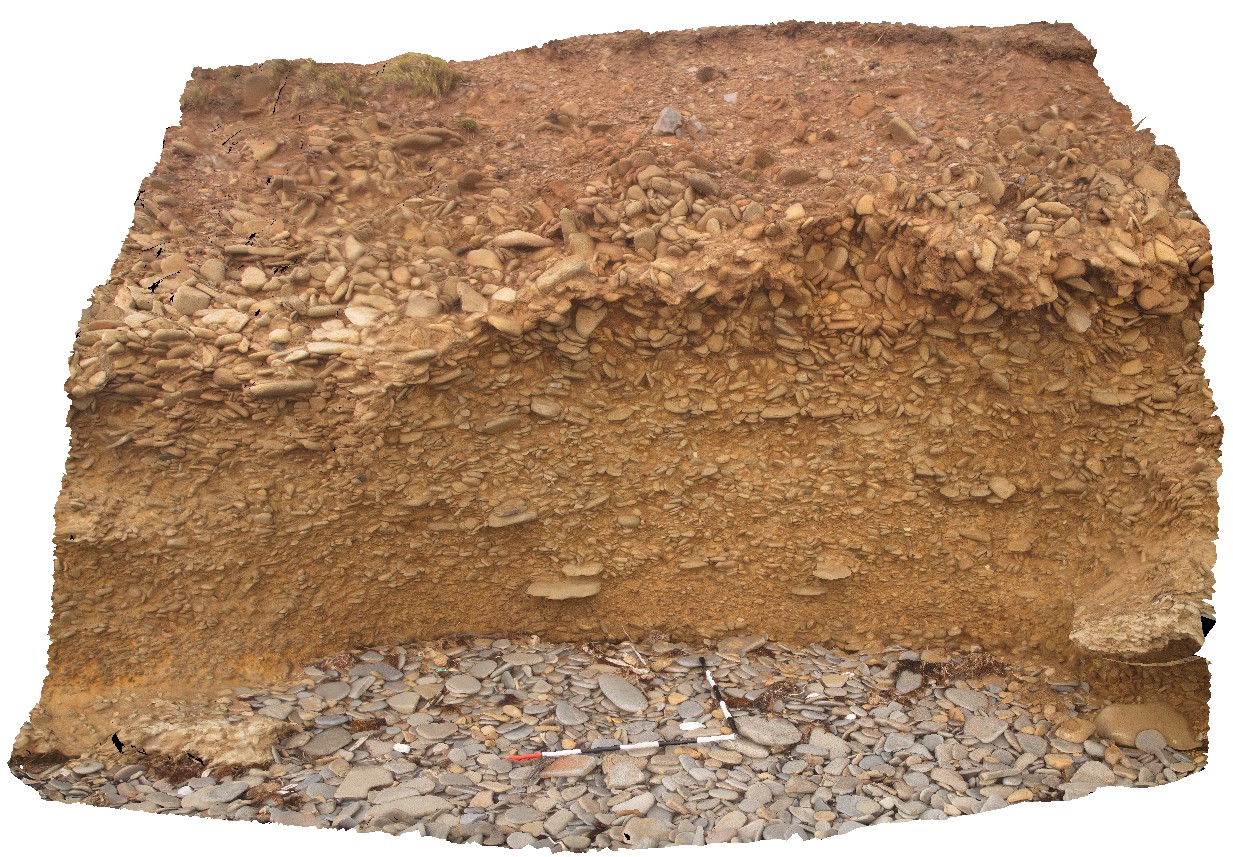
modern paleo-beach deposits of flat cobble shingles. Black Jack Hills, Tas. |
0.00 |
-42.99360000000 |
147.65126000000 |
-9999.000 |
paleo-beach, paleo-deposit |
conglomerate |
BlackjackUAV1 Map
 |
20 |
01/01/9999 midnight |
UAV |
aerial view of exposed layered volcanic package, including basalt lava flows and volcanic breccias. Black Jack Hills, Tas. |
100.00 |
-42.99280500000 |
147.65259900000 |
-9999.000 |
breccia, lava flow, basalt, volcanics, volcanic package |
basalt |
BlackjackUAV2 Map
 |
20 |
01/01/9999 midnight |
UAV |
aerial view of exposed modern paleo-beach deposits of flat cobble shingles. Black Jack Hills, Tas. |
50.00 |
-42.99353100000 |
147.65130500000 |
70.729 |
paleo-beach deposit, paleo land form, shingles |
conglomerate |
JackHills1 Map
 |
5 |
08/02/2016 noon |
3D |
Sigmoidal quartz vein in sheared augen gneiss on W side of the Jack Hills, East Murchison. W.A. |
0.80 |
-26.14334000000 |
117.08675000000 |
-9999.000 |
gneiss, augen, metamorphic |
gneiss |
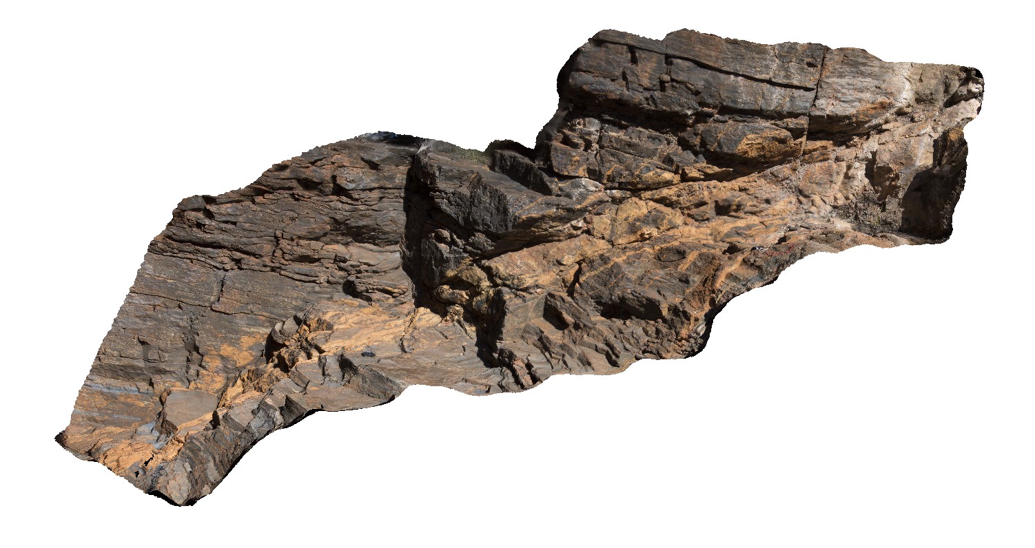
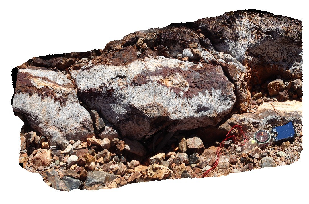
Joffre1 Map
 |
5 |
08/02/2016 noon |
3D |
Fault filled with fibrous carbonate minerals in BIF formation near entrance to Joffre Gorge. Karijini National Park, W.A. |
4.00 |
-22.39036100000 |
118.26834600000 |
-9999.000 |
banded Iron Formation, fault, carbonate, structure |
BIF |
Knox1 Map
 |
5 |
05/26/2016 noon |
3D |
Refolded open fold hinge in thinly banded iron sediments, Knox Gorge, Karijini National Park. W.A. |
5.00 |
-22.36676000000 |
118.29784900000 |
-9999.000 |
Banded iron formation, fold, open fold, refolded fold, structure |
BIF |
Knox2 Map
 |
5 |
08/01/2016 noon |
3D |
Ripples in BIF, Knox Gorge. Karijini National Park, W.A. |
1.50 |
-22.36654100000 |
118.29787200000 |
-9999.000 |
ripple marks, sedimentology, banded iron formation, BIF |
BIF |
Knox3 Map
 |
5 |
08/01/2016 noon |
3D |
Boudinaged silica rich layer with late fractures in BIF. Both fractures and boudinage presumably relate to sediment loading. Karijini National Park. W.A. |
3.50 |
-22.36895100000 |
118.29720900000 |
-9999.000 |
boudinage, structure, fracture, BIF |
BIF |
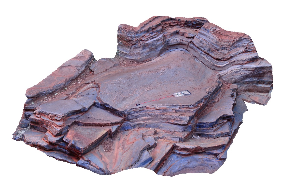
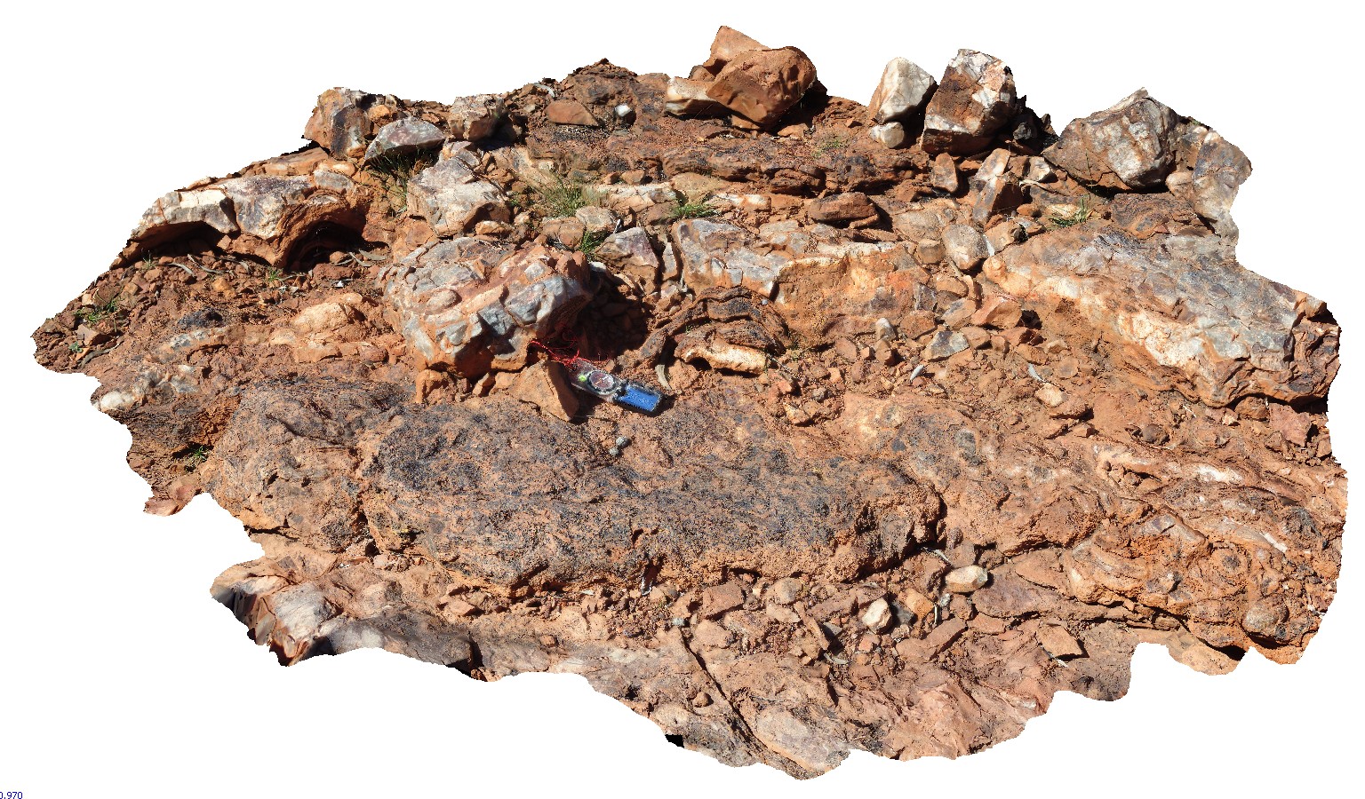
NorthPole1 Map
 |
10000 |
08/02/2016 noon |
3D |
Epithermal crystalline barite-silica vein with radiating crystals. Iron-oxides in vein centre result from oxidation of pyrite. Marble Bar Rd, near Coppin Gap, W.A. |
1.00 |
-20.72168000000 |
119.35366400000 |
-9999.000 |
epithermal, barite, vein |
sediments |
NorthPole2 Map
 |
10000 |
08/02/2016 noon |
3D |
3.49Ga stromatolite beds in the Dresser Formation. Marble Bar Rd, near Coppin Gap, W.A. |
2.50 |
-20.72168000000 |
119.35366400000 |
-9999.000 |
stromatolite, fossil, palaeontology |
limestone |