WTasFSP14 Map
 |
5 |
01/01/9999 midnight |
FSP |
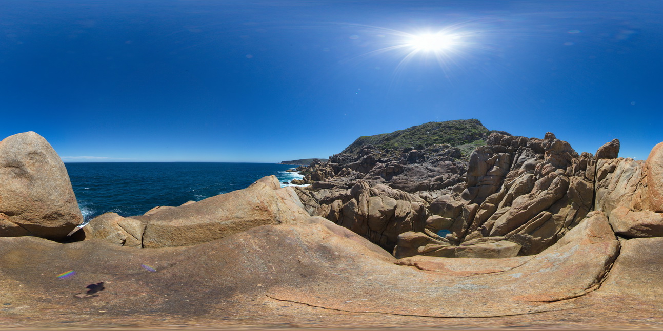
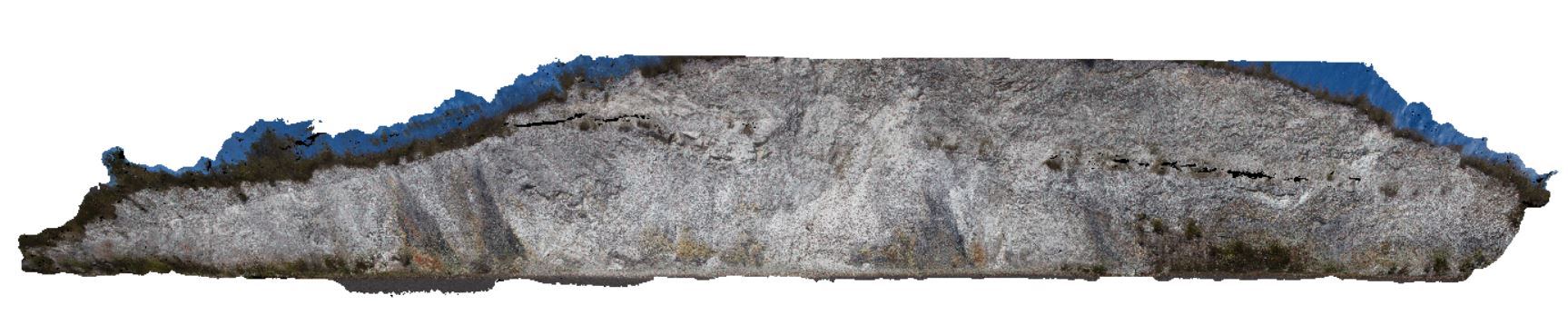
exposure, showing the Heemskirk White Granite with small tourmaline patches in the foreground and the contact with the Heemskirk Red Granite in the middle ground. Trial Harbour, West |
500.00 |
-41.92283000000 |
145.15660000000 |
-9999.000 |
igneous contact, granite, contact alteration |
granite, granite |
WTasFSP15 Map
 |
5 |
01/01/9999 midnight |
FSP |
exposure, showing the Heemskirk White Granite with small tourmaline patches in the foreground and the contact with the Heemskirk Red Granite in the middle ground. Trial Harbour, West |
500.00 |
-41.92282000000 |
145.15688000000 |
-9999.000 |
igneous contact, tourmaline orbicules, contact alteration |
granite, granite |
WTasFSP15 Map
|
5 |
01/01/9999 midnight |
FSP |
exposure, showing the Heemskirk White Granite with small tourmaline patches in the foreground and the contact with the Heemskirk Red Granite in the middle ground. Trial Harbour, West |
500.00 |
-41.92282000000 |
145.15688000000 |
-9999.000 |
igneous contact, tourmaline orbicules, contact alteration |
granite, granite |
WTasFSP17 Map
 |
5 |
01/01/9999 midnight |
FSP |
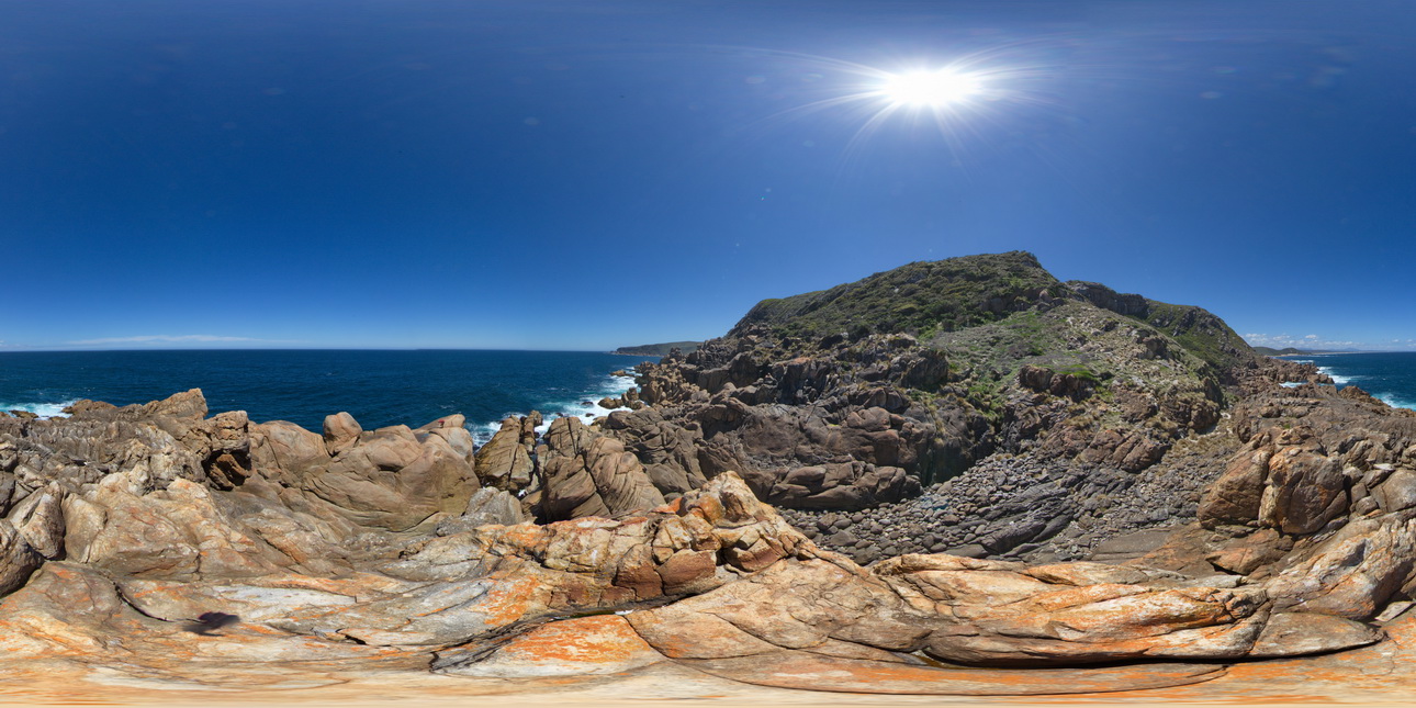
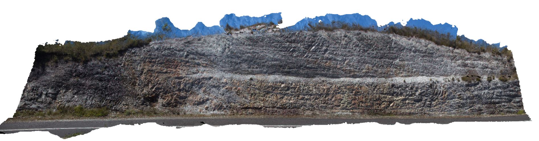
intrusive contact where the Heemkirk Red Granite intrudes the Trial Harbour Ultramafic Complex. Granite has large mafic / ultramafic xenoliths. Trial Harbour, West Tasmania. |
500.00 |
-41.92490000000 |
145.16226000000 |
-9999.000 |
igneous contact |
granite, ultramafic |
WTasFSP17 Map
|
5 |
01/01/9999 midnight |
FSP |
intrusive contact where the Heemkirk Red Granite intrudes the Trial Harbour Ultramafic Complex. Granite has large mafic / ultramafic xenoliths. Trial Harbour, West Tasmania. |
500.00 |
-41.92490000000 |
145.16226000000 |
-9999.000 |
igneous contact |
granite, ultramafic |
WTasFSP18 Map
 |
5 |
01/01/9999 midnight |
FSP |
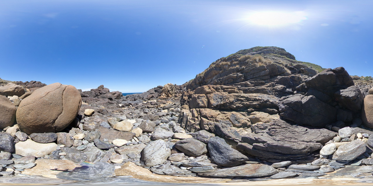
intrusive contact where the Heemkirk Red Granite intrudes the Trial Harbour Ultramafic Complex. Trial Harbour, West Tasmania. |
500.00 |
-41.92499000000 |
145.16190000000 |
-9999.000 |
igneous contact, granite |
granite, ultramafic |
WTasFSP18 Map
|
5 |
01/01/9999 midnight |
FSP |
intrusive contact where the Heemkirk Red Granite intrudes the Trial Harbour Ultramafic Complex. Trial Harbour, West Tasmania. |
500.00 |
-41.92499000000 |
145.16190000000 |
-9999.000 |
igneous contact, granite |
granite, ultramafic |
WTas9 Map
 |
5 |
01/01/9999 midnight |
3D |
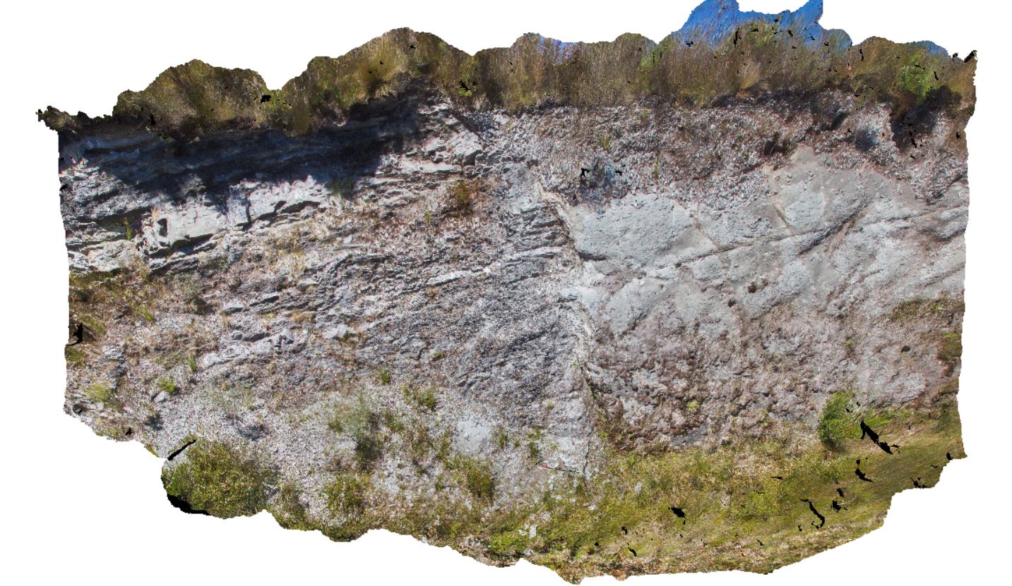
faulted contact between Oonah Formation siltstone and quartzite and Permian diamictite. Heemskirk Road, West Tasmania. |
9.00 |
-41.85563000000 |
145.31541000000 |
-9999.000 |
structure, drag fault, fault |
mudstone, diamictite |
WTas10 Map
 |
5 |
01/01/9999 midnight |
3D |
open folds in Oonah Formation metasedimentary rocks in road cut near Piney Creek. West Tasmania. |
75.00 |
-41.83059000000 |
145.26230000000 |
-9999.000 |
metasediments, quartzite, fold, structure |
metasediments |
WTas11 Map
 |
5 |
01/01/9999 midnight |
3D |
reclined fold in Oonah Formation metasedimentary rocks in road cut near Piney Creek. West Tasmania. |
100.00 |
-41.83089000000 |
145.25879000000 |
-9999.000 |
reclined fold, fold, structure |
quartzite |
WTas12 Map
 |
5 |
01/01/9999 midnight |
3D |
open folds in thinly bedded sandstone and siltstone. Granville Harbour, West Tasmania. |
5.00 |
-41.80283000000 |
145.02208000000 |
-9999.000 |
fold, open fold, structure |
metasediment |
WTasFSP19 Map
 |
5 |
01/01/9999 midnight |
FSP |
outcropping folded sediments of the Oonah Formation. Granville Harbour, West Tasmania. |
100.00 |
-41.78020000000 |
145.00650000000 |
-9999.000 |
fold, structure, Oonah Formation |
quartzite |
WTasFSP20 Map
 |
5 |
01/01/9999 midnight |
FSP |
outcropping folded sediments of the Oonah Formation with cross cutting felsic dyke. Granville Harbour, West Tasmania. |
1000.00 |
-41.77933000000 |
145.00633000000 |
-9999.000 |
fold, structure, dyke |
metasediments |
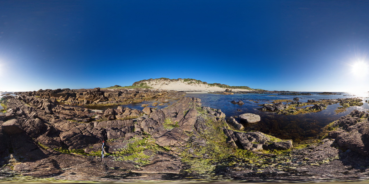
WTasFSP21 Map
 |
5 |
01/01/9999 midnight |
FSP |
basal Ordovician conglomerate of the 'Duck Creek' conglomerate, with Oona Formation rocks to the south. Granville Harbour, West Tasmania. |
1000.00 |
-41.77914000000 |
145.00606000000 |
-9999.000 |
conglomerate, fold, structure |
conglomerate |
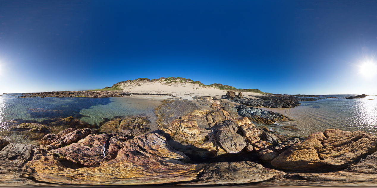
WTasFSP22 Map
 |
5 |
01/01/9999 midnight |
FSP |
steeply dipping conglomerate beds at the base of the Ordovician, with carbonate units to the north. Granville Harbour, West Tasmania. |
1000.00 |
-41.77903000000 |
145.00580000000 |
-9999.000 |
fold, structure, conglomerate |
conglomerate |
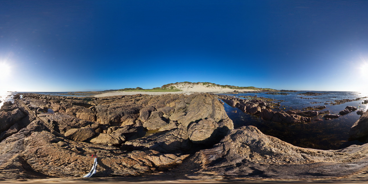
WTasFSP23 Map
 |
5 |
01/01/9999 midnight |
FSP |
moderately dipping calcareous quartzite beds exposed at beach at Granville Harbour, West Tasmania. |
1000.00 |
-41.77887000000 |
145.00580000000 |
-9999.000 |
dip, bedding |
carbonate |
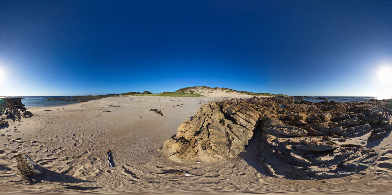
WTasFSP24 Map
 |
5 |
01/01/9999 midnight |
FSP |
steeply dipping sandstone and siltstone beds exposed along the beach at Granville Harbour, West Tasmania. |
1000.00 |
-41.77747000000 |
145.00507000000 |
-9999.000 |
dip, structure |
sandstone |
WTasFSP25 Map
 |
5 |
01/01/9999 midnight |
FSP |
steeply dipping sandstone and siltstone beds exposed along the beach at Granville Harbour, West Tasmania. |
1000.00 |
-41.77426000000 |
145.00587000000 |
-9999.000 |
dip, bedding, sedimentology, sandstone |
sandstone |
WTasFSP26 Map
 |
5 |
01/01/9999 midnight |
FSP |
steeply dipping sandstone and siltstone beds exposed along the beach at Granville Harbour, West Tasmania. |
1000.00 |
-41.77359000000 |
145.00658000000 |
-9999.000 |
dip, bedding, sedimentology, structure |
sandstone |
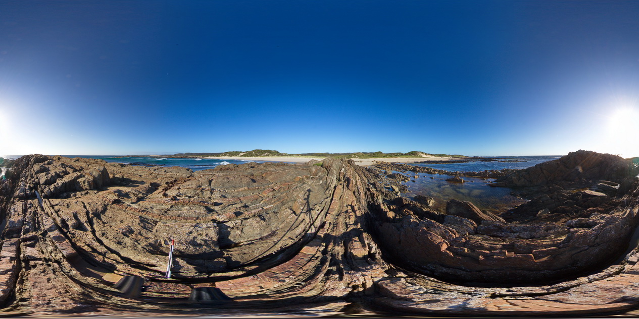
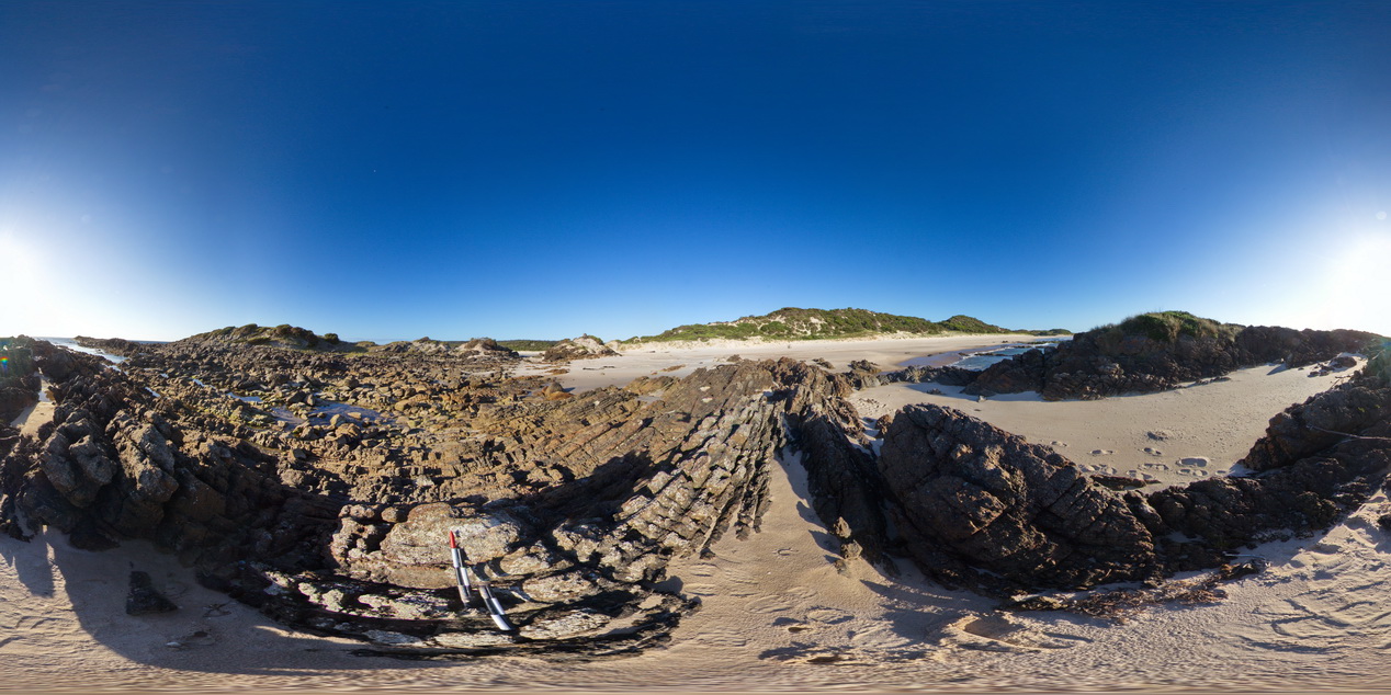
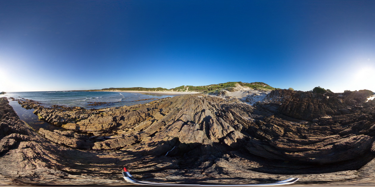
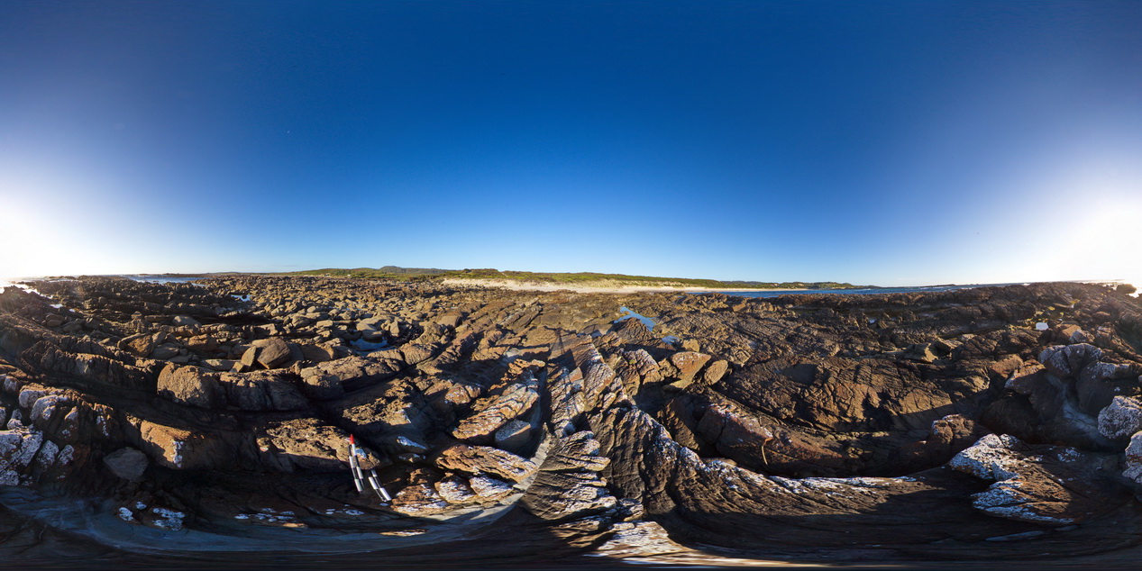
WTasFSP27 Map
 |
5 |
01/01/9999 midnight |
FSP |
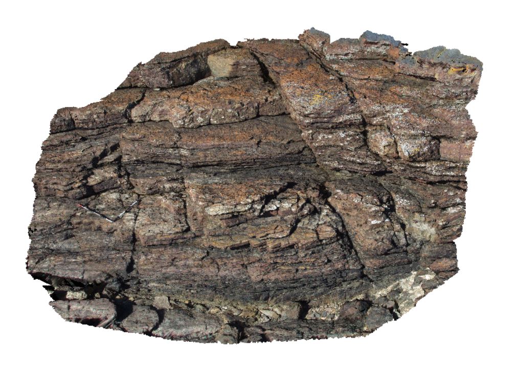
shallowly to moderately dipping, pale grey, fine-grained quartz sandstone with subordinate interbedded greenish-grey siltstone. Abundantly fossiliferous in parts. Duck Creek, West Tasmania. |
1000.00 |
-41.76950000000 |
145.00429000000 |
-9999.000 |
dip, bedding, sandstone, structure |
sandstone |
WTasUAV4 Map
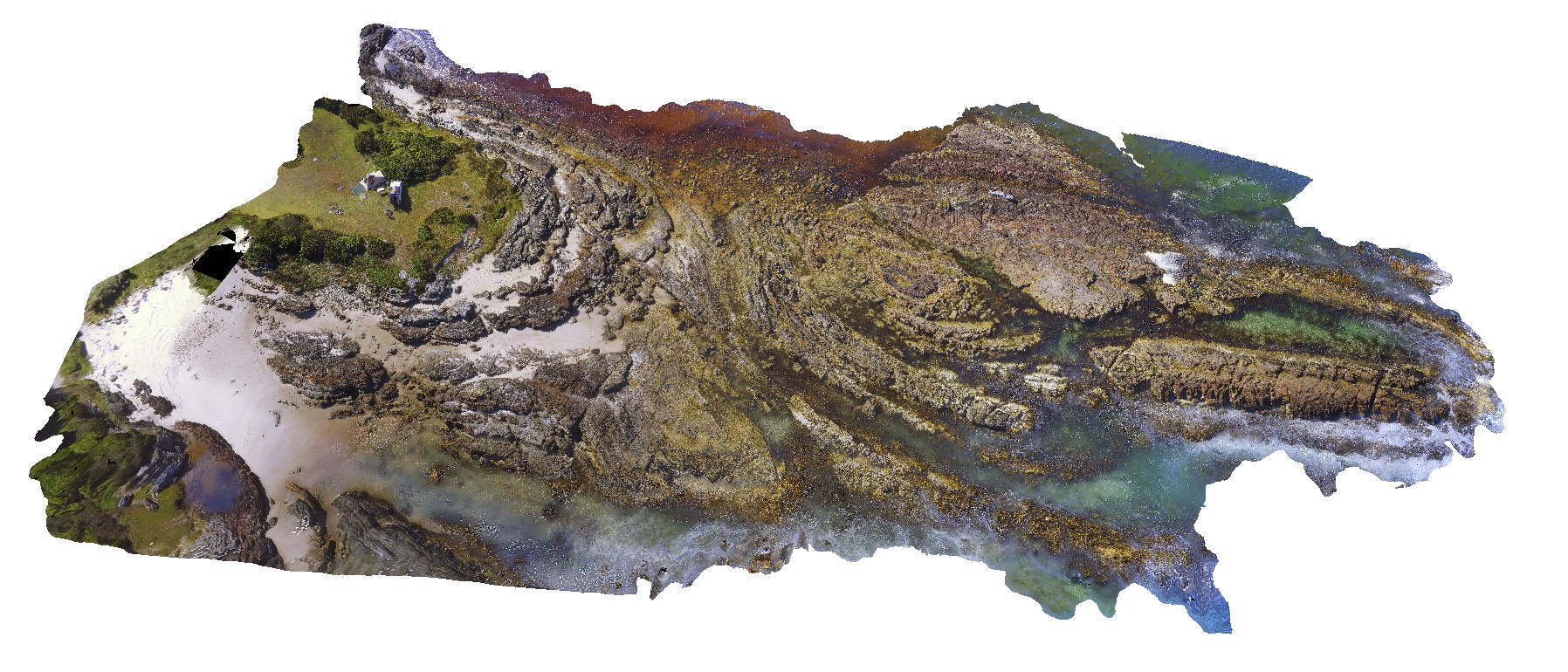 |
5 |
01/01/9999 midnight |
UAV |
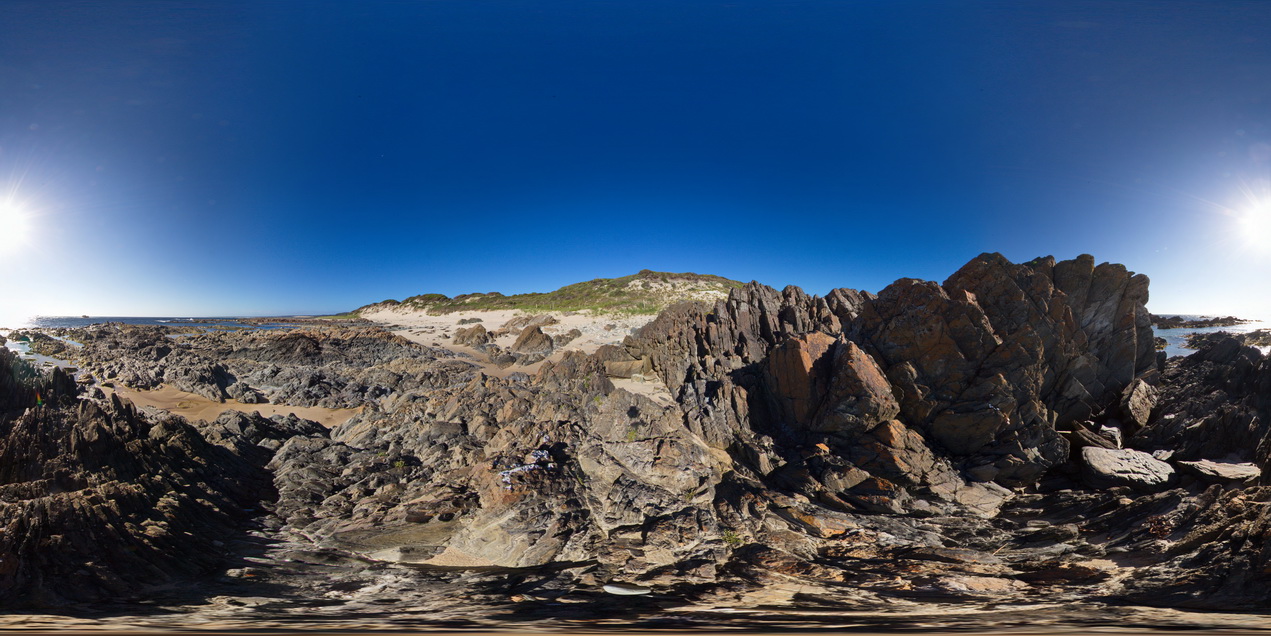
aerial view of folds in sandstone and siltstone Silurian aged rocks. Duck Creek, west coast, Tasmania. |
100.00 |
-41.76811000000 |
145.00443100000 |
-9999.000 |
fold, structure |
sandstone |