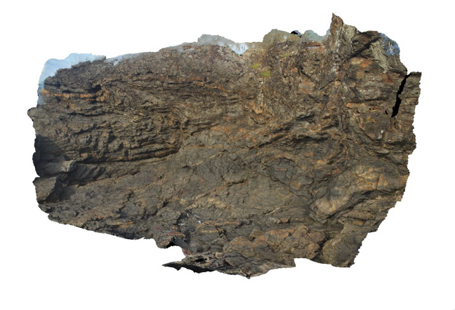
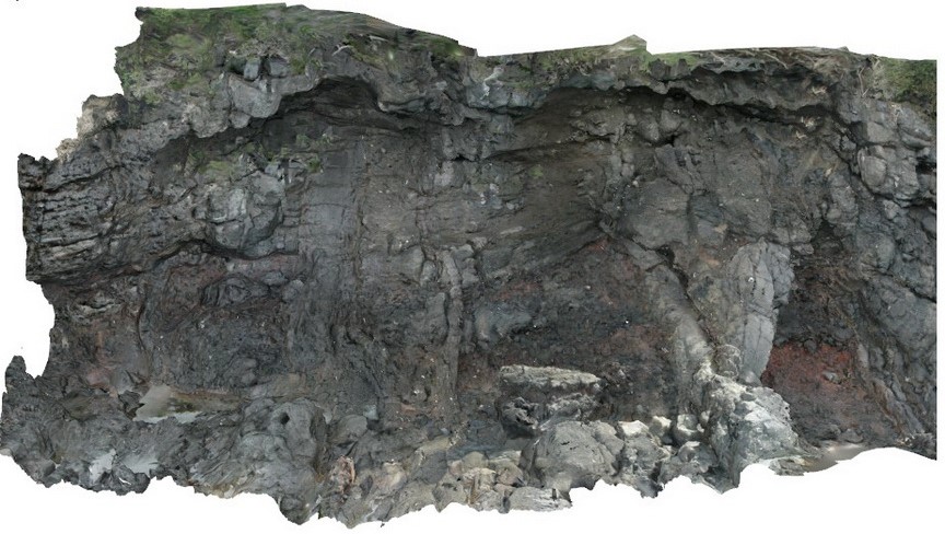
HastingsPt3 Map
 |
1 |
07/09/2015 4:28 p.m. |
3D |
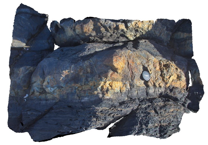
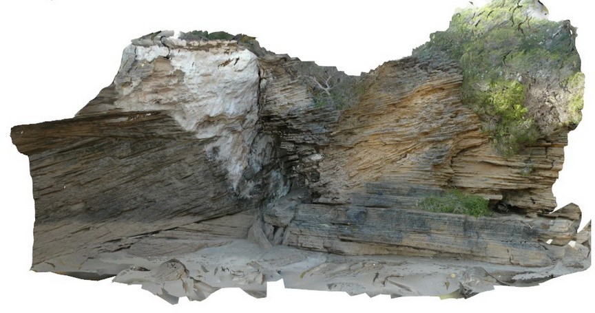
Overturned beds (writing on lens cap is upright) with grading and scours. Devonian-Carboniferous Neranleigh-Fernvale Beds. Hastings Point, QLD. |
1.30 |
-28.33673000000 |
153.57729000000 |
-9999.000 |
overturned bedding, structure, sedimentology |
sandstone |
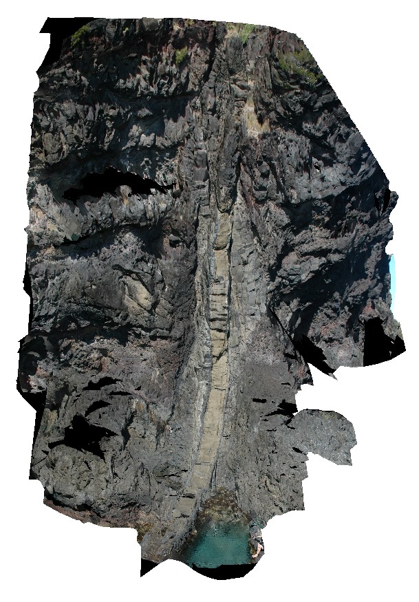
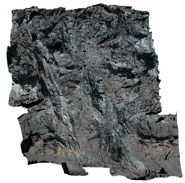
HastingsPt5 Map
 |
5 |
07/09/2015 4:31 p.m. |
3D |
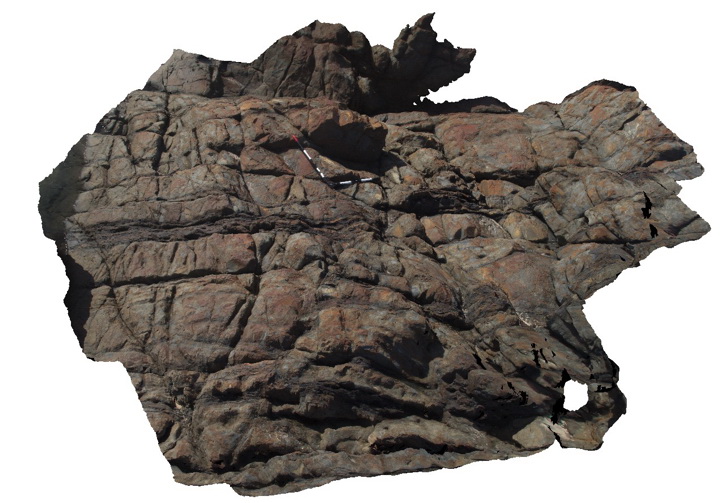
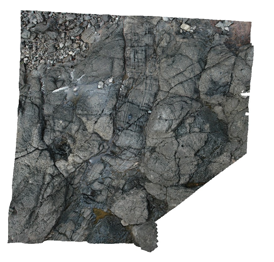
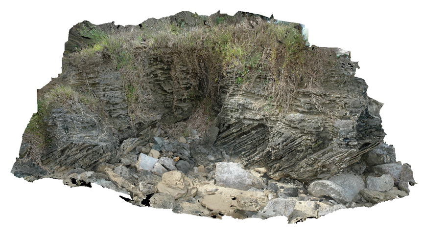
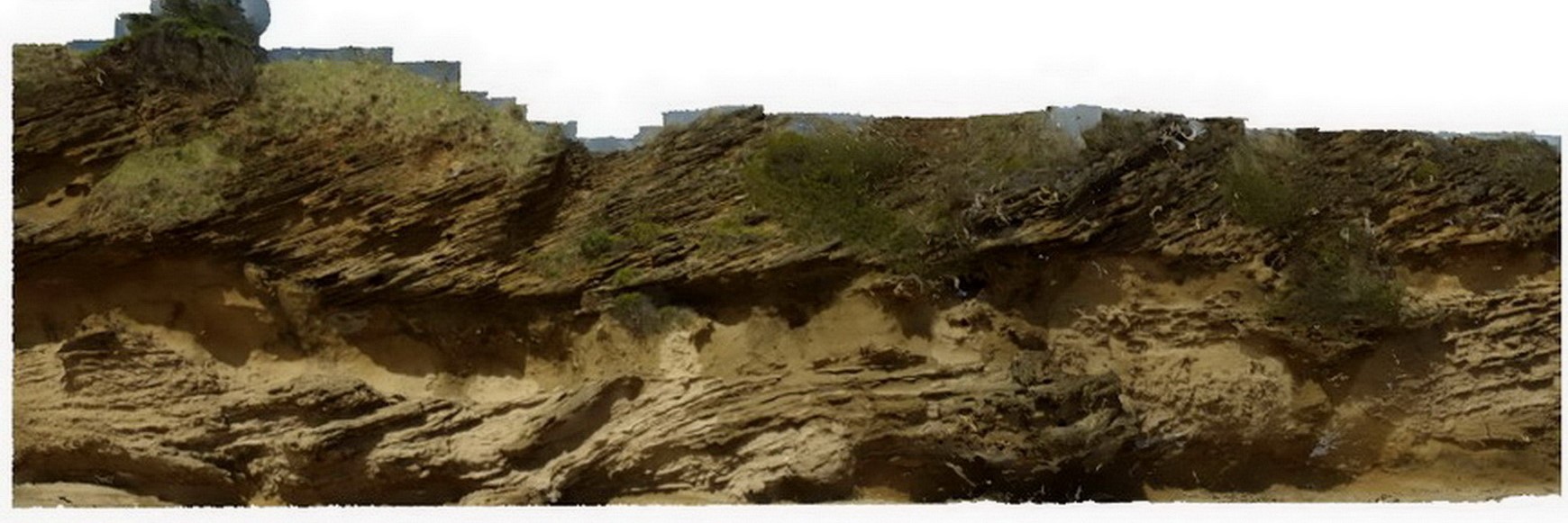
Fault cross cutting dipping metasedimentary layers of the Devonian-Carboniferous Neranleigh-Fernvale Beds. Hastings Point, QLD. |
5.00 |
-28.36320000000 |
153.57991000000 |
1.000 |
fault, bedding, structure |
sandstone |
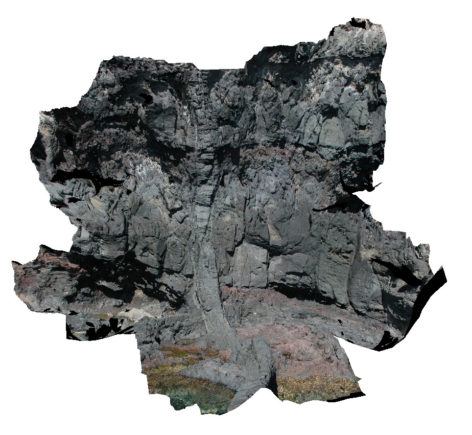
Byron3 Map
 |
5 |
07/08/2015 10:20 a.m. |
3D |
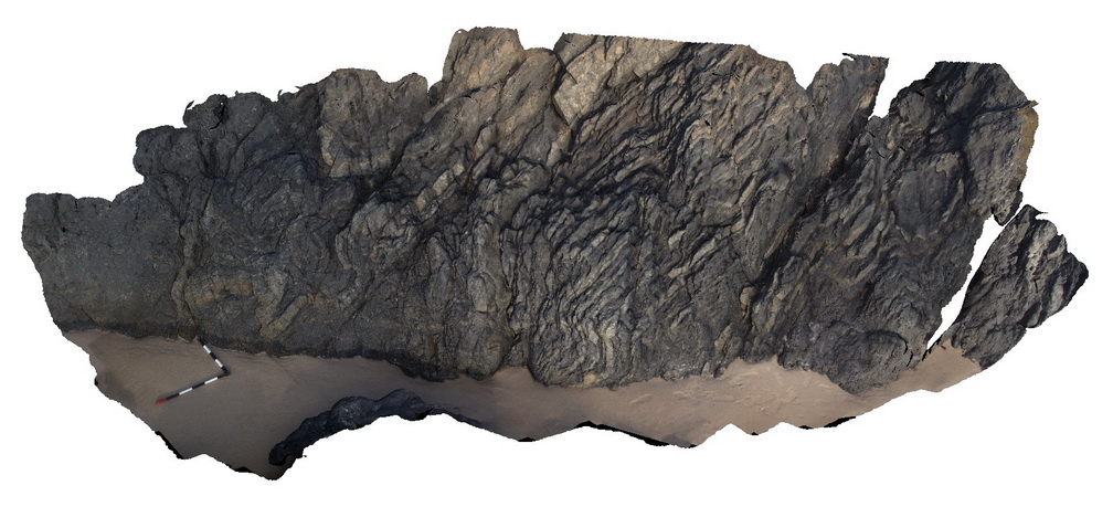
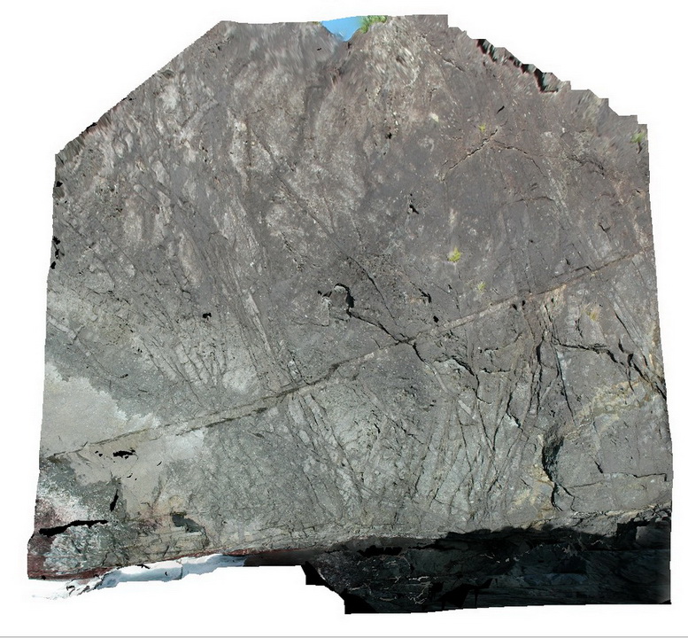
folded and faulted low-grade, fine grained metasediments of the Neranleigh-Fernvale Beds. Byron Bay, N.S.W. |
6.00 |
-28.63475000000 |
153.63560000000 |
1.000 |
metasediments, folds, faults, structure |
metasediments |
Byron2 Map
 |
5 |
07/08/2015 10:19 a.m. |
3D |
folded and faulted low-grade, fine grained metasediments of the Neranleigh-Fernvale Beds. Byron Bay, N.S.W. |
8.00 |
-28.63455000000 |
153.63579000000 |
1.000 |
metasediments, folds, faults, structure |
metasediments |
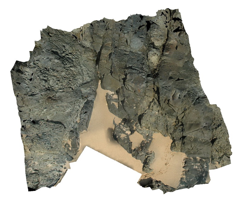
Byron1 Map
 |
5 |
07/08/2015 10:18 a.m. |
3D |
folded and faulted fine grained, low grade metasediments of the Neranleigh-Fernvale Beds. Byron Bay, N.S.W. |
8.00 |
-28.63433000000 |
153.63599000000 |
1.000 |
metasediments, folds, faults, structure |
metasediments |
LordHowe1 Map
 |
20 |
03/16/2015 2:50 p.m. |
3D |
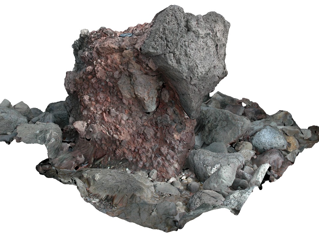
basalts intruded by dyke with altered contact aureole. Lord Howe Island. |
4.50 |
-31.51223562000 |
159.04326309000 |
0.000 |
dyke, basalt, contact aureole |
basalt |
LordHowe2 Map
 |
20 |
03/16/2015 2:51 p.m. |
3D |
sub vertical dyke intruding basalts. Lord Howe Island. |
4.00 |
-31.51208767000 |
159.04361289000 |
0.000 |
dyke, basalt |
basalt |
LordHowe4 Map
 |
20 |
03/16/2015 2:52 p.m. |
3D |
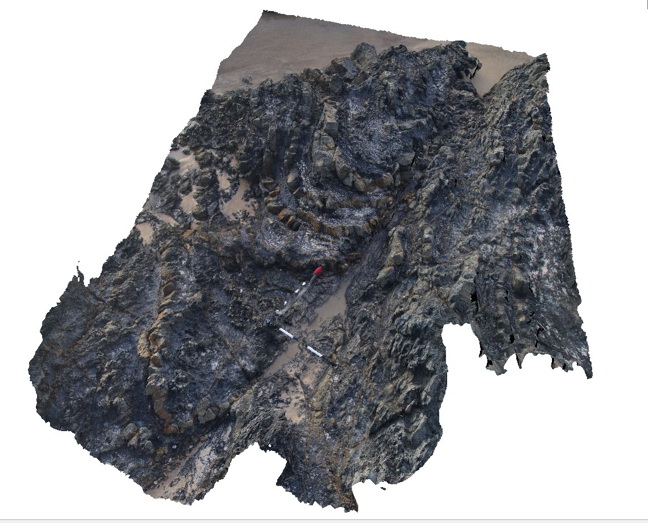
dyke cross cutting basalt flows and scoria beds. Lord Howe Island. |
2.00 |
-31.51417954000 |
159.04388484000 |
0.000 |
basalt, dyke, scoria |
basalt |
LordHowe3 Map
 |
20 |
03/16/2015 2:51 p.m. |
3D |
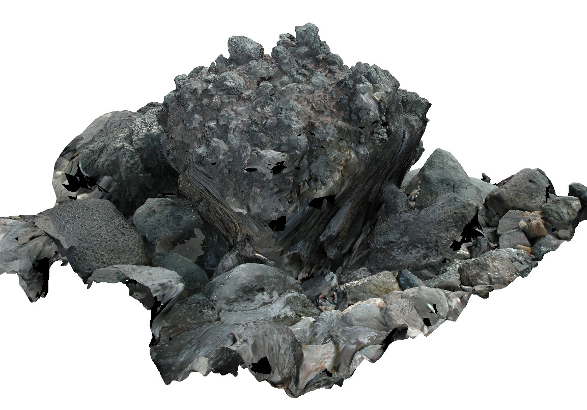
dykes intruding basalt package, crosscut by faulting. Lord Howe Island. |
12.00 |
-31.51219080000 |
159.04403311000 |
0.000 |
fault, structure, dyke, basalt |
basalt |
LordHowe10 Map
 |
20 |
03/16/2015 2:50 p.m. |
3D |
basalts intruded by dykes. Lord Howe Island. |
0.00 |
-31.52197862000 |
159.05226474000 |
0.000 |
dyke, intrusion |
basalt |
LordHowe11 Map
 |
20 |
03/16/2015 2:50 p.m. |
3D |
fine grained dyke intruding basalts. Lord Howe Island. |
4.00 |
-31.52093803000 |
159.05276210000 |
0.000 |
dyke, intrusion, basalt |
basalt |
LordHowe9 Map
 |
20 |
03/16/2015 2:53 p.m. |
3D |
irregular dyke cross cutting basalt and scoria. Lord Howe Island. |
3.00 |
-31.52041332000 |
159.05301019000 |
0.000 |
basalt, dyke |
basalt |
LordHowe14 Map
 |
20 |
03/16/2015 2:51 p.m. |
3D |
flow banded edges in dyke intruding basalts. Lord Howe Island. |
2.00 |
-31.52042509000 |
159.05329047000 |
0.000 |
dyke, intrusion |
basalt |
LordHowe12 Map
 |
20 |
03/16/2015 2:50 p.m. |
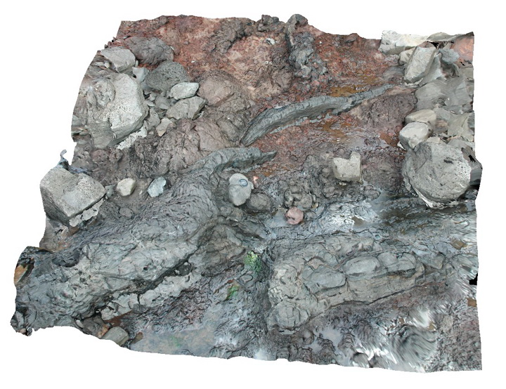
3D |
block of welded? Scoria. Lord Howe Island. |
1.00 |
-31.52021693000 |
159.05343760000 |
0.000 |
|
basalt |
LordHowe13 Map
 |
20 |
03/16/2015 2:51 p.m. |
3D |
welded scoria. Lord Howe Island. |
0.00 |
-31.51990632000 |
159.05360757000 |
0.000 |
|
basalt |
LordHowe15 Map
 |
20 |
03/16/2015 2:51 p.m. |
3D |
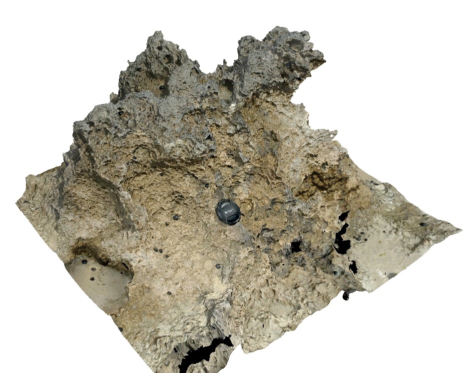
weathered calcarenite. Lord Howe Island. |
1.00 |
-31.52049204000 |
159.05723998000 |
0.000 |
calcarenite, sedimentology |
calcarenite |
LordHowe16 Map
 |
20 |
03/16/2015 2:51 p.m. |
3D |
cross bedding in calcareous sands, showing high angle beds truncated by flat overlying layers. Lord Howe Island. |
3.00 |
-31.52292326000 |
159.05789234000 |
0.000 |
sedimentology, cross bedding |
sandstone |
LordHowe8 Map
 |
20 |
03/16/2015 2:53 p.m. |
3D |
cross bedding in calcareous sands, showing multiple cross bedding layers. Lord Howe Island. |
3.00 |
-31.54793721000 |
159.07464631000 |
0.000 |
cross bedding, sedimentology |
sand |
LordHowe7 Map
 |
0 |
03/16/2015 2:52 p.m. |
3D |
cross bedding in calcareous sands, showing high-angle beds truncated by flat overlying layers. Lord Howe Island. |
5.00 |
-31.54798706000 |
159.07471865000 |
-9999.000 |
sedimentology, cross bedding |
sand |
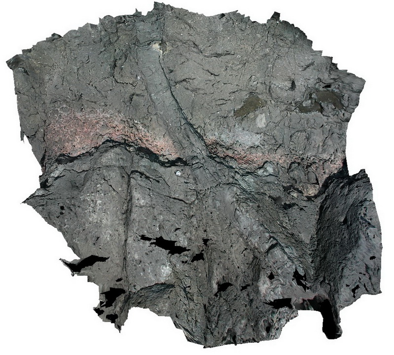
LordHowe5 Map
 |
20 |
03/16/2015 2:52 p.m. |
3D |
irregular dyke crosscutting basalt. Lord Howe Island. |
2.50 |
-31.55435777000 |
159.09508447000 |
0.000 |
dyke, basalt, intrusive |
basalt |
LordHowe6 Map
 |
20 |
03/16/2015 2:52 p.m. |
3D |
basalt cut by multi-directional dyke swarm. Lord Howe Island. |
12.00 |
-31.55469752000 |
159.09578331000 |
0.000 |
basalt, dyke, intrusive |
basalt |