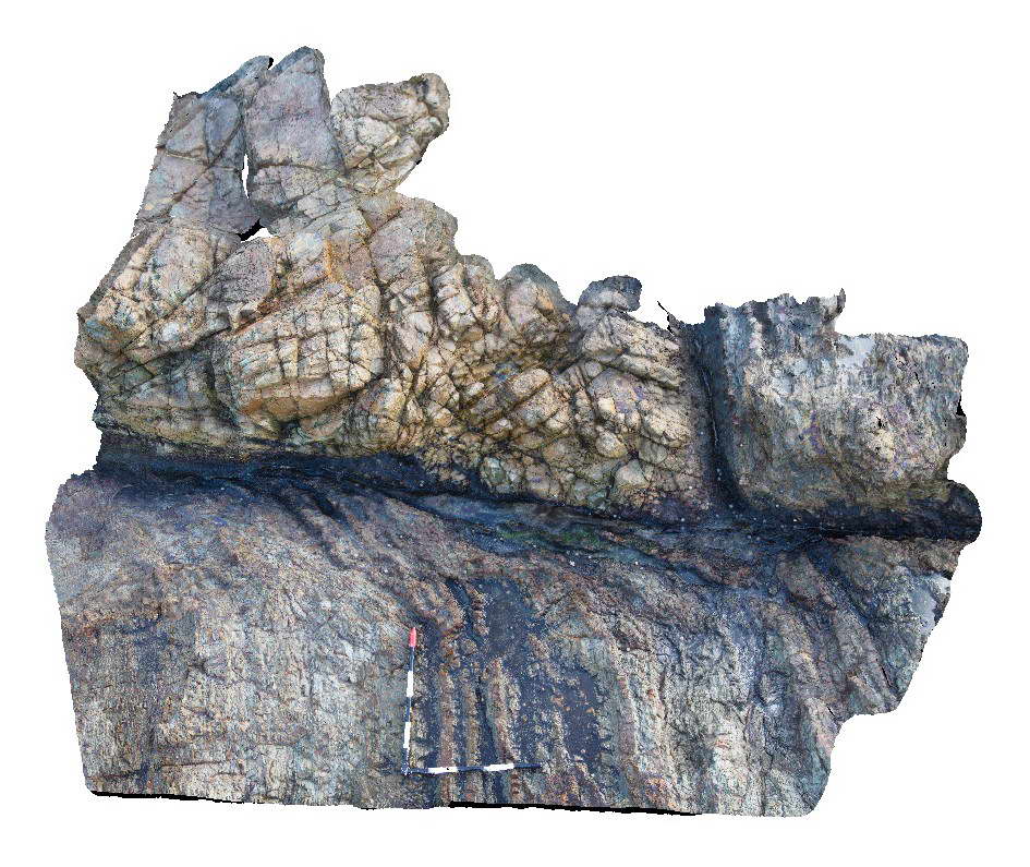
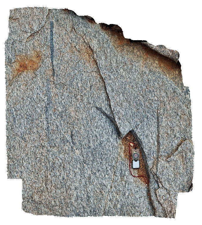
YuraygirFSP1 Map
 |
5 |
06/16/2015 5:51 p.m. |
FSP |
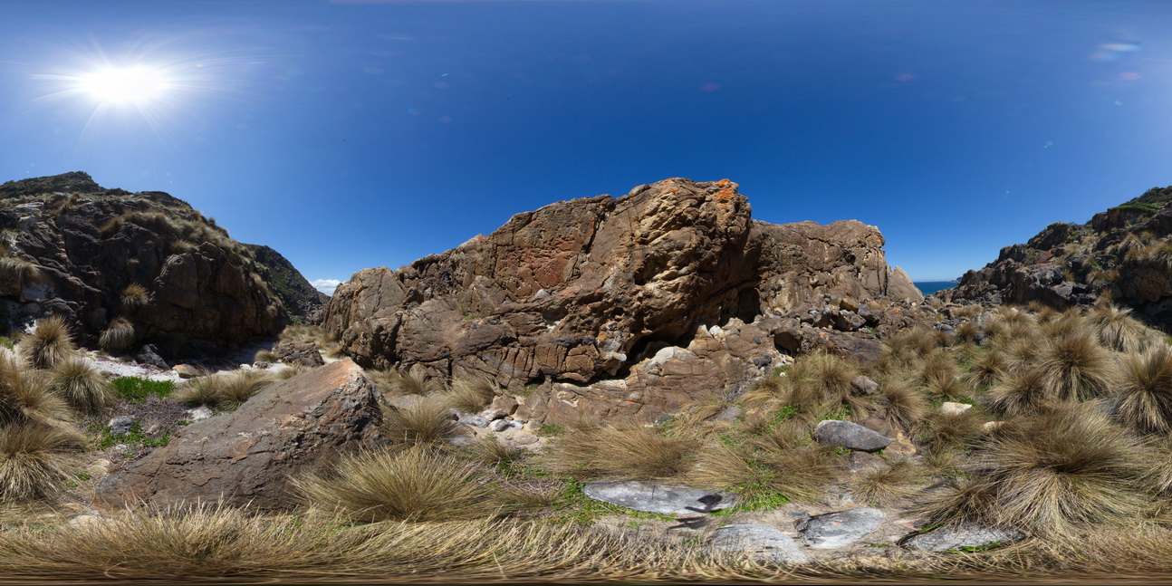
View of steeply dipping metasedimentary units (sandstone and siltstone of the Carboniferous Coramba Beds. Yuraygir, N.S.W. |
50.00 |
-29.94940000000 |
153.25934000000 |
0.000 |
bedding |
sandstone, siltstone |
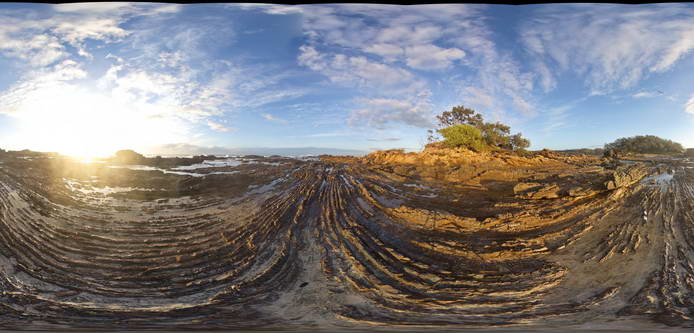
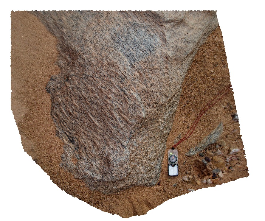
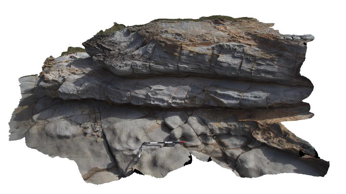
Yuraygir1 Map
 |
5 |
06/16/2015 5:51 p.m. |
3D |
Fault in low grade metasedimentary rocks of the Carboniferous Coramba Beds showing well developed fault drag on layers. Yuraygir, N.S.W. |
2.00 |
-29.94744000000 |
153.25958000000 |
0.000 |
fault, fault drag, structure |
Mudstone |
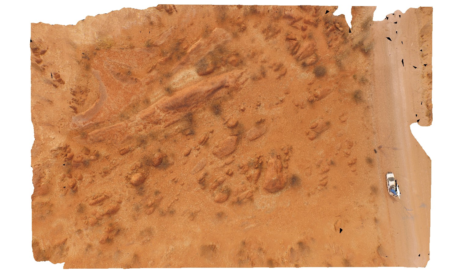
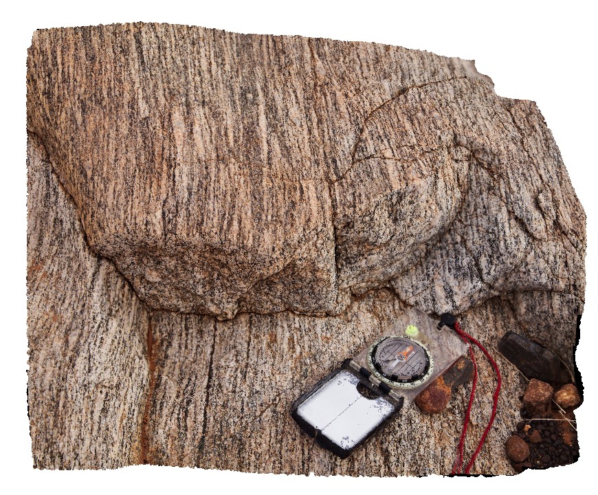
YinnetharraUAV1 Map
 |
20 |
05/27/2016 noon |
UAV |
aerial view of typical outcrop of rounded granitic tors. North of Thirty Three River, Cobra-Dairy Creek Road, W.A. |
50.00 |
-24.51352090000 |
116.24685660000 |
-9999.000 |
granite, outcrop, granite tor |
granite |
Yinnetharra7 Map
 |
5 |
05/27/2016 noon |
3D |
L tectonite in 3D exposure with highly stretched fabric zone or xenolith. Cobra-Dairy Creek Road - Gascoyne River crossing, W.A. |
1.50 |
-24.65472000000 |
116.16769000000 |
-9999.000 |
L tectonite, structure, xenolith, granodiorite |
granodiorite |
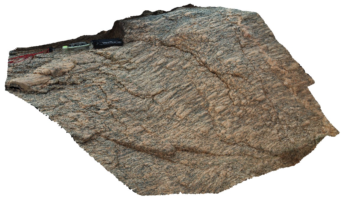
Yinnetharra6 Map
 |
5 |
05/27/2016 noon |
3D |
L tectonic fabric exposed in 3 dimensions, showing stretching lineation. Cobra-Dairy Creek Road - Gascoyne River crossing, W.A. |
6.30 |
-24.65446000000 |
116.16731000000 |
-9999.000 |
L tectonic fabric, structure, stretching lineation |
granodiorite |
Yinnetharra5 Map
 |
5 |
05/27/2016 noon |
3D |
pavement of granodiorite with deformed 'L' tectonic fabric and highly stretched xenoliths. Cobra-Dairy Creek Road - Gascoyne River crossing, W.A. |
1.40 |
-24.65460000000 |
116.16716000000 |
-9999.000 |
L tectonic fabric, structure, granodiorite |
granodiorite |
Yinnetharra4 Map
 |
5 |
05/27/2016 noon |
3D |
oblique view of L tectonite, showing highly stretched feldspar and quartz. Cobra-Dairy Creek Road - Gascoyne crossing, W.A. |
0.65 |
-24.65478000000 |
116.16774000000 |
-9999.000 |
mineral stretching, L tectonite, gneiss, metamorphic |
gneiss |
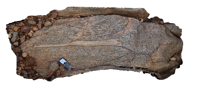
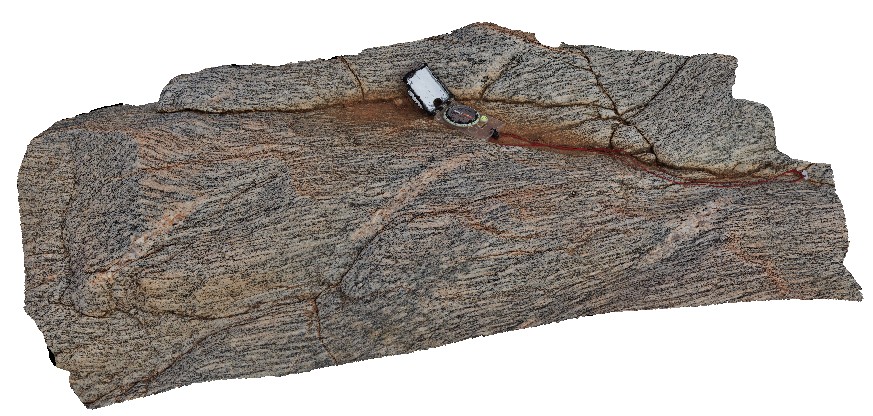
Yinnetharra3 Map
 |
5 |
05/27/2016 noon |
3D |
en-echelon veins in L tectonite granite/granodiorite gneiss. Cobra-Dairy Creek Road - Gascoyne crossing, W.A. |
1.00 |
-24.65477000000 |
116.16772000000 |
-9999.000 |
en-echelon veins, L tectonite, granodiorite gneiss |
gneiss |
Yinnetharra2 Map
 |
5 |
05/27/2016 noon |
3D |
3D exposure of L tectonic fabric in granodiorite gneiss. Cobra-Dairy Creek Road - Gascoyne crossing, W.A. |
0.60 |
-25.65475000000 |
116.16776000000 |
-9999.000 |
L tectonic fabric, granodiorite, gneiss, metamorphism |
gneiss |
Yinnetharra1 Map
 |
5 |
05/27/2016 noon |
3D |
L (LS) tectonised granodiorite with plagioclase augens and mineral banding. Cobra-Dairy Creek Road - Gascoyne crossing, W.A. |
1.00 |
-25.65487000000 |
116.16776000000 |
-9999.000 |
L fabric, gneiss, fold, sheared, structure |
granodiorite |
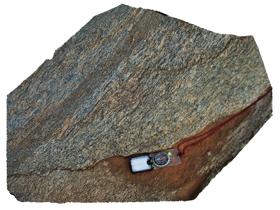
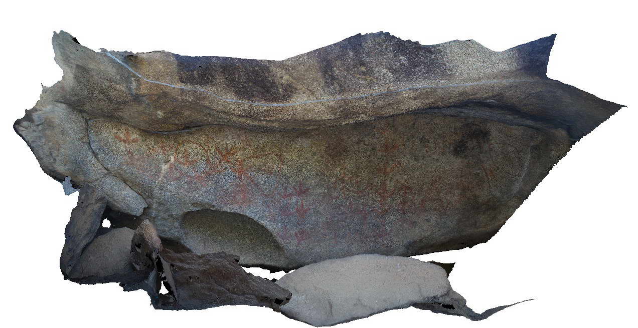
Yarrowyck2 Map
 |
5 |
06/16/2015 5:51 p.m. |
3D |
Detail of Yarrowick rock art site in granite of the Permo-Triassic Gwydir River Monzogranite. Mount Yarrowick, N.S.W. |
0.50 |
-30.45472000000 |
151.37651000000 |
900.000 |
rock art |
granite |
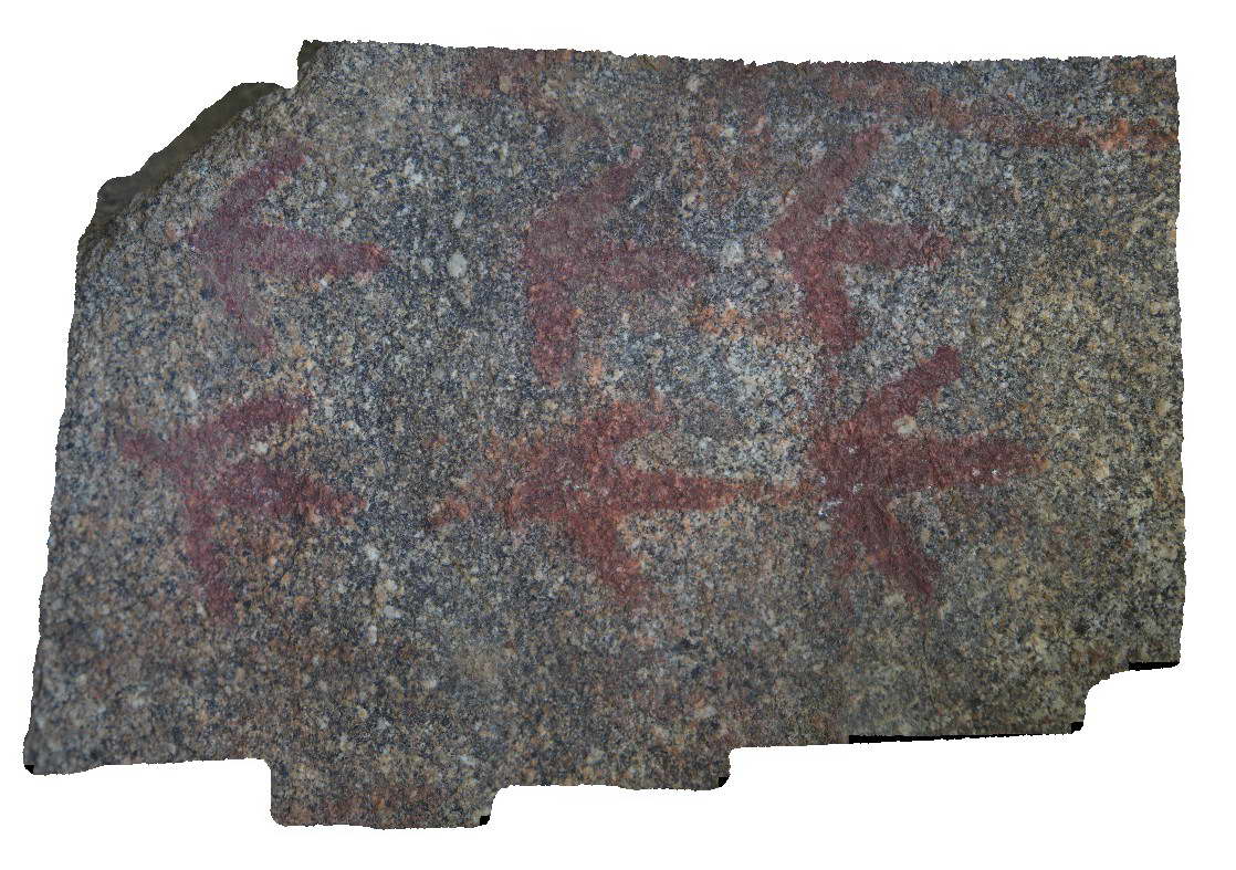
Yarrowyck1 Map
 |
5 |
06/16/2015 5:50 p.m. |
3D |
Yarrowick rock art site in granite of the Permo-Triassic Gwydir River Monzogranite. Mount Yarrowick, N.S.W. |
3.00 |
-30.45472000000 |
151.37651000000 |
900.000 |
rock art |
granite |
Yamba2 Map
 |
5 |
06/16/2015 5:49 p.m. |
3D |
cross bedded sandstone units of the Jurassic Gatton Sandstone. Yamba, N.S.W. |
3.00 |
-29.43242000000 |
153.36531000000 |
7.000 |
cross bedding, sedimentology |
sandstone |
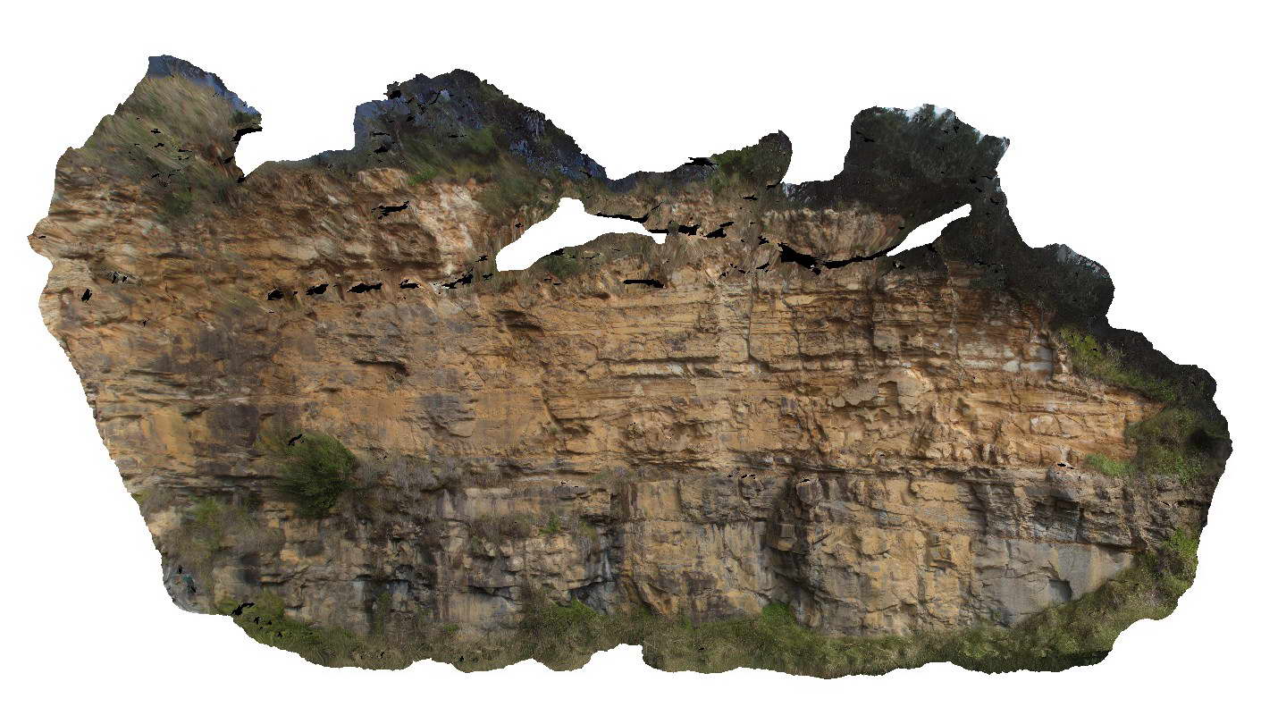
Yamba1 Map
 |
5 |
06/16/2015 5:49 p.m. |
3D |
cliff face of cross bedded sandstone of the Jurassic Gatton Sandstone. Yamba, N.S.W. |
25.00 |
-29.43177000000 |
153.36409000000 |
5.000 |
cross bedding, sedimentology |
sandstone |
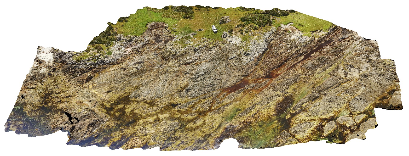
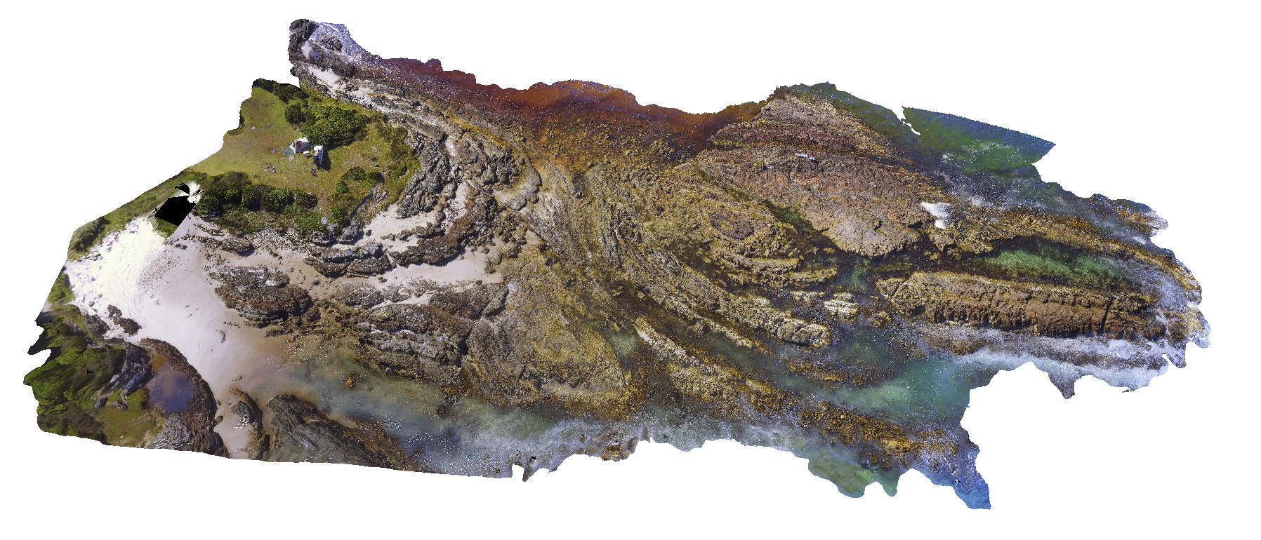
WTasUAV6 Map
 |
5 |
01/01/9999 midnight |
UAV |
faulted contact between the Eldon Group and Oonah Formation, with strong cleavage associated with fault zone cutting bedding. North of Duck Creek, west coast, Tasmania. |
50.00 |
-41.76542300000 |
145.00094900000 |
-9999.000 |
fault, faulted contact, structure, Oonah Formation, Eldon Group, foliation, cleavage |
sandstone, sandstone |
WTasUAV5 Map
 |
5 |
01/01/9999 midnight |
UAV |
aerial view of folds in sandstone and siltstone Silurian aged rocks with detail of small basin. Duck Creek, west coast, Tasmania. |
20.00 |
-41.76892000000 |
145.00370700000 |
-9999.000 |
fold, basin, structure, multiple folds |
sandstone |
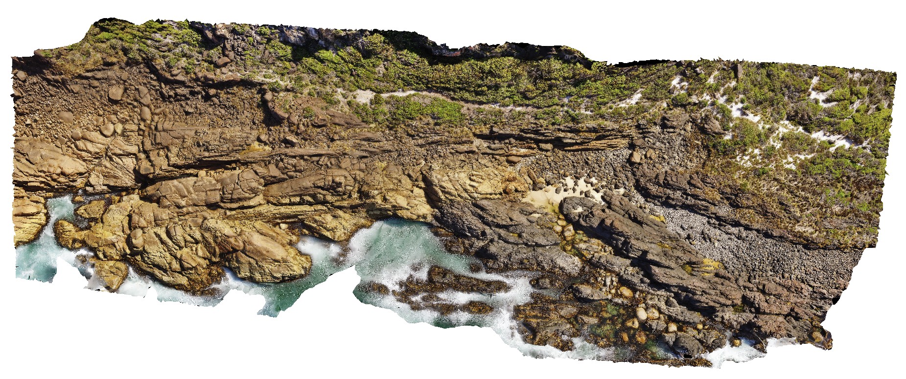
WTasUAV4 Map
 |
5 |
01/01/9999 midnight |
UAV |
aerial view of folds in sandstone and siltstone Silurian aged rocks. Duck Creek, west coast, Tasmania. |
100.00 |
-41.76811000000 |
145.00443100000 |
-9999.000 |
fold, structure |
sandstone |
WTasUAV3 Map
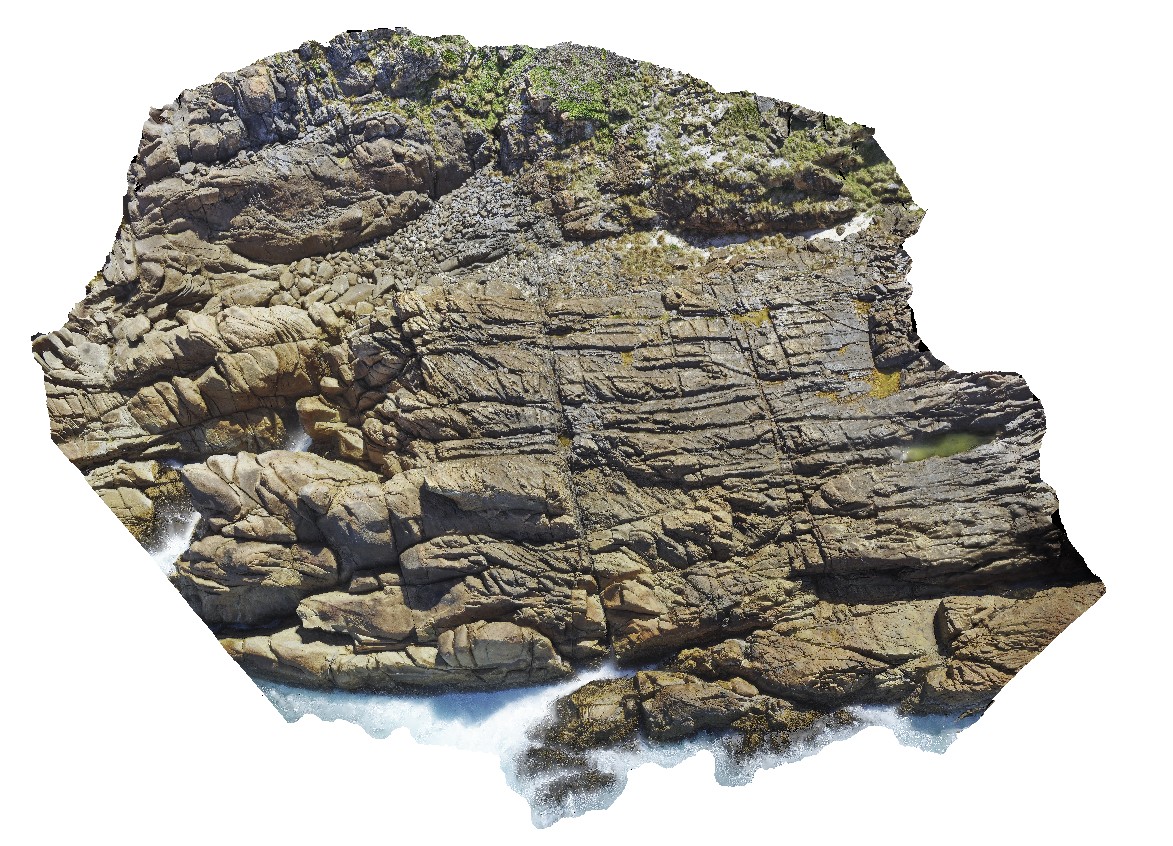 |
20 |
01/01/9999 midnight |
UAV |
aerial view of jointed granite, with magmatic - hydrothermal alteration and veining. Trial Harbour, West Tasmania. |
100.00 |
-41.92280300000 |
145.15734300000 |
-9999.000 |
granite, tourmaline orbicules, intrusive contact |
granite |
WTasUAV2 Map
 |
20 |
01/01/9999 midnight |
UAV |
aerial view of Heemskirk Granite in contact with ultramafic suite at north end of Trial Harbour. Trial Harbour, West Tas. |
50.00 |
-41.92522000000 |
145.16256400000 |
-9999.000 |
igneous contact, contact, Heemskirk Granite |
granite, ultramafic |
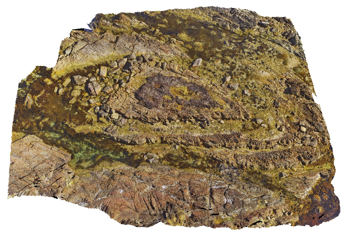
WTasUAV1 Map
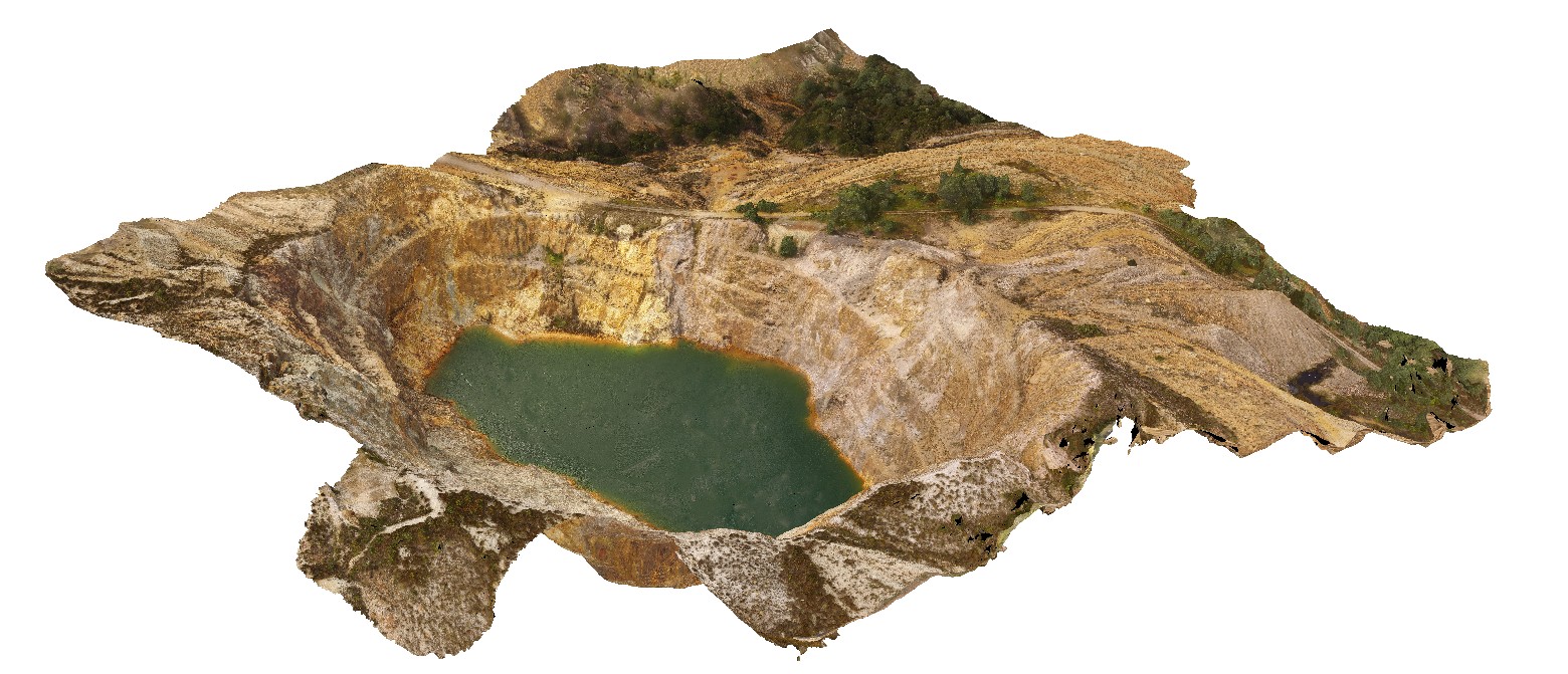 |
20 |
01/01/9999 midnight |
UAV |
aerial view of the Iron Blow open pit at My Lyell with view of the Lyell Schist and Owen Group. Gormanston, West Tasmania. |
0.00 |
-42.06835300000 |
145.59241300000 |
-9999.000 |
fault, contact, structure, Mount Lyell, Lyell Schist, Owen Group, conglomerate, Iron Blow Copper Mine |
schist, conglomerate |
WTasFSP9 Map
 |
5 |
01/01/9999 midnight |
FSP |
360 degree view of coastal platform and exposure, showing the Heemskirk White Granite with very large tourmaline orbicules. Trial Harbour, West Tasmania. |
50.00 |
-41.92305000000 |
145.15689000000 |
-9999.000 |
granite, tourmaline orbicule, igneous contact |
granite |
WTasFSP8 Map
 |
5 |
01/01/9999 midnight |
FSP |
360 degree view of coastal exposure, showing the contact between the Heemskirk White Granite with very large tourmaline orbicules and the Heemskirk Red Granite. Trial Harbour, West Tasmania. |
50.00 |
-41.92303000000 |
145.15695000000 |
-9999.000 |
igneous contact, tourmaline orbicule, contact alteration |
granite, granite |
WTasFSP7 Map
 |
5 |
01/01/9999 midnight |
FSP |
360 degree view of coastal exposure, showing the contact between the White Heemskirk Granite with tourmaline orbicules and the Red Heemskirk Granite with quartz veins. Trial Harbour, West Tasmania. |
100.00 |
-41.92303000000 |
145.15710000000 |
-9999.000 |
igneous contact |
granite, granite |
WTasFSP6 Map
 |
5 |
01/01/9999 midnight |
FSP |
360 degree view of coastal exposure, showing the contact between the White Heemskirk Granite with tourmaline orbicules and the Red Heemskirk Granite. Trial Harbour, West Tasmania. |
100.00 |
-41.92289000000 |
145.15701000000 |
-9999.000 |
igneous contact |
granite, granite |
WTasFSP5 Map
 |
5 |
01/01/9999 midnight |
FSP |
360 degree view of coastal exposure, showing the contact between the White Heemskirk Granite with tourmaline orbicules and the Red Heemskirk Granite. Trial Harbour, West Tasmania. |
100.00 |
-41.92286000000 |
145.15720000000 |
-9999.000 |
igneous contact, tourmaline orbicules |
granite, granite |