BH2014n15 Map
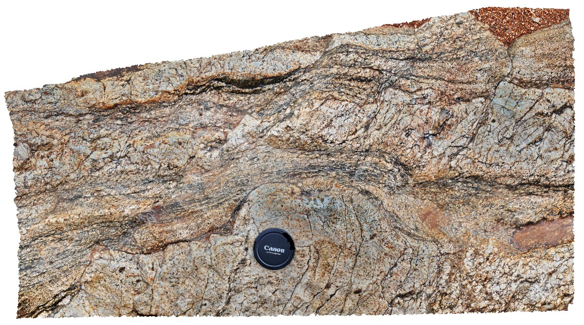 |
20 |
03/24/2015 2:41 p.m. |
3D terrestrial photogrammetric model |
folds and small fault offsets / S-C fabric in sheared quartz pegmatite. Broken Hill, N.S.W. |
0.50 |
-31.61762936000 |
141.49430254000 |
-9999.000 |
S-C fabric, structure, pegmatite, shear |
pegmatite |
BH2014n16 Map
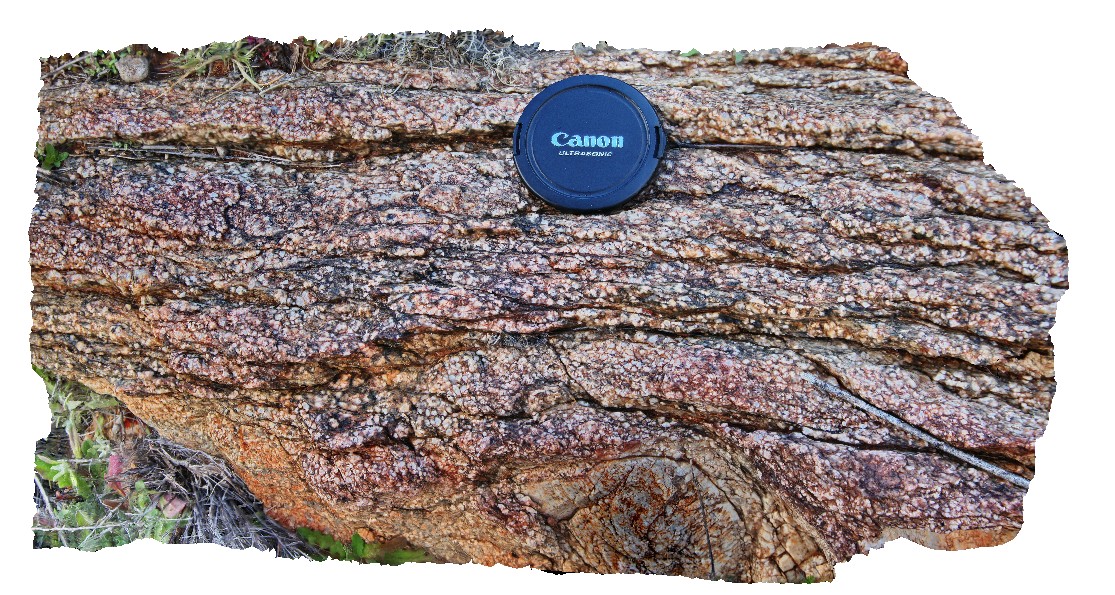 |
20 |
03/24/2015 2:50 p.m. |
3D terrestrial photogrammetric model |
anastomosing cleavage in quartz pegmatite Broken Hill, N.S.W. |
0.40 |
-31.61771255000 |
141.49431190000 |
-9999.000 |
anastomosing cleavage, structure, pegmatite |
pegmatite |
Bh2014n17 Map
 |
20 |
01/01/9999 midnight |
3D terrestrial photogrammetric model |
quartz pegmatite with fine and coarse-grain size. Broken Hill, N.S.W. |
0.40 |
-31.61709854000 |
141.49443331000 |
-9999.000 |
pegmatite, metamorphic |
pegmatite |
BH2014n18 Map
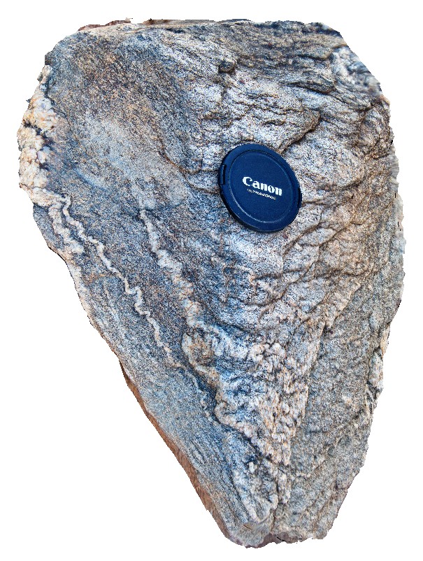 |
20 |
03/16/2015 3:04 p.m. |
3D terrestrial photogrammetric model |
ptygmatic folding of quartz veins in gneiss. Broken Hill, N.S.W. |
0.25 |
-31.61361432000 |
141.49636511000 |
-9999.000 |
ptygmatic folding, fold, gneiss, structure, metamorphic |
gneiss |
BH2014n19 Map
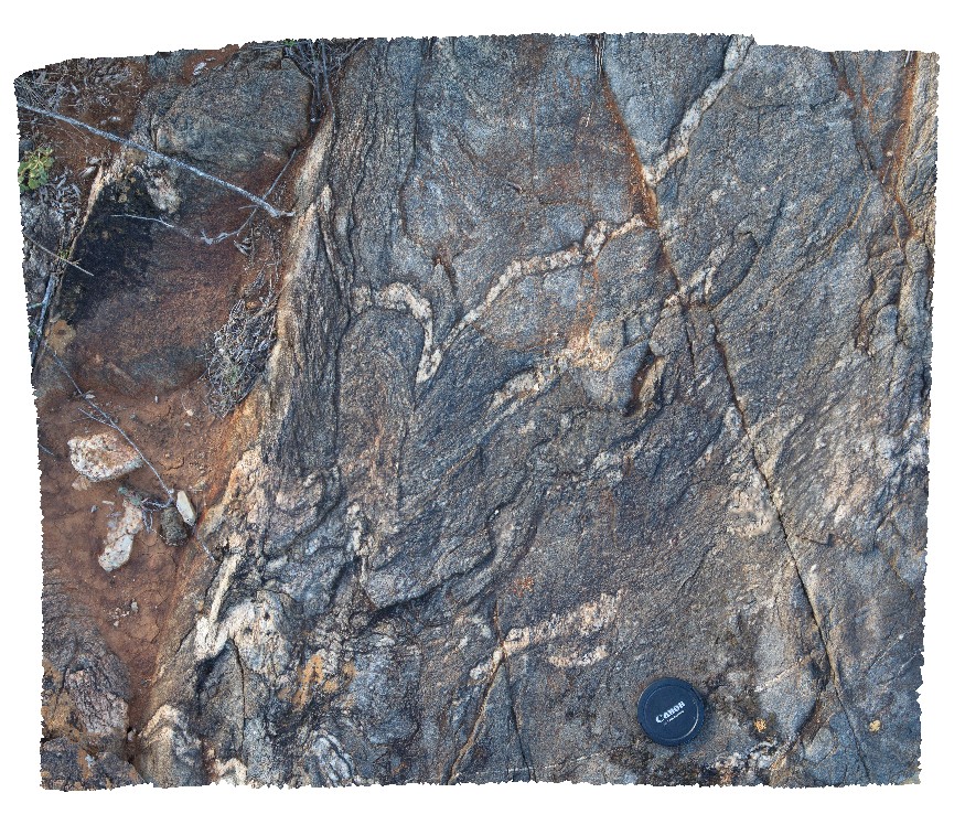 |
20 |
03/16/2015 3:05 p.m. |
3D terrestrial photogrammetric model |
folding in gneiss and quartz veins. Broken Hill, N.S.W. |
1.00 |
-31.61365513000 |
141.49653115000 |
-9999.000 |
fold, structure, gneiss, metamorphic |
gneiss |
BH2014n2 Map
 |
20 |
03/16/2015 3:03 p.m. |
3D terrestrial photogrammetric model |
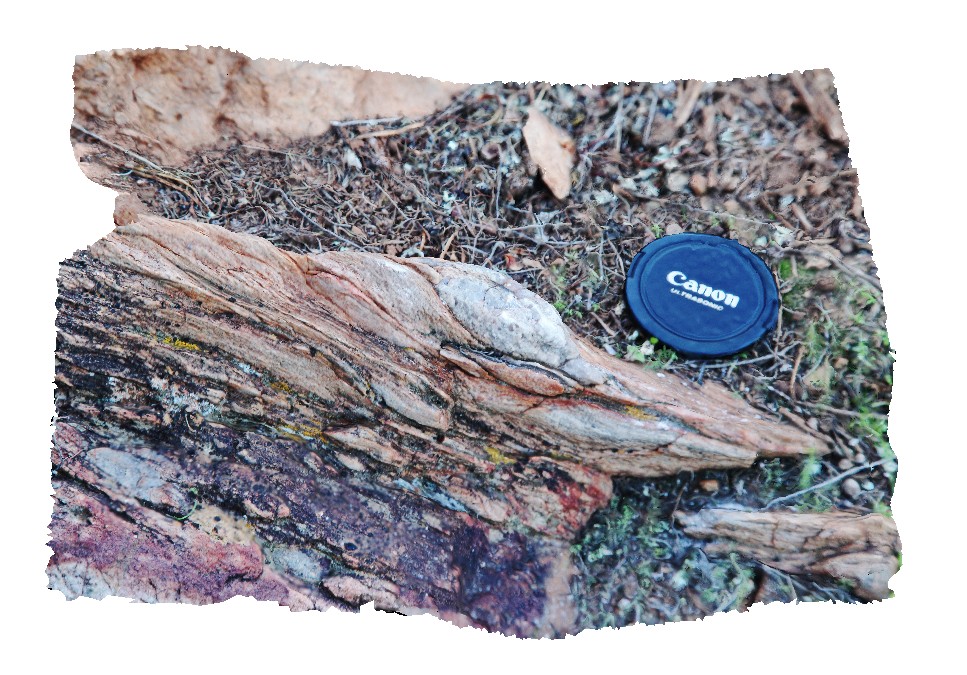
view of S-C fabric developed around flattened cobbles in conglomerate layer in sediments. Broken Hill, N.S.W. |
0.20 |
-31.61237439000 |
141.52996952000 |
-9999.000 |
S-C fabric`, structure, conglomerate, flattening |
conglomerate |
BH2014n20 Map
 |
20 |
01/01/9999 midnight |
3D terrestrial photogrammetric model |
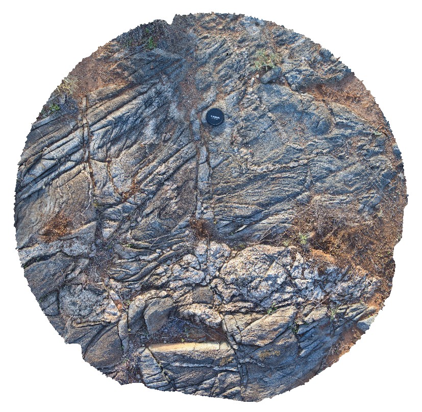
folded gneiss, with developed S-C fabric and disrupted quartz vein. Broken Hill, N.S.W. |
0.50 |
-31.61390352000 |
141.49519117000 |
-9999.000 |
fold, gneiss, structure, S-C fabric |
gneiss |
BH2014n3 Map
 |
20 |
03/16/2015 3:03 p.m. |
3D terrestrial photogrammetric model |
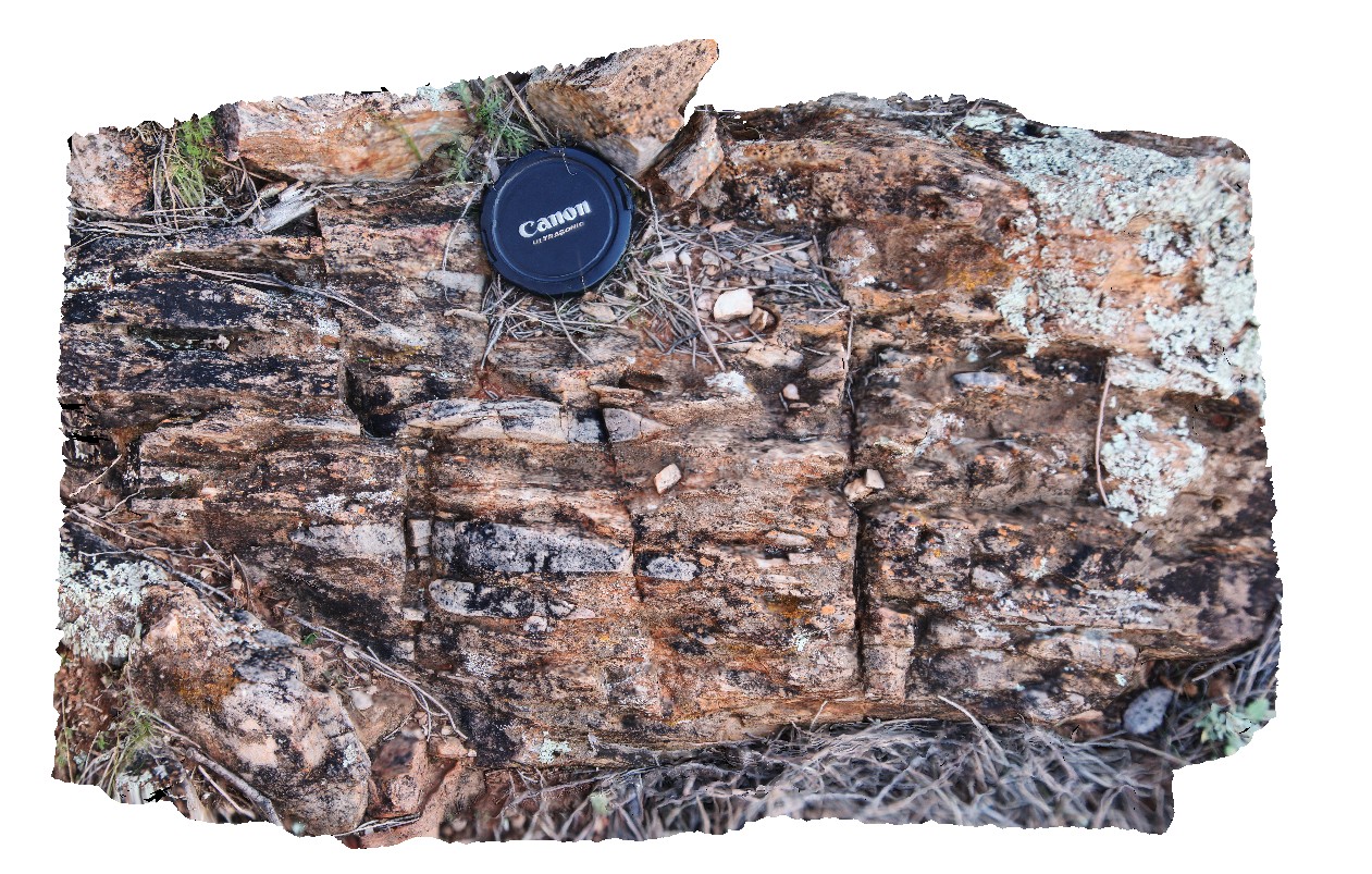
view of flattened quartz pebbles / cobbles in pebble layer of metasediments. Broken Hill, N.S.W. |
0.50 |
-31.61278094000 |
141.53035524000 |
-9999.000 |
conglomerate, metasediment, stretching, structure |
conglomerate |
BH2014n4 Map
 |
20 |
03/16/2015 3:02 p.m. |
3D terrestrial photogrammetric model |
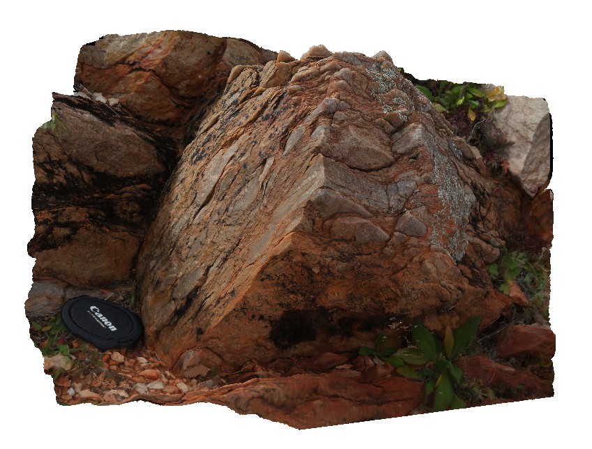
S-C fabric developed in steeply dipping quartz conglomerate layer in metasediments. Broken Hill, N.S.W. |
0.50 |
-31.61251976000 |
141.53012009000 |
-9999.000 |
S-C fabric, structure, conglomerate, flattening |
conglomerate |
BH2014n5 Map
 |
20 |
03/13/2015 9:59 a.m. |
3D terrestrial photogrammetric model |
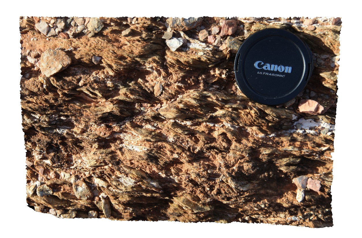
S-C fabric developed in metasediment. Broken Hill, N.S.W. |
0.20 |
-31.61294092000 |
141.53049184000 |
-9999.000 |
S-C fabric, structure, metasediment |
metasediment |
BH2014n6 Map
 |
20 |
03/17/2015 1:35 p.m. |
3D terrestrial photogrammetric model |
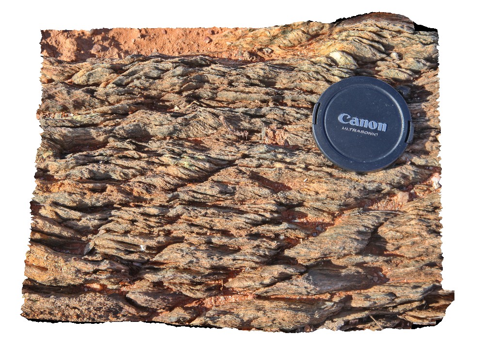
well developed S-C fabric in metasediment. Broken Hill, N.S.W. |
0.20 |
-31.61295228000 |
141.53052256000 |
-9999.000 |
S-C fabric, metasediment, structure |
metasediment |
BH2014n7 Map
 |
20 |
03/17/2015 2:10 p.m. |
3D terrestrial photogrammetric model |
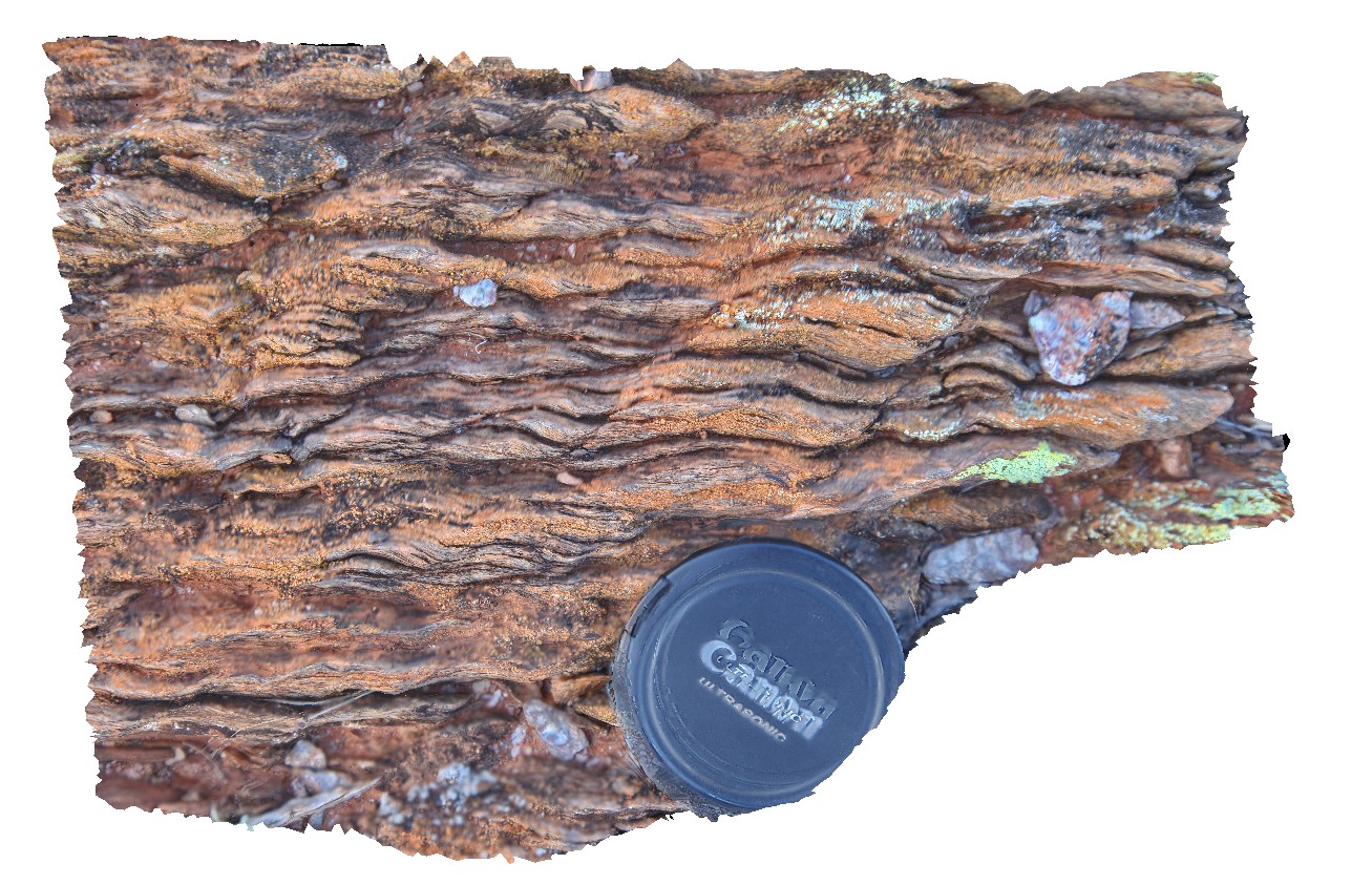
well developed S-C fabric in metasediment. Broken Hill, N.S.W. |
0.15 |
-31.61297855000 |
141.53056219000 |
-9999.000 |
S-C fabric, structure, metasediment |
psammite |
BH2014n8 Map
 |
20 |
03/18/2015 2:17 p.m. |
3D terrestrial photogrammetric model |
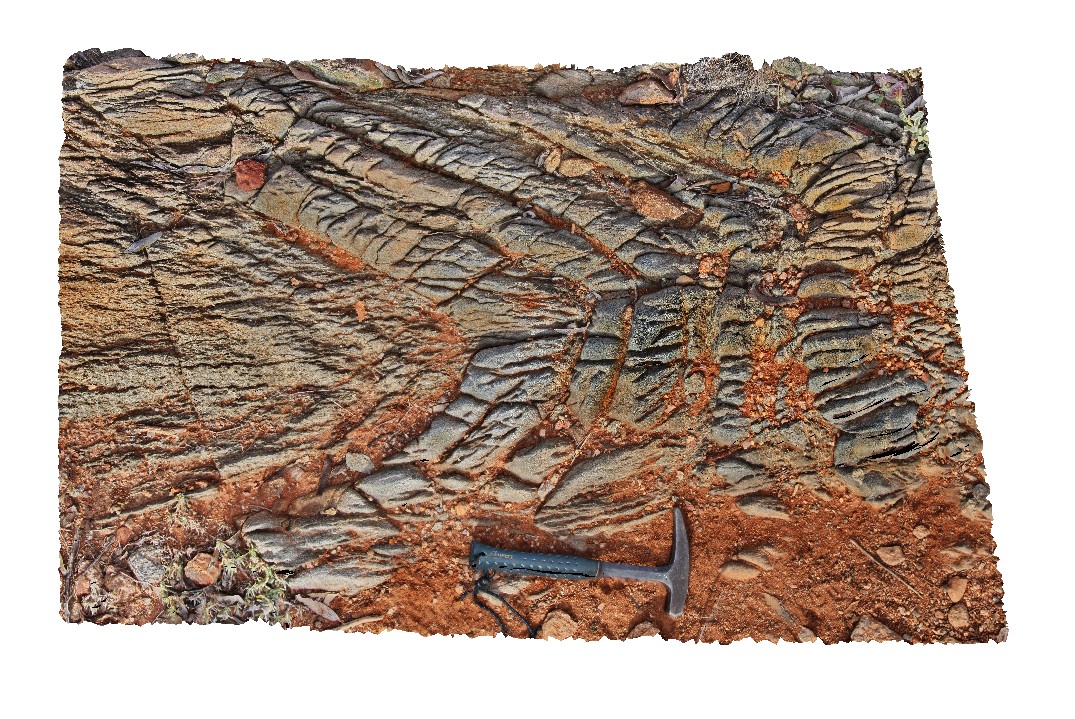
steeply plunging fold hinge in gneiss, with spaced axial planar cleavage. Broken Hill, N.S.W. |
2.00 |
-31.62004724000 |
141.49297042000 |
-9999.000 |
steeply plunging, fold hinge, spaced cleavage, structure |
gneiss |
BH2014n9 Map
 |
20 |
03/18/2015 3:42 p.m. |
3D terrestrial photogrammetric model |
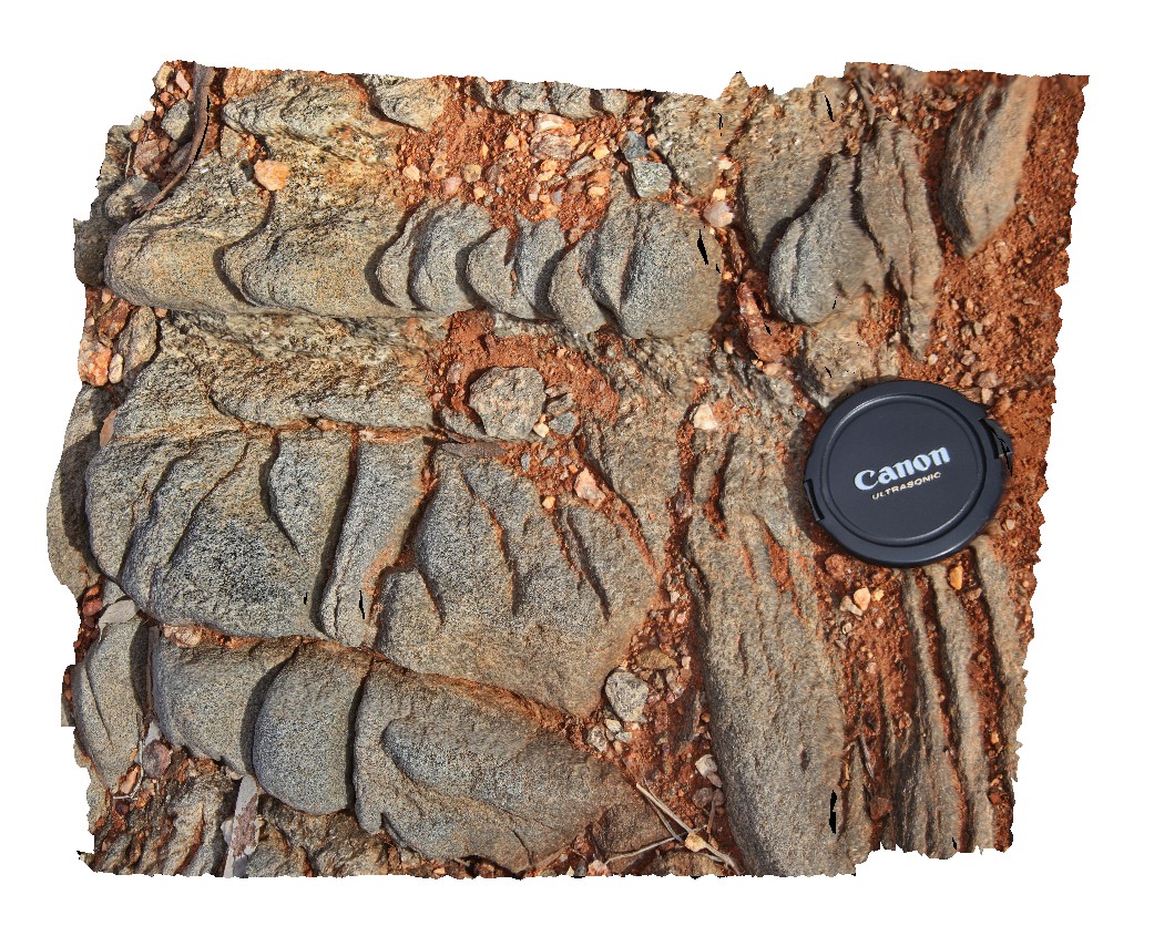
spaced cleavage in gneiss after metasediments. Broken Hill, N.S.W. |
0.30 |
-31.62006366000 |
141.49296080000 |
-9999.000 |
spaced cleavage, structure |
gneiss |
BHill100 Map
 |
5 |
09/18/2015 11:12 a.m. |
3D terrestrial photogrammetric model |
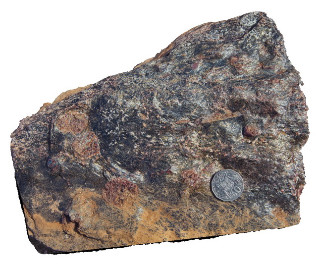
block of Bi-gt-staurolite schist in Cues Formation, Broken Hill. N.S.W. |
0.30 |
-32.19953000000 |
141.01125000000 |
-9999.000 |
Bi-garnet-staurolite schist |
schist |
BHill101 Map
 |
5 |
09/19/2015 7:01 a.m. |
3D terrestrial photogrammetric model |
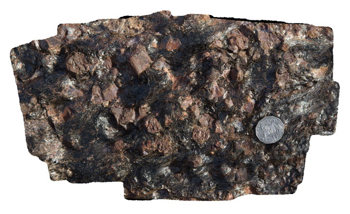
detail of gt-bi schist in Cues Formation, Broken Hill. N.S.W. |
0.30 |
-32.19953000000 |
141.01125000000 |
-9999.000 |
Bi-garnet schist |
schist |
BHill102 Map
 |
5 |
09/19/2015 7:01 a.m. |
3D terrestrial photogrammetric model |
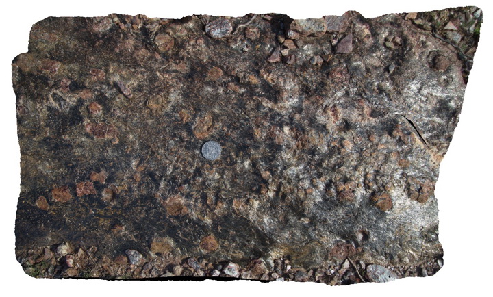
detail of gt-bi schist in Cues Formation, Broken Hill. N.S.W. |
0.60 |
-32.19953000000 |
141.01125000000 |
-9999.000 |
biotite garnet schist |
schist |
BHill103 Map
 |
5 |
09/19/2015 7:02 a.m. |
3D terrestrial photogrammetric model |
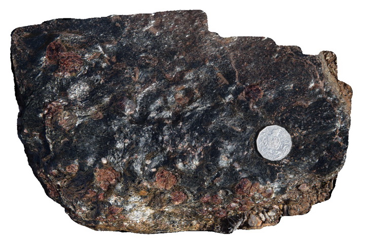
detail of gt-bi schist in Cues Formation, Broken Hill. N.S.W. |
0.25 |
-32.19953000000 |
141.01125000000 |
-9999.000 |
garnet biotite schist |
schist |
BHill104 Map
 |
5 |
09/19/2015 7:02 a.m. |
3D terrestrial photogrammetric model |
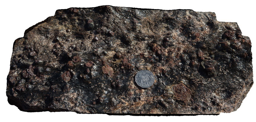
detail of gt-bi schist in Cues Formation, Broken Hill. N.S.W. |
0.35 |
-32.19953000000 |
141.01125000000 |
-9999.000 |
garnet biotite schist |
schist |
BHill105 Map
 |
5 |
09/19/2015 7:06 a.m. |
3D terrestrial photogrammetric model |
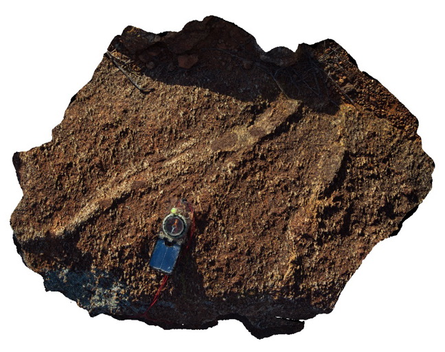
pelitic metasediments, featuring sillimanite rich band with porphyroblastic garnet. Apparent F1 fold with prominent S2 fabric. Possible earlier fabric shown in the garnets. Allendale Metasediments, Broken Hill. N.S.W. |
0.80 |
-31.84462000000 |
141.41537000000 |
-9999.000 |
metasediments |
metasediments |
BHill106 Map
 |
5 |
09/19/2015 7:07 a.m. |
3D terrestrial photogrammetric model |
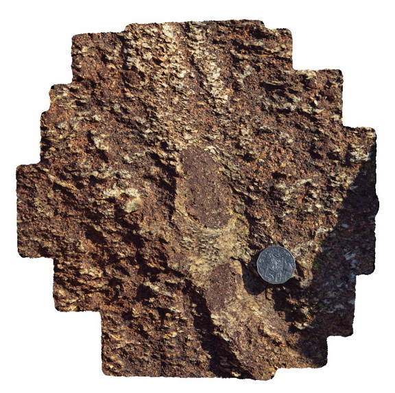
detail of large garnet and sillimanite porphyroblasts from site BHill105, Broken Hill. N.S.W. |
0.30 |
-31.84462000000 |
141.41537000000 |
-9999.000 |
garnet porphyroblast, sillimanite porphyroblast |
schist |
BHill107 Map
 |
5 |
09/19/2015 7:29 a.m. |
3D terrestrial photogrammetric model |
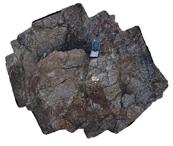
detail of graphic intergrown texture in pegmatite. Allendale Metasediments, Broken Hill. N.S.W. |
1.00 |
-31.84457000000 |
141.41505000000 |
-9999.000 |
pegmatite |
pegmatite |
BHill108 Map
 |
5 |
09/19/2015 7:46 a.m. |
3D terrestrial photogrammetric model |
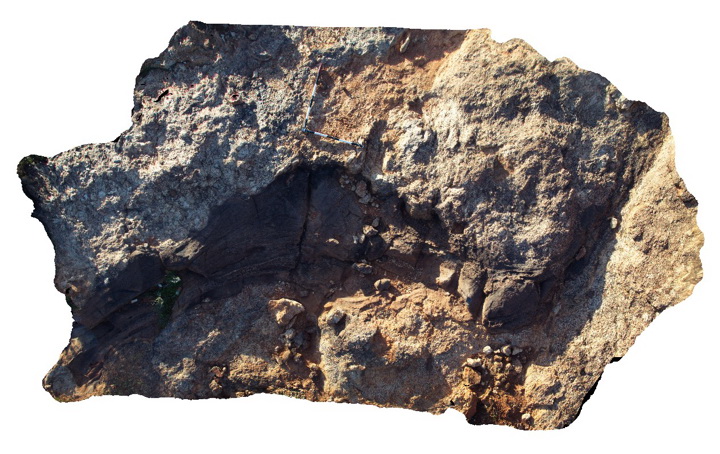
view of folded 'raft' of metasediment in pegmatite, Broken Hill. N.S.W. |
4.50 |
-31.84523000000 |
141.41393000000 |
-9999.000 |
metasediments, pegmatite, fold |
pegmatite |
BHill109 Map
 |
5 |
09/19/2015 8:26 a.m. |
3D terrestrial photogrammetric model |
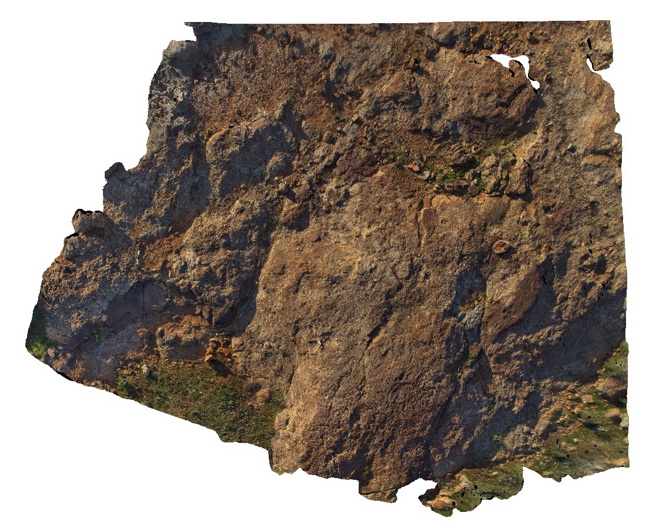
over view of folded meta psammite layer in pegmatite, with orientation of folded psammite consistent with F2 folds. S1 fabric in pelitic layer is folded parallel to F2. Broken Hill. N.S.W. |
7.00 |
-31.84523000000 |
141.41393000000 |
-9999.000 |
xenolith, F2 folding |
pegmatite, metapsammite |
BHill110 Map
 |
5 |
09/19/2015 7:48 a.m. |
3D terrestrial photogrammetric model |
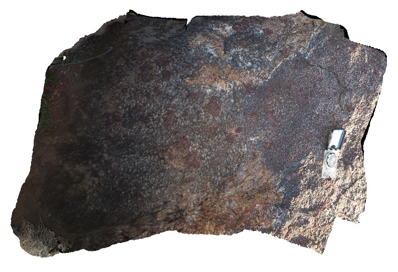
pelitic metasediments with large garnets, S2 fabric and crenulated S1 fabric. Broken Hill. N.S.W. |
0.70 |
-31.84558000000 |
141.41388000000 |
-9999.000 |
garnet, S1, S2, structure |
metasediment |
 AusGeol.org