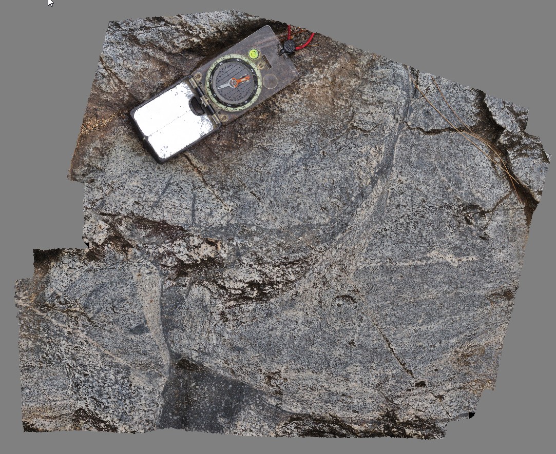
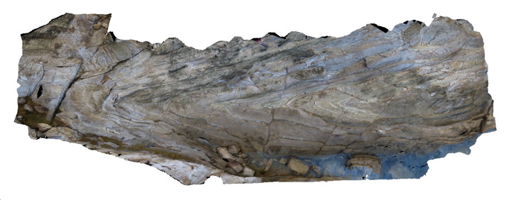
Bellthorpe3 Map
 |
5 |
04/12/2016 2:34 p.m. |
3D |
shear textures and multiple intrusive phases in granite. Bellthorpe, QLD. |
0.30 |
-26.82771000000 |
152.62271000000 |
-9999.000 |
intrusive, shearing, structure |
granite |
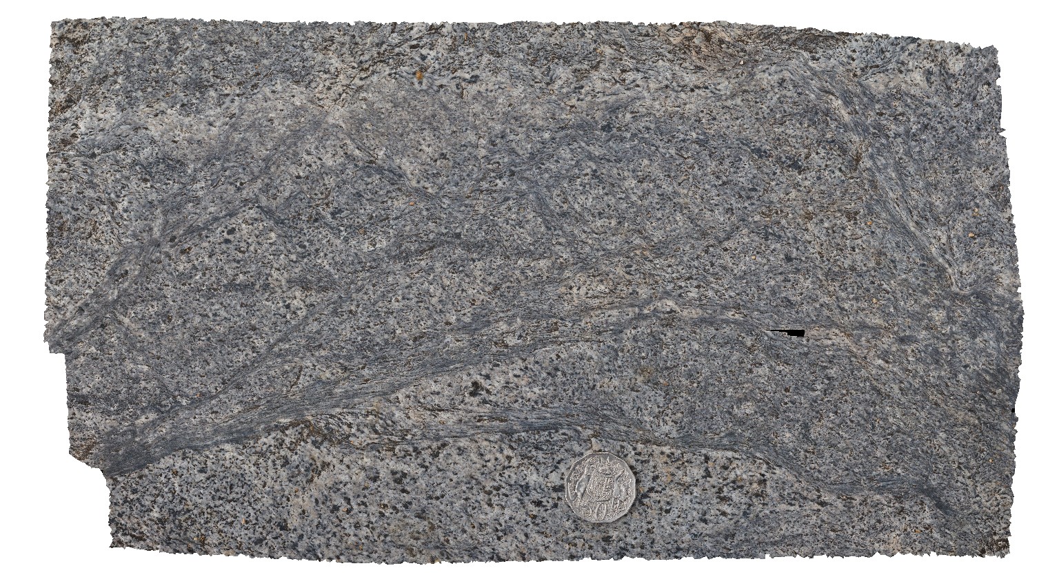
Bellthorpe4 Map
 |
5 |
04/12/2016 11:38 a.m. |
3D |
shear textures in granite, Bellthorpe, QLD. |
0.30 |
-26.82764000000 |
152.62271000000 |
-9999.000 |
shearing, granite |
granite |
Bellthorpe5 Map
 |
5 |
04/12/2016 12:36 p.m. |
3D |
dykes in large xenoliths with fragments of dykes. Bellthorpe, QLD. |
1.00 |
-26.82782000000 |
152.62265000000 |
-9999.000 |
dyke, xenolith, breccia |
granite, granite |
Bellthorpe6 Map
 |
5 |
04/12/2016 1:20 p.m. |
3D |
dykes in xenolith Bellthorpe, QLD. |
0.50 |
-26.82780000000 |
152.62260000000 |
-9999.000 |
xenolith, dyke |
granite |
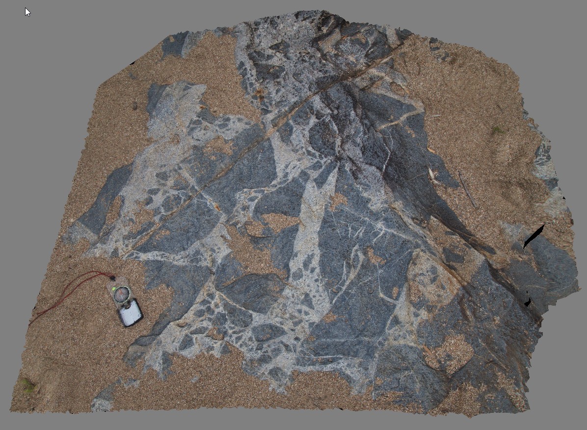
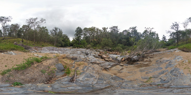
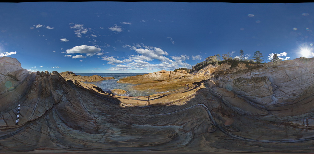
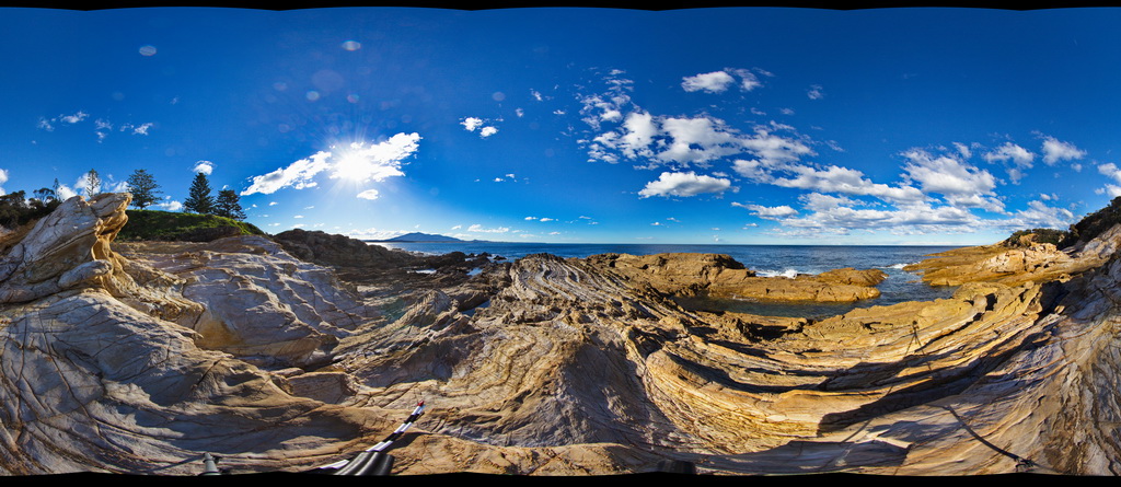
BellthorpeFSP1 Map
 |
20 |
04/12/2016 1:43 p.m. |
FSP |
creek exposure next to Cedarvale Road, showing multiple intrusion phases and xenoliths in granite. Bellthorpe, QLD. |
100.00 |
-26.82772000000 |
152.62267000000 |
-9999.000 |
xenolith, igneous contact, intrusion |
granite |
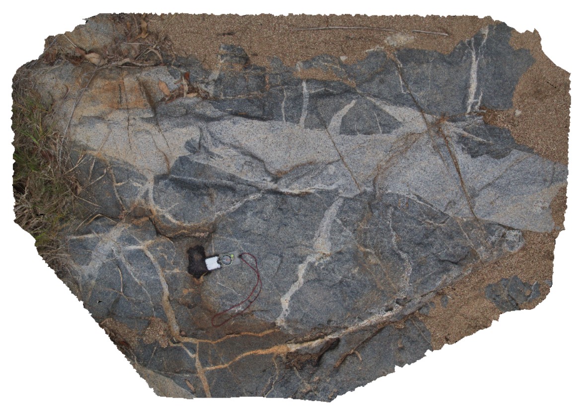
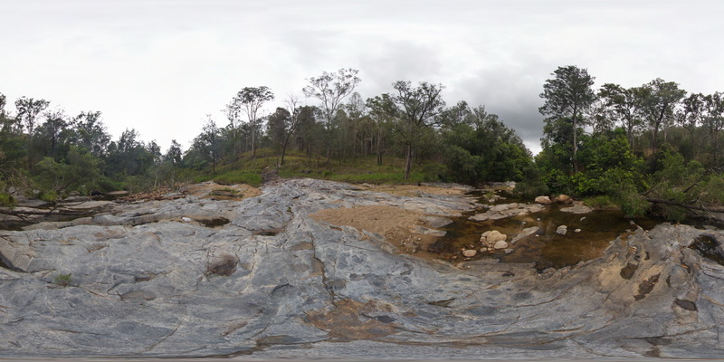
BellthorpeFSP2 Map
 |
20 |
04/12/2016 1:35 p.m. |
FSP |
creek exposure next to Cedarvale Road, showing multiple intrusion phases and xenoliths in granite. Bellthorpe, QLD. |
100.00 |
-26.82766000000 |
152.62268000000 |
-9999.000 |
intrusion, xenolith, granite |
granite |
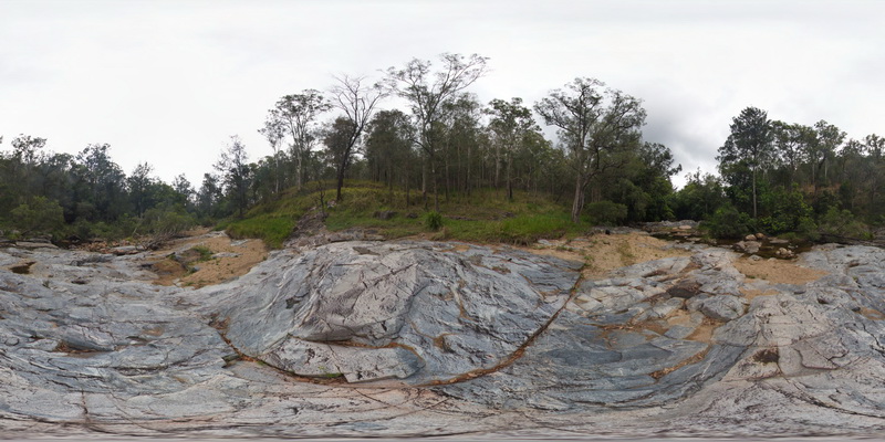
BellthorpeFSP3 Map
 |
20 |
04/12/2016 1:39 p.m. |
FSP |
creek exposure next to Cedarvale Road, showing multiple intrusion phases and xenoliths in granite. Bellthorpe, QLD. |
100.00 |
-26.82768000000 |
152.62267000000 |
-9999.000 |
igneous intrusion, intrusive contact, xenolith |
granite |
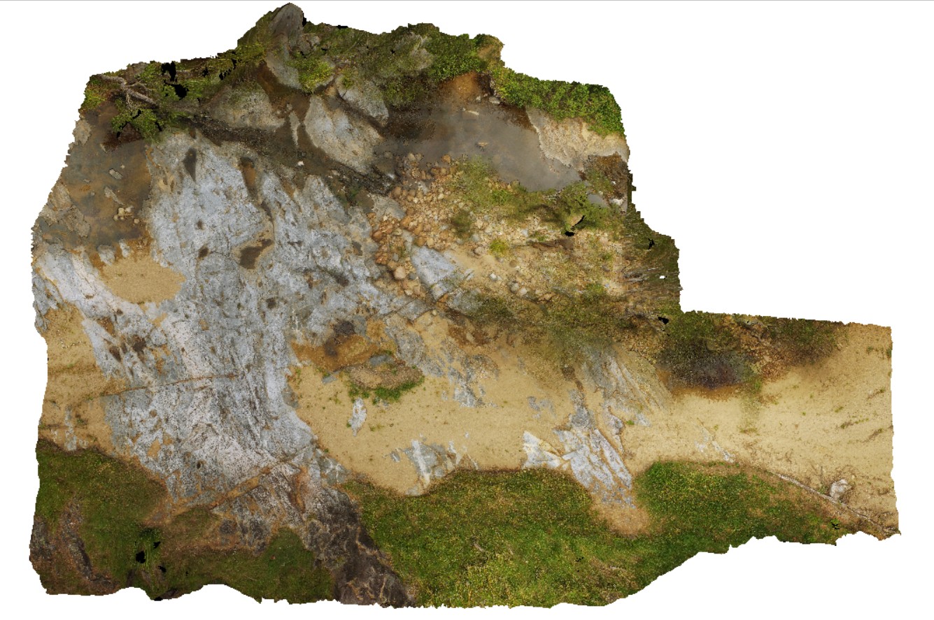
BellthorpeUAV1 Map
 |
50 |
01/01/9999 midnight |
UAV |
Aerial view of granodiorite with multiple intrusive phases and metasediment xenoliths. Bellthorpe, QLD. |
100.00 |
-26.82770700000 |
152.62270000000 |
2.000 |
granodiorite, intrusive contact |
granodiorite |
Bermagui2 Map
 |
5 |
05/18/2015 12:57 p.m. |
3D |
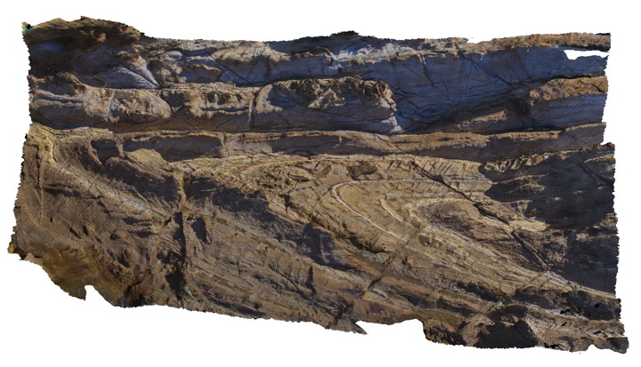
plunging anticline in Ordovician sandstones of the Abercrombie Formation. N.S.W. |
12.00 |
-36.42352000000 |
150.08267000000 |
2.000 |
sandstone, fold, anticline, structure |
sandstone |
Bermagui3 Map
 |
5 |
05/18/2015 12:58 p.m. |
3D |
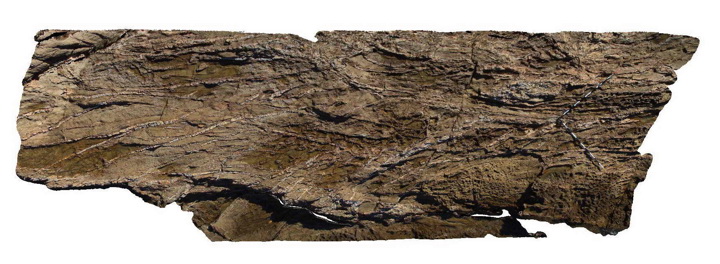
Fault zone cross-cutting steeply dipping sandstone beds of the Ordovician Abercrombie Formation. Visualisation is approximately 8-10m across. Bermagui, N.S.W. |
9.00 |
-36.42400000000 |
150.08278000000 |
-9999.000 |
fault zone, sandstone, structure |
sandstone |
Bermagui4 Map
 |
5 |
05/18/2015 12:59 p.m. |
3D |
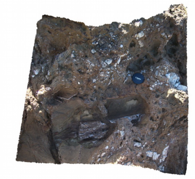
Detail of fault breccia within Ordovician Abercrombie Formation. Bermagui, N.S.W. |
1.00 |
-36.42400000000 |
150.08278000000 |
2.000 |
fault, breccia, structure |
breccia |
Bermagui5 Map
 |
5 |
05/18/2015 12:59 p.m. |
3D |
Quartz vein networks cutting sandstone of the Ordovician Abercrombie Formation. Bermagui, N.S.W. |
8.00 |
-36.42444000000 |
150.08282000000 |
1.000 |
sandstone, quartz vein, structure |
sandstone, quartz |
BermaguiFSP1 Map
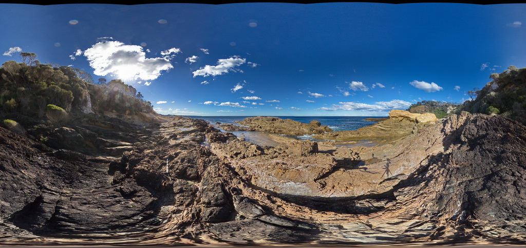 |
5 |
08/21/2015 11:38 a.m. |
FSP |
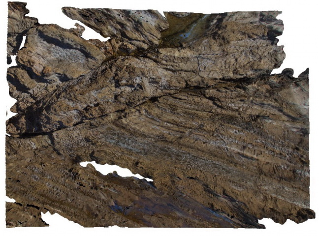
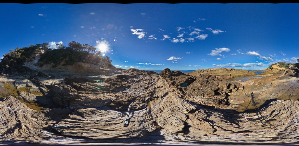
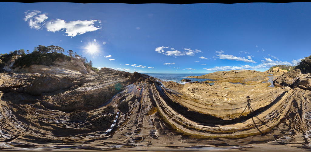
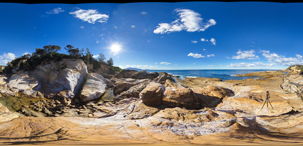
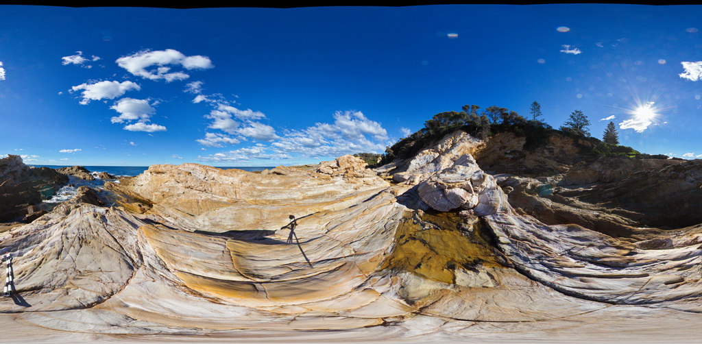
thickly bedded, folded and faulted turbiditic metasediments of the Ordovician Adaminaby Group. Bermagui, N.S.W. |
50.00 |
-36.42449000000 |
150.08263000000 |
-9999.000 |
structure, sedimentology, turbidite |
turbidite |
BermaguiFSP10 Map
 |
5 |
08/25/2015 11:51 a.m. |
FSP |
thickly bedded, folded and faulted turbiditic metasediments of the Ordovician Adaminaby Group. Bermagui, N.S.W. |
50.00 |
-36.42320000000 |
150.08281000000 |
2.000 |
structure, sedimentology |
turbidite |
BermaguiFSP11 Map
 |
5 |
08/25/2015 11:51 a.m. |
FSP |
thickly bedded, folded and faulted turbiditic metasediments of the Ordovician Adaminaby Group. Bermagui, N.S.W. |
50.00 |
-36.42369000000 |
150.08292000000 |
2.000 |
structure, sedimentology, turbidite |
turbidite |
BermaguiFSP12 Map
 |
5 |
08/25/2015 11:51 a.m. |
FSP |
Thickly bedded, folded and faulted turbiditic metasediments of the Ordovician Adaminaby Group. Bermagui, N.S.W. |
50.00 |
-36.42302000000 |
150.08258000000 |
2.000 |
structure, sedimentology |
turbidite |
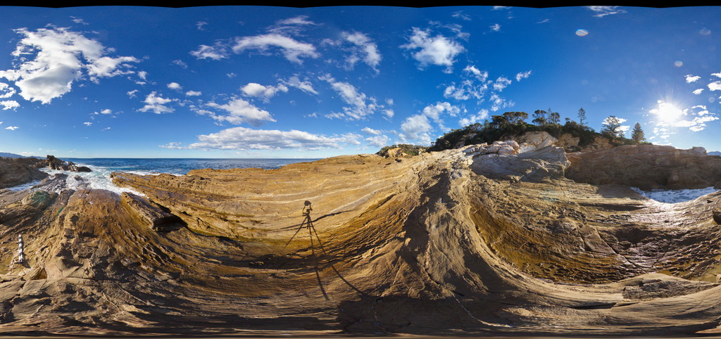
BermaguiFSP2 Map
 |
5 |
08/25/2015 10:38 a.m. |
FSP |
Thickly bedded, folded and faulted turbiditic metasediments of the Ordovician Adaminaby Group. Bermagui, N.S.W. |
50.00 |
-36.42448000000 |
150.08275000000 |
2.000 |
structure, sedimentology |
turbidite |
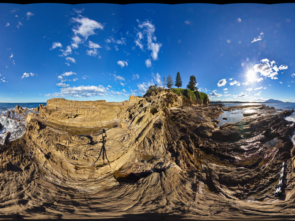
BermaguiFSP3 Map
 |
5 |
08/25/2015 10:41 a.m. |
FSP |
Thickly bedded, folded and faulted turbiditic metasediments of the Ordovician Adaminaby Group. Bermagui, N.S.W. |
50.00 |
-36.42427000000 |
150.08307000000 |
2.000 |
sedimentology, structure |
turbidite |
BermaguiFSP4 Map
 |
5 |
08/25/2015 11:50 a.m. |
FSP |
Thickly bedded, folded and faulted turbiditic metasediments of the Ordovician Adaminaby Group. Bermagui, N.S.W. |
50.00 |
-36.42420000000 |
150.08276000000 |
2.000 |
structure, sedimentology |
turbidite |
BermaguiFSP5 Map
 |
5 |
08/28/2015 12:42 p.m. |
FSP |
Thickly bedded, folded and faulted turbiditic metasediments of the Ordovician Adaminaby Group. Bermagui, N.S.W. |
50.00 |
-36.42405000000 |
150.08273000000 |
2.000 |
structure, sedimentology |
turbidite |
BermaguiFSP6 Map
 |
5 |
08/28/2015 12:39 p.m. |
FSP |
Thickly bedded, folded and faulted turbiditic metasediments of the Ordovician Adaminaby Group. Bermagui, N.S.W. |
50.00 |
-36.42387000000 |
150.08269000000 |
2.000 |
sedimentology, structure |
turbidite |
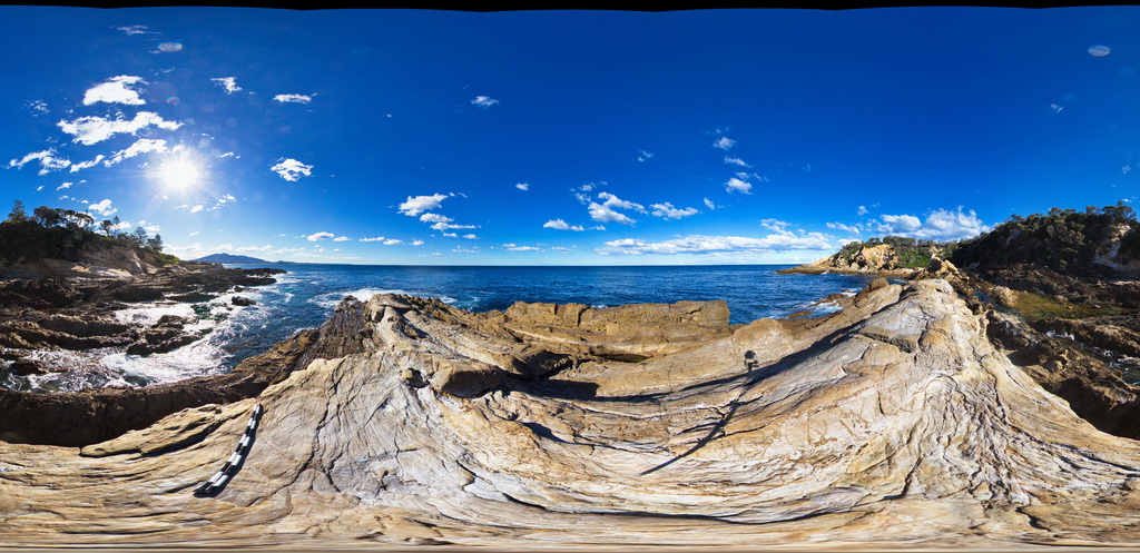
BermaguiFSP7 Map
 |
5 |
08/25/2015 10:54 a.m. |
FSP |
Thickly bedded, folded and faulted turbiditic metasediments of the Ordovician Adaminaby Group. Bermagui, N.S.W. |
50.00 |
-36.42367000000 |
150.08269000000 |
2.000 |
sedimentology, structure |
turbidite |
BermaguiFSP8 Map
 |
5 |
08/25/2015 11:51 a.m. |
FSP |
Thickly bedded, folded and faulted turbiditic metasediments of the Ordovician Adaminaby Group. Bermagui, N.S.W. |
50.00 |
-36.42347000000 |
150.08270000000 |
2.000 |
sedimentology, structure |
turbidite |
BermaguiFSP9 Map
 |
5 |
08/25/2015 11:51 a.m. |
FSP |
Thickly bedded, folded and faulted turbiditic metasediments of the Ordovician Adaminaby Group. Bermagui, N.S.W. |
50.00 |
-36.42334000000 |
150.08270000000 |
2.000 |
structure, sedimentology |
turbidite |
BermaguiPole1 Map
 |
5 |
05/18/2015 1:01 p.m. |
3D |
pole photography of a large, tight plunging anticline in Adaminaby Group low grade turbiditic metasediments. Bermagui, N.S.W. |
20.00 |
-36.42342000000 |
150.08270000000 |
2.000 |
fold, anticline, structure |
turbidite |