BHill59 Map
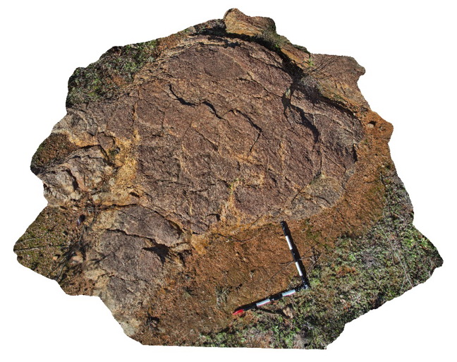 |
5 |
09/15/2015 4:04 p.m. |
3D |
view of boudins and folded gneissic fabric in Rasp Ridge Gneiss. Broken Hill. N.S.W. |
2.20 |
-31.96804000000 |
141.44859000000 |
-9999.000 |
boudinage, metamorphic, gneiss |
gneiss |
BHill60 Map
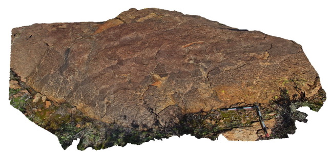 |
5 |
09/15/2015 4:07 p.m. |
3D |
disrupted lithological layering in Rasp Ridge Gneiss. Broken Hill. N.S.W. |
5.00 |
-31.96756000000 |
141.44865000000 |
-9999.000 |
layering, gneiss |
gneiss |
BHill61 Map
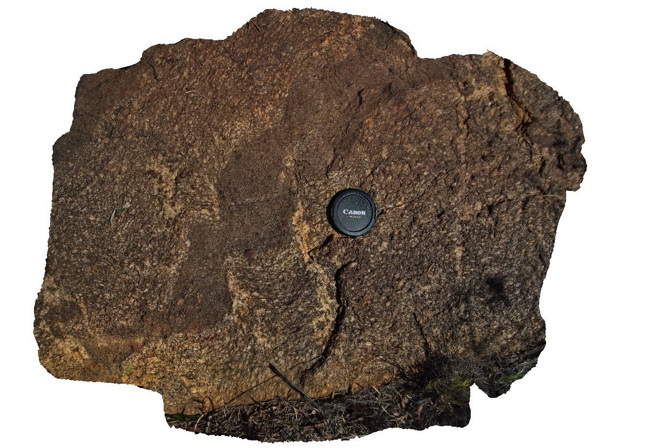 |
5 |
09/15/2015 4:54 p.m. |
3D |
view of detail from location BHill60 of layering and folding in gneissic fabric from Rasp Ridge Gneiss. Broken Hill. N.S.W. |
1.00 |
-31.96756000000 |
141.44865000000 |
-9999.000 |
gneissic layering, metamorphic |
gneiss |
BHill62 Map
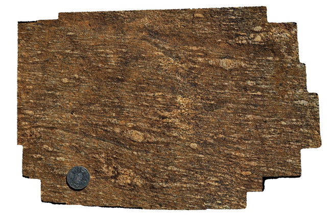 |
5 |
09/15/2015 4:56 p.m. |
3D |
Detail of feldspar porphyroblasts in Rasp Ridge Gneiss. Broken Hill. N.S.W. |
0.40 |
-31.96737000000 |
141.44806000000 |
-9999.000 |
porphyroblast, gneiss |
gneiss |
BHill63 Map
 |
5 |
09/16/2015 8:11 a.m. |
3D |
Gossan at Brown's Shaft in Hores Gneiss, showing steeply dipping banded and folded gneiss outcrop. Broken Hill, N.S.W. |
7.00 |
-31.95463000000 |
141.47885000000 |
-9999.000 |
gossan, gneiss, mine |
gneiss |
BHill64 Map
 |
5 |
09/16/2015 8:12 a.m. |
3D |
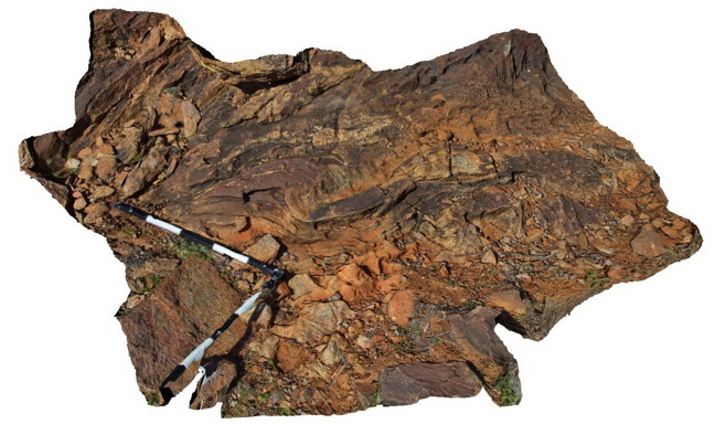
view of 'S' shape plunging folds in thinly banded psammopelitic metasediments near Allens Tank area, Broken Hill. N.S.W. |
2.00 |
-31.61792000000 |
141.48766000000 |
-9999.000 |
S fold, metasediments |
metasediments |
BHill65 Map
 |
5 |
09/16/2015 11:08 a.m. |
3D |
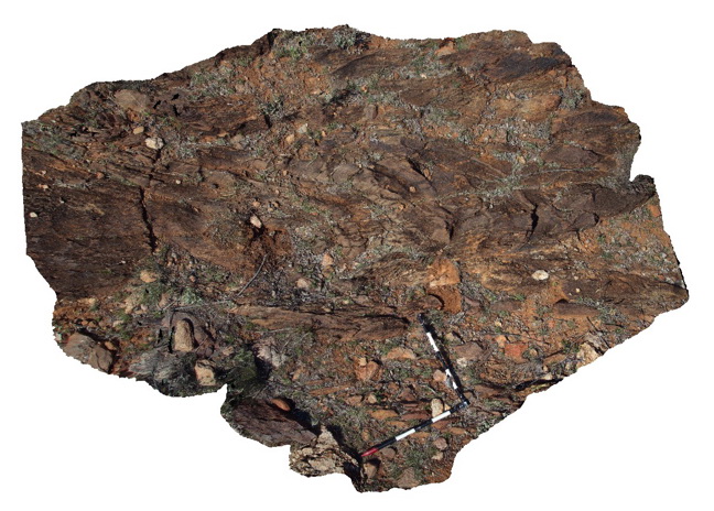
'S' shaped plunging anticline in psammopelitic metasediments. Allens Tank area, Broken Hill. N.S.W. |
3.00 |
-31.61755000000 |
141.48842000000 |
-9999.000 |
psammopelitic metasediments, S folding |
metasediment |
BHill66 Map
 |
5 |
09/16/2015 11:08 a.m. |
3D |
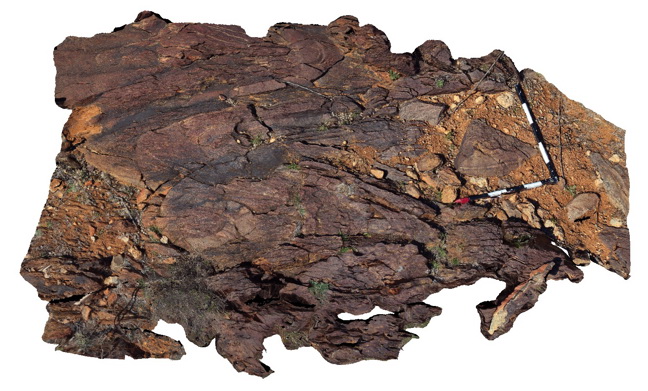
tight, 'S' shaped, plunging folds in psammopelitic metasediments. Next to sample location BHill65. Allens Tank area, Broken Hill. N.S.W. |
2.50 |
-31.61754000000 |
141.48846000000 |
-9999.000 |
psammopelitic metasediments, S fold |
psammopelitic |
BHill67 Map
 |
5 |
09/16/2015 11:09 a.m. |
3D |
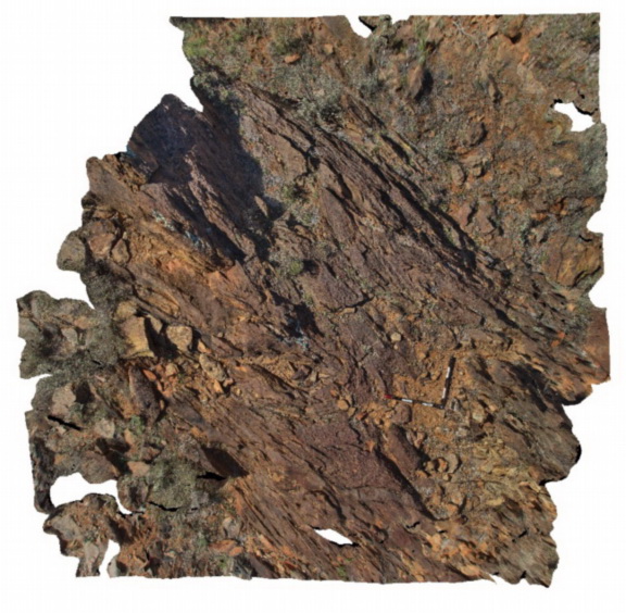
view of folded pavement, showing a large 'S' plunging antiform in finely banded psammopelitic metasediments. Allens Tank area, Broken Hill. N.S.W. |
5.50 |
-31.61759000000 |
141.48851000000 |
-9999.000 |
psammopelitic metasediments, S fold |
psammopelitic |
BHill68 Map
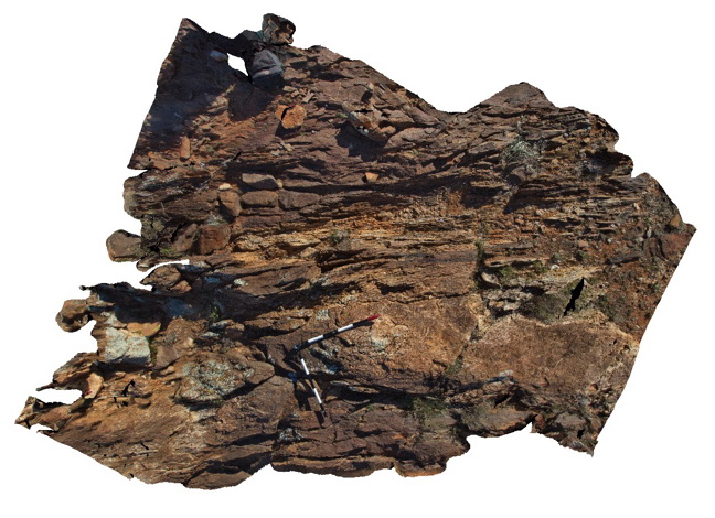 |
5 |
09/16/2015 11:09 a.m. |
3D |
view of sheared margin of a pegmatite body in surrounding banded psammopelitic metasediments. Allens Tank area, Broken Hill. N.S.W. |
3.00 |
-31.61839000000 |
141.48828000000 |
-9999.000 |
shear zone, intrusive contact, metasediments |
psammopelitic, pegmatite |
BHill69 Map
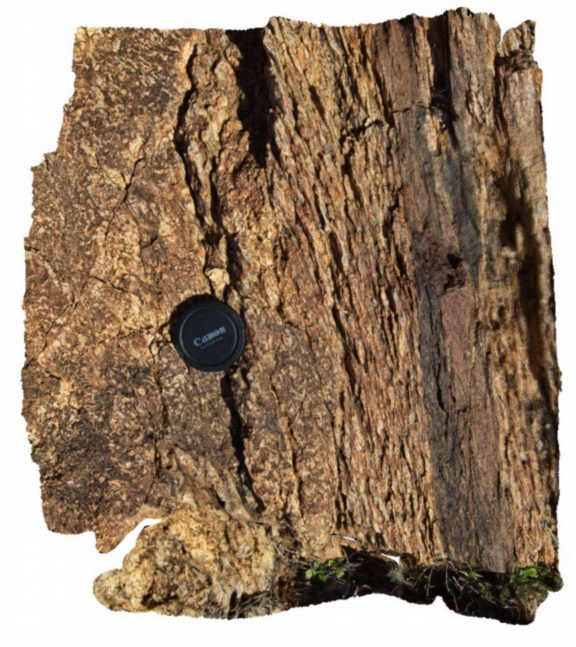 |
5 |
09/16/2015 11:10 a.m. |
3D |
detailed view of sheared margin of a pegmatite body, showing shear textures. Allens Tank area, Broken Hill. N.S.W. |
0.35 |
-31.61839000000 |
141.48828000000 |
-9999.000 |
shear zone, pegmatite |
pegmatite |
BHill70 Map
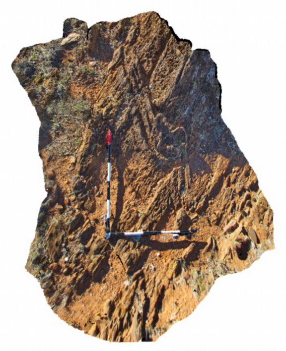 |
5 |
09/16/2015 11:11 a.m. |
3D |
outcrop of steeply plunging parasitic folds in pelitic metasediments, Allans Tank area, Broken Hill, N.S.W. |
0.40 |
-31.61768000000 |
141.48912000000 |
-9999.000 |
parasitic fold, pelite |
pelite |
BHill71 Map
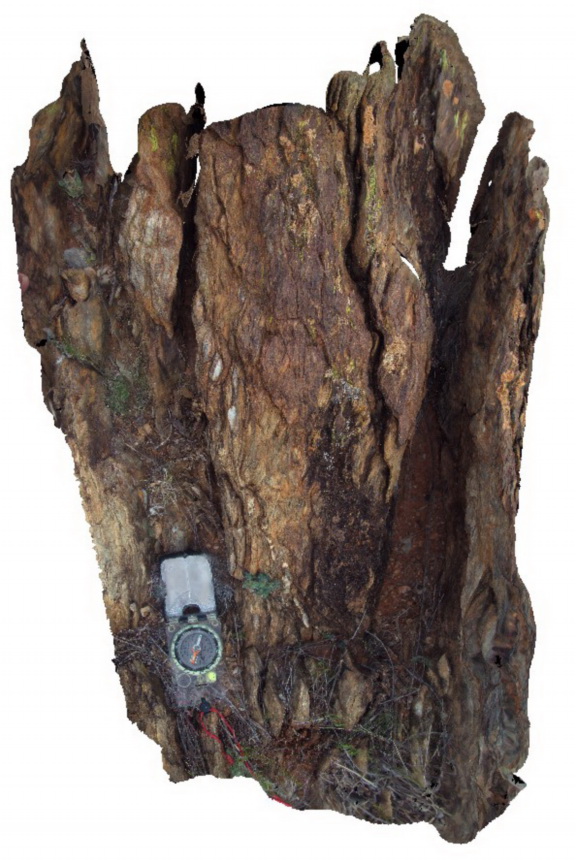 |
5 |
09/16/2015 11:11 a.m. |
3D |
shear bands in retrograde shear, showing sinistral movement and boudinaged quartz vein. Allans Bore Area, Broken Hill. N.S.W. |
1.00 |
-31.61037000000 |
141.49367000000 |
-9999.000 |
shear zone, boudinage |
metasediment |
BHill72 Map
 |
5 |
09/16/2015 11:12 a.m. |
3D |
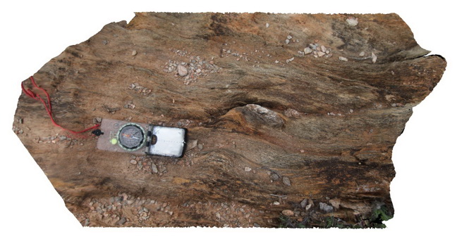
detailed view of shear zone, showing shear textures, fabric and quartz boudin. Allans Bore Area, Broken Hill. N.S.W. |
0.70 |
-31.61191000000 |
141.49388000000 |
-9999.000 |
shear zone, boudin, shear fabric |
metasediments |
BHill73 Map
 |
5 |
09/16/2015 11:12 a.m. |
3D |
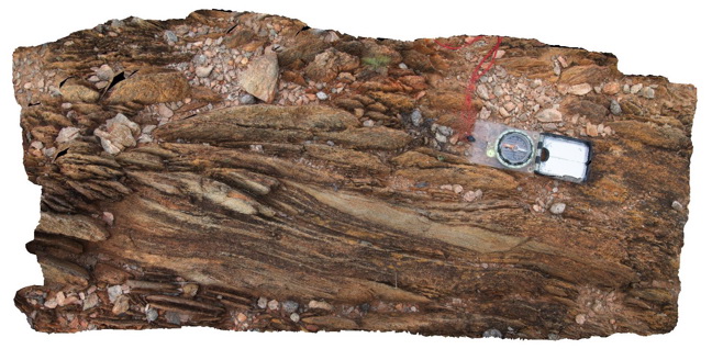
view of shear zone, showing sheared psammitic layers in metasediments. Allans Bore Area, Broken Hill. N.S.W. |
0.90 |
-31.61191000000 |
141.49387000000 |
-9999.000 |
shear zone, psammite |
psammite |
BHill74 Map
 |
5 |
09/16/2015 11:13 a.m. |
3D |
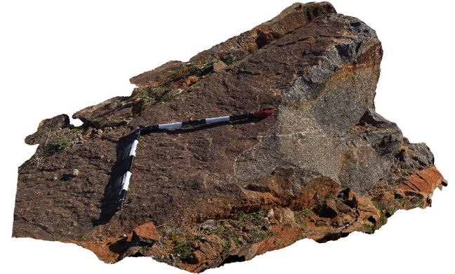
View of biotite 'eyes' after garnet in boulder of Rasp Hill Gneiss. 9 Mile road, Broken Hill. N.S.W. |
2.00 |
-31.98720000000 |
141.42928000000 |
-9999.000 |
retrograde metamorphism |
gneiss |
BHill75 Map
 |
5 |
09/16/2015 11:13 a.m. |
3D |
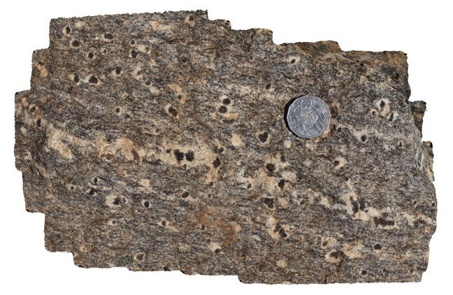
detail of 'biotite eye' after garnet from sample location BHill74. 9 Mile road, Broken Hill. N.S.W. |
0.30 |
-31.98720000000 |
141.42928000000 |
-9999.000 |
retrograde metamorphism |
gneiss |
BHill76 Map
 |
5 |
09/16/2015 11:14 a.m. |
3D |
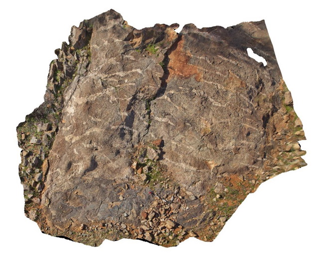
pavement outcrop showing contact between mafic (dark area under scale bar) and felsic gneisses with apparent lensoidal leucosomes. 9 Mile road, Broken Hill. N.S.W. |
6.50 |
-31.87205000000 |
141.42947000000 |
-9999.000 |
leucosome, gneiss |
gneiss |
BHill77 Map
 |
5 |
09/16/2015 11:14 a.m. |
3D |
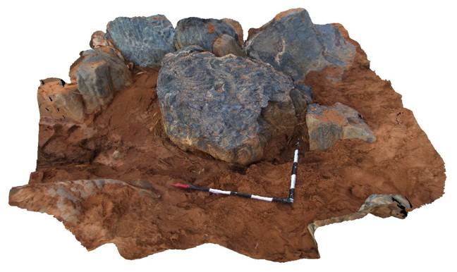
creek exposure, showing mega porphyroblastic andalusite psuedomorphed by Sillimanite. Near 9 Mile road, Broken Hill. N.S.W. |
1.50 |
-31.84042000000 |
141.44072000000 |
-9999.000 |
Andalusite psuedomorph, mega porphyroblastic |
gneiss |
BHill78 Map
 |
5 |
09/16/2015 11:15 a.m. |
3D |
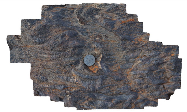
detail of andalusite mega porphyroblasts psuedomorphed by Sillimanite from site BHill77. Near 9 Mile road, Broken Hill. N.S.W. |
0.45 |
-31.84042000000 |
141.44072000000 |
-9999.000 |
Andalusite psuedomorph, sillimanite |
psammite |
BHill79 Map
 |
5 |
09/16/2015 11:17 a.m. |
3D |
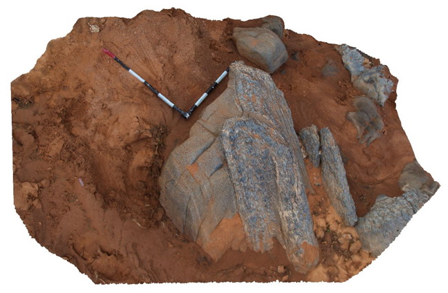
creek exposure near 9 Mile road, showing folded pelitic and psammitic layers with sillimanite. Broken Hill. N.S.W. |
2.00 |
-31.84014000000 |
141.44077000000 |
-9999.000 |
fold, psammite, pelitic, sillimanite |
pelite |
BHill80 Map
 |
5 |
09/16/2015 11:25 a.m. |
3D |
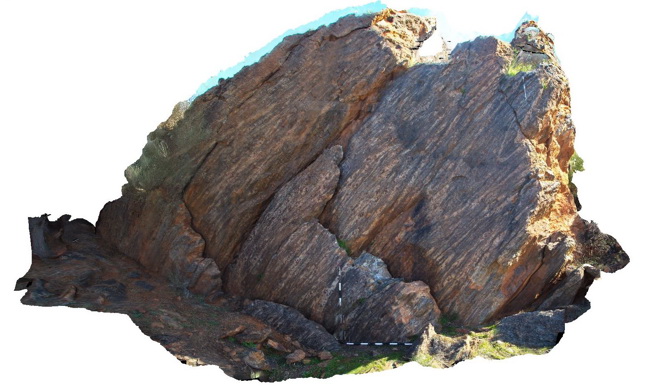
Outcrop, showing 'Hobb's Fold' in layered garnet gneiss of the Sundown Group. Broken Hill. N.S.W. |
4.00 |
-31.93096000000 |
141.51889000000 |
-9999.000 |
fold, structure |
garnet gneiss |
BHill81 Map
 |
5 |
09/18/2015 11:33 a.m. |
3D |
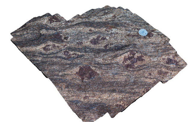
detail of garnet porphyroblasts, sillimanite and mineral banding in gneiss. Broken Hill. N.S.W. |
0.70 |
-31.93096000000 |
141.51889000000 |
-9999.000 |
garnet gneiss, porphyroblastic |
garnet gneiss |
BHill82 Map
 |
5 |
09/18/2015 11:01 a.m. |
3D |
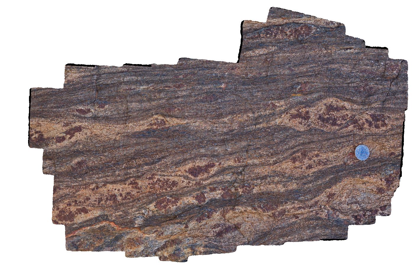
detail of garnet porphyroblasts, sillimanite and mineral banding in gneiss. Broken Hill. N.S.W. |
0.20 |
-31.93096000000 |
141.51889000000 |
-9999.000 |
garnet sillimanite gneiss |
garnet gneiss |
BHill83 Map
 |
5 |
09/18/2015 11:02 a.m. |
3D |
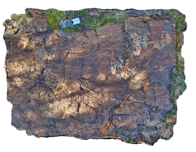
fold with axial plane sillimanite in banded garnet, sillimanite gneiss. Broken Hill. N.S.W. |
0.20 |
-31.93103000000 |
141.51883000000 |
-9999.000 |
axial planar cleavage, sillimanite, garnet sillimanite gneiss |
gneiss |


