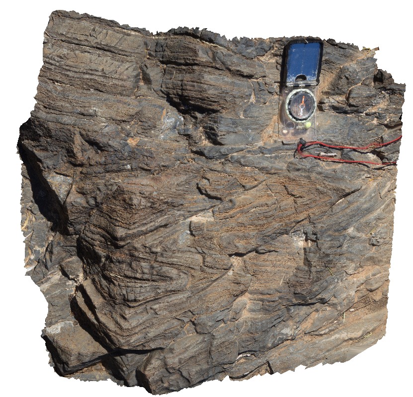
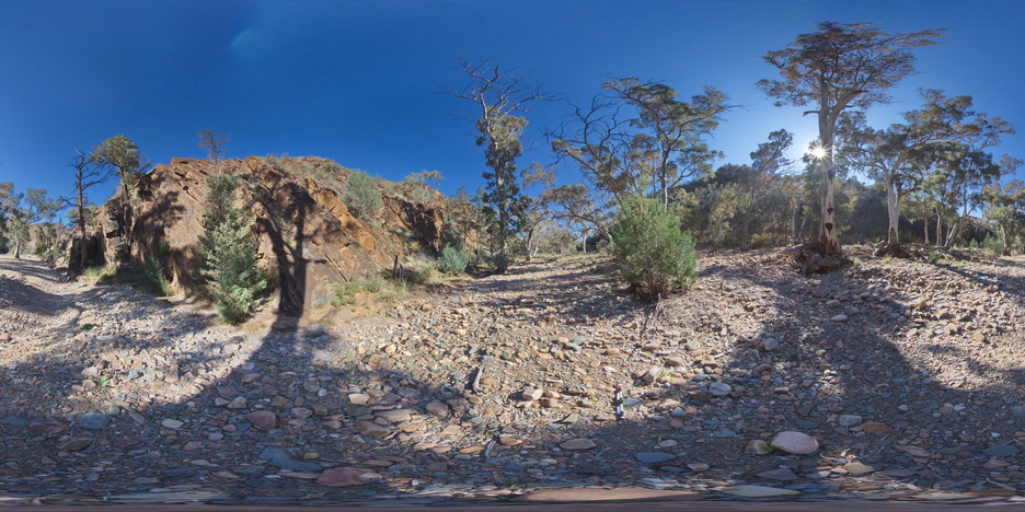
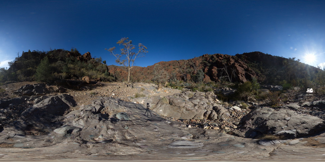
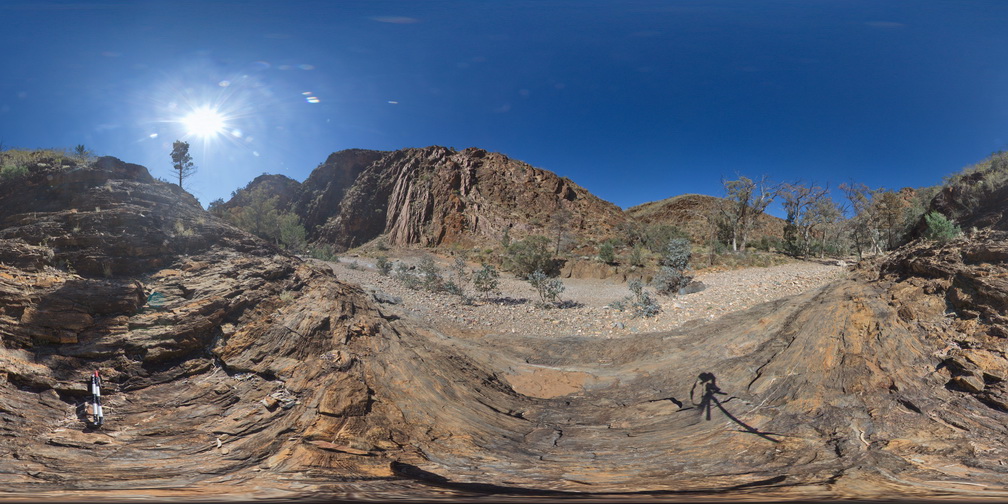
Weetootla31 Map
 |
0 |
09/27/2015 6:20 p.m. |
3D |
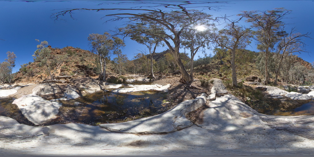
steeply plunging tight folds in carbonate mudstone. Weetootla Creek. |
0.30 |
-30.47536000000 |
139.24422000000 |
-9999.000 |
structure, fold |
mudstone |
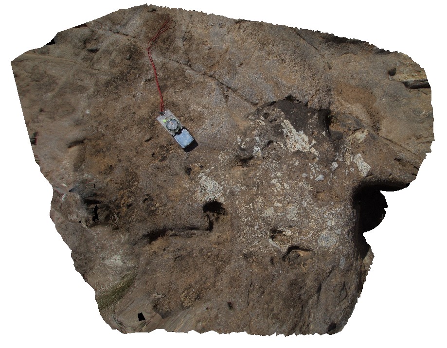
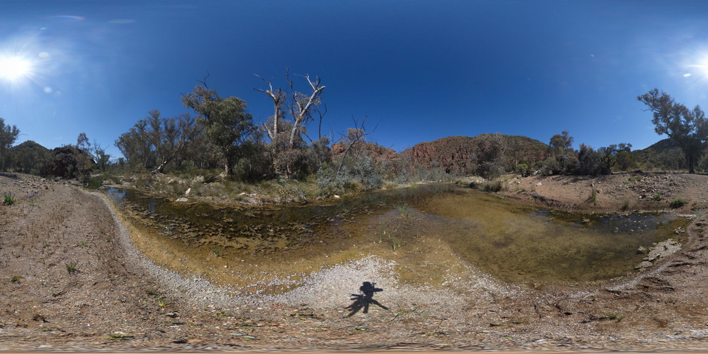
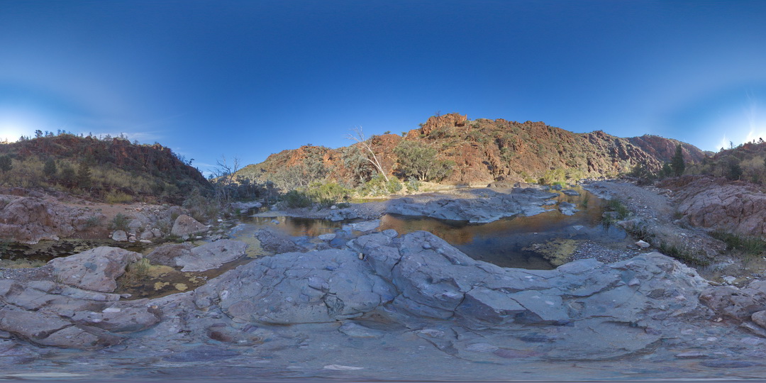
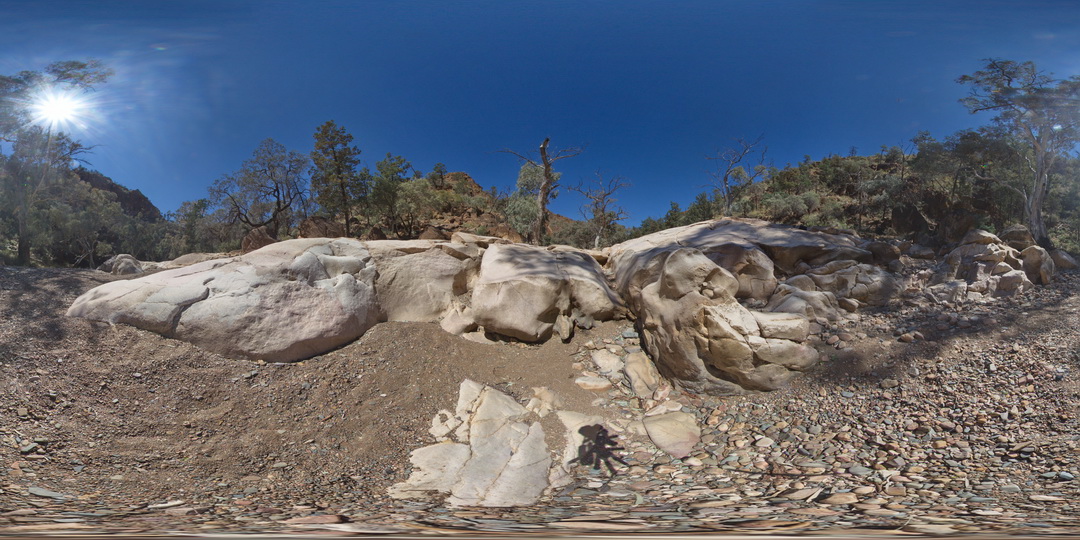
Weetootla32 Map
 |
0 |
09/27/2015 6:21 p.m. |
3D |
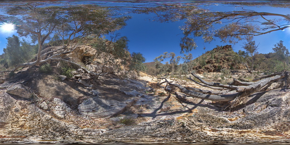
carbonate breccia filling a karstic cavity in massive carbonate. Recent breccia?. Side Creek form Balcanoona Creek. |
1.00 |
-30.47367000000 |
139.24706000000 |
-9999.000 |
karst, breccia |
carbonate |
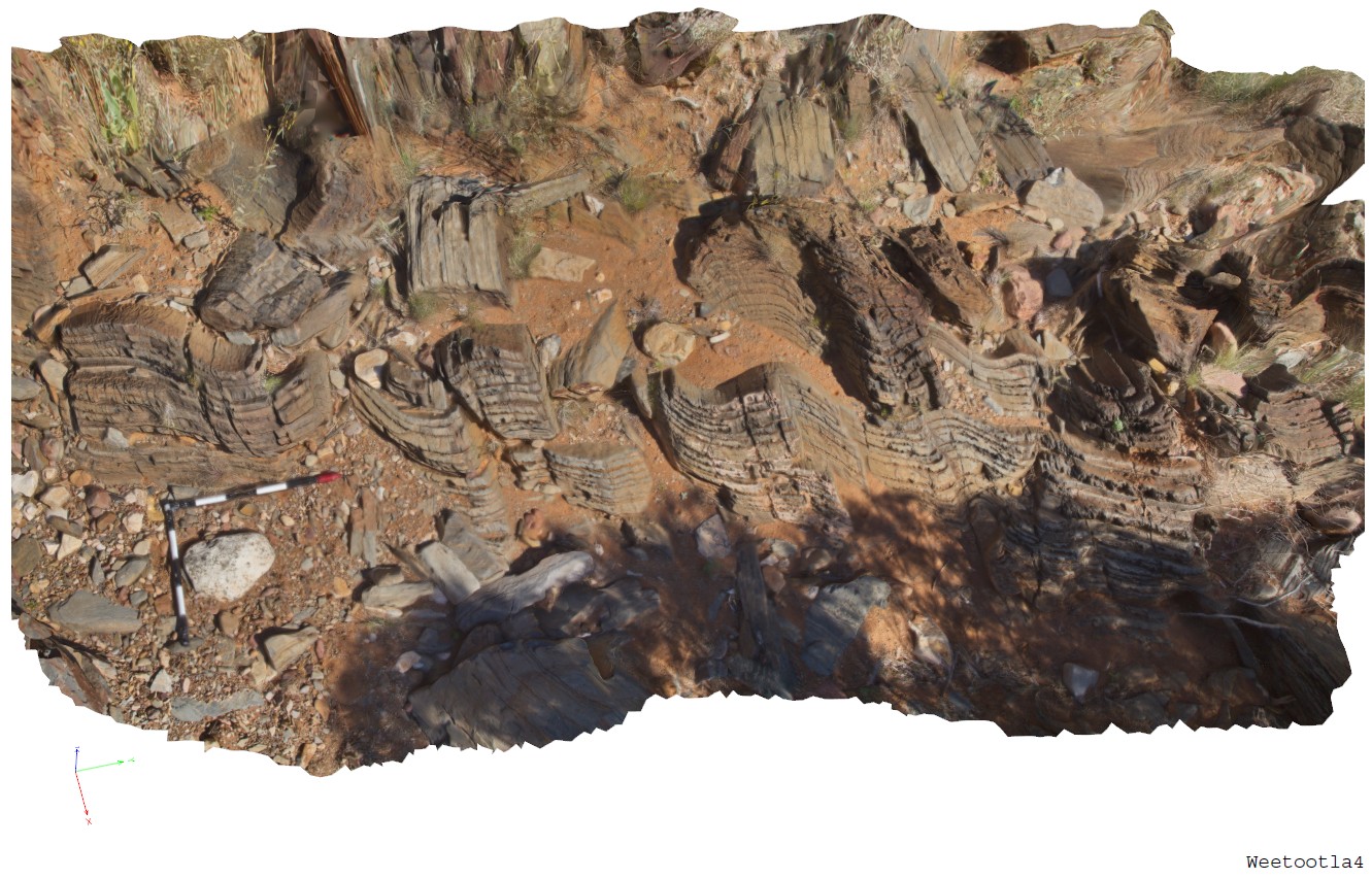
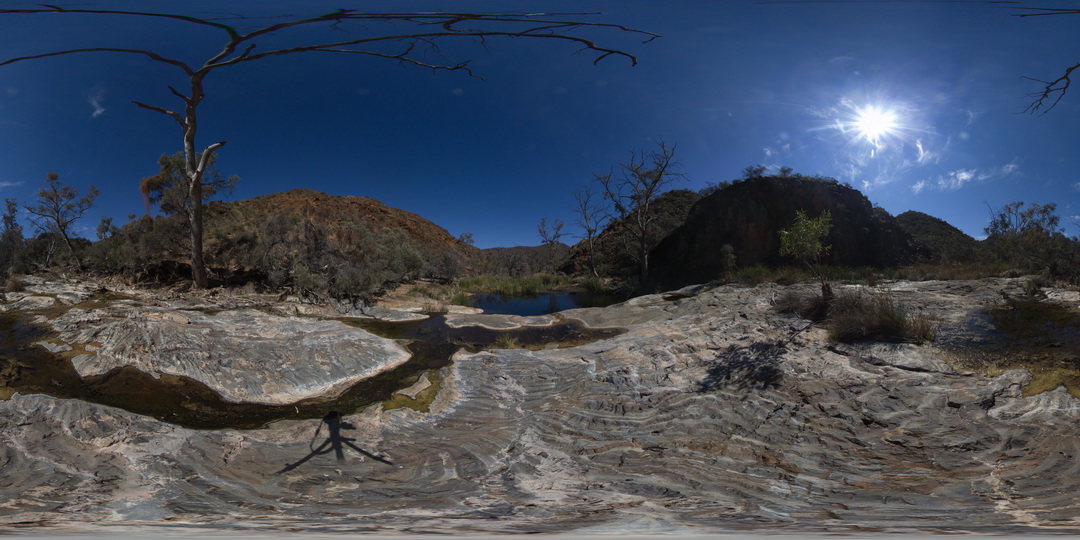
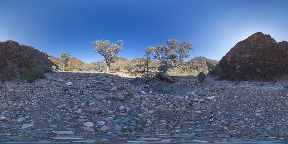
Weetootla4 Map
 |
0 |
09/27/2015 4:29 p.m. |
3D |
open folds in carbonate mudstone of the Balcanoona Formation. Well developed axial planar cleavage in places. Weetootla Gorge. |
4.50 |
-30.48387000000 |
139.22316000000 |
-9999.000 |
folding, bedding, cleavage, structure |
carbonate |
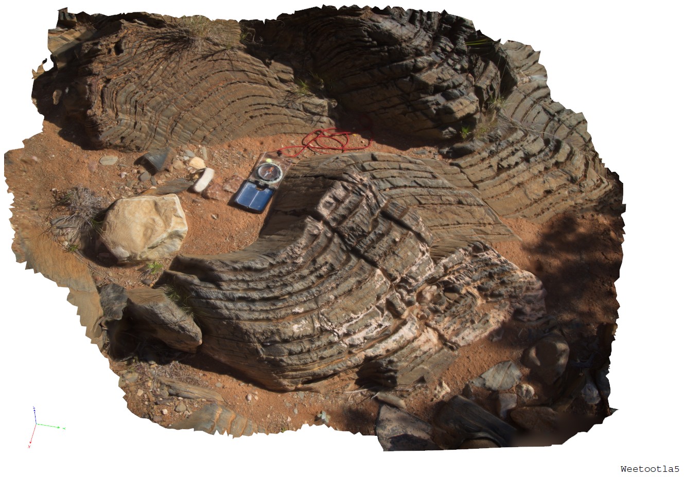
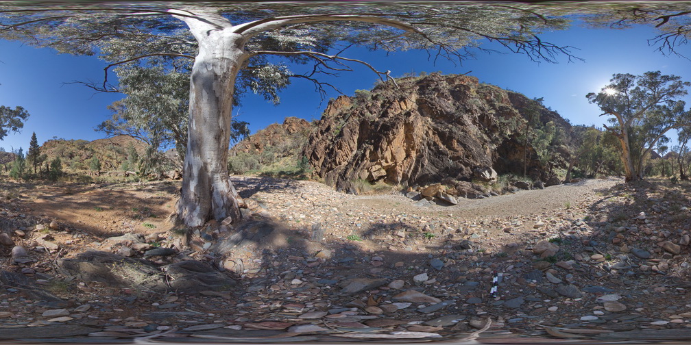
Weetootla5 Map
 |
0 |
09/27/2015 4:29 p.m. |
3D |
close up of open folds in carbonate mudstone of the Balcanoona Formation. Well developed axial planar cleavage in places. Weetootla Gorge. |
1.00 |
-30.48387000000 |
139.22316000000 |
-9999.000 |
folding, cleavage, structure |
carbonate |
Weetootla6 Map
 |
0 |
09/27/2015 4:30 p.m. |
3D |
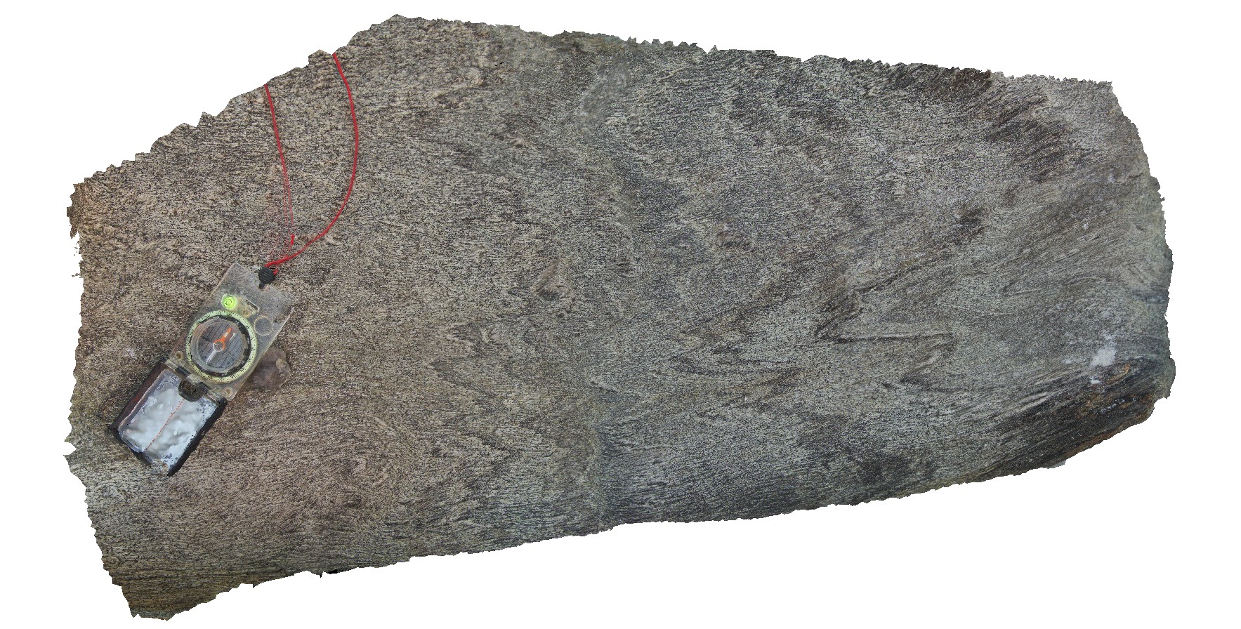
carbonate tension gashes in sandy mudstone layer. Carbonate has been weathered out to leave voids. Weetootla Gorge. |
0.50 |
-30.48292000000 |
139.22432000000 |
-9999.000 |
bedding, tension gash, structure |
mudstone |
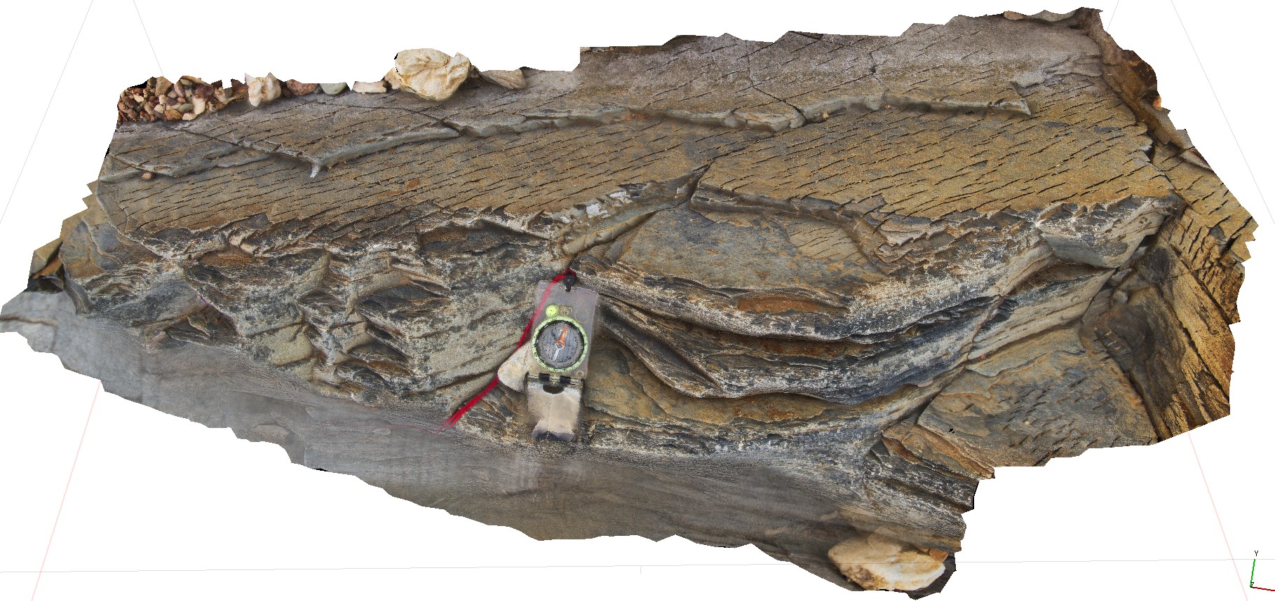
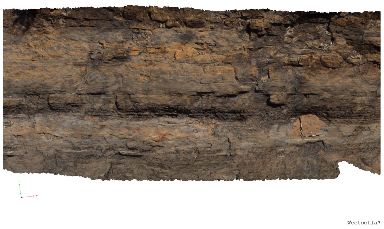
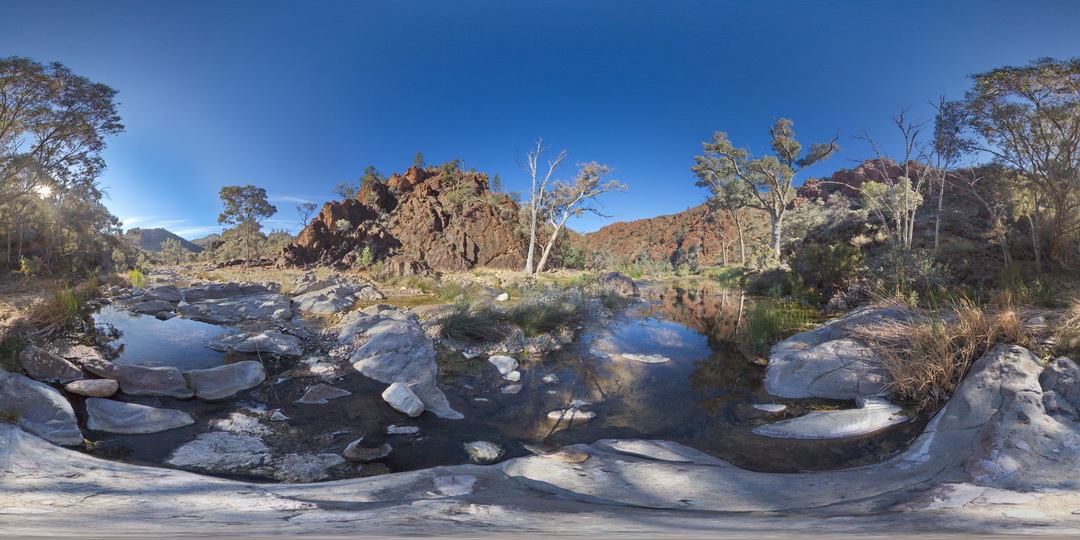
Weetootla7 Map
 |
0 |
09/27/2015 4:30 p.m. |
3D |
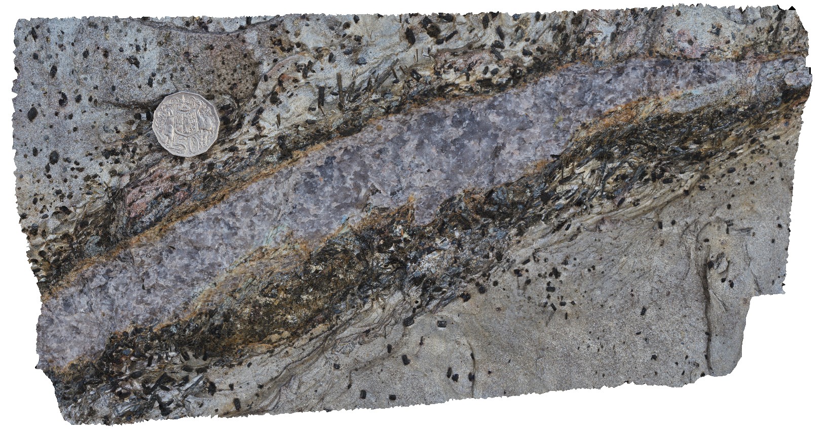
bedded carbonate with numerous clasts of carbonate (brown) and breccia horizons. Weetootla Gorge. |
9.00 |
-30.48117000000 |
139.22685000000 |
-9999.000 |
bedding, sedimentology |
carbonate |
Weetootla8 Map
 |
0 |
09/27/2015 4:34 p.m. |
3D |
detail of carbonate breccia within bedding. Weetootla gorge. |
0.00 |
-30.48112000000 |
139.22684000000 |
-9999.000 |
breccia, sedimentology |
carbonate |
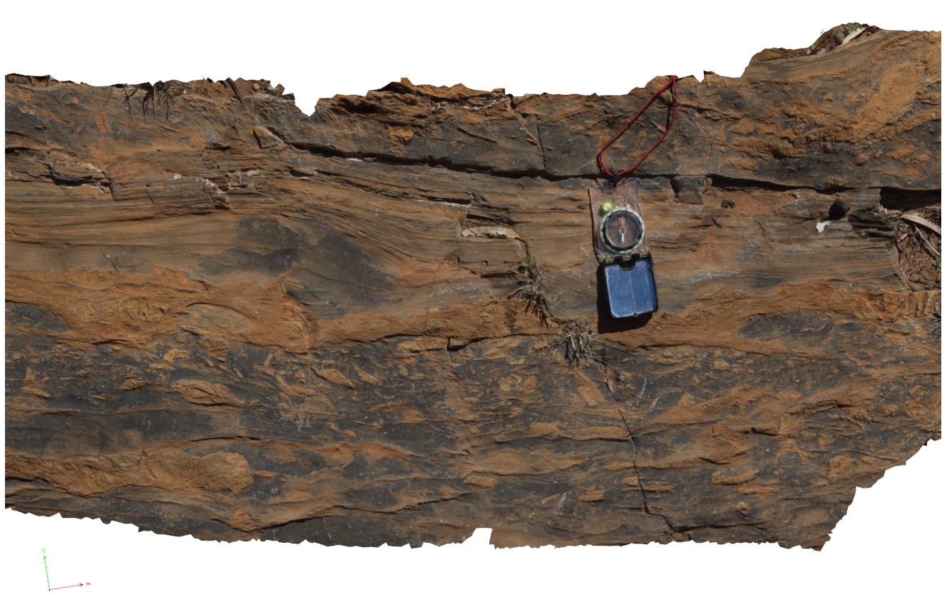
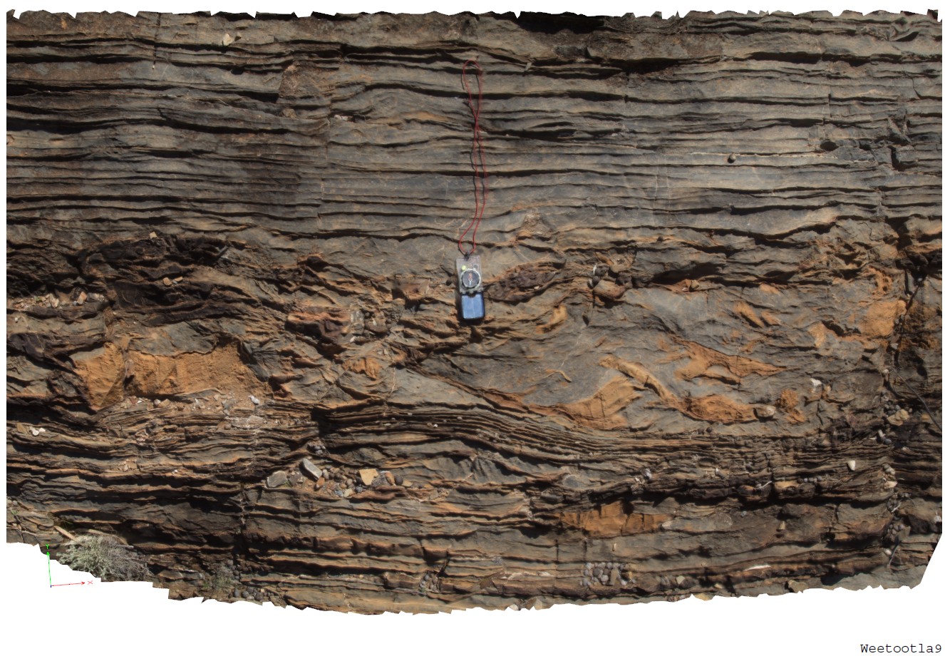
Weetootla9 Map
 |
0 |
09/27/2015 4:36 p.m. |
3D |
thicker beds containing carbonate breccia between thinner carbonate bedding. Weetootla Gorge. |
1.00 |
-30.48114000000 |
139.22696000000 |
-9999.000 |
sedimentary breccia, sedimentology |
carbonate |
WeetootlaFSP1 Map
 |
0 |
09/27/2015 4:37 p.m. |
FSP |
view of bedded and folded carbonate muds. Balcanoona Creek. Weetootla. |
0.00 |
-30.48160000000 |
139.22220000000 |
-9999.000 |
fold, structure |
carbonate |
WeetootlaFSP10 Map
 |
0 |
09/27/2015 4:37 p.m. |
FSP |
view of folded carbonate mudstone. Junction with Weetootla Creek and Balcanoona Creek. |
0.00 |
-30.48236000000 |
139.23982000000 |
-9999.000 |
fold, structure |
mudstone |
WeetootlaFSP11 Map
 |
0 |
09/27/2015 4:37 p.m. |
FSP |
view of thinly bedded carbonate mudstone pavement, showing folding. Weetootla Creek. |
0.00 |
-30.47598000000 |
139.24332000000 |
-9999.000 |
fold, structure |
mudstone |
WeetootlaFSP12 Map
 |
0 |
09/27/2015 4:37 p.m. |
FSP |
View of steeply dipping sediments (hills) and creek exposure of diamictite. Balcanoona Creek. |
0.00 |
-30.48433000000 |
139.24013000000 |
-9999.000 |
diamictite, sediments |
diamictite, mudstone |
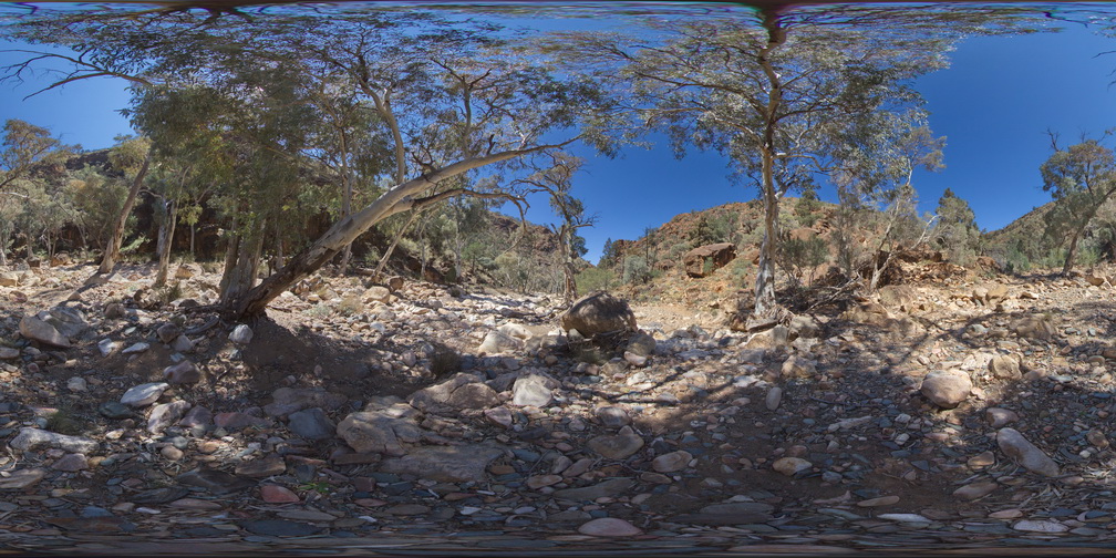
WeetootlaFSP13 Map
 |
0 |
09/27/2015 4:37 p.m. |
FSP |
view of diamictite in creek bed. Hells Gate, Balcanoona Creek. |
0.00 |
-30.48458000000 |
139.24080000000 |
-9999.000 |
sedimentology |
diamictite, mudstone |
WeetootlaFSP14 Map
 |
0 |
09/27/2015 4:37 p.m. |
FSP |
view of diamictite in creek bed within Balcanoona Creek. |
0.00 |
-30.48415000000 |
139.24211000000 |
-9999.000 |
sedimentology |
diamictite, mudstone |
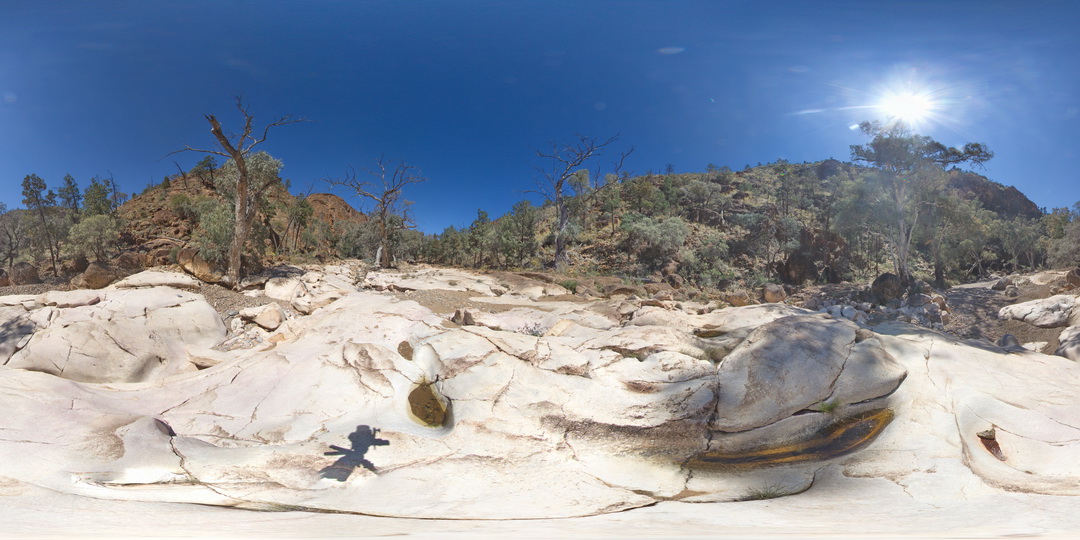
WeetootlaFSP15 Map
 |
0 |
09/27/2015 6:21 p.m. |
FSP |
massive to very thinly bedded carbonates of the Balcanoona Formation, Weetootla Creek. |
0.00 |
-30.47003000000 |
139.24716000000 |
-9999.000 |
bedded, sedimentology |
carbonate |
WeetootlaFSP2 Map
 |
0 |
09/27/2015 4:38 p.m. |
FSP |
view of moderately to steeply dipping, bedded and folded carbonate mudstone hills. Weetootla Gorge. |
0.00 |
-30.48287000000 |
139.22424000000 |
-9999.000 |
folded, structure |
carbonate |
WeetootlaFSP3 Map
 |
0 |
09/27/2015 4:38 p.m. |
FSP |
folded carbonate mudstone hills of the Balcanoona Formation, Weetootla gorge |
0.00 |
-30.48111000000 |
139.22438000000 |
-9999.000 |
folded, structure |
carbonate |
WeetootlaFSP4 Map
 |
0 |
09/27/2015 4:38 p.m. |
FSP |
view of steeply dipping stratigraphy, Weetootla Gorge. |
0.00 |
-30.48114000000 |
139.22690000000 |
-9999.000 |
structure |
mudstone |
WeetootlaFSP5 Map
 |
0 |
09/27/2015 4:38 p.m. |
FSP |
outcrop of massive carbonate. Weetootla gorge. |
0.00 |
-30.47945000000 |
139.22777000000 |
-9999.000 |
sedimentology |
carbonate |
WeetootlaFSP6 Map
 |
0 |
09/27/2015 4:38 p.m. |
FSP |
outcrop of massive homogeneous carbonate. Weetootla gorge. |
0.00 |
-30.47952000000 |
139.22774000000 |
-9999.000 |
sedimentology |
carbonate |
WeetootlaFSP7 Map
 |
0 |
09/27/2015 4:38 p.m. |
FSP |
carbonate float and outcrop in creek bed. Weetootla gorge. |
0.00 |
-30.47935000000 |
139.22894000000 |
-9999.000 |
|
carbonate |
WeetootlaFSP8 Map
 |
0 |
09/27/2015 4:38 p.m. |
FSP |
view of massive, homogeneous carbonate crop in creek bed. Weetootla gorge. |
0.00 |
-30.47953000000 |
139.23003000000 |
-9999.000 |
sedimentology |
carbonate |
WeetootlaFSP9 Map
 |
0 |
09/27/2015 4:38 p.m. |
FSP |
view of mega-boudins in folded carbonate mudstone. Weetootla gorge. |
0.00 |
-30.47988000000 |
139.23091000000 |
-9999.000 |
sedimentology, boudin, structure |
carbonate |
WestBeach1 Map
 |
0 |
06/05/2016 10:47 a.m. |
3D |
M geometry folds with penetrative cleavage in garnet schist. West Beach, W.A. |
1.00 |
-33.95337000000 |
119.97512000000 |
-9999.000 |
penetrative cleavage, M folding, garnet schist |
garnet schist |
WestBeach10 Map
 |
0 |
06/05/2016 10:35 a.m. |
3D |
Biotite and kyanite crystals growing on quartz vein selvage. West Beach, W.A. |
0.35 |
-33.95360000000 |
119.97449000000 |
-9999.000 |
biotite vein selvage, kyanite vein selvage |
schist |