Tumby2 Map
 |
0 |
10/20/2015 3:21 p.m. |
3D |
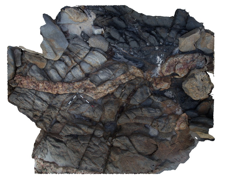
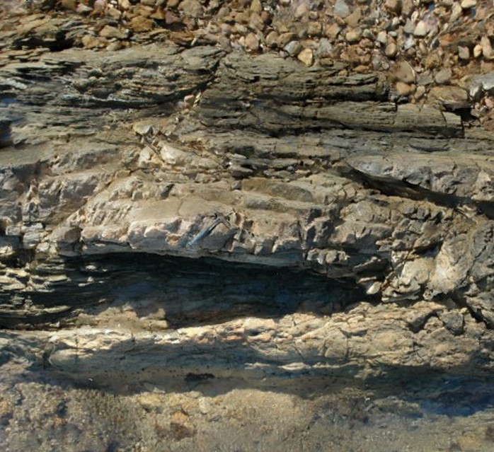
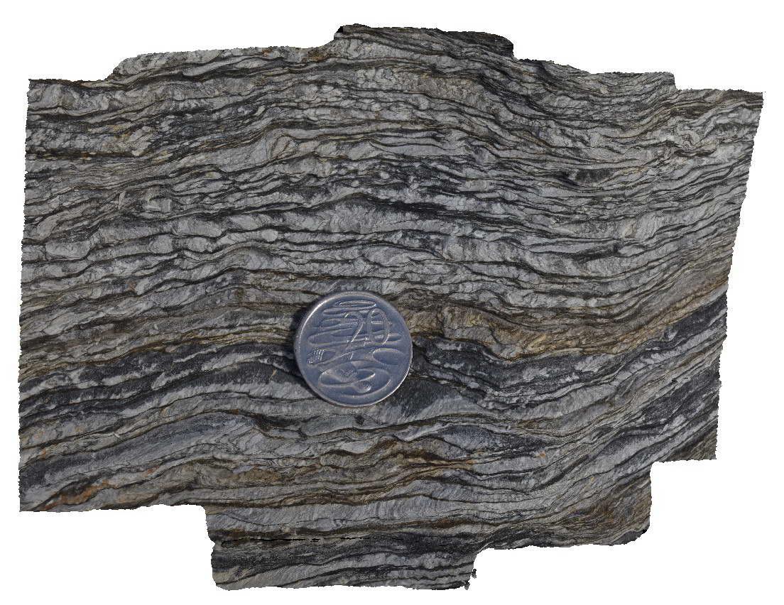
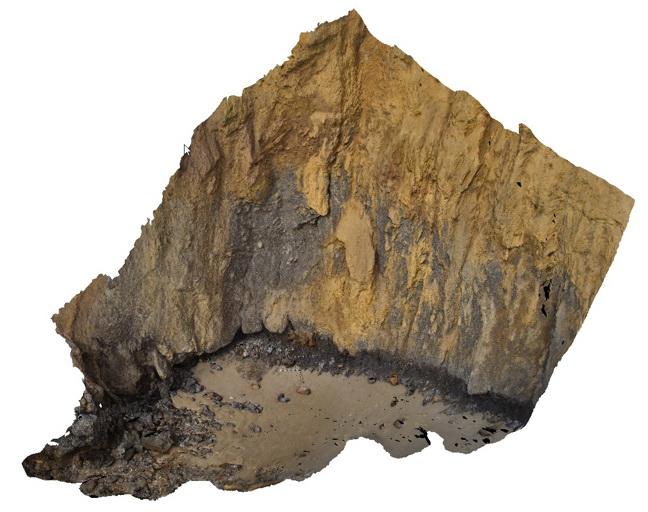
granitic gneiss in contact with amphibolite and intruded by pegmatite dyke. Contact between amphibolite and granitic gneiss is sheared. Trinity Haven Road, Tumby. |
4.00 |
-34.45443000000 |
136.11522000000 |
-9999.000 |
igneous contact, granitic gneiss, amphibolite, sheared contact |
granitic gneiss, pegmatite |
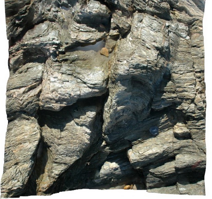
ULURU1 Map
 |
5 |
07/30/2016 12:13 p.m. |
3D |
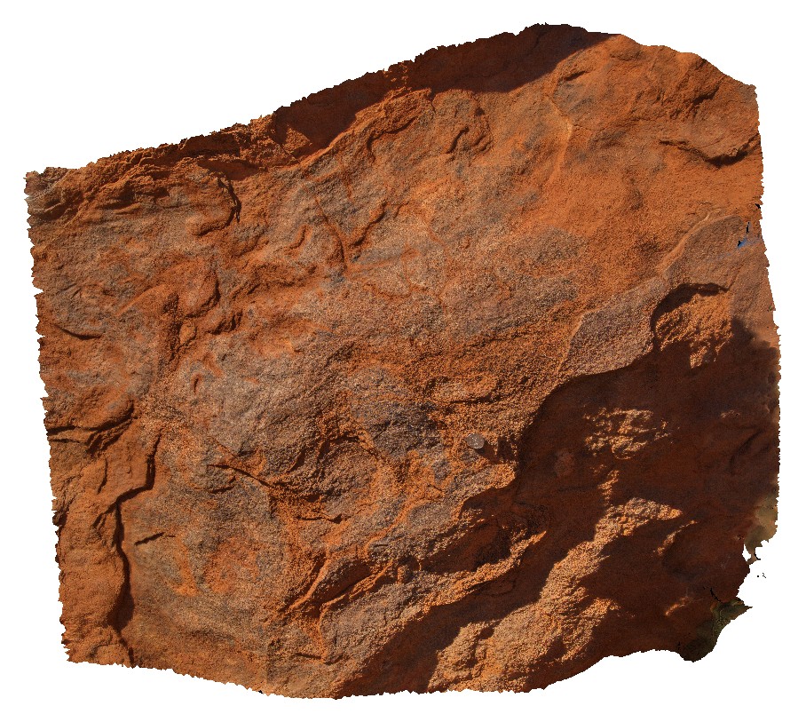
close-up view of the Mutitjulu Arkose sandstone. Uluru, N.T. |
1.00 |
-25.34051900000 |
131.02611300000 |
525.949 |
Uluru, Arkose sandstone, Mutitjulu Arkose, sedimentology |
Arkose |
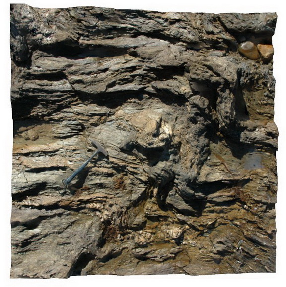
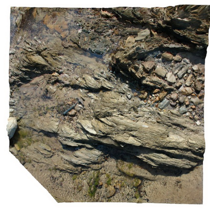
ULURU2 Map
 |
0 |
07/30/2016 12:19 p.m. |
3D |
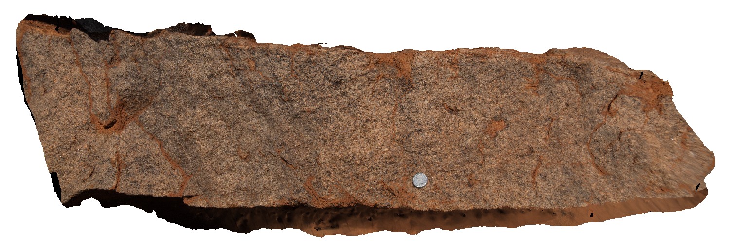
close-up view of freshly exposed Mutitjulu Arkose sandstone, showing coarse grains. Uluru, N.T. |
1.00 |
-25.34085700000 |
131.02541500000 |
526.182 |
arkose, sandstone, sedimentology, Mutitjulu Arkose, Uluru |
arkose |
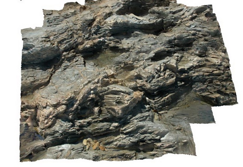
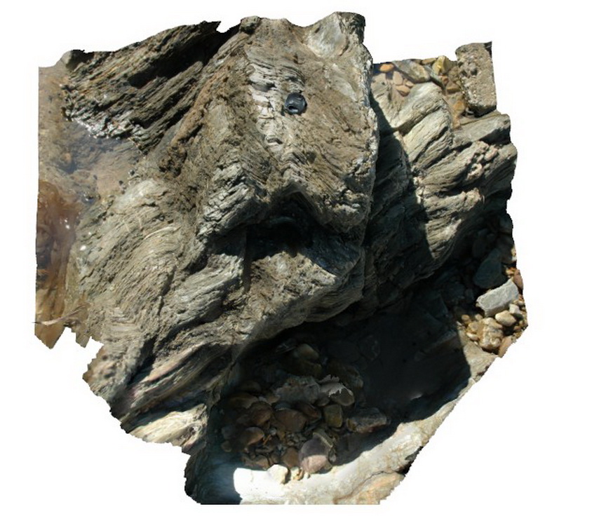
ULURU3 Map
 |
5 |
01/01/9999 midnight |
3D |
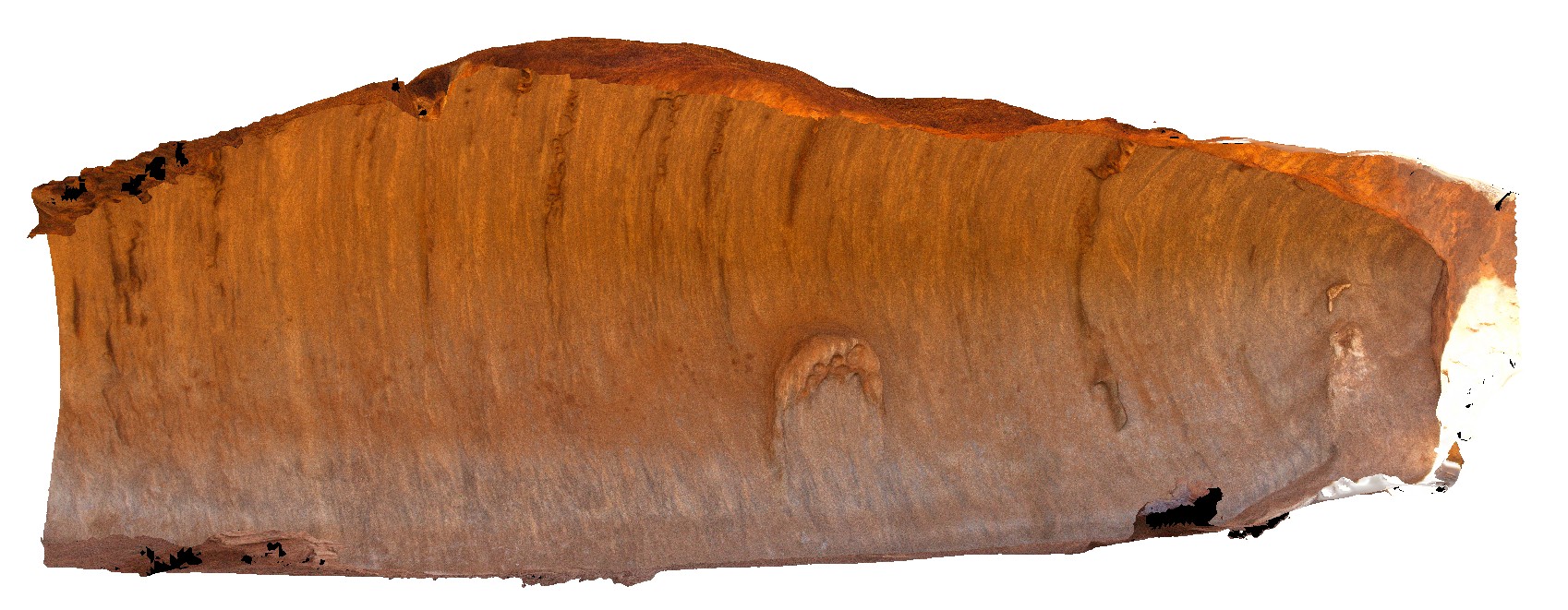
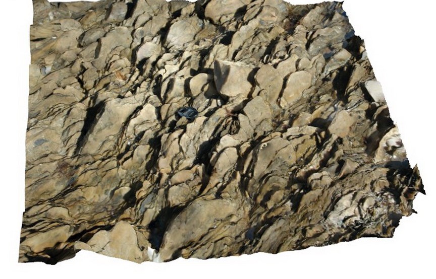
outcrop-scale example of sub-vertical trough in Mutitjulu Arkose. Uluru, N.T. |
13.00 |
-25.34085700000 |
131.02541500000 |
526.182 |
trough, Mutitjulu Arkose, Uluru, sedimentology |
arkose |
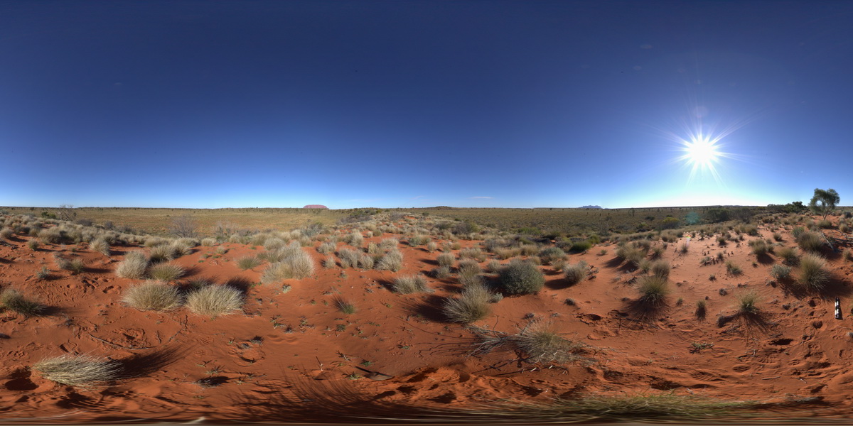
ULURUFSP1 Map
 |
0 |
07/29/2016 4:48 p.m. |
FSP |
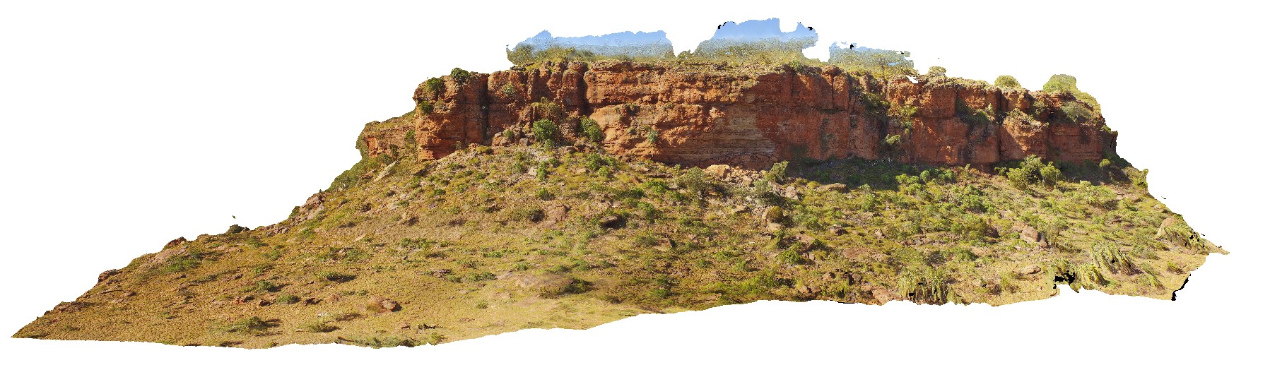
view of Uluru and south Kata Tjuta (The Olgas) from North of Uluru. Uluru, N.T. |
3000.00 |
-25.25783500000 |
130.95546700000 |
519.982 |
Uluru, monolith |
sandstone |
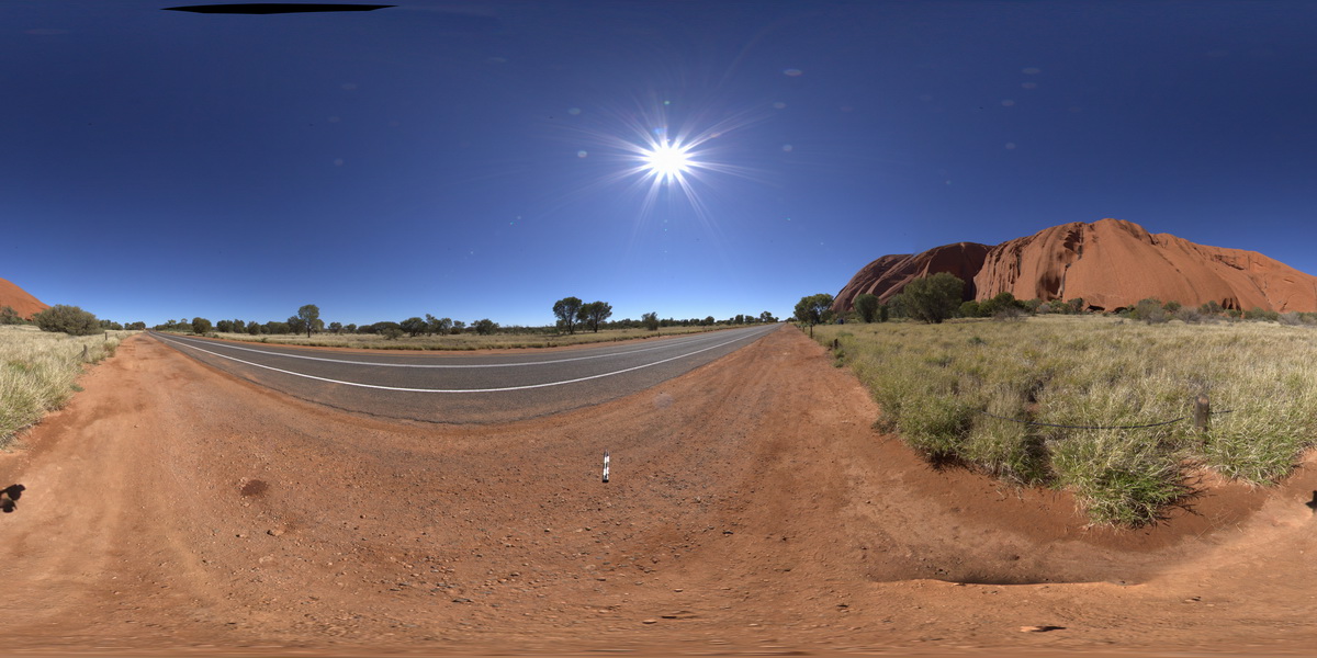
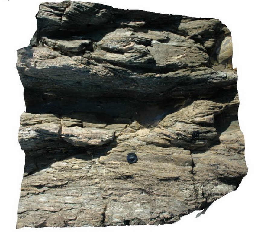
ULURUFSP2 Map
 |
5 |
07/30/2016 12:38 p.m. |
FSP |
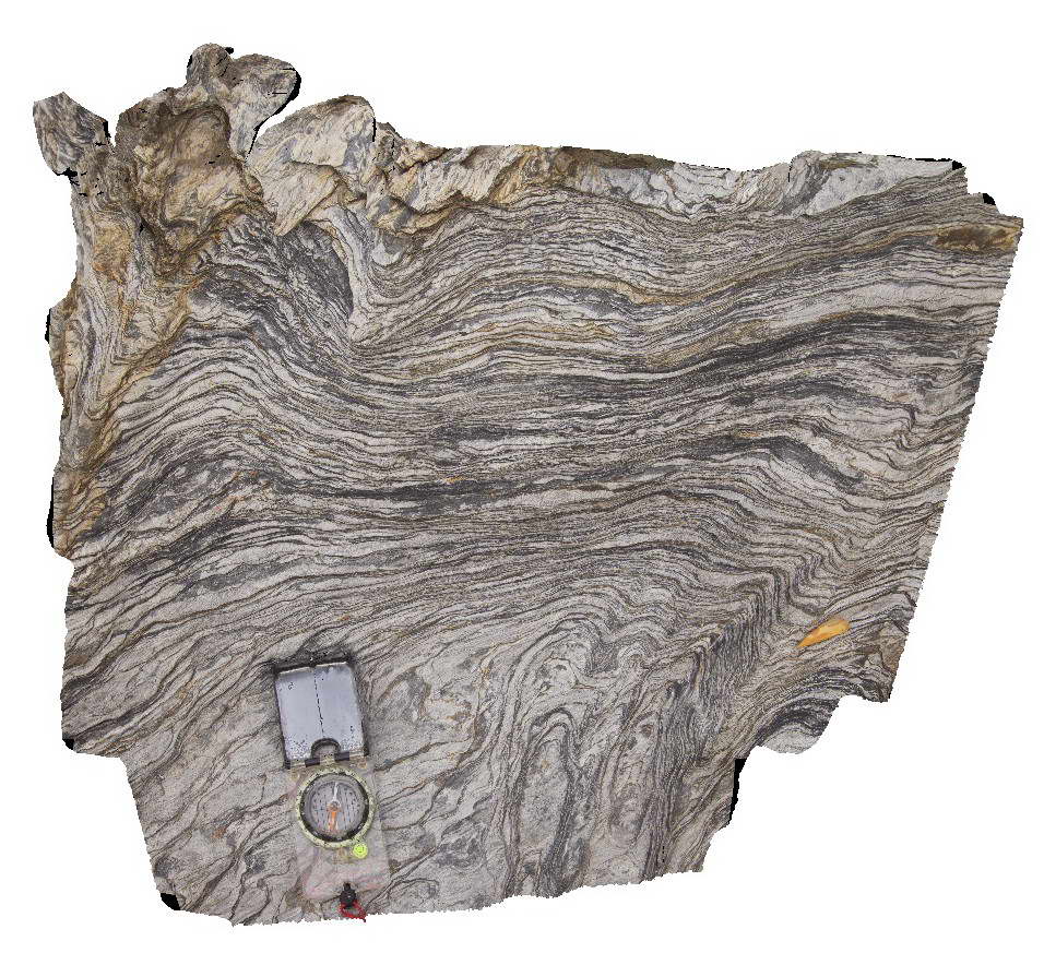
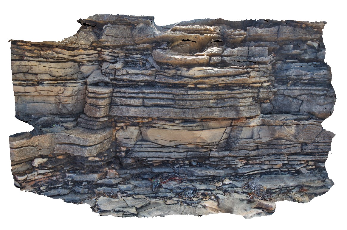
view large surface of Uluru, showing sub-vertical bedding in Mutitjulu Arkose. Uluru, N.T. |
500.00 |
-25.34001400000 |
131.02446100000 |
524.355 |
Uluru, Mutitjulu Arkose, bedding, structure |
arkose |
Ulverstone1 Map
 |
5 |
03/16/2015 2:38 p.m. |
3D |
open, gently plunging folds in quartzite. Picnic Point, Ulverstone, northern Tasmania. |
3.00 |
-41.14106766000 |
146.16132458000 |
5.000 |
fold, open fold, fold plunge |
quartzite |
Ulverstone10 Map
 |
5 |
03/16/2015 2:39 p.m. |
3D |
folded quartzite bands and quartz veins in psammites. Picnic Point, Ulverstone, northern Tasmania. |
4.00 |
-41.14048435000 |
146.16051871000 |
1.000 |
kink band, fold, structure, metamorphics |
psammite |
Ulverstone2 Map
 |
5 |
03/16/2015 2:39 p.m. |
3D |
kink bands in steeply to sub vertical, thinly dipping, thinly layered quartzites / psammites. Picnic Point, Ulverstone, northern Tasmania. |
0.75 |
-41.14120440000 |
146.16139584000 |
5.000 |
kink band, fold, structure, metamorphic |
quartzite |
Ulverstone3 Map
 |
5 |
03/16/2015 2:39 p.m. |
3D |
kink bands in finely layered quartzites, with faulting and possible fault stacking / ramping along kink axial plane. Picnic Point, Ulverstone, northern Tasmania. |
1.20 |
-41.14132308000 |
146.16136448000 |
5.000 |
kink band, fault, fault stack |
quartzite |
Ulverstone4 Map
 |
5 |
03/16/2015 2:39 p.m. |
3D |
moderately plunging kink folds, some with associated axial planar faulting in thinly layered quartzites. Picnic Point, Ulverstone, northern Tasmania. |
1.20 |
-41.14121636000 |
146.16151430000 |
5.000 |
kink band, fault, metamorphics |
quartzite |
Ulverstone5 Map
 |
5 |
03/16/2015 2:39 p.m. |
3D |
bedding and cleavage relationship, with later kink bands in bedded quartzite and stretched cobble conglomerate. Picnic Point, Ulverstone, northern Tasmania. |
1.00 |
-41.14094861000 |
146.16122978000 |
5.000 |
kink band, cleavage, bedding, metamorphics |
quartzite |
Ulverstone6 Map
 |
5 |
03/16/2015 2:39 p.m. |
3D |
view of kink band in phyllites, showing change in cleavage direction. Picnic Point, Ulverstone, northern Tasmania. |
4.00 |
-41.14084147000 |
146.16113507000 |
1.000 |
kink band, structure, phyllite |
phyllite |
Ulverstone7 Map
 |
5 |
03/16/2015 2:39 p.m. |
3D |
fold hinge in blocky quartzite and psammite beds. Picnic Point, Ulverstone, northern Tasmania. |
5.00 |
-41.14071054000 |
146.16135617000 |
1.000 |
fold, quartzite |
quartzite |
Ulverstone8 Map
 |
5 |
03/16/2015 2:40 p.m. |
3D |
moderately dipping, stretched cobble conglomerate. Picnic Point, Ulverstone, northern Tasmania. |
1.00 |
-41.14084150000 |
146.16139565000 |
1.000 |
stretching, metamorphics, structure |
conglomerate |
Ulverstone9 Map
 |
5 |
03/16/2015 2:40 p.m. |
3D |
view of moderately dipping, folded metasediments. Picnic Point, Ulverstone, northern Tasmania. |
4.00 |
-41.14062129000 |
146.16058225000 |
1.000 |
fold, dip, metasediment, structure, metamorphics |
metasediment |
Valla1 Map
 |
1 |
06/16/2015 5:43 p.m. |
3D |
Phyllite in horizontal cleavage. Valla Beach, N.S.W. |
0.70 |
-30.59363000000 |
153.01398000000 |
-9999.000 |
cleavage |
phyllite |
Valla2 Map
 |
5 |
06/16/2015 5:43 p.m. |
3D |
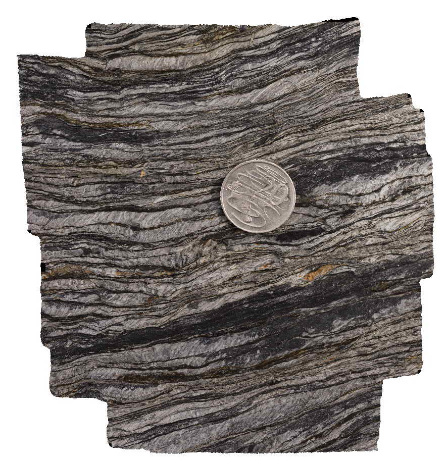
'phyllite' of the Permo-Carboniferous Nambucca Beds. Layering is defined by alternating mica-rich and quartz rich domains that are tectonic in origin. Prominent crenulation cleavage and development of new microlithons. Valla Beach, N.S.W. |
0.20 |
-30.59363000000 |
153.01398000000 |
2.000 |
crenulation cleavage, microlithons, structure |
phyllite |
Valla3 Map
 |
1 |
06/16/2015 5:43 p.m. |
3D |
'phyllite' of the Permo-Carboniferous Nambucca Beds. Layering is defined by alternating mica-rich and quartz rich domains that are tectonic in origin. Prominent crenulation cleavage and development of new microlithons. Valla Beach, N.S.W. |
0.14 |
-30.59363000000 |
153.01398000000 |
2.000 |
microlithon, structure, crenulation cleavage |
phyllite |
VictoriaDowns1 Map
 |
0 |
06/19/2016 noon |
3D |
wavy bedding in dolostone. Buchanan Highway, N.T. |
2.60 |
-15.92971000000 |
130.63803000000 |
-9999.000 |
wavy bedding, dolostone, sedimentology |
dolostone |
VictoriaDowns2 Map
 |
0 |
06/19/2016 noon |
3D |
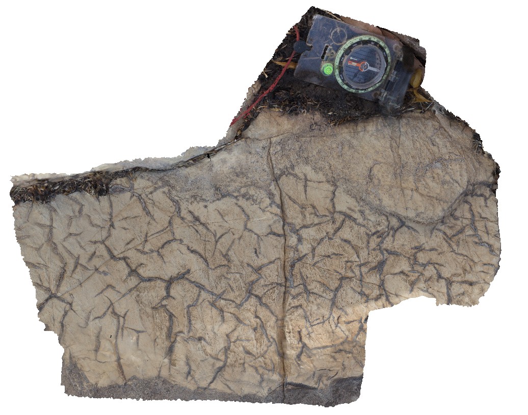
mud cracks within bedding plane of dolostone. Buchanan Highway, N.T. |
0.40 |
-15.93015000000 |
130.63948000000 |
-9999.000 |
mud cracks, dolostone, sedimentology |
dolostone |
VictoriaDownsUAV1 Map
 |
0 |
06/19/2016 noon |
UAV |
aerial view through Jasper Gorge and sandstone cliff. Buchanan Highway, N.T. |
0.00 |
-16.02912000000 |
130.73447000000 |
-9999.000 |
sandstone, cliff, Jasper Gorge |
sandstone |
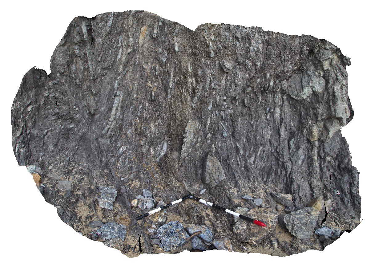
Walkerville1 Map
 |
5 |
05/18/2015 2:23 p.m. |
3D |
Contact between the Liptrap Formation sandstone and limestone. Contact is a fault melange. Walkerville South, Vic. |
15.00 |
-38.85546000000 |
145.99707000000 |
-9999.000 |
fault, structure, melange |
melange |
Walkerville2 Map
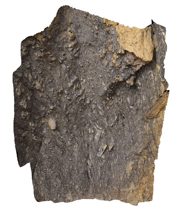 |
5 |
05/18/2015 2:23 p.m. |
3D |
Detail of fault melange shown in Walkerville1. Exposure is 5-10 m up the cliff - maximum clast size is ~0.5m. Walkerville South, Vic. |
6.00 |
-38.85546000000 |
145.99707000000 |
-9999.000 |
fault, melange, structure |
melange |
Walkerville3 Map
 |
1 |
05/18/2015 2:24 p.m. |
3D |
Detail of fault zone textures in Liptrap Sandstone. Walkerville South, Vic. |
2.00 |
-38.85549500000 |
145.99678000000 |
-9999.000 |
fault, melange |
Melange |