Walkerville4 Map
 |
5 |
05/18/2015 2:24 p.m. |
3D |
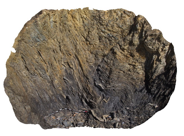
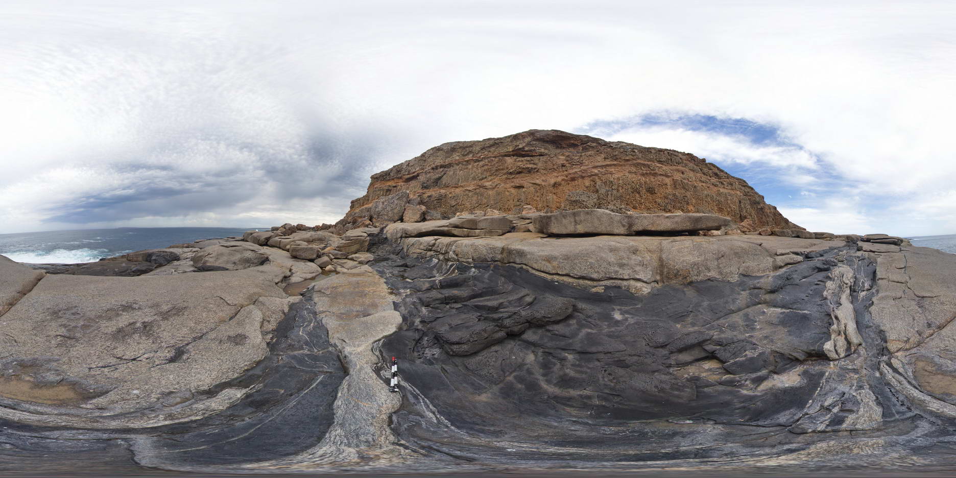
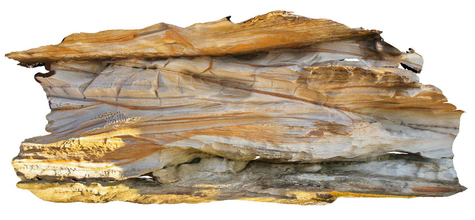
Fault at a low angle to bedding in thinly bedded sandstone and siltstone of the Liptrap Formation. Walkerville South, Vic. |
4.00 |
-38.85529500000 |
145.99678000000 |
1.000 |
fault, structure, turbidite |
sandstone, siltstone |
Walkerville5 Map
 |
5 |
05/18/2015 2:24 p.m. |
3D |
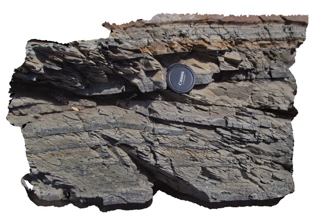
bedding - cleavage relationship and small fault in distal turbidites of the Liptrap Formation. Walkerville South, Vic. |
1.00 |
-38.85517000000 |
145.99669000000 |
1.000 |
turbidite, bedding - cleavage relationship, fault, structure, sedimentology |
turbidite |
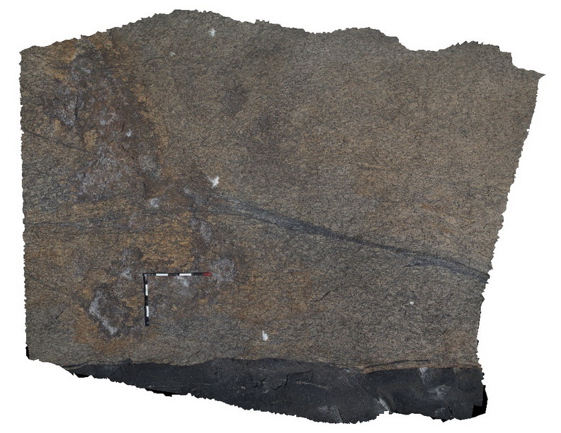
Walkerville6 Map
 |
5 |
05/18/2015 2:25 p.m. |
3D |
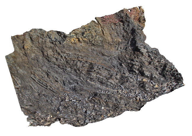
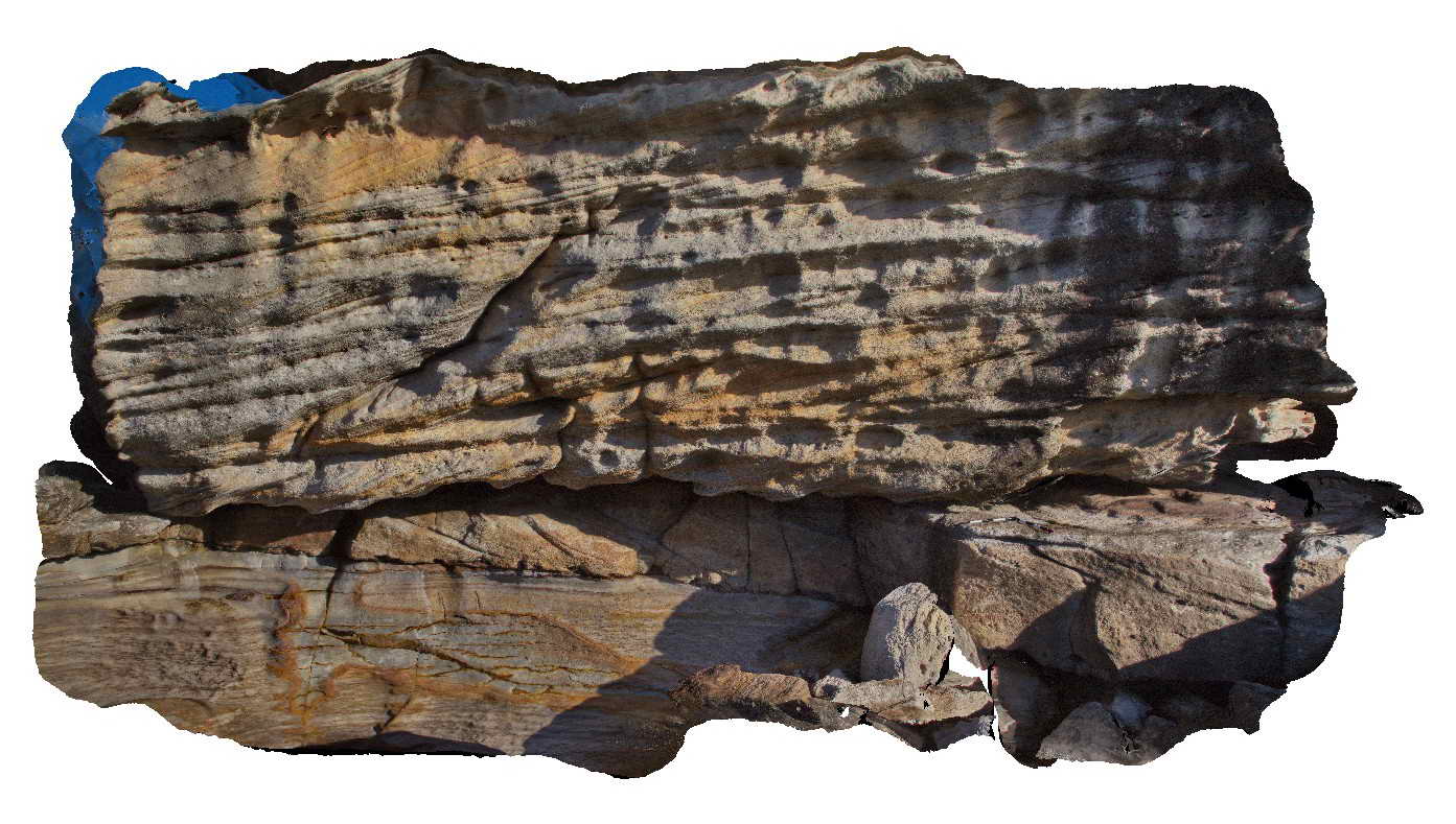
Complex folds and faults in distal turbidites of the Liptrap Formation. Walkerville South, Vic. |
3.00 |
-38.85467000000 |
145.99640000000 |
1.000 |
turbidite, folds, faults, structure |
turbidite |
Walkerville7 Map
 |
5 |
05/18/2015 2:25 p.m. |
3D |
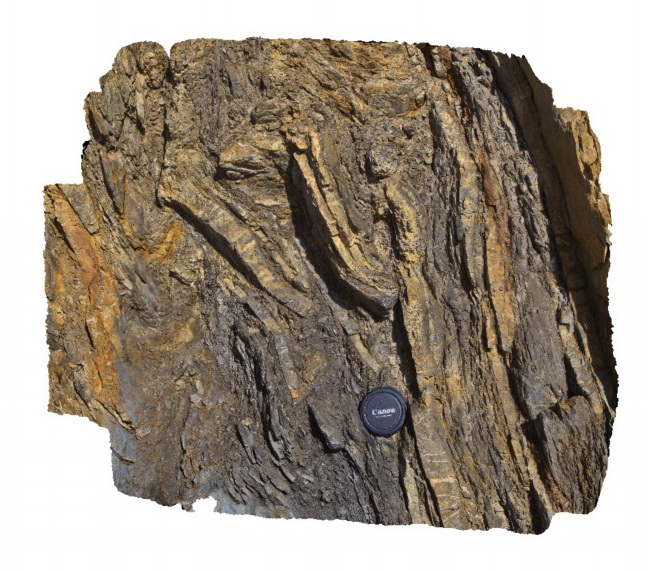
Detailed view of disrupted folds in turbidites of the Liptrap Formation - detail of Walkerville 6 visualisation. Walkerville South, Vic. |
1.00 |
-38.85467000000 |
145.99669000000 |
-9999.000 |
fold, fault, turbidite, structure |
turbidite |
Wanna1 Map
 |
0 |
10/20/2015 4:52 p.m. |
3D |
anastomosing shear zones in granitic gneiss, Wanna, Port Lincoln. |
2.20 |
-34.89307000000 |
135.85384000000 |
-9999.000 |
shear zone, granitic gneiss |
granite gneiss |
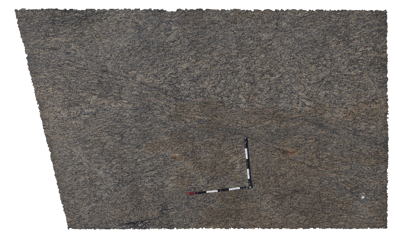
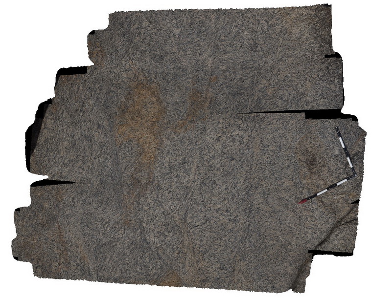
Wanna2 Map
 |
0 |
10/20/2015 4:53 p.m. |
3D |
intrusive contacts with mafic dyke and granitic gneiss, Wanna, Port Lincoln. |
4.00 |
-34.89298000000 |
135.85373000000 |
-9999.000 |
mafic dyke, intrusive contact |
granite gneiss, meta dolerite |
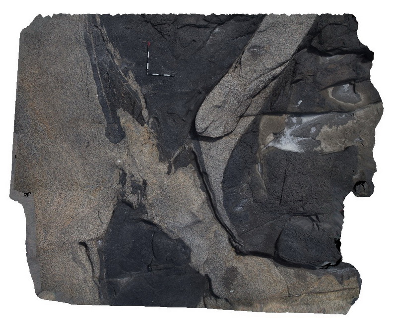
Wanna4 Map
 |
0 |
10/20/2015 4:54 p.m. |
3D |
granite gneiss xenolith in meta dolerite dyke. Wanna, Port Lincoln. |
5.00 |
-34.89271000000 |
135.85362000000 |
-9999.000 |
meta dolerite, granite gneiss, xenolith |
meta dolerite, granite gneiss |
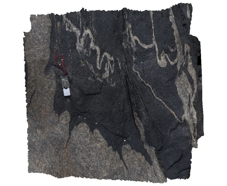
Wanna5 Map
 |
0 |
10/20/2015 4:55 p.m. |
3D |
detail of ptygmatic folding and meta dolerite dyke contact with granite gneiss. Wanna, Port Lincoln. |
0.30 |
-34.89279000000 |
135.85350000000 |
-9999.000 |
folding, metamorphic, igneous contact |
granite gneiss, meta dolerite |
Wanna6 Map
 |
0 |
10/20/2015 4:55 p.m. |
3D |
anastomosing shear zone in granite gneiss. Wanna, Port Lincoln. |
3.50 |
-34.89263000000 |
135.84358000000 |
-9999.000 |
anastomosing, shear zone |
granite gneiss |
Wanna7 Map
 |
0 |
10/20/2015 4:55 p.m. |
3D |
shear zones in granite gneiss. Wanna, Port Lincoln. |
3.00 |
-34.89243000000 |
135.85341000000 |
-9999.000 |
shear zone, granite gneiss |
granite gneiss |
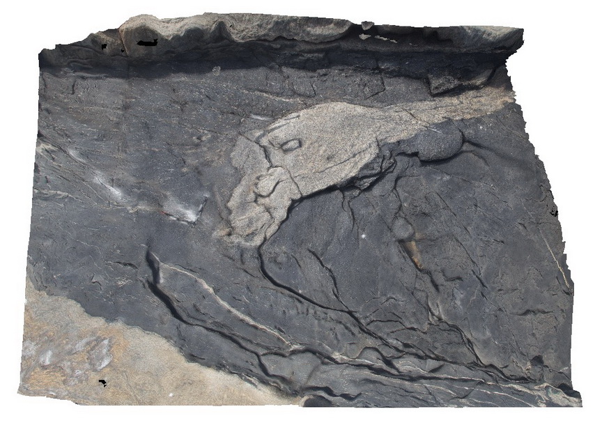
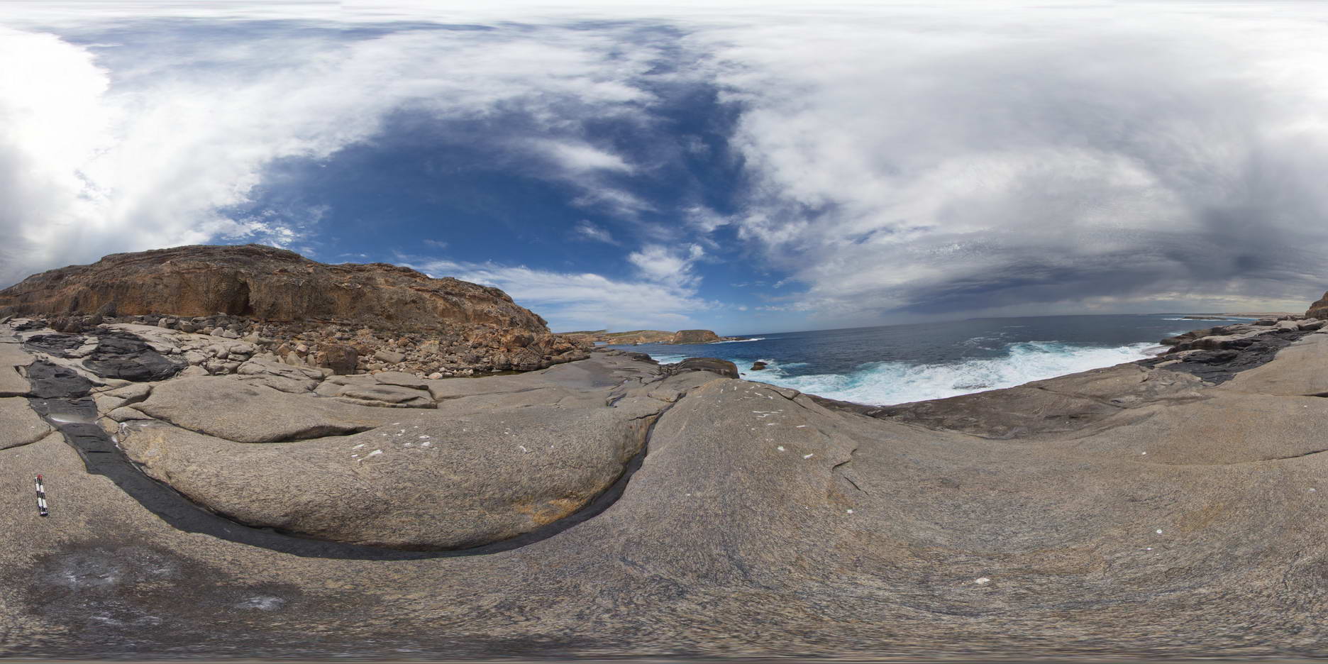
WannaFSP1 Map
 |
0 |
10/20/2015 4:56 p.m. |
FSP |
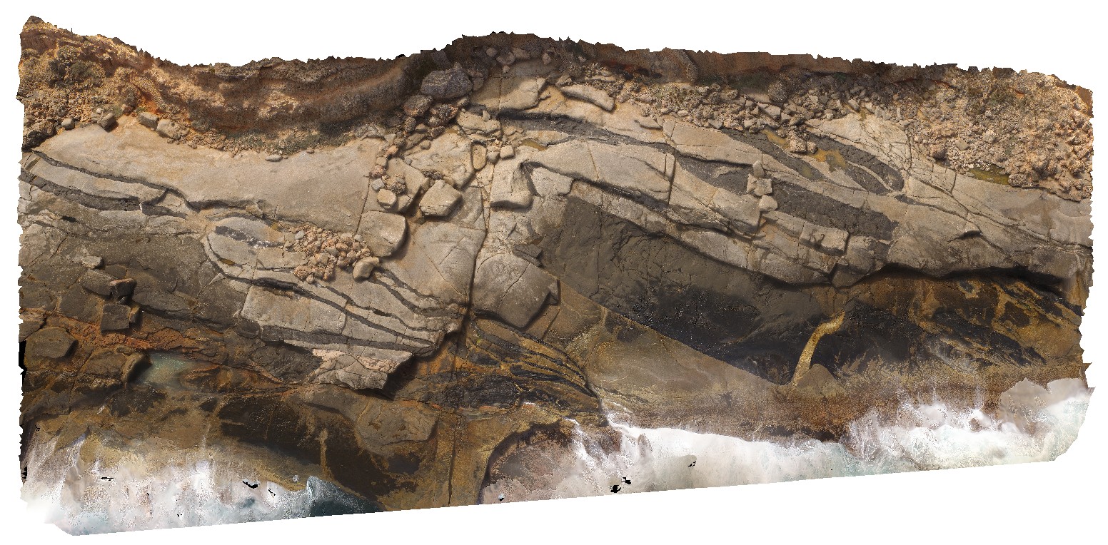
shore platform exposure, showing intruded meta-dolerite dykes into granite gneiss, overlain by recent Holocene coastal sediments. Wanna, Port Lincoln. |
100.00 |
-34.89305000000 |
135.85373000000 |
-9999.000 |
igneous contact, unconformity, granite gneiss, meta dolerite |
granite gneiss, meta dolerite, sand |
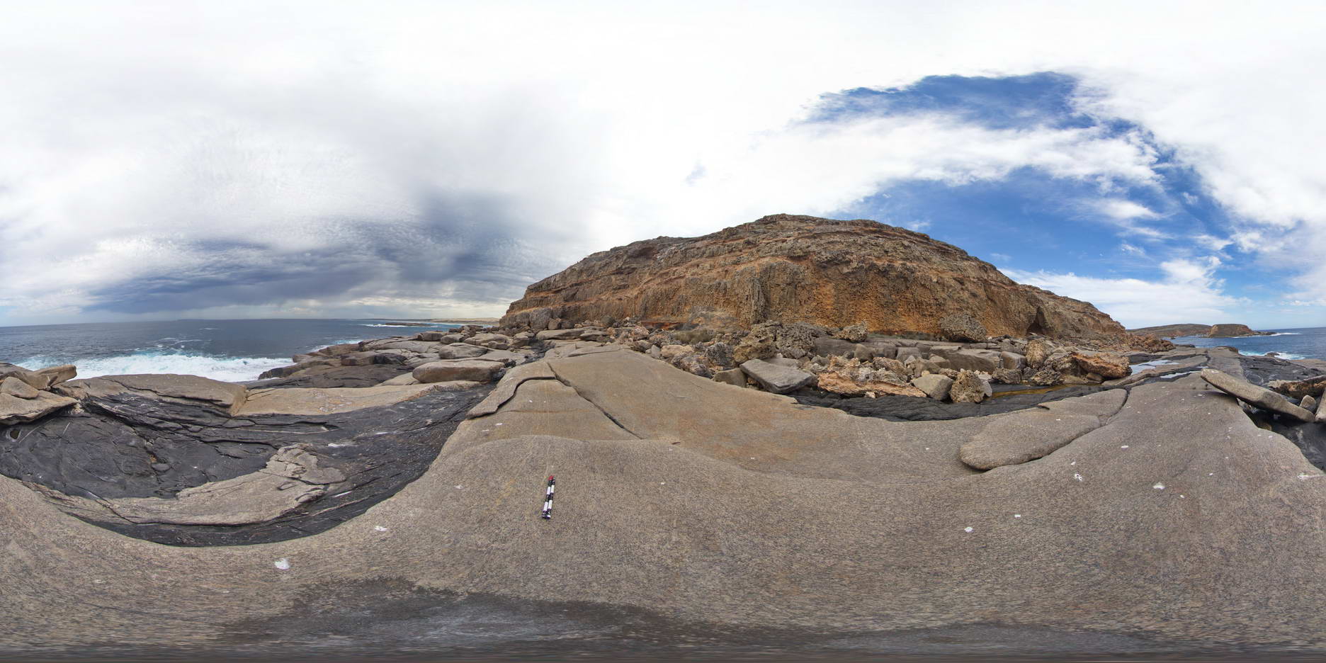
WannaFSP2 Map
 |
0 |
10/20/2015 4:57 p.m. |
FSP |
shore platform exposure, showing intruded meta-dolerite dykes into granite gneiss, overlain by recent Holocene coastal sediments. Wanna, Port Lincoln. |
100.00 |
-34.89268000000 |
135.85359000000 |
-9999.000 |
intrusive contact, unconformity, meta dolerite, granite gneiss |
granite gneiss, meta dolerite, sand |
WannaFSP3 Map
 |
0 |
10/20/2015 4:57 p.m. |
FSP |
shore platform exposure, showing intruded meta-dolerite dykes into granite gneiss, overlain by recent Holocene coastal sediments. Wanna, Port Lincoln. |
100.00 |
-34.89238000000 |
135.85358000000 |
-9999.000 |
igneous intrusion, unconformity |
granite gneiss, meta dolerite, sand |
WannaUAV1 Map
 |
0 |
10/20/2015 4:57 p.m. |
UAV |
aerial view of shore exposure, showing intruding meta dolerite dykes into granite gneiss, Wanna, Port Lincoln. |
100.00 |
-34.89307000000 |
135.85373000000 |
-9999.000 |
meta dolerite, granite gneiss, intrusive contact |
granite gneiss, meta dolerite |
WARA1 Map
 |
5 |
07/21/2016 9:22 a.m. |
3D |
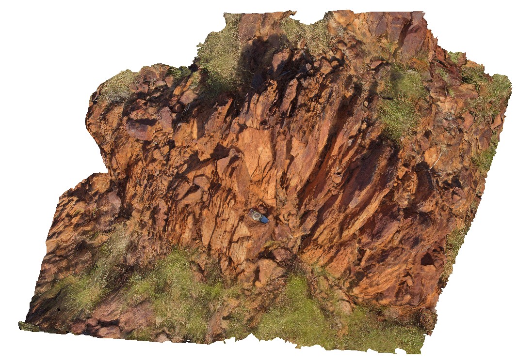
foliated ironstone / sandstone outcrop, North West of Tennant Creek, N.T. |
3.00 |
-19.61521200000 |
134.17483300000 |
411.539 |
foliation, structure, sandstone, Warramunga Formation |
sandstone |
WARA2 Map
 |
0 |
07/22/2016 10:13 a.m. |
3D |
Warramunga Formation sandstone with bedding and foliation. Near Bill Allen lookout. Tennant Creek, N.T. |
0.80 |
-19.65035900000 |
134.21173300000 |
397.286 |
Warramunga Formation, bedding, foliation, structure |
sandstone |
WARAFSP1 Map
 |
0 |
07/21/2016 9:38 a.m. |
FSP |
foliated ironstone / sandstone outcrop, North West of Tennant Creek, N.T. |
0.00 |
-19.61547200000 |
134.17657700000 |
386.669 |
foliation, structure |
sandstone |
Watamolla1 Map
 |
1 |
06/17/2015 9:18 a.m. |
3D |
cross-bedded quartz sandstone of the Triassic Hawkesbury Sandstone. Watamolla Beach, N.S.W. |
5.00 |
-34.13844000000 |
151.11827000000 |
2.000 |
sedimentology, cross bedding, fluvial |
sandstone |
Watamolla2 Map
 |
5 |
06/17/2015 9:22 a.m. |
3D |
cross-bedded quartz sandstone of the Triassic Hawkesbury Sandstone. Watamolla Beach, N.S.W. |
5.00 |
-34.13958000000 |
151.12096000000 |
2.000 |
|
sandstone |
WaterfallbayUAV1 Map
 |
20 |
01/01/9999 midnight |
UAV |
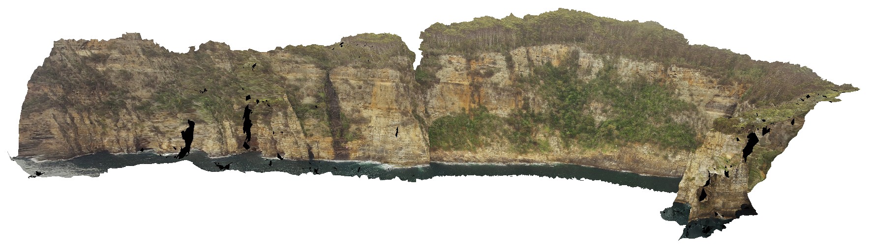
extensive aerial view of 'clean' Permian sediment cliffs. Waterfall Bay, Tasmania. |
500.00 |
-43.05168000000 |
147.94986900000 |
170.448 |
Permian sediments, dolerite dyke, faults, sedimentology |
sediments |
WaterfallbayUAV2 Map
 |
20 |
01/01/9999 midnight |
UAV |
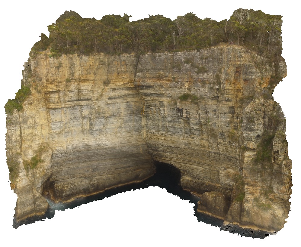
extensive aerial view of 'clean' Permian sediment cliffs with sea cave. Waterfall Bay, Tasmania. |
140.00 |
-43.05807400000 |
147.94901500000 |
112.000 |
sea cave, Permian sediment, Parmeener Supergroup |
sediment |
Waterworks1 Map
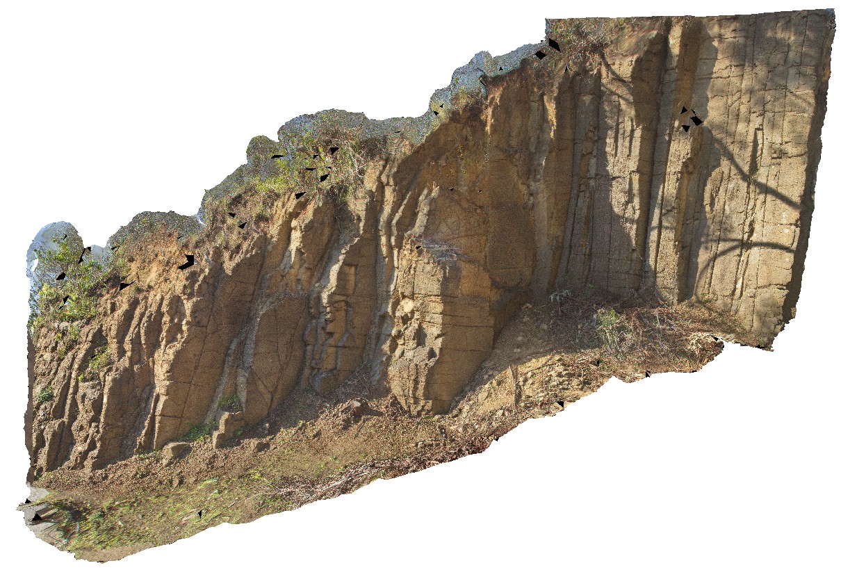 |
5 |
08/18/2016 12:59 p.m. |
3D |
blocky, columnar and sub-horizontal jointing in weathered Jurassic dolerite sill exposure. Waterworks reserve, Hobart. Tasmania. |
10.00 |
-42.90288100000 |
147.31135500000 |
113.000 |
joint, columnar jointing, weathering, Jurassic Dolerite, dolerite |
dolerite |
WBunglesUAV1 Map
 |
0 |
02/23/2016 12:25 p.m. |
UAV |
location inferred from google earth |
0.00 |
-31.33049800000 |
148.99571900000 |
-9999.000 |
|
|
WeeJasper1 Map
 |
50 |
06/17/2015 9:28 a.m. |
3D |
Dipping limestone beds of the Devonian Cavan Bluff Limestone intersecting topography to create a circular outcrop. Wee Jasper, N.S.W. |
150.00 |
-35.02699000000 |
148.82231000000 |
430.000 |
dipping beds, structure |
limestone |
WeeJasper2 Map
 |
5 |
06/17/2015 9:38 a.m. |
3D |
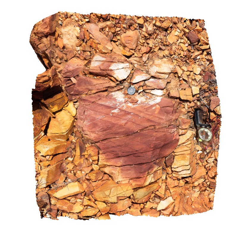
fault striations on bedding surfaces in shale of the Devonian Majurgong Formation. Wee Jasper, N.S.W. |
2.00 |
-35.11063000000 |
148.68202000000 |
380.000 |
fault striations, structure |
shale |