Wilka11 Map
 |
0 |
09/27/2015 5:08 p.m. |
3D terrestrial photogrammetric model |
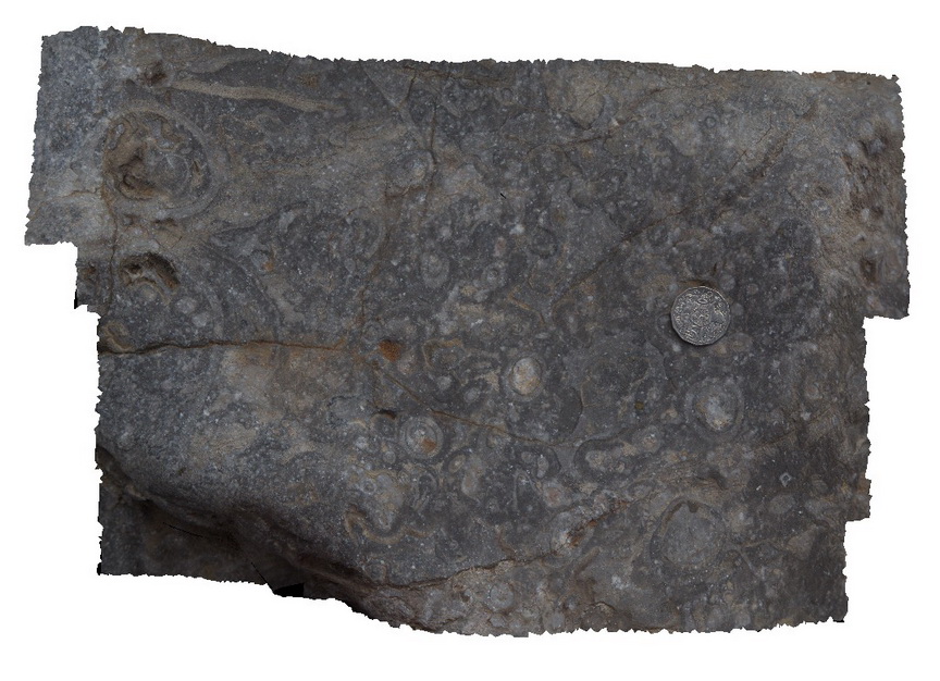
detail of archaeocyatha bearing carbonates, Wilkawillina Trail, Flinders Ranges. |
0.20 |
-31.29892000000 |
138.90530000000 |
-9999.000 |
Archaeocyatha |
limestone |
Wilka12 Map
 |
0 |
09/27/2015 5:09 p.m. |
3D terrestrial photogrammetric model |
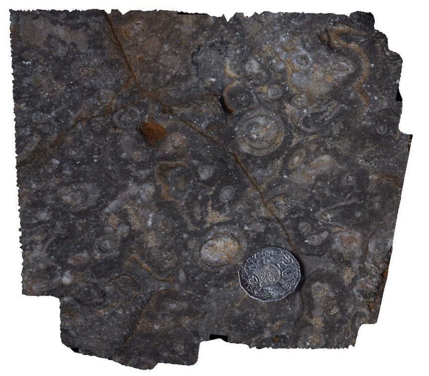
detail of archaeocyatha bearing carbonates, Wilkawillina Trail, Flinders Ranges. |
0.20 |
-31.29892000000 |
138.90530000000 |
-9999.000 |
Archaeocyatha |
limestone |
Wilka13 Map
 |
0 |
09/27/2015 5:09 p.m. |
3D terrestrial photogrammetric model |
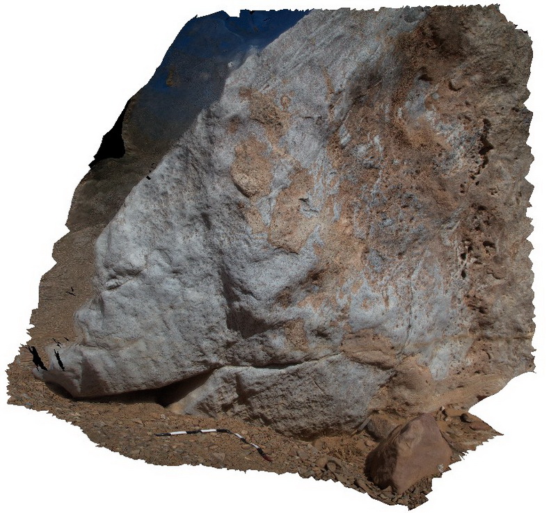
dolomitisation of limestone, Wilkawillina Trail, Flinders Ranges. |
5.00 |
-31.29876000000 |
138.90601000000 |
-9999.000 |
dolomitisation of limestone |
dolomite |
Wilka14 Map
 |
20 |
09/27/2015 5:10 p.m. |
3D terrestrial photogrammetric model |
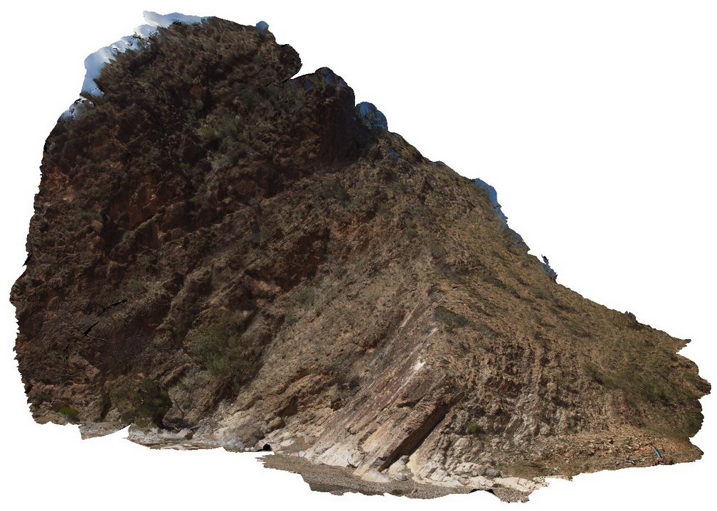
out crop of moderately dipping beds showing the contact between the Rownsley Quartzite and the Wilkawillina Limestone. Wilkawillina Trail, Flinders Ranges. |
20.00 |
-31.30021000000 |
138.90201000000 |
-9999.000 |
geological contact |
quartzite, limestone |
Wilka15 Map
 |
0 |
09/27/2015 5:10 p.m. |
3D terrestrial photogrammetric model |
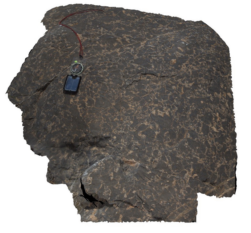
brecciation in dolomitisation of Wilkawillina limestone. Wilkawillina Trail, Flinders Ranges. |
0.50 |
-31.29783000000 |
138.89418000000 |
-9999.000 |
breccia, dolomitisation of limestone |
limestone |
Wilka16 Map
 |
0 |
09/27/2015 5:10 p.m. |
3D terrestrial photogrammetric model |
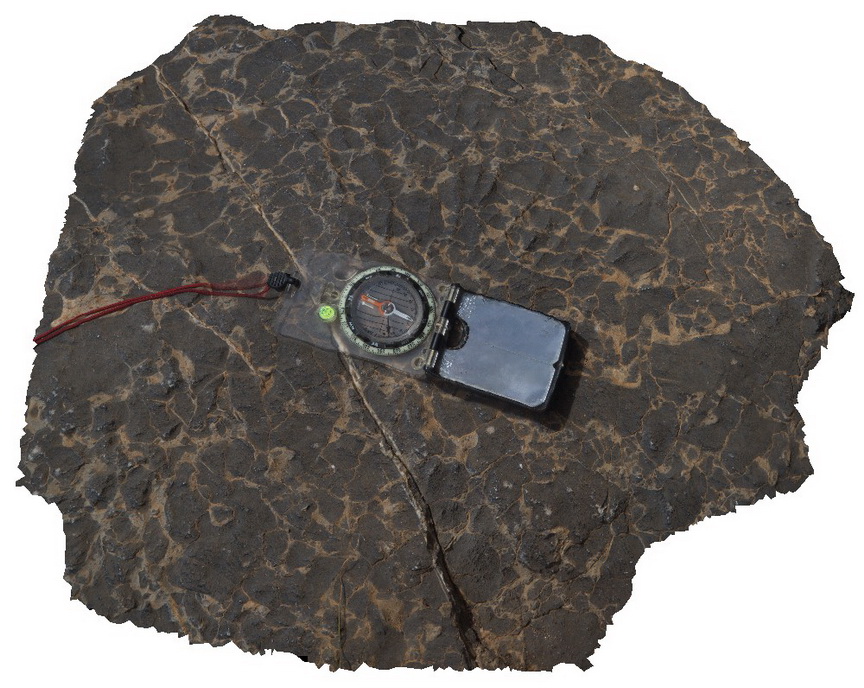
detail, brecciation in dolomitisation of Wilkawillina limestone. Wilkawillina Trail, Flinders Ranges. |
0.20 |
-31.29783000000 |
138.89418000000 |
-9999.000 |
breccia |
limestone |
Wilka17 Map
 |
0 |
09/27/2015 5:11 p.m. |
3D terrestrial photogrammetric model |
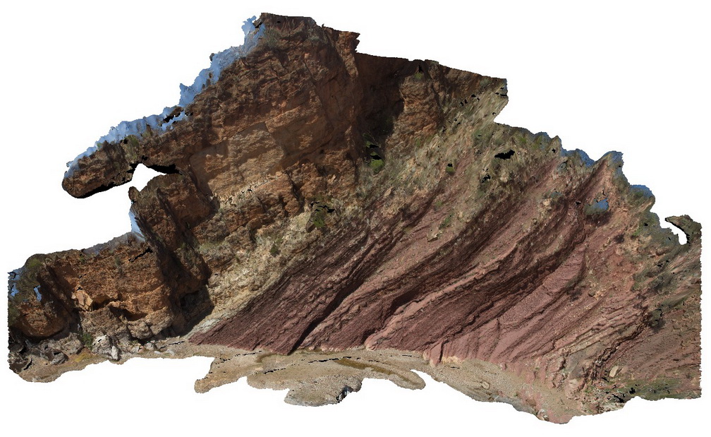
view of cliff exposure showing moderately dipping beds and the geological contact between Bonney Sandstone and Wilkawillina limestone. Wilkawillina Trail, Flinders Ranges. |
100.00 |
-31.29806000000 |
138.89104000000 |
-9999.000 |
geological contact |
sandstone, limestone |
Wilka19 Map
 |
0 |
09/27/2015 5:12 p.m. |
3D terrestrial photogrammetric model |
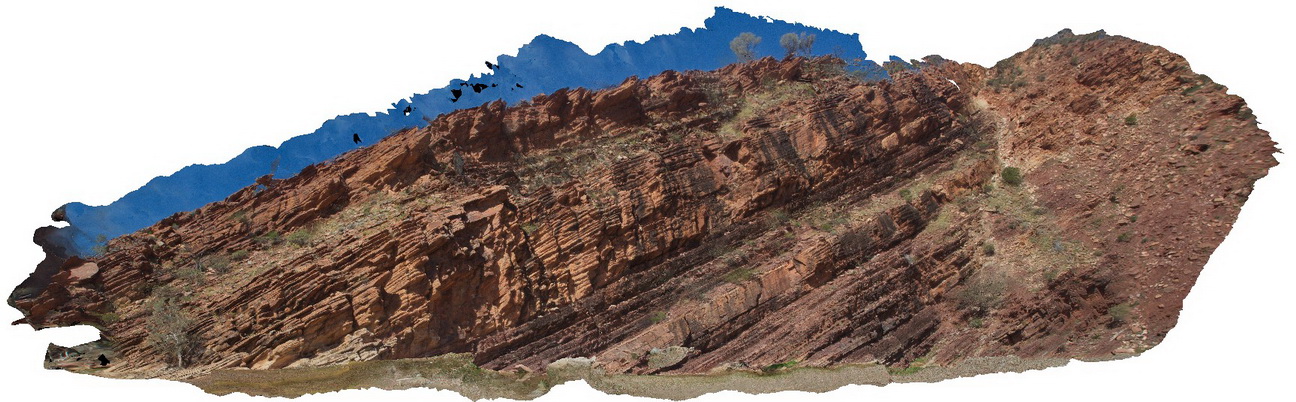
outcrop of Bonney Sandstone, showing finely bedded red sandstone. Willkawillina Trail, Fraser Ranges. |
20.00 |
-31.29801000000 |
138.88535000000 |
-9999.000 |
bedded |
sandstone |
Wilka2 Map
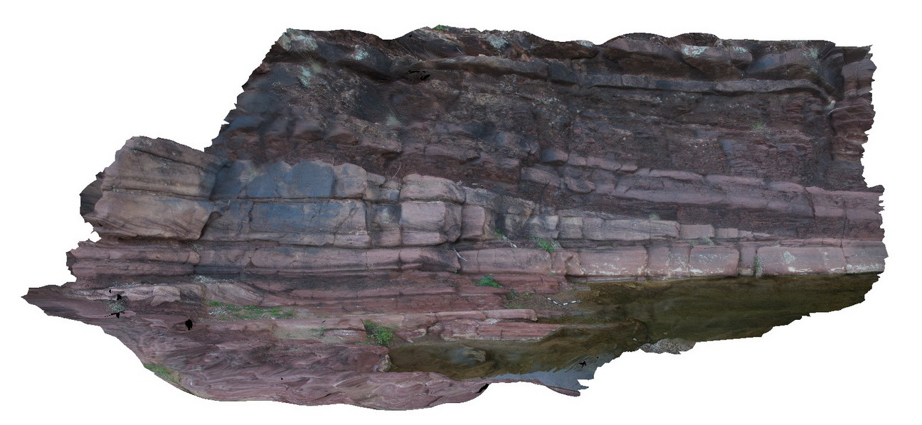 |
0 |
09/27/2015 5:12 p.m. |
3D terrestrial photogrammetric model |
disconformity in Bonney Sandstone. Cross bedded channel sands truncated at top and overlain by red, silty material. Wilkawillina Trail. Flinders Ranges. |
8.00 |
-31.29623000000 |
138.88773000000 |
-9999.000 |
disconformity, cross bedding |
sandstone |
Wilka3 Map
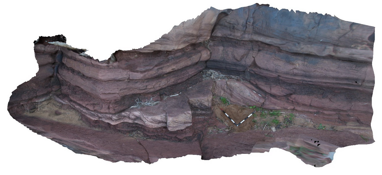 |
0 |
09/27/2015 5:13 p.m. |
3D terrestrial photogrammetric model |
detail of cross bedded channel structures in Bonney Sandstone. |
6.50 |
-31.29630000000 |
138.88757000000 |
-9999.000 |
cross bedding, sedimentary structures |
sandstone |
Wilka4 Map
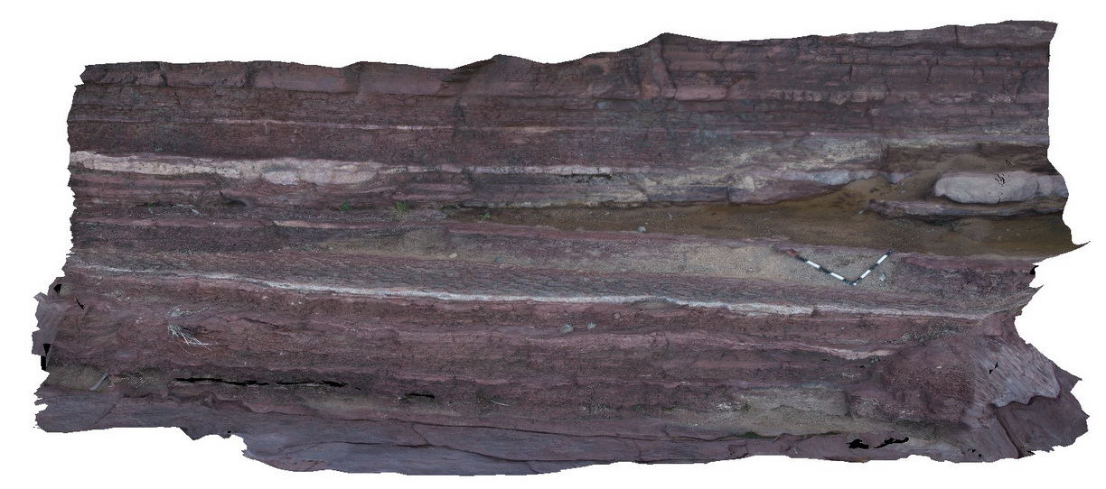 |
0 |
09/27/2015 5:14 p.m. |
3D terrestrial photogrammetric model |
pavement of ripple-marked sandstone in Bonney Sandstone. Wilkawillina Trail, Flinders Rangers. |
5.00 |
-31.29619000000 |
138.88741000000 |
-9999.000 |
ripple marks, sedimentology |
sandstone |
Wilka5 Map
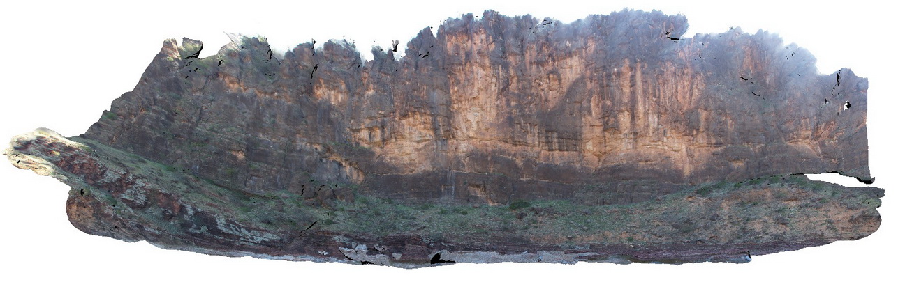 |
0 |
09/27/2015 5:14 p.m. |
3D terrestrial photogrammetric model |
massive cliff exposure of the Bonney Sandstone, showing cross bedding in the basal portion. Wilkawillina Trail, Flinders Rangers |
100.00 |
-31.29641000000 |
138.88800000000 |
-9999.000 |
sedimentology, cross bedding |
sandstone |
Wilka6 Map
 |
0 |
09/27/2015 5:16 p.m. |
3D terrestrial photogrammetric model |
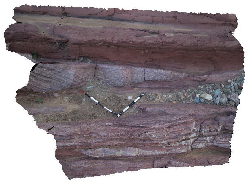
Channel sediments with cross beds in fine ripple laminated silt and fine sandstone. Wilkawillina Trail. Flinders Ranges. |
3.00 |
-31.29641000000 |
138.88800000000 |
-9999.000 |
cross bedding, sedimentology |
sandstone |
Wilka7 Map
 |
0 |
09/27/2015 5:17 p.m. |
3D terrestrial photogrammetric model |
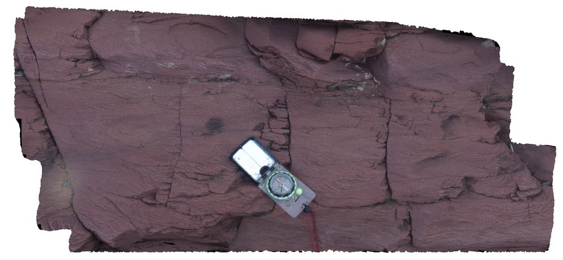
ripple and cross laminations in red silty fine grained sandstone. Bonney Sandstone, Wilkawillina Trail, Flinders Ranges. |
0.20 |
-31.29641000000 |
138.88800000000 |
-9999.000 |
cross beds |
sandstone |
Wilka8 Map
 |
0 |
09/27/2015 5:18 p.m. |
3D terrestrial photogrammetric model |
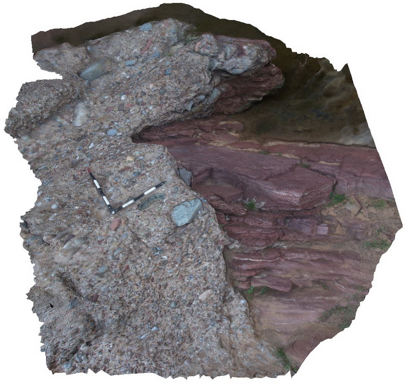
Quaternary consolidated conglomerate with silica? Cement overlying Bonney Formation. Wilkawillina Trail, Flinders Ranges. |
4.00 |
-31.29638000000 |
138.88771000000 |
-9999.000 |
geological unconformity |
sandstone, conglomerate |
Wilka9 Map
 |
0 |
09/27/2015 5:19 p.m. |
3D terrestrial photogrammetric model |
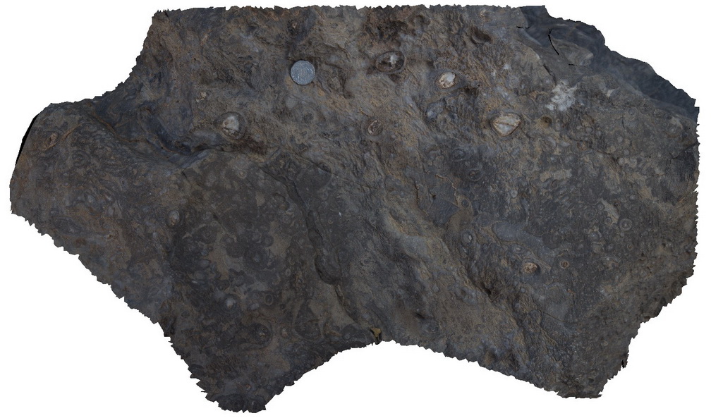
Out crop of archaeocyatha bearing carbonates, Wilkawillina Trail, Flinders Ranges. |
0.30 |
-31.29892000000 |
138.90530000000 |
-9999.000 |
Archaeocyatha |
limestone |
WilkaFSP1 Map
 |
0 |
09/27/2015 5:20 p.m. |
Full Spherical Panorama |
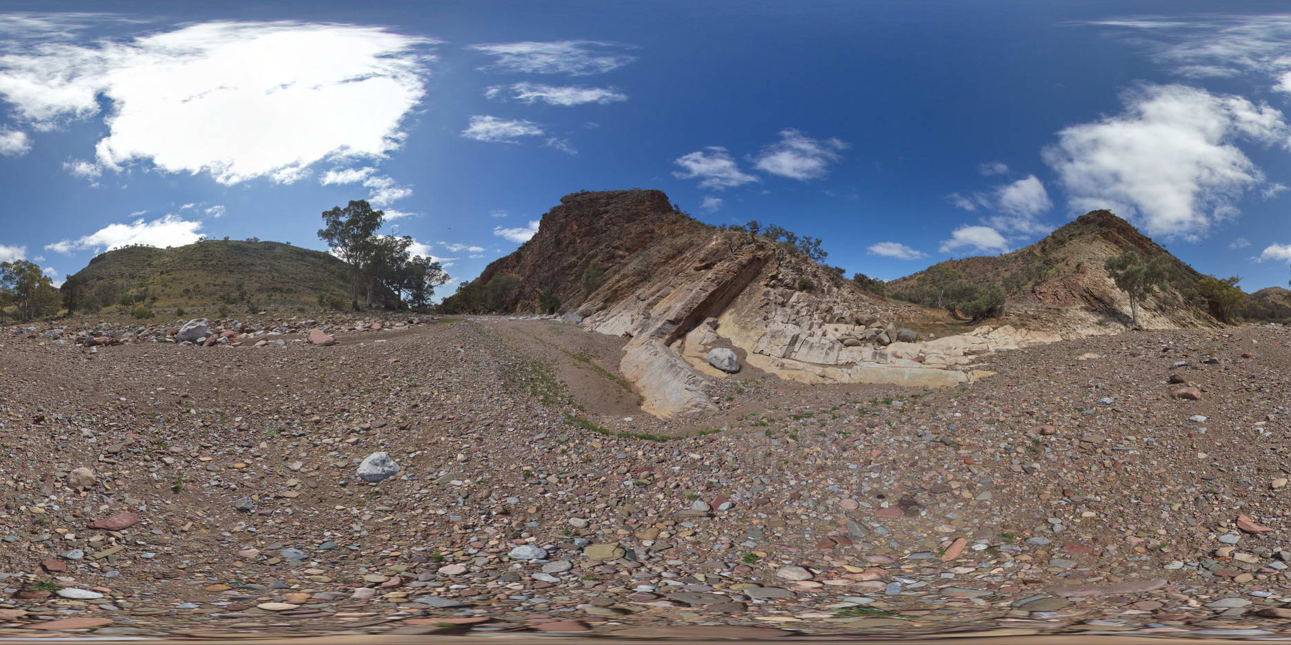
out crop of moderately dipping beds showing the contact between the Rownsley Quartzite and the Wilkawillina Limestone. Wilkawillina Trail, Flinders Ranges. |
1000.00 |
-31.30042000000 |
138.90196000000 |
-9999.000 |
geological contact |
sandstone, limestone |
WilkaFSP2 Map
 |
0 |
09/27/2015 5:20 p.m. |
Full Spherical Panorama |
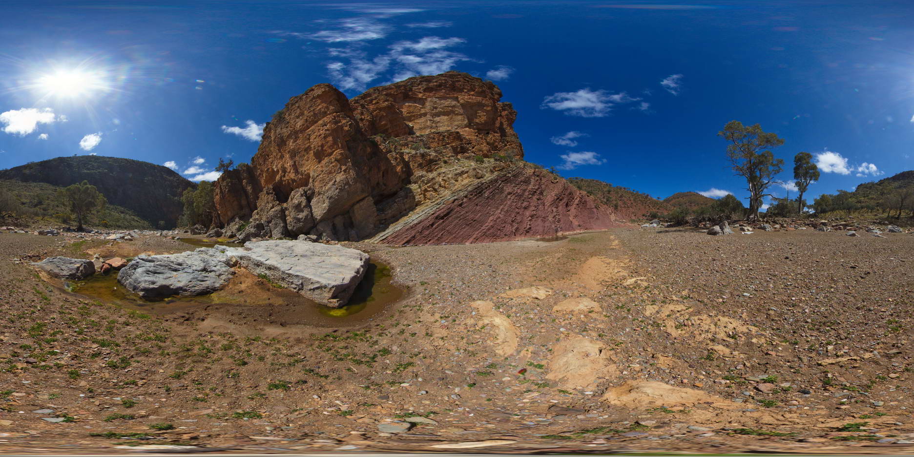
outcrop showing the geological contact between the Bonney Sandstone and the Wilkawillina Limestone, Wilkawillian Trail, Flinders Ranges. |
100.00 |
-31.29792000000 |
138.89125000000 |
-9999.000 |
geological contact |
sandstone, limestone |
WilkaFSP3 Map
 |
0 |
09/27/2015 5:20 p.m. |
Full Spherical Panorama |
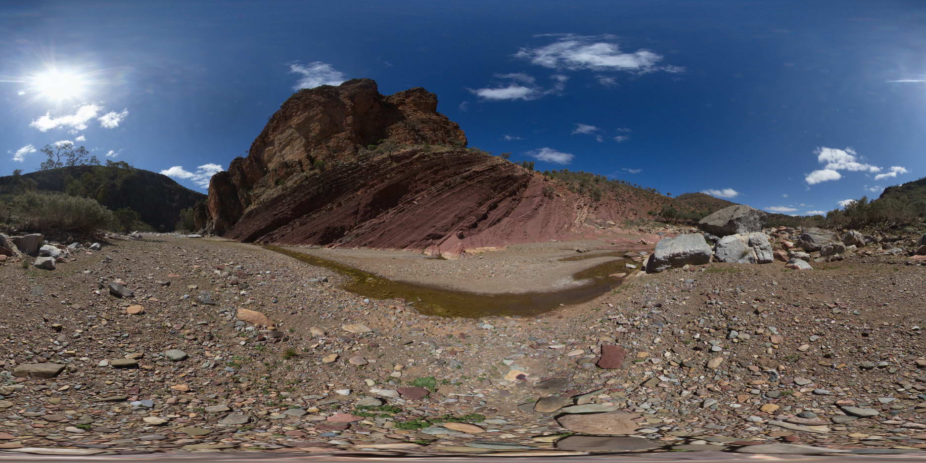
outcrop of the geological contact between the Bonney Sandstone and the Wilkawillina Limestone, Wilkwillina Train, Flinders Ranges. |
1000.00 |
-31.29826000000 |
138.89099000000 |
-9999.000 |
geological contact |
sandstone, limestone |
WilkaFSP4 Map
 |
0 |
09/27/2015 5:21 p.m. |
Full Spherical Panorama |
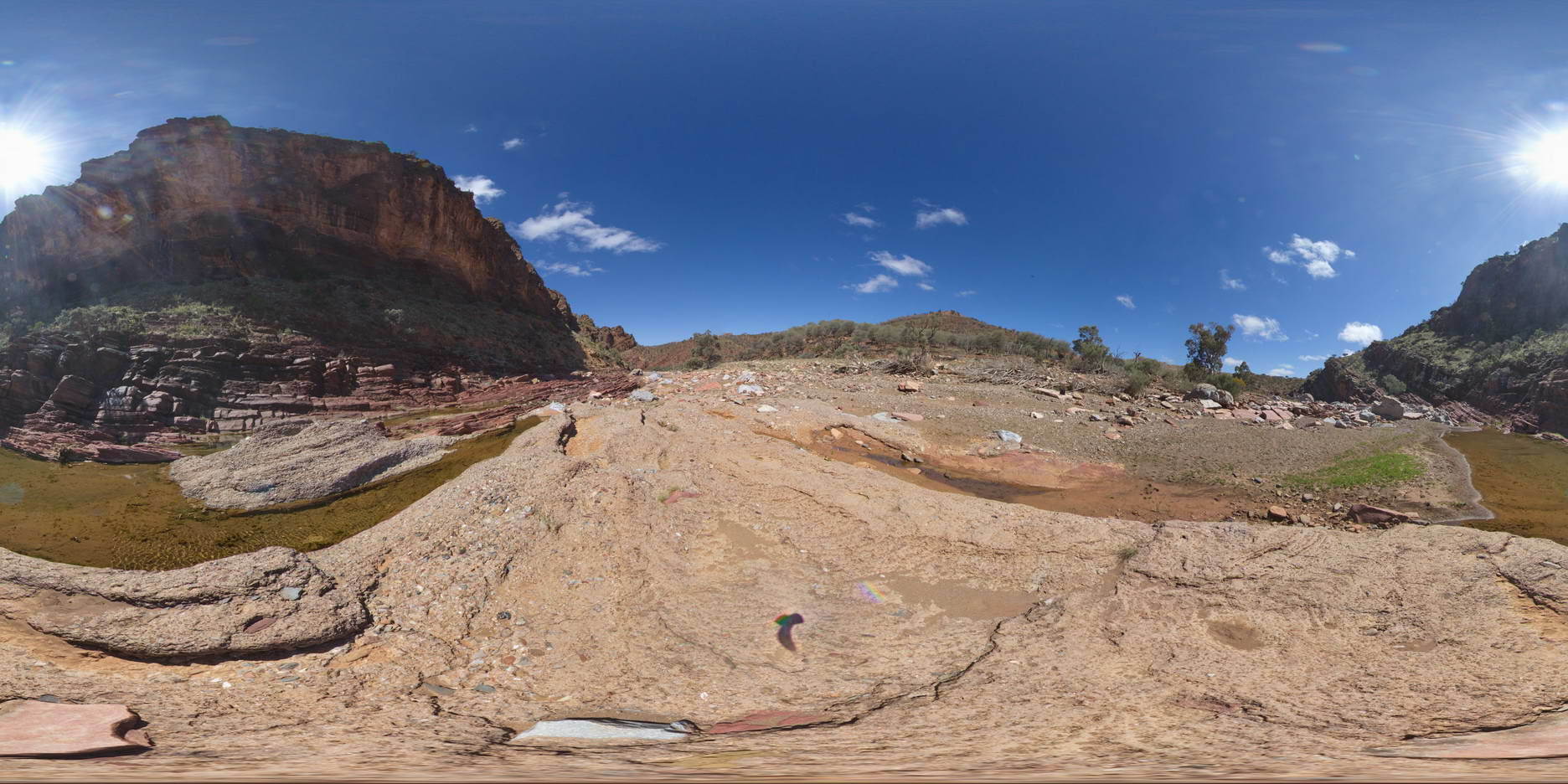
view of diamictite exposure in creek bed, overlain by Bonney Sandstone, overlain by Wilkawillina Limestone. |
1000.00 |
-31.29642000000 |
138.88765000000 |
-9999.000 |
geological contact |
sandstone, limestone |
WilkaFSP5 Map
 |
0 |
09/27/2015 5:21 p.m. |
Full Spherical Panorama |
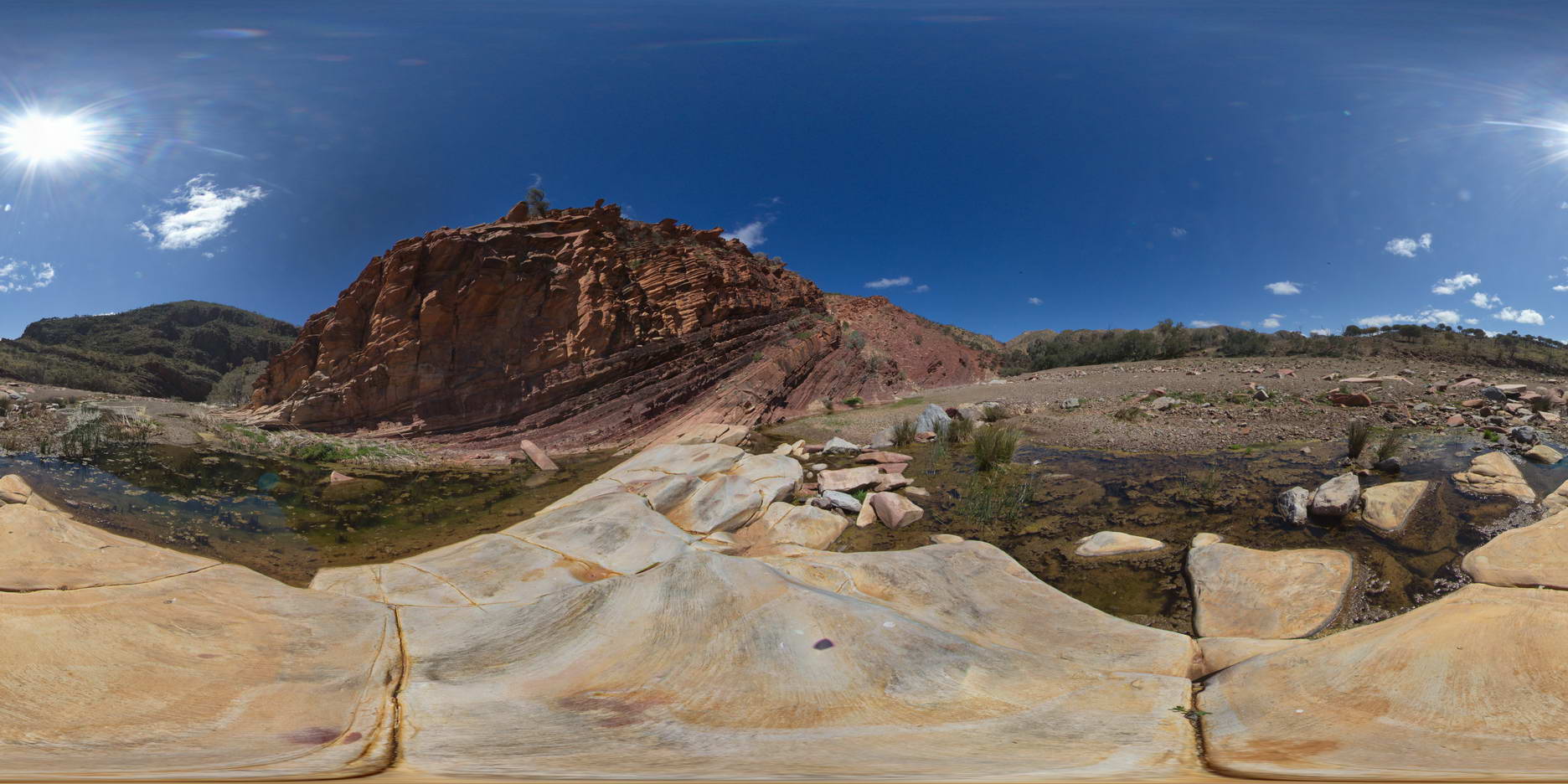
View of moderately dipping beds of the Bonney Sandstone, Wilkawillina Trail, Flinders Ranges. |
100.00 |
-31.29801000000 |
138.88535000000 |
-9999.000 |
sandstone, bedding |
sandstone |
WilkaUAV1 Map
 |
0 |
09/27/2015 5:21 p.m. |
3D UAV photogrammetric model |
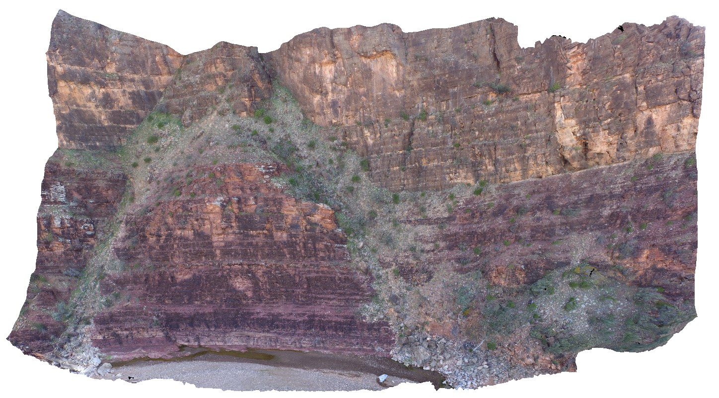
cliff exposure showing contact between the Bonney Sandstone and Wilkawillna Limestone. Wilkawillna Trail. |
300.00 |
-31.29360000000 |
138.88297000000 |
-9999.000 |
geological contact |
sandstone, limestone |
WilkaUAV2 Map
 |
0 |
09/27/2015 5:21 p.m. |
3D UAV photogrammetric model |
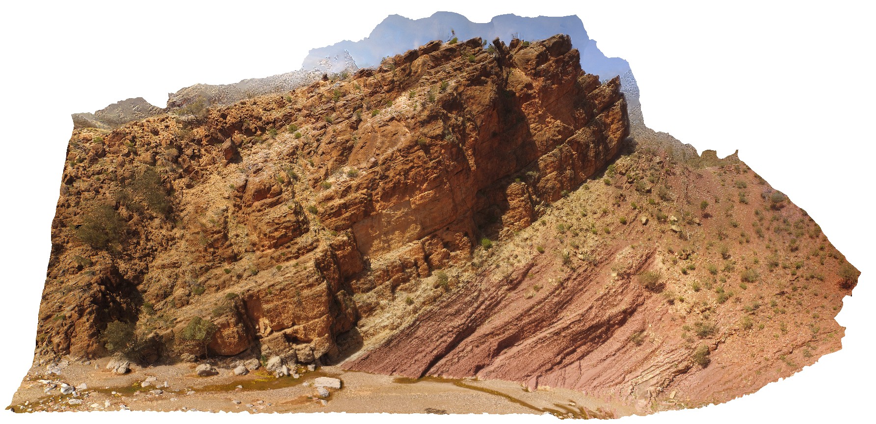
cliff outcrop showing the geological contact between the Bonney Sandstone and the Wilkawillina Limestone, Wilkawillian Trail, Flinders Ranges. |
100.00 |
-31.29782700000 |
138.89135100000 |
-9999.000 |
geological contact |
sandstone, limestone |
Willyabrup1 Map
 |
0 |
01/01/9999 midnight |
3D terrestrial photogrammetric model |
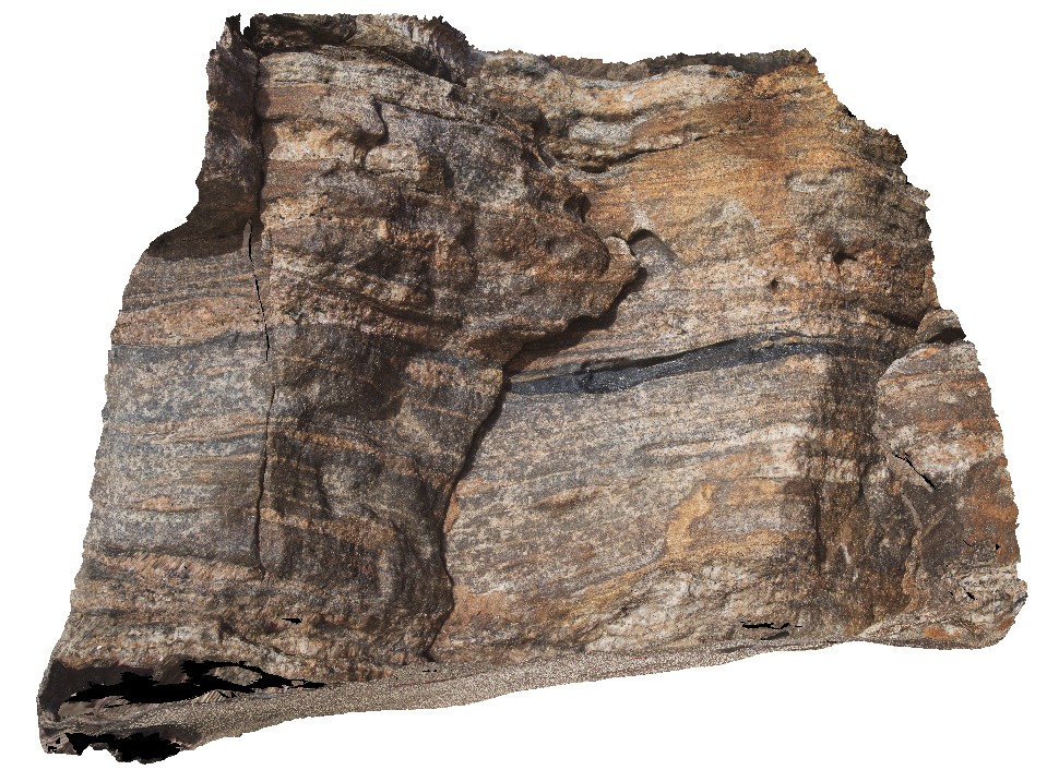
hinge of isoclinal recumbent fold in amphibolite layer in gneiss. Willyabrup road, W.A. |
0.00 |
-33.80754000000 |
114.99713000000 |
-9999.000 |
isoclinal fold, recumbent fold, amphibolite |
amphibolite |
Willyabrup2 Map
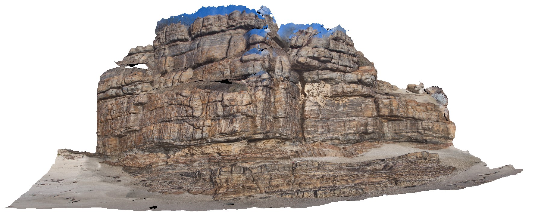 |
0 |
01/01/9999 midnight |
3D terrestrial photogrammetric model |
gneiss cliff outcrop. Willyabrup road, W.A. |
10.00 |
-33.80737000000 |
114.99719000000 |
-9999.000 |
gneiss |
gneiss |
 AusGeol.org