WreckBeach8 Map
 |
0 |
06/14/2016 2:28 p.m. |
3D |
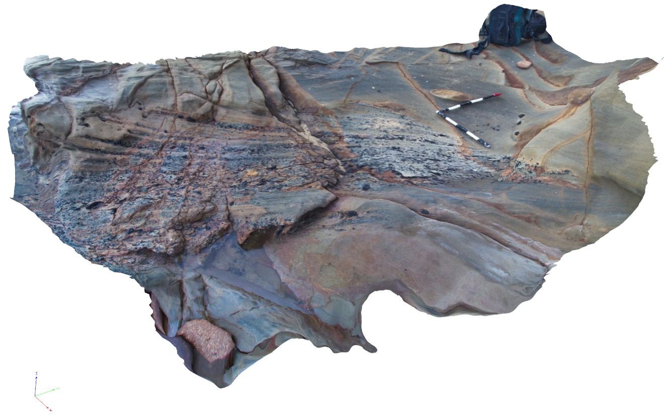
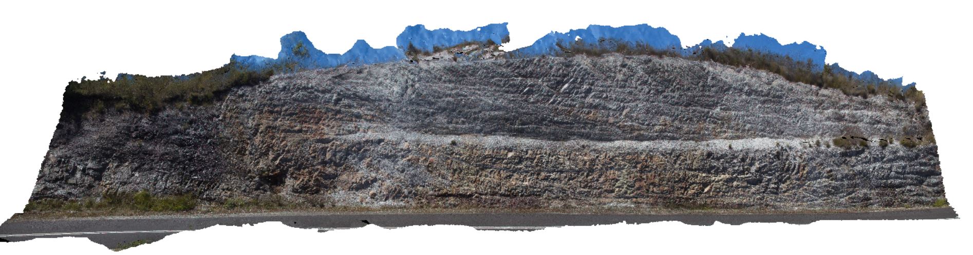
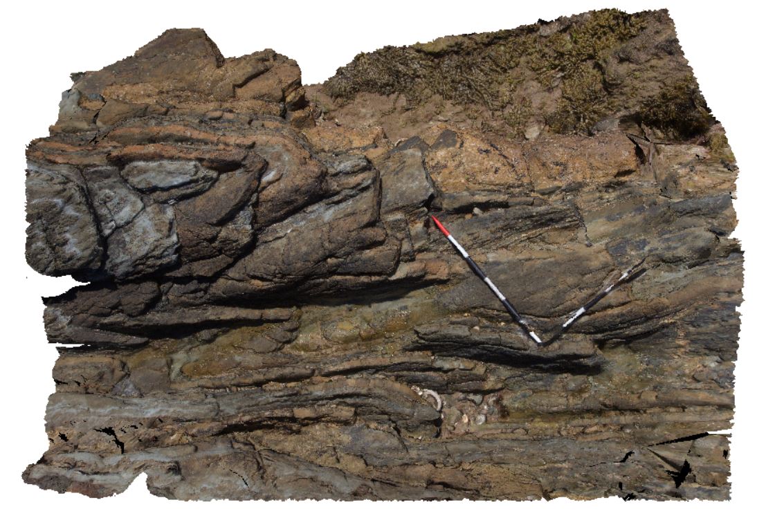
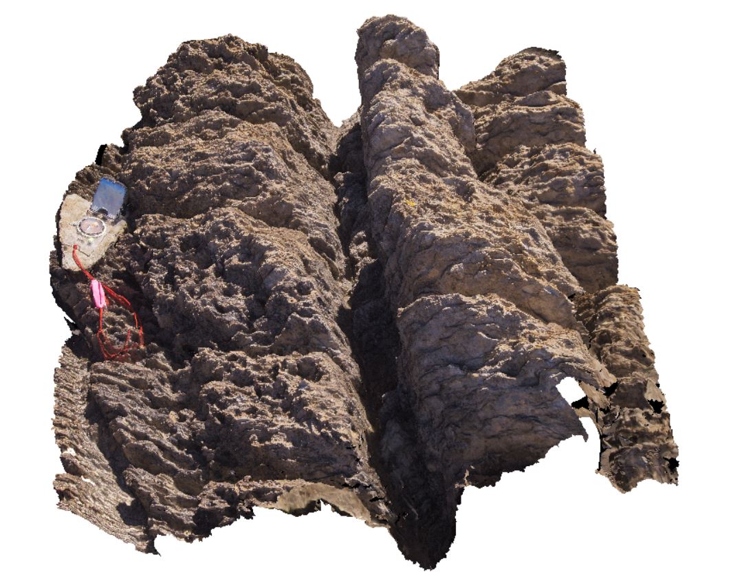
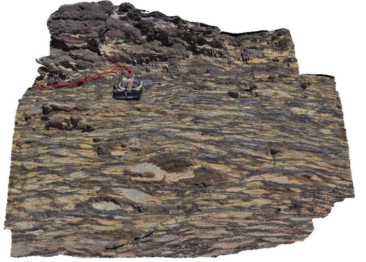
exposed shore platform, showing a truncated layer containing cross beds and layers with coaly fragments. Wreck Beach, Vic. |
3.00 |
-38.75654000000 |
143.21471000000 |
-9999.000 |
truncated bed, coal, cross bed |
sandstone |
WreckBeach9 Map
 |
0 |
06/14/2016 2:33 p.m. |
3D |
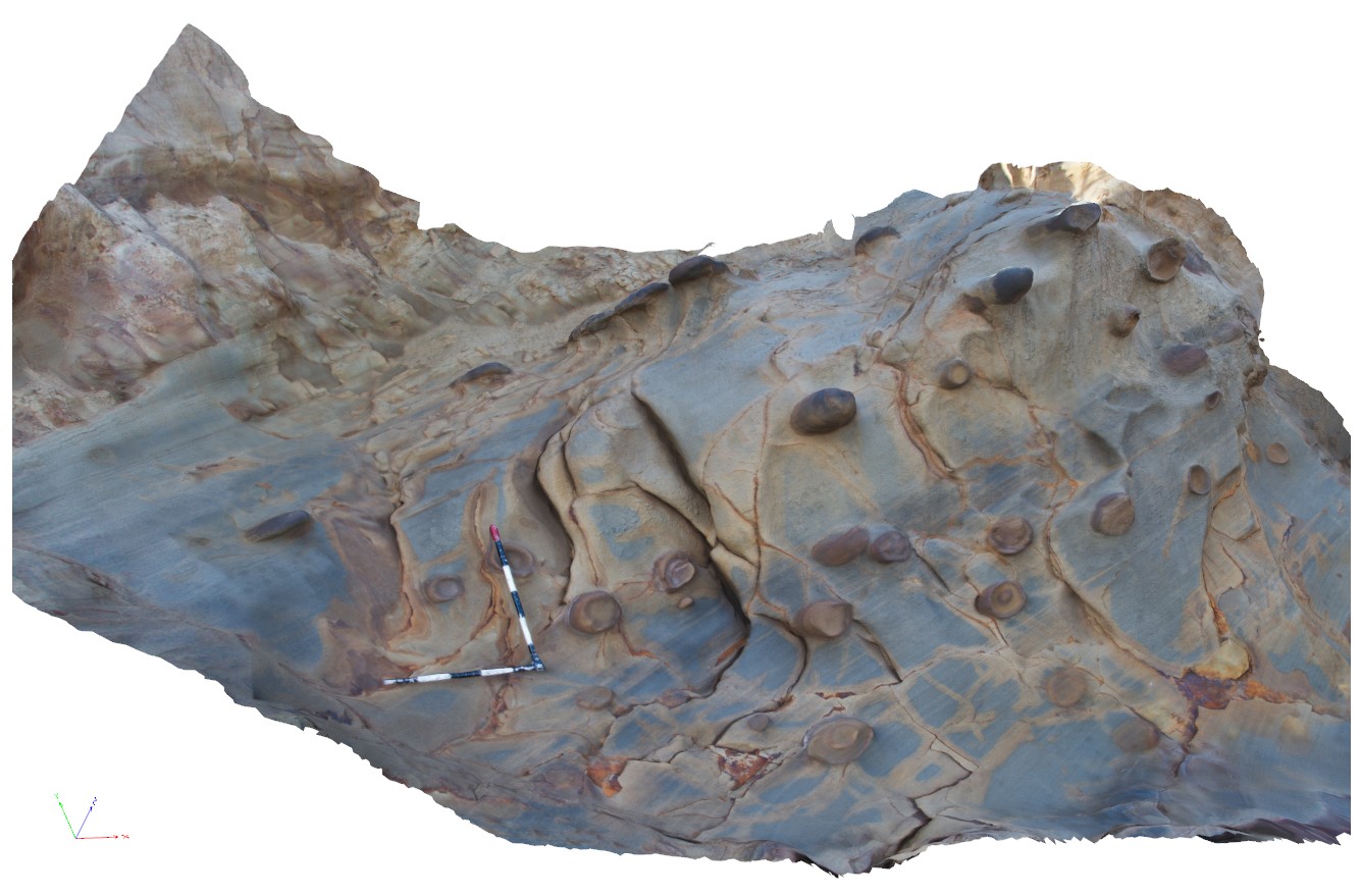
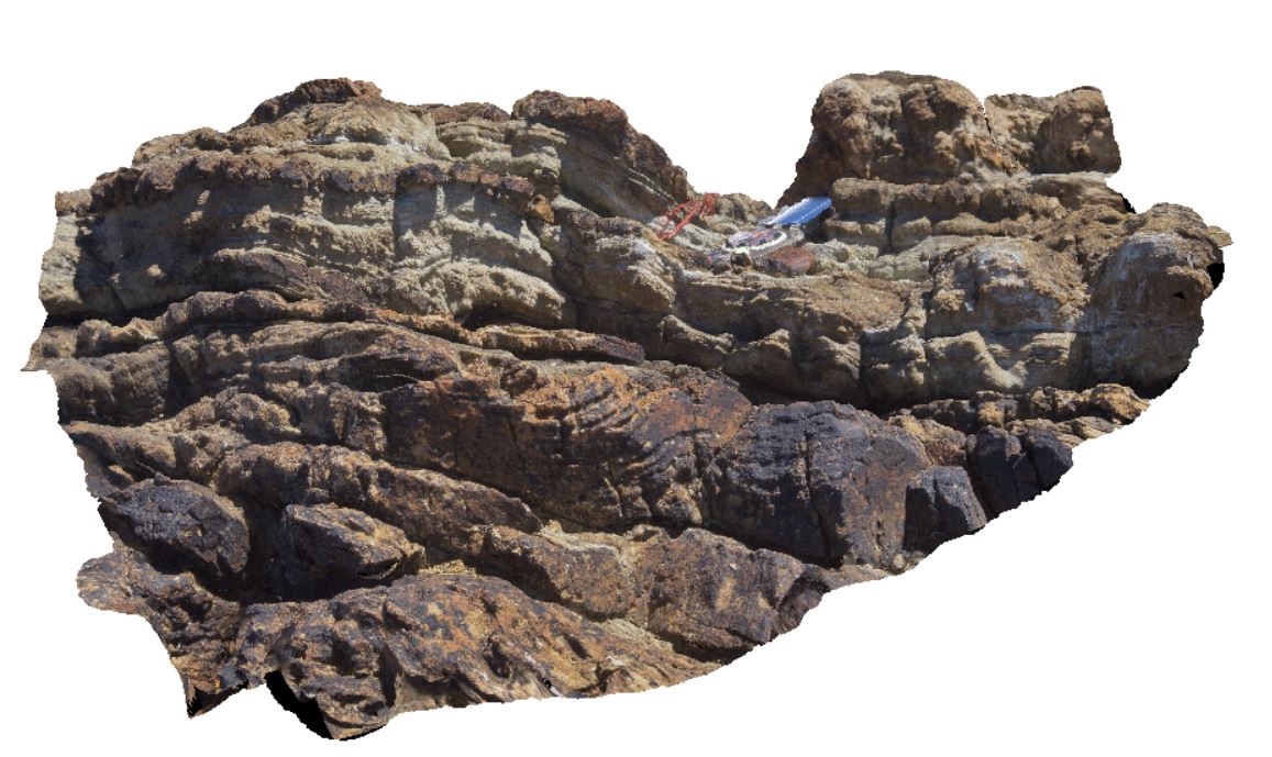
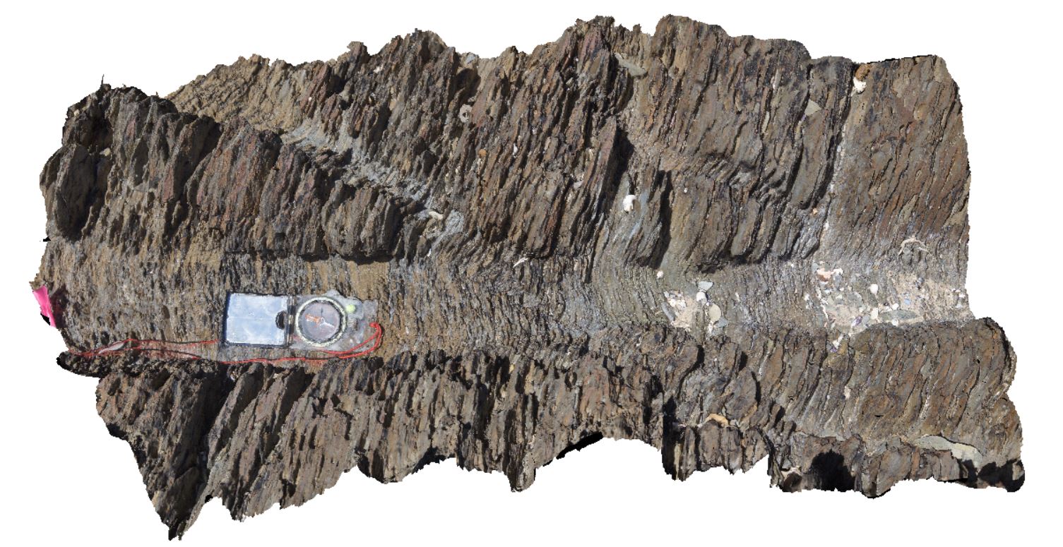
view showing rounded, fist-sized, aligned concretions in cross bedded sandstone. Wreak Beach, Vic. |
4.20 |
-38.75652000000 |
143.21480000000 |
-9999.000 |
concretion, sandstone |
sandstone |
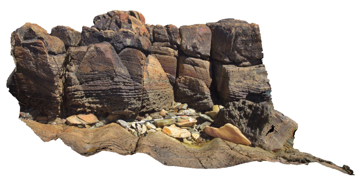
WTas1 Map
 |
5 |
01/01/9999 midnight |
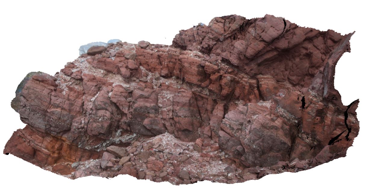
3D |
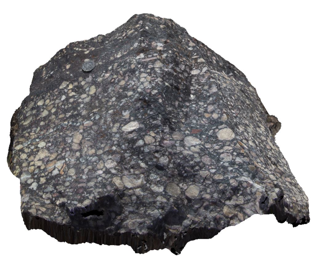
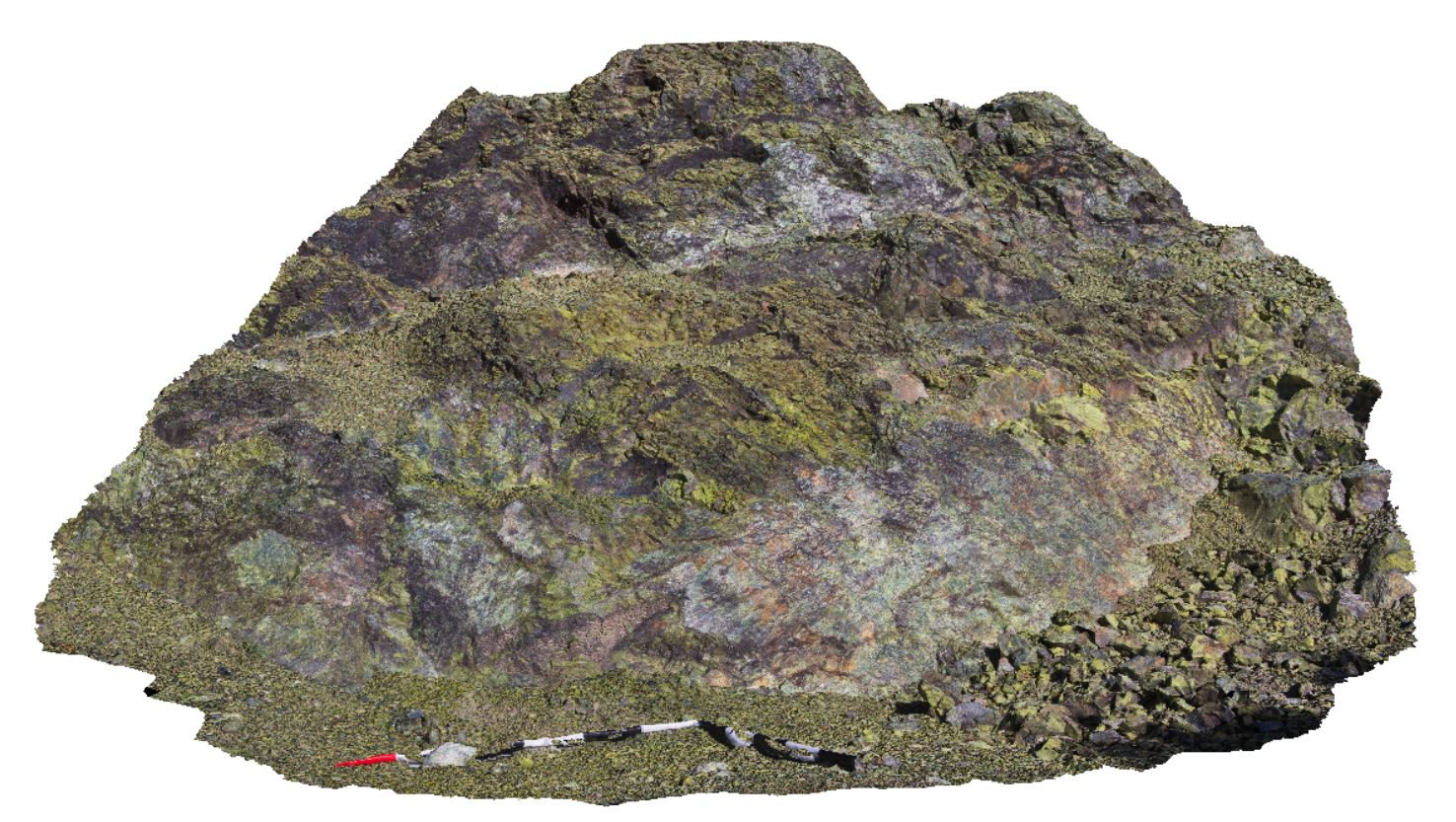
boulder of Owen conglomerate, Gormanston, Tas. |
0.80 |
-42.07930000000 |
145.59424000000 |
-9999.000 |
conglomerate |
conglomerate |
WTas10 Map
 |
5 |
01/01/9999 midnight |
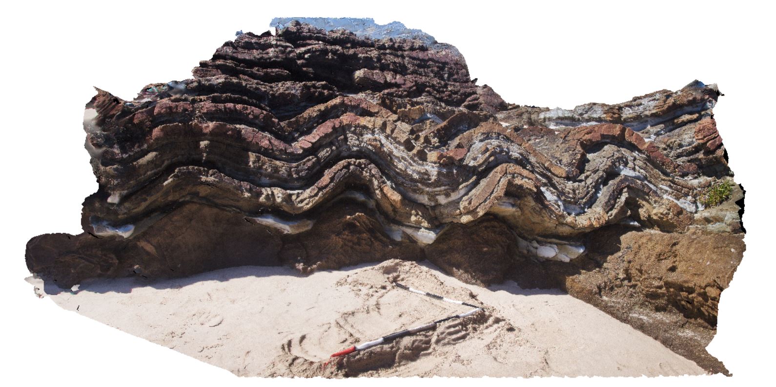
3D |
open folds in Oonah Formation metasedimentary rocks in road cut near Piney Creek. West Tasmania. |
75.00 |
-41.83059000000 |
145.26230000000 |
-9999.000 |
metasediments, quartzite, fold, structure |
metasediments |
WTas11 Map
 |
5 |
01/01/9999 midnight |
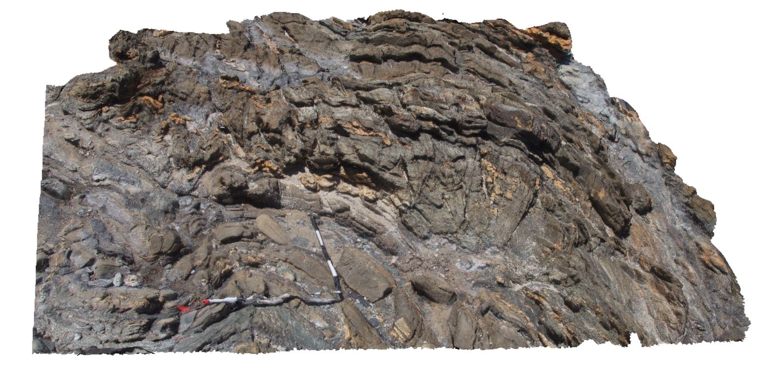
3D |
reclined fold in Oonah Formation metasedimentary rocks in road cut near Piney Creek. West Tasmania. |
100.00 |
-41.83089000000 |
145.25879000000 |
-9999.000 |
reclined fold, fold, structure |
quartzite |
WTas12 Map
 |
5 |
01/01/9999 midnight |
3D |
open folds in thinly bedded sandstone and siltstone. Granville Harbour, West Tasmania. |
5.00 |
-41.80283000000 |
145.02208000000 |
-9999.000 |
fold, open fold, structure |
metasediment |
WTas13 Map
 |
5 |
01/01/9999 midnight |
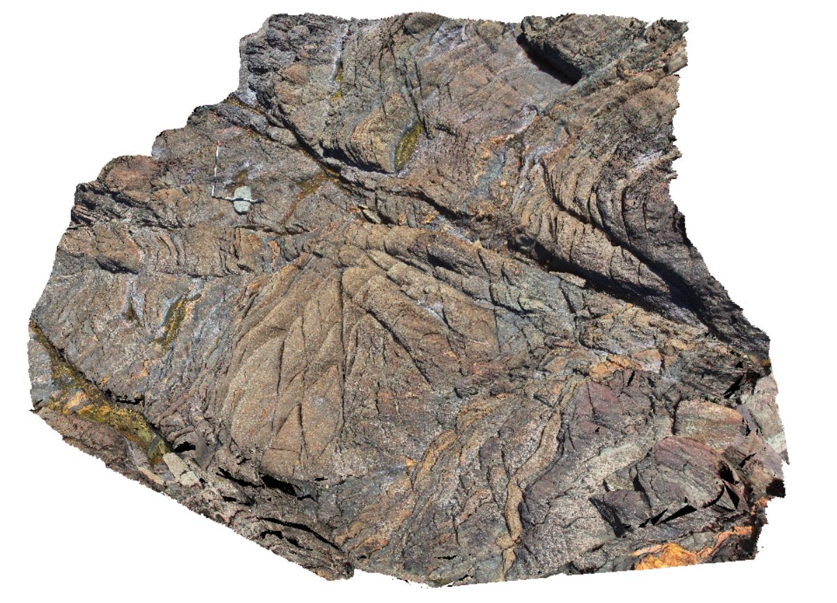
3D |
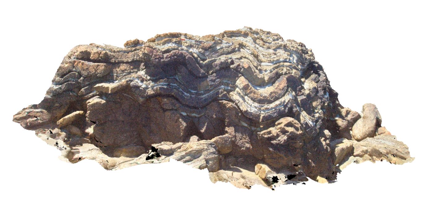
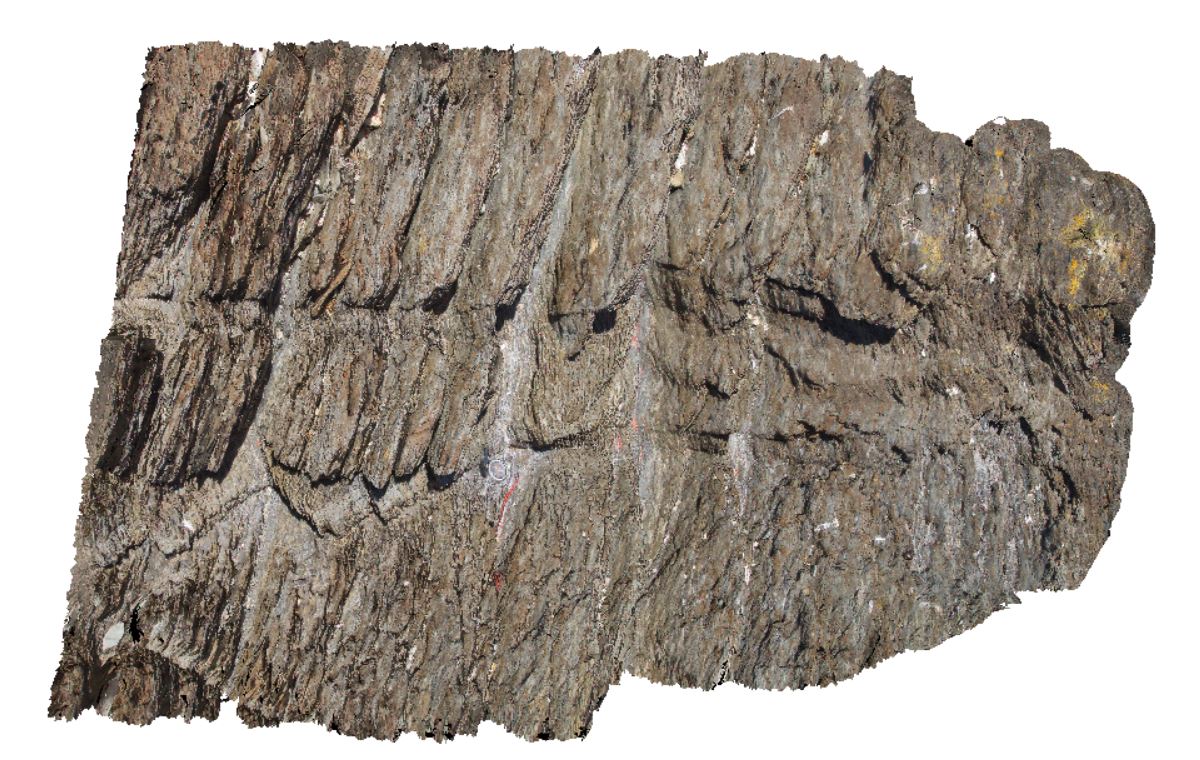
folds and cross bedding in Silurian Eldon Group rocks. Lineations also evident. Duck Creek, west coast, Tasmania. |
4.00 |
-41.76839000000 |
145.00342000000 |
-9999.000 |
fold, structure, cross bedding, sedimentology, lineation, L0, L1 |
sandstone |
WTas14 Map
 |
5 |
01/01/9999 midnight |
3D |
'S' folds on fold limb in Silurian Eldon Group sandstones and siltstones. Duck Creek, west coast, Tasmania. |
3.00 |
-41.76817000000 |
145.00381000000 |
-9999.000 |
fold, 'S' fold, fold limb, structure |
sandstone |
WTas15 Map
 |
5 |
01/01/9999 midnight |
3D |
slightly asymmetric folds in finely bedded sandstones and siltstones. Duck Creek, west coast, Tasmania. |
2.50 |
-41.76809000000 |
145.00375000000 |
-9999.000 |
fold, asymmetric fold, structure |
sandstone |
WTas16 Map
 |
5 |
01/01/9999 midnight |
3D |
small asymmetric folds and cross beds in Eldon Group rocks on fold limb. Duck Creek, west coast, Tasmania. |
0.80 |
-41.76812000000 |
145.00432000000 |
-9999.000 |
asymmetric fold, fold, structure, fold limb |
sandstone |
WTas17 Map
 |
5 |
01/01/9999 midnight |
3D |
symmetric folds in fold axis. Eldon Group rocks. Duck Creek, west coast, Tasmania. |
3.00 |
-41.76806000000 |
145.00407000000 |
-9999.000 |
symmetric fold, fold, structure, fold axis |
sandstone |
WTas18 Map
 |
5 |
01/01/9999 midnight |
3D |
open, symmetric folds with irregular spaced transecting cleavage. Duck Creek, west coast, Tasmania. |
1.80 |
-41.76797000000 |
145.00395000000 |
-9999.000 |
symmetric fold, fold, structure, cleavage, spaced cleavage |
sandstone |
WTas19 Map
 |
5 |
01/01/9999 midnight |
3D |
slightly asymmetric folds in thinly bedded sandstones and siltstones. Duck Creek, west coast, Tasmania. |
3.20 |
-41.76785000000 |
145.00401000000 |
-9999.000 |
fold, asymmetric fold, structure, bedding |
sandstone |
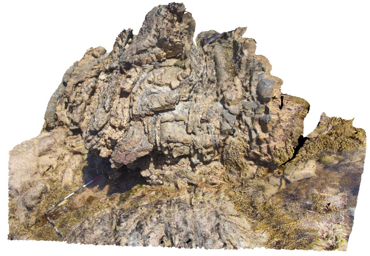
WTas2 Map
 |
5 |
01/01/9999 midnight |
3D |
open folding in Owen Group red sandstone with conglomerate lenses and cut by quartz veins. Gormanston, Tasmania. |
5.00 |
-42.07760000000 |
145.59273000000 |
-9999.000 |
open fold, Owen Group, fold, structure |
sandstone |
WTas20 Map
 |
5 |
01/01/9999 midnight |
3D |
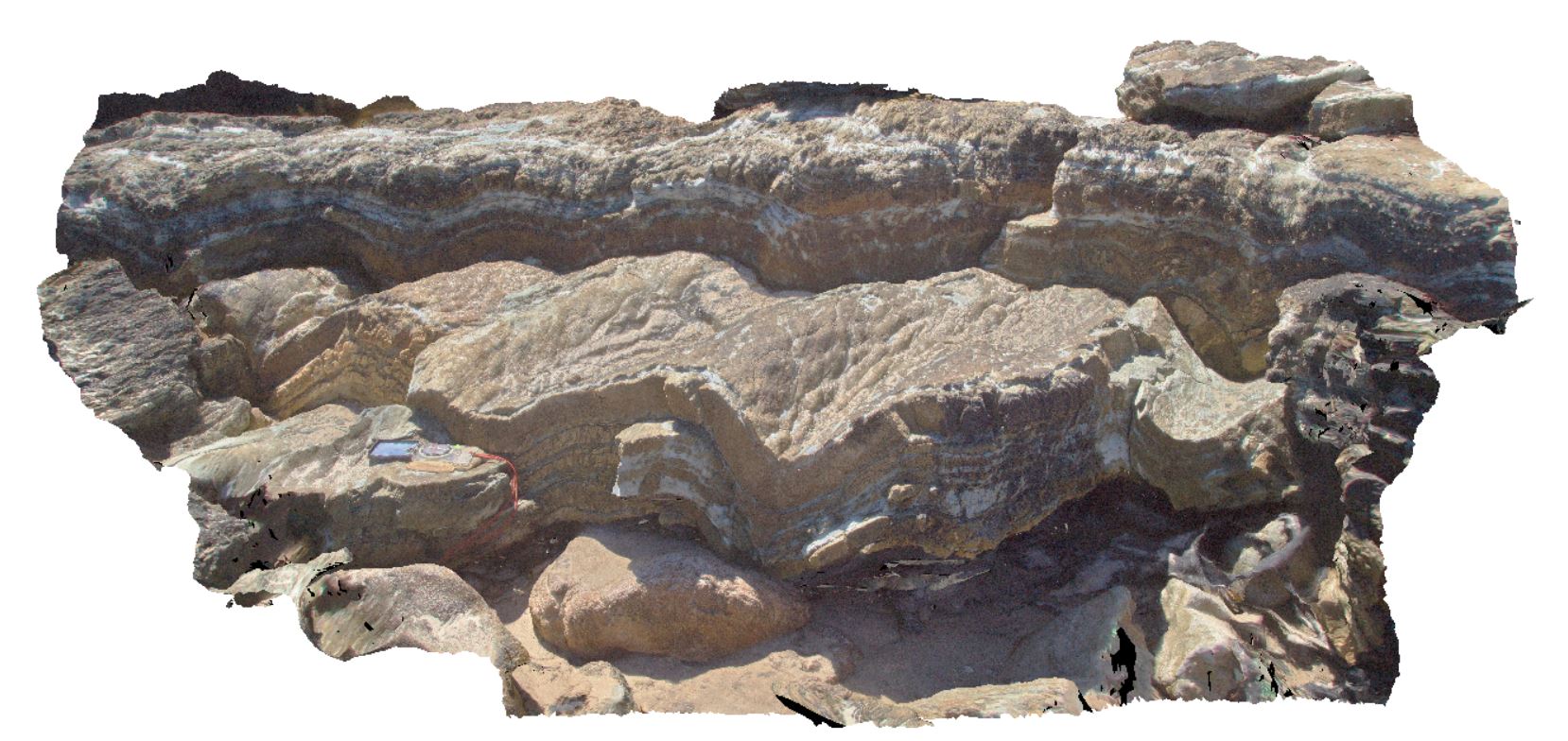
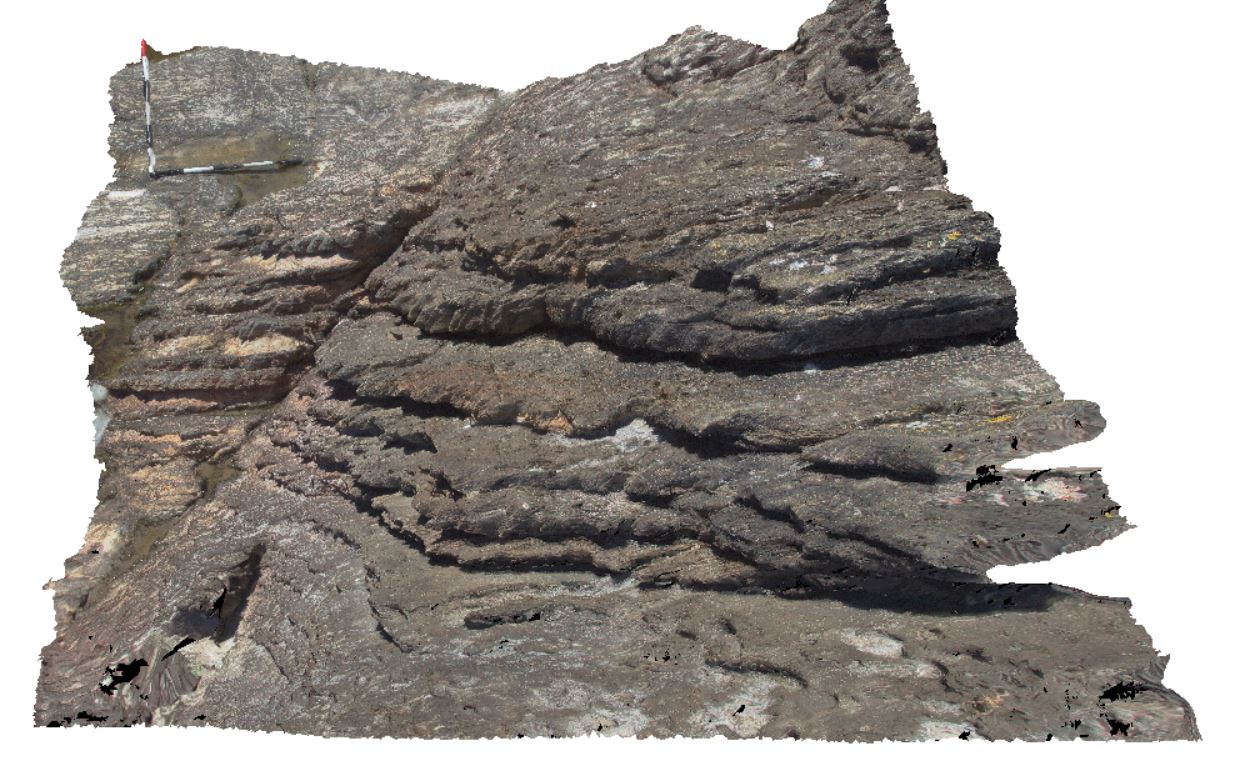
open folds with spaced cleavage? In thinly bedded, cross-bedded sandstone of the Eldon Group. Duck Creek, west coast, Tasmania. |
3.20 |
-41.76774000000 |
145.00415000000 |
-9999.000 |
open fold, fold, structure, cross bedding |
sandstone |
WTas21 Map
 |
5 |
01/01/9999 midnight |
3D |
folded beds with crenulated, phyllitic cleavage and disrupted quartz veins. North of Duck Creek, west coast, Tasmania. |
0.00 |
-41.76512000000 |
145.00049000000 |
-9999.000 |
fold, cleavage, phyllitic cleavage, structure, quartz veins |
metasediments |
WTas22 Map
 |
5 |
01/01/9999 midnight |
3D |
folded and faulted sedimentary rocks of the Oonah Formation. North of Duck Creek, west coast, Tasmania. |
0.00 |
-41.76543000000 |
145.00070000000 |
-9999.000 |
fold, cleavage, fault |
sandstone |
WTas23 Map
 |
5 |
01/01/9999 midnight |
3D |
steeply dipping, sandy shales, with spaced cleavage, cross-cut by kink bands / crenulated cleavage. North of Duck Creek, west coast, Tasmania. |
1.00 |
-41.76581000000 |
145.00122000000 |
-9999.000 |
crenulated cleavage, kink band, cleavage, structure, shale, Bell Shale |
shale |
WTas24 Map
 |
5 |
01/01/9999 midnight |
3D |
steeply dipping, sandy shales, with spaced cleavage, cross-cut by kink bands / crenulated cleavage. North of Duck Creek, west coast, Tasmania. |
1.40 |
-41.76581000000 |
145.00122000000 |
-9999.000 |
spaced cleavage, crenulated cleavage, kink band, cleavage, structure, dip |
shale |
WTas25 Map
 |
5 |
01/01/9999 midnight |
3D |
moderately to steeply dipping, sandy shale, with spaced cleavage, cross-cut by kink bands / crenulated cleavage. North of Duck Creek, west coast, Tasmania. |
2.60 |
-41.76577000000 |
145.00139000000 |
-9999.000 |
dip, cleavage, kink band, crenulated cleavage, structure |
shale |
WTas26 Map
 |
5 |
01/01/9999 midnight |
3D |
bedding layering in shale, intensely disrupted by anastomosing cleavage. North of Duck Creek, west coast, Tasmania. |
0.65 |
-41.76564000000 |
145.00153000000 |
-9999.000 |
anastomosing cleavage, cleavage, structure |
shale |
WTas27 Map
 |
5 |
01/01/9999 midnight |
3D |
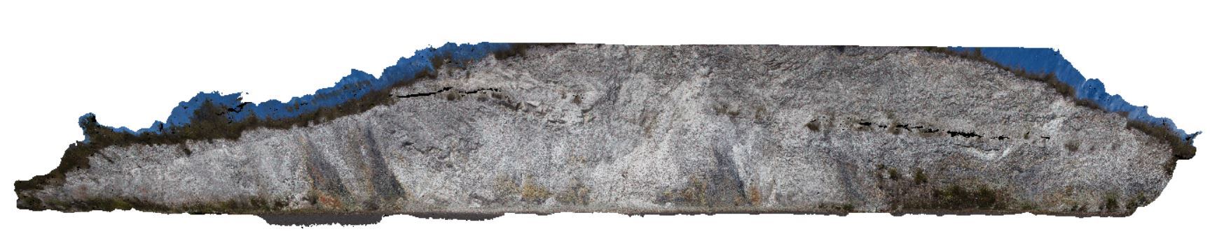
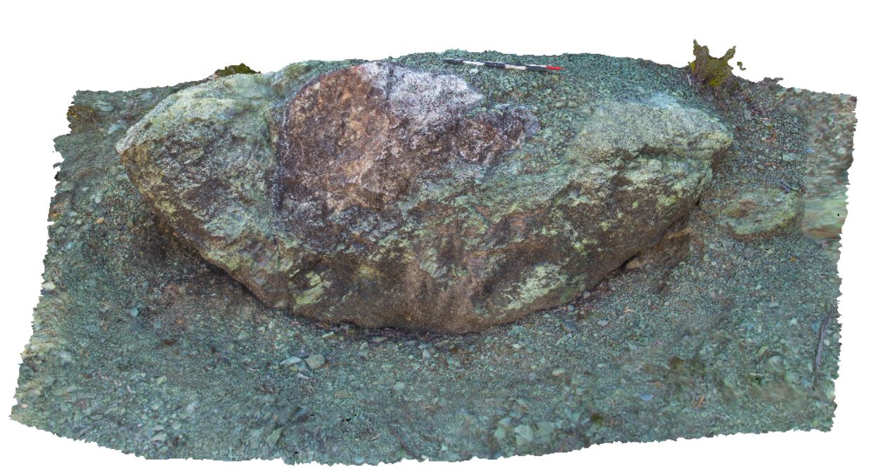
quarry in ultramafic rock that has been pervasively serpentinised. Highway to Zeehan, near Mount Razorback. West Tasmania. |
5.00 |
-41.82995000000 |
145.41296000000 |
-9999.000 |
serpentinite, ultramafic, quarry |
ultramafic |
WTas28 Map
 |
5 |
01/01/9999 midnight |
3D |
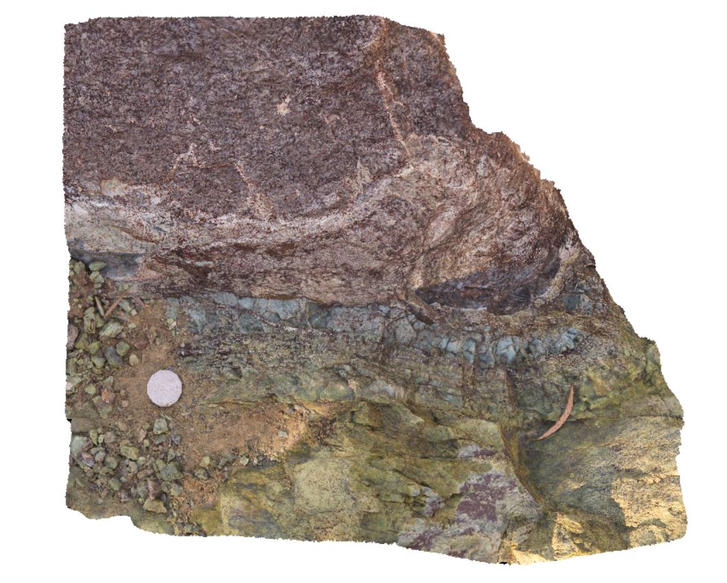
quarry in ultramafic rock, showing boulder with serpentinite altered rim and preserved core. Murchison Highway to Zeehan, near Mount Razorback. West Tasmania. |
4.00 |
-41.82993000000 |
145.41266000000 |
-9999.000 |
ultramafic, quarry, serpentinite |
ultramafic |
WTas29 Map
 |
5 |
01/01/9999 midnight |
3D |
ultramafic rock, showing detail of contact reaction rim from site WTas28. Quarry on Murchison Highway to Zeehan, near Mount Razorback. West Tasmania. |
0.60 |
-41.82993000000 |
145.41266000000 |
-9999.000 |
contact reaction, ultramafic, serpentinite |
ultramafic |
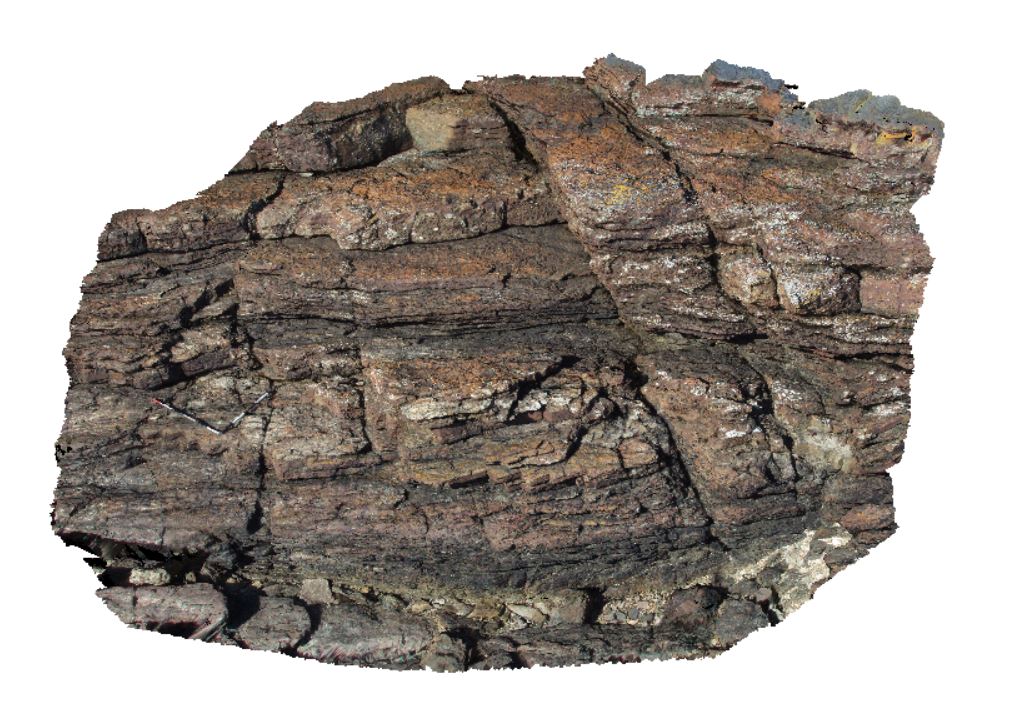
WTas3 Map
 |
5 |
01/01/9999 midnight |
3D |
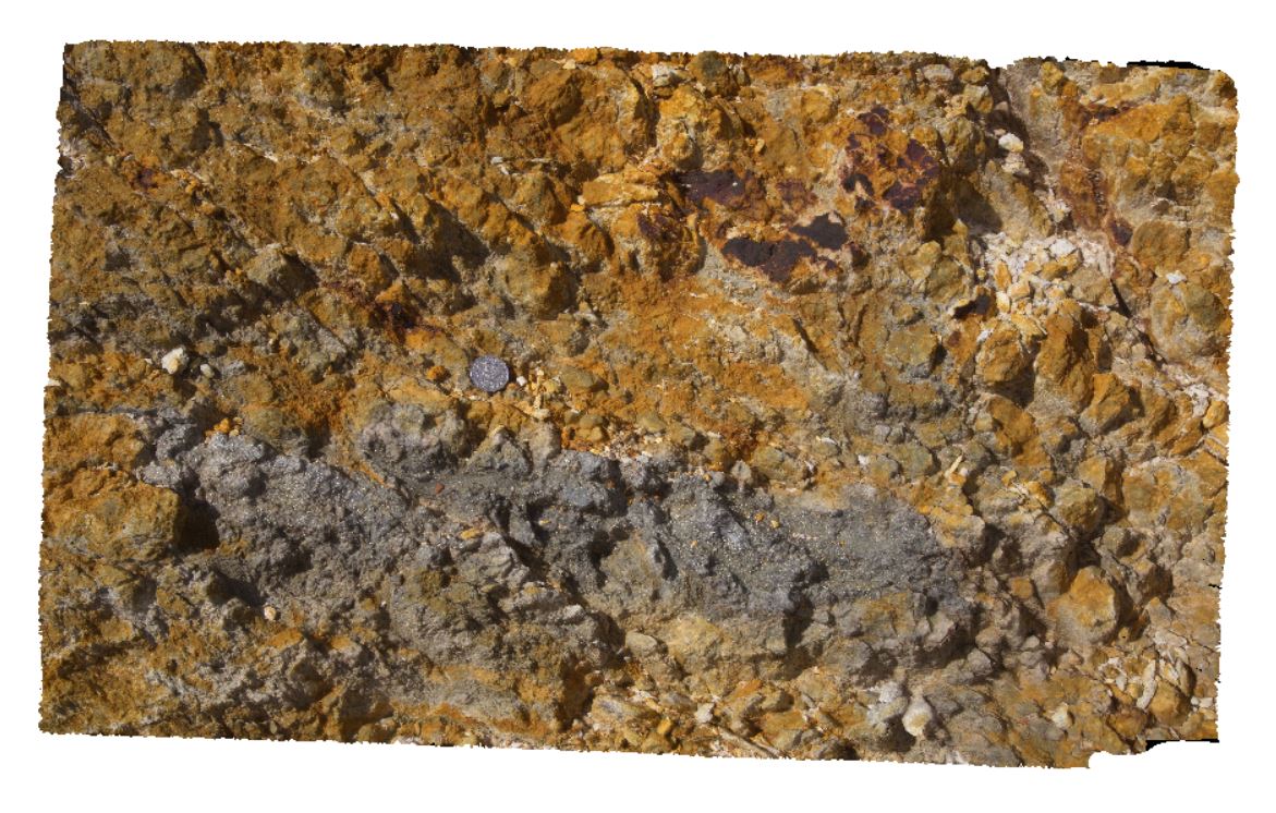
qtz-sericite-pyrite alteration in Lyell Schist, Mt Lyell, Queenstown, Tasmania. |
1.00 |
-42.07684000000 |
145.58220000000 |
-9999.000 |
Lyell Schist, Mt Lyell, schist |
schist |