Windjana2 Map
 |
0 |
06/05/2016 noon |
3D |
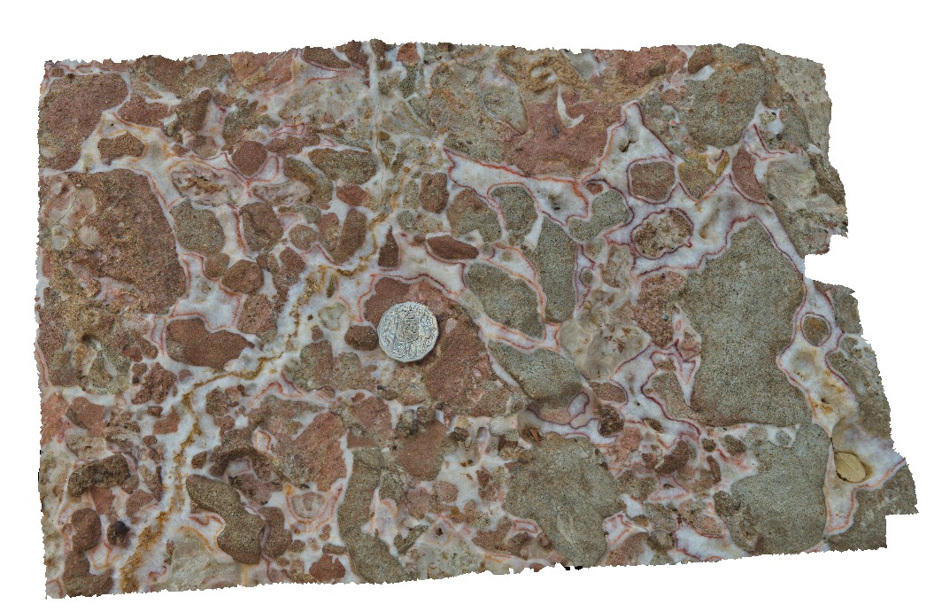
detailed view of cockade banding of calcite cement in conglomerate. East Windjara Gorge, W.A. |
0.00 |
-17.41123000000 |
124.97225000000 |
-9999.000 |
conglomerate, reef-margin facies, cockade banding |
conglomerate |
Windjana3 Map
 |
0 |
06/05/2016 noon |
3D |
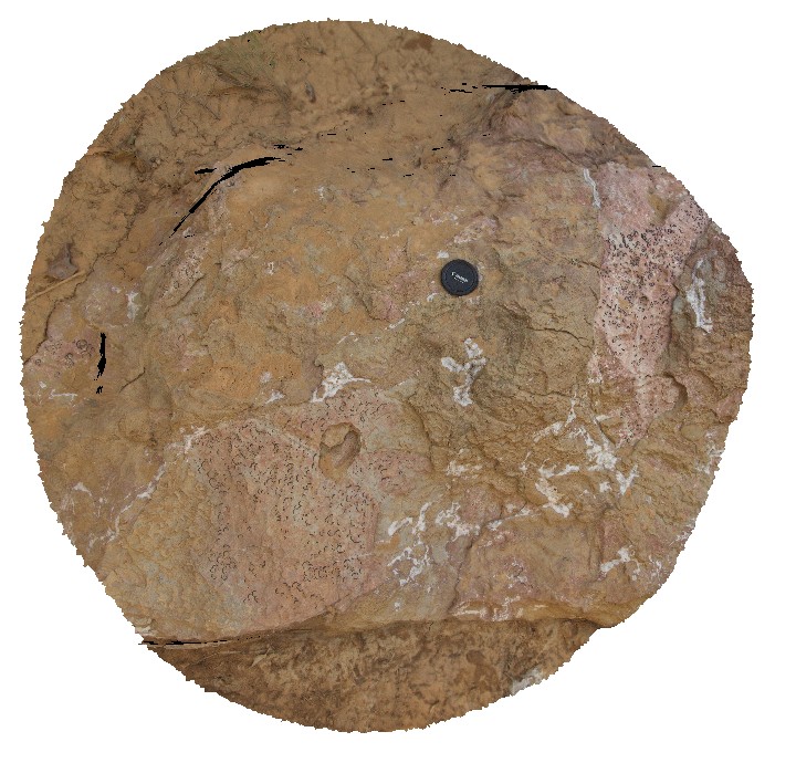
large fossiliferous clasts in block of limestone conglomerate / debris flow? East Windjana Gorge, W.A. |
1.50 |
-17.41121000000 |
124.97224000000 |
-9999.000 |
fossiliferous, limestone, conglomerate, fossil, palaeontology |
conglomerate |
Windjana4 Map
 |
0 |
06/05/2016 noon |
3D |
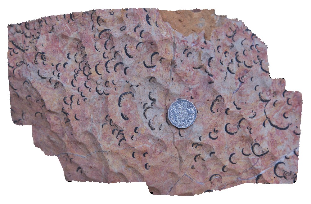
detail of fossils from site Windjana3. East Windjana Gorge, W.A. |
0.30 |
-17.41121000000 |
124.97224000000 |
-9999.000 |
fossiliferous limestone, fossil, palaeontology |
limestone |
Windjana5 Map
 |
0 |
06/05/2016 noon |
3D |
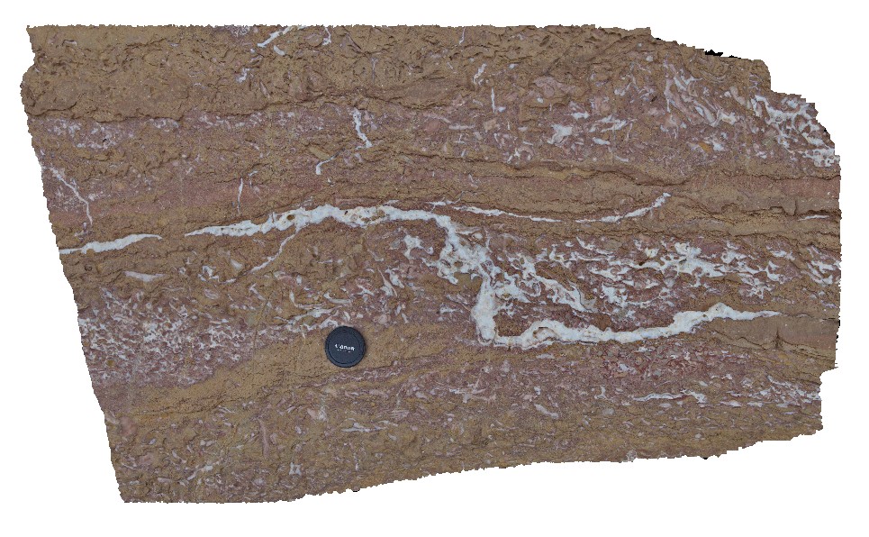
conglomerate with sparry calcite cement, East Windjara Gorge, W.A. |
0.00 |
-17.41102000000 |
124.97226000000 |
-9999.000 |
sparry calcite cement, limestone conglomerate |
conglomerate |
WindjanaFSP1 Map
 |
0 |
06/05/2016 noon |
FSP |
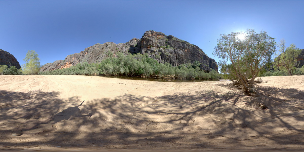
view of the 'Classic Face' of Windjana Gorge, showing different reef facies. Windjana Gorge, W.A. |
500.00 |
-17.41155000000 |
124.96238000000 |
-9999.000 |
palaeontology, fossil, Classic Face, reef |
limestone, limestone |
WindjanaFSP2 Map
 |
0 |
06/05/2016 noon |
FSP |
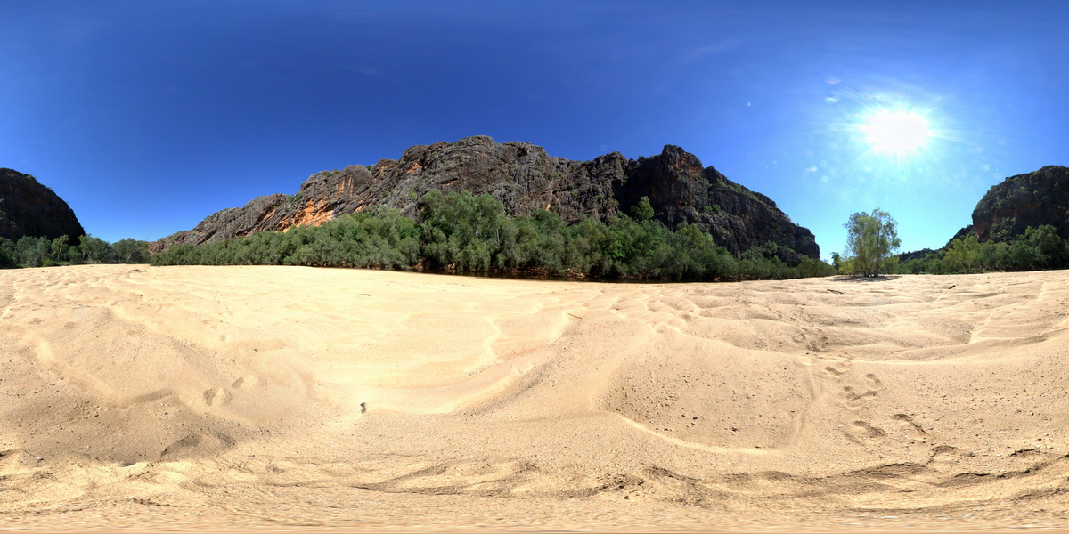
view of the 'Classic Face' of Windjana Gorge, showing different reef facies. Windjana Gorge, W.A. |
500.00 |
-17.41243000000 |
124.96246000000 |
-9999.000 |
Classic Face, Windjana Gorge, Reef Facies, Devonian reef, palaeontology |
limestone, limestone |
WindjanaFSP3 Map
 |
0 |
06/05/2016 noon |
FSP |
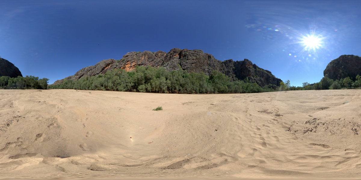
view of the 'Classic Face' of Windjana Gorge, showing different reef facies. Windjana Gorge, W.A. |
500.00 |
-17.41253000000 |
124.96309000000 |
-9999.000 |
palaeontology, Devonian Reef, Classic Face, Windjana Gorge |
limestone, limestone |
WindjanaUAV1 Map
 |
0 |
06/05/2016 noon |
UAV |
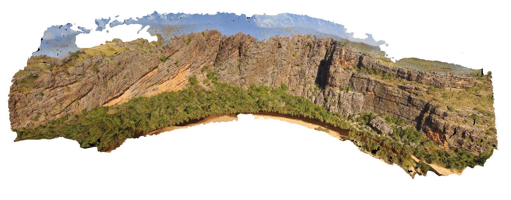
view of the ~400m 'Classic Face' of the reef facies at Windana Gorge, showing fore-reef, reefal-slope and platform facies and also, reef front and other reef facies. Windjana Gorge, W.A. |
400.00 |
-17.41218800000 |
124.96265530000 |
-9999.000 |
Reef facies, limestone, Windgana Gorge, sedimentology |
limestone, limestone |
Wongwibinda1 Map
 |
5 |
06/16/2015 5:43 p.m. |
3D |
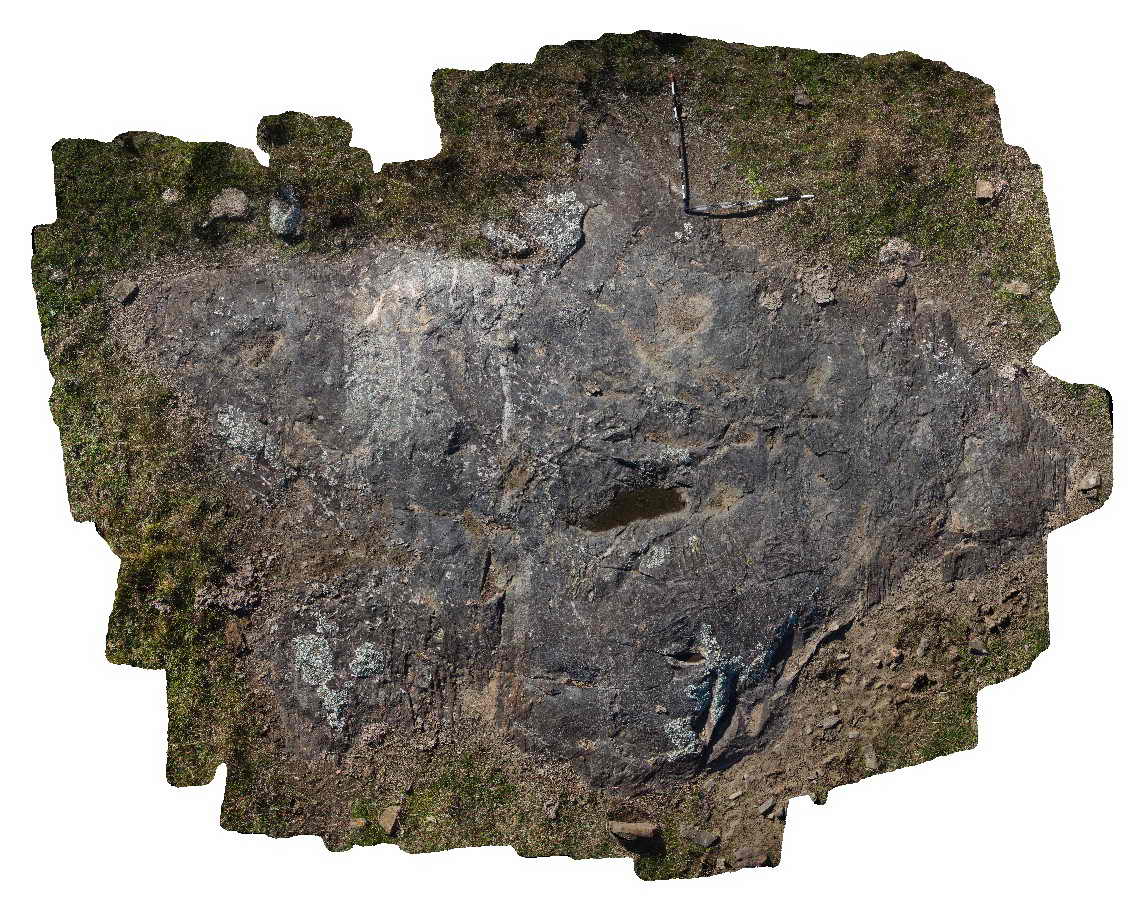
Pavement of migmatised metasedimentary rocks of the Carboniferous Wongwibinda Complex. Guyra Road, N.S.W. |
5.00 |
-30.27490000000 |
152.10399000000 |
1260.000 |
migmatite, metamorphic, high temperature |
migmatite |
Wongwibinda2 Map
 |
5 |
06/16/2015 5:45 p.m. |
3D |
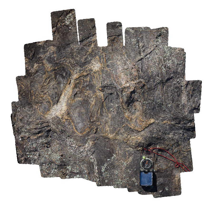
Detailed view of folded leucosomes in a pavement of migmatised metasedimentary rocks of the Carboniferous Wongwibinda Complex. Guyra Road, N.S.W. |
1.00 |
-30.27490000000 |
152.10399000000 |
1260.000 |
migmatite, metamorphism, igneous, fold, structure, high temperature |
migmatite |
Wongwibinda3 Map
 |
1 |
06/16/2015 5:46 p.m. |
3D |
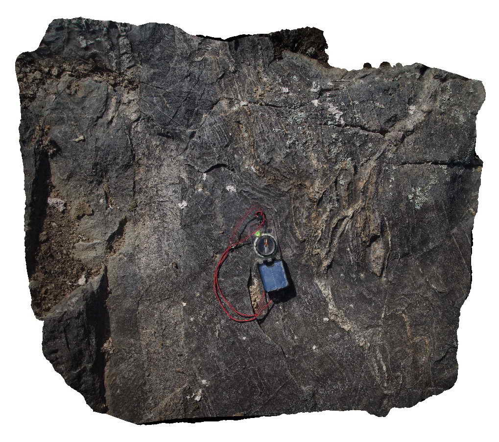
Detail of folded leucosomes and a thin granitic dyke in metasedimentary rocks of the Carboniferous Wongwibinda Complex. Guyra Road, N.S.W. |
1.00 |
-30.27490000000 |
152.10399000000 |
-9999.000 |
leucosome, migmatite, high temperature metamorphism, dyke, fold, structure |
migmatite, microgranite |
Wongwibinda4 Map
 |
5 |
06/16/2015 5:46 p.m. |
3D |
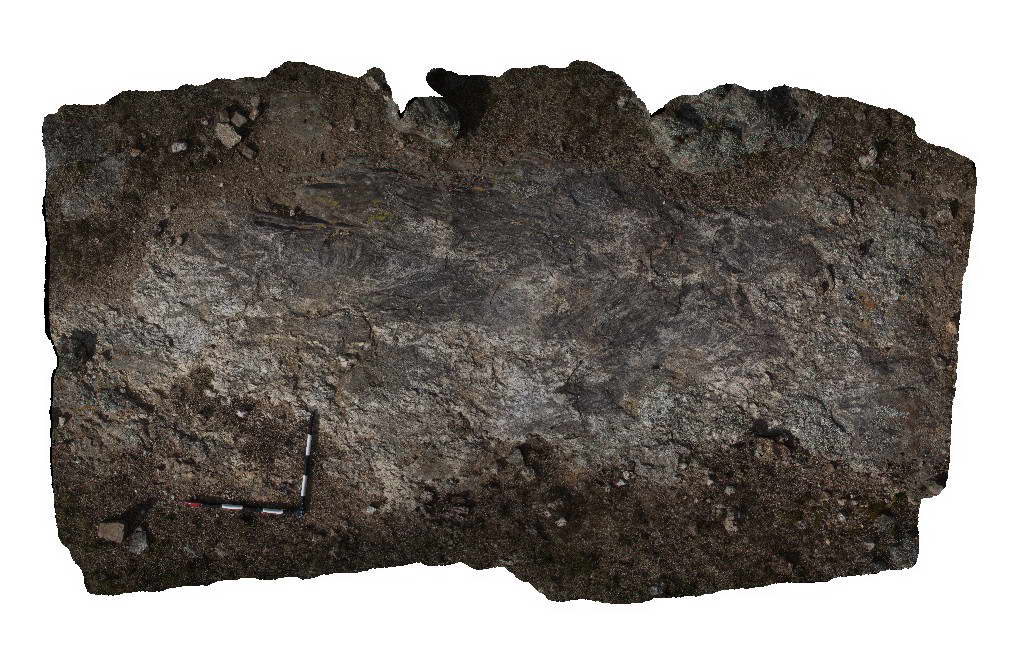
Pavement of migmatite in the Carboniferous Wongwibinda Complex. Guyra Road, N.S.W. |
5.00 |
-30.27561000000 |
152.10387000000 |
1260.000 |
migmatite, high temperature metamorphism |
migmatite |
Wongwibinda5 Map
 |
5 |
06/16/2015 5:47 p.m. |
3D |
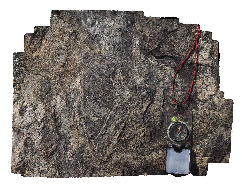
Detail of migmatite outcrop showing pervasive folded leucosomes. Carboniferous Wongwibinda Complex. Guyra Road, N.S.W. |
0.60 |
-30.27561000000 |
152.10387000000 |
1260.000 |
migmatite, leucosomes, folds, high temperature metamorphism, structure |
migmatite |
Wongwibinda6 Map
 |
5 |
06/16/2015 5:48 p.m. |
3D |
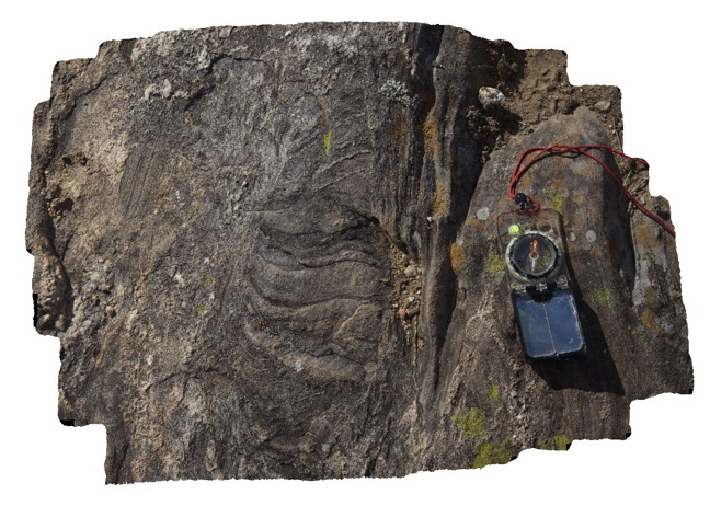
Detailed view of migmatite outcrop. Carboniferous Wongwibinda Complex. Guyra Road, N.S.W. |
0.60 |
-30.27561000000 |
152.10387000000 |
1260.000 |
migmatite, leucosomes, high temperature metamorphism, structure |
migmatite |
Wongwibinda7 Map
 |
5 |
06/16/2015 5:48 p.m. |
3D |
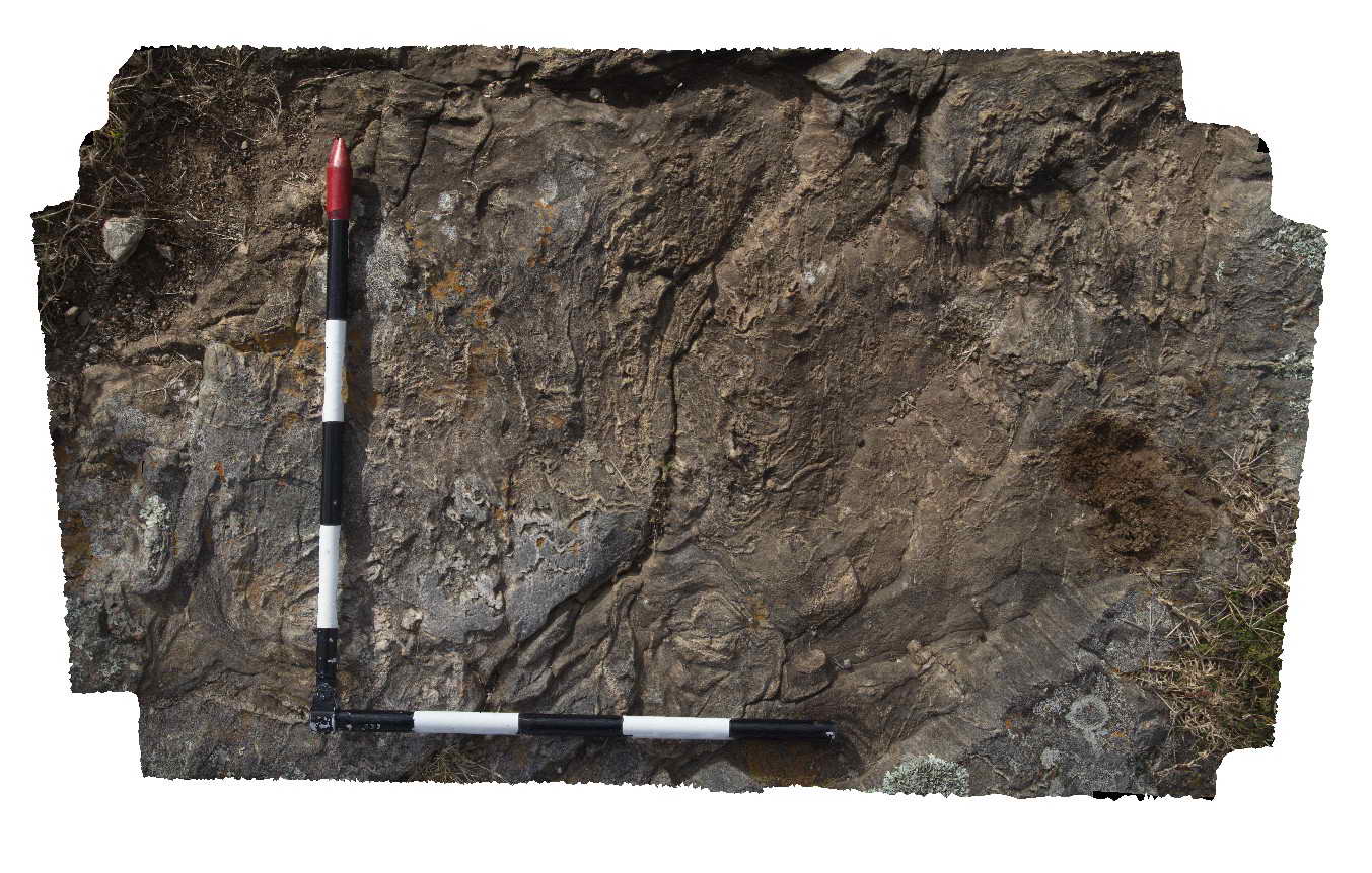
Migmatite outcrop with abundant folded leucosomes. Carboniferous Wongwibinda Complex. Guyra Road, N.S.W. |
1.00 |
-30.28173000000 |
152.15536000000 |
1240.000 |
migmatite, leucosomes, structure, folds, high temperature metamorphism |
migmatite |
WreckBeach1 Map
 |
0 |
06/14/2016 2:13 p.m. |
3D |
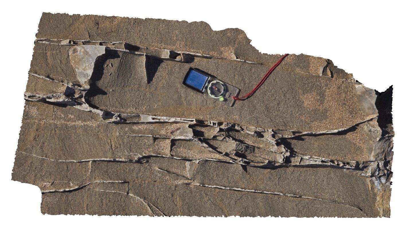
shore platform exposure of multiple carbonate veins in well sorted sandstone. Wreck Beach, Vic. |
1.20 |
-38.75579000000 |
143.21394000000 |
-9999.000 |
sandstone, carbonate vein |
sandstone |
WreckBeach10 Map
 |
0 |
06/14/2016 2:34 p.m. |
3D |
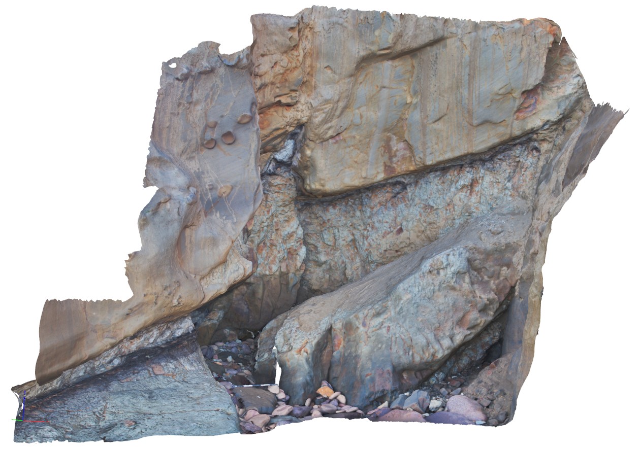
fault zone cutting sandstone and mudstone layers with some coaly fragments. Wreck Beach, Vic. |
3.50 |
-38.75656000000 |
143.21494000000 |
-9999.000 |
fault, coal, sedimentology |
sandstone |
WreckBeach11 Map
 |
0 |
06/14/2016 2:06 p.m. |
3D |
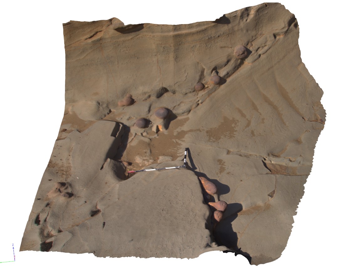
view of concretion horizons in cross-bedded sandstone. Wreck Beach, Vic. |
3.00 |
-38.75724000000 |
143.21513000000 |
-9999.000 |
concretions, cross-bedded, sedimentology |
sandstone |
WreckBeach12 Map
 |
0 |
06/14/2016 2:38 p.m. |
3D |
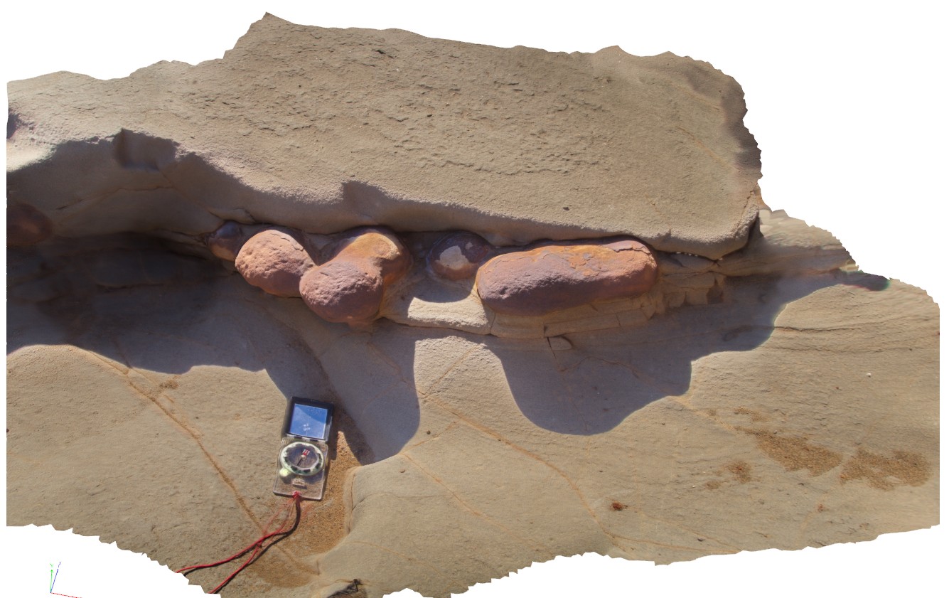
view of concretion horizons in cross-bedded sandstone. Wreck Beach, Vic. |
0.00 |
-38.75724000000 |
143.21513000000 |
-9999.000 |
concretions, cross-beds, sedimentology |
sandstone |
WreckBeach13 Map
 |
0 |
06/14/2016 2:42 p.m. |
3D |
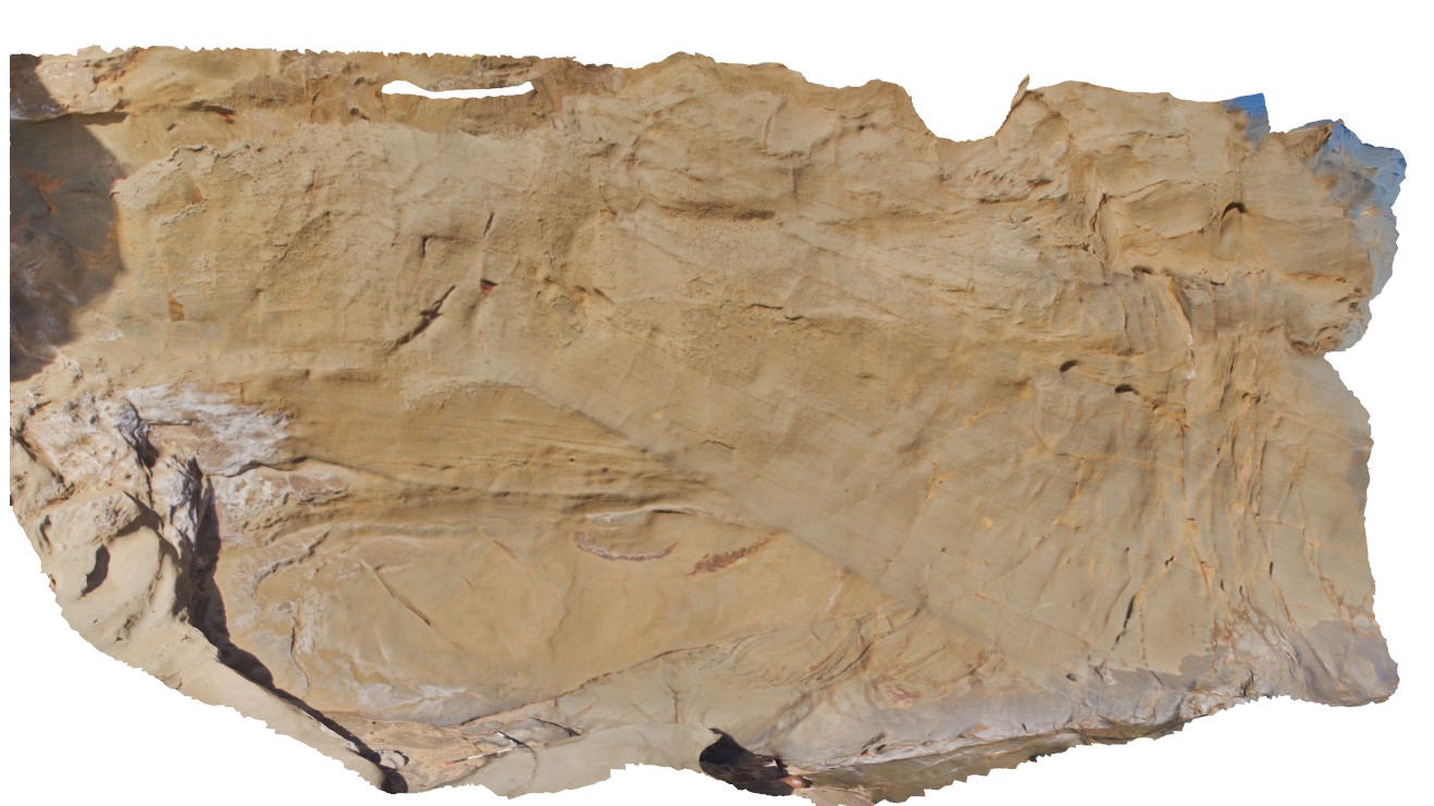
view of the side of a deep channel, showing cross-section through thick cross-beds in sandstone. Wreck Beach. Vic. |
6.50 |
-38.75755000000 |
143.21515000000 |
-9999.000 |
cross-bedding, sedimentology |
sandstone |
WreckBeach2 Map
 |
0 |
06/14/2016 2:13 p.m. |
3D |
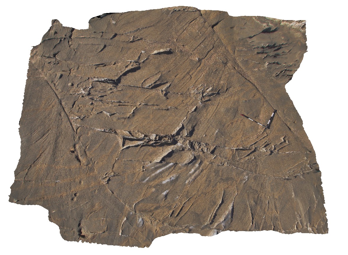
view of carbonate vein network in bedded sandstone. Veins show two dominant orientations. Wreck Beach, Vic. |
3.50 |
-38.75590000000 |
143.21396000000 |
-9999.000 |
carbonate vein, vein network, sedimentology |
sandstone |
WreckBeach3 Map
 |
0 |
06/14/2016 2:19 p.m. |
3D |
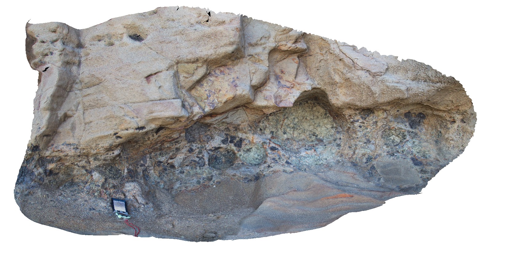
view of mud pellet conglomerate layer in cross bedded sandstone. Wreck Beach, Vic. |
1.00 |
-38.75611000000 |
143.21428000000 |
-9999.000 |
mud pellet, sedimentology |
sandstone |
WreckBeach4 Map
 |
0 |
06/14/2016 2:19 p.m. |
3D |
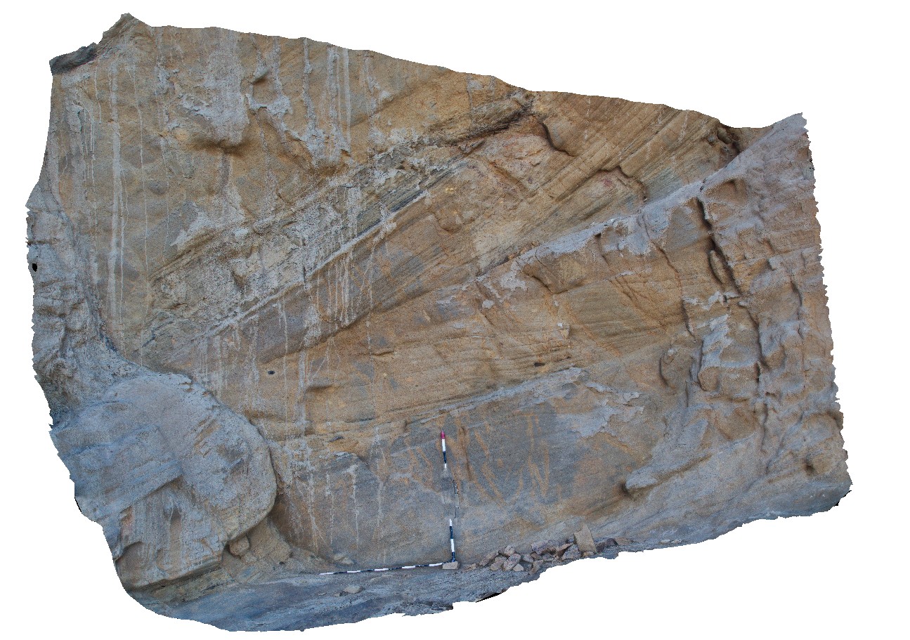
cliff exposure showing cross bedding in sandstone units, Wreck Beach. Vic. |
2.50 |
-38.75616000000 |
143.21423000000 |
-9999.000 |
cross bedding, sandstone |
sandstone |
WreckBeach5 Map
 |
0 |
06/14/2016 2:25 p.m. |
3D |
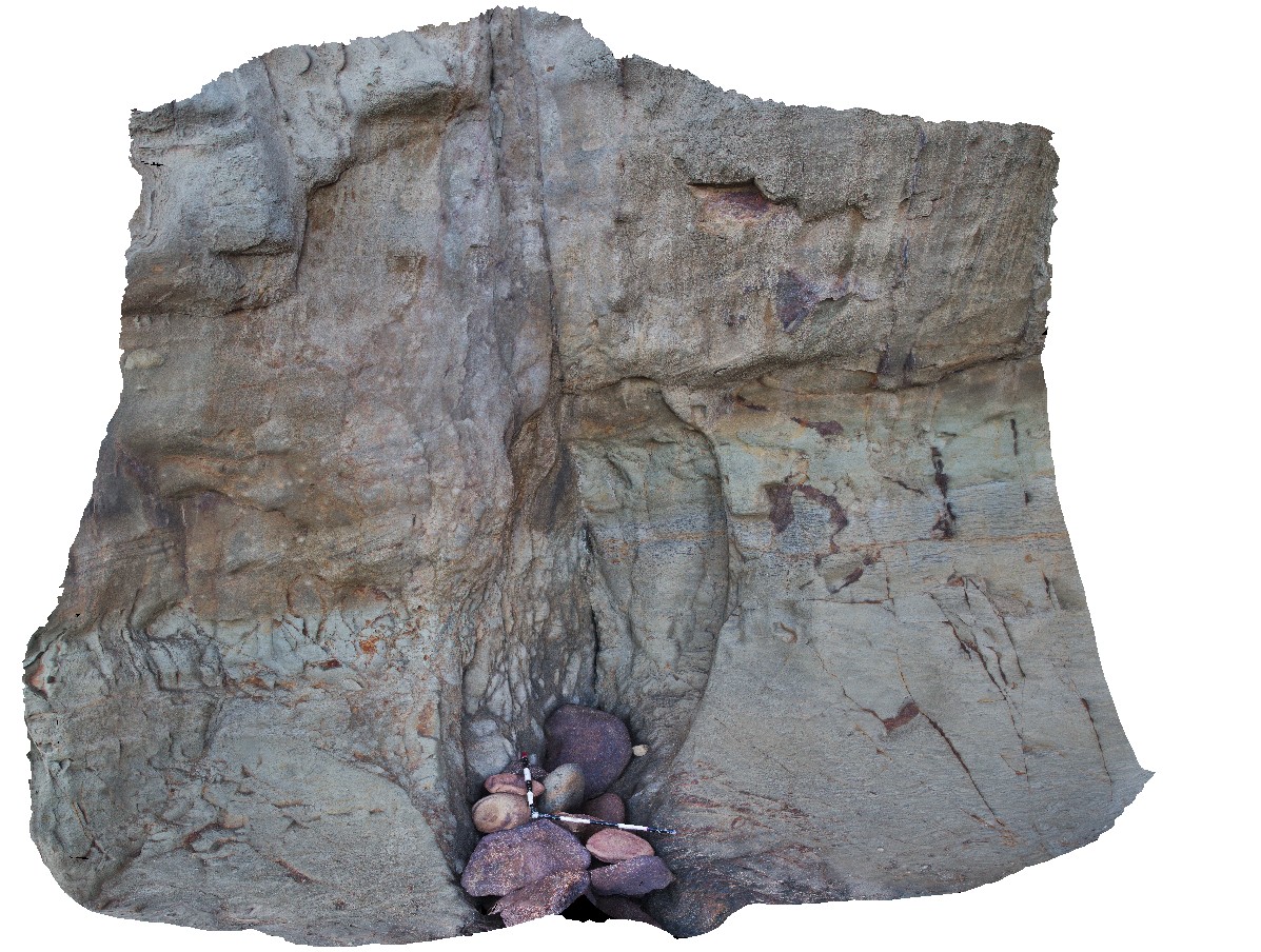
view of sub-vertical? Fault cutting sandstone with fault breccia. Wreck Beach, Vic. |
3.00 |
-38.75634000000 |
143.21460000000 |
-9999.000 |
fault, fault breccia, structure, sandstone |
sandstone |
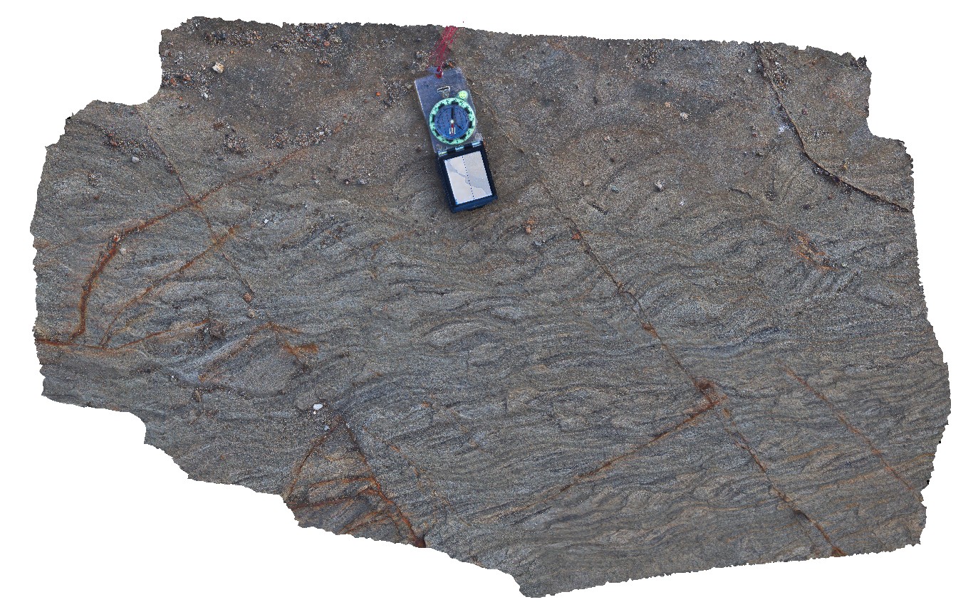
WreckBeach6 Map
 |
0 |
06/14/2016 2:30 p.m. |
3D |
shore platform exposure of oblique view through ripple cross stratification in sandstone. Wreck Beach, Vic. |
1.00 |
-38.75635000000 |
143.21468000000 |
-9999.000 |
ripple marks, sandstone, sedimentology |
sandstone |


