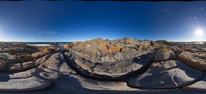
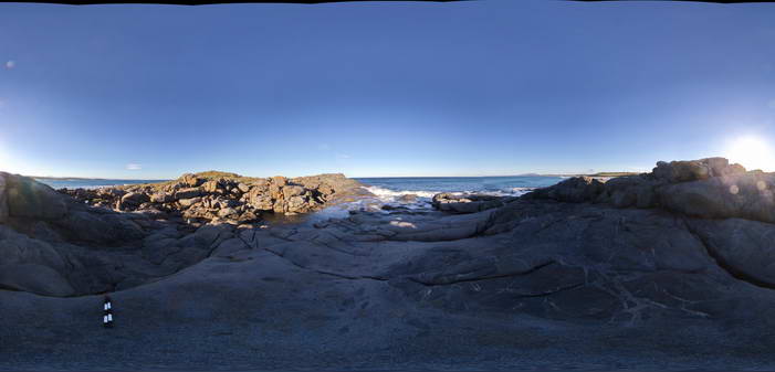
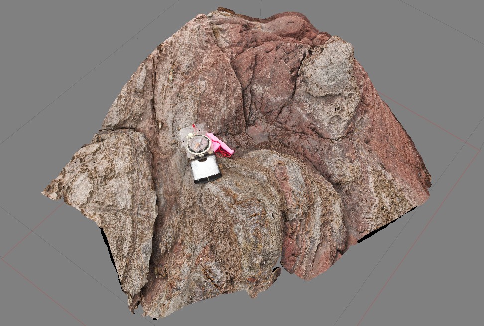
BingiFSP1 Map
 |
5 |
01/01/9999 midnight |
FSP |
View of granodiorite with cross-cutting 'dolerite' dyke. Bingi, N.S.W. |
50.00 |
-36.01247000000 |
150.16364000000 |
2.000 |
dyke, igneous, structure |
granodiorite, dolerite |
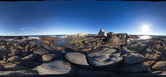
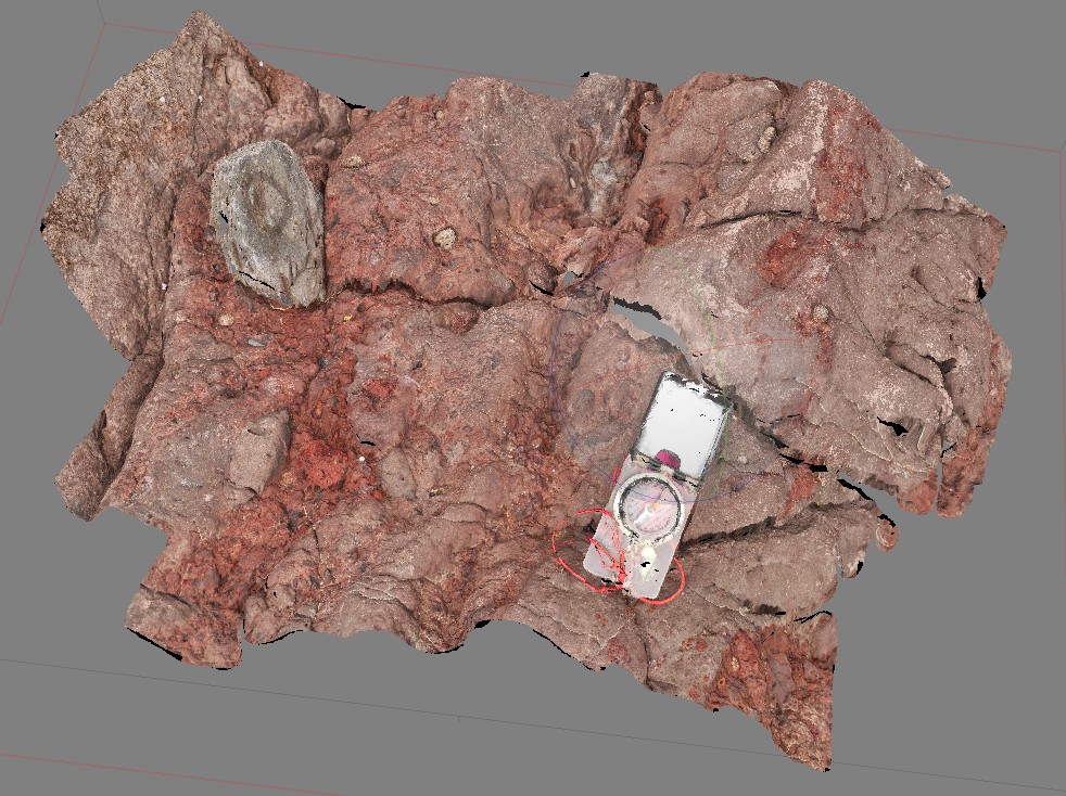
BingiFSP2 Map
 |
5 |
01/01/9999 midnight |
FSP |
View of granodiorite cut by an aplite dyke that is cut by a xenolith crowded 'dolerite' dyke. Bingi, N.S.W. |
50.00 |
-36.01248000000 |
150.16402000000 |
1.000 |
dykes, igneous, structure |
granodiorite, aplite, dolerite |
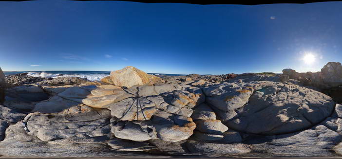
BingiFSP3 Map
 |
5 |
01/01/9999 midnight |
FSP |
View of granodiorite with multiple Xenoliths and the cross-cutting aplite dyke. Bingi, N.S.W. |
50.00 |
-36.01263000000 |
150.16399000000 |
3.000 |
dyke, igneous, xenolith |
granodiorite, aplite |
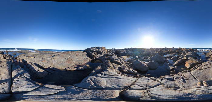
BingiFSP4 Map
 |
5 |
01/01/9999 midnight |
FSP |
View of jointed granodiorite cut by a dolerite dyke. Bingi, N.S.W. |
50.00 |
-36.01300000000 |
150.16405000000 |
2.000 |
joints, dyke, structure, igneous |
granodiorite, dolerite |
BingiFSP5 Map
 |
5 |
01/01/9999 midnight |
FSP |
View of jointed granodiorite cut by two generations of mafic dykes. Bingi, N.S.W. |
50.00 |
-36.01312000000 |
150.16391000000 |
4.000 |
dykes, igneous, structure |
granodiorite, dolerite |
BingiFSP6 Map
 |
5 |
01/01/9999 midnight |
FSP |
View of Jointed granodiorite cut by a 'red' mafic dyke. Bingi, N.S.W. |
50.00 |
-36.01323000000 |
150.16356000000 |
2.000 |
dyke, igneous, joints, structure |
granodiorite, dolerite |
BingiFSP7 Map
 |
5 |
01/01/9999 midnight |
FSP |
View of jointed granodiorite and diorite/gabbro. Bingi, N.S.W. |
50.00 |
-36.01328000000 |
150.16313000000 |
3.000 |
igneous, structure |
granodiorite, diorite |
BingiFSP8 Map
 |
5 |
01/01/9999 midnight |
FSP |
View of jointed granodiorite just east of the main zone of magma mingling. Bingi, N.S.W. |
50.00 |
-36.01313000000 |
150.16278000000 |
3.000 |
igneous, structure |
granodiorite |
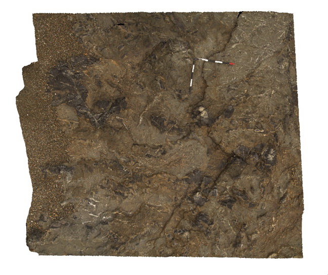
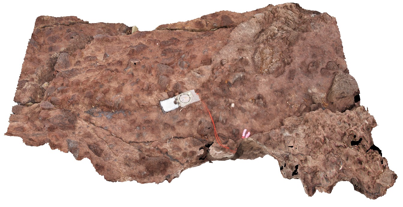
BingiFSP9 Map
 |
5 |
01/01/9999 midnight |
FSP |
View of zone of 'magma mingling' between granodiorite and diorite/gabbro. Bingi, N.S.W. |
50.00 |
-36.01310000000 |
150.16245000000 |
3.000 |
magma mingling, igneous, enclave, xenolith |
granodiorite |
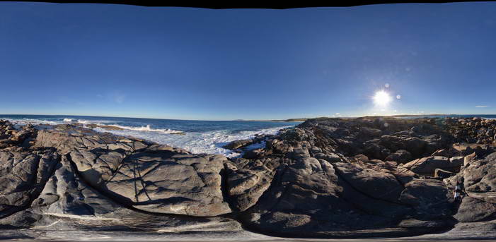
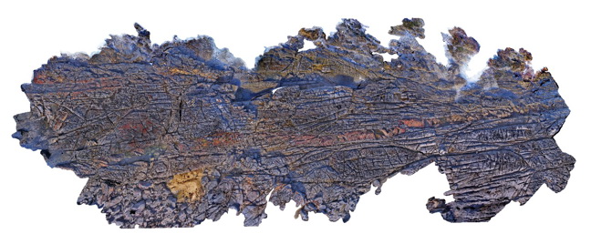
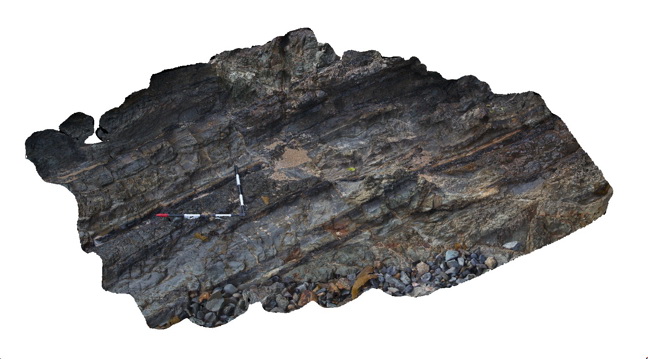
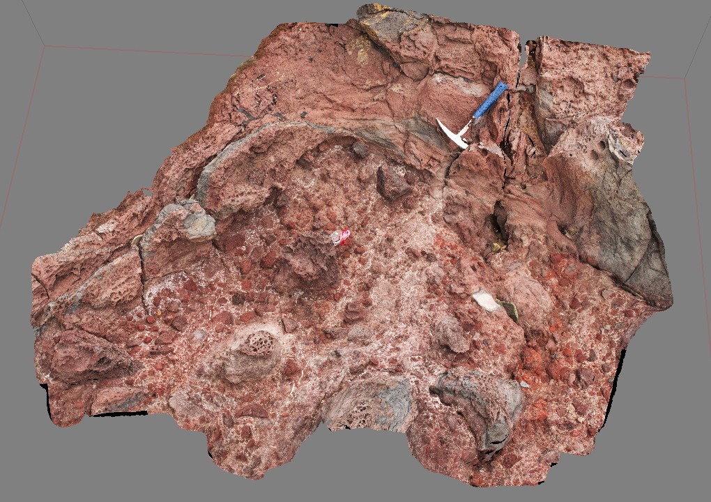
BingiPole1 Map
 |
5 |
10/08/2015 2:05 p.m. |
3D |
Model of a large outcrop of granodiorite? With cross cutting mafic dykes and intense jointing. Bingi, N.S.W. |
80.00 |
-36.01318000000 |
150.16365000000 |
3.000 |
dykes, structure, joints, igneous |
granodiorite, dolerite |
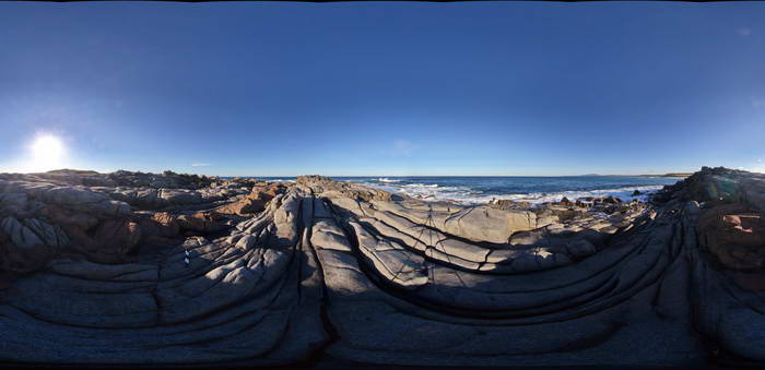
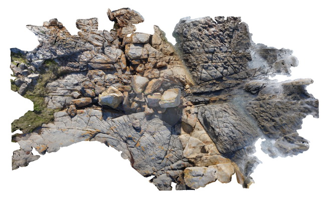
BingiPole2 Map
 |
5 |
10/08/2015 2:31 p.m. |
3D |
Large outcrop of granodiorite cut by an aplite dyke and then cut by a xenolith crowded mafic dyke. Bingi, N.S.W. |
50.00 |
-36.01262000000 |
150.16379000000 |
3.000 |
dykes, igneous, joints, structure |
granodiorite, aplite, dolerite |
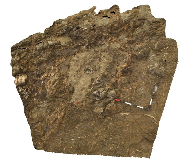
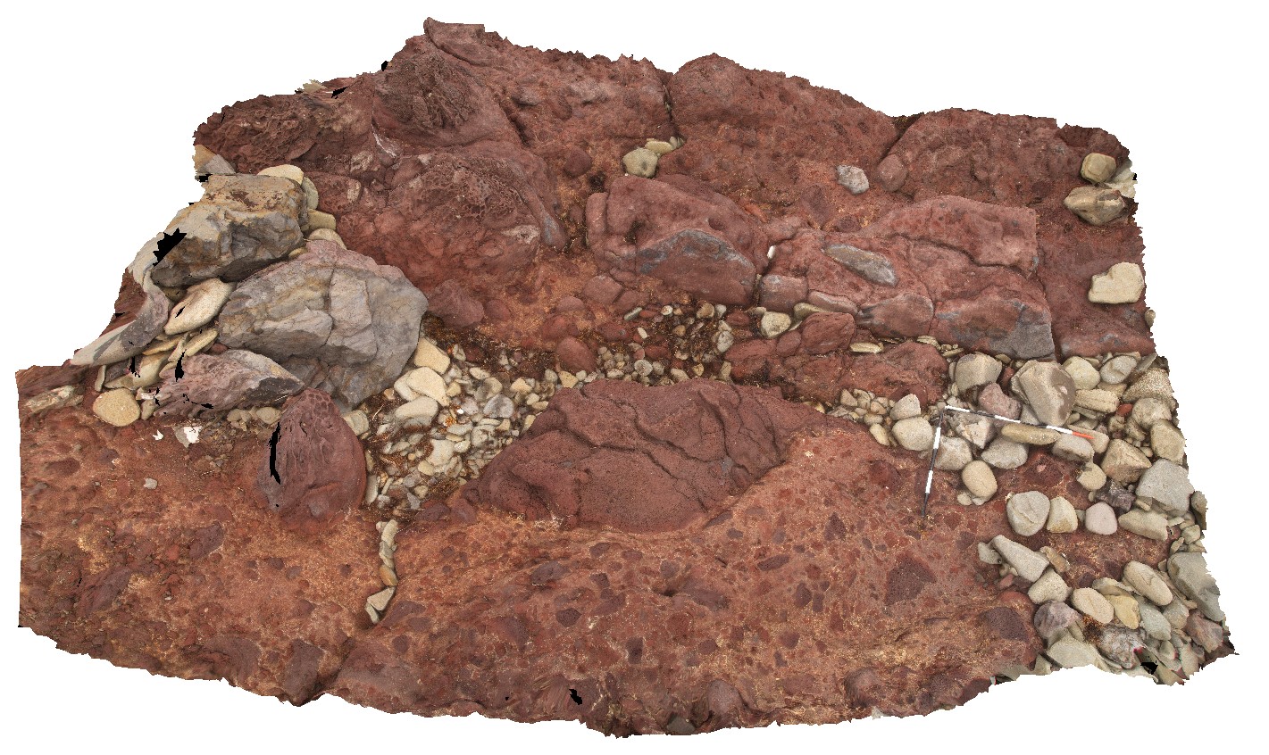
Blackhead1 Map
 |
5 |
07/08/2015 9:23 a.m. |
3D |
Chert? clasts/nodules in intensely deformed sandstone. Black Head, N.S.W. |
2.00 |
-32.07052000000 |
152.54614000000 |
0.000 |
sandstone, chert, nodules, sedimentology, structure |
sandstone, chert |
Blackhead2 Map
 |
5 |
07/08/2015 9:25 a.m. |
3D |
Matrix supported breccia consisting of dark chert clasts/nodules in a matrix of medium to fine grained sandstone with numerous quartz veins. Black Head, N.S.W. |
5.00 |
-32.07057000000 |
152.54620000000 |
0.000 |
sandstone, chert, breccia, structure |
breccia |
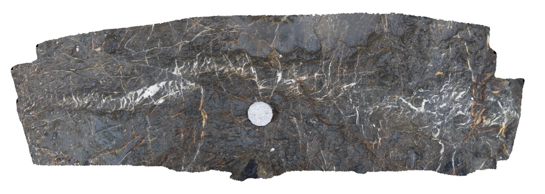
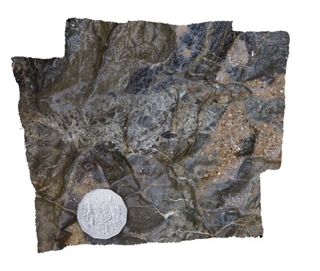
Blackhead3 Map
 |
1 |
07/08/2015 9:26 a.m. |
3D |
Detail of quartz veins and faults in matrix supported breccia. Black Head, N.S.W. |
0.40 |
-32.07057000000 |
152.54620000000 |
0.000 |
mudstone, quartz veins, fault, structure |
Breccia |
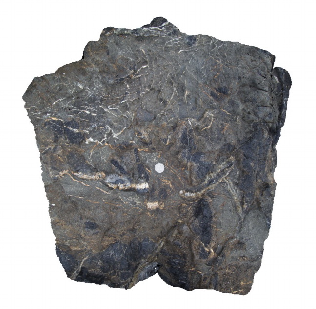
Blackhead4 Map
 |
5 |
07/08/2015 9:29 a.m. |
3D |
Detail of chert blocks and quartz veins in breccia. Black Head, N.S.W. |
1.00 |
-32.07057000000 |
152.54620000000 |
0.000 |
breccia, quartz veins, chert, structure |
breccia, chert |
Blackhead5 Map
 |
5 |
07/08/2015 9:30 a.m. |
3D |
faults and exotic blocks in fine sandstone. Black Head, N.S.W. |
3.00 |
-32.07090000000 |
152.54692000000 |
0.000 |
faults, sandstone, structure |
sandstone |
Blackhead6 Map
 |
5 |
07/08/2015 9:31 a.m. |
3D |
faults cutting dipping beds of sandstone, mudstone and chert. Black Head, N.S.W. |
3.00 |
-32.07087000000 |
152.54707000000 |
1.000 |
sandstone, mudstone, chert, faults, structure |
sandstone, mudstone, chert |
Blackhead7 Map
 |
5 |
07/08/2015 9:32 a.m. |
3D |
Detail of fault breccia in very fine sandstone. Black Head, N.S.W. |
0.10 |
-32.07087000000 |
152.54707000000 |
0.000 |
sandstone, fault breccia, structure |
sandstone, breccia |
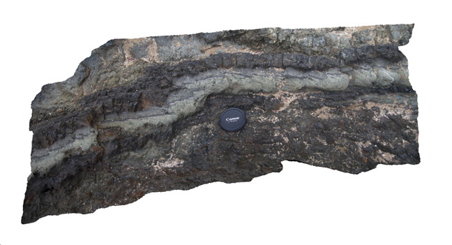
Blackhead8 Map
 |
5 |
07/08/2015 9:33 a.m. |
3D |
folded and faulted metasediments - some layers have been boudinaged. Black Head, N.S.W. |
7.00 |
-32.07085000000 |
152.54720000000 |
0.000 |
fold, boudin, fault, structure |
metasediments |
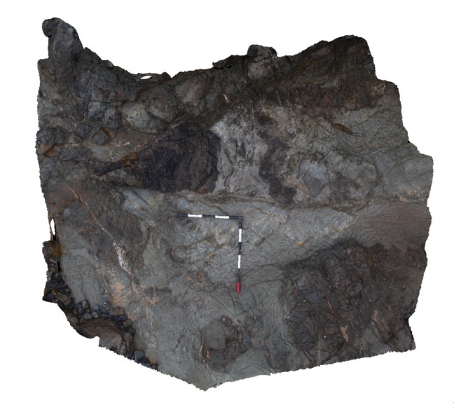
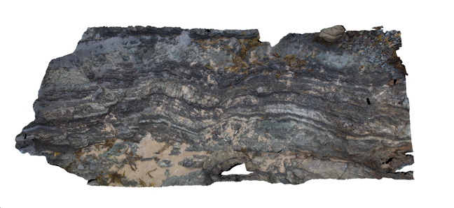
Blackhead9 Map
 |
5 |
07/08/2015 9:34 a.m. |
3D |
Detail of small scale thrust faulting in metasediments shown in Blackhead8 model. Black Head, N.S.W. |
1.00 |
-32.07083000000 |
152.54721000000 |
0.000 |
thrust fault, metasediments, structure |
metasediments |
Blackjack1 Map
 |
5 |
01/01/9999 midnight |
3D |
volcanic breccia with basaltic vesicular clasts on shore line. Black Jack Hills, Tas. |
1.00 |
-42.99269000000 |
147.65282000000 |
-9999.000 |
volcanic breccia, basalt, volcanic |
basalt |
Blackjack10 Map
 |
20 |
01/01/9999 midnight |
3D |
contact between volcanic breccia and a basalt lava flow. Black Jack Hills, Tas. |
0.60 |
-42.99270000000 |
147.65276000000 |
-9999.000 |
lava, basalt, flow |
basalt |
Blackjack11 Map
 |
20 |
01/01/9999 midnight |
3D |
volcanic breccia with basaltic vesicular clasts on shore line. Black Jack Hills, Tas. |
0.60 |
-42.99269000000 |
147.65282000000 |
-9999.000 |
volcanic breccia, volcanics, bomb |
basalt |
Blackjack12 Map
 |
20 |
01/01/9999 midnight |
3D |
contact between volcanic breccia and a basalt lava flow. Black Jack Hills, Tas. |
0.50 |
-42.99270000000 |
147.65276000000 |
-9999.000 |
contact, basaltic flow, breccia, volocanics |
basalt |
Blackjack2 Map
 |
5 |
01/01/9999 midnight |
3D |
lava and volcanic breccia, including very large basaltic bombs. Black Jack Hills, Tas. |
4.20 |
-42.99270000000 |
147.65276000000 |
-9999.000 |
basalt, volcanic, bomb |
basalt, basalt |