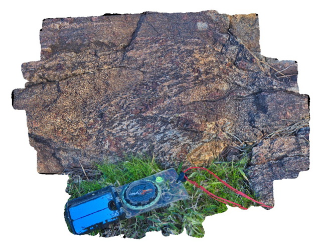
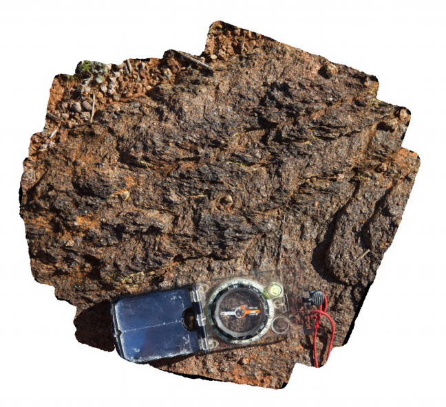
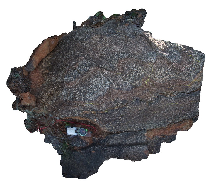
BHill84 Map
 |
5 |
09/18/2015 11:02 a.m. |
3D |
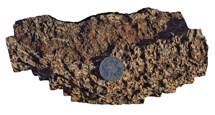
detail of fold with axial plane sillimanite in banded garnet, sillimanite gneiss. Broken Hill. N.S.W. |
0.40 |
-31.93103000000 |
141.51883000000 |
-9999.000 |
axial planar cleavage, garnet sillimanite gneiss |
garnet gneiss` |
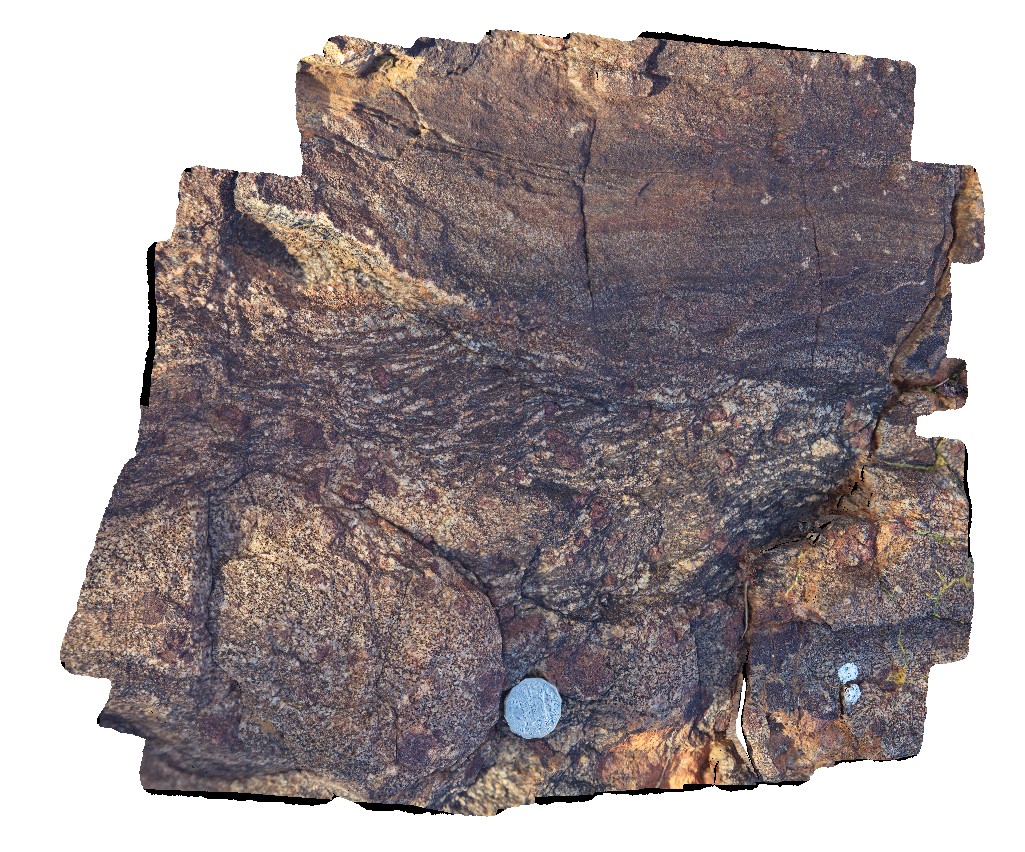
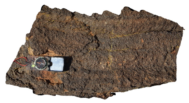
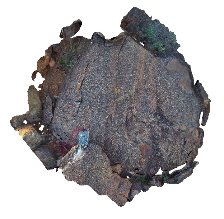
BHill85 Map
 |
5 |
09/18/2015 11:03 a.m. |
3D |
detail of gneiss texture from site NHill83, showing folded porphyroblastic garnet and sillimanite gneiss of the Sundown Group. Broken Hill. N.S.W. |
0.40 |
-31.93103000000 |
141.51883000000 |
-9999.000 |
porphyroblastic, garnet, sillimanite, gneiss |
garnet gneiss |
BHill86 Map
 |
5 |
09/18/2015 11:04 a.m. |
3D |
schistosity in folded pelitic layer with sillimanite. Broken Hill. N.S.W. |
2.50 |
-31.83297000000 |
141.42822000000 |
-9999.000 |
schistosity, fold, sillimanite, metamorphic |
pelite |
BHill87 Map
 |
5 |
09/18/2015 11:04 a.m. |
3D |
detail of F1 fold with cross cutting S2 fabric. Broken Hill. N.S.W. |
2.00 |
-31.83340000000 |
141.42754000000 |
-9999.000 |
F1 fold, S2 fabric, structure |
pelite |
BHill88 Map
 |
5 |
09/18/2015 11:05 a.m. |
3D |
detail of S1 fabric cross cutting S0 and crenulated by S2, which is locally parallel to S0. Broken Hill. N.S.W. |
0.30 |
-31.83367000000 |
141.42719000000 |
-9999.000 |
crenulation cleavage, bedding to cleavage relationships |
pelite |
BHill89 Map
 |
5 |
09/18/2015 11:05 a.m. |
3D |
S1 fabric crenulated by S2, which is ~ parallel to compositional layering. Broken Hill. N.S.W. |
0.60 |
-31.83353000000 |
141.42731000000 |
-9999.000 |
sillimanite gneiss, crenulated cleavage, folding, structural relationships |
pelite |
BHill90 Map
 |
5 |
09/18/2015 11:07 a.m. |
3D |
S1 fabric crenulated by S2 in pelitic rocks from the Sundown Group. Broken Hill. N.S.W. |
0.20 |
-31.83326000000 |
141.42741000000 |
-9999.000 |
S1 fabric, S2 fabric, cross cutting relationships |
pelite |
BHill91 Map
 |
5 |
09/18/2015 11:07 a.m. |
3D |
detail of F2 fold with folded S1 and poorly developed S2 cleavage in sillimanite gneiss band. Located at Site BHill79, Broken Hill. N.S.W. |
0.30 |
-31.83294000000 |
141.42819000000 |
-9999.000 |
S1, S2, F2 fold, structural relationships |
pelite |
BHill92 Map
 |
5 |
09/18/2015 11:08 a.m. |
3D |
macro photo taken close to Site BHill91, showing detail of poorly developed S2 cleavage crenulating S2 in Sillimanite gneiss. N.S.W. |
0.30 |
-31.83294000000 |
141.42819000000 |
-9999.000 |
S1, S2, structural relationships |
sillimanite gneiss |
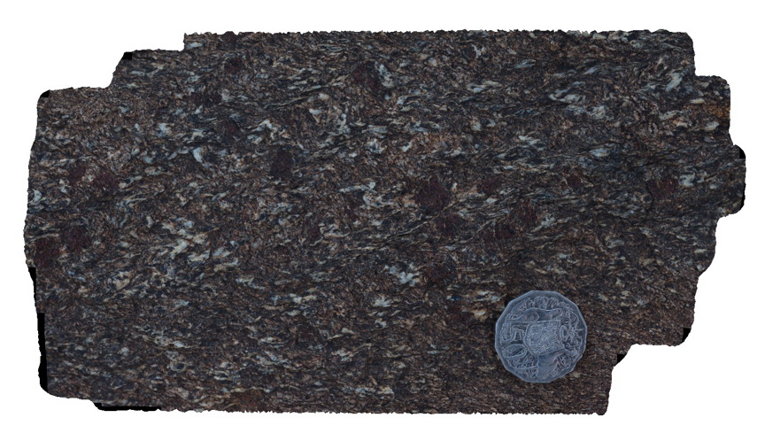
BHill93 Map
 |
5 |
09/18/2015 11:08 a.m. |
3D |
steeply plunging F2 folds with S2 and possible S1 cleavage in gneiss with possible early garnets. Broken Hill. N.S.W. |
2.00 |
-31.83270000000 |
141.42863000000 |
-9999.000 |
F2, S2, S1, structural relationships |
gneiss |
BHill94 Map
 |
5 |
09/18/2015 11:09 a.m. |
3D |
same location as BHill86, showing detail of foliation schistosity in folded pelitic layer with sillimanite. Broken Hill. N.S.W. |
0.30 |
-31.83270000000 |
141.42863000000 |
-9999.000 |
garnet sillimanite schist, fold, foliation |
schist |
BHill95 Map
 |
5 |
09/18/2015 11:10 a.m. |
3D |
view of inverse grading in pelitic sediments, Broken Hill. N.S.W. |
0.70 |
-31.83447000000 |
141.42853000000 |
-9999.000 |
inverse grading, pelitic sediments, sillimanite |
pelite |
BHill96 Map
 |
5 |
09/18/2015 11:10 a.m. |
3D |
view of F2 parasitic folds with refracted S2 fabric. Original sedimentary grading apparent. Broken Hill. N.S.W. |
0.20 |
-31.83461000000 |
141.42857000000 |
-9999.000 |
graded bedding, F2, S2, structural relationships |
pelite |
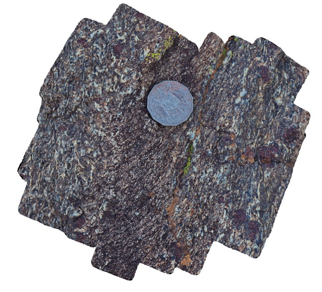
BHill97 Map
 |
5 |
09/18/2015 11:10 a.m. |
3D |
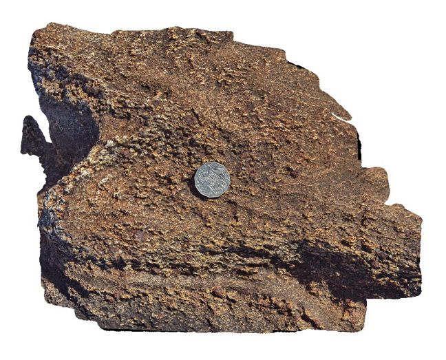
view of bedding and foliation cross cutting relationships in garnet gneiss. Broken Hill. N.S.W. |
0.50 |
-31.83472000000 |
141.42847000000 |
-9999.000 |
fold, cleavage |
gneiss |
BHill98 Map
 |
5 |
11/17/2015 2:25 p.m. |
3D |
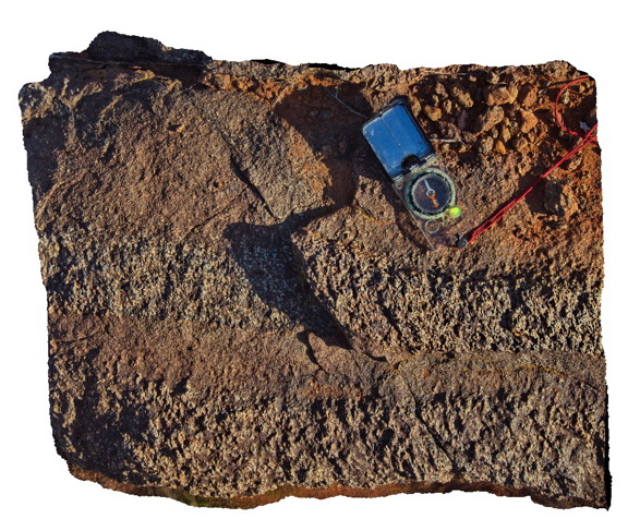
detail of foliation texture in garnet-sillimanite-gneiss from site BHill97. Broken Hill. N.S.W. |
0.30 |
-31.83472000000 |
141.42847000000 |
-9999.000 |
garnet sillimanite gneiss, foliation texture |
gneiss |
BHill99 Map
 |
5 |
09/18/2015 11:12 a.m. |
3D |
detail of foliation texture in garnet-sillimanite-gneiss from site BHill97. Broken Hill. N.S.W. |
0.15 |
-31.83472000000 |
141.42847000000 |
-9999.000 |
structure, foliation, garnet sillimanite gneiss |
gneiss |
BHillFSP1 Map
 |
0 |
10/19/2015 9:02 a.m. |
FSP |
overview of outcropping Sundown Group Metasediments and distant hills. Broken Hill. N.S.W. |
3000.00 |
-31.83332000000 |
141.42719000000 |
-9999.000 |
Sundown Metasediments. |
metasediment |
BHillFSP10 Map
 |
0 |
10/19/2015 9:55 a.m. |
FSP |
overview of outcropping folded and bedded / graded Sundown Group Metasediments and distant hills. Broken Hill. N.S.W. |
3000.00 |
-31.83354000000 |
141.42888000000 |
-9999.000 |
Sundown Group, metasediments |
metasediments |
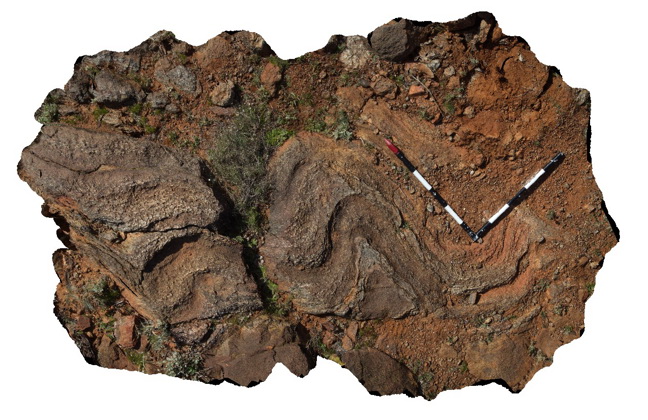
BHillFSP11 Map
 |
0 |
10/19/2015 10:29 a.m. |
FSP |
overview of outcropping folded Sundown Group Metasediments and pegmatite? (pale coloured) Broken Hill. N.S.W. |
3000.00 |
-31.83339000000 |
141.42923000000 |
-9999.000 |
Sundown Group, metasediments, pegmatite |
metasediment, Pegmatite |
BHillFSP12 Map
 |
0 |
10/19/2015 10:33 a.m. |
FSP |
overview of outcropping folded and banded / bedded Sundown Group Metasediments, Broken Hill. N.S.W. |
3000.00 |
-31.83396000000 |
141.43024000000 |
-9999.000 |
Sundown Group, metasediment, fold, structure |
metasediment |
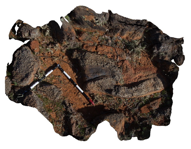
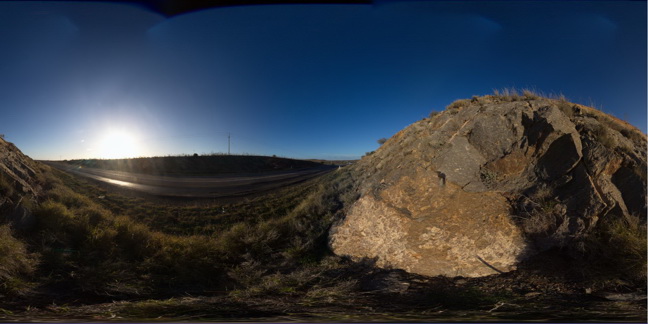
BHillFSP13 Map
 |
0 |
10/19/2015 10:37 a.m. |
FSP |
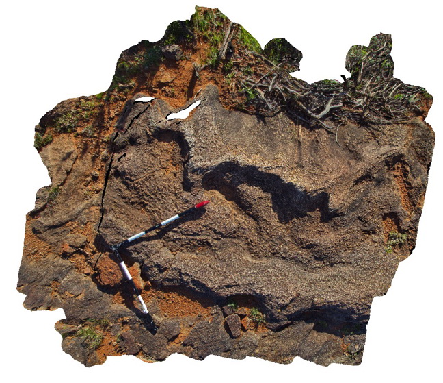
view of road cutting exposure, showing small wavelength folds in Rasp Ridge Granite Gneiss, Broken Hill. N.S.W. |
200.00 |
-32.00615000000 |
141.29033000000 |
-9999.000 |
fold, structure |
gneiss |
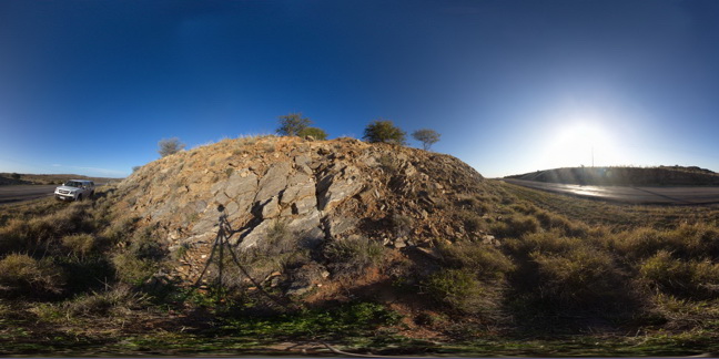
BHillFSP14 Map
 |
0 |
10/19/2015 10:47 a.m. |
FSP |
road cutting rock exposure, showing folded banded gneiss. Broken Hill. N.S.W. |
200.00 |
-32.00615000000 |
141.29013000000 |
-9999.000 |
fold, gneiss |
gneiss |
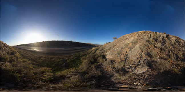
BHillFSP15 Map
 |
0 |
10/19/2015 10:51 a.m. |
FSP |
road cutting, showing steeply plunging?, tight parasitic folds in banded gneiss. Broken Hill. N.S.W. |
200.00 |
-32.00617000000 |
141.29002000000 |
-9999.000 |
parasitic fold, structure |
gneiss |
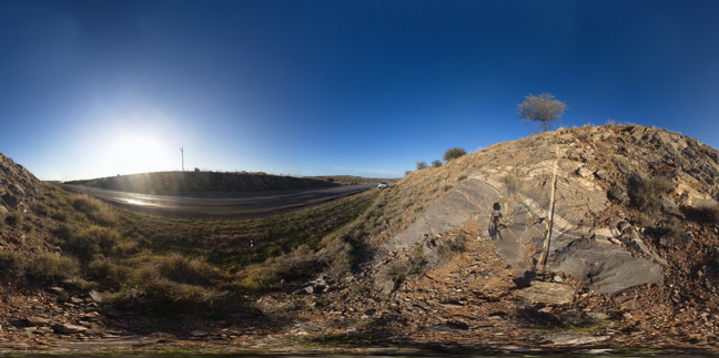
BHillFSP16 Map
 |
0 |
10/19/2015 10:55 a.m. |
FSP |
road cutting, showing banded and folded gneiss. Broken Hill. N.S.W. |
200.00 |
-32.00619000000 |
141.28996000000 |
-9999.000 |
fold, gneiss, structure, metamorphic |
gneiss |
BHillFSP17 Map
 |
0 |
10/19/2015 10:59 a.m. |
FSP |
road cutting through Rasp Ridge Granite Gneiss, showing small scale folding in fine banding and joint surfaces. Broken Hill. N.S.W. |
200.00 |
-32.00624000000 |
141.28984000000 |
-9999.000 |
fold, joint surface |
gneiss |