GordonRd1 Map
 |
0 |
02/29/2016 1:37 p.m. |
3D |
open asymmetric fold in bedded quartzite. Gordon Dam Road, near Gordon Dam. Tasmania. |
10.00 |
-42.73655000000 |
145.97487000000 |
-9999.000 |
fold, quartzite, asymmetric fold, structure |
quartzite |
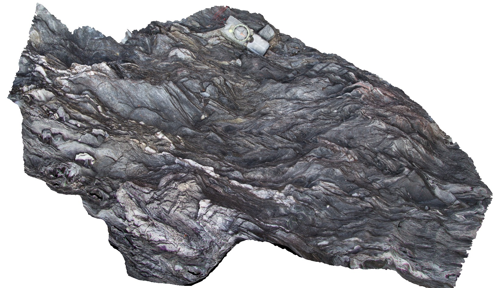
GordonRd7 Map
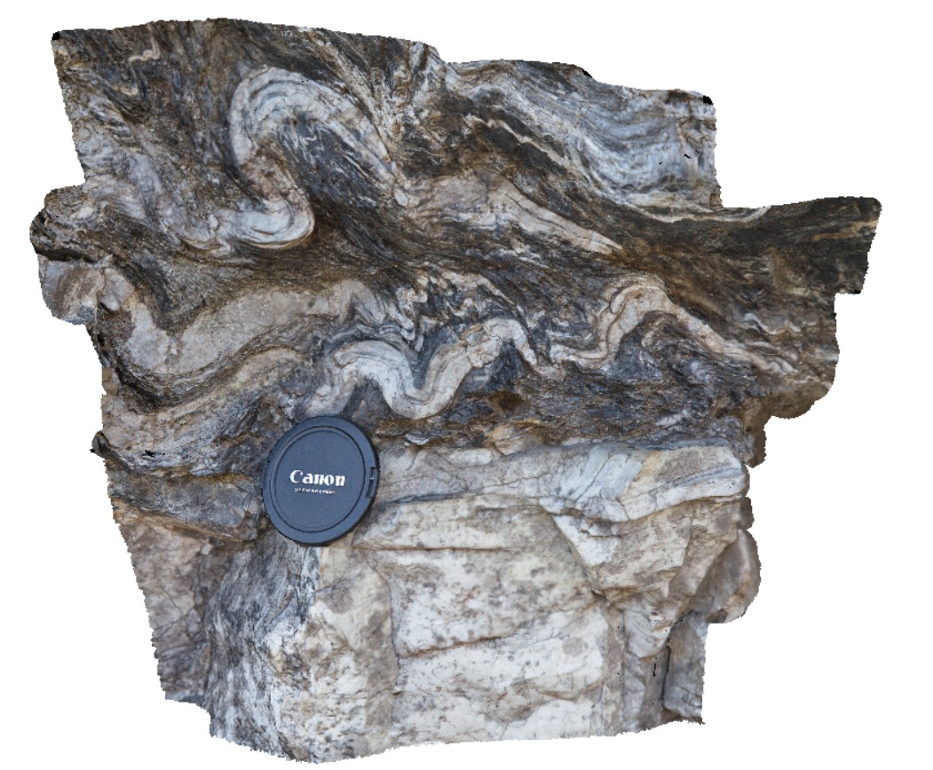 |
0 |
02/29/2016 1:40 p.m. |
3D |
detail of disharmonic folding on the boundary of quartzite unite. Gordons Dam Road. Tasmania. |
0.50 |
-42.73633000000 |
145.97752000000 |
-9999.000 |
disharmonic folding, structure, phyllite |
phyllite |
GordonRd6 Map
 |
0 |
02/29/2016 1:39 p.m. |
3D |
detail of disharmonic folds on boundary of quartzite unit. Gordon Dam, Tasmania. |
1.50 |
-42.73633000000 |
145.97752000000 |
-9999.000 |
phyllite, disharmonic folding, structure |
phyllite |
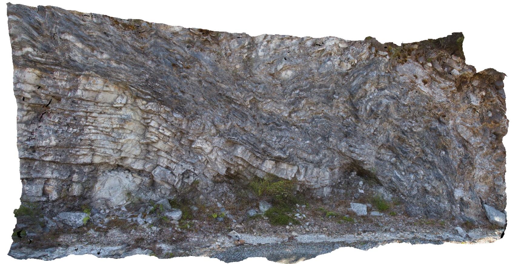
GordonRd4 Map
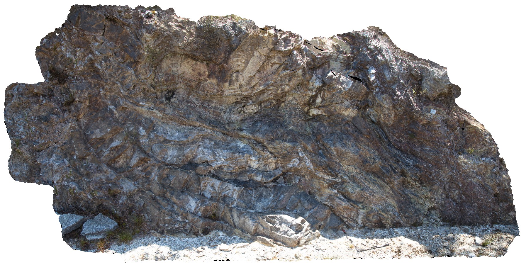 |
0 |
02/29/2016 1:38 p.m. |
3D |
disharmonic folds and fault in quartzite and phyllite beds, Gordons Dam Road, Tasmania. |
6.00 |
-42.73633000000 |
145.97754000000 |
-9999.000 |
disharmonic folding, quartzite, phyllite, deformation |
quartzite |
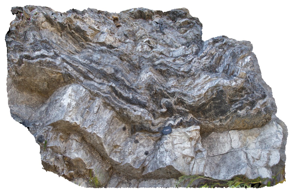
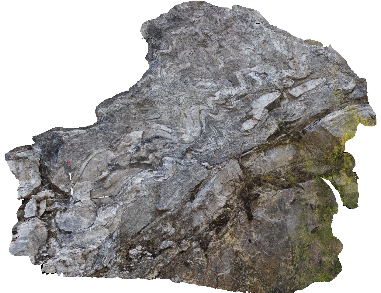
GordonRd5 Map
 |
0 |
02/29/2016 1:39 p.m. |
3D |
road cutting showing disharmonic folding in quartzite and phyllite beds. Gordon Dam road, Tasmania. |
5.00 |
-42.73633000000 |
145.97752000000 |
-9999.000 |
disharmonic folding, quartzite, phyllite, structure |
quartzite |
GordonRd2 Map
 |
0 |
02/29/2016 1:37 p.m. |
3D |
small recumbent folds in phyllite beds with folded quartz veins. Gordon Dam Road, near Gordon Dam. Tasmania. |
1.00 |
-42.73601000000 |
145.97472000000 |
-9999.000 |
recumbent fold, fold, structure, phyllite |
phyllite |
GordonRd3 Map
 |
0 |
02/29/2016 1:38 p.m. |
3D |
multiply deformed sediments, showing folds in phyllite and quartzite, with quartzite boudins. Gordon Dam Road, near Gordon Dam. Tasmania. |
4.50 |
-42.73540000000 |
145.97485000000 |
-9999.000 |
folds, deformation, boudinage, structure, phyllite |
phyllite |
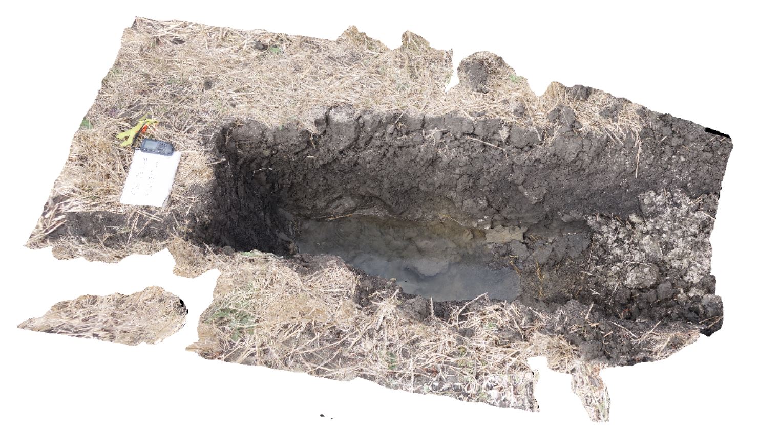
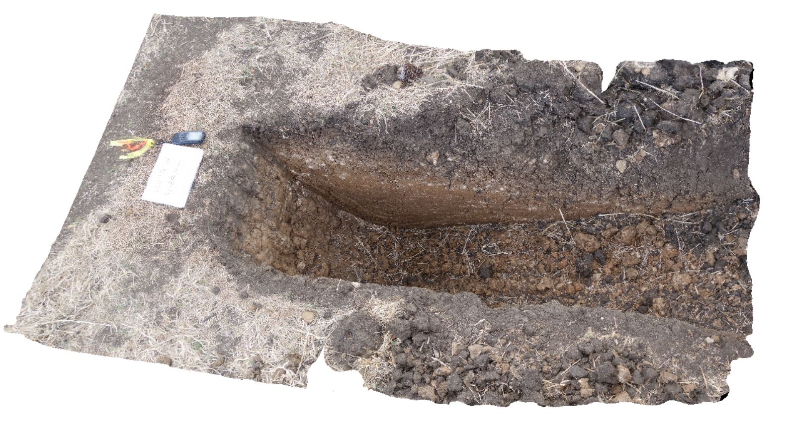
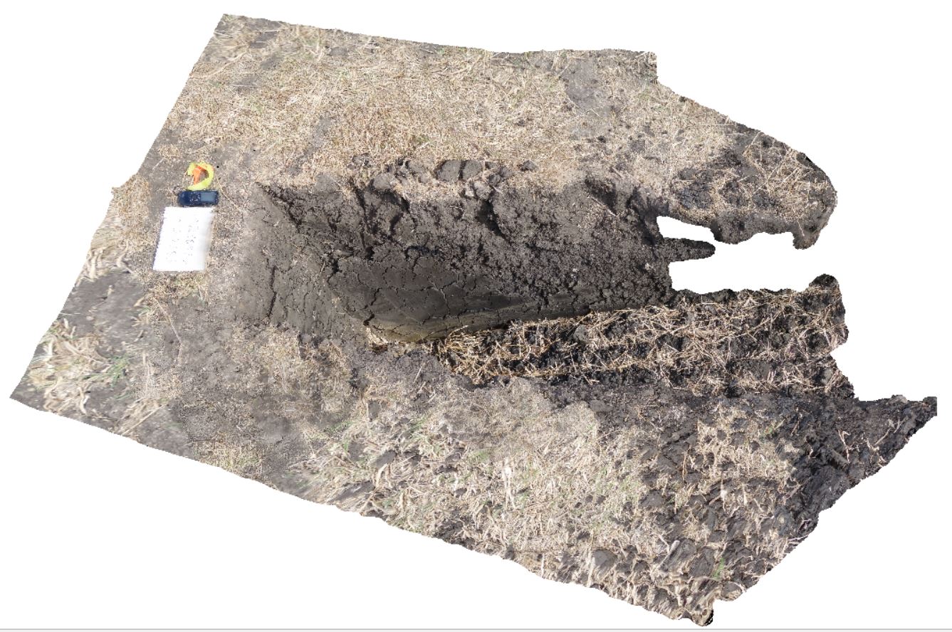
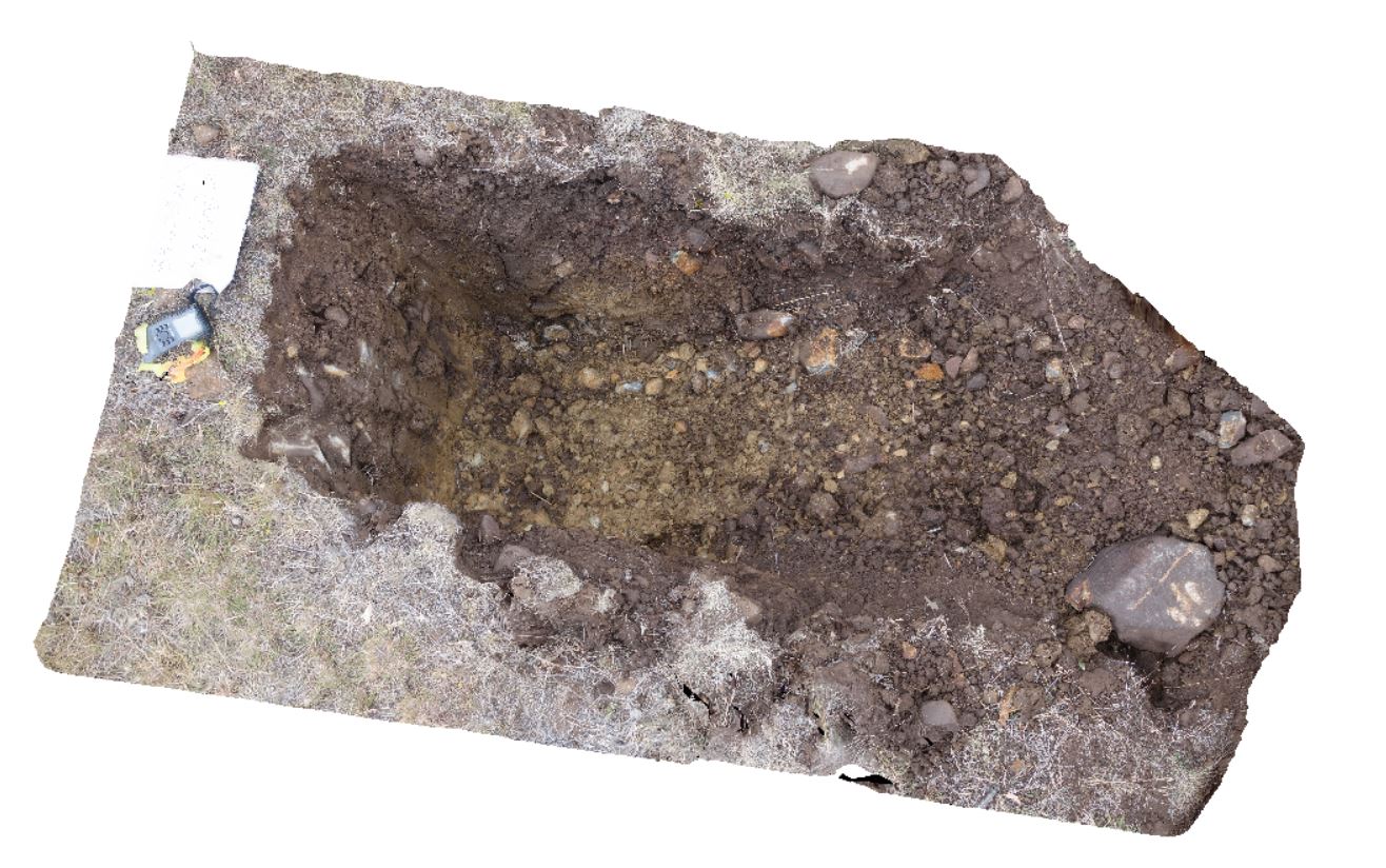
DaisyBanksPit6 Map
 |
20 |
03/17/2015 1:54 p.m. |
3D |
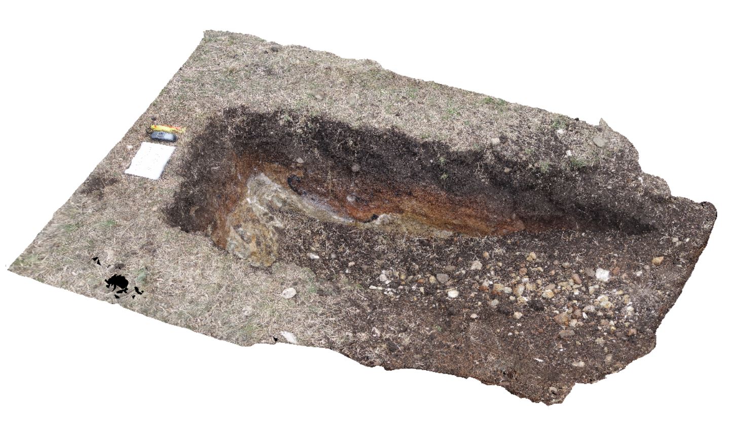
~80cm deep pit into soil and clays overlying Quaternary alluvial and marsh deposits of modern flood plains; of gravel, sand, silt and clay. Richmond, Tas. |
2.00 |
-42.73310300000 |
147.43077000000 |
-9999.000 |
clay, alluvial, regolith |
clay |
GordonRd8 Map
 |
0 |
02/29/2016 1:40 p.m. |
3D |
road cutting showing folds in quartzite and phyllite, Gordon Dam road, Tasmania. |
4.00 |
-42.73270000000 |
145.98196000000 |
-9999.000 |
folding, structure, quartzite |
phyllite |
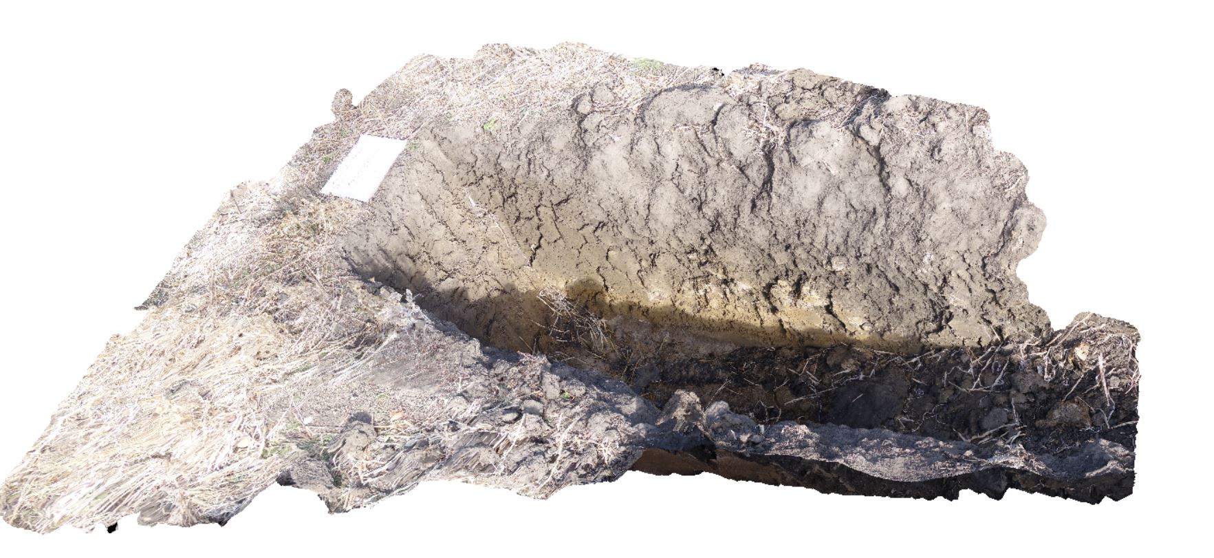
DaisyBanksPit5 Map
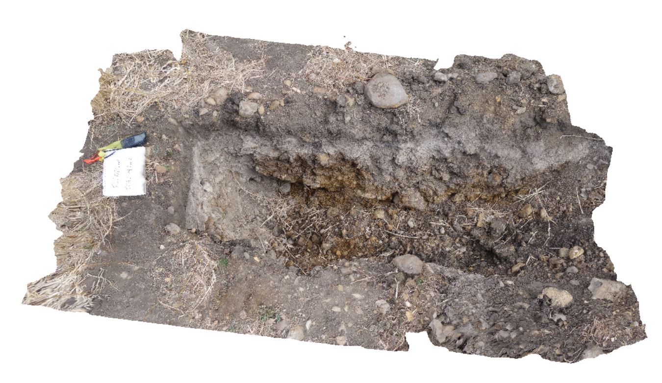 |
20 |
03/17/2015 1:50 p.m. |
3D |
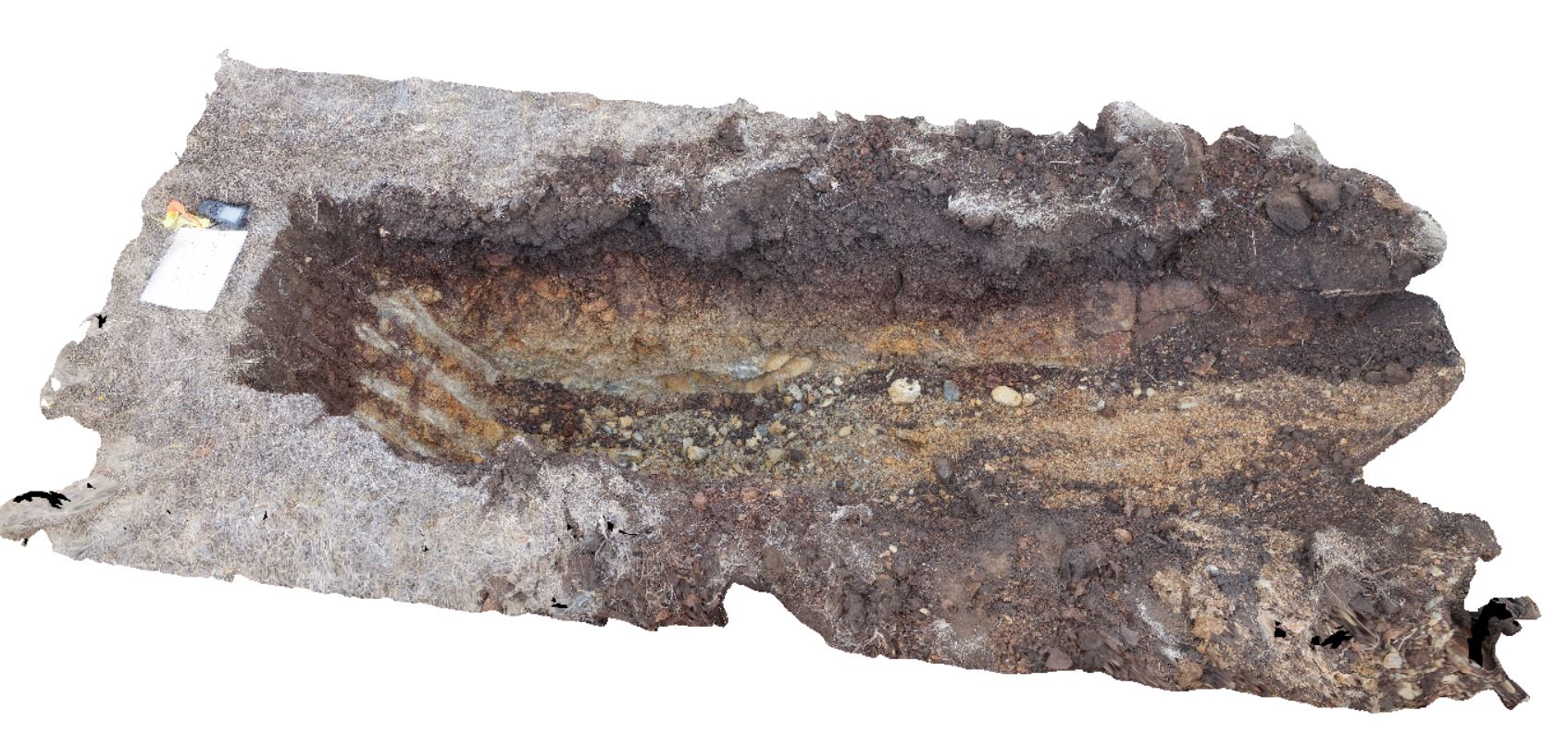
~80cm wide pit into recent sediments overlying Quaternary alluvial and marsh deposits of modern flood plains; of gravel, sand, silt and clay. Richmond, Tas. |
2.00 |
-42.73253700000 |
147.42790800000 |
-9999.000 |
palaeochannel, alluvial, regolith |
Gravel |
DaisyBanksPit7 Map
 |
20 |
03/17/2015 2 p.m. |
3D |
Undifferentiated alluvial soils and clays developed on Quaternary alluvial terrace gravel deposits predominantly derived from Parmeener and Palaeogene-Neogene units with clasts commonly of basalt and in places dolerite. Richmond, Tas. |
2.00 |
-42.73247900000 |
147.42657600000 |
-9999.000 |
clay, alluvial, regolith |
clay |
DaisyBanksPit8 Map
 |
20 |
03/17/2015 2:03 p.m. |
3D |
~80cm deep pit into soil and clays overlying Paleogene-Neogene silicified rock. Richmond, Tas. |
2.00 |
-42.73246200000 |
147.42641700000 |
-9999.000 |
clay, alluvial, regolith |
clay |
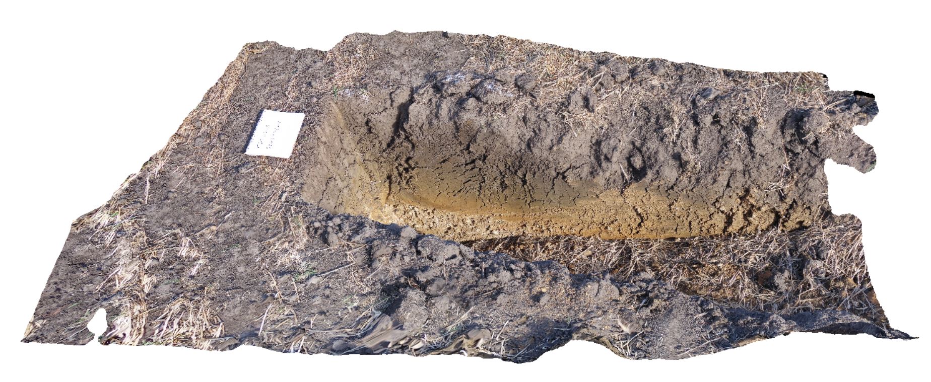
DaisyBanksPit4 Map
 |
20 |
03/17/2015 1:45 p.m. |
3D |
~80cm deep pit into soil and clays overlying Quaternary alluvial and marsh deposits of modern flood plains; of gravel, sand, silt and clay. Richmond, Tas. |
2.00 |
-42.73176200000 |
147.42817100000 |
-9999.000 |
Clay, alluvium, regolith |
Clay |
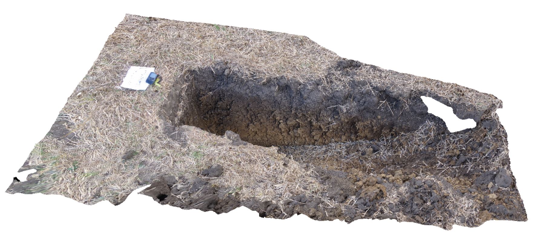
DaisyBanksPit2 Map
 |
20 |
03/17/2015 1:33 p.m. |
3D |
~80cm deep pit into soil and clays overlying quaternary alluvial deposits. Richmond, Tas. |
2.00 |
-42.73141700000 |
147.43138200000 |
-9999.000 |
clay, alluvium, regolith |
clay |
DaisyBanksPit1 Map
 |
20 |
03/17/2015 1:18 p.m. |
3D |
Undifferentiated alluvial soils and clays developed on Quaternary alluvial terrace gravel deposits predominantly derived from Parmeener and Palaeogene-Neogene units with clasts commonly of basalt and in places dolerite. Richmond, Tas. |
2.00 |
-42.73095300000 |
147.43018100000 |
-9999.000 |
clay, alluvium, regolith |
clay |
DaisyBanksPit3 Map
 |
20 |
03/17/2015 1:37 p.m. |
3D |
~80cm deep pit into soil and clays overlying Quaternary alluvial and marsh deposits of modern flood plains; of gravel, sand, silt and clay. Richmond, Tas. |
2.00 |
-42.73071600000 |
147.42842100000 |
-9999.000 |
clay, alluvium, regolith |
Clay |
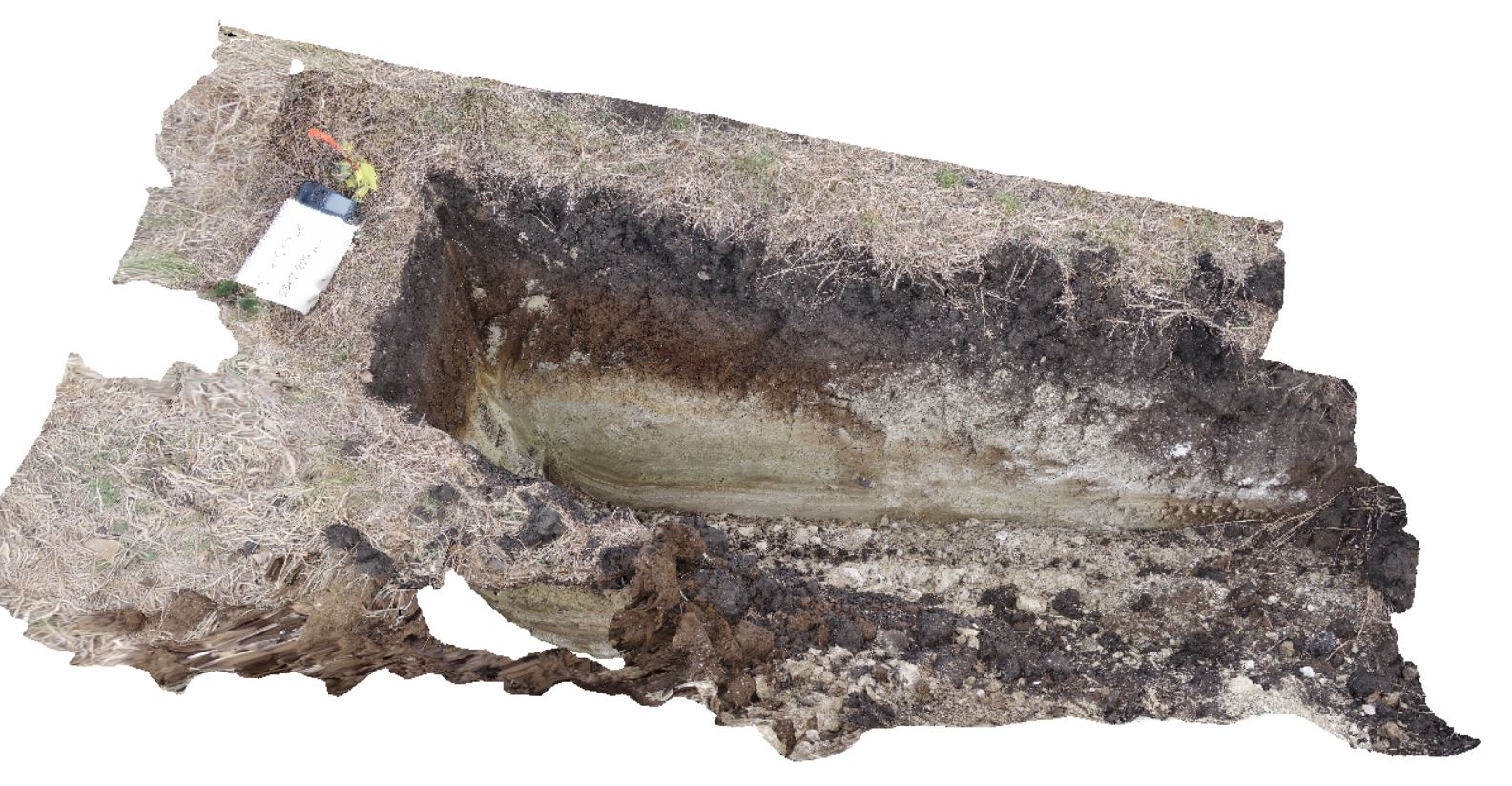
DaisyBanksPit15 Map
 |
20 |
03/24/2015 9:47 a.m. |
3D |
~80cm pit into dark grey sandy soils and white-brown sandy clay overlying Jurassic Dolerite. Richmond, Tas. |
2.00 |
-42.73051200000 |
147.42269000000 |
-9999.000 |
Clay, Jurassic Dolerite, regolith |
clay |
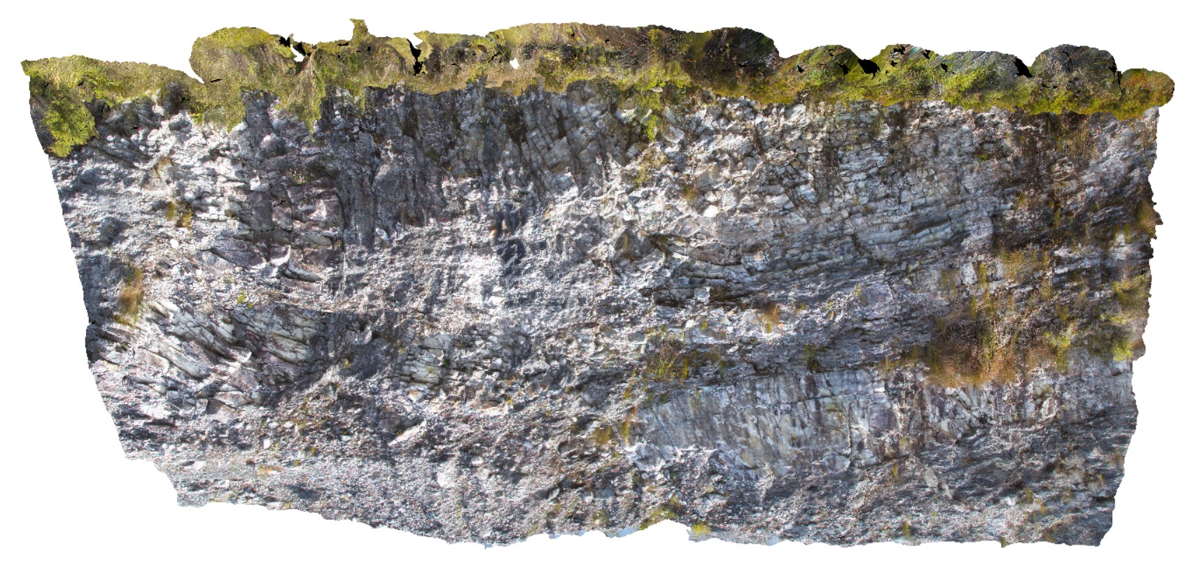
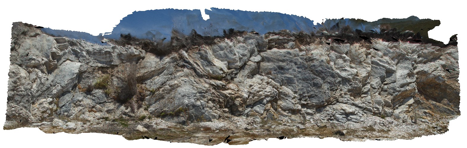
GordonDam2 Map
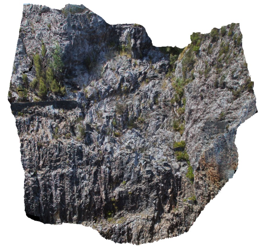 |
20 |
04/12/2016 9:02 a.m. |
3D |
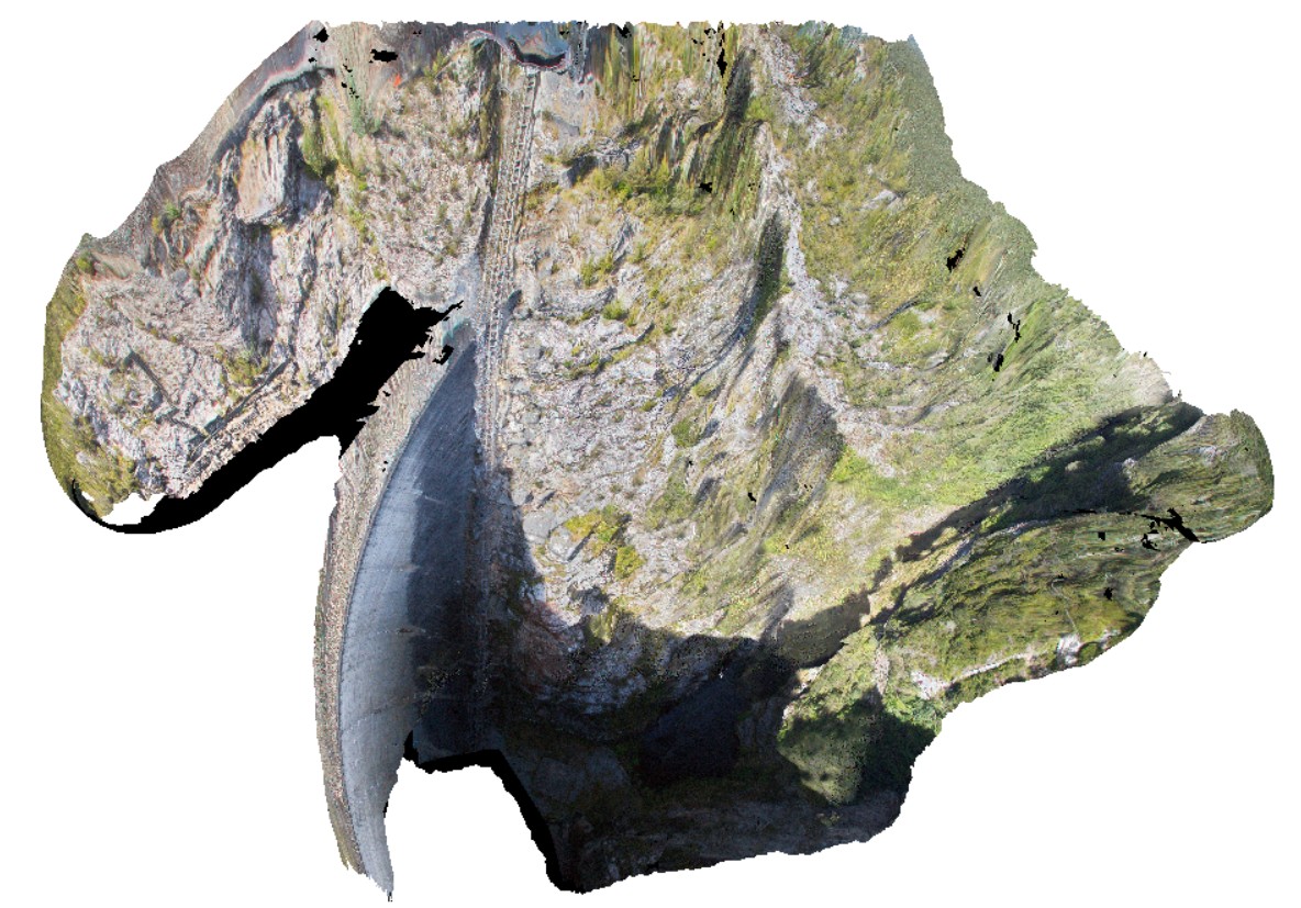
view of upstream part of the southern abutment of the Gordon Dam, showing folded and deformed quartzites and phyllites. Gordon Dam, Tasmania. |
20.00 |
-42.73044300000 |
145.97555560000 |
-9999.000 |
folding, structure, quartzite |
quartzite |
GordonDam3 Map
 |
20 |
02/29/2016 9:51 a.m. |
3D |
view of northern abutment of the Gordon Dam, showing folded and deformed beds of quartzite and phyllite. Tasmania. |
200.00 |
-42.73044300000 |
145.97555560000 |
-9999.000 |
fold, quartzite, deformation |
quartzite |
GordonDamUAV1 Map
 |
20 |
02/23/2016 9:14 a.m. |
UAV |
folded quartzite and phyllite in south abutment of Gordon Dam. Gordon Dam Road, near Gordon Dam. Tasmania. |
200.00 |
-42.73044300000 |
145.97555560000 |
-9999.000 |
folding, structure, phyllite, quartzite |
quartzite |
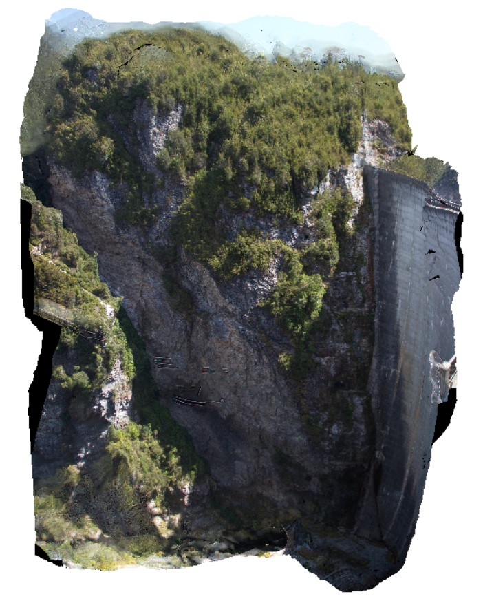
GordonDamUAV2 Map
 |
20 |
02/23/2016 9:14 a.m. |
UAV |
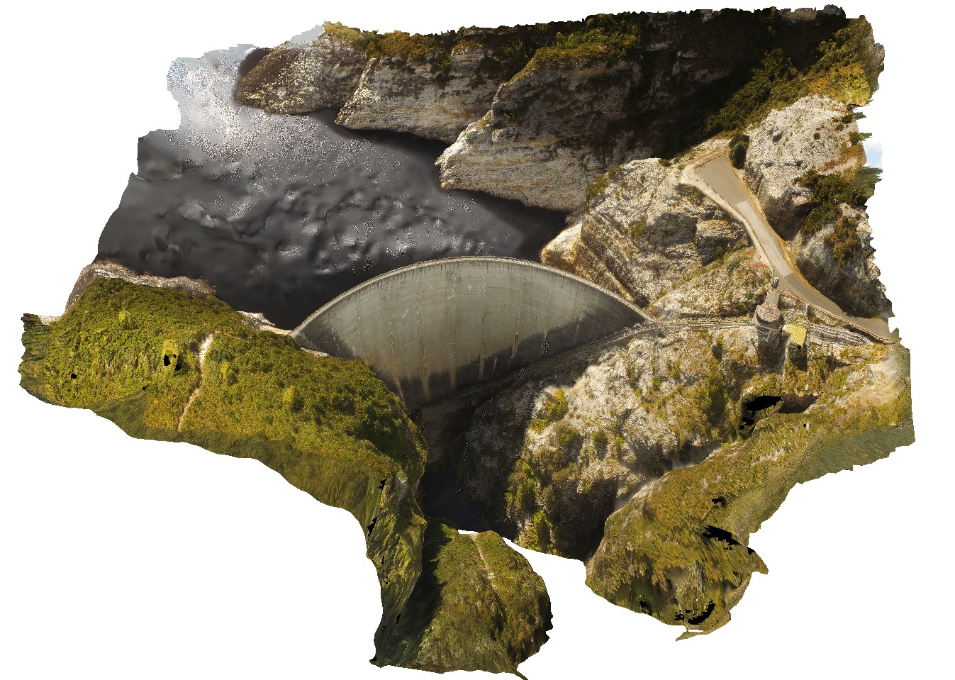
Aerial view of the Gordon Dam, showing folded quartzite and phyllite metasediments outcrop. Gordon Dam. Tasmania. |
200.00 |
-42.73044300000 |
145.97555560000 |
-9999.000 |
dam, quartzite, phyllite, structure |
quartzite |
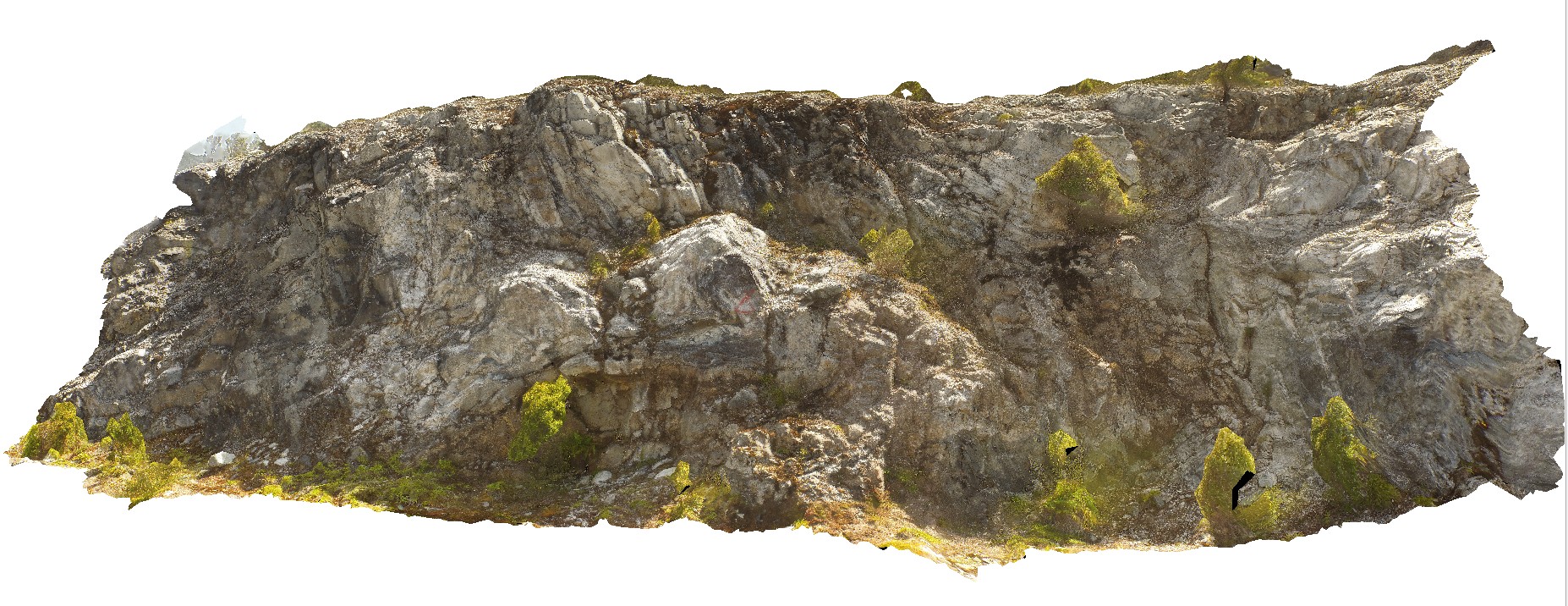
GordonDam1 Map
 |
20 |
04/07/2016 12:19 p.m. |
3D |
view of deformed and folded quartzite in the southern abutment of the Gordon Dam, Tasmania. |
200.00 |
-42.73044300000 |
145.97555560000 |
-9999.000 |
folded, quartzite, structure |
quartzite |
DaisyBanksPit10 Map
 |
20 |
03/23/2015 11:20 a.m. |
3D |
~80cm deep pit into Cenozoic soil and clays overlying (inferred) Jurassic Dolerite. Richmond, Tas. |
2.00 |
-42.73042400000 |
147.42464400000 |
-9999.000 |
Jurassic Dolerite, Clay, Alluvial, regolith |
Clay |
DaisyBanksPit14 Map
 |
20 |
03/24/2015 10:06 a.m. |
3D |
~80cm pit into dark grey sandy soils and white-brown sandy clay overlying Jurassic Dolerite. Richmond, Tas. |
2.00 |
-42.73006300000 |
147.42246700000 |
-9999.000 |
Clay, Jurassic Dolerite, regolith |
Clay |
Brighton3 Map
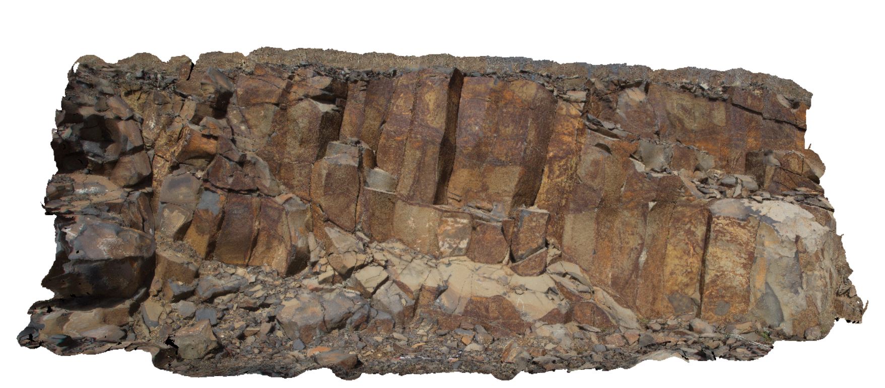 |
5 |
01/01/9999 midnight |
3D |
columnar jointing in Tertiary Basalt in road cutting. Brighton, Tas. |
8.00 |
-42.73004000000 |
147.23798000000 |
-9999.000 |
columnar jointing, joint, Tertiary basalt |
basalt |