ARLTUN2 Map
 |
5 |
07/26/2016 4:26 p.m. |
3D terrestrial photogrammetric model |
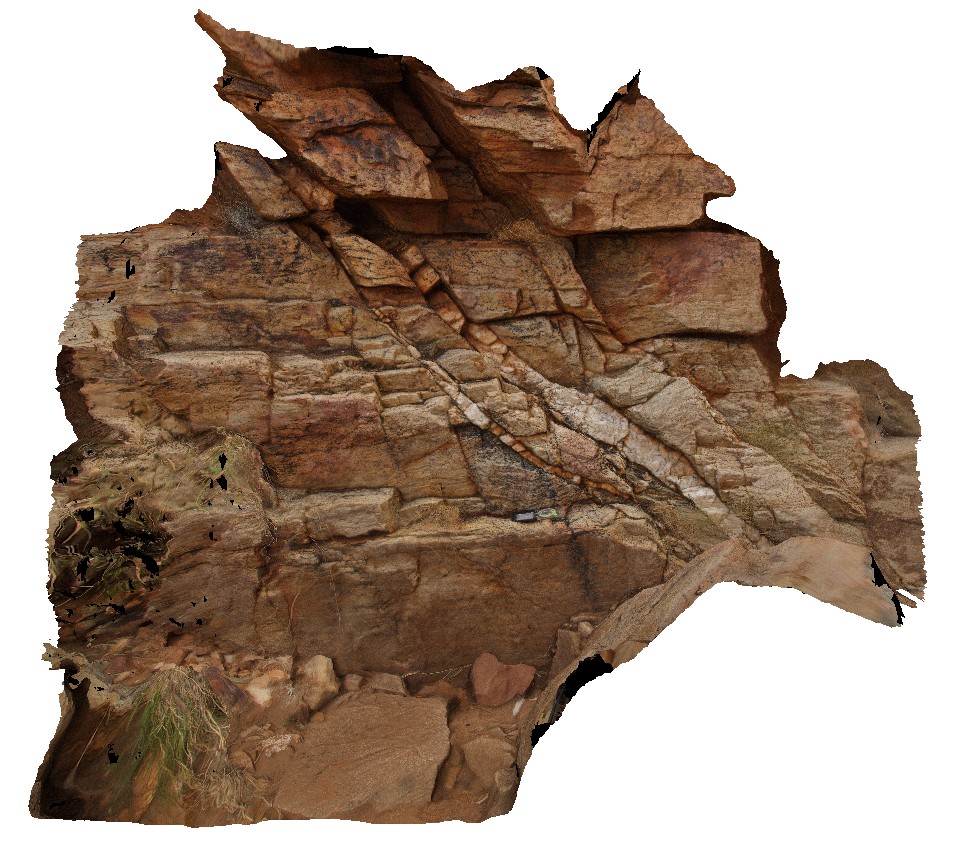
foliated and crenulated quartz-feldspar schist cut by quartz vein. Joker Creek. Arltunga Historical Reserve, N.T. |
2.40 |
-23.44461400000 |
134.73566200000 |
702.927 |
crenulation, foliation, structure, fold, vein, schist, metamorphic |
schist |
ARLTUN3 Map
 |
5 |
01/01/9999 midnight |
3D terrestrial photogrammetric model |
crenulated cleavage in foliated schist. Joker Creek. Arltunga Historical Reserve, N.T. |
1.80 |
-23.44461400000 |
134.73566200000 |
702.927 |
crenulation, cleavage, foliation, structure, fold, metamorphic, schist |
schist |
Armidale1 Map
 |
5 |
10/06/2015 11:03 a.m. |
3D terrestrial photogrammetric model |
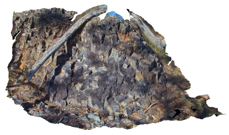
Tertiary columnar basalt with mantle xenoliths. Armidale, N.S.W |
5.00 |
-30.48196000000 |
151.63914000000 |
-9999.000 |
basalt, columnar jointing, igneous |
basalt |
Armidale2 Map
 |
5 |
07/27/2015 10:20 a.m. |
3D terrestrial photogrammetric model |
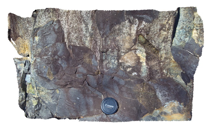
Detail of mantle xenoliths in Tertiary basalt at site of Armidale1. Armidale, N.S.W |
0.50 |
-30.48196000000 |
151.63914000000 |
-9999.000 |
basalt, xenolith |
basalt |
Armidale3 Map
 |
5 |
07/27/2015 10:33 a.m. |
3D terrestrial photogrammetric model |
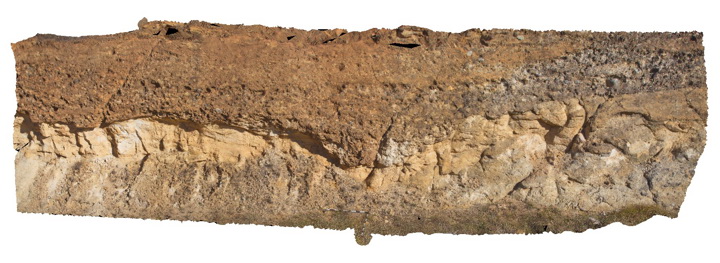
Conglomerate channel cut into underlying sandstone in the Eocene-Oligocene Armidale beds. Armidale, N.S.W |
12.00 |
-30.49301000000 |
151.65099000000 |
-9999.000 |
conglomerate, sandstone, channel |
sandstone, conglomerate |
Armidale4 Map
 |
5 |
07/27/2015 10:33 a.m. |
3D terrestrial photogrammetric model |
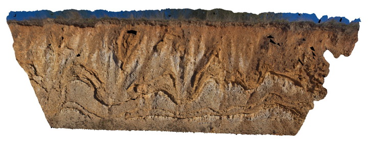
Liesegang bands in Eocene-Oligocene sandstone of the Armidale beds. Armidale, N.S.W |
20.00 |
-30.49326000000 |
151.65179000000 |
-9999.000 |
sandstone, liesegang bands |
sandstone |
Armidale5 Map
 |
5 |
10/06/2015 10:52 a.m. |
3D terrestrial photogrammetric model |
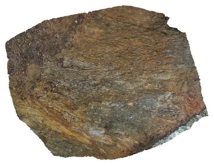
Tightly folded chert and mudstone beds within the Devonian to Carboniferous Sandon Beds. Armidale, N.S.W |
5.00 |
-30.57193000000 |
151.64053000000 |
-9999.000 |
chert, mudstone, fold |
chert, mudstone |
Armidale6 Map
 |
5 |
07/27/2015 10:35 a.m. |
3D terrestrial photogrammetric model |
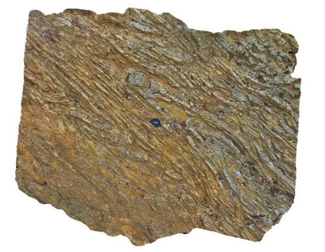
Detail of the folded chert layers and mudstone layers within the Devonian-Carboniferous Sandon Beds. Armidale, N.S.W |
2.00 |
-30.57193000000 |
151.64053000000 |
-9999.000 |
chert, mudstone, reclined fold |
chert, mudstone |
Armidale7 Map
 |
5 |
07/27/2015 10:35 a.m. |
3D terrestrial photogrammetric model |
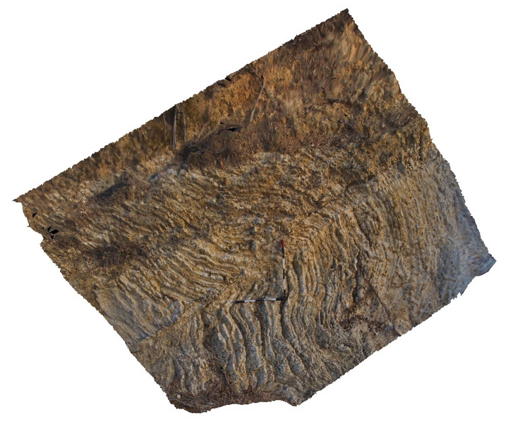
Folded and faulted thin chert and mudstone layers of the Devonian to Carboniferous Sandon Beds with overlying transported regolith. Armidale, N.S.W |
4.00 |
-30.57199000000 |
151.64069000000 |
-9999.000 |
chert, mudstone, fold, fault, regolith |
chert, mudstone |
Armidale8 Map
 |
5 |
10/06/2015 1:43 p.m. |
3D terrestrial photogrammetric model |
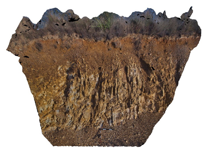
Regolith profile over folded Devonian to Carboniferous Sandon Beds. Armidale, N.S.W |
4.00 |
-30.56921000000 |
151.64027000000 |
-9999.000 |
regolith, chert, mudstone |
chert, mudstone |
Augustus1 Map
 |
0 |
05/27/2016 noon |
3D terrestrial photogrammetric model |
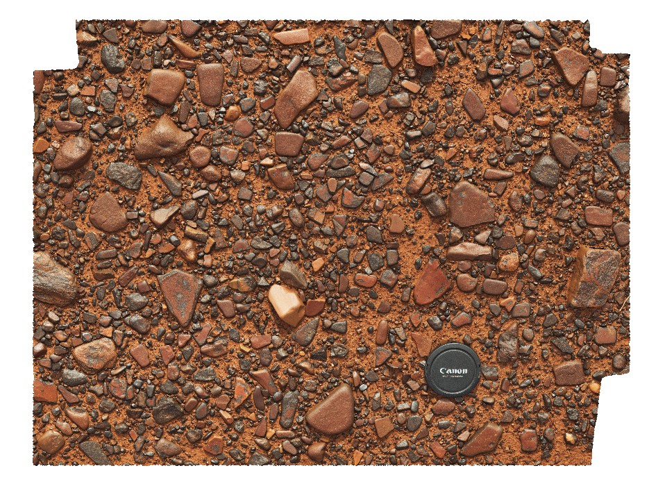
gibber plain with desert varnish. Near Mount Augustus, W.A. |
0.60 |
-24.25354000000 |
117.00278000000 |
-9999.000 |
desert varnish, detrital material |
lag |
Ballarat1 Map
 |
0 |
06/05/2016 10:33 a.m. |
3D terrestrial photogrammetric model |
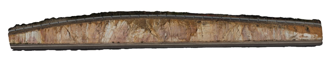
folded and faulted metasediments of the Castlemain Group, Norman Street road cut. South side. Ballarat, Vic. |
25.00 |
-37.53779000000 |
143.87029000000 |
-9999.000 |
fold, fault, structure |
metasediments |
Ballarat10 Map
 |
0 |
06/05/2016 10:36 a.m. |
3D terrestrial photogrammetric model |
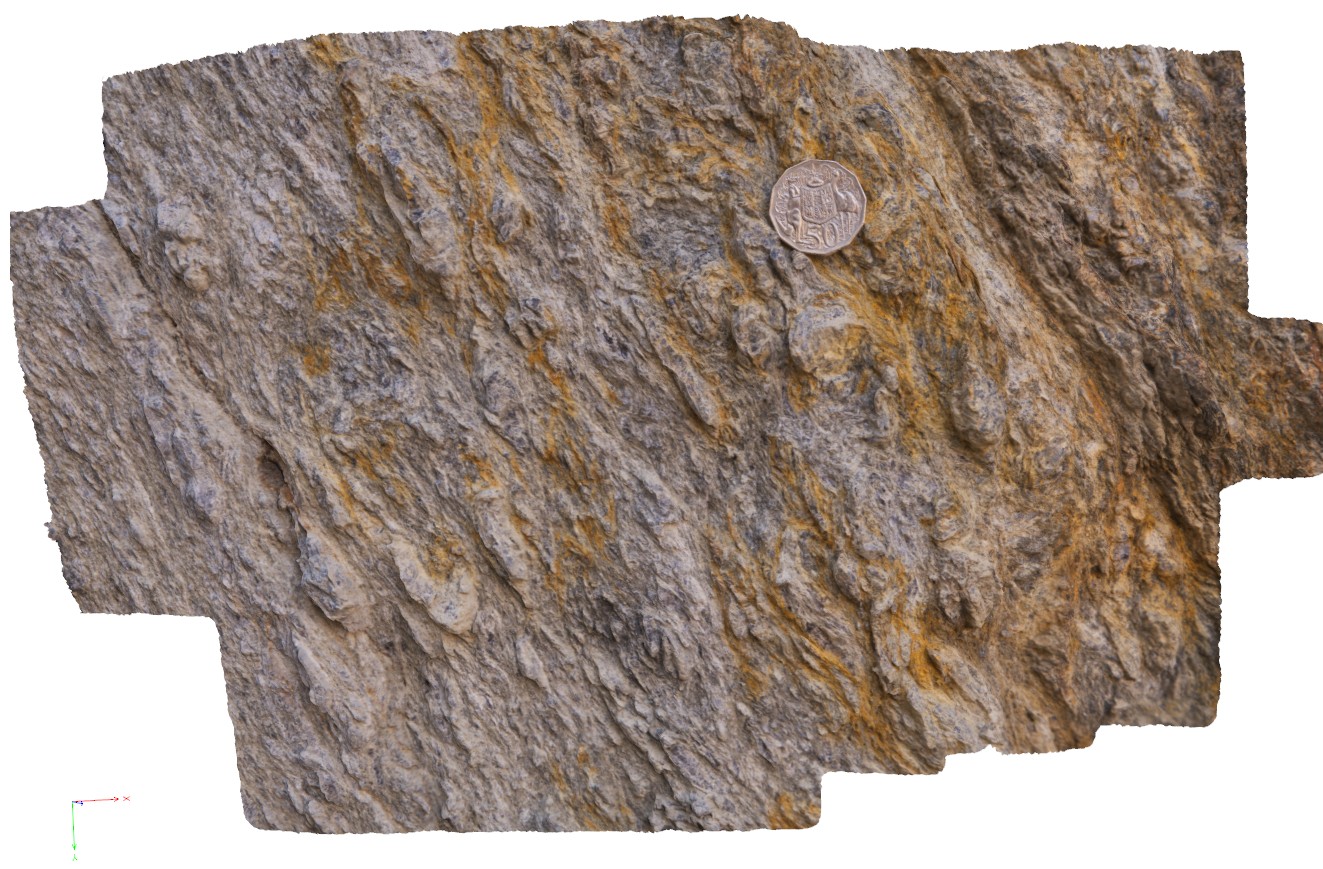
detail of deformation in the footwall of the Avoca Fault, showing development of coarse mica. Ballarat, Vic. |
0.40 |
-37.72817000000 |
143.62782000000 |
-9999.000 |
fault zone, deformation |
schist |
Ballarat11 Map
 |
0 |
06/05/2016 10:36 a.m. |
3D terrestrial photogrammetric model |
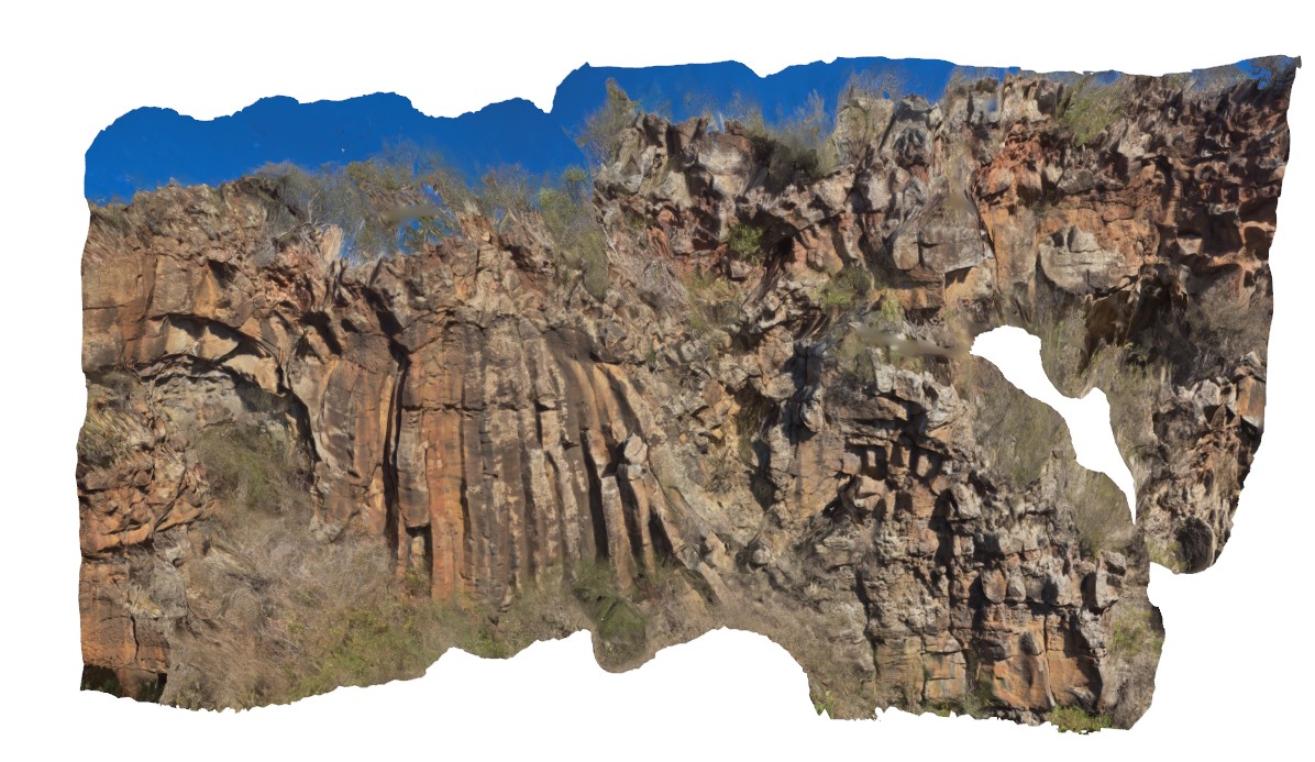
outcrop of columnar jointed plug in layered basalt. Devils Kitchen Geological Reserve. Ballarat. Vic. |
25.00 |
-37.72890000000 |
143.62309000000 |
-9999.000 |
basalt plug, columnar jointed basalt |
basalt |
Ballarat2 Map
 |
0 |
06/05/2016 10:33 a.m. |
3D terrestrial photogrammetric model |
folded and faulted metasediments of the Castlemain Group, Norman Street road cut. North side. Ballarat, Vic. |
21.00 |
-37.53761000000 |
143.87025000000 |
-9999.000 |
fault, fold |
metasediment |
Ballarat3 Map
 |
0 |
06/05/2016 10:34 a.m. |
3D terrestrial photogrammetric model |
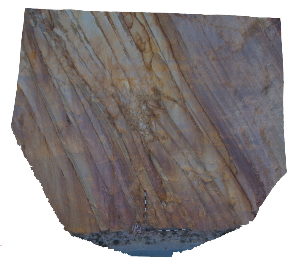
detail of bedding, liesegang banding and quartz veins in sandstone layers of road cut from sites Ballarat1 and 2. Norman Street road cut. North side. Ballarat, Vic. |
2.50 |
-37.53766000000 |
143.87071000000 |
-9999.000 |
liesegang banding, quartz vein, bedding, turbidite |
sandstone |
Ballarat4 Map
 |
0 |
06/05/2016 10:34 a.m. |
3D terrestrial photogrammetric model |
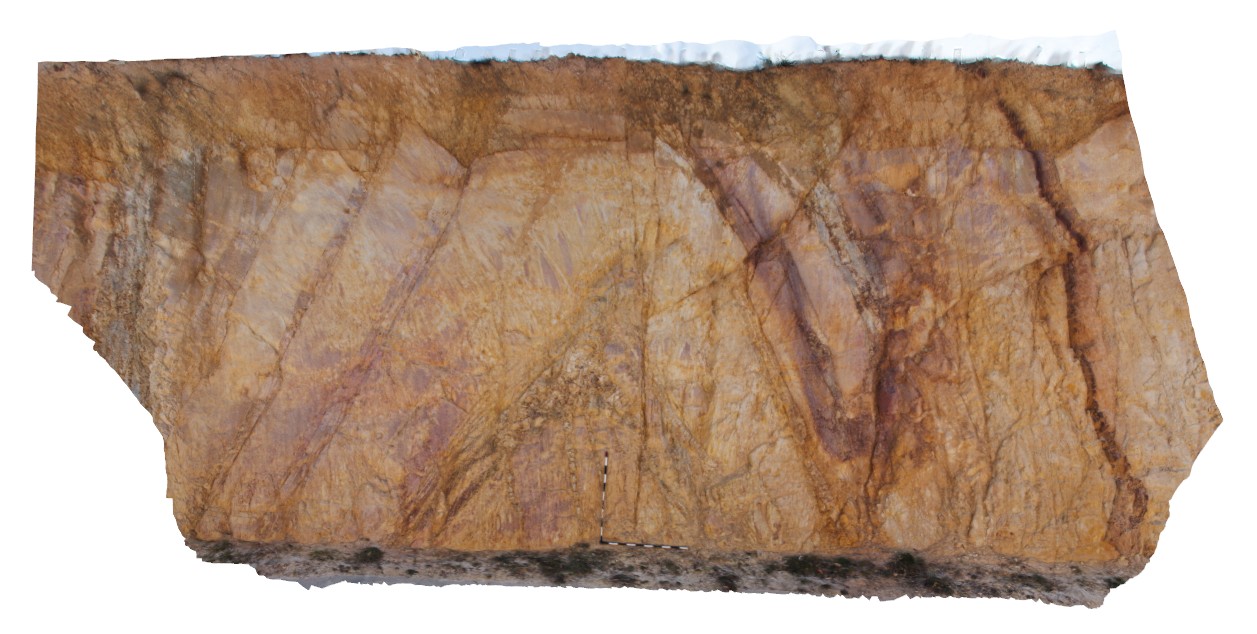
detail of antiform on north side of road cut. Norman Street road cut. North side. Ballarat, Vic. |
6.50 |
-37.53758000000 |
143.87032000000 |
-9999.000 |
antiform, bedding, folding, structure, turbidite |
turbidite |
Ballarat5 Map
 |
0 |
06/05/2016 10:34 a.m. |
3D terrestrial photogrammetric model |
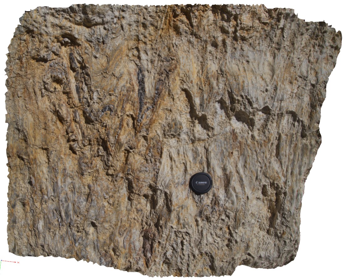
polydeformed / folded and faulted rocks near the Avoca Fault, Linton-Piggoreet Road. Ballarat. Vic. |
1.00 |
-37.72517000000 |
143.62535000000 |
-9999.000 |
deformation, fault zone |
metasediments |
Ballarat6 Map
 |
0 |
06/05/2016 10:34 a.m. |
3D terrestrial photogrammetric model |
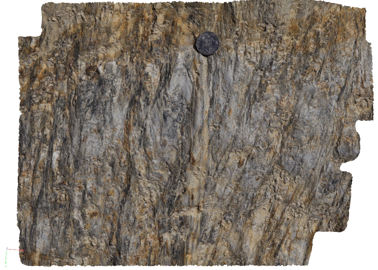
polydeformed / folded and faulted rocks and quartz veins near the Avoca Fault, Linton-Piggoreet Road. Ballarat. Vic. |
0.50 |
-37.52512000000 |
143.62543000000 |
-9999.000 |
fold, shear, quartz vein |
metasediments |
Ballarat7 Map
 |
0 |
06/05/2016 10:35 a.m. |
3D terrestrial photogrammetric model |
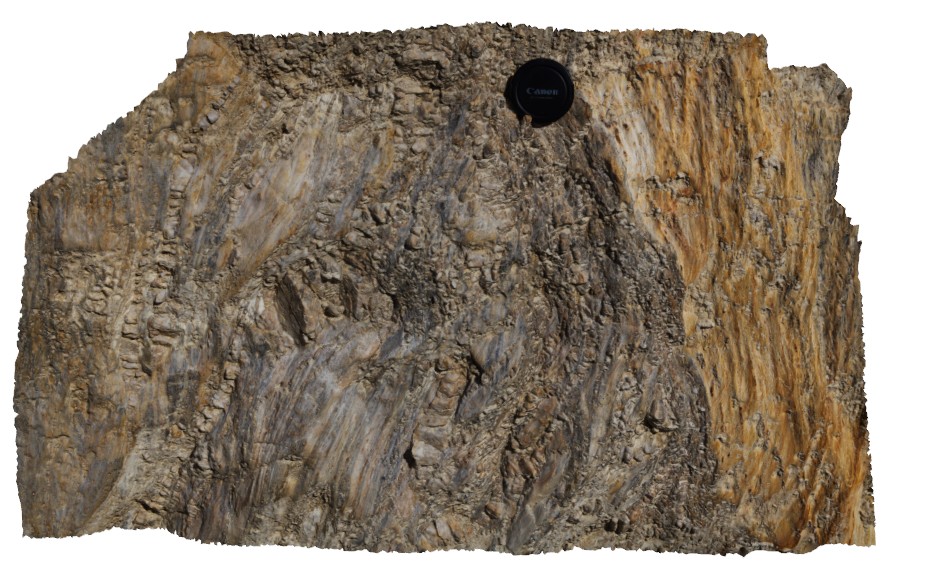
polydeformed / folded and faulted rocks and quartz veins near the Avoca Fault, Linton-Piggoreet Road. Ballarat. Vic. |
0.70 |
-37.72512000000 |
143.62545000000 |
-9999.000 |
fault zone, shear zone, deformation, quartz vein |
metasediment |
Ballarat8 Map
 |
0 |
06/05/2016 10:35 a.m. |
3D terrestrial photogrammetric model |
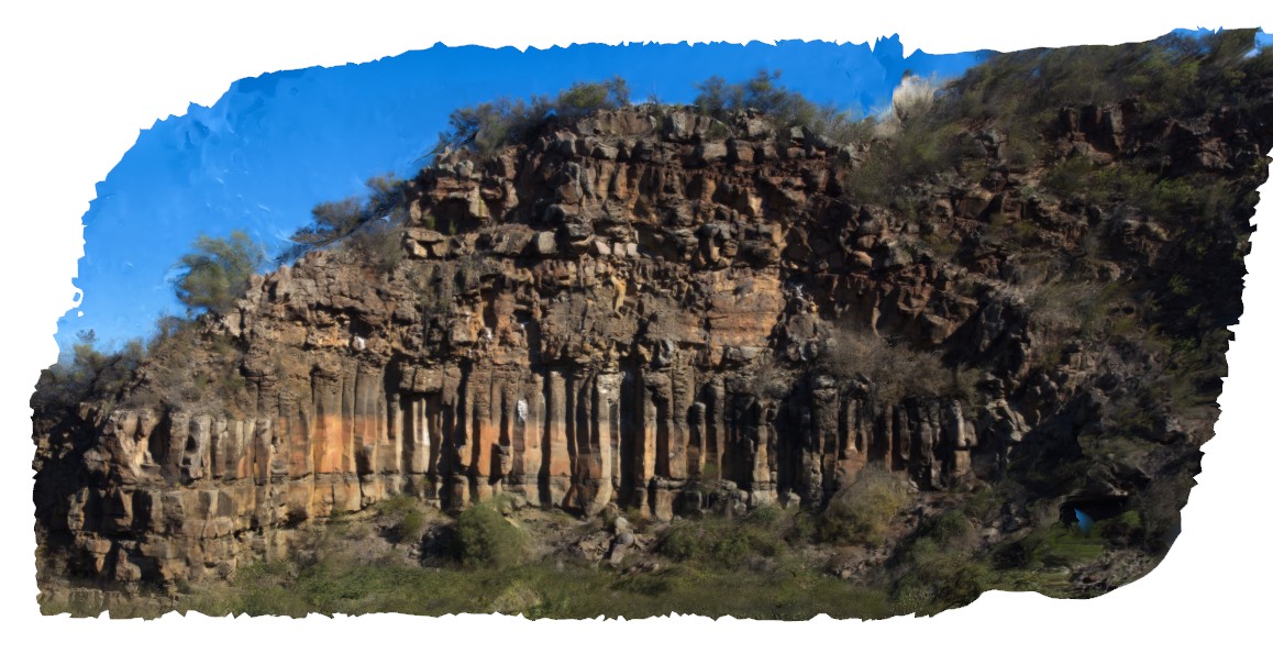
columnar, jointed basalt and flow with residual vesicular top. Devils Kitchen Geological Reserve. Ballarat. Vic. |
40.00 |
-37.72656000000 |
143.62198000000 |
-9999.000 |
columnar basalt, vesicular basalt, columnar jointing |
basalt |
Ballarat9 Map
 |
0 |
06/05/2016 10:36 a.m. |
3D terrestrial photogrammetric model |
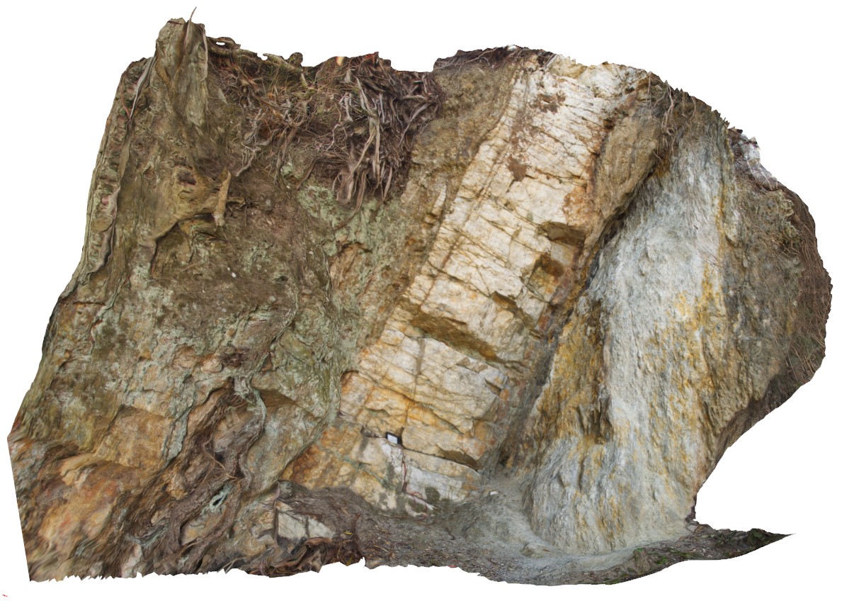
steeply dipping quartz vein / blow along the possible position of the Avoca Fault, Ballarat, Vic. |
3.00 |
-37.72817000000 |
143.62782000000 |
-9999.000 |
fault zone, quartz vein, shear zone |
metasediments, quartz |
Barrens1 Map
 |
0 |
06/05/2016 10:35 a.m. |
3D terrestrial photogrammetric model |
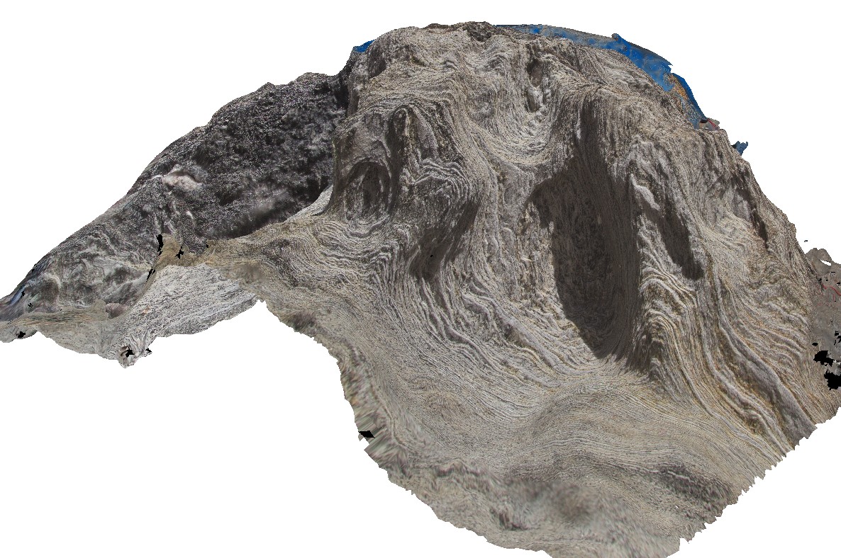
finely laminated and folded schist with penetrating cleavage, Barrens Beach, W.A. |
0.70 |
-33.92590000000 |
120.03191000000 |
-9999.000 |
cleavage, folding, structure |
schist |
Barrens10 Map
 |
0 |
06/09/2016 11:58 a.m. |
3D terrestrial photogrammetric model |
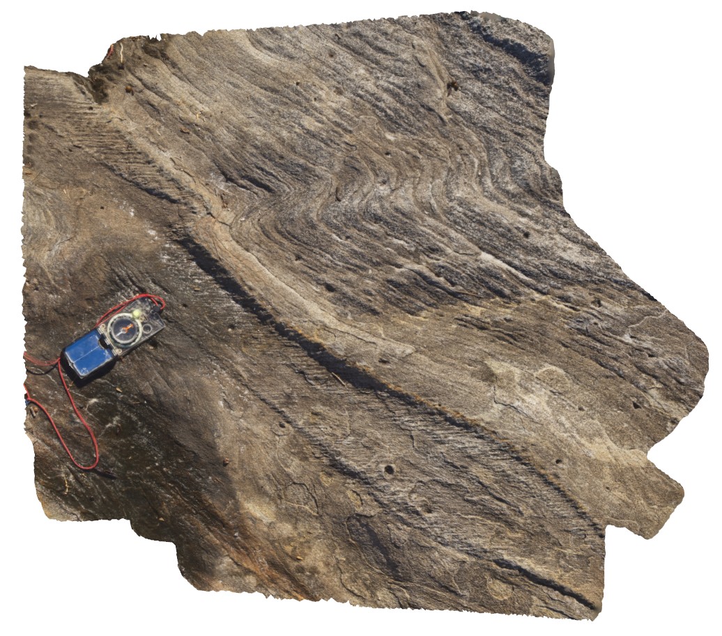
cleavage partitioned into silty unit in folded psammitic metasediments. Barrens Beach. W.A. |
0.80 |
-33.92697000000 |
120.03423000000 |
-9999.000 |
partitioned cleavage, folding, metasediments |
metasediment |
Barrens11 Map
 |
0 |
06/05/2016 10:39 a.m. |
3D terrestrial photogrammetric model |
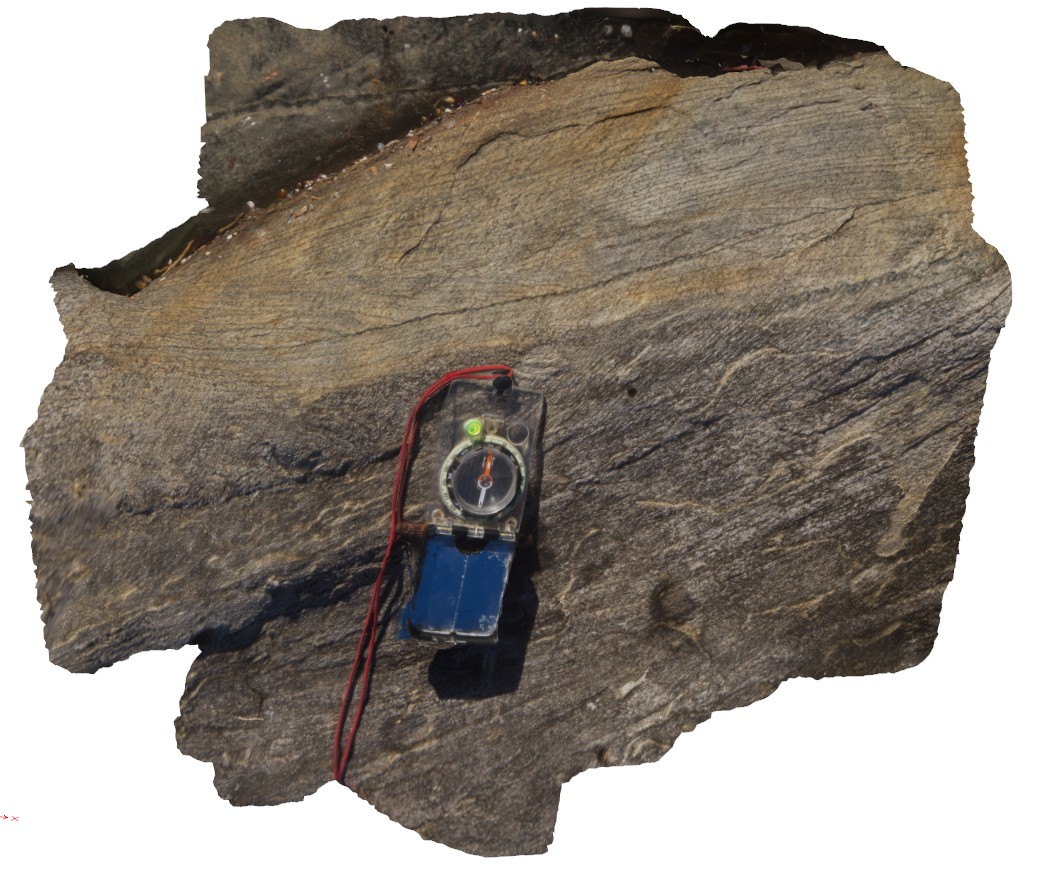
cross beds and cleavage in psammitic metasediments. Barrens Beach, W.A. |
0.60 |
-33.92699000000 |
120.03423000000 |
-9999.000 |
cross bedding, psammitic metasediments |
psammite |
 AusGeol.org