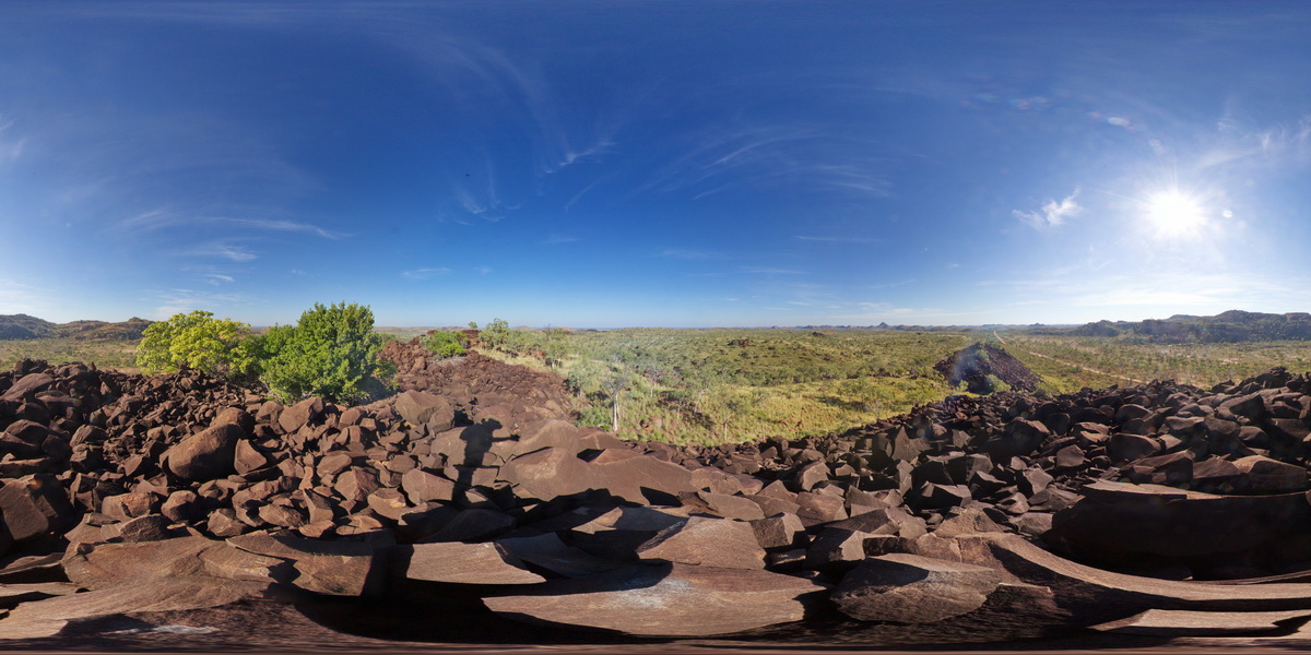
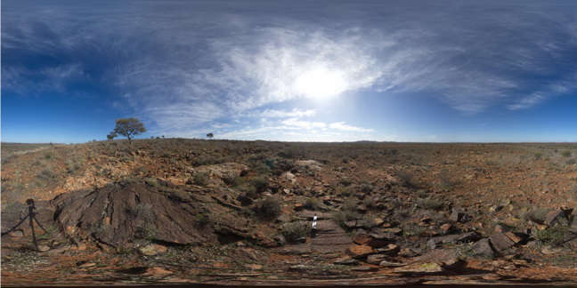
GibbRiverFSP1 Map
 |
0 |
06/06/2016 noon |
FSP |
view from gabbroic knoll of surrounding granite country. Gibb River Road, near Mount Amy. W.A. |
5000.00 |
-17.20575000000 |
124.91619000000 |
-9999.000 |
gabbro, granite |
gabbro |
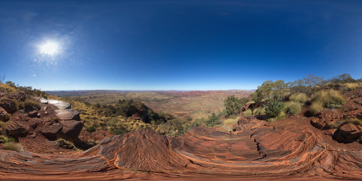
TomPriceGIGa1 Map
 |
0 |
05/29/2016 noon |
GIGA |
360 degree view from near the summit of Mount Nameless, showing Mount Tom Price mine operations and surrounding country. Tom Price, W.A. |
5000.00 |
-22.71881000000 |
117.76555000000 |
-9999.000 |
banded iron formation, chert |
BIF |
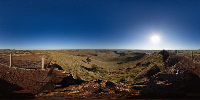
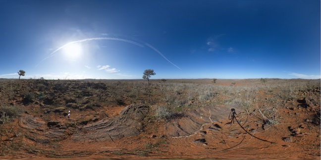
AilerFSP1 Map
 |
0 |
08/04/2016 10:54 a.m. |
FSP |
panoramic view from small hill of gneisses forming the Western and Hartz Ranges. The Garden Road, North of Alice Springs. N.T. |
5000.00 |
-23.23560700000 |
134.03837800000 |
809.222 |
gneiss, metamorphic |
gneiss |
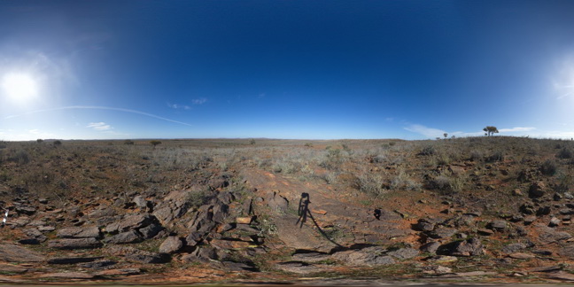
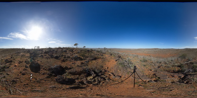
GibbRiverFSP2 Map
 |
0 |
06/06/2016 noon |
FSP |
view from gabbroic knoll of surrounding granite country. Gibb River Road, near Mount Amy. W.A. |
5000.00 |
-17.20631000000 |
124.91576000000 |
-9999.000 |
gabbro, granite |
gabbro |
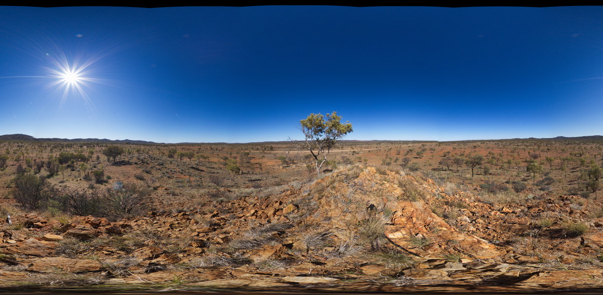
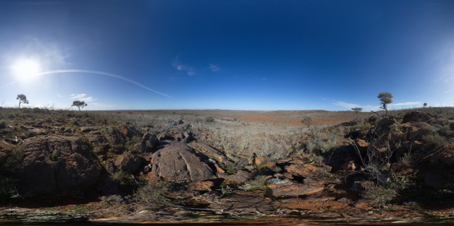
EPilbaraFSP1 Map
 |
0 |
06/01/2016 noon |
FSP |
view of granite outcrops and surrounding area. Woodstock - Rocky Island Road, East Pilbara, W.A. |
5000.00 |
-21.60411000000 |
119.02820000000 |
-9999.000 |
granite outcrop |
granite |
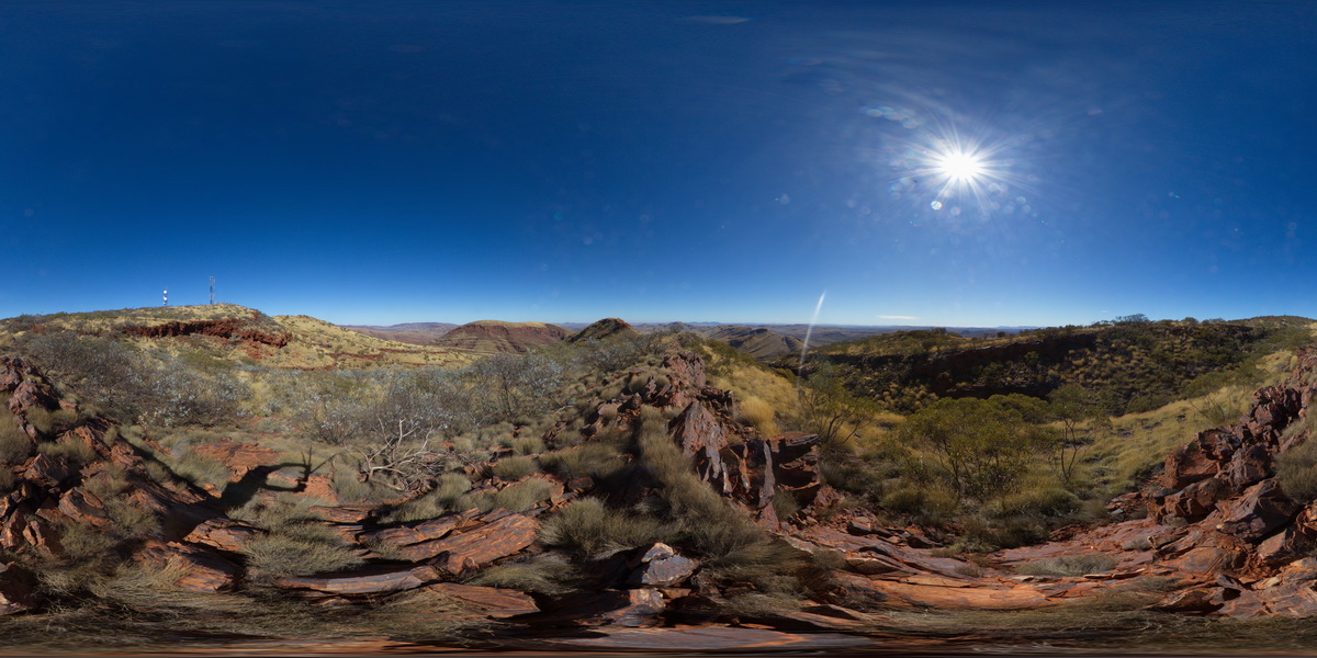
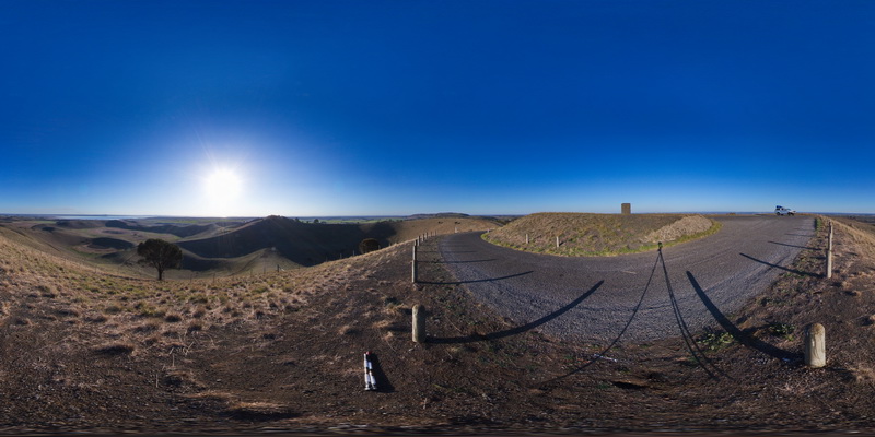
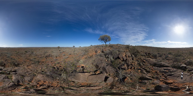
TomPriceFSP2 Map
 |
0 |
05/29/2016 noon |
FSP |
360 degree view from near the summit of Mount Nameless, showing surrounding ridge dominated landscape of sedimentary geology. Tom Price, W.A. |
5000.00 |
-22.71666000000 |
117.76108000000 |
-9999.000 |
Brockman Iron Formation, Pilbara, Hamersley Basin |
BIF |
TomPriceFSP1 Map
 |
0 |
05/29/2016 noon |
FSP |
360 degree view from near the summat of Mount Nameless, showing Mount Tom Price mine operations and surrounding country. Tom Price, W.A. |
5000.00 |
-22.71881000000 |
117.76555000000 |
-9999.000 |
Brockman Iron Formation, Tom Price |
BIF |
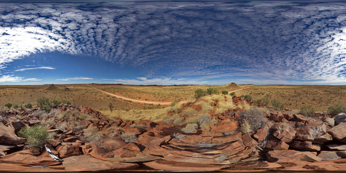
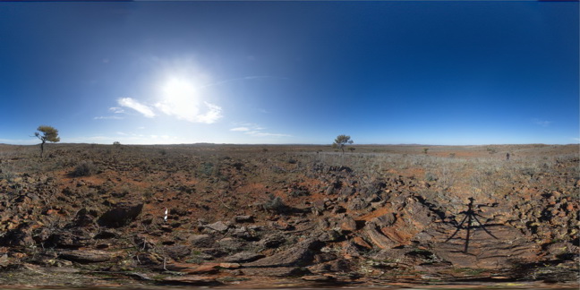
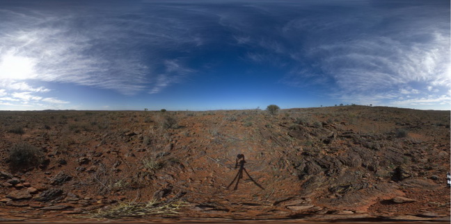
EPilbaraFSP9 Map
 |
0 |
06/01/2016 noon |
FSP |
view from small gabbroic? Knoll looking to N and W. Also showing large black dolerite? Dyke 'wall' to the SE. Woodstock - Rocky Island Road, East Pilbara, W.A. |
5000.00 |
-21.53850000000 |
119.33490000000 |
-9999.000 |
mafic dyke, structural weakness |
dolerite |
BHillFSP7 Map
 |
0 |
10/19/2015 9:43 a.m. |
FSP |
overview of outcropping folded Sundown Group Metasediments and distant hills. Broken Hill. N.S.W. |
3000.00 |
-31.83292000000 |
141.42769000000 |
-9999.000 |
Sundown Group, metasediments, fold |
metasediments |
BHillFSP8 Map
 |
0 |
10/19/2015 9:47 a.m. |
FSP |
overview of outcropping folded Sundown Group Metasediments and distant hills. Broken Hill. N.S.W. |
3000.00 |
-31.83298000000 |
141.42821000000 |
-9999.000 |
Sundown Group, metasediments, fold |
metasediments |
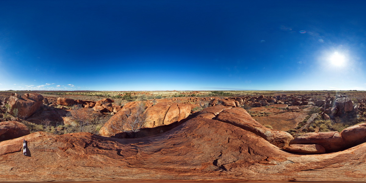
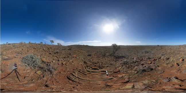
ArkaroolaFSP12 Map
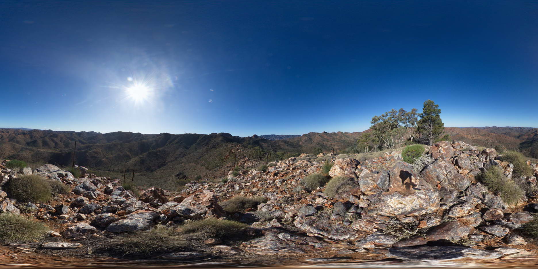 |
5 |
11/26/2015 3:15 p.m. |
FSP |
view from Mt Gee looking over the surrounding area. Outcrop of Mt Gee Sinter in the foreground. Arkaroola. Northern Flinders Ranges, S.A. |
3000.00 |
-30.22729000000 |
139.34213000000 |
-9999.000 |
sinter |
sinter |
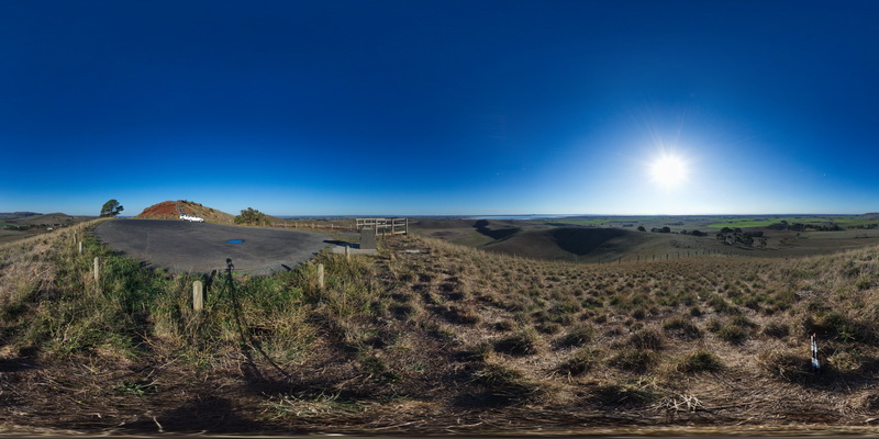
MtGambierFSP1 Map
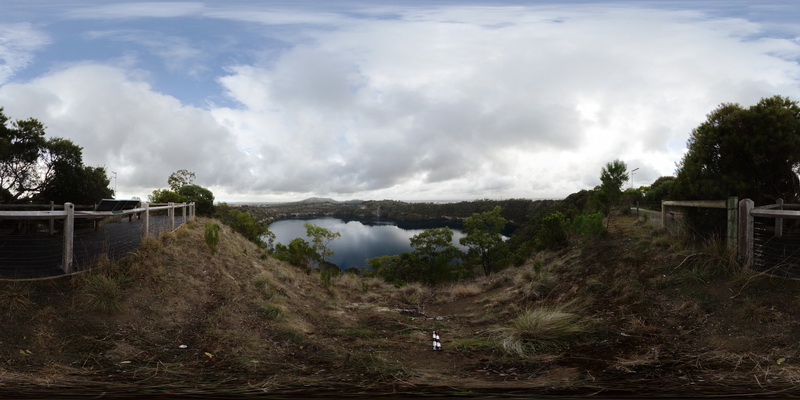 |
0 |
06/05/2016 10:48 a.m. |
FSP |
view from Blue Lake lookout, showing view of the volcanic crater forming Blue Lake and surrounding country side. Mount Gambier, S.A. |
3000.00 |
-37.85010000000 |
140.78181000000 |
-9999.000 |
Volcanic Centre, crater |
igneous |
GairdinerFSP1 Map
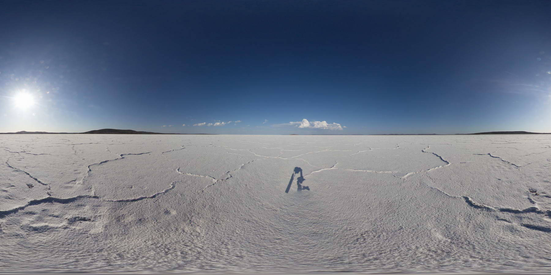 |
0 |
01/26/2016 3:54 p.m. |
FSP |
view across Lake Gairdiner, showing salt pan and surrounding hills. |
3000.00 |
-32.12901000000 |
135.90388000000 |
-9999.000 |
salt lake, evaporite |
evaporite |
BHillFSP2 Map
 |
0 |
10/19/2015 9:12 a.m. |
FSP |
overview of outcropping folded Sundown Group Metasediments and distant hills. Broken Hill. N.S.W. |
3000.00 |
-31.83338000000 |
141.42760000000 |
-9999.000 |
Sundown Metasediments., fold |
metasediments |
AlvieFSP3 Map
 |
0 |
06/05/2016 10:33 a.m. |
FSP |
view from Red Rocks carpark of old maar volcano and cinder cones. Alvie, Vic. |
3000.00 |
-38.24778000000 |
143.50368000000 |
-9999.000 |
maar volcano, cinder cone |
volcanics |
AlvieFSP2 Map
 |
0 |
06/05/2016 10:33 a.m. |
FSP |
view from Red Rocks lookout of surrounding volcanic topography of old maar volcanos and cinder cones. Foreground shows the Red Rocks scoria deposits. Alvie, Vic. |
3000.00 |
-38.24814000000 |
143.50490000000 |
-9999.000 |
scoria, maar volcano, cinder cone, volcanics |
scoria |
AlvieFSP4 Map
 |
0 |
06/05/2016 10:33 a.m. |
FSP |
view from Red Rocks carpark of old maar volcano and cinder cones. Alvie, Vic. |
3000.00 |
-38.25128000000 |
143.50841000000 |
-9999.000 |
maar volcano, cinder cone, volcanic topography |
volcanics |
BHillFSP6 Map
 |
0 |
10/19/2015 9:39 a.m. |
FSP |
overview of outcropping folded and crenulated Sundown Group Metasediments and distant hills. Broken Hill. N.S.W. |
3000.00 |
-31.83335000000 |
141.42799000000 |
-9999.000 |
Sundown Group, crenulation cleavage |
metasediment |
BHillFSP11 Map
 |
0 |
10/19/2015 10:29 a.m. |
FSP |
overview of outcropping folded Sundown Group Metasediments and pegmatite? (pale coloured) Broken Hill. N.S.W. |
3000.00 |
-31.83339000000 |
141.42923000000 |
-9999.000 |
Sundown Group, metasediments, pegmatite |
metasediment, Pegmatite |
BHillFSP5 Map
 |
0 |
10/19/2015 9:35 a.m. |
FSP |
overview of outcropping Sundown Group Metasediments and distant hills. Broken Hill. N.S.W. |
3000.00 |
-31.83376000000 |
141.42818000000 |
-9999.000 |
Sundown Group, metasediments |
metasediments |
BHillFSP12 Map
 |
0 |
10/19/2015 10:33 a.m. |
FSP |
overview of outcropping folded and banded / bedded Sundown Group Metasediments, Broken Hill. N.S.W. |
3000.00 |
-31.83396000000 |
141.43024000000 |
-9999.000 |
Sundown Group, metasediment, fold, structure |
metasediment |
BHillFSP4 Map
 |
0 |
10/19/2015 9:19 a.m. |
FSP |
overview of outcropping and graded? / bedded Sundown Group Metasediments and distant hills. Broken Hill. N.S.W. |
3000.00 |
-31.83373000000 |
141.42775000000 |
-9999.000 |
Sundown Group, metasediments |
metasediment |
BHillFSP1 Map
 |
0 |
10/19/2015 9:02 a.m. |
FSP |
overview of outcropping Sundown Group Metasediments and distant hills. Broken Hill. N.S.W. |
3000.00 |
-31.83332000000 |
141.42719000000 |
-9999.000 |
Sundown Metasediments. |
metasediment |
BHillFSP9 Map
 |
0 |
10/19/2015 9:51 a.m. |
FSP |
overview of outcropping folded and bedded / graded Sundown Group Metasediments and distant hills. Broken Hill. N.S.W. |
3000.00 |
-31.83300000000 |
141.42867000000 |
-9999.000 |
Sundown Group, metasediments, fold, bedded |
metasediment |
BHillFSP3 Map
 |
0 |
10/19/2015 9:16 a.m. |
FSP |
overview of outcropping, folded and graded? / bedded Sundown Group Metasediments and distant hills. Broken Hill. N.S.W. |
3000.00 |
-31.83345000000 |
141.42760000000 |
-9999.000 |
metasediments, Sundown Group |
metasediment |