Arkaroola29 Map
 |
5 |
11/06/2015 1:52 p.m. |
3D terrestrial photogrammetric model |
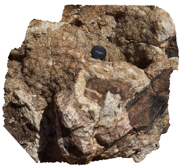
detail of breccia vugh, showing terminating quartz crystals and cross sections of nail hole texture. Radium Hill Breccia, Arkaroola. Northern Flinders Ranges, S.A. |
0.20 |
-30.22877000000 |
139.34573000000 |
-9999.000 |
terminating quartz crystals, nail hole quartz |
quartz |
Arkaroola3 Map
 |
5 |
09/27/2015 5:34 p.m. |
3D terrestrial photogrammetric model |
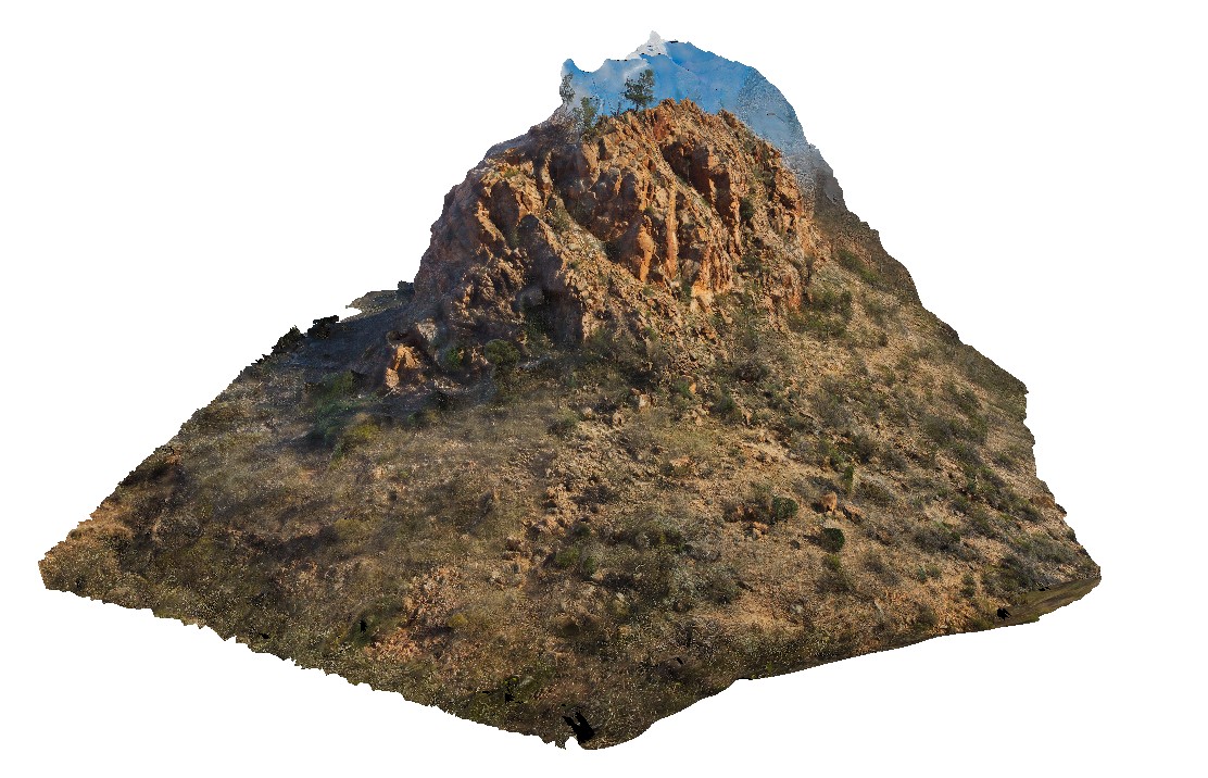
view of 'The Pinnacles' showing massive leucogranite, Arkaroola. Northern Flinders Ranges, S.A. |
75.00 |
-30.29702400000 |
139.31017400000 |
-9999.000 |
leucogranite, pegmatite |
granite |
Arkaroola30 Map
 |
5 |
09/27/2015 5:35 p.m. |
3D terrestrial photogrammetric model |
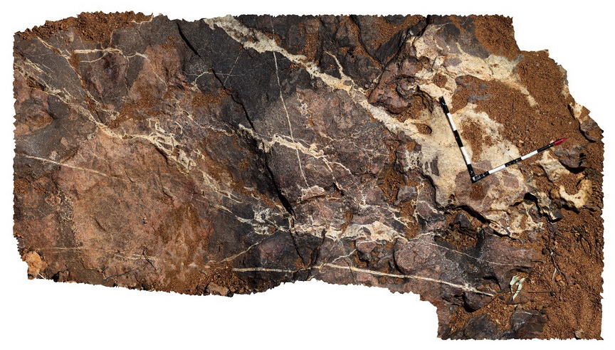
Pavement of granitic breccia with multiple cross-cutting veins and multiple brecciation phases. Creek bed above waterfall in Radium Ridge Breccias. Veins show terminating quartz crystals. Arkaroola. Northern Flinders Ranges, S.A. |
3.50 |
-30.22879000000 |
139.34567000000 |
-9999.000 |
Radium Ridge, Breccia |
breccia |
Arkaroola31 Map
 |
5 |
11/06/2015 1:53 p.m. |
3D terrestrial photogrammetric model |
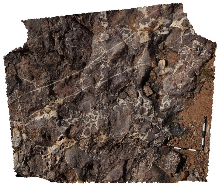
Pavement of granitic breccia with multiple cross-cutting veins and multiple brecciation phases. Creek bed above waterfall in Radium Ridge Breccias. Veins show terminating quartz crystals. Arkaroola. Northern Flinders Ranges, S.A. |
3.00 |
-30.22895000000 |
139.34540000000 |
-9999.000 |
breccia, quartz vein |
breccia |
Arkaroola32 Map
 |
5 |
11/06/2015 1:54 p.m. |
3D terrestrial photogrammetric model |
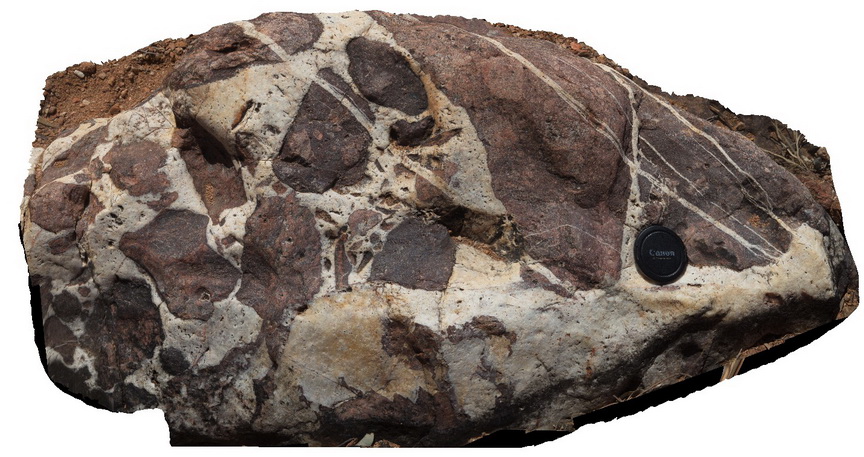
close-up view of re-brecciated haematitic and granitic breccia cemented by nail hole quartz above the waterfall below Mt Gee, Arkaroola. Northern Flinders Ranges, S.A. |
0.30 |
-30.22895000000 |
139.34540000000 |
-9999.000 |
rebrecciated, quartz vein |
breccia |
Arkaroola33 Map
 |
5 |
11/06/2015 1:55 p.m. |
3D terrestrial photogrammetric model |
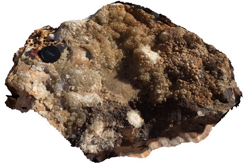
boulder exhibiting excellent terminating quartz crystals, encrusting side of vugh. Some form radiating aggregates. Mt Gee, Arkaroola. Northern Flinders Ranges, S.A. |
0.30 |
-30.22897000000 |
139.34520000000 |
-9999.000 |
radiating quartz |
quartz |
Arkaroola34 Map
 |
5 |
11/12/2015 9:58 a.m. |
3D terrestrial photogrammetric model |
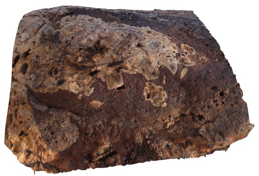
Boulder of quartz psuedomorph after fluorite. Detail shows quartz banding on psuedomorph edges with free growing quartz infilling the cavity. Mt Gee, Arkaroola. Northern Flinders Ranges, S.A. |
0.30 |
-30.22892000000 |
139.34242000000 |
-9999.000 |
quartz psuedomorph, psuedomorph |
quartz |
Arkaroola35 Map
 |
5 |
11/12/2015 9:59 a.m. |
3D terrestrial photogrammetric model |
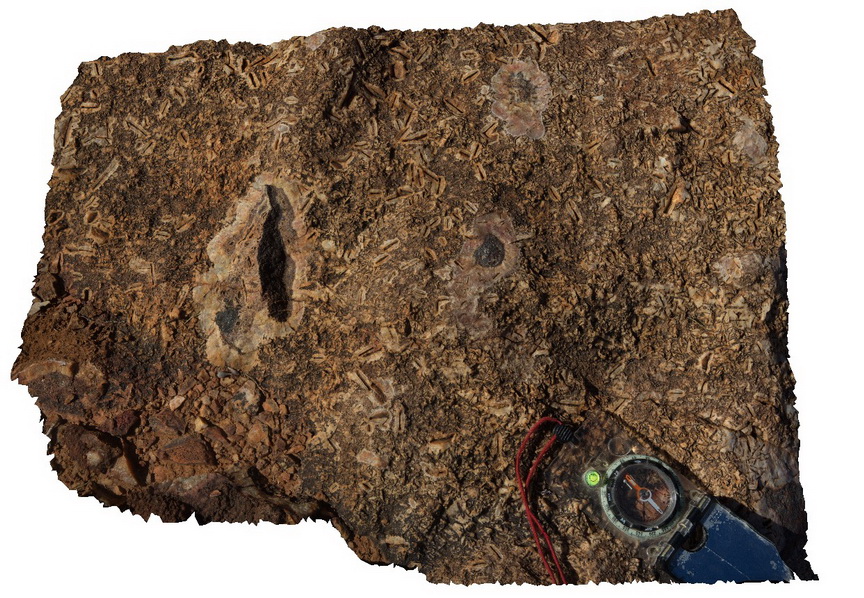
Voids after Calcite? Or other mineral rimmed by finely crystalline quartz and silica. Fragments of hematite enclosed in cryptocrystalline silica. Mt Gee, Arkaroola. Northern Flinders Ranges, S.A. |
0.30 |
-30.22387000000 |
139.34242000000 |
-9999.000 |
cryptocrystalline silica, quartz mineral casts |
sinter |
Arkaroola36 Map
 |
5 |
11/12/2015 9:59 a.m. |
3D terrestrial photogrammetric model |
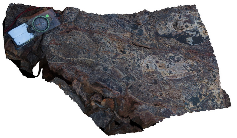
breccia, showing multiple phases of brecciation. Quartz veining cross cutting and hosting breccia clasts. Northern Flinders Ranges, S.A. |
0.30 |
-30.22387000000 |
139.34239000000 |
-9999.000 |
breccia, quartz veining |
sinter |
Arkaroola37 Map
 |
5 |
11/12/2015 10 a.m. |
3D terrestrial photogrammetric model |
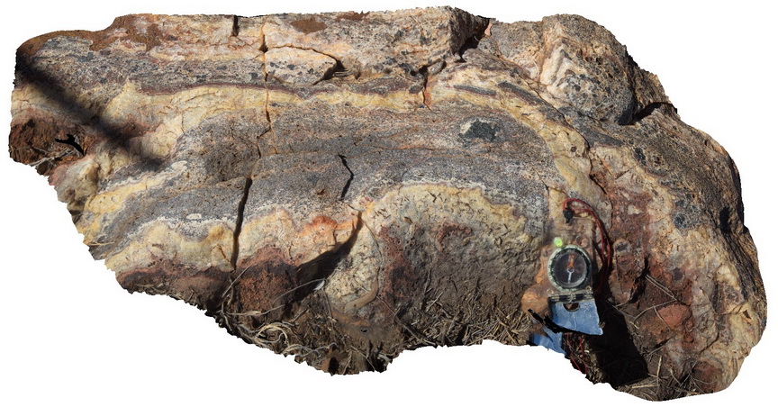
example of colloform quartz banding on breccia clasts, Radium Ridge Breccia, Arkaroola. Northern Flinders Ranges, S.A. |
0.50 |
-30.22390000000 |
139.34235000000 |
-9999.000 |
colloform banding |
sinter |
Arkaroola38 Map
 |
5 |
11/12/2015 10 a.m. |
3D terrestrial photogrammetric model |
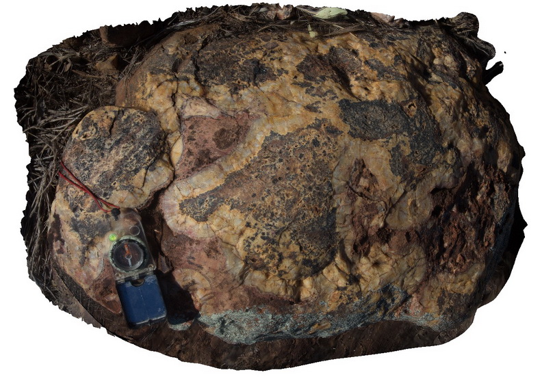
Detail of breccia with colloform quartz banding surrounding clasts. Specular hematite and other minerals also present. Arkaroola. Northern Flinders Ranges, S.A. |
0.70 |
-30.22391000000 |
139.34218000000 |
-9999.000 |
colloform quartz banding, breccia |
sinter |
Arkaroola39 Map
 |
5 |
11/12/2015 10:01 a.m. |
3D terrestrial photogrammetric model |
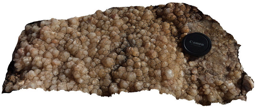
detail of terminating quartz crystals encrusting vein selvage?, part of Mt Gee sinter, Arkaroola. Northern Flinders Ranges, S.A. |
0.30 |
-30.22345000000 |
139.34189000000 |
-9999.000 |
quartz crystal, crystal terminations |
sinter |
Arkaroola4 Map
 |
5 |
11/06/2015 1:32 p.m. |
3D terrestrial photogrammetric model |
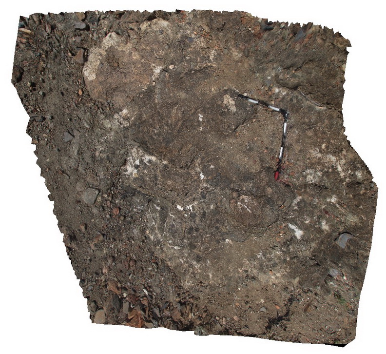
hydrothermal breccia exposed on the track to the Pinnacles, Arkaroola. Clasts include granite and metasomatised sediments, Arkaroola. Northern Flinders Ranges, S.A. |
3.00 |
-30.29797000000 |
139.30904000000 |
-9999.000 |
hydrothermal breccia |
Breccia |
Arkaroola40 Map
 |
5 |
11/12/2015 10:01 a.m. |
3D terrestrial photogrammetric model |
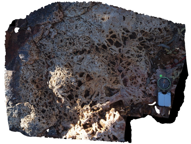
fine quartz colloform banding creating box work textures in sinter outcrop, Mt Gee, Arkaroola. Northern Flinders Ranges, S.A. |
1.00 |
-30.22618000000 |
139.34225000000 |
-9999.000 |
boxwork texture, sinter |
sinter |
Arkaroola41 Map
 |
5 |
11/12/2015 10:02 a.m. |
3D terrestrial photogrammetric model |
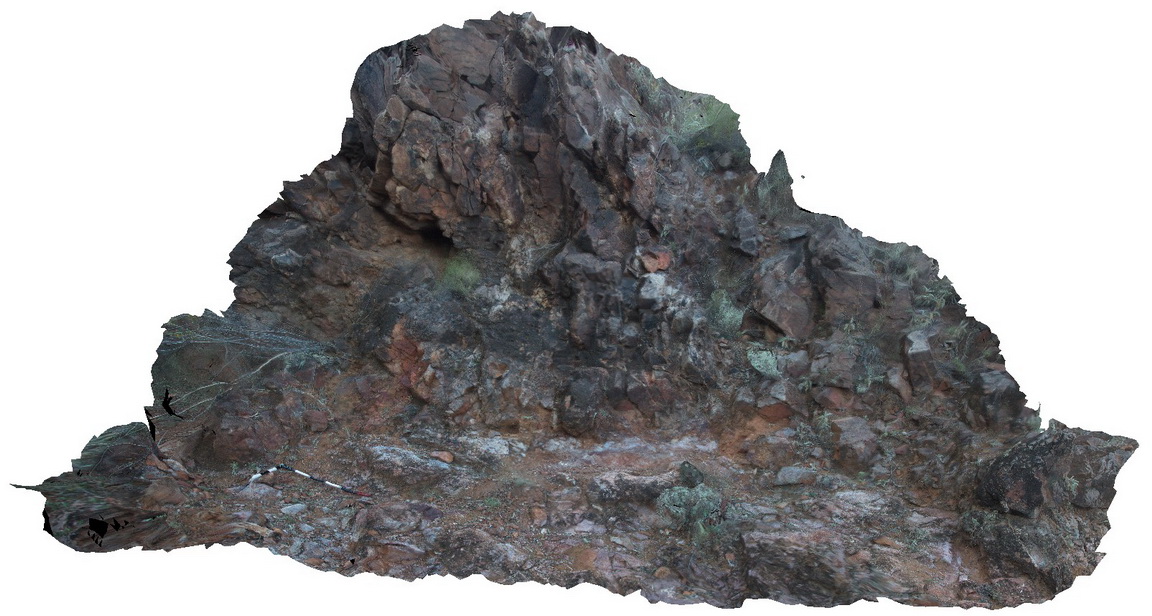
Basal unconformity between the Mount Neill Granite basement and the basal Adelaidean Paralana Quartzite, near the Arkaroola Waterhole, Arkaroola. Northern Flinders Ranges, S.A. |
5.00 |
-30.28329000000 |
139.33298000000 |
-9999.000 |
Adelaidean Unconformity |
metagranite, quartzite |
Arkaroola42 Map
 |
5 |
11/12/2015 10:02 a.m. |
3D terrestrial photogrammetric model |
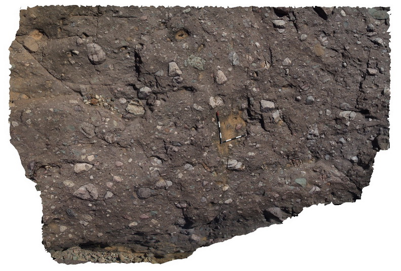
diamictite exposure at Tillite Gorge, Arkaroola. Northern Flinders Ranges, S.A. |
5.00 |
-30.32765000000 |
139.40970000000 |
-9999.000 |
tillite |
diamictite |
Arkaroola43 Map
 |
5 |
11/12/2015 10:04 a.m. |
3D terrestrial photogrammetric model |
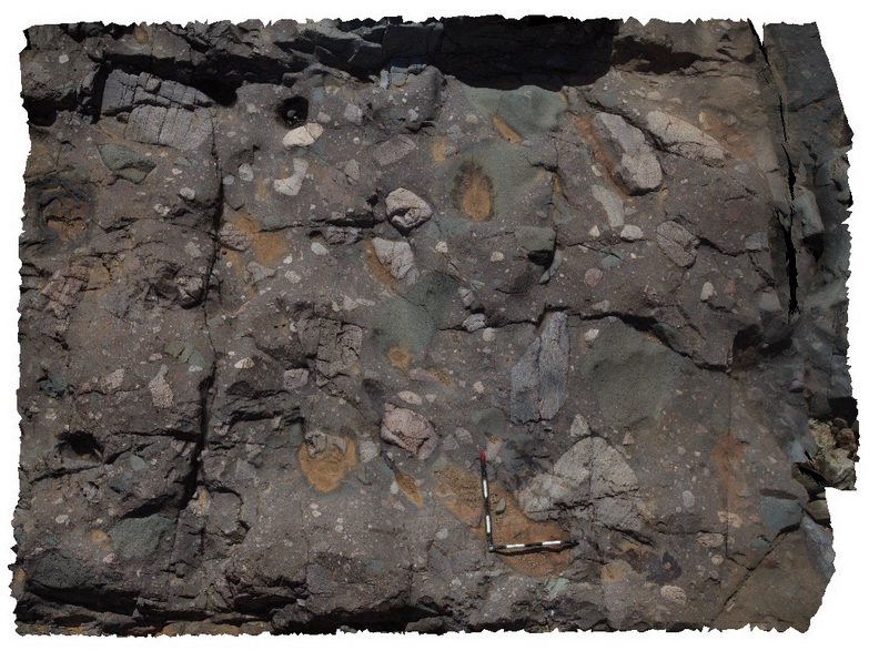
diamictite pavement exposed in the bottom of a creek bed, Tillite Gorge, Arkaroola. Northern Flinders Ranges, S.A. |
4.00 |
-30.32911000000 |
139.40944000000 |
-9999.000 |
diamictite |
diamictite |
Arkaroola44 Map
 |
5 |
11/12/2015 10:04 a.m. |
3D terrestrial photogrammetric model |
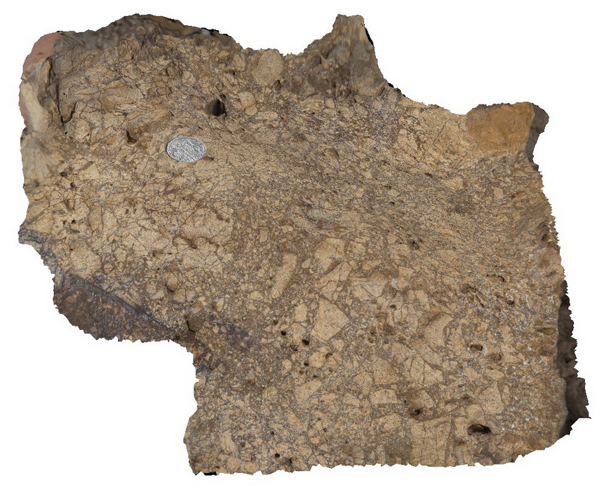
silica cemented breccia in creek boulder of Balcanoona Carbonate, Tillite Gorge, Arkaroola. Northern Flinders Ranges, S.A. |
0.20 |
-30.32681000000 |
139.40901000000 |
-9999.000 |
breccia, silica cement |
carbonate |
Arkaroola45 Map
 |
5 |
11/12/2015 10:05 a.m. |
3D terrestrial photogrammetric model |
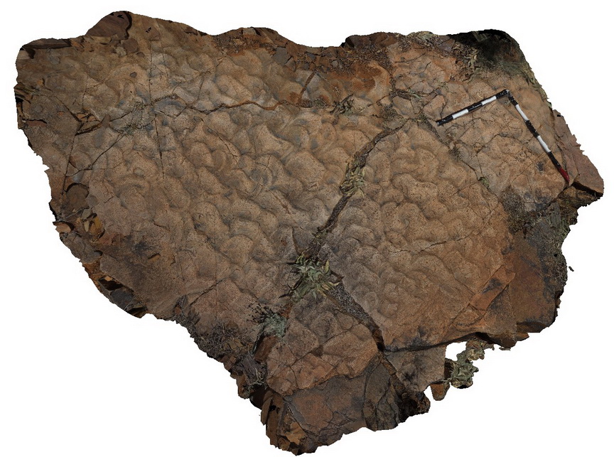
preserved pavement of asymmetric ripples in Wartupa Quartzite, Groan Creek, Arkaroola. Northern Flinders Ranges, S.A. |
2.00 |
-30.29587000000 |
139.43205000000 |
-9999.000 |
ripple marks, bedding planes, sedimentology |
quartzite |
Arkaroola46 Map
 |
5 |
11/12/2015 10:05 a.m. |
3D terrestrial photogrammetric model |
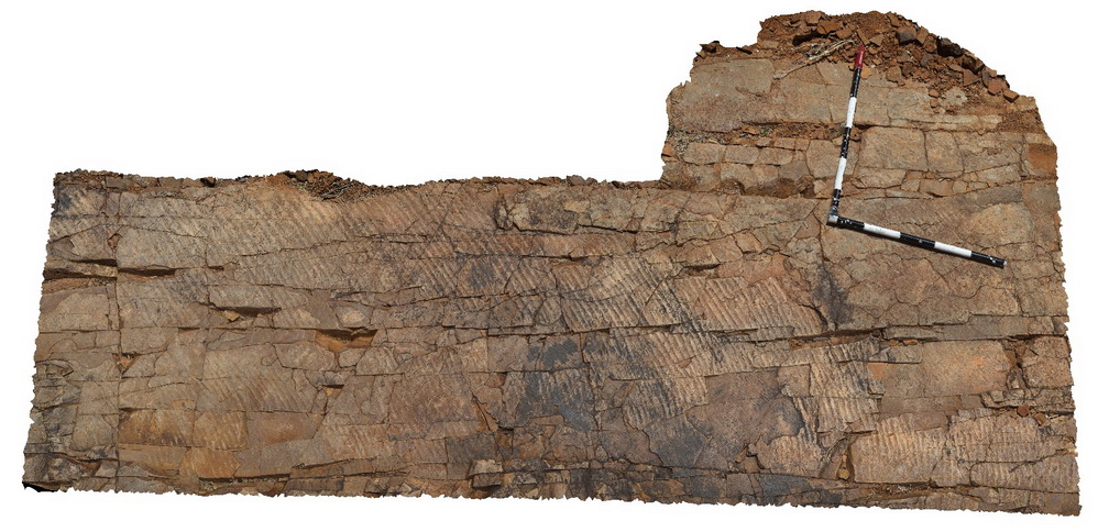
pavement with small symmetrical ripples, mud cracks and raindrop overprints in Wartupa Quartzite, Groan Creek, Arkaroola. Northern Flinders Ranges, S.A. |
2.50 |
-30.29617000000 |
139.43236000000 |
-9999.000 |
ripple marks, mud cracks, sedimentology |
quartzite |
Arkaroola47 Map
 |
5 |
11/12/2015 10:06 a.m. |
3D terrestrial photogrammetric model |
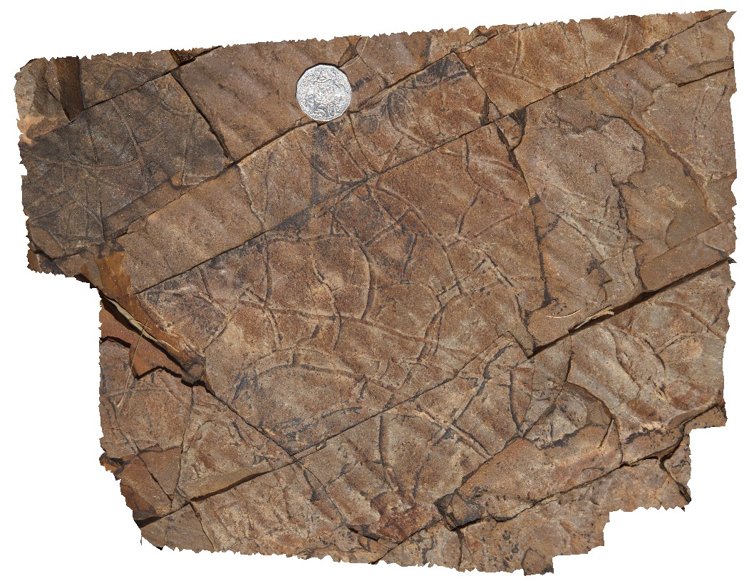
detail in preserved pavement of mud cracks in Wartupa Quartzite, Groan Creek, Arkaroola. Northern Flinders Ranges, S.A. |
0.30 |
-30.29617000000 |
139.43236000000 |
-9999.000 |
mud cracks, sedimentology |
quartzite |
Arkaroola48 Map
 |
5 |
11/12/2015 10:06 a.m. |
3D terrestrial photogrammetric model |
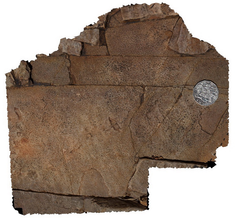
detail in preserved pavement of rain drop indentations in Wartupa Quartzite, Groan Creek, Arkaroola. Northern Flinders Ranges, S.A. |
0.30 |
-30.29617000000 |
139.43236000000 |
-9999.000 |
rain drop indentations, sedimentology |
quartzite |
Arkaroola49 Map
 |
5 |
11/12/2015 10:07 a.m. |
3D terrestrial photogrammetric model |
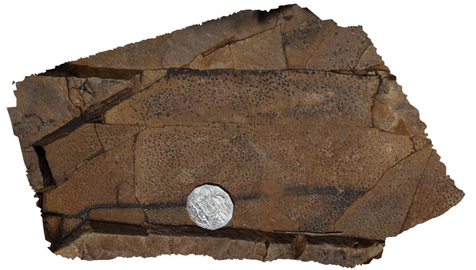
detail in preserved pavement of rain drop indentations in Wartupa Quartzite, Groan Creek, Arkaroola. Northern Flinders Ranges, S.A. |
0.20 |
-30.29617000000 |
139.43236000000 |
-9999.000 |
rain drop indentations, sedimentology |
quartzite |
Arkaroola5 Map
 |
5 |
11/06/2015 1:34 p.m. |
3D terrestrial photogrammetric model |
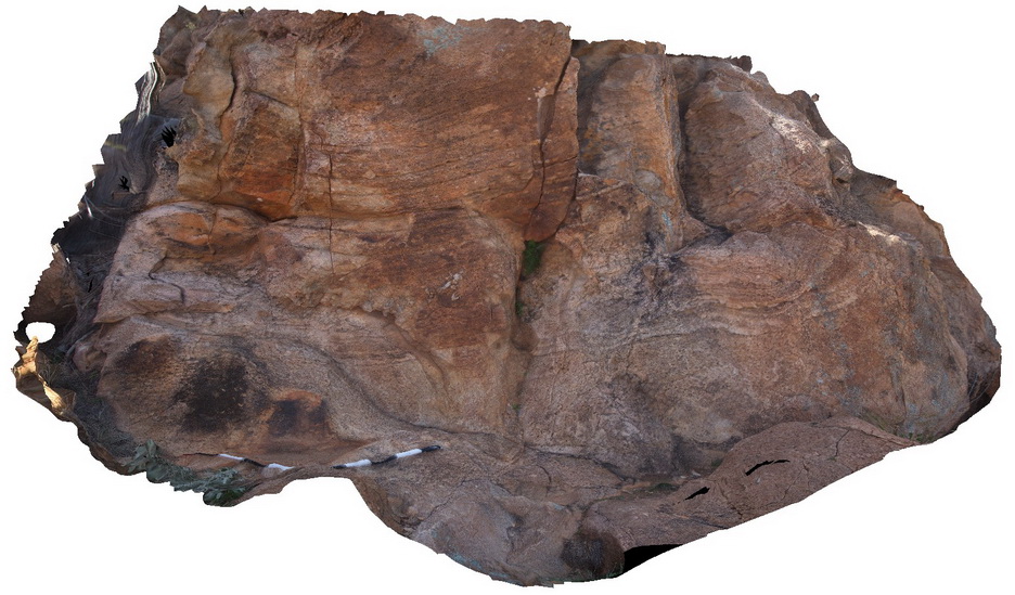
layering in fine grained, equigranular granite on top of 'the pinnacles', Arkaroola. Northern Flinders Ranges, S.A. |
4.00 |
-30.29722000000 |
139.31032000000 |
-9999.000 |
granite banding |
granite |
Arkaroola50 Map
 |
5 |
11/12/2015 10:07 a.m. |
3D terrestrial photogrammetric model |
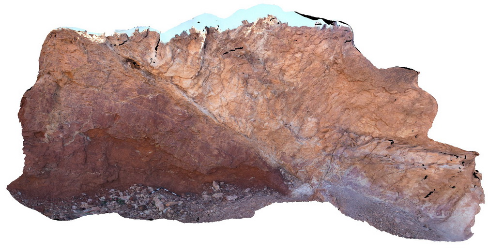
exposure of the Lady Buxton thrust fault in Lady Buxton Creek. Weathered Neoproterozoic Wywyana carbonate units thrust over ferruginous Cenozoic sediments (gravels). The fault displays evidence of neotectonic activity. Near Lady Buxton Mine, Arkaroola. SA |
6.00 |
-30.26333500000 |
139.42368200000 |
-9999.000 |
thrust fault, structure |
marble, conglomerate |
 AusGeol.org