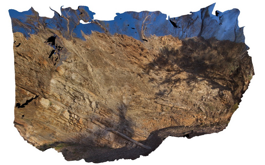
AmadFSP5 Map
 |
5 |
08/01/2016 12:07 p.m. |
FSP |
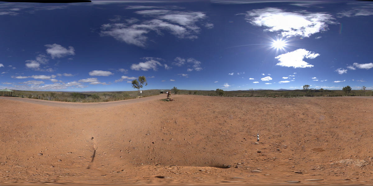
panorama view from western end of Mac Donnell Range from Taylors Pass. Gosse Bluff to the south. N.T. |
0.00 |
-23.67139200000 |
132.36578700000 |
832.751 |
conglomerate |
conglomerate |
AmadFSP6 Map
 |
5 |
08/01/2016 12:47 p.m. |
FSP |
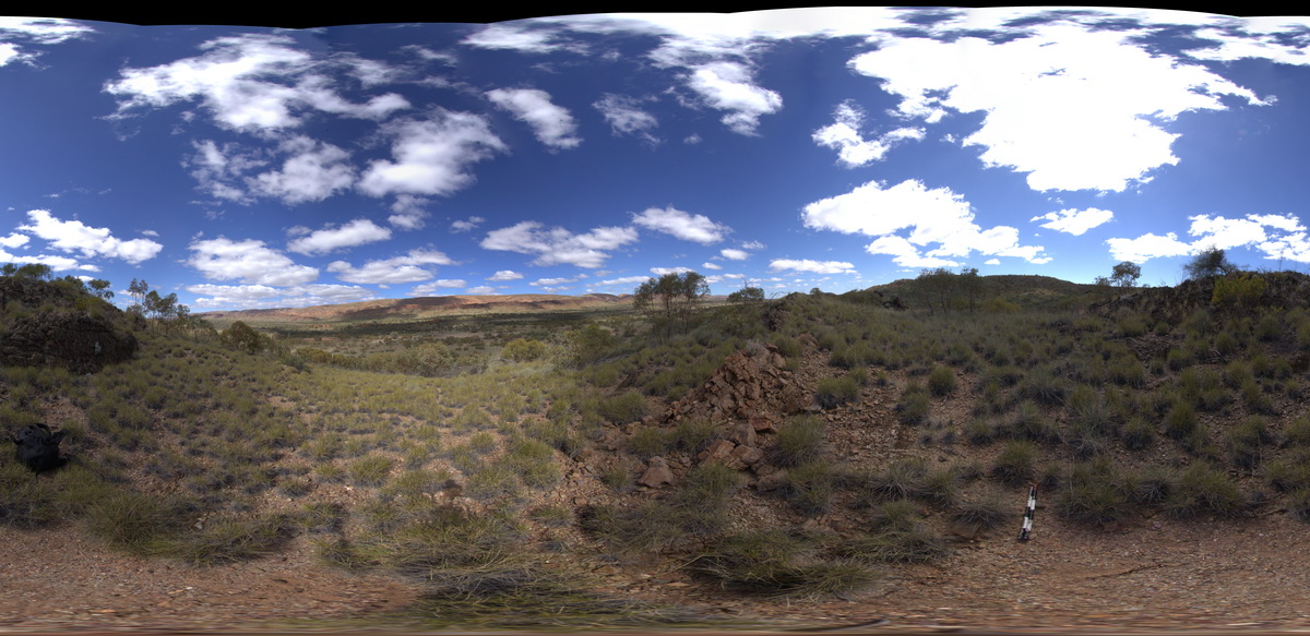
panorama view along road between Redbank Gorge and Ormiston Gorge. Line of steeply dipping strata on the ridge to the south. West MacDonnell National Park, N.T. |
2000.00 |
-23.65119300000 |
132.59554500000 |
706.566 |
dip, strata, structure |
siltstone |
AMADUAV1 Map
 |
5 |
07/27/2016 11:20 a.m. |
UAV |
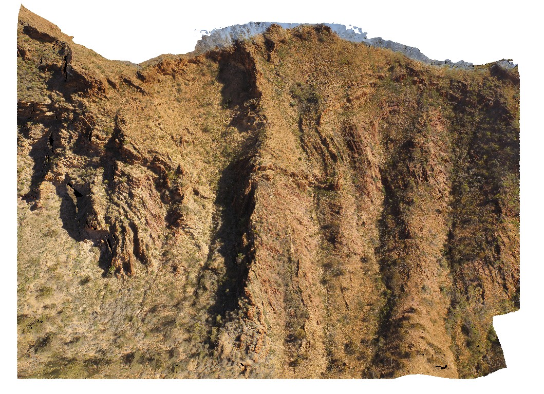
aerial view of chaotic folded sediments from the Bitter Springs Group. Bitter Springs Gorge, N.T. |
500.00 |
-23.54199600000 |
134.46085000000 |
534.638 |
chaotic folding, sediments, fold, structure, Bitter Springs |
sediments |
AMADUAV2 Map
 |
5 |
01/01/9999 midnight |
UAV |
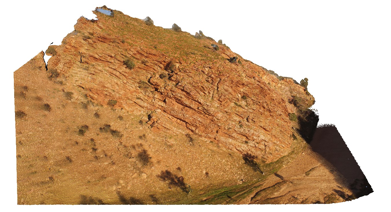
bedding in quartzose Heavitree Sandstone. The Gap, Alice Springs. N.T. |
500.00 |
-23.72543800000 |
133.86616800000 |
534.638 |
bedding, sandstone, sedimentology |
sandstone |
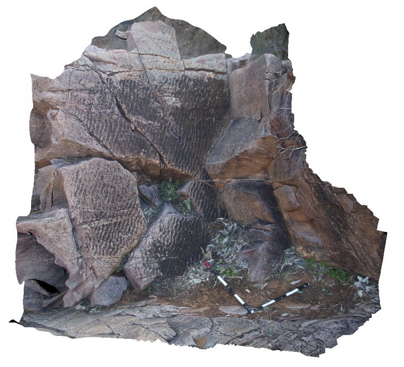
Arkaroola1 Map
 |
5 |
11/06/2015 1:30 p.m. |
3D |
moderately to steeply dipping siliciclastic strata with cross cutting fault. Road cutting on Four Mile Track approaching Arkaroola Village from the west. Northern Flinders Ranges, S.A. |
10.00 |
-30.29754000000 |
139.25706000000 |
-9999.000 |
fault, structure |
sandstone |
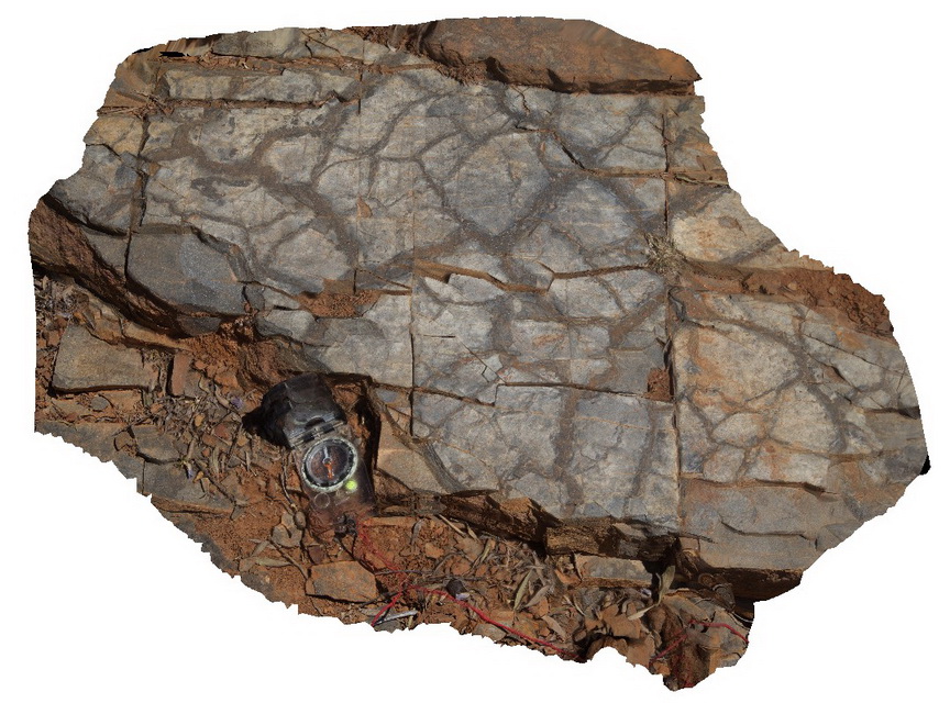
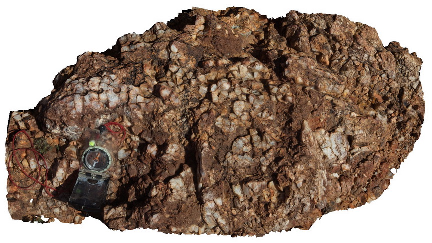
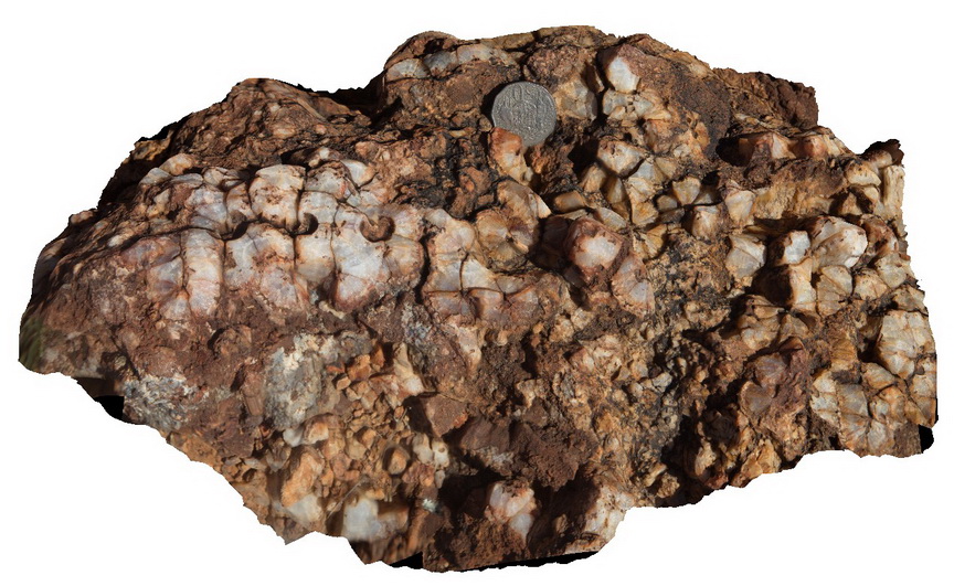
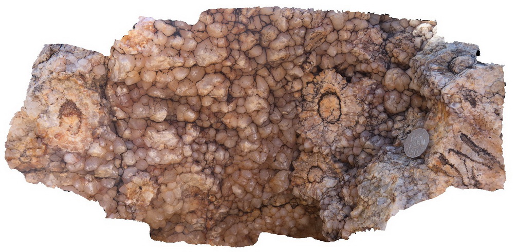
Arkaroola10 Map
 |
5 |
11/06/2015 1:38 p.m. |
3D |
ripple and cross laminations and truncated cross beds in a boulder of the Blue Mine Conglomerate, Arkaroola. Northern Flinders Ranges, S.A. |
0.00 |
-30.32560000000 |
139.37225000000 |
-9999.000 |
cross beds, ripple marks, conglomerate |
conglomerate |
Arkaroola11 Map
 |
5 |
11/06/2015 1:38 p.m. |
3D |
crossbedding and irregular Iron oxide staining, Kingsmil Creek, Arkaroola. Northern Flinders Ranges, S.A. |
1.50 |
-30.32899000000 |
139.37225000000 |
-9999.000 |
cross bedding |
conglomerate |
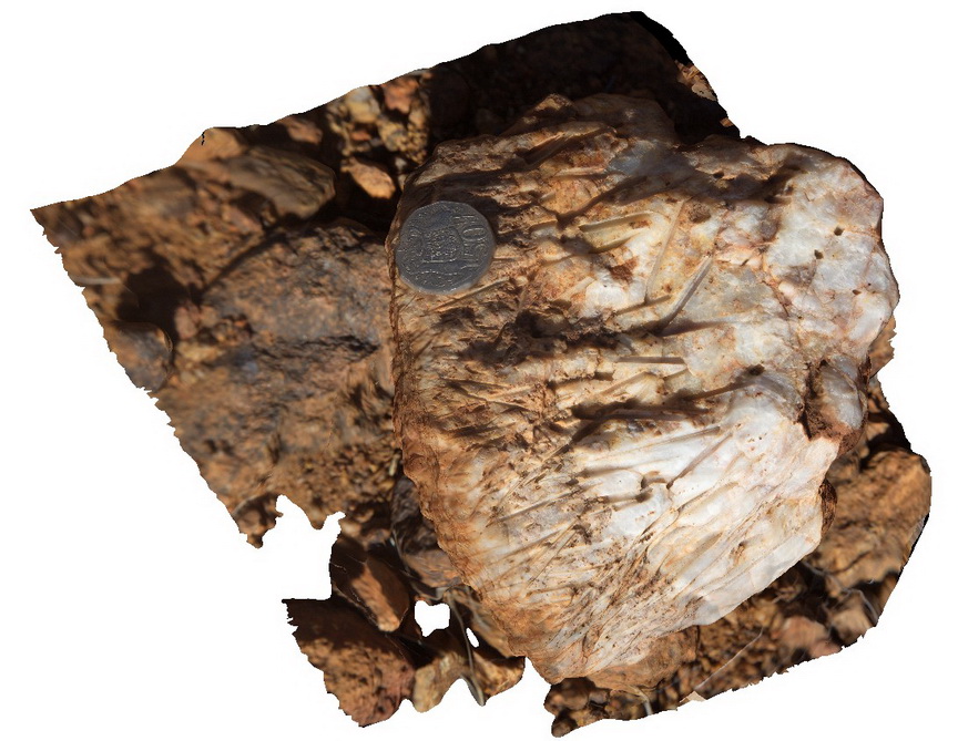
Arkaroola12 Map
 |
5 |
11/06/2015 1:39 p.m. |
3D |
fine, sandy layers showing ripple and cross laminations and rip up clasts. Kingsmil Creek, Arkaroola. Northern Flinders Ranges, S.A. |
0.40 |
-30.32899000000 |
139.37225000000 |
-9999.000 |
ripple marks, cross laminations |
conglomerate |
Arkaroola13 Map
 |
5 |
11/06/2015 1:40 p.m. |
3D |
ripple marks in sandy layer and mud cracks in muddy layer, Arkaroola. Northern Flinders Ranges, S.A. |
2.00 |
-30.34227000000 |
139.37666000000 |
-9999.000 |
ripple marks, mud cracks, sedimentology |
conglomerate |
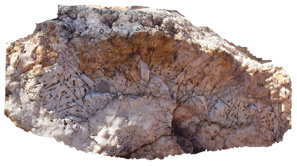
Arkaroola14 Map
 |
5 |
01/05/2016 12:27 p.m. |
3D |
detail of mud cracks in muddy layer of Blue Mine Conglomerate, Arkaroola. Northern Flinders Ranges, S.A. |
0.30 |
-30.34227000000 |
139.37666000000 |
-9999.000 |
mud cracks, sedimentology |
mudstone |
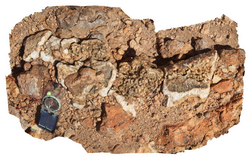
Arkaroola15 Map
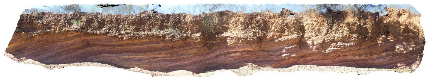 |
5 |
02/11/2016 3:12 p.m. |
3D |
'The Ochre Wall' feature. Oxidised siltstone and mudstone of the Angepena Formation, unconformably overlain by a think calcrete layer, which is then unconformably overlain by alluvial material. This feature is on the eastern side of the Paralana Fault. |
12.00 |
-30.33480000000 |
139.38176000000 |
-9999.000 |
unconformity |
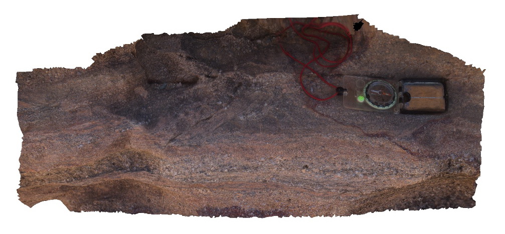
siltstone, calcrete, conglomerate |
Arkaroola16 Map
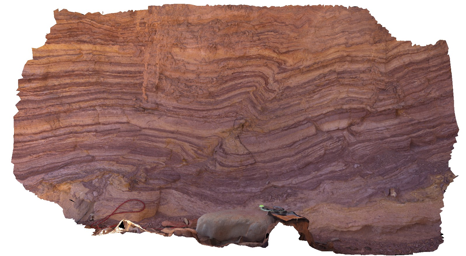 |
5 |
02/11/2016 3:12 p.m. |
3D |
detail of oxidised finely layered siltstone and mudstone beds, cut by small reverse fault, Arkaroola. Northern Flinders Ranges, S.A. |
1.00 |
-30.33489000000 |
139.38184000000 |
-9999.000 |
fault, structure |
siltstone |
Arkaroola17 Map
 |
5 |
02/11/2016 3:11 p.m. |
3D |
oxidised finely layered siltstone and mudstone beds, cut by broken small reverse fault, near 'the Ochre Wall', Arkaroola. Northern Flinders Ranges, S.A. |
0.50 |
-30.33459000000 |
139.38184000000 |
-9999.000 |
reverse fault, structure |
siltstone |
Arkaroola18 Map
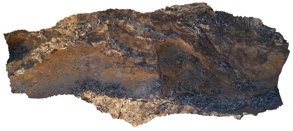 |
5 |
02/11/2016 3:11 p.m. |
3D |
Intense brecciation of carbonate and mudstone units within the Angepena Formation, highlights the Paralana Fault Zone. Road cutting. Arkaroola. Northern Flinders Ranges, S.A. |
6.00 |
-30.33401000000 |
139.38097000000 |
-9999.000 |
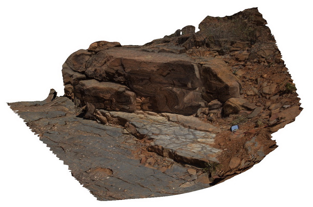
brecciation, Paralana Fault Zone, structure |
carbonate |
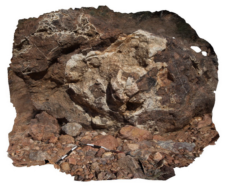
Arkaroola19 Map
 |
5 |
11/06/2015 1:44 p.m. |
3D |
clast supported / vuggy granite breccia with quartz crystals lining the vughs. Arkaroola. Northern Flinders Ranges, S.A. |
0.20 |
-30.22029000000 |
139.36478000000 |
-9999.000 |
quartz, breccia |
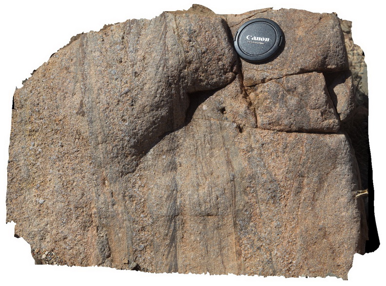
granite |
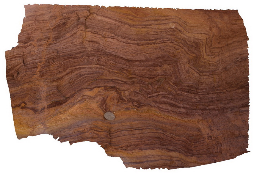
Arkaroola2 Map
 |
5 |
11/06/2015 1:31 p.m. |
3D |
preserved ripple marks in the Wortupa Quartzite at Bolla-Bollana Waterhole, Arkaroola. Northern Flinders Ranges, S.A. |
3.00 |
-30.25688000000 |
139.28178000000 |
-9999.000 |
ripple mark, sedimentology |
quartzite |
Arkaroola20 Map
 |
5 |
11/06/2015 1:44 p.m. |
3D |
quartz vein with cavity fill textures and terminating crystal faces. Arkaroola. Northern Flinders Ranges, S.A. |
0.40 |
-30.22059000000 |
139.36423000000 |
-9999.000 |
vugh, quartz vein, mineral texture |
quartz |
Arkaroola21 Map
 |
5 |
11/06/2015 1:45 p.m. |
3D |
detail of radiating quartz aggregates encrusting 'nail hole' quartz. Arkaroola. Northern Flinders Ranges, S.A. |
0.60 |
-30.22062000000 |
139.36400000000 |
-9999.000 |
nail hole quartz, mineral texture |
quartz |
Arkaroola22 Map
 |
5 |
11/06/2015 1:46 p.m. |
3D |
detail of radiating quartz aggregates encrusting 'nail hole' quartz. Arkaroola. Northern Flinders Ranges, S.A. |
0.50 |
-30.22062000000 |
139.36400000000 |
-9999.000 |
nail hole quartz, mineral texture |
quartz |
Arkaroola23 Map
 |
5 |
11/06/2015 1:46 p.m. |
3D |
detailed cross section through 'nail hole' quartz texture, showing radiating structure and long 'nail' cavity. Arkaroola. Northern Flinders Ranges, S.A. |
0.20 |
-30.22062000000 |
139.36400000000 |
-9999.000 |
nail hole quartz, mineral texture |
quartz |
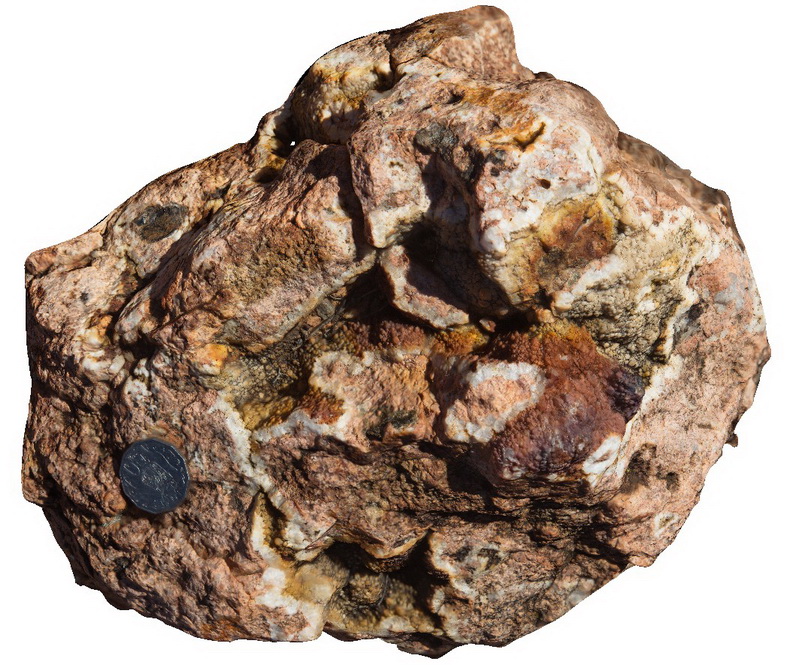
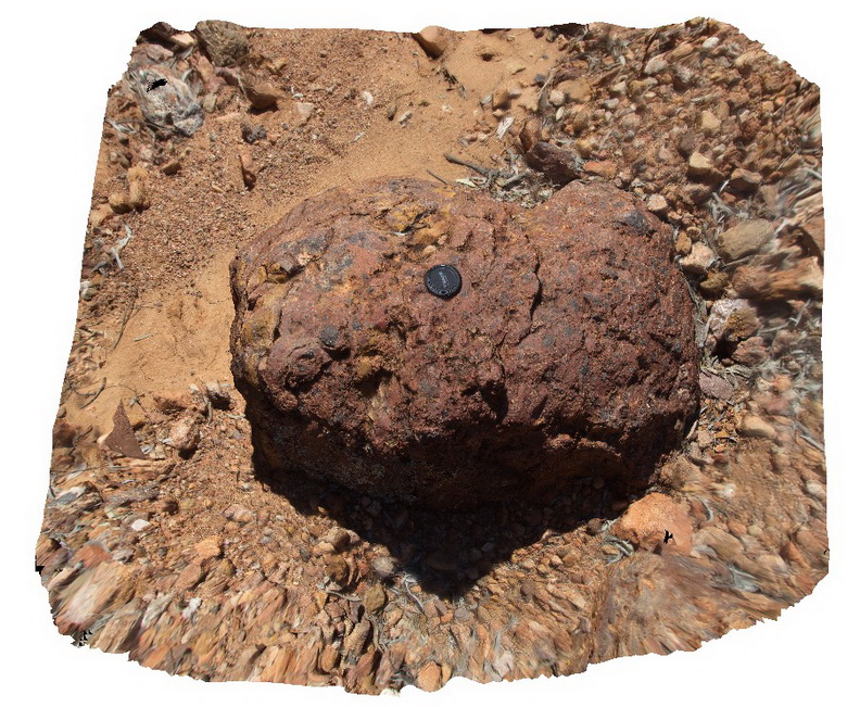
Arkaroola24 Map
 |
5 |
11/06/2015 1:47 p.m. |
3D |
haematite breccia boulder, showing specular hematite clasts (dark patches) in a quartz and hematite matrix. Arkaroola. Northern Flinders Ranges, S.A. |
1.00 |
-30.22403000000 |
139.35928000000 |
-9999.000 |
specular hematite, breccia |
breccia |
Arkaroola25 Map
 |
5 |
11/06/2015 1:48 p.m. |
3D |
Granitic breccia with large quartz veins with open space filling and nail hole quartz. Arkaroola. Northern Flinders Ranges, S.A. |
3.00 |
-30.22875000000 |
139.34589000000 |
-9999.000 |
nail hole quartz |
Sinter |
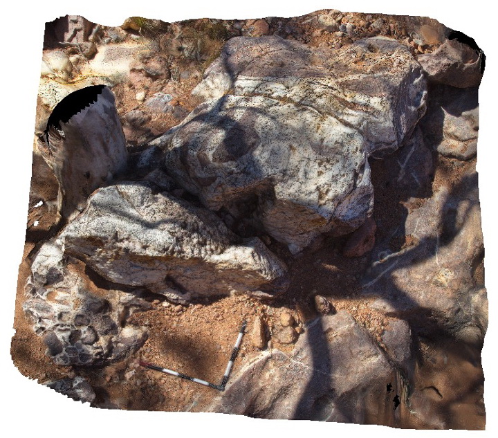
Arkaroola26 Map
 |
5 |
09/27/2015 5:32 p.m. |
3D |
Detail of terminating quartz crystals and cross sections of their radiating habit around former laumontite crystals giving the 'nail hole' morphology. Arkaroola. Northern Flinders Ranges, S.A. |
0.30 |
-30.22875000000 |
139.34589000000 |
-9999.000 |
quartz, nail hole |
quartz |
Arkaroola27 Map
 |
5 |
11/06/2015 1:51 p.m. |
3D |
detail of nail hole quartz texture vein infill, Radium Ridge, Arkaroola. Northern Flinders Ranges, S.A. |
0.20 |
-30.22875000000 |
139.34589000000 |
-9999.000 |
nail hole quartz |
quartz |
Arkaroola28 Map
 |
5 |
02/03/2016 2:11 p.m. |
3D |
large boulder of Radium Ridge breccia, with vughs infilled by radiating and terminating quartz. Radium Ridge, Arkaroola. Northern Flinders Ranges, S.A. |
3.00 |
-30.22877000000 |
139.34573000000 |
-9999.000 |
nail hole quartz, breccia, Radium Ridge |
Sinter |