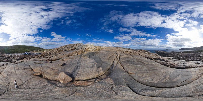
Albany8 Map
 |
0 |
06/05/2016 10:36 a.m. |
3D |
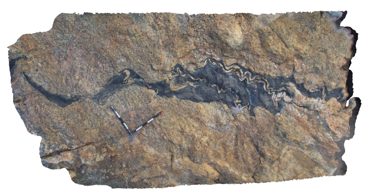
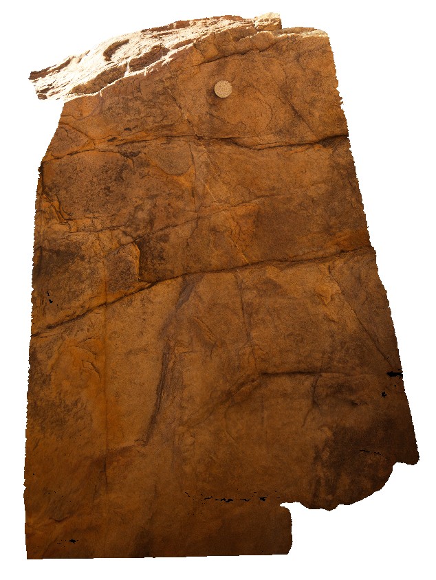
erosional features in Quaternary calcareous beach sediments. Albany, W.A. |
6.50 |
-35.11587000000 |
117.90143000000 |
-9999.000 |
Quaternary calcareous beach sediments, limestone |
limestone |
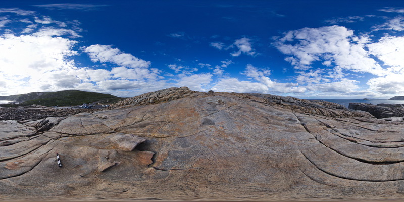
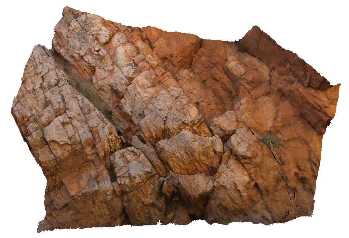
Albany9 Map
 |
0 |
01/01/9999 midnight |
3D |
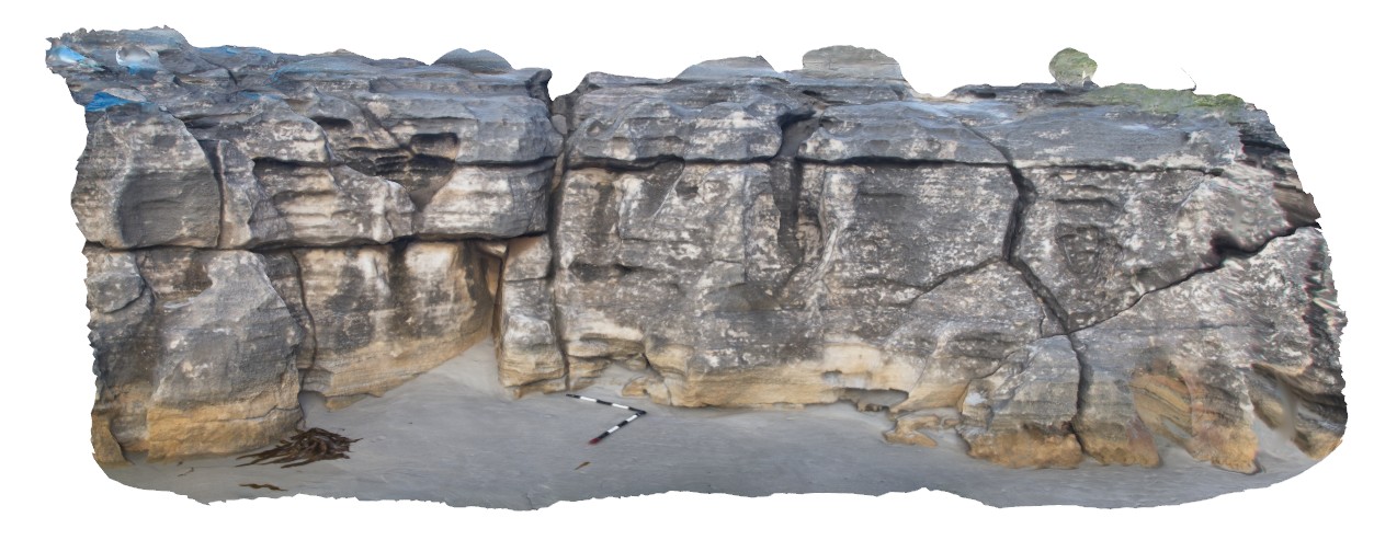
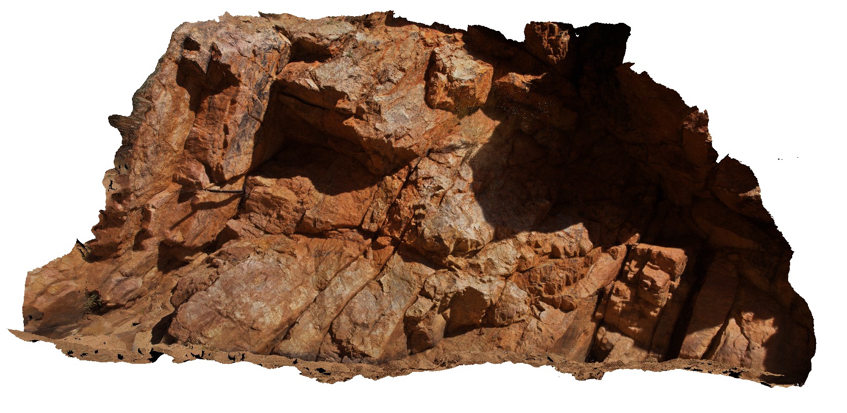
disrupted and deformed mafic dyke with internal folded granitic dykes / leucosomes. Albany, W.A. |
4.50 |
-35.11731000000 |
117.89973000000 |
-9999.000 |
mafic dyke, deformation, granite, leucosome |
granite, mafic |
AlbanyFSP1 Map
 |
0 |
06/05/2016 10:39 a.m. |
FSP |
shore outcrop of intrusive contact between porphyritic granite and grey finer-grained granodiorite. Albany, W.A. |
100.00 |
-35.08979000000 |
117.95058000000 |
-9999.000 |
igneous contact, porphyritic granite, granodiorite |
granite, granodiorite |
AlbanyFSP2 Map
 |
0 |
06/05/2016 10:39 a.m. |
FSP |
shoreline outcrop, showing complex intrusive relationships between porphyry granite, intruded by grey granodiorite and cross cut by porphyry dykes. Albany, W.A. |
100.00 |
-35.08977000000 |
117.95050000000 |
-9999.000 |
igneous contact, intrusive contact, xenolith |
granite, granodiorite, porphyry |
AlbanyFSP3 Map
 |
0 |
06/05/2016 10:39 a.m. |
FSP |
shoreline outcrop, showing complex intrusive relationships between porphyry granite, intruded by grey granodiorite and cross cut by porphyry dykes. Albany, W.A. |
100.00 |
-35.08969000000 |
117.95044000000 |
-9999.000 |
granodiorite, granite, porphyry dyke |
granite, granodiorite, porphyry |
AlbanyFSP4 Map
 |
0 |
06/05/2016 10:40 a.m. |
FSP |
shoreline outcrop, showing complex intrusive relationships between porphyry granite, intruded by grey granodiorite and cross cut by porphyry dykes. Albany, W.A. |
100.00 |
-35.08969000000 |
117.95036000000 |
-9999.000 |
porphyry granite, granodiorite, porphyry dyke |
granite, granodiorite, porphyry |
AlbanyFSP5 Map
 |
0 |
06/05/2016 10:40 a.m. |
FSP |
overview of the shore exposure at 'The Gap', showing granodiorite intruding banded granitic gneiss with disaggregated mafic dykes. Albany |
100.00 |
-35.11831000000 |
117.89301000000 |
-9999.000 |
granitic gneiss, mafic dyke, igneous intrusion |
granitic gneiss, granodiorite |
AlbanyFSP6 Map
 |
0 |
06/05/2016 10:40 a.m. |
FSP |
overview of the shore exposure at 'The Gap', showing granodiorite intruding banded granitic gneiss with disaggregated mafic dykes. Albany |
100.00 |
-35.11838000000 |
117.89299000000 |
-9999.000 |
mafic dyke, banded gneiss, structure, folding |
gneiss, granodiorite |
AlbanyFSP7 Map
 |
0 |
01/01/9999 midnight |
FSP |
Overall view of the shore exposure at 'The Gap', showing banded granitic gneiss intruded by grey granodiorite. Albany. W.A. |
100.00 |
-35.11848000000 |
117.89305000000 |
-9999.000 |
granodiorite, banded gneiss, igneous contract |
granite gneiss, granodiorite |
AlbanyFSP8 Map
 |
0 |
01/01/9999 midnight |
FSP |
Overall view of the shore exposure at 'The Gap', showing banded granitic gneiss intruded by grey granodiorite. Albany. W.A. |
100.00 |
-35.11839000000 |
117.89310000000 |
-9999.000 |
granitic gneiss, granodiorite |
granite gneiss, granodiorite |
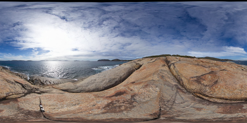
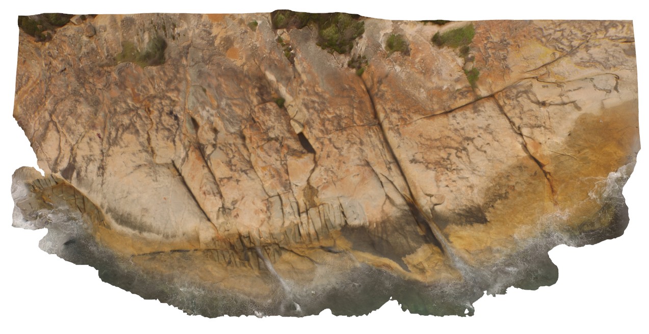
AlbanyUAV1 Map
 |
0 |
01/01/9999 midnight |
UAV |
aerial view, showing complex relationships in granite. Porphyritic granite with 'quartzite' xenoliths intruded by grey 'granodiorite' all cut by thin pegmatite dykes. Albany, W.A. |
50.00 |
-35.08986000000 |
117.95056000000 |
-9999.000 |
granite, intrusive contact, xenolith |
granite, granodiorite, porphyry |
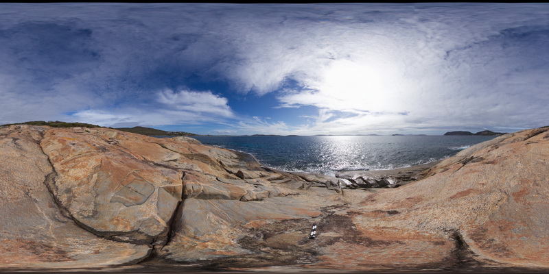
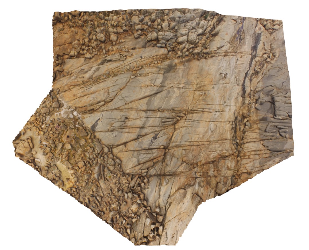
AlbanyUAV2 Map
 |
20 |
01/01/9999 midnight |
UAV |
aerial view of granitic rocks with mafic pods intruded by granodiorite at 'The Gap, Albany, W.A. |
50.00 |
-35.11831000000 |
117.89304000000 |
-9999.000 |
granitic gneiss, granodiorite, mafic dyke, igneous intrusion |
granitic gneiss, granodiorite |
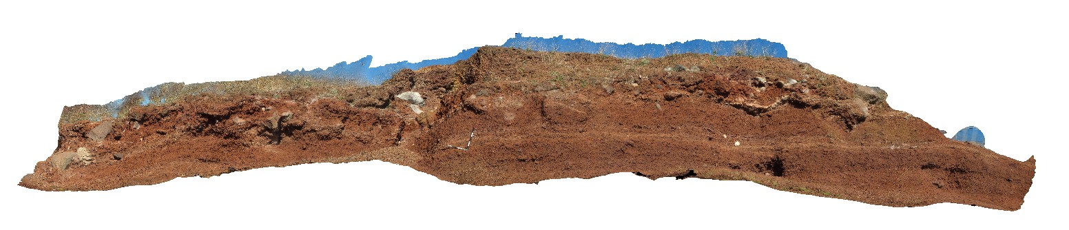
Alvie1 Map
 |
5 |
06/05/2016 10:33 a.m. |
3D |
scoria deposit at the Red Rock look out. Alvie, Vic. |
14.00 |
-38.24777000000 |
143.50450000000 |
-9999.000 |
scoria, volcanics |
scoria |
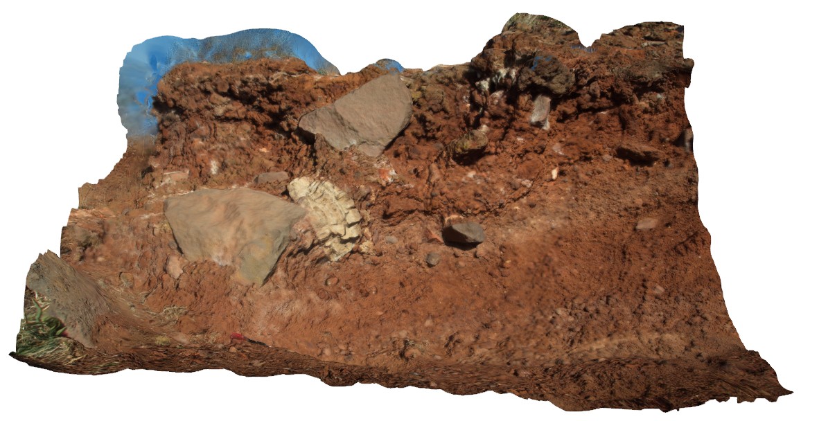
Alvie2 Map
 |
5 |
06/05/2016 10:33 a.m. |
3D |
detail of scoria and bombs at the Red Rock look out. Alvie, Vic. |
3.20 |
-38.24774000000 |
143.50458000000 |
-9999.000 |
scoria, bomb, volcanics |
scoria |
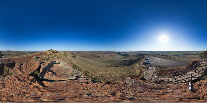
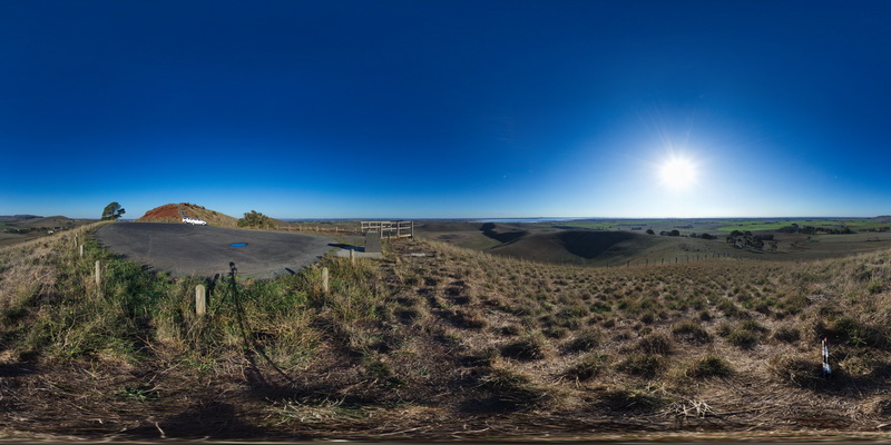
AlvieFSP1 Map
 |
0 |
06/05/2016 10:33 a.m. |
FSP |
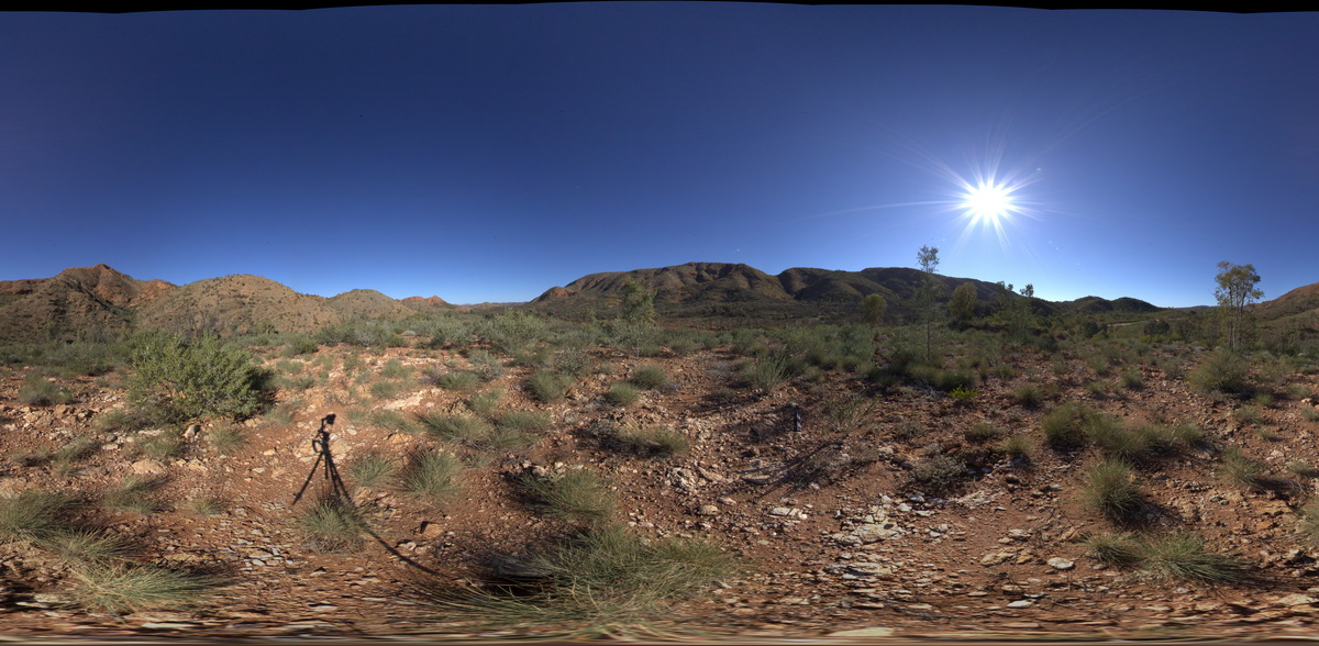
view from Red Rocks carpark of old maar volcano and cinder cones. Alvie, Vic. |
3000.00 |
-38.24793000000 |
143.50452000000 |
-9999.000 |
maar volcano, cinder cone, volcanics |
volcanics |
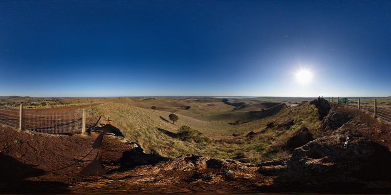
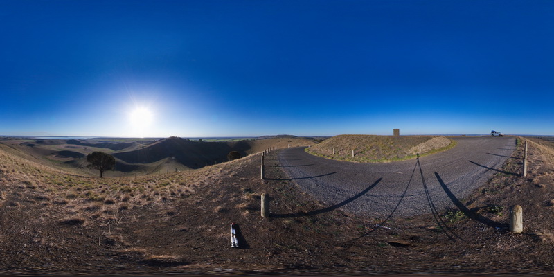
AlvieFSP2 Map
 |
0 |
06/05/2016 10:33 a.m. |
FSP |
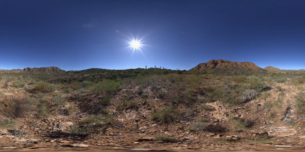
view from Red Rocks lookout of surrounding volcanic topography of old maar volcanos and cinder cones. Foreground shows the Red Rocks scoria deposits. Alvie, Vic. |
3000.00 |
-38.24814000000 |
143.50490000000 |
-9999.000 |
scoria, maar volcano, cinder cone, volcanics |
scoria |
AlvieFSP3 Map
 |
0 |
06/05/2016 10:33 a.m. |
FSP |
view from Red Rocks carpark of old maar volcano and cinder cones. Alvie, Vic. |
3000.00 |
-38.24778000000 |
143.50368000000 |
-9999.000 |
maar volcano, cinder cone |
volcanics |
AlvieFSP4 Map
 |
0 |
06/05/2016 10:33 a.m. |
FSP |
view from Red Rocks carpark of old maar volcano and cinder cones. Alvie, Vic. |
3000.00 |
-38.25128000000 |
143.50841000000 |
-9999.000 |
maar volcano, cinder cone, volcanic topography |
volcanics |
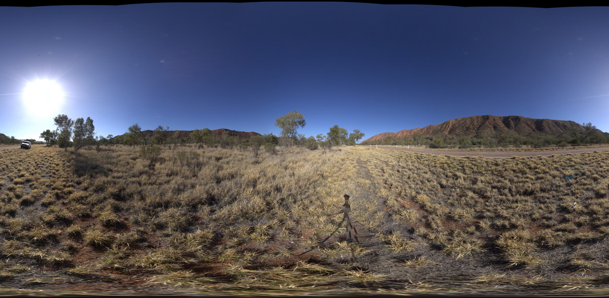
AMAD1 Map
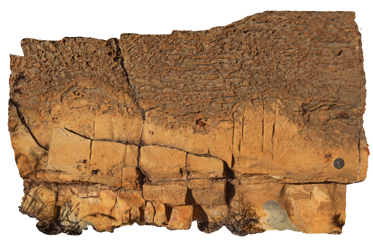 |
5 |
07/28/2016 9:49 a.m. |
3D |
finely layered and folded dolostone (grey) and siltstone (brown) at Corroboree Rock, Amadeus Basin. N.T. |
1.00 |
-23.68094400000 |
134.21737300000 |
569.980 |
dolostone, fold, siltstone, sedimentology, weathering |
dolostone |
AMAD2 Map
 |
0 |
07/28/2016 11:10 a.m. |
3D |
fine laminations in steeply dipping Heavitree sandstone beds. Emily and Jessie Gaps Nature Reserve, Amadeus Basin. N.T. |
7.00 |
-23.74697300000 |
134.01561200000 |
543.978 |
sedimentology, laminated sandstone |
sandstone |
AMAD3 Map
 |
5 |
01/01/9999 midnight |
3D |
en echelon tension quartz veins in Heavitree sandstone. Emily and Jessie Gaps Nature Park. N.T. |
0.70 |
-23.73857000000 |
133.95099000000 |
-9999.000 |
en-echelon vein, quartz vein, tension, structure |
sandstone |
AMAD4 Map
 |
5 |
01/01/9999 midnight |
3D |
slickenlines in Heavitree sandstone. Emily and Jessie Gaps Nature Park. N.T. |
0.00 |
-23.73857000000 |
133.95099000000 |
-9999.000 |
slickenlines, structure, kinematic indicators |
sandstone |
AMADFSP1 Map
 |
5 |
07/27/2016 10:04 a.m. |
FSP |
view of folded sediments from the Bitter Springs Group. Bitter Springs Gorge, N.T. |
1000.00 |
-23.54177100000 |
134.50347000000 |
617.659 |
sediments, sedimentology, fold, structure |
sediments |
AMADFSP2 Map
 |
5 |
07/27/2016 10:41 a.m. |
FSP |
view of chaotic folded sediments from the Bitter Springs Group. Bitter Springs Gorge, N.T. |
1000.00 |
-23.54297700000 |
134.46775700000 |
551.281 |
chaotic fold, fold, structure, sediment, sedimentology |
sediment |
AMADFSP3 Map
 |
5 |
07/28/2016 10:18 a.m. |
FSP |
geological contact between Bitter Springs Group dolostone (brown) and Heavitree Sandstone (red), west of Corroboree Rock, Amadeus Basin. N.T. |
0.00 |
-23.70432000000 |
134.18723900000 |
539.275 |
sedimentology, geological contact, Amadeus Basin |
dolostone, sandstone |