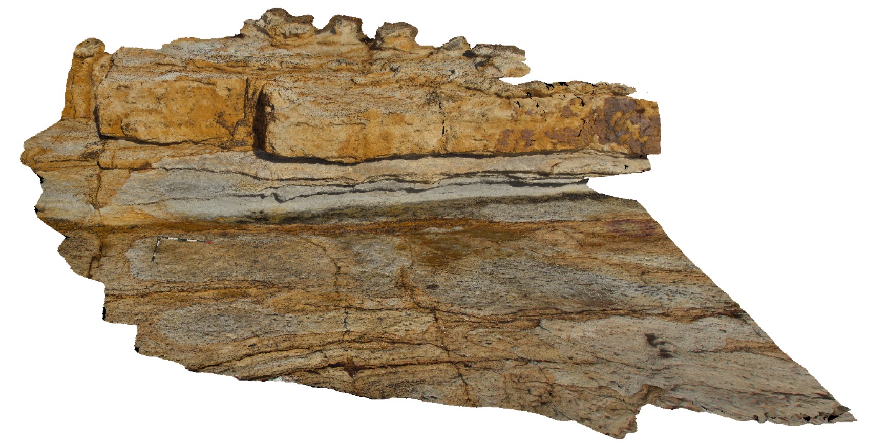
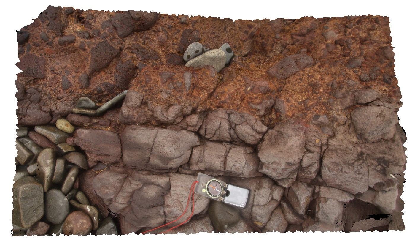
BlackmansBay4 Map
 |
0 |
02/25/2016 2:49 p.m. |
3D |
bedding in sandstone and siltstone in Permian sediments, Blackmans Bay. Tasmania. |
5.00 |
-42.99990000000 |
147.32851000000 |
-9999.000 |
bedding, sedimentology |
sandstone |
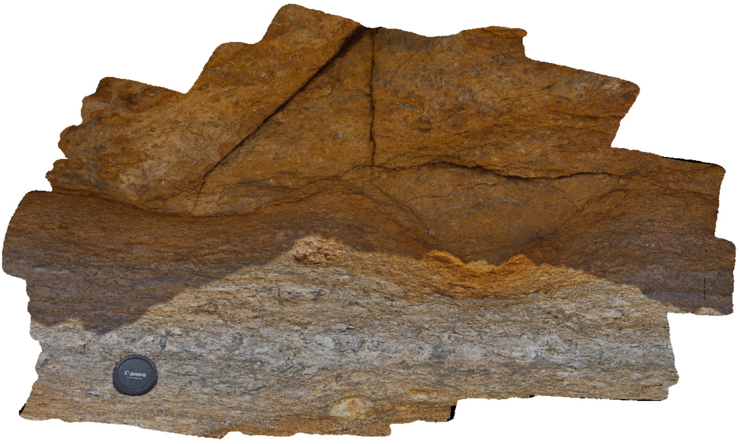
BlackmansBay2 Map
 |
0 |
02/25/2016 2:47 p.m. |
3D |
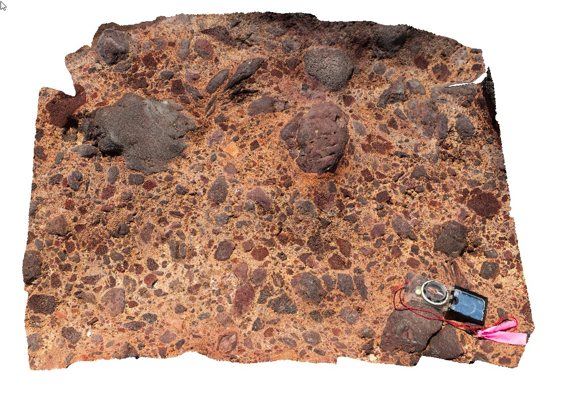
detail of dropstones in sandstone layer of Permian sediments. Blackmans Bay. Tasmania. |
0.40 |
-42.99987000000 |
147.32823000000 |
-9999.000 |
dropstone, sedimentology |
sandstone |
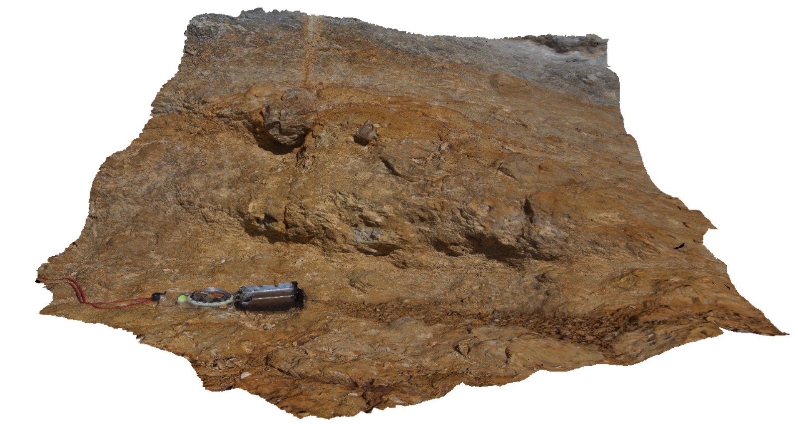
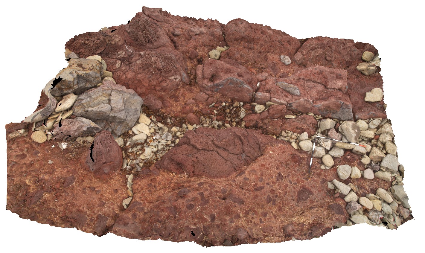
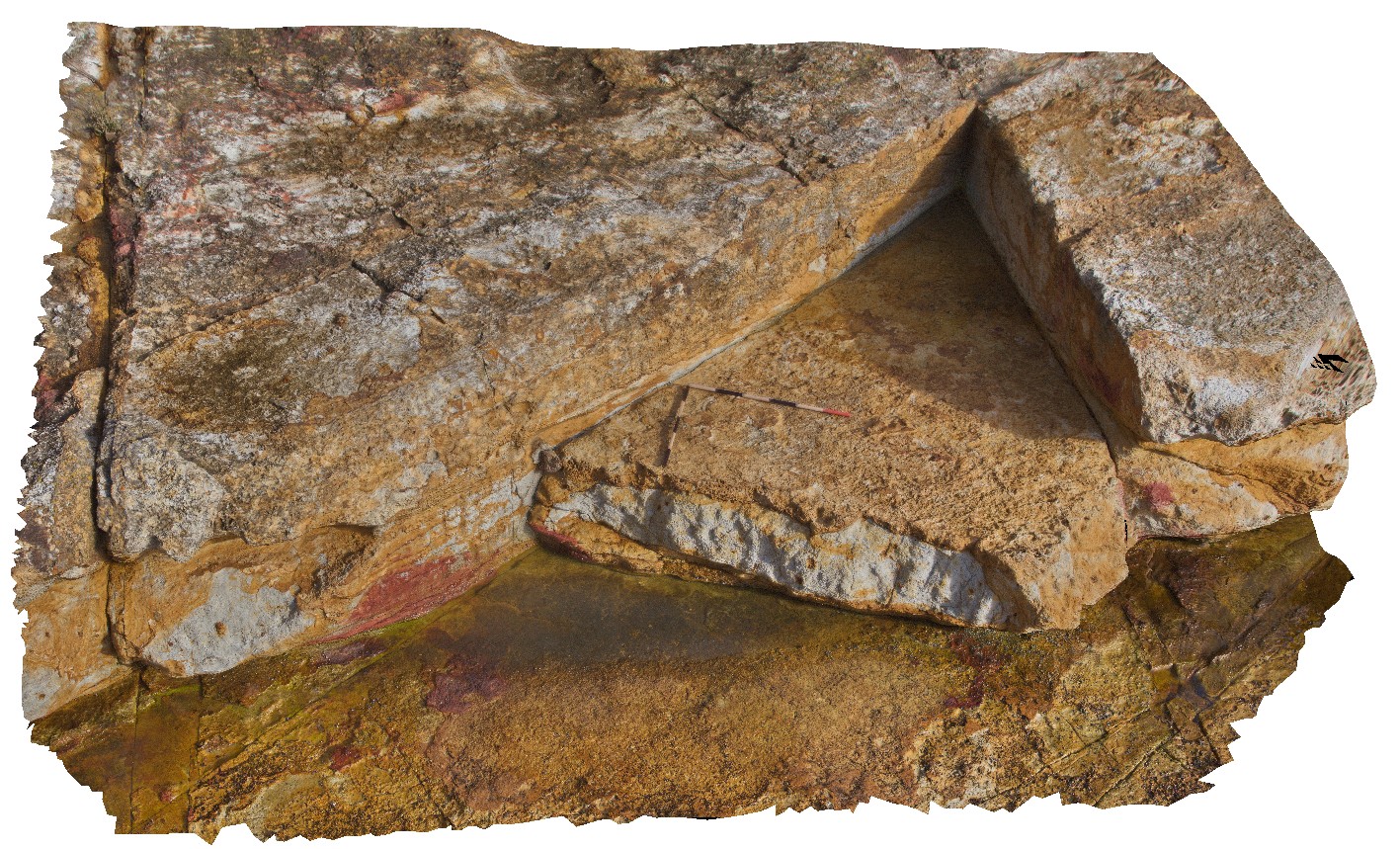
BlackmansBay1 Map
 |
0 |
02/25/2016 2:46 p.m. |
3D |
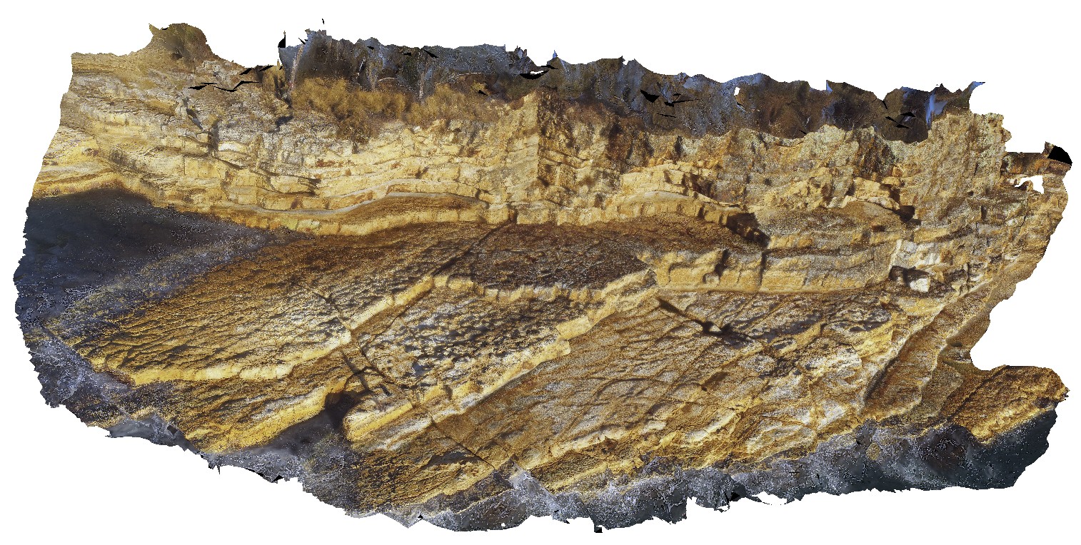
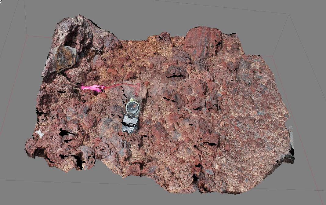
view of section of cliff exposure in Permian shallow marine sediments. Blackmans Bay, Tasmania. |
7.00 |
-42.99987000000 |
147.32823000000 |
-9999.000 |
Permian, strata |
siltstone |
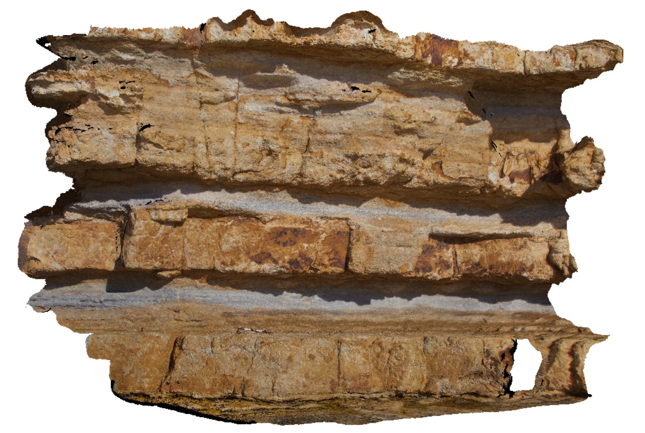
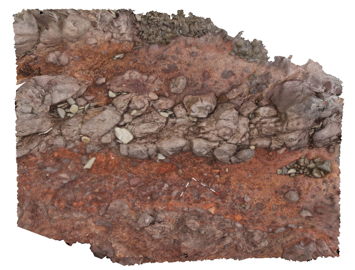
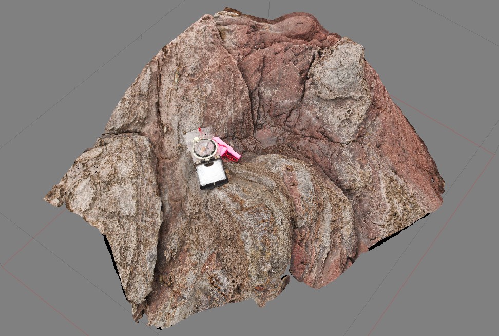
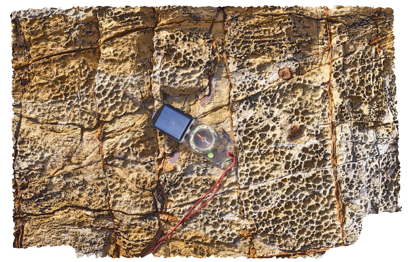
BlackmansBay3 Map
 |
0 |
02/25/2016 2:48 p.m. |
3D |
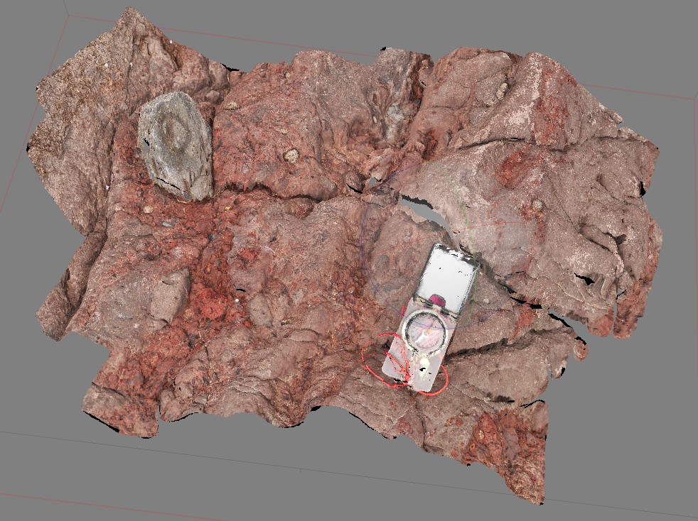
detail of bioturbated siltstone and overlaying pebbly sandstone. Blackmans Bay, Tasmania. |
0.80 |
-42.99987000000 |
147.32823000000 |
-9999.000 |
bioturbations, strata, palaeontology, sedimentology |
sandstone |
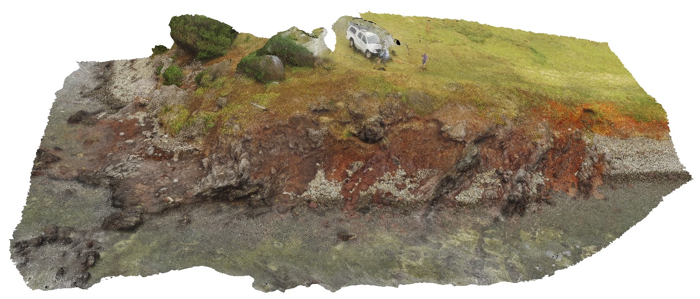
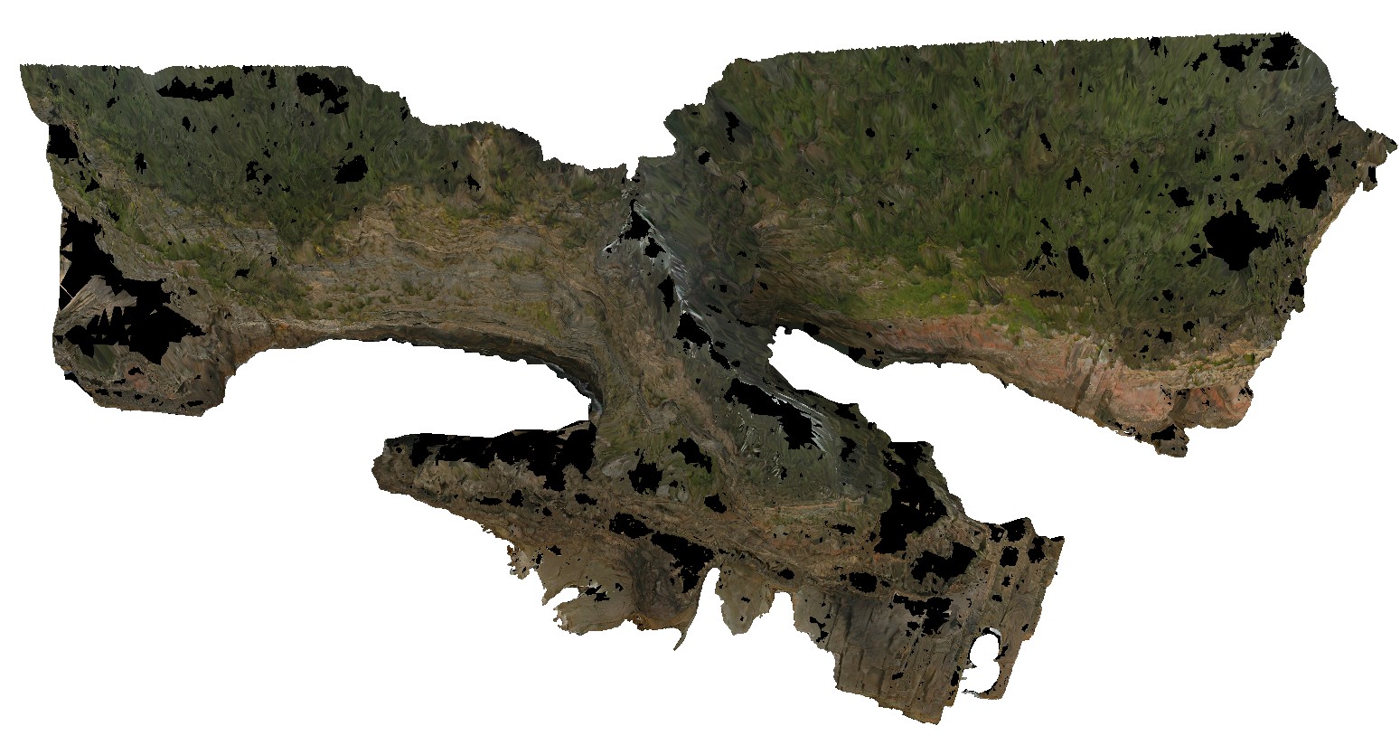
BlackmansBayUAV1 Map
 |
0 |
04/12/2016 3:27 p.m. |
UAV |
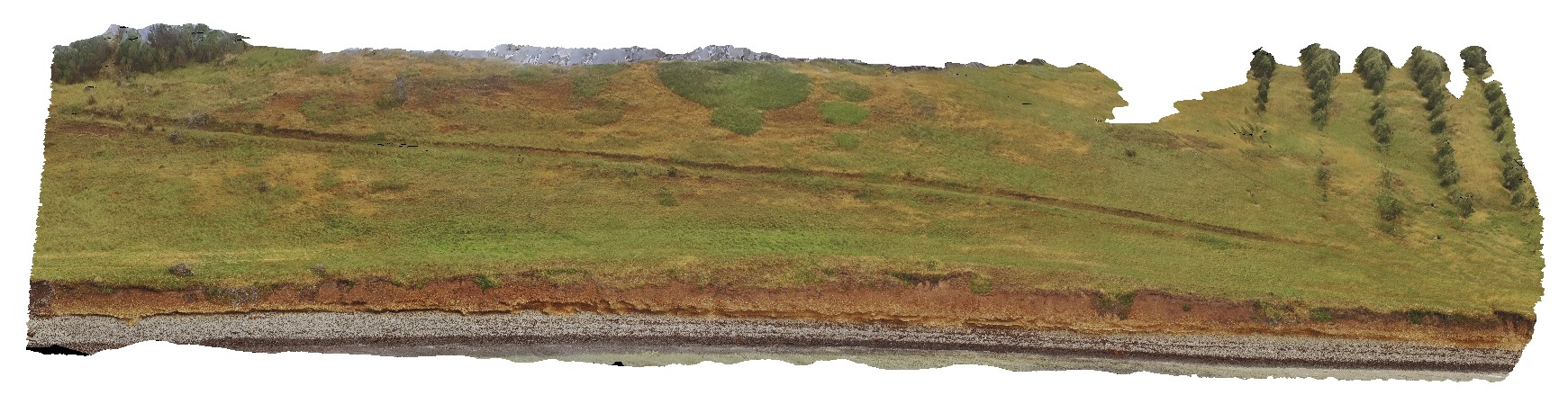
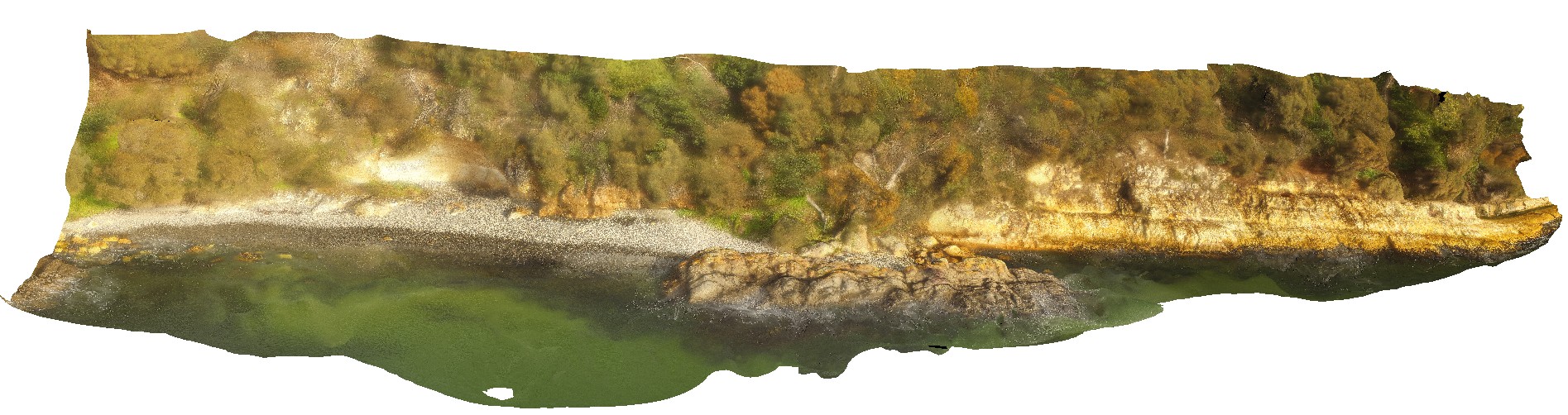
aerial view of Permian cliff at northern end of Blackmans Bay beach, showing bedding and exposed shore platform. Tasmania. |
100.00 |
-42.99987000000 |
147.32823000000 |
-9999.000 |
shore platform, strata, Permian |
siltstone |
Blackjack6 Map
 |
5 |
01/01/9999 midnight |
3D |
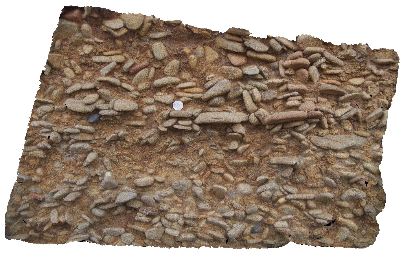
modern paleo-beach deposits of flat cobble shingles. Black Jack Hills, Tas. |
1.00 |
-42.99360000000 |
147.65126000000 |
-9999.000 |
conglomerate, paleo-beach |
conglomerate |
Blackjack5 Map
 |
5 |
01/01/9999 midnight |
3D |
modern paleo-beach deposits of flat cobble shingles. Black Jack Hills, Tas. |
0.00 |
-42.99360000000 |
147.65126000000 |
-9999.000 |
paleo-beach, paleo-deposit |
conglomerate |
BlackjackUAV2 Map
 |
20 |
01/01/9999 midnight |
UAV |
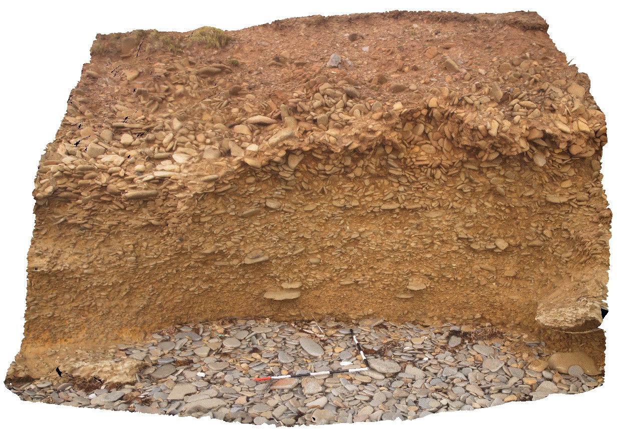
aerial view of exposed modern paleo-beach deposits of flat cobble shingles. Black Jack Hills, Tas. |
50.00 |
-42.99353100000 |
147.65130500000 |
70.729 |
paleo-beach deposit, paleo land form, shingles |
conglomerate |
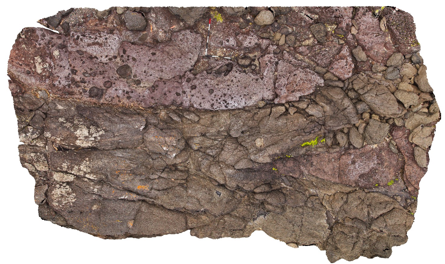
Blackjack3 Map
 |
5 |
01/01/9999 midnight |
3D |
Tertiary basalt with two layers of breccia and lava. Black Jack Hills, Tas. |
8.00 |
-42.99283000000 |
147.65251000000 |
-9999.000 |
lava, basalt, breccia, volcanics |
basalt |
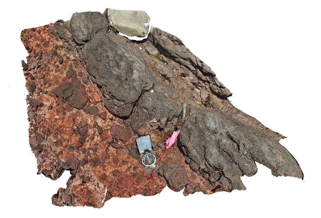
Blackjack4 Map
 |
5 |
01/01/9999 midnight |
3D |
contact between volcanic breccia and a basalt lava flow with 'strung out' vesicles in the flow. Black Jack Hills, Tas. |
1.00 |
-42.99283000000 |
147.65256000000 |
-9999.000 |
lava flow, volcanic breccia, basalt flow, basalt, contact |
basalt, breccia |
BlackjackUAV1 Map
 |
20 |
01/01/9999 midnight |
UAV |
aerial view of exposed layered volcanic package, including basalt lava flows and volcanic breccias. Black Jack Hills, Tas. |
100.00 |
-42.99280500000 |
147.65259900000 |
-9999.000 |
breccia, lava flow, basalt, volcanics, volcanic package |
basalt |
Blackjack2 Map
 |
5 |
01/01/9999 midnight |
3D |
lava and volcanic breccia, including very large basaltic bombs. Black Jack Hills, Tas. |
4.20 |
-42.99270000000 |
147.65276000000 |
-9999.000 |
basalt, volcanic, bomb |
basalt, basalt |
Blackjack10 Map
 |
20 |
01/01/9999 midnight |
3D |
contact between volcanic breccia and a basalt lava flow. Black Jack Hills, Tas. |
0.60 |
-42.99270000000 |
147.65276000000 |
-9999.000 |
lava, basalt, flow |
basalt |
Blackjack12 Map
 |
20 |
01/01/9999 midnight |
3D |
contact between volcanic breccia and a basalt lava flow. Black Jack Hills, Tas. |
0.50 |
-42.99270000000 |
147.65276000000 |
-9999.000 |
contact, basaltic flow, breccia, volocanics |
basalt |
Blackjack8 Map
 |
10 |
01/01/9999 midnight |
3D |
lava overlying volcanic breccia, including very large basaltic bombs. Black Jack Hills, Tas. |
1.00 |
-42.99270000000 |
147.65276000000 |
-9999.000 |
lava, breccia, volcanic, basalt |
basalt |
Blackjack1 Map
 |
5 |
01/01/9999 midnight |
3D |
volcanic breccia with basaltic vesicular clasts on shore line. Black Jack Hills, Tas. |
1.00 |
-42.99269000000 |
147.65282000000 |
-9999.000 |
volcanic breccia, basalt, volcanic |
basalt |
Blackjack11 Map
 |
20 |
01/01/9999 midnight |
3D |
volcanic breccia with basaltic vesicular clasts on shore line. Black Jack Hills, Tas. |
0.60 |
-42.99269000000 |
147.65282000000 |
-9999.000 |
volcanic breccia, volcanics, bomb |
basalt |
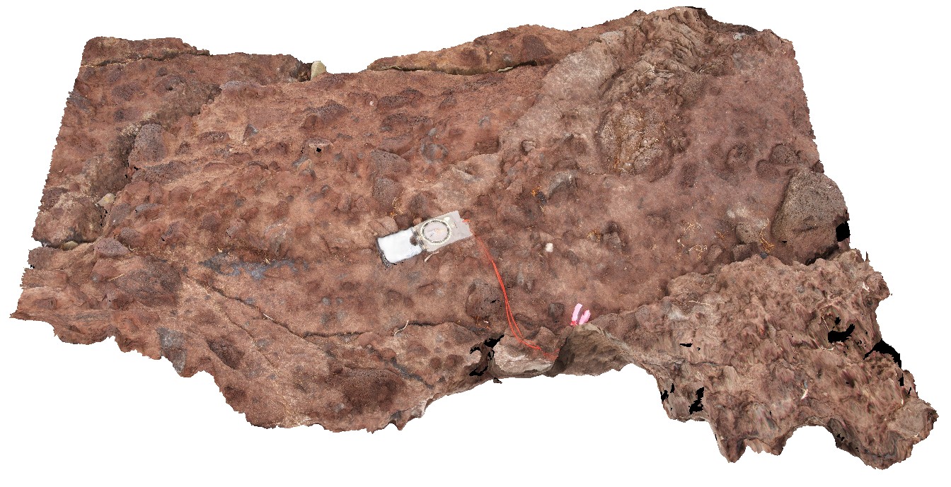
Blackjack9 Map
 |
10 |
01/01/9999 midnight |
3D |
detail of scoria / volcaniclastic deposit. Black Jack Hills, Tas. |
1.00 |
-42.99269000000 |
147.65282000000 |
-9999.000 |
volcanics, basalt, scoria |
basalt |
Blackjack7 Map
 |
10 |
01/01/9999 midnight |
3D |
volcanic breccia with basaltic vesicular clasts on shore line. Black Jack Hills, Tas. |
1.00 |
-42.99269000000 |
147.65282000000 |
-9999.000 |
basaltic breccia`, volcanic textures |
basalt |
KingstonUAV1 Map
 |
20 |
07/15/2016 noon |
UAV |
aerial view of Permian sandstone contact with Jurassic dolerite. Shore exposure south of Kingston Beach, Tas. |
100.00 |
-42.98581000000 |
147.32770000000 |
-9999.000 |
Permian sandstone, Jurassic dolerite, intrusive contact |
sandstone, dolerite |
Kingston1 Map
 |
0 |
07/15/2016 noon |
3D |
Permian sandstone outcrop with concretions and dropstones visible. Shore exposure south of Kingston Beach, Tas. |
0.80 |
-42.98557000000 |
147.32727000000 |
-9999.000 |
shore platform, Permian, dropstone, concretion, glacial |
sandstone |
Kingston2 Map
 |
0 |
07/15/2016 noon |
3D |
dropstones in marine, Permian sandstone. Shore exposure south of Kingston Beach, Tas. |
4.20 |
-42.98520000000 |
147.32668000000 |
-9999.000 |
glacial, marine facies, dropstone |
sandstone |
KingstonFSP1 Map
 |
20 |
07/15/2016 noon |
FSP |
view of shore platform exposure, showing pavement and cliffs of Permian sandstone with liesegang banding. Kingston Beach, Tasmania. |
1000.00 |
-42.98515000000 |
147.32671000000 |
-9999.000 |
Permian, sandstone, liesegang bands, sedimentology |
sandstone |
Surville1 Map
 |
50 |
03/16/2015 2:21 p.m. |
3D |
view form off-shore of cliff exposure, showing basement unconformable contact between Devonian Granite and the overlying sedimentary Parmeener Supergroup. Cape Surville, Tasman Peninsula. Tasmania. |
500.00 |
-42.97529481000 |
147.98872815000 |
0.500 |
basement unconformity, Devonian granite, Parmeener Supergroup, basement geology |
granite, siltstone |
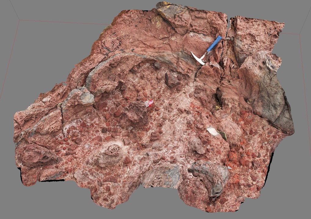
Ironstone1 Map
 |
5 |
01/01/9999 midnight |
3D |
contact between basalt and overlying pyroclastic with bombs up to 0.3m across. Ironstone Point, Tas. |
0.00 |
-42.97108000000 |
147.73396000000 |
-9999.000 |
basalt, pyroclastics, volcanics |
basalt |