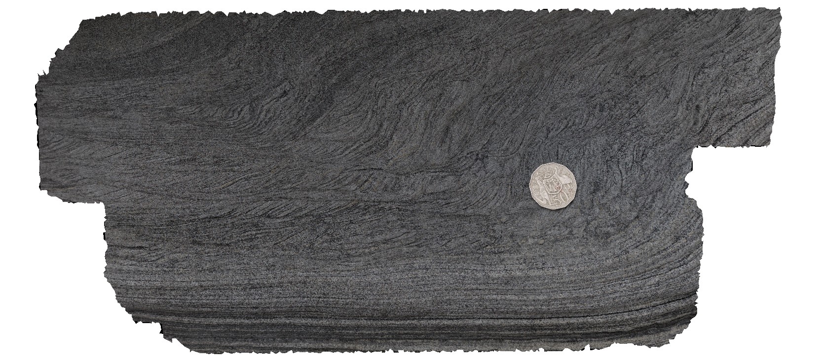
Harveys13 Map
 |
0 |
11/17/2015 10:49 a.m. |
3D |
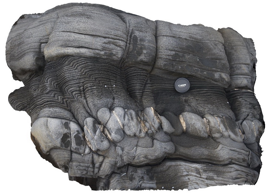
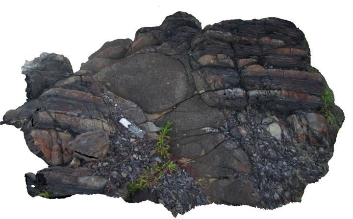
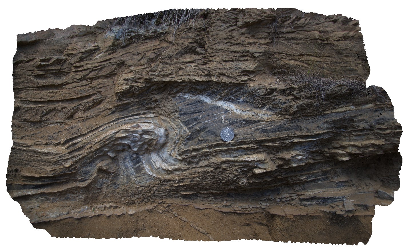
boudinaged clean/blocky sand layer with quartz veins and deformation in silty layers. Harvey's Bay, Kangaroo Island. S.A. |
1.00 |
-35.74693000000 |
136.63998000000 |
-9999.000 |
boudinage, folding, structure, zebra rock |
sandstone |
Harveys14 Map
 |
0 |
11/17/2015 10:49 a.m. |
3D |
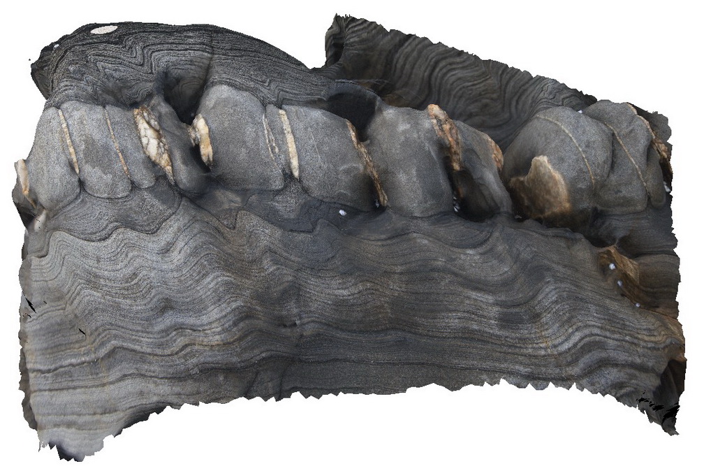
folded cross-bedded sandstone and blocky sandstone layer. Blocky sandstone layer has been boudinaged with quartz veins intruding boudin necks / gaps. Harvey's Bay, Kangaroo Island. S.A. |
0.50 |
-35.74696000000 |
136.64000000000 |
-9999.000 |
cross-bedded, boudinage, quartz vein |
sandstone |
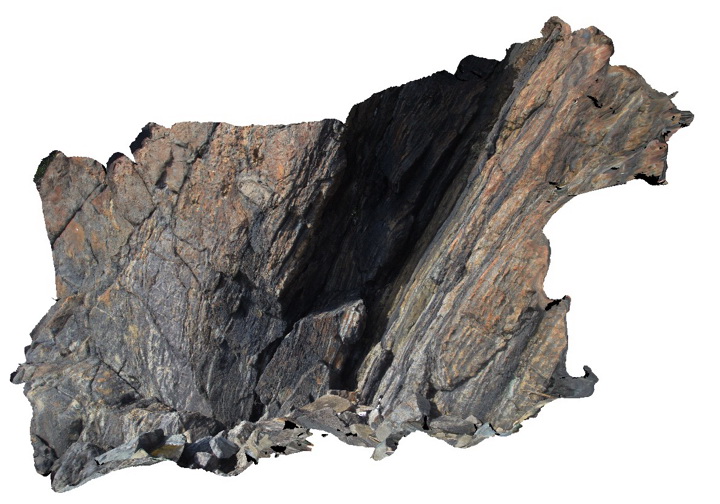
Harveys2 Map
 |
0 |
02/22/2016 7:49 p.m. |
3D |
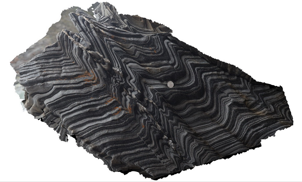
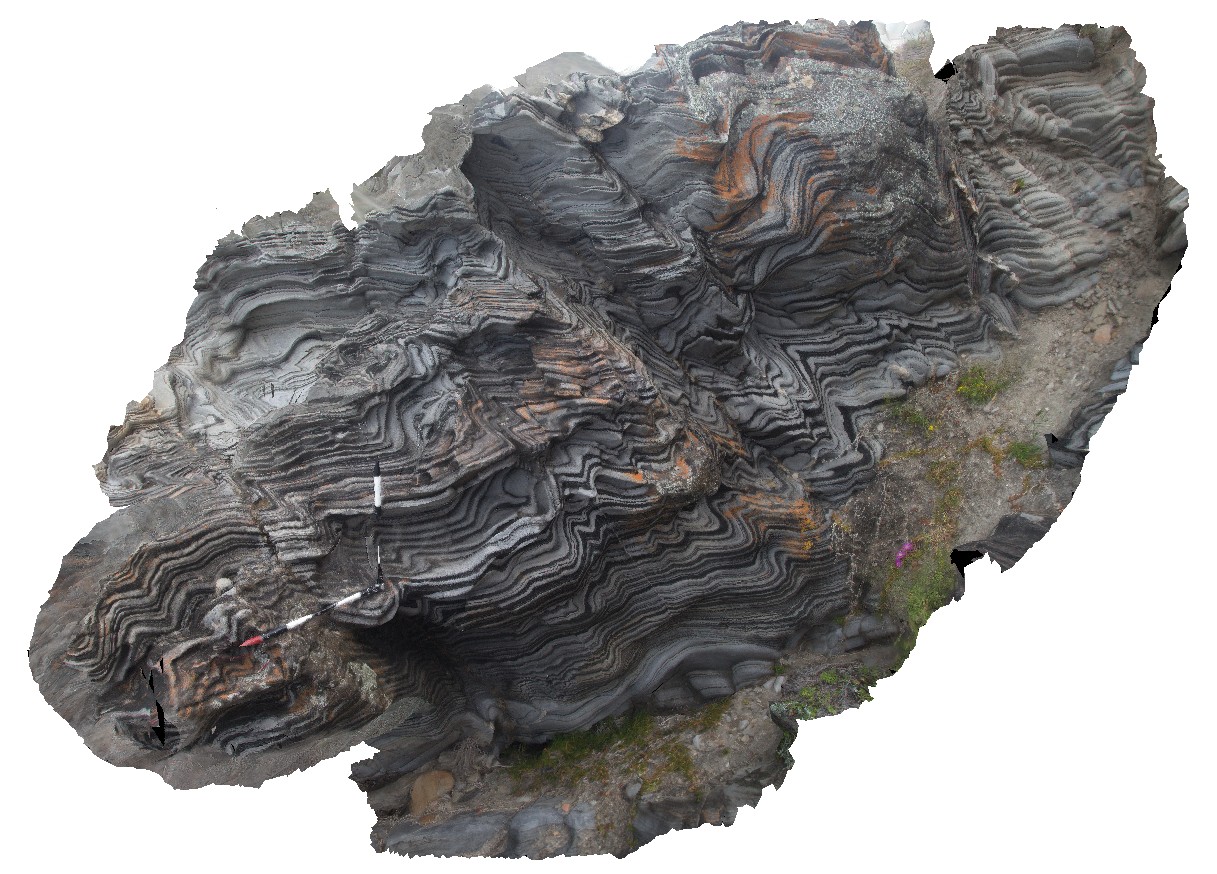
steeply dipping, plunging folds in zebra rocks, Harvey's Bay, Kangaroo Island. S.A. |
3.00 |
-35.74834000000 |
136.63893000000 |
-9999.000 |
folding, structure, zebra rock |
sandstone |
Harveys3 Map
 |
0 |
11/17/2015 10:41 a.m. |
3D |
detail of folds in zebra rock, looking down plunge. Harvey's Bay, Kangaroo Island. S.A. |
3.00 |
-35.74832000000 |
136.63892000000 |
-9999.000 |
folds, zebra rock, structure, fold plunge |
sandstone |
Harveys4 Map
 |
0 |
04/28/2016 2:12 p.m. |
3D |
steeply dipping beds with folds in zebra rock, looking down plunge. Harvey's Bay, Kangaroo Island. S.A. |
3.50 |
-35.74832000000 |
136.63884000000 |
-9999.000 |
zebra rock, fold plunge, structure |
sandstone |
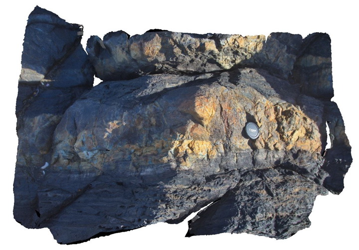
Harveys5 Map
 |
0 |
11/17/2015 10:43 a.m. |
3D |
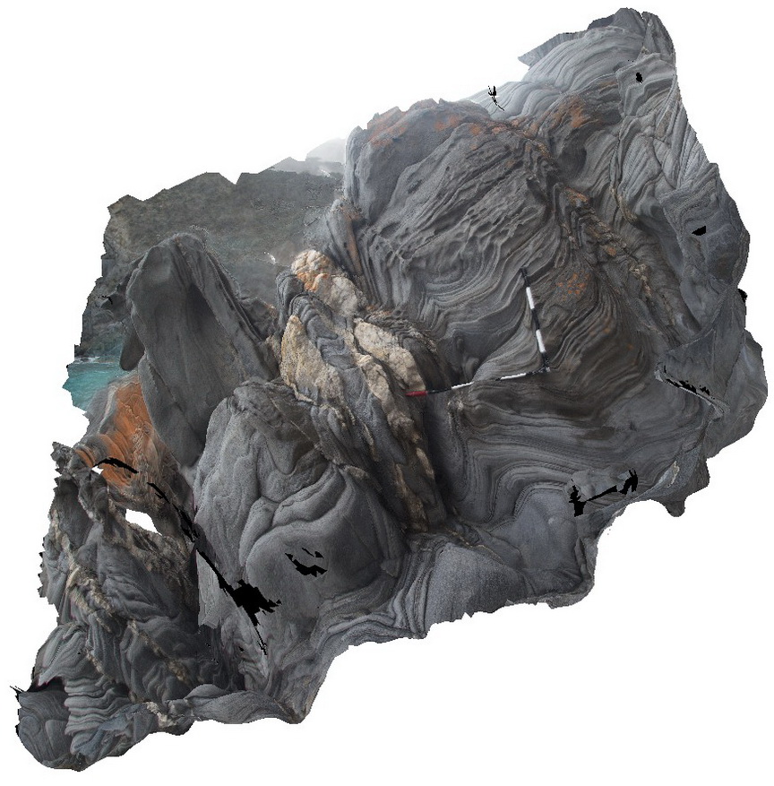
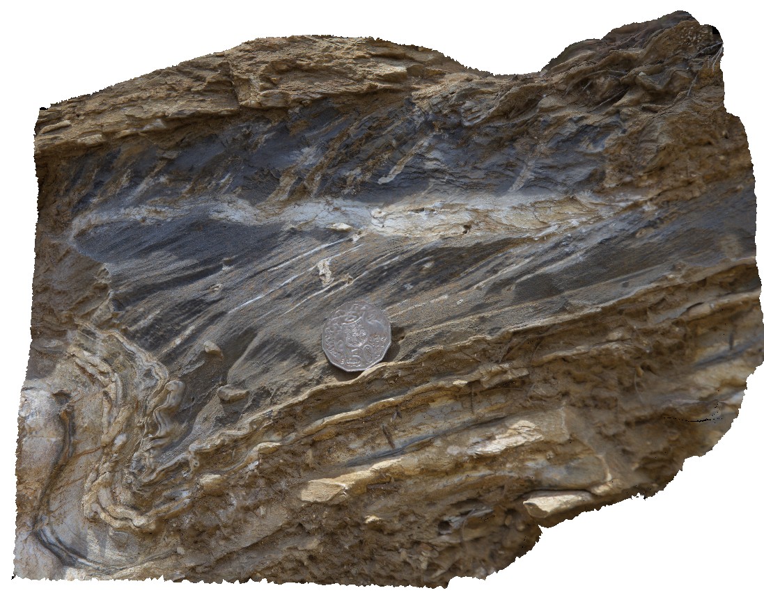
folding in finely bedded meta-sandstone, with quartz veins. Harvey's Bay, Kangaroo Island. S.A. |
3.00 |
-35.74825000000 |
136.63876000000 |
-9999.000 |
zebra rock, folds, structure |
sandstone |
Harveys6 Map
 |
0 |
11/17/2015 10:44 a.m. |
3D |
small-scale disharmonic folds / soft sediment deformation in finely laminated sandstone. Harvey's Bay, Kangaroo Island. S.A. |
0.30 |
-35.74823000000 |
136.63890000000 |
-9999.000 |
disharmonic folding, soft sediment deformation |
sandstone |
Harveys7 Map
 |
0 |
11/17/2015 10:45 a.m. |
3D |
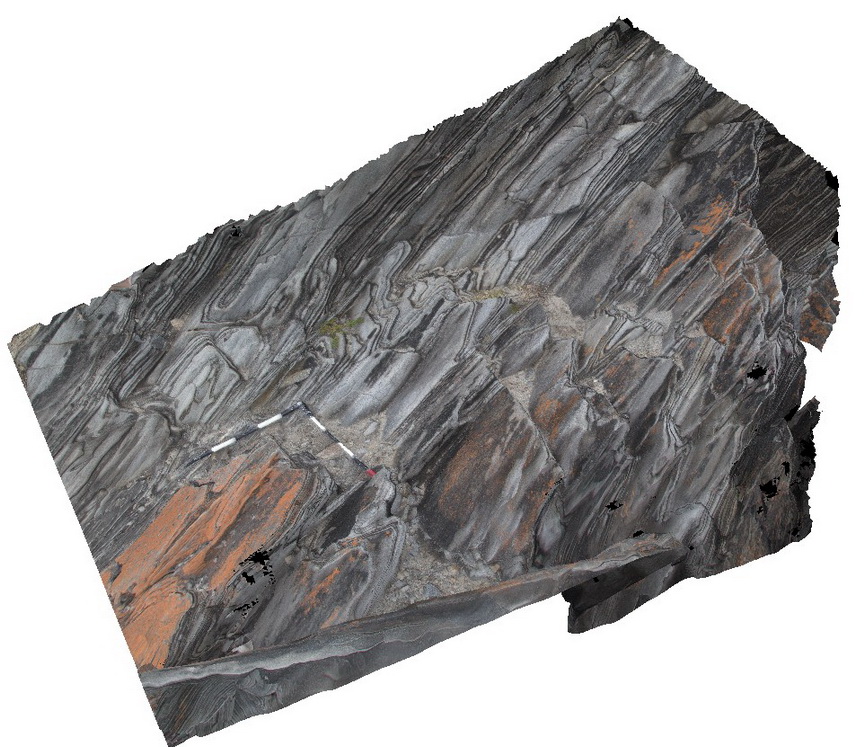
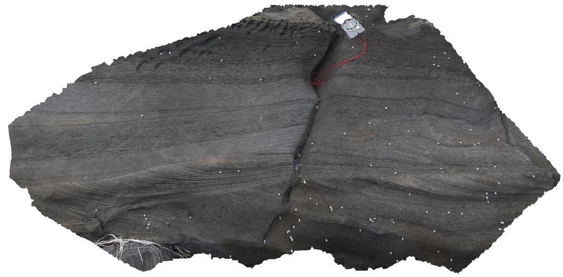
cross bedding and ripple marks in zebra rocks / sandstone. Harvey's Bay, Kangaroo Island. S.A. |
1.00 |
-35.74820000000 |
136.63887000000 |
-9999.000 |
zebra rock, cross bedding, ripple mark, sedimentology |
sandstone |
Harveys8 Map
 |
0 |
11/17/2015 10:45 a.m. |
3D |
detail of planar beds and ripple marks in sandstone. Harvey's Bay, Kangaroo Island. S.A. |
0.30 |
-35.74833000000 |
136.63899000000 |
-9999.000 |
ripple marks, laminar bedding, sedimentology |
sandstone |
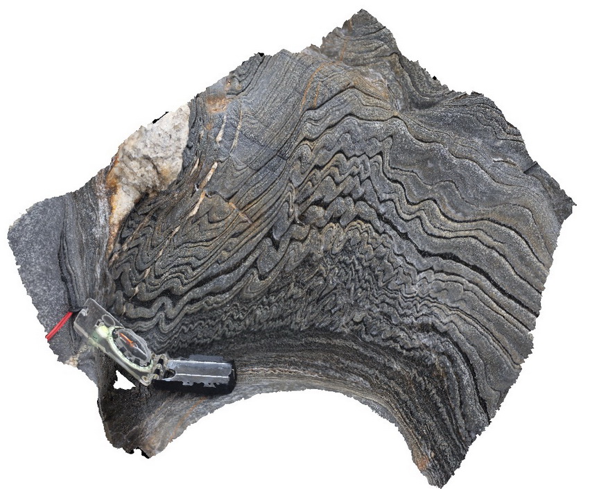
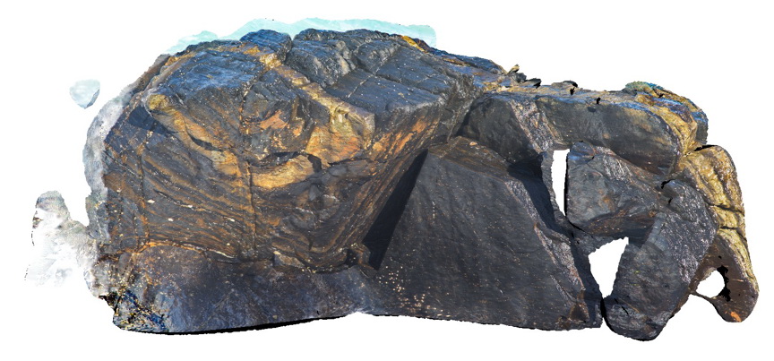
Harveys9 Map
 |
0 |
11/17/2015 10:46 a.m. |
3D |
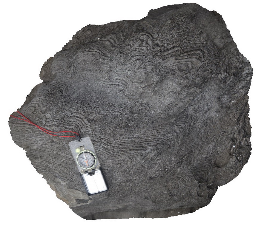
polyharmonic folds in zebra rock, Harvey's Bay, Kangaroo Island. S.A. |
0.30 |
-35.74724000000 |
136.63953000000 |
-9999.000 |
polyharmonic fold, zebra rock |
sandstone |
HarveysFSP1 Map
 |
0 |
10/20/2015 3:23 p.m. |
FSP |
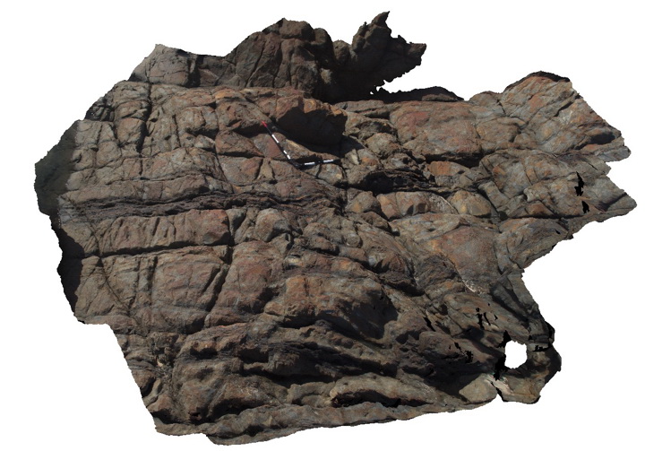
view of shore exposure, showing open folds of finely bedded sandstone / zebra rock. Outcrop shows small fold hinge and 'S' and 'Z' parasitic folding. Harvey's Bay, Kangaroo Island. S.A. |
1000.00 |
-35.74832000000 |
136.63885000000 |
-9999.000 |
fold hinge, S and Z fold vergence, zebra rock, sandstone, structure |
sandstone |
HarveysFSP2 Map
 |
0 |
10/20/2015 3:23 p.m. |
FSP |
view of shore exposure, showing open folds of finely bedded sandstone / zebra rock. Outcrop shows small fold hinge and 'S' and 'Z' parasitic folding. Harvey's Bay, Kangaroo Island. S.A. |
1000.00 |
-35.74822000000 |
136.63869000000 |
-9999.000 |
fold hinge, parasitic fold, zebra rock, structure |
sandstone |
HarveysFSP3 Map
 |
0 |
10/20/2015 3:23 p.m. |
FSP |
view of shore exposure, showing open folds of finely bedded sandstone / zebra rock, cut by quartz veins. Outcrop shows small fold hinge and parasitic folding. Harvey's Bay, Kangaroo Island. S.A. |
1000.00 |
-35.74806000000 |
136.63852000000 |
-9999.000 |
parasitic folding, structure, folding, zebra rock |
sandstone |
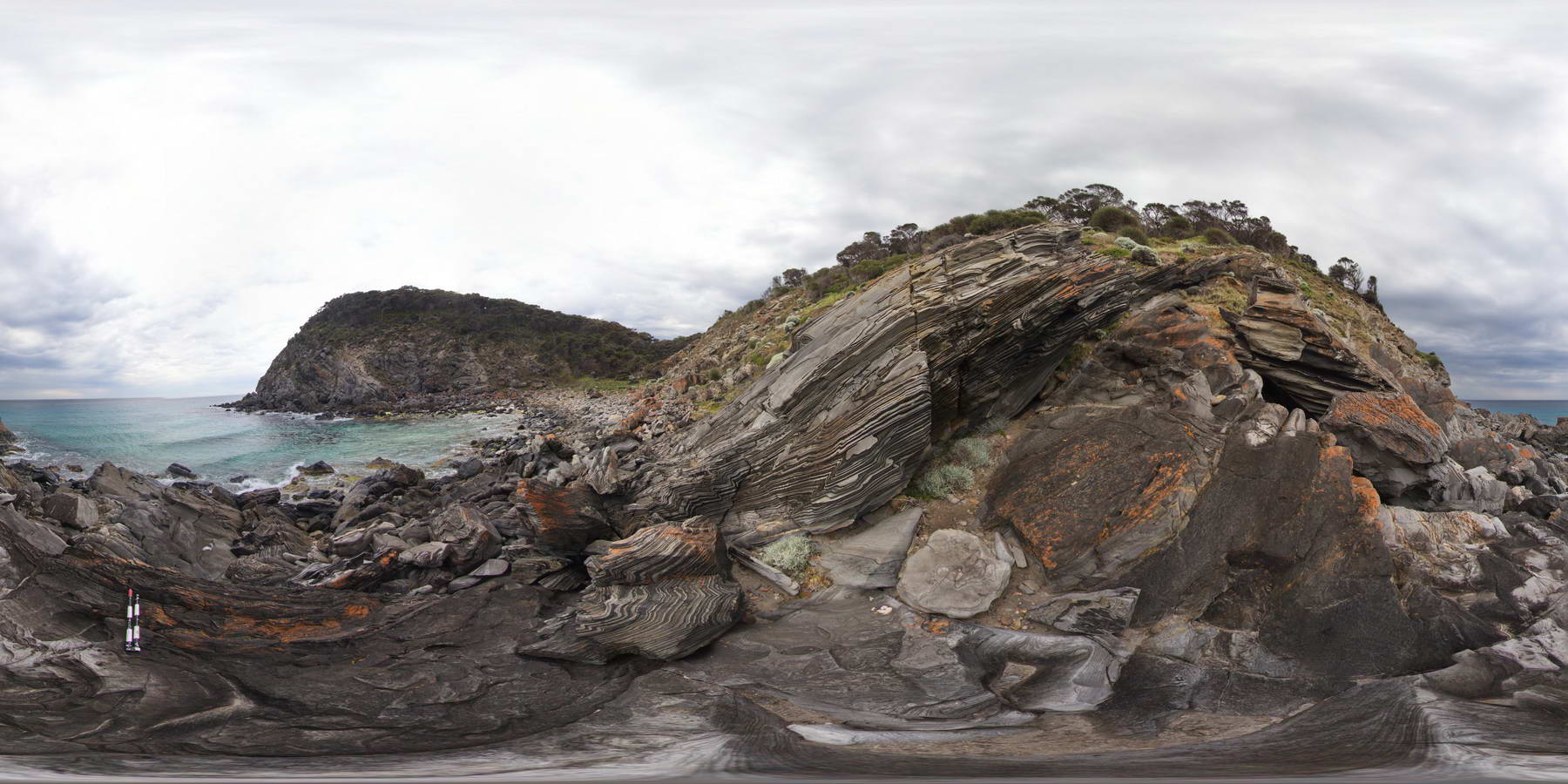
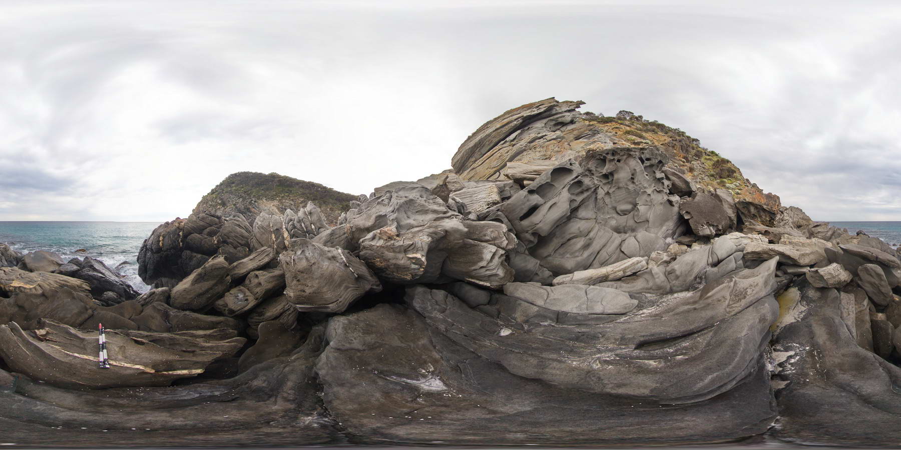
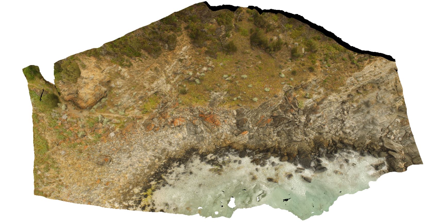
HarveysUAV1 Map
 |
0 |
10/20/2015 3:31 p.m. |
UAV |
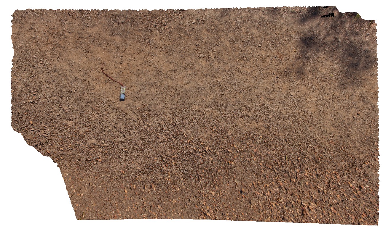
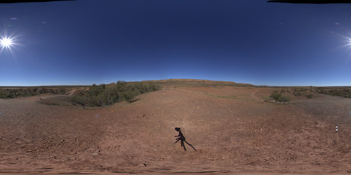
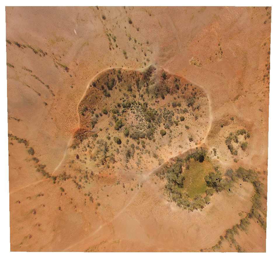
aerial view, showing moderately dipping 'zebra rock'. Harvey's Retreat. Kangaroo Island. S.A. |
100.00 |
-35.74834500000 |
136.63902300000 |
-9999.000 |
zebra rock |
sandstone |
HastingsPt1 Map
 |
5 |
07/09/2015 4:26 p.m. |
3D |
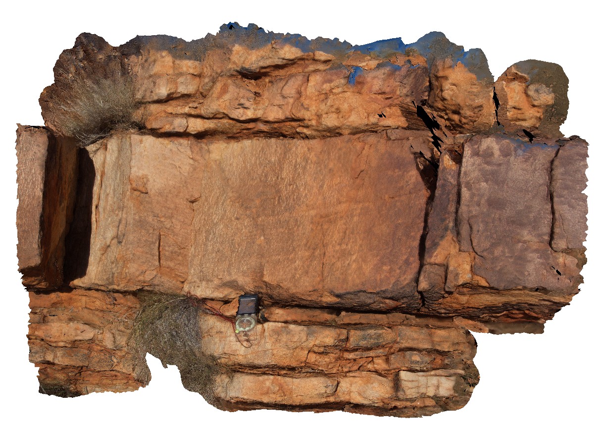
Tilted metasediments of the Devonian-Carboniferous Neranleigh-Fernvale Beds. Hastings Point, QLD. |
5.00 |
-28.33566000000 |
153.57724000000 |
2.000 |
bedding |
sandstone |
HastingsPt2 Map
 |
1 |
07/09/2015 4:27 p.m. |
3D |
fold in metasediments in offshore rock - approximately 2.5m across. Devonian - Carboniferous Neranleigh-Fernvale Beds. Hastings Point, QLD. |
0.00 |
-28.33676000000 |
153.57729000000 |
-9999.000 |
fold, structure |
sandstone |
HastingsPt3 Map
 |
1 |
07/09/2015 4:28 p.m. |
3D |
Overturned beds (writing on lens cap is upright) with grading and scours. Devonian-Carboniferous Neranleigh-Fernvale Beds. Hastings Point, QLD. |
1.30 |
-28.33673000000 |
153.57729000000 |
-9999.000 |
overturned bedding, structure, sedimentology |
sandstone |
HastingsPt4 Map
 |
5 |
10/20/2015 2:40 p.m. |
3D |
mafic dyke cross cutting metasediments of the Devonian-Carboniferous Neranleigh-Fernvale Beds. Hastings Point, QLD. |
1.50 |
-28.33675000000 |
153.57719000000 |
8.000 |
dyke, structure, sedimentology |
sandstone, dolerite |
HastingsPt5 Map
 |
5 |
07/09/2015 4:31 p.m. |
3D |
Fault cross cutting dipping metasedimentary layers of the Devonian-Carboniferous Neranleigh-Fernvale Beds. Hastings Point, QLD. |
5.00 |
-28.36320000000 |
153.57991000000 |
1.000 |
fault, bedding, structure |
sandstone |
HENB1 Map
 |
0 |
07/29/2016 12:14 p.m. |
3D |
disrupted bedding between impact craters. Henbury Meteorites Conservation Reserve. N.T. |
0.00 |
-24.57255600000 |
133.14790100000 |
464.641 |
Meteorite, impact craters, disrupted bedding |
sediments |
HENB2 Map
 |
0 |
07/29/2016 12:56 p.m. |
3D |
laminated sandstone on ridge immediately south of Henbury impact sight. Henbury Meteorites Conservation Reserve. N.T. |
0.00 |
-24.57323400000 |
133.12315300000 |
464.466 |
Henbury, Meteorite, impact crater |
sandstone |
HENBFSP1 Map
 |
0 |
07/29/2016 12:23 p.m. |
FSP |
view of impact craters from lip of second main crater. 2 smaller craters to the SW in front of ridge. Henbury Meteorites Conservation Reserve. N.T. |
0.00 |
-24.57256800000 |
133.14765900000 |
467.793 |
impact craters, Meteorite, Henbury |
sediments |
HENBUAV1 Map
 |
0 |
07/29/2016 11:43 a.m. |
UAV |
aerial view of Henbury impact craters. Henbury Meteorites Conservation Reserve. N.T. |
200.00 |
-24.57164500000 |
133.14883500000 |
460.694 |
meteorite impact craters, Henbury, Meteorites |
sediments |
IndustryRd1 Map
 |
5 |
01/01/9999 midnight |
3D |
F2 parasitic folds and crenulated S1 fabric (folded bedding and S1). S1 oblique to bedding. |
0.00 |
-41.13119000000 |
147.03804000000 |
-9999.000 |
parasitic fold, crenulated cleavage, S1 fabric, F2 fold, fold, structure |
|
IndustryRd2 Map
 |
5 |
01/01/9999 midnight |
3D |
close up of F2 parasitic folds and crenulated S1 fabric (folded bedding and S1). S1 oblique to bedding. |
0.00 |
-41.13119000000 |
147.03804000000 |
-9999.000 |
parasitic fold, structure, crenulated cleavage, S1, F2 fold |
|