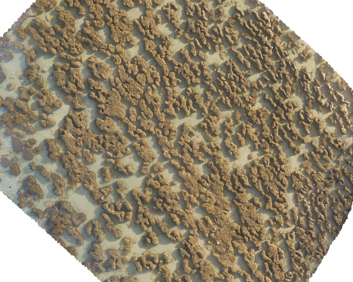
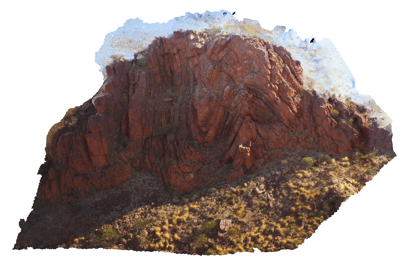
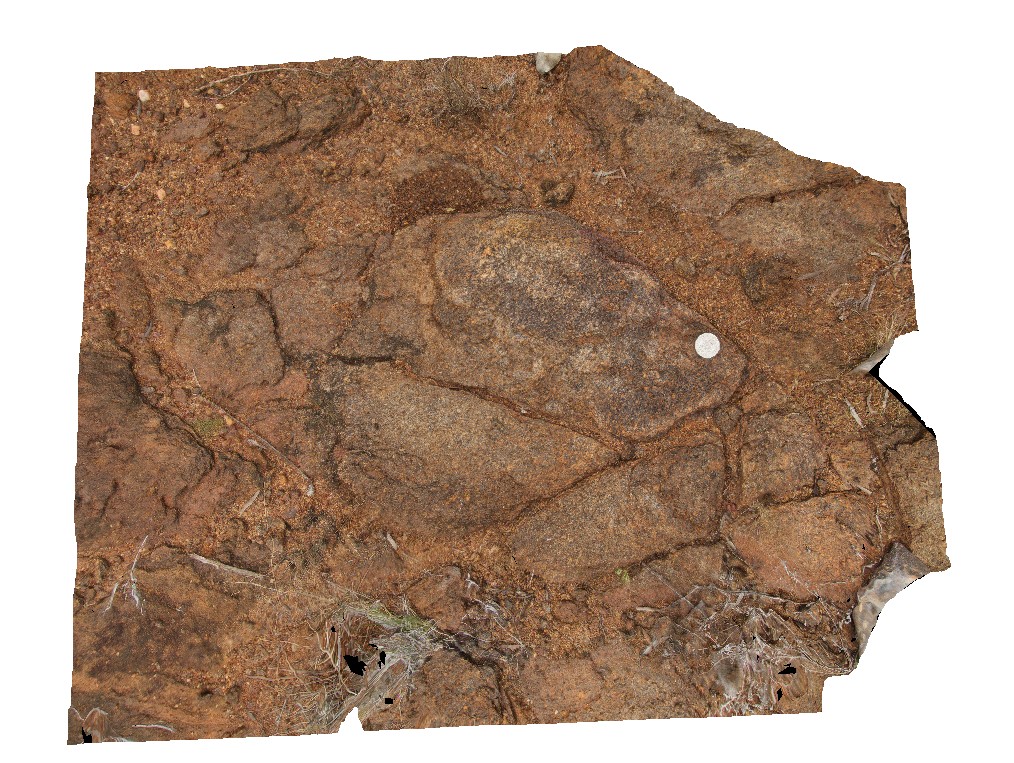
Hamelin9 Map
 |
0 |
05/23/2016 noon |
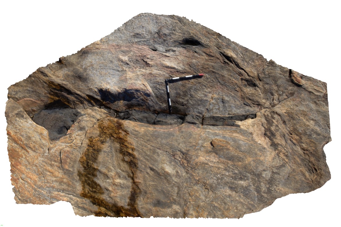
3D |
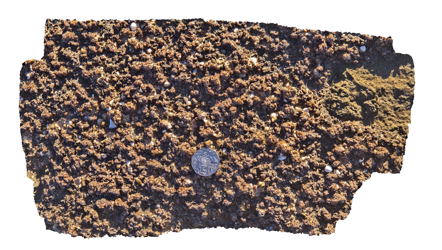
view of pustular mat feature of stromatolite. Hamelin Pool. Shark Bay, W.A. |
0.45 |
-24.40056000000 |
114.15903000000 |
-9999.000 |
tidal flat deposits, stromatolites, pustular mat |
tidal flat deposits |
HamelinUAV1 Map
 |
0 |
05/23/2016 noon |
UAV |
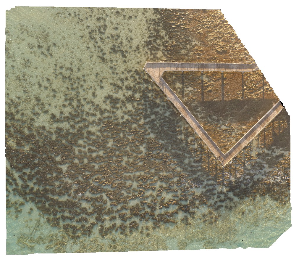
aerial view of submerged stromatolite colony. Hamelin Pool. Shark Bay, W.A. |
50.00 |
-26.40043900000 |
114.15878700000 |
-9999.000 |
tidal flat deposits, stromatolite |
tidal flat deposits |
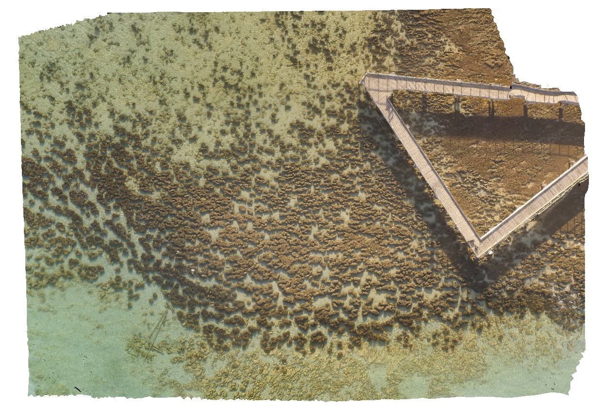
HamelinUAV2 Map
 |
0 |
05/23/2016 noon |
UAV |
aerial view of submerged stromatolite colony. Hamelin Pool. Shark Bay, W.A. |
100.00 |
-26.40027700000 |
114.15869900000 |
-9999.000 |
tidal flat deposits, stromatolite |
tidal flat deposits |
HamelinUAV3 Map
 |
0 |
05/23/2016 noon |
UAV |
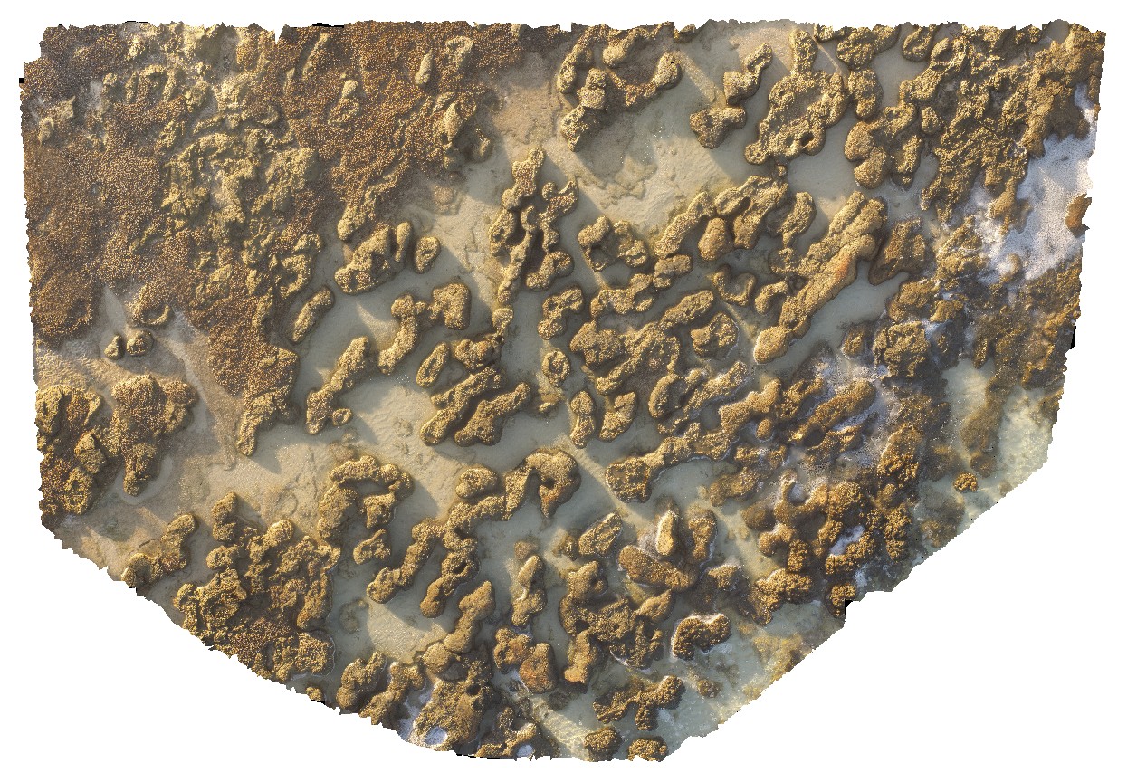
aerial view of stromatolites and fine interstitial sediments. Hamelin Pool. Shark Bay, W.A. |
25.00 |
-26.40072100000 |
114.15898800000 |
-9999.000 |
tidal flat deposits, stromatolite |
tidal flat deposits |
HamelinUAV4 Map
 |
0 |
05/23/2016 noon |
UAV |
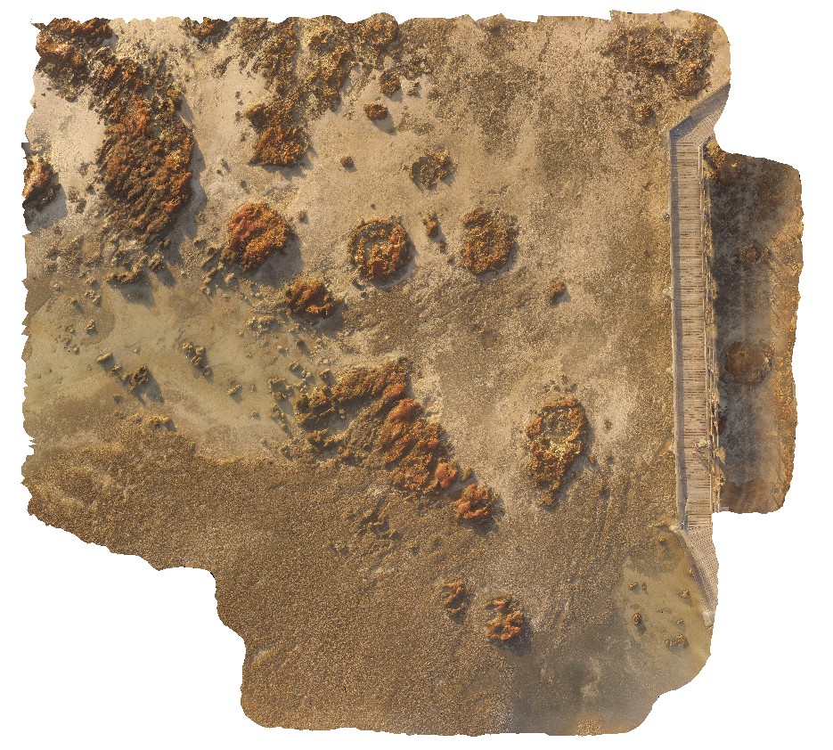
aerial view of large stromatolite mounds - supra-tidal. Hamelin Pool. Shark Bay, W.A. |
50.00 |
-26.40053100000 |
114.15087300000 |
-9999.000 |
tidal flat deposits, stromatolites |
tidal flat deposits |
HamelinUAV5 Map
 |
0 |
05/23/2016 noon |
UAV |
aerial view of submerged stromatolites. Hamelin Pool. Shark Bay, W.A. |
50.00 |
-26.40031000000 |
114.15875100000 |
-9999.000 |
tidal flat deposits, stromatolite |
tidal flat deposits |
HamelinUAV6 Map
 |
0 |
05/23/2016 noon |
UAV |
aerial view of submerged stromatolites. Hamelin Pool. Shark Bay, W.A. |
100.00 |
-26.40043000000 |
114.15891500000 |
-9999.000 |
tidal flat deposits, stromatolite |
tidal flat deposits |
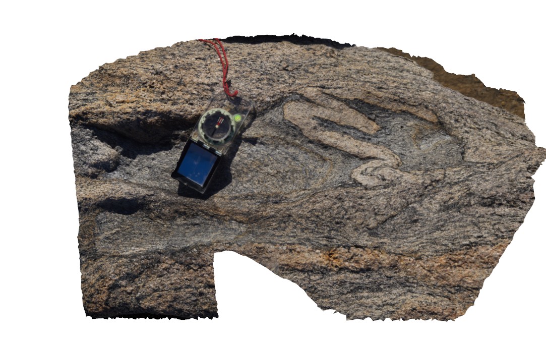
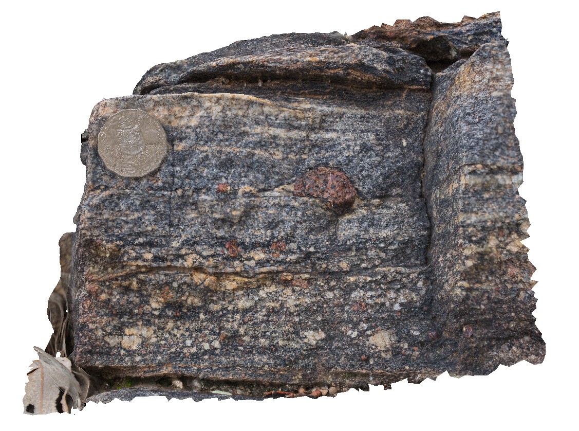
HammerHead1 Map
 |
0 |
06/05/2016 10:45 a.m. |
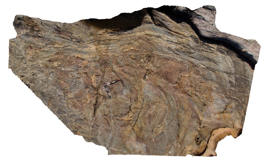
3D |
folded layering in gneiss / migmatite, possibly caused by original lithological variation. Hammer Head, W.A. |
0.70 |
-33.94940000000 |
122.57458000000 |
-9999.000 |
fold, structure |
migmatite |
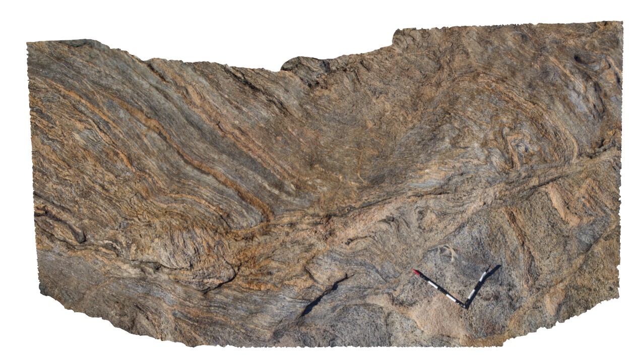
HammerHead2 Map
 |
0 |
06/05/2016 10:45 a.m. |
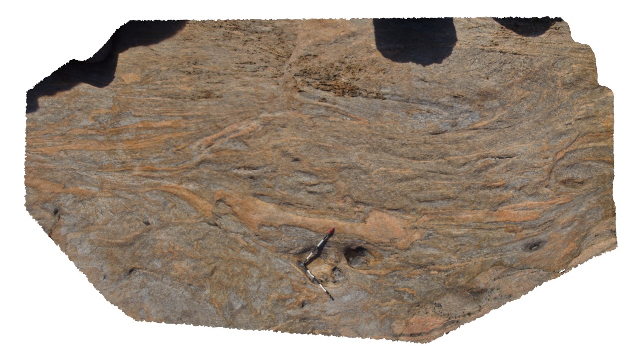
3D |
view of folded leucosomes and gneissic layers offset by shear zone. Hammer Head, W.A south coast. |
4.20 |
-33.94936000000 |
122.57462000000 |
-9999.000 |
leucosomes, shear zone, fold, structure |
migmatite |
HammerHead3 Map
 |
0 |
06/05/2016 10:46 a.m. |
3D |
mafic enclaves / remnants of original mafic dyke in layered gneiss. Hamer Head, W.A south coast. |
4.00 |
-33.94922000000 |
122.57465000000 |
-9999.000 |
mafic dyke, gneiss |
gneiss, mafic |
HammerHead4 Map
 |
0 |
06/05/2016 10:46 a.m. |
3D |
tightly folded gneiss with mafic zone that may represent dykes. Hammer Head, W.A south coast. |
7.00 |
-33.94917000000 |
122.57466000000 |
-9999.000 |
tight fold, gneiss, structure |
gneiss, mafic |
HammerHead5 Map
 |
0 |
06/05/2016 10:47 a.m. |
3D |
folded gneissic layering with shear zones in leucosomes. Hammer Head, W.A. South coast. |
5.00 |
-33.94862000000 |
122.57486000000 |
-9999.000 |
fold, structure, gneiss |
gneiss |
HammerHead6 Map
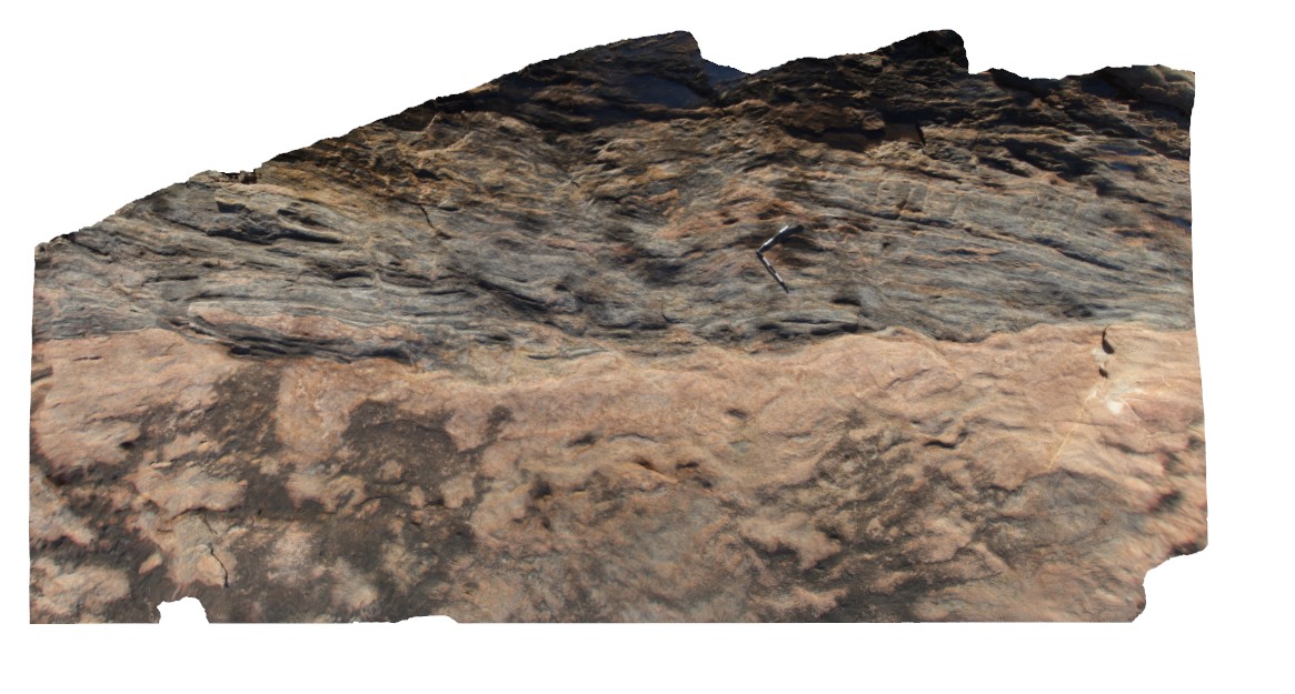 |
0 |
06/05/2016 10:47 a.m. |
3D |
view of contact between layered Bi-gneiss and granite. Hammer Hear, W.A south coast. |
9.00 |
-33.94737000000 |
122.57014000000 |
-9999.000 |
geological contact, structural domain |
gneiss, granite |
HardyUAV1 Map
 |
0 |
05/28/2016 noon |
UAV |
'M' folding in the Marra Mamba Iron Formation outcrop. Nanutarra Road, W.A. |
100.00 |
-22.95306990000 |
117.31003260000 |
-9999.000 |
M folding, banded Iron Formation, BIF, structure, folding |
BIF |
HARTS1 Map
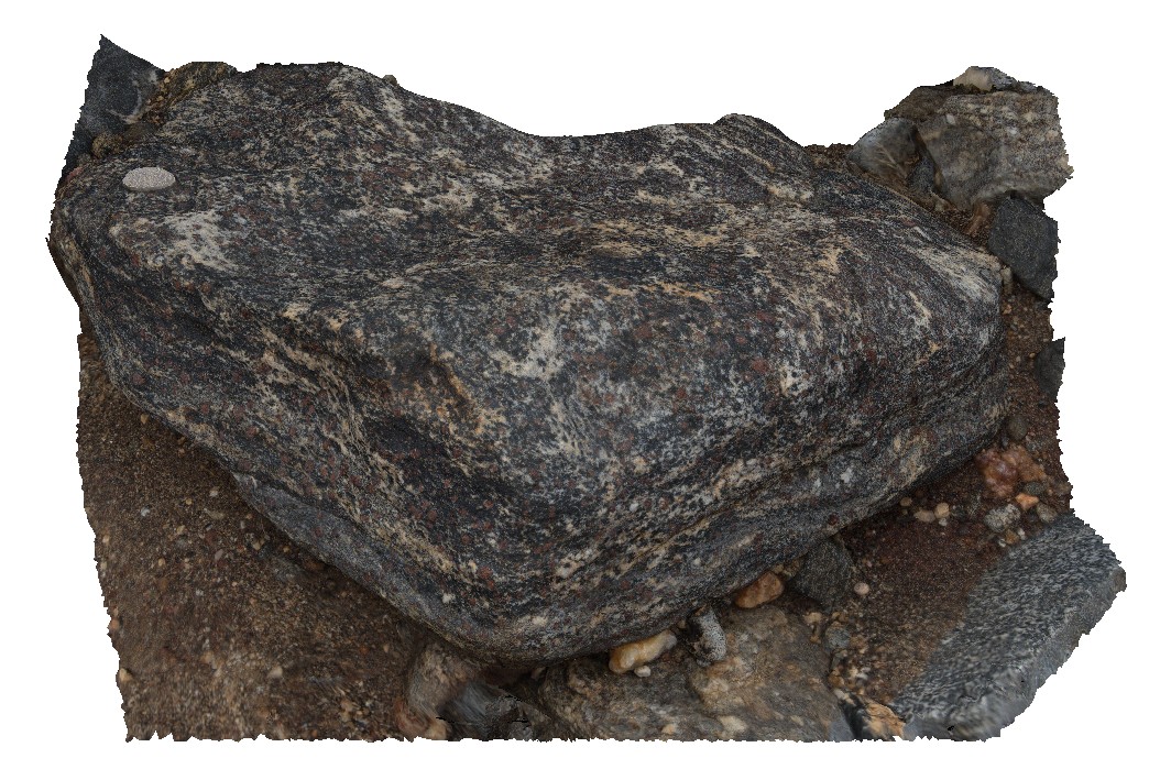 |
5 |
07/25/2016 3:02 p.m. |
3D |
view of coarse-grained bi-gt gneiss boulder. Harts Range, N.T. |
0.50 |
-23.13541900000 |
135.06157000000 |
633.891 |
bi-gt-gneiss, gneiss, metamorphic, Harts range metamorphics |
gneiss |
HARTS2 Map
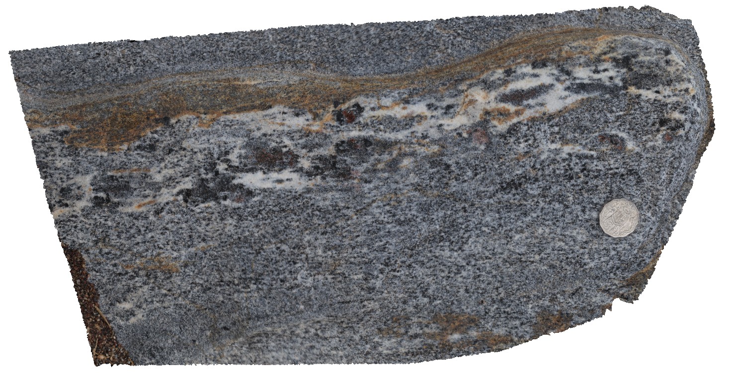 |
5 |
07/25/2016 3:07 p.m. |
3D |
garnet gneiss in leucocratic layer of bt-gneiss. Harts Range, N.T. |
0.40 |
-23.13530700000 |
135.06145700000 |
633.085 |
gneiss, harts range metamorphics, metamorphic |
gneiss |
HARTS3 Map
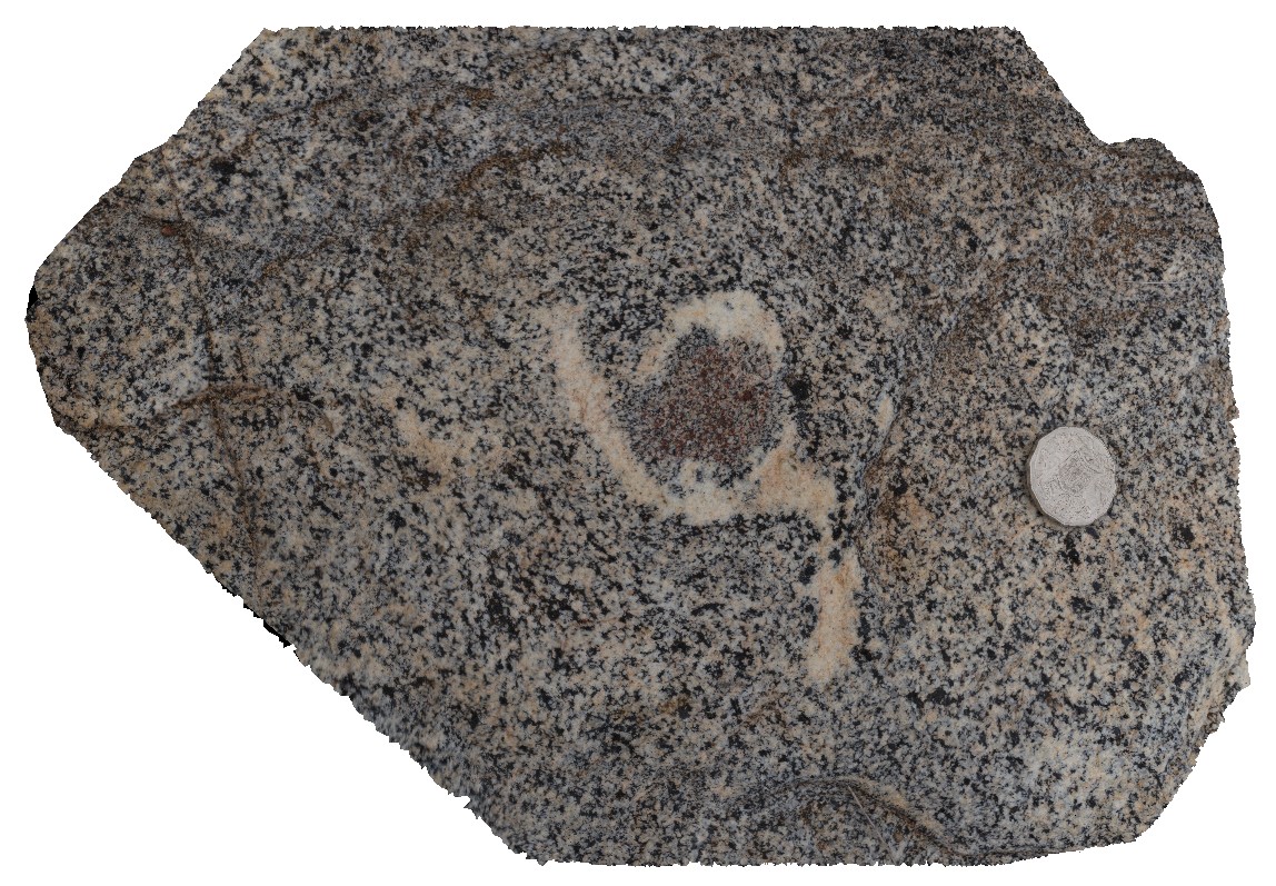 |
5 |
07/25/2016 3:09 p.m. |
3D |
view of 2-3cm wide garnet porphyroblast in bt-gneiss. Harts Range, N.T. |
0.30 |
-23.13526300000 |
135.06147100000 |
633.312 |
porphyroblast, biotite gneiss, harts range, metamorphic |
gneiss |
HARTS4 Map
 |
5 |
07/26/2016 12:52 p.m. |
3D |
weathering texture on garnet bearing gneiss from the Harts Range Metamorphic Complex. Harts Range, N.T. |
1.00 |
-23.28101900000 |
135.08098400000 |
569.231 |
gneiss, metamorphic |
gneiss |
HARTS5 Map
 |
5 |
07/26/2016 1:20 p.m. |
3D |
view of cross section of small garnet porphyroblast in bi-gt gneiss. Harts Range, N.T. |
0.20 |
-23.27660300000 |
135.03500500000 |
646.190 |
Harts Range Metamorphic Complex, metamorphic, gneiss |
gneiss |
HARTS6 Map
 |
5 |
07/26/2016 2:05 p.m. |
3D |
foliated biotite gneiss, containing mus-qtz porphyroblasts with pressure shadows. Harts Range, N.T. |
0.50 |
-23.27949400000 |
134.98622000000 |
614.991 |
pressure shadow, metamorphic, structure, foliation, gneiss, porphyroblast |
gneiss |
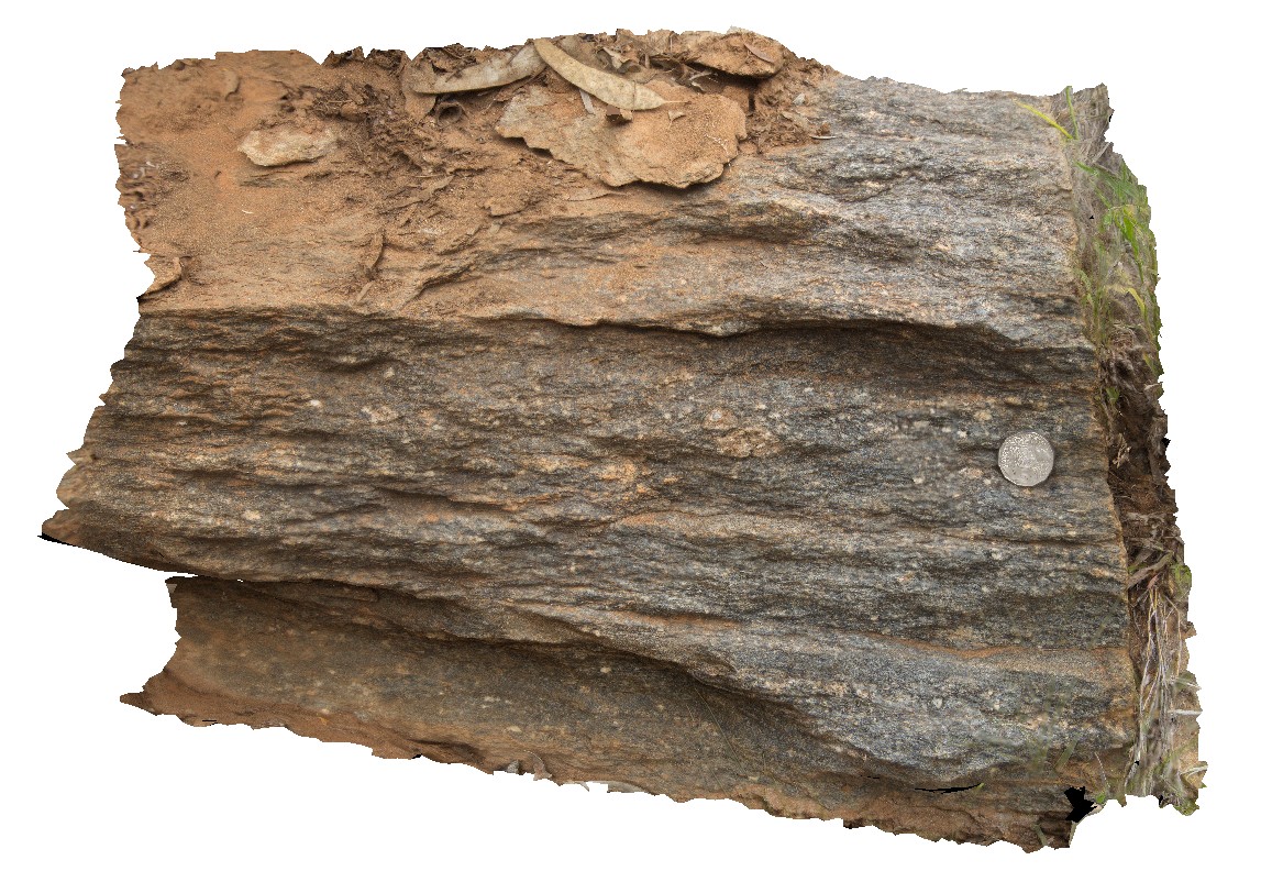
HARTS7 Map
 |
5 |
07/26/2016 2:36 p.m. |
3D |
quarts and feldspar augen in finely laminated amphibolite. Harts Range, N.T. |
0.80 |
-23.26729200000 |
134.88561700000 |
603.098 |
amphibolite, augen, structure, laminated, metamorphic |
amphibolite |
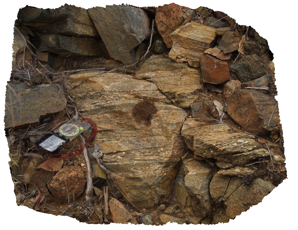
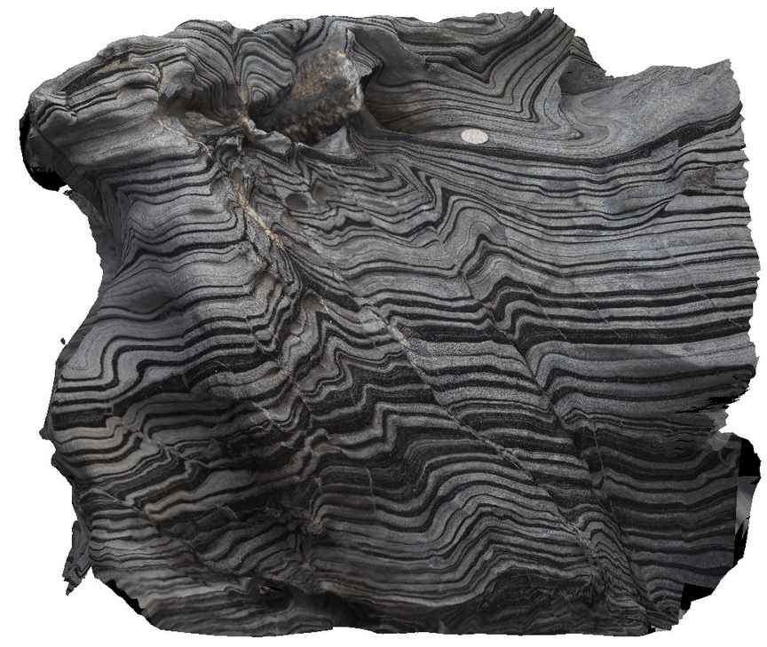
Harveys1 Map
 |
0 |
11/17/2015 10:39 a.m. |
3D |
folds, faults and quartz veins in zebra rocks. Harvey's Bay, Kangaroo Island. S.A. |
1.00 |
-35.74831000000 |
136.63898000000 |
-9999.000 |
zebra stripe rock, fold, fault, structure |
sandstone |
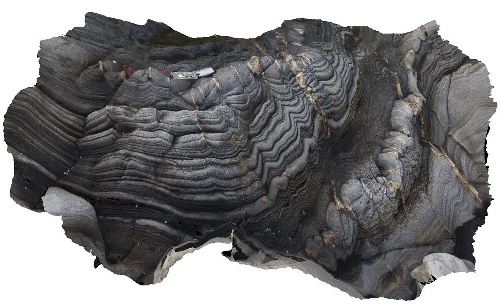
Harveys10 Map
 |
0 |
11/17/2015 10:47 a.m. |
3D |
polyharmonic folds in zebra rock, Harvey's Bay. Kangaroo Island. S.A. |
0.40 |
-35.74722000000 |
136.63954000000 |
-9999.000 |
polyharmonic fold, zebra rock |
sandstone |
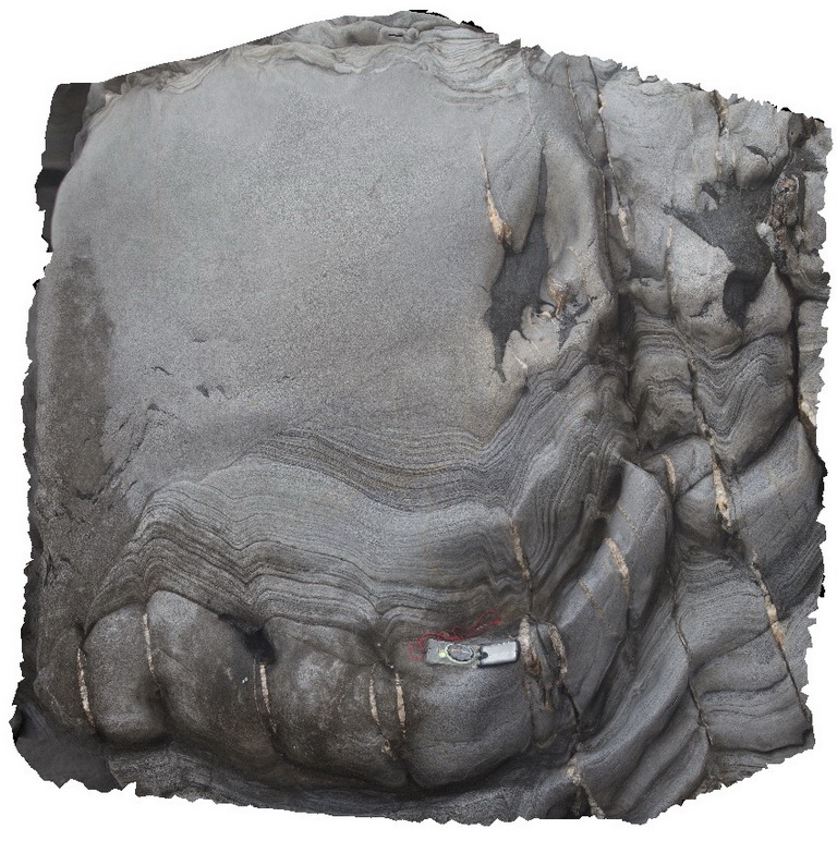
Harveys11 Map
 |
0 |
11/17/2015 10:48 a.m. |
3D |
sandstone channel cutting laminated beds, with rip-up clasts and boulders in competent sandstone. Harvey's Bay, Kangaroo Island. S.A. |
1.00 |
-35.74685000000 |
136.64009000000 |
-9999.000 |
folding, channel, rip-up clasts, sediment structure |
sandstone |
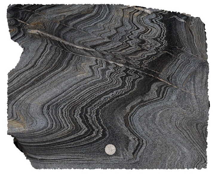
Harveys12 Map
 |
0 |
11/17/2015 10:48 a.m. |
3D |
polyharmonic folds in zebra rock / banded sandstone, with fold hinges intruded by quartz veins. Harvey's Bay, Kangaroo Island. S.A. |
1.50 |
-35.74689000000 |
136.64000000000 |
-9999.000 |
zebra rock, polyharmonic folds, fold hinge, quartz vein |
sandstone |