GordonRd10 Map
 |
0 |
02/29/2016 1:41 p.m. |
3D |
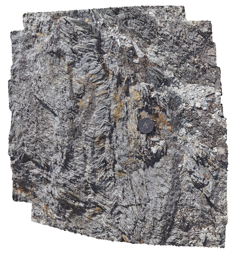
detail of small-scale kinks and associated crenulation cleavage in phyllites. Gordon Dam road. Tasmania. |
0.50 |
-42.81057000000 |
146.09669000000 |
-9999.000 |
crenulation cleavage, chevron folds, phyllite, structure |
phyllite |
GordonRd12 Map
 |
0 |
02/29/2016 1:42 p.m. |
3D |
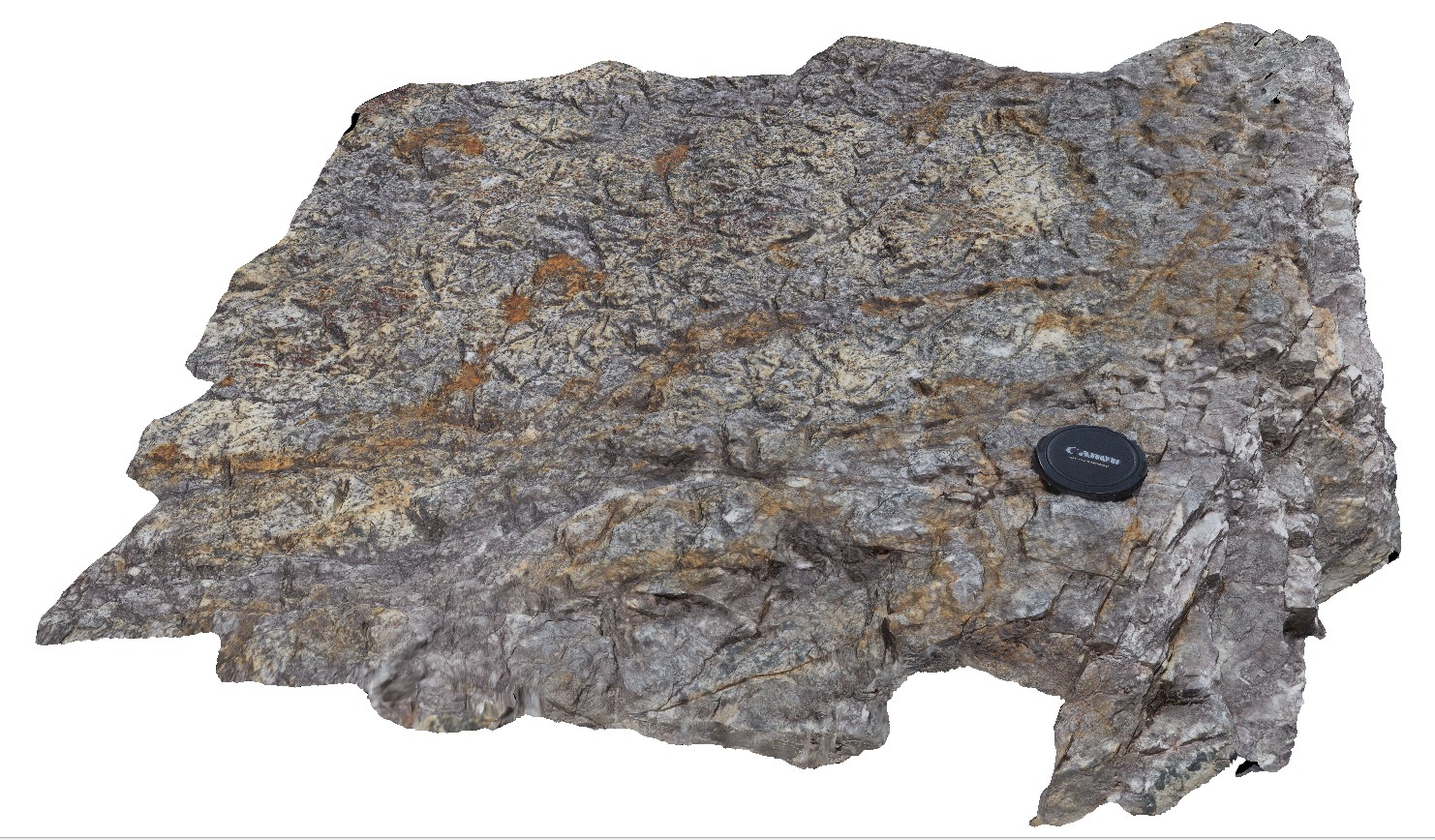
detail of psuedomorphs on bedding plane from image GordonRd11. Tasmania. |
0.60 |
-42.79335000000 |
146.39572000000 |
-9999.000 |
psuedomorphs, bedding plane |
sandstone |
GordonRd13 Map
 |
0 |
02/29/2016 11:20 a.m. |
3D |
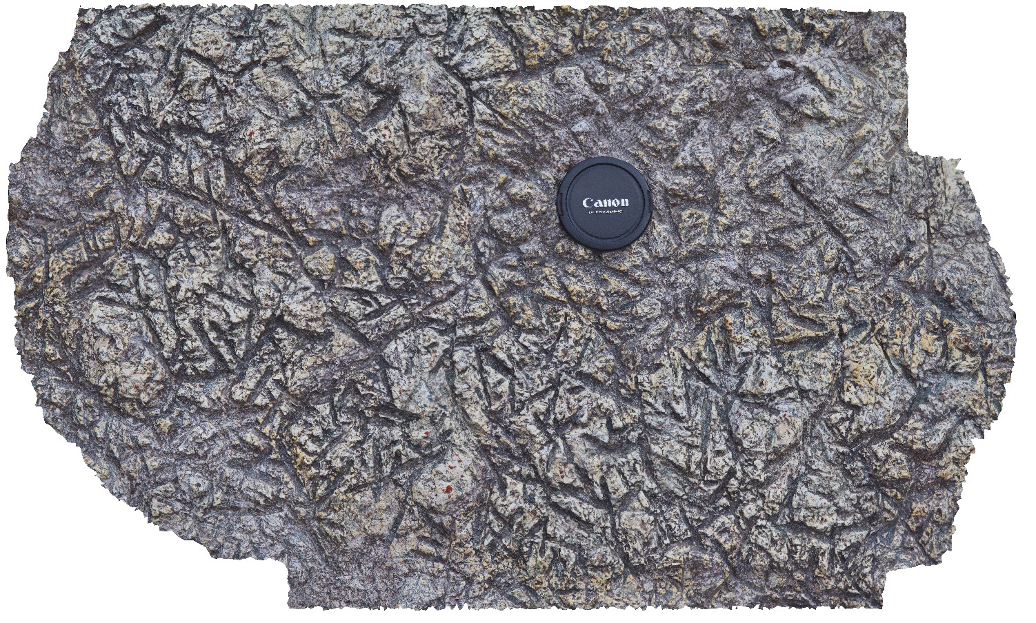
detail of psuedomorphs on bedding plane from image GordonRd11. Gordon Dam, Tasmania. |
0.30 |
-42.79327000000 |
146.39574000000 |
-9999.000 |
psuedomorphs, bedding plane |
sandstone |
GordonRd2 Map
 |
0 |
02/29/2016 1:37 p.m. |
3D |
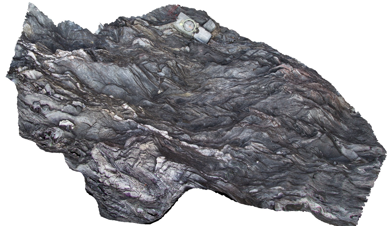
small recumbent folds in phyllite beds with folded quartz veins. Gordon Dam Road, near Gordon Dam. Tasmania. |
1.00 |
-42.73601000000 |
145.97472000000 |
-9999.000 |
recumbent fold, fold, structure, phyllite |
phyllite |
GordonRd3 Map
 |
0 |
02/29/2016 1:38 p.m. |
3D |
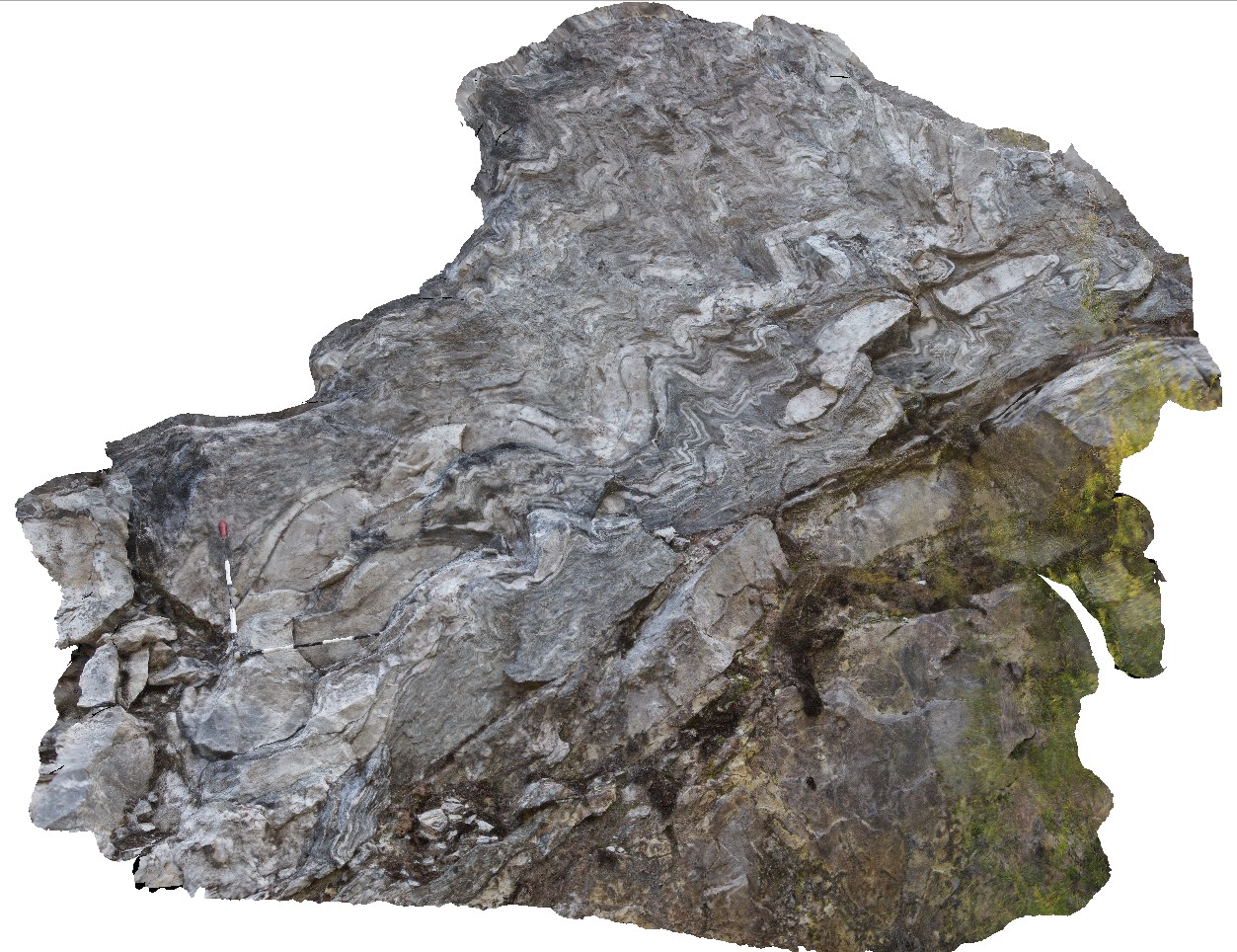
multiply deformed sediments, showing folds in phyllite and quartzite, with quartzite boudins. Gordon Dam Road, near Gordon Dam. Tasmania. |
4.50 |
-42.73540000000 |
145.97485000000 |
-9999.000 |
folds, deformation, boudinage, structure, phyllite |
phyllite |
GordonRd4 Map
 |
0 |
02/29/2016 1:38 p.m. |
3D |
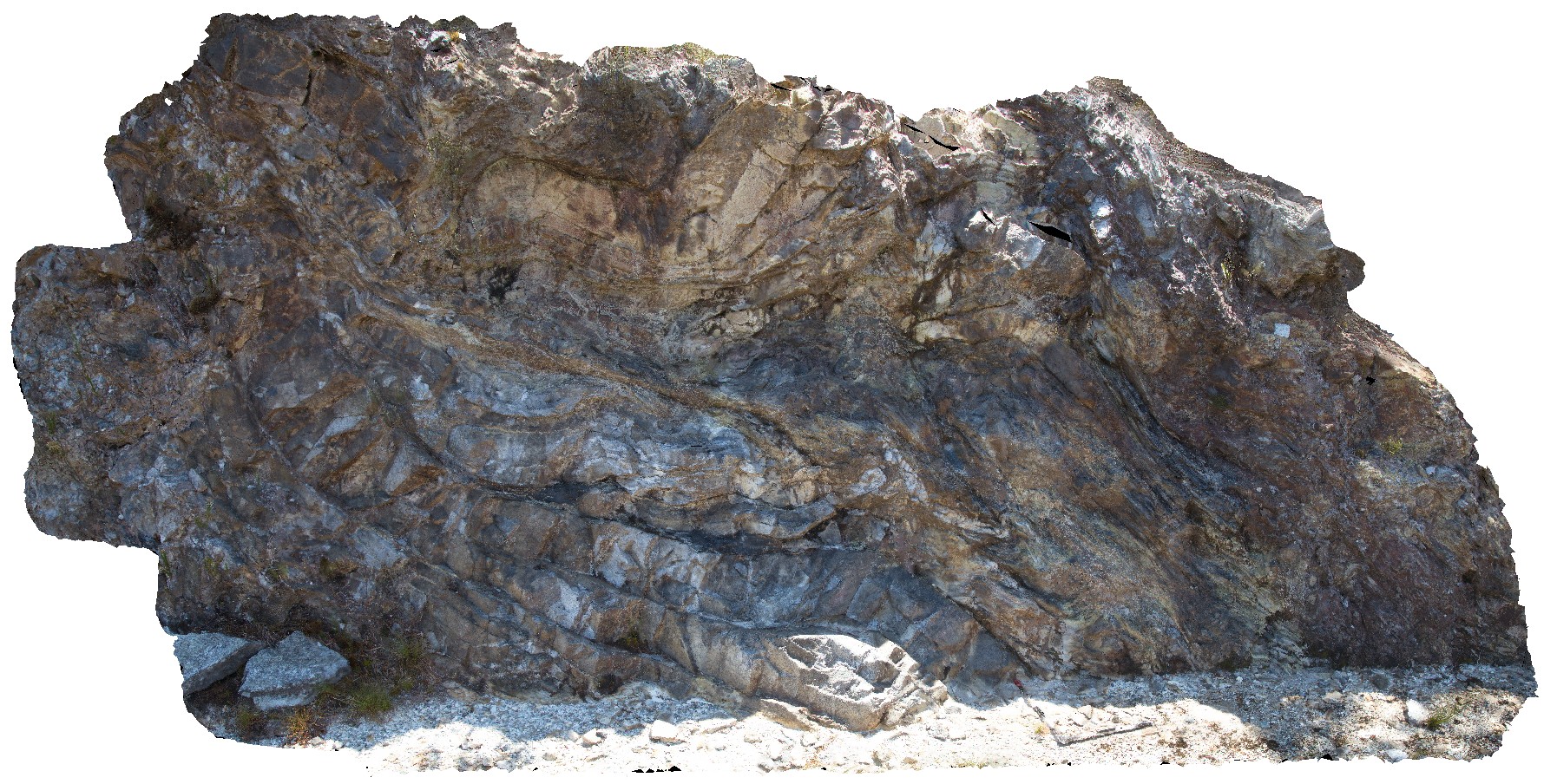
disharmonic folds and fault in quartzite and phyllite beds, Gordons Dam Road, Tasmania. |
6.00 |
-42.73633000000 |
145.97754000000 |
-9999.000 |
disharmonic folding, quartzite, phyllite, deformation |
quartzite |
GordonRd5 Map
 |
0 |
02/29/2016 1:39 p.m. |
3D |
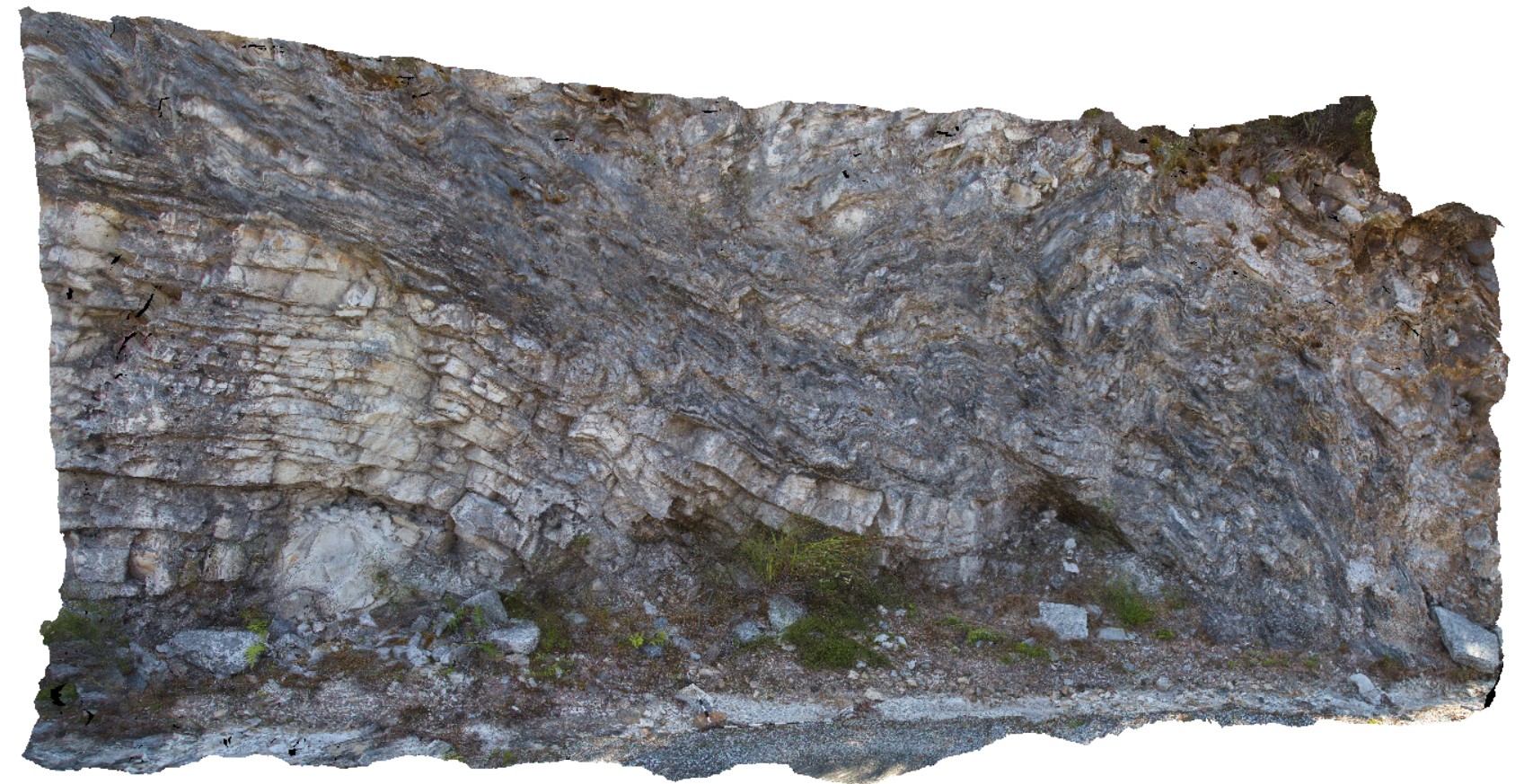
road cutting showing disharmonic folding in quartzite and phyllite beds. Gordon Dam road, Tasmania. |
5.00 |
-42.73633000000 |
145.97752000000 |
-9999.000 |
disharmonic folding, quartzite, phyllite, structure |
quartzite |
GordonRd6 Map
 |
0 |
02/29/2016 1:39 p.m. |
3D |
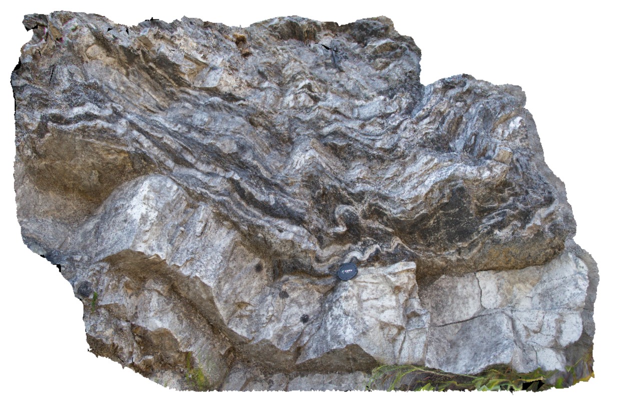
detail of disharmonic folds on boundary of quartzite unit. Gordon Dam, Tasmania. |
1.50 |
-42.73633000000 |
145.97752000000 |
-9999.000 |
phyllite, disharmonic folding, structure |
phyllite |
GordonRd7 Map
 |
0 |
02/29/2016 1:40 p.m. |
3D |
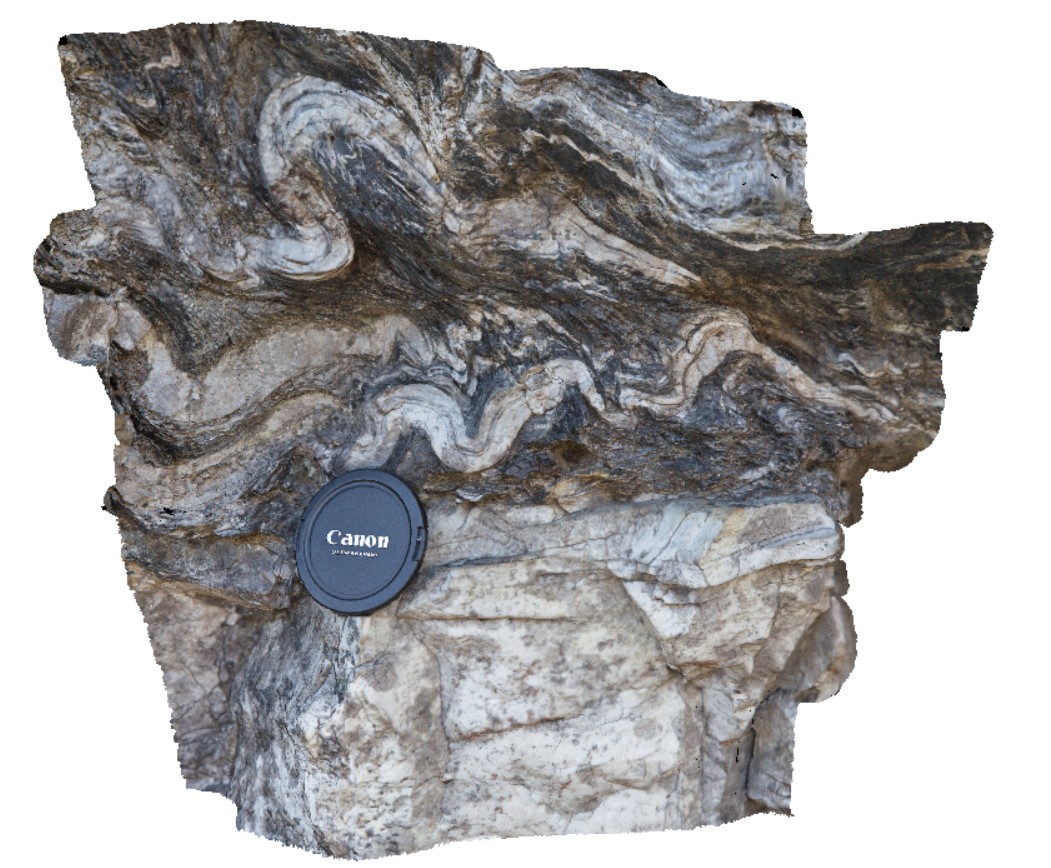
detail of disharmonic folding on the boundary of quartzite unite. Gordons Dam Road. Tasmania. |
0.50 |
-42.73633000000 |
145.97752000000 |
-9999.000 |
disharmonic folding, structure, phyllite |
phyllite |
GordonRd8 Map
 |
0 |
02/29/2016 1:40 p.m. |
3D |
road cutting showing folds in quartzite and phyllite, Gordon Dam road, Tasmania. |
4.00 |
-42.73270000000 |
145.98196000000 |
-9999.000 |
folding, structure, quartzite |
phyllite |
GordonRd9 Map
 |
0 |
02/29/2016 1:41 p.m. |
3D |
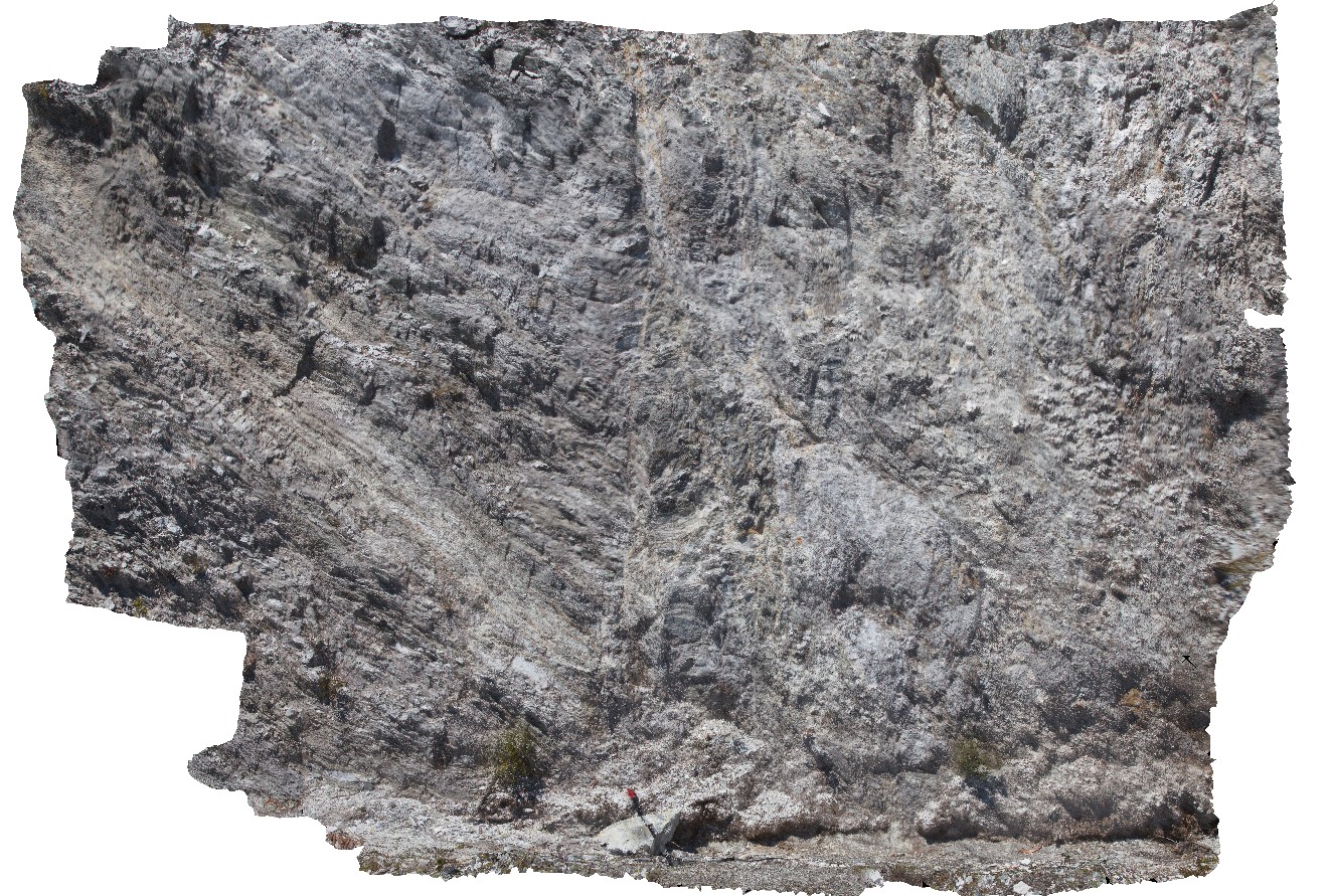
folded and faulted phyllite with crenulation of cleavage. Gordon Dam. Tasmania. |
4.00 |
-42.81057000000 |
146.09669000000 |
-9999.000 |
crenulation cleavage, folding, phyllite, fault, structure |
phyllite |
GordonRdUAV1 Map
 |
20 |
02/23/2016 9:18 a.m. |
UAV |
view of polyharmonic folding quartzite and phyllite beds, Gordon Dam Road, Tasmania. |
6.00 |
-42.81057000000 |
146.09669000000 |
-9999.000 |
polyharmonic folding, quartzite, deformation |
phyllite |
Gosse1 Map
 |
5 |
01/01/9999 midnight |
FSP |
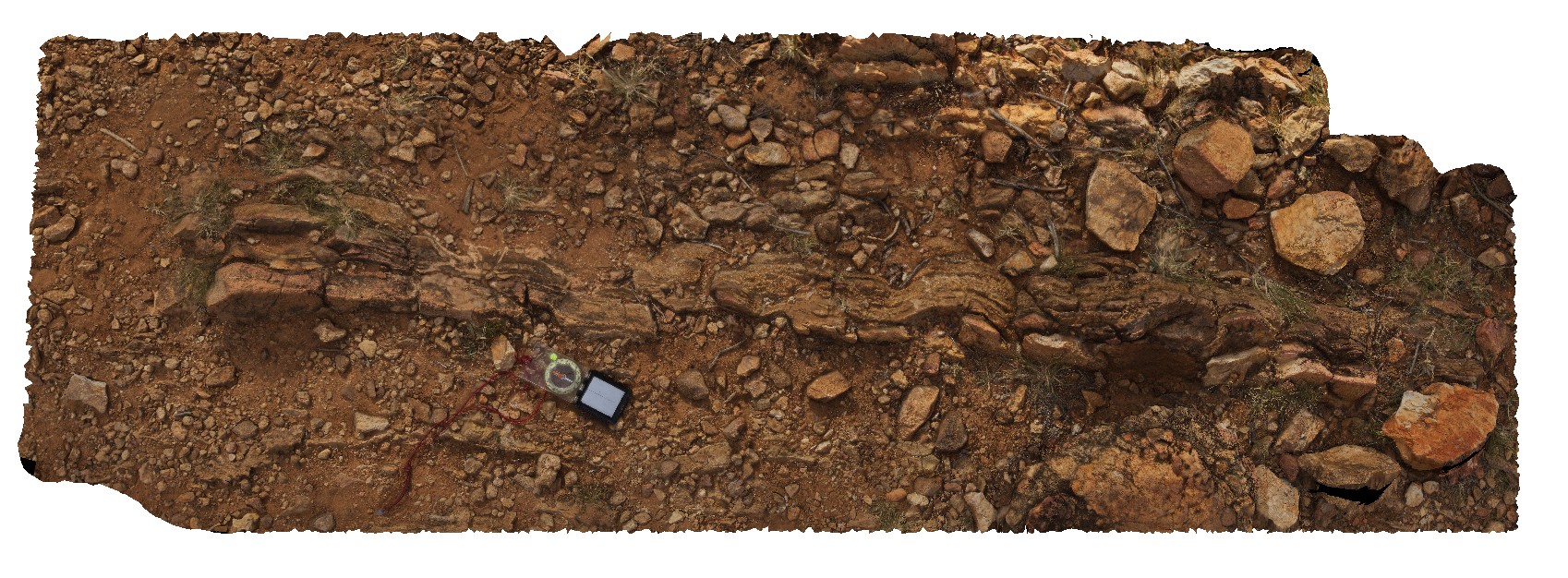
siltstone and thinly bedded sandstone showing possible load and clast sorting features. Gosse Bluff Conservation Reserve. N.T. |
2.20 |
-23.81855800000 |
132.31356200000 |
734.142 |
sedimentology, fold, impact shock, impact load features |
siltstone |
Gosse2 Map
 |
0 |
08/01/2016 10:55 a.m. |
3D |
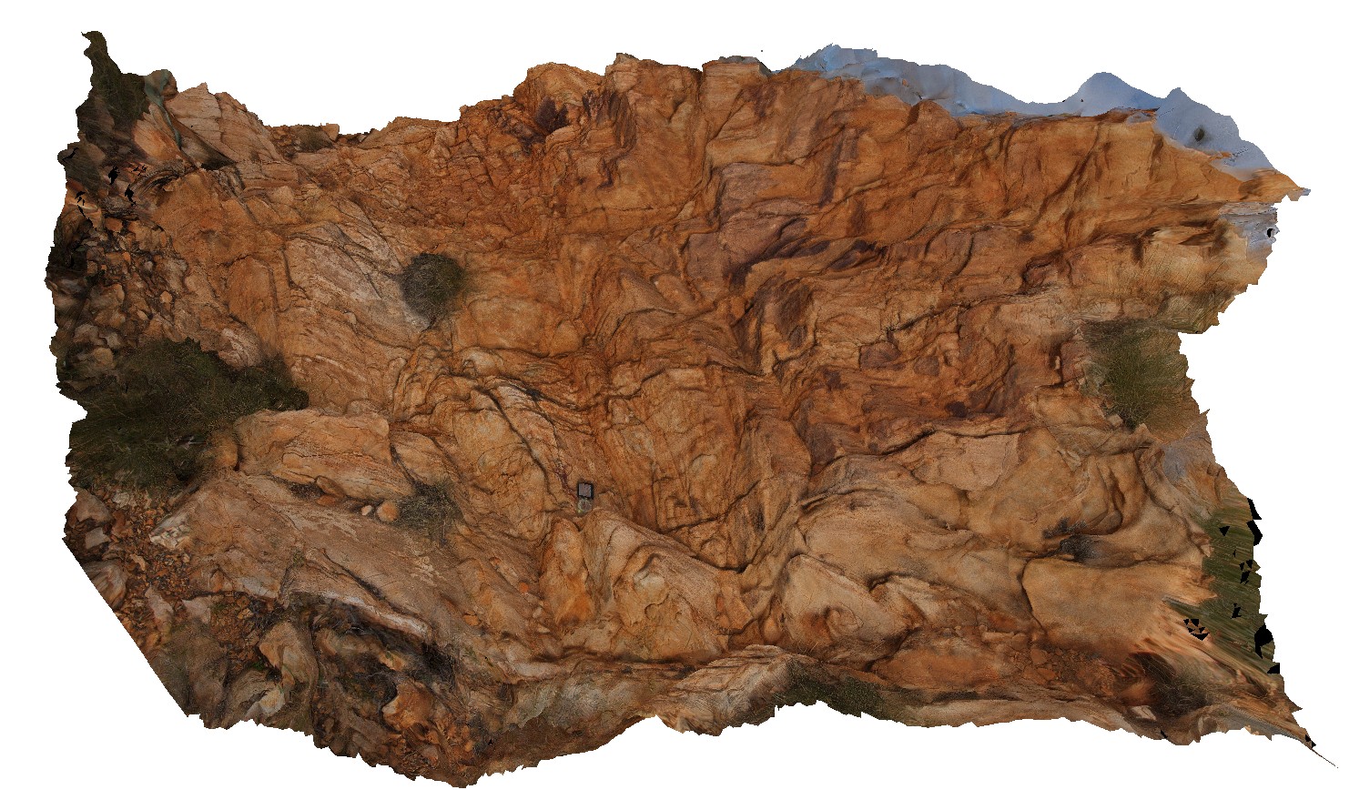
thinly bedded, disrupted, sub-vertical sandstone on hill on the east side of Gosse Bluff. Gosse Bluff Conservation Reserve. N.T. |
3.00 |
-23.81670600000 |
132.31661400000 |
746.476 |
sub-vertical bedding, impact crater, disrupted bedding |
sandstone |
Gosse3 Map
 |
0 |
08/01/2016 11:28 a.m. |
3D |
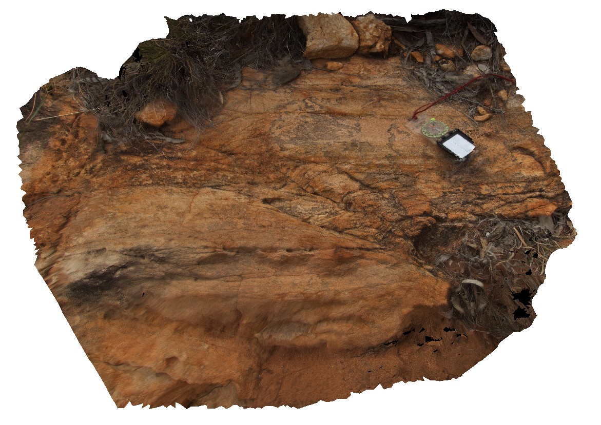
small-scale sinistral shear in sandstone of Gosse Bluff. Gosse Bluff Conservation Reserve. N.T. |
1.00 |
-23.81574900000 |
132.31744700000 |
724.967 |
shear, sinistral, structure, fault |
sandstone |
GosseFSP1 Map
 |
0 |
08/01/2016 10:02 a.m. |
FSP |
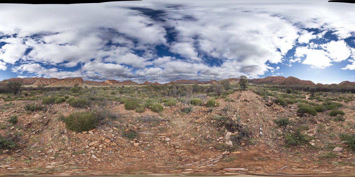
panorama view inside crater at Gosse Bluff, showing sub-vertical strata , heaved up by circa - 140Ma comet impact. Gosse Bluff Conservation Reserve. N.T. |
1000.00 |
-23.81855800000 |
132.31356200000 |
734.142 |
impact crater, strata, crater, Gosse Bluff |
sandstone |
Granville1 Map
 |
0 |
08/09/2016 noon |
3D |
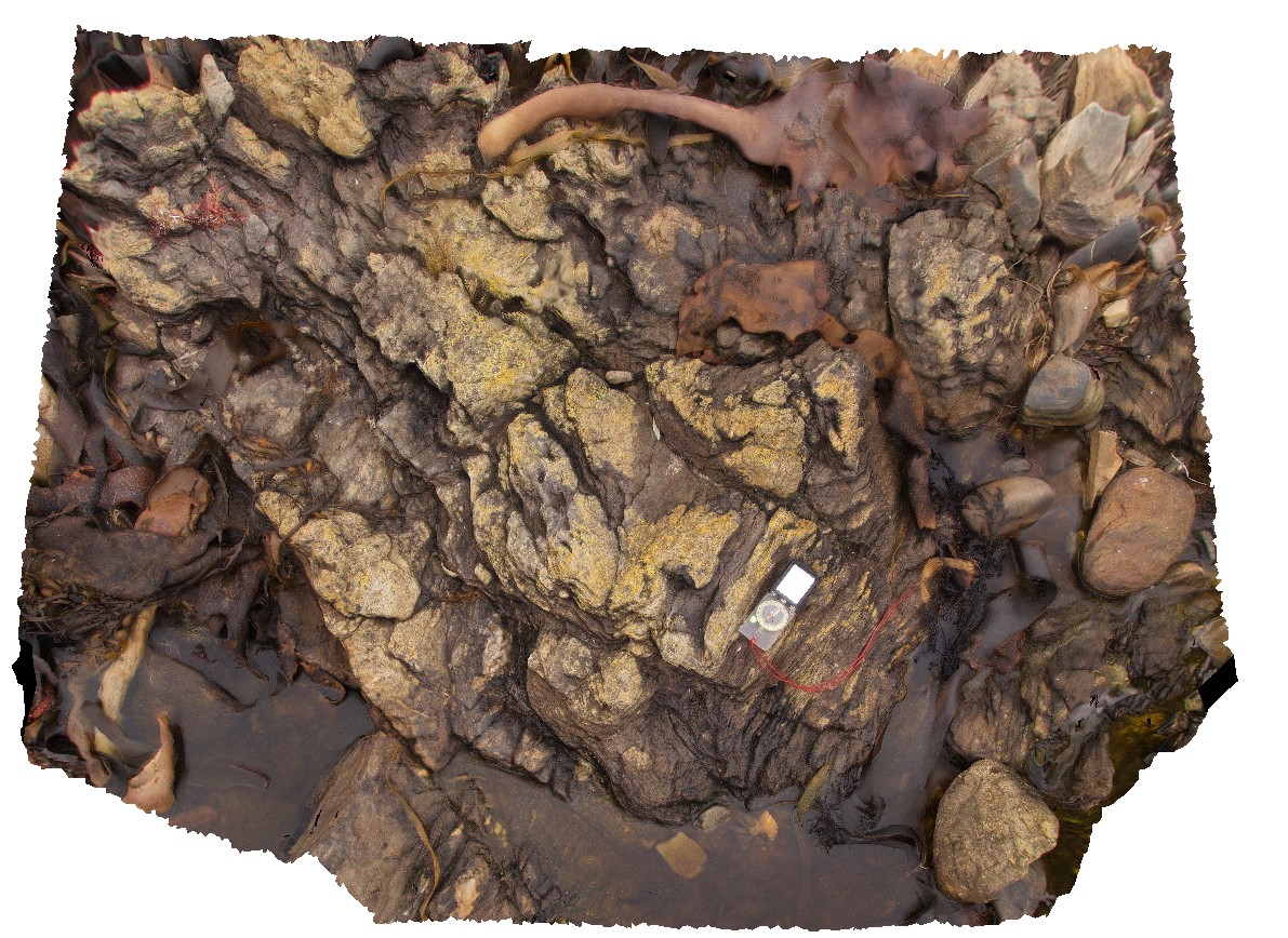
open folds in phyllite of the Oonah Formation. Granville Harbour, West Coast Tasmania. |
1.60 |
-41.80844000000 |
145.03284000000 |
-9999.000 |
open fold, fold, structure, Oonah Formation, phyllite |
phyllite |
Granville10 Map
 |
0 |
08/09/2016 noon |
3D |
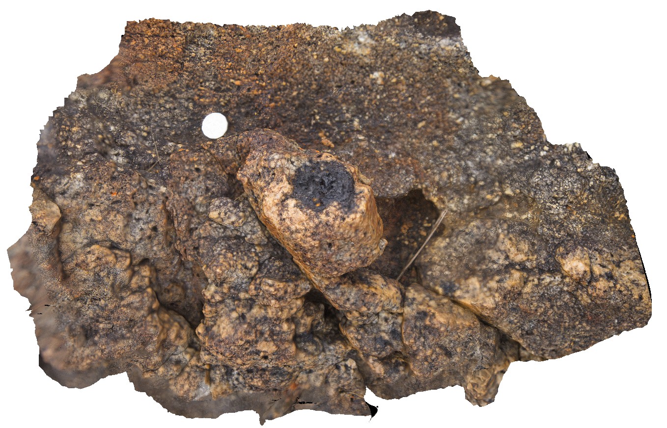
tourmaline ball in quartz vein in granite. Granville Harbour, West Coast Tasmania. |
0.60 |
-41.81134000000 |
145.02841000000 |
-9999.000 |
tourmaline ball, quartz vein |
granite |
Granville2 Map
 |
0 |
08/09/2016 noon |
3D |
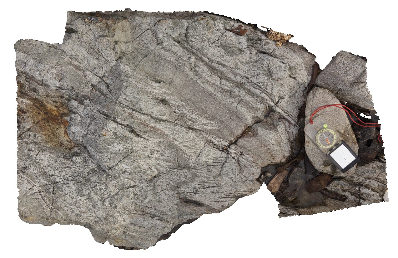
folds in interbedded phyllite and quartzite with axial planar cleavage and cross-cutting crenulation cleavage. Granville Harbour, West Coast Tasmania. |
1.00 |
-41.80755000000 |
145.03352000000 |
-9999.000 |
axial planar cleavage, crenulation cleavage, fold, structure |
quartzite |
Granville3 Map
 |
0 |
08/09/2016 noon |
3D |
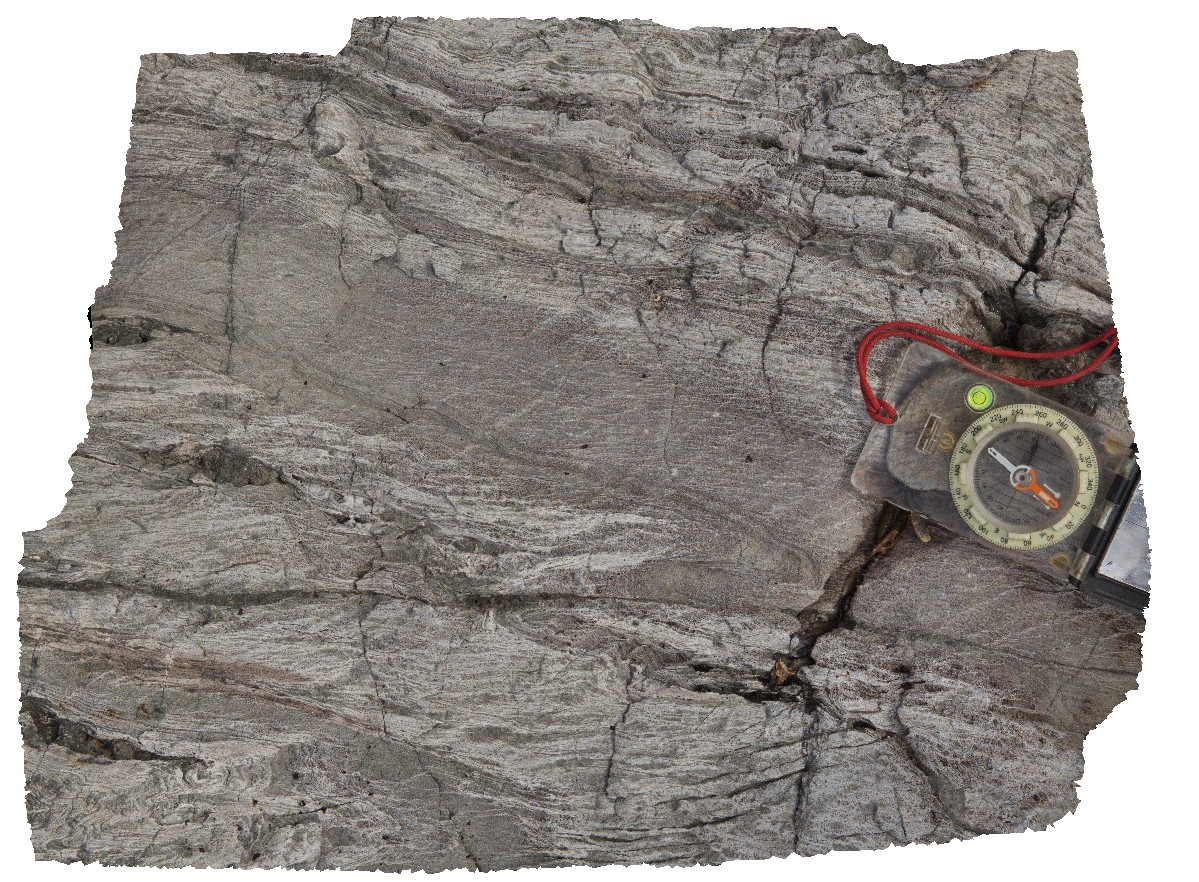
macro view of folds, cleavage and crenulation cleavage in outcrop from site Granville2. Granville Harbour, West Coast Tasmania. |
0.40 |
-41.80755000000 |
145.03352000000 |
-9999.000 |
fold, crenulation cleavage, structure |
quartzite |
Granville4 Map
 |
0 |
08/09/2016 noon |
3D |
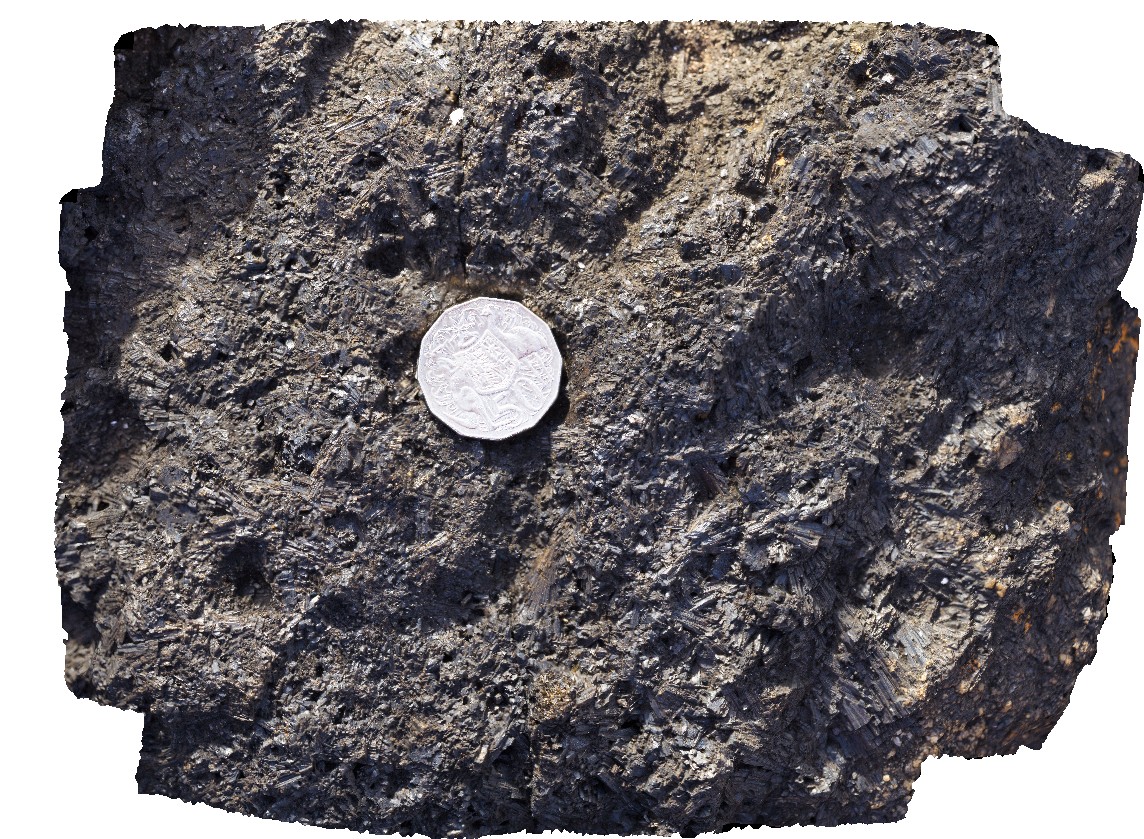
view of tourmaline crystals in cavity in granite. Granville Harbour, West Coast Tasmania. |
0.20 |
-41.81020000000 |
145.02740000000 |
-9999.000 |
tourmaline, crystal, granite |
granite |
Granville5 Map
 |
0 |
08/09/2016 noon |
3D |
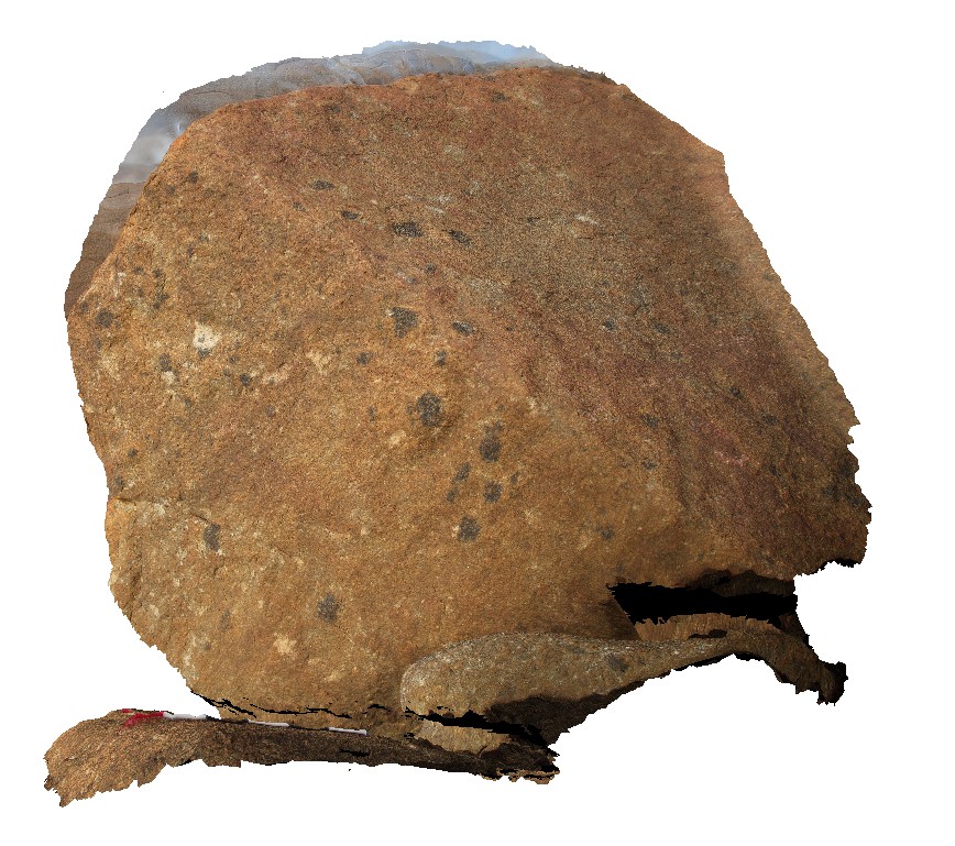
tourmaline blebs in Heemskirk granite. Granville Harbour, West Coast Tasmania. |
3.00 |
-41.81033000000 |
145.02757000000 |
-9999.000 |
tourmaline blebs, mineralogy |
granite |
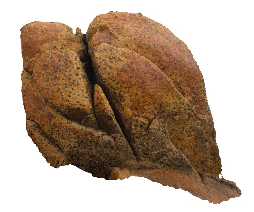
Granville6 Map
 |
0 |
08/09/2016 noon |
3D |
tourmaline blebs in 'white' Heemskirk Granite. Granville Harbour, West Coast Tasmania. |
1.50 |
-41.81115000000 |
145.02753000000 |
-9999.000 |
tourmaline bleb, mineralogy |
granite |
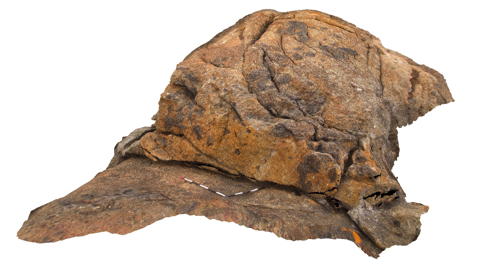
Granville7 Map
 |
0 |
08/09/2016 noon |
3D |
irregular tourmaline aggregates in porphyritic granite. Granville Harbour, West Coast Tasmania. |
4.00 |
-41.81117000000 |
145.02811000000 |
-9999.000 |
porphyritic granite, tourmaline aggregates |
granite |
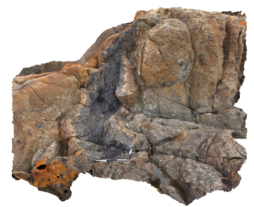
Granville8 Map
 |
0 |
08/09/2016 noon |
3D |
tourmaline 'pipe' / zone in porphyritic granite with quartz selvage. Granville Harbour, West Coast Tasmania. |
2.80 |
-41.81120000000 |
145.02811000000 |
-9999.000 |
tourmaline, mineralogy |
granite |


