Ironstone1 Map
 |
5 |
01/01/9999 midnight |
3D |
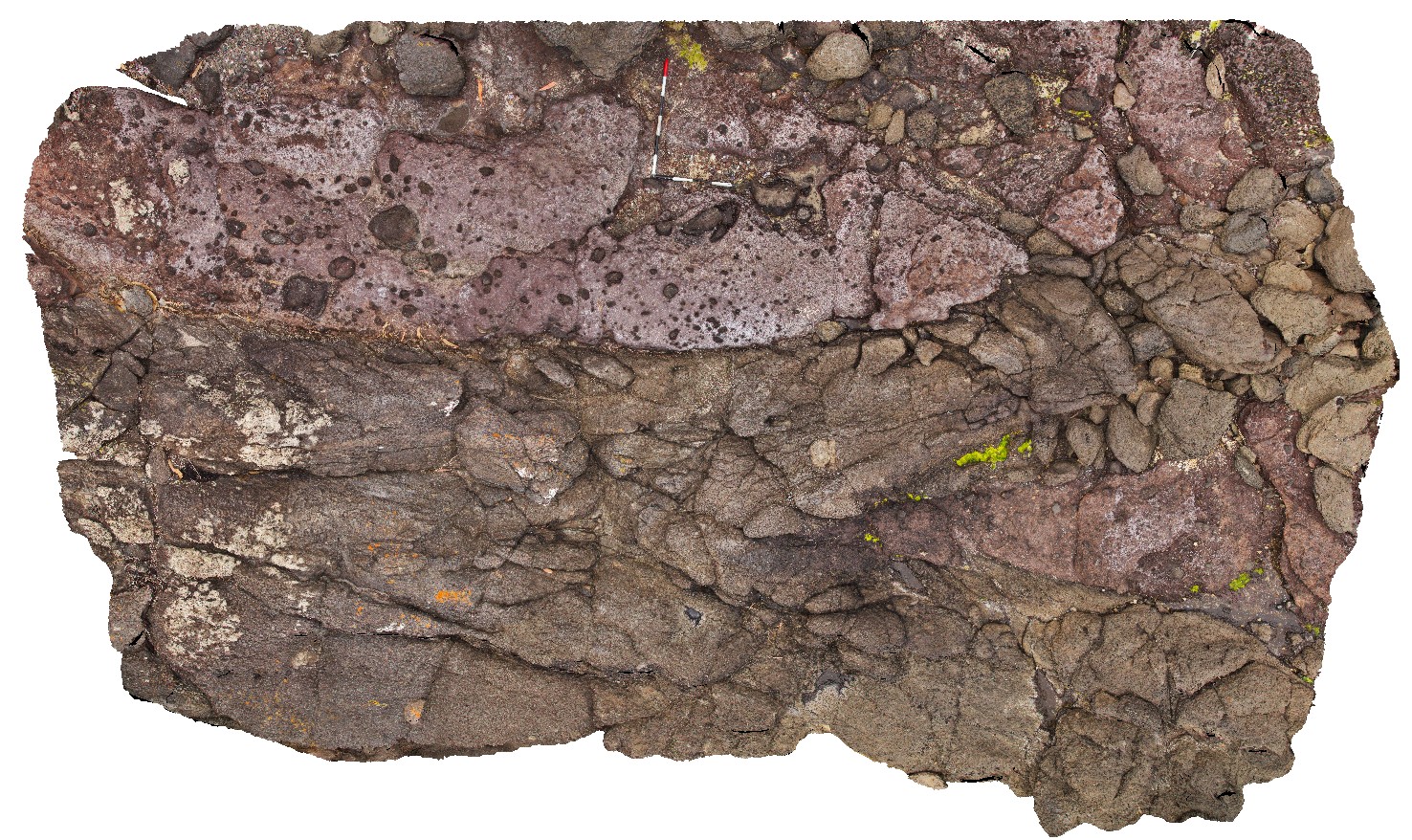
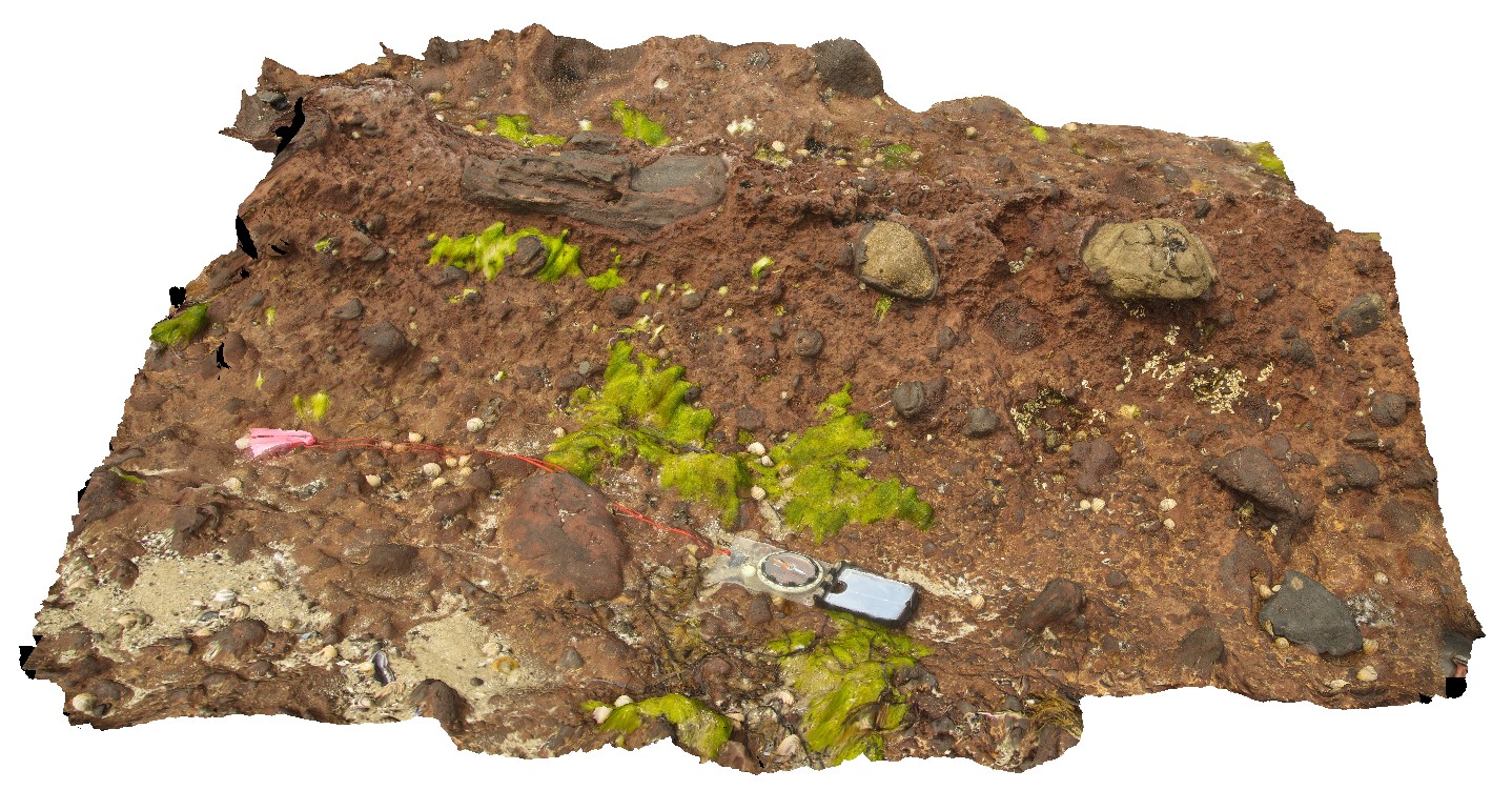
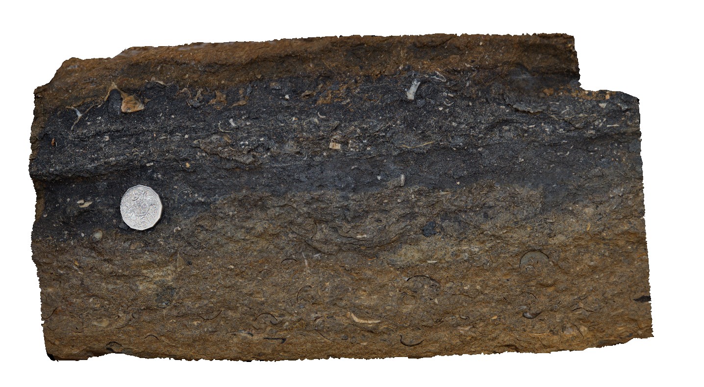
contact between basalt and overlying pyroclastic with bombs up to 0.3m across. Ironstone Point, Tas. |
0.00 |
-42.97108000000 |
147.73396000000 |
-9999.000 |
basalt, pyroclastics, volcanics |
basalt |
Ironstone2 Map
 |
5 |
01/01/9999 midnight |
3D |
detail of basalt contact from site IronstonePt1, with overlying pyroclastics. Ironstone Point, Tas. |
0.00 |
-42.97108000000 |
147.73396000000 |
-9999.000 |
basalt, pyroclastic, volcanics |
basalt |
Ironstone3 Map
 |
5 |
01/01/9999 midnight |
3D |
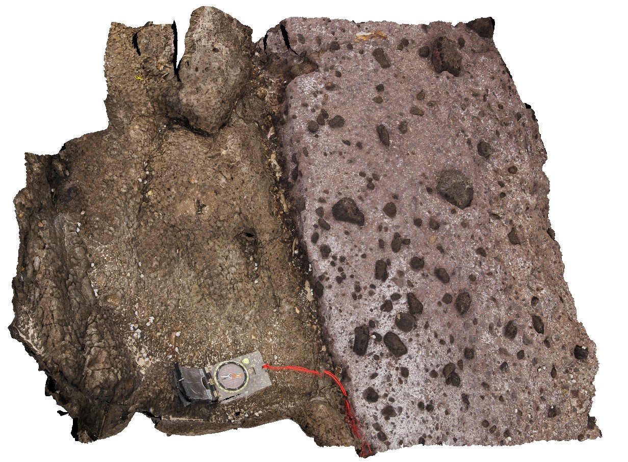
contact between basalt and underlying volcanic breccia. Ironstone Point, Tas. |
0.00 |
-42.97063000000 |
147.73338000000 |
-9999.000 |
basalt lava, volcanic breccia, volcanics |
basalt |
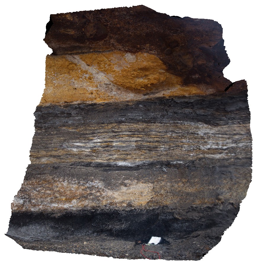
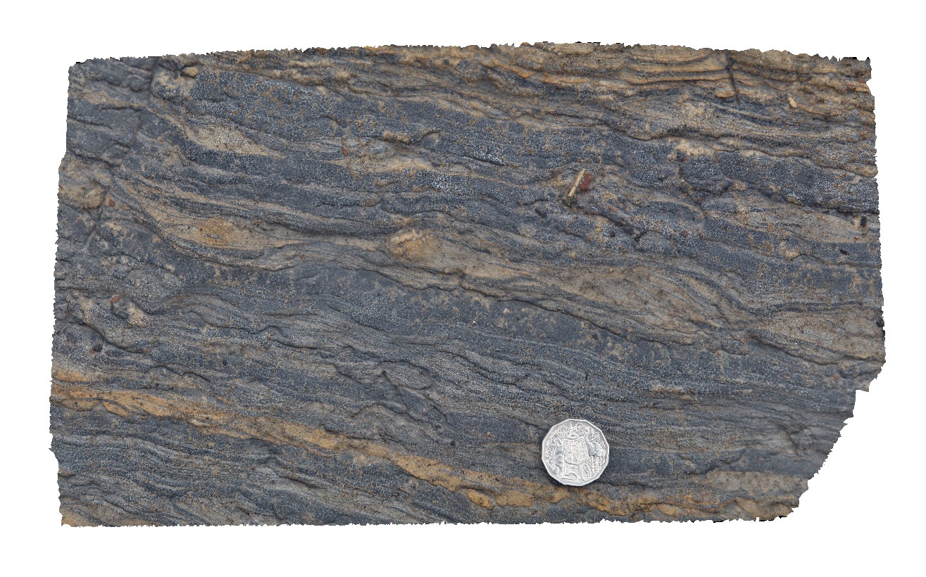
Ironstone4 Map
 |
5 |
01/01/9999 midnight |
3D |
detail of contact between basalt and underlying volcanic breccia from site IronstonePt3. Ironstone Point, Tas. |
0.00 |
-42.97063000000 |
147.73338000000 |
-9999.000 |
basalt, lava, volcanics, Tertiary basalt, geological contact |
basalt |
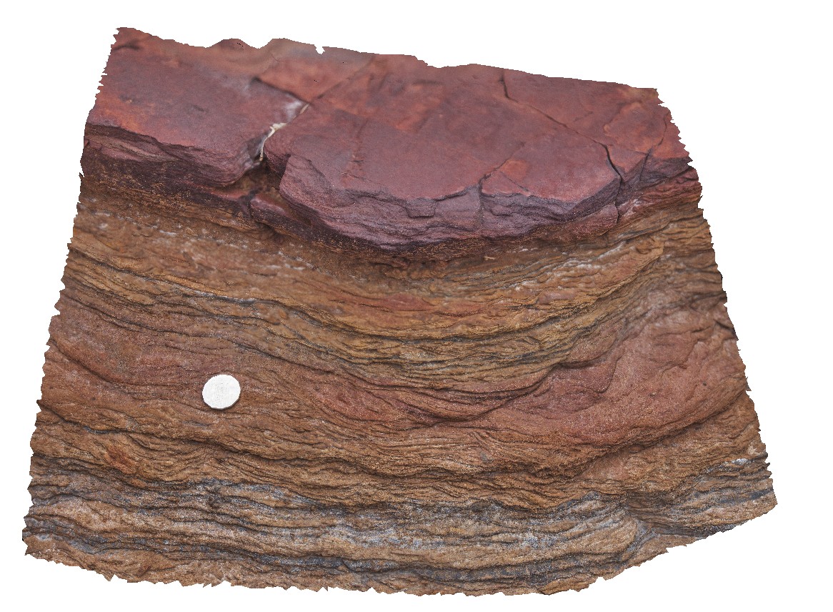
Ironstone5 Map
 |
5 |
01/01/9999 midnight |
3D |
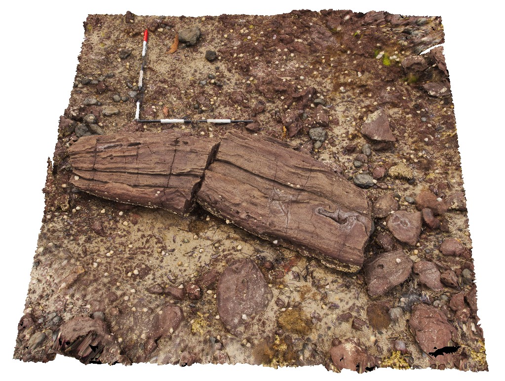
giant bomb in pyroclastic deposits. Ironstone Point, Tas. |
0.00 |
-42.97054000000 |
147.73294000000 |
-9999.000 |
pyroclastic, basalt, volcanics, bomb, Tertiary basalt |
basalt |
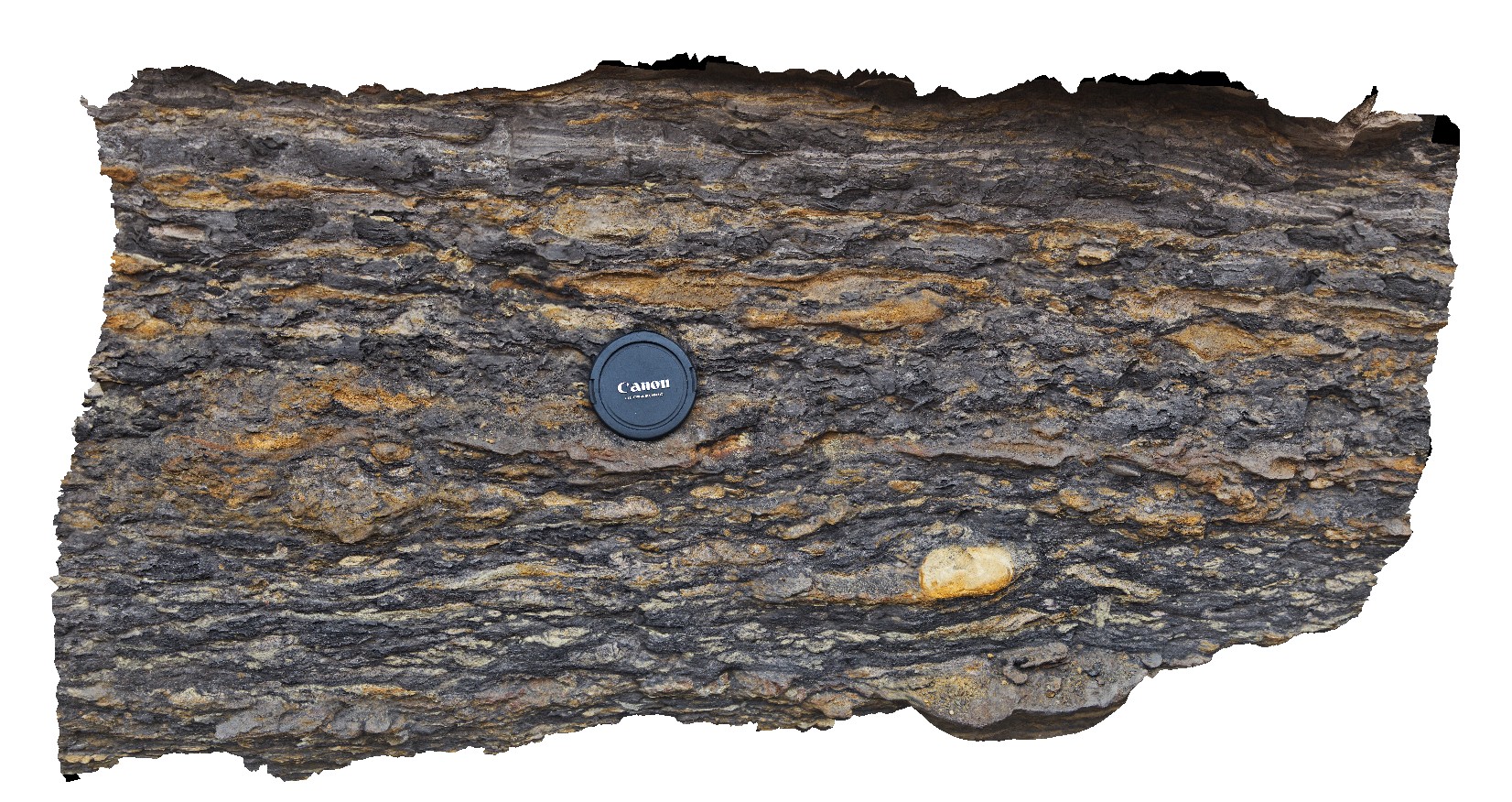
Ironstone6 Map
 |
5 |
01/01/9999 midnight |
3D |
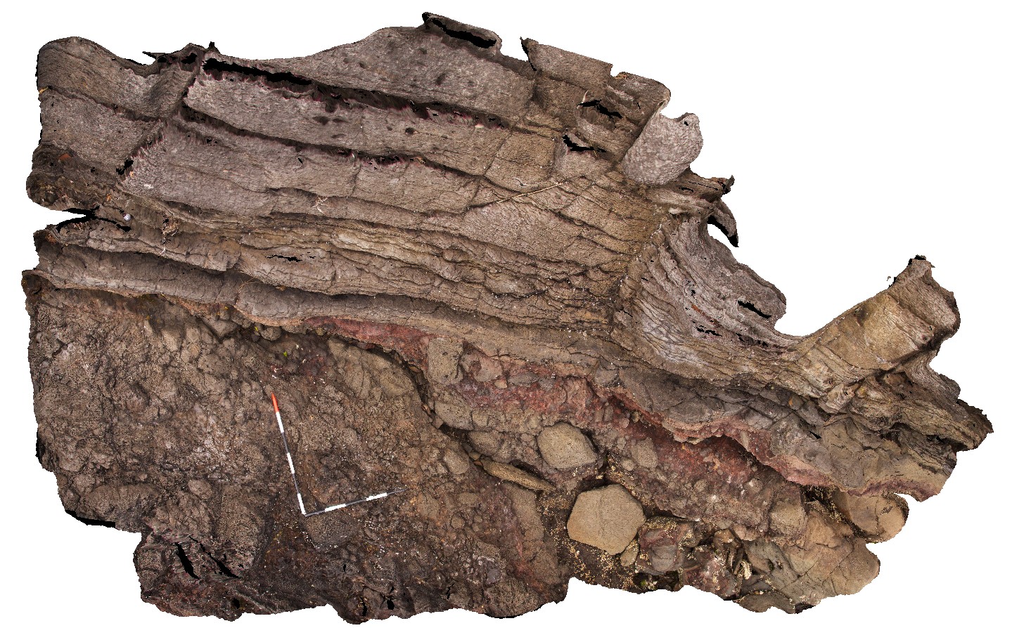
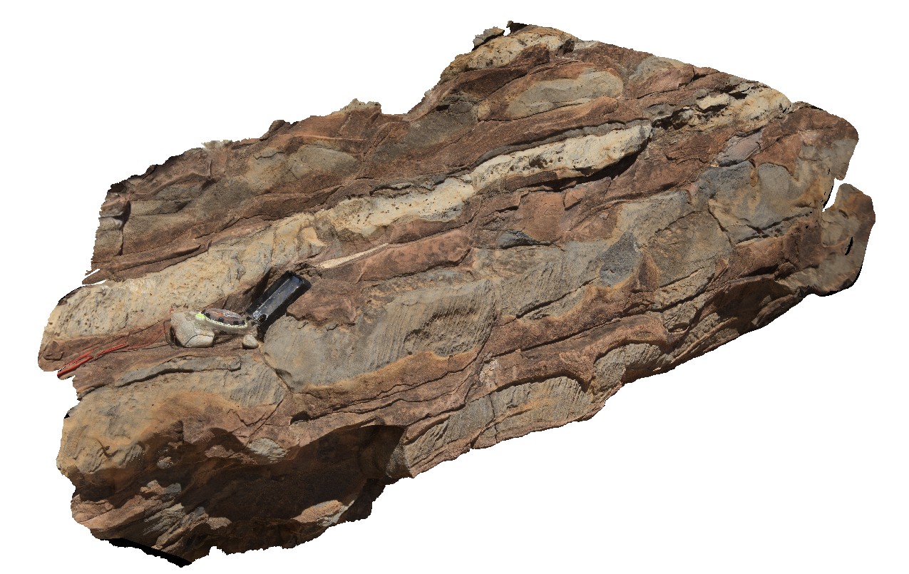
breccia with coated clasts of dolerite and Triassic sandstone. Ironstone Point, Tas. |
0.00 |
-42.97052000000 |
147.73407000000 |
-9999.000 |
breccia, country rock, xenoliths |
basalt |
Ironstone7 Map
 |
5 |
01/01/9999 midnight |
3D |
large, flow-banded bombs in pyroclastics. Ironstone Point, Tas. |
0.00 |
-42.97071000000 |
147.73529000000 |
-9999.000 |
flow-banded, bomb, pyroclastics, basalt, volcanic |
basalt |
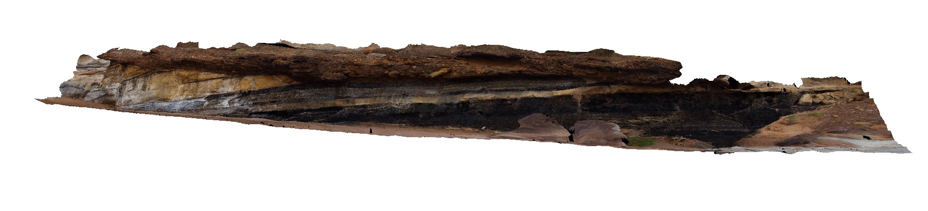
IronstonePtUAV1 Map
 |
20 |
01/01/9999 midnight |
UAV |
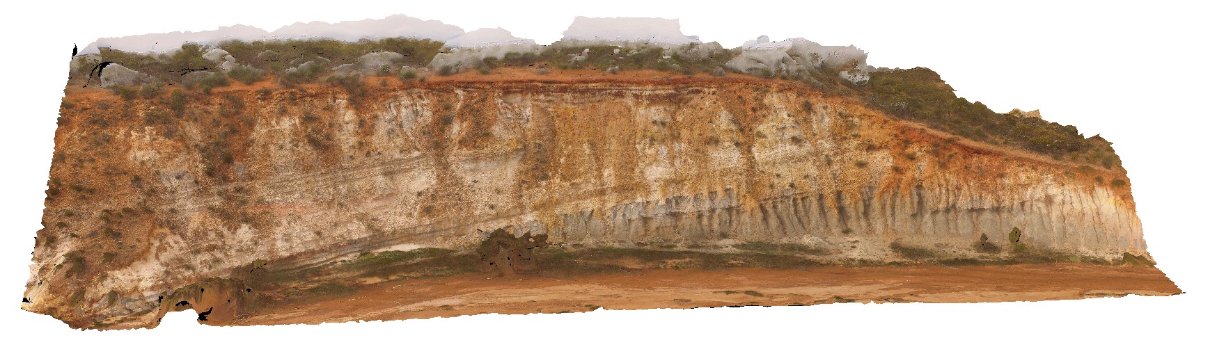
aerial view around Ironstone Point and basaltic flows and associated volcanics. Ironstone Point. Tasmania. |
200.00 |
-42.97061200000 |
147.73363000000 |
35.300 |
basalt flow, basalt, volcanics |
basalt |
IrwinRiver1 Map
 |
0 |
05/19/2016 noon |
3D |
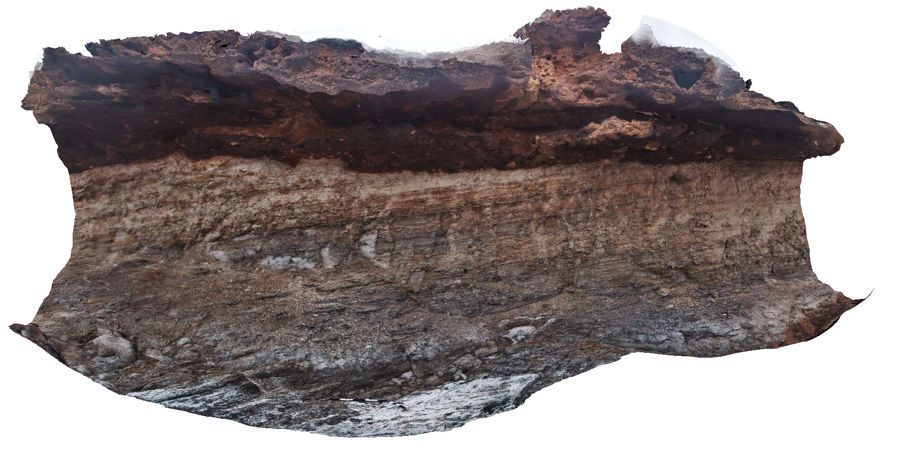
'floodplain' sediments of the Irwin River Coal Measures conformably overlain by ferricrete. Coal seam Conservation Park, Irwin River, W.A. |
5.50 |
-28.95838000000 |
115.55332000000 |
-9999.000 |
coal measures, flood plain sediments, sedimentology, geological conformity |
coal measures |
IrwinRiver10 Map
 |
0 |
05/19/2016 noon |
3D |
brachiopod, crinoid and gastropod fossils in thin limestone layer in sandstone. Coal seam Conservation Park, Irwin River, W.A. |
0.60 |
-28.94323000000 |
115.54694000000 |
-9999.000 |
brachiopod, crinoid, gastropod, fossil, palaeontology |
sandstone |
IrwinRiver11 Map
 |
0 |
05/19/2016 noon |
3D |
gently dipping coal seam and associated floodplain strata unconformably overlain by Quaternary ferricrete. Coal seam Conservation Park, Irwin River, W.A. |
17.00 |
-28.93731000000 |
115.55065000000 |
-9999.000 |
floodplain strata, coal measures, ferricrete, conformity |
sandstone |
IrwinRiver12 Map
 |
0 |
05/19/2016 noon |
3D |
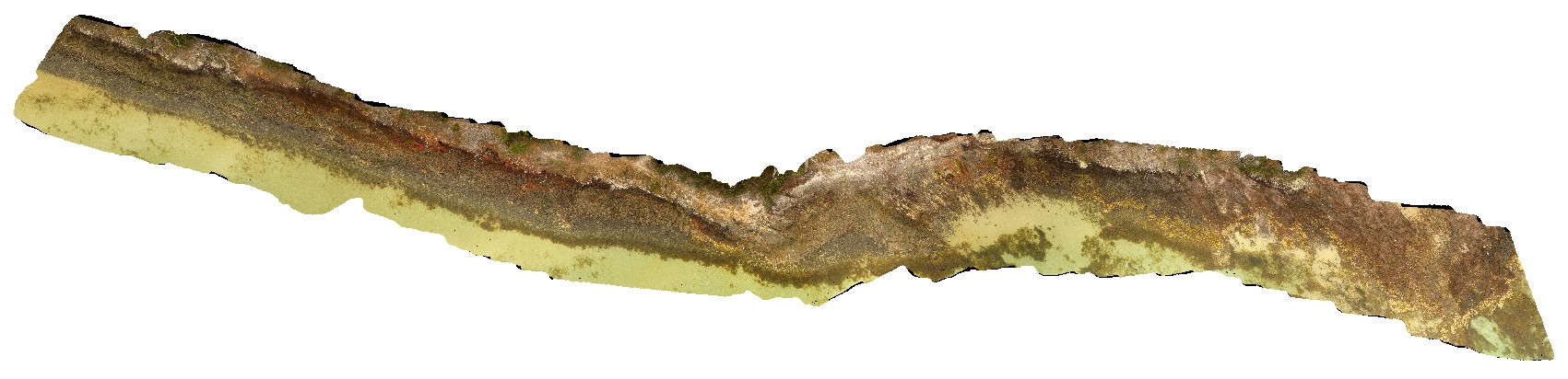
detailed section from the top of a coal seam, showing rippled laminations. Coal seam Conservation Park, Irwin River, W.A. |
1.50 |
-28.93731000000 |
115.55065000000 |
-9999.000 |
coal measure, stratigraphical |
coal seam |
IrwinRiver2 Map
 |
0 |
05/19/2016 noon |
3D |
ripple cross-laminated siltstone / fine sandstone. Coal seam Conservation Park, Irwin River, W.A. |
1.20 |
-28.95853000000 |
115.55456000000 |
-9999.000 |
coal measures, ripple marks |
siltstone |
IrwinRiver3 Map
 |
0 |
05/19/2016 noon |
3D |
detail of ripple cross-laminations at site IrwinRiver2. Coal seam Conservation Park, Irwin River, W.A. |
0.60 |
-28.95853000000 |
115.55456000000 |
-9999.000 |
ripple cross-laminations, sedimentology |
siltstone |
IrwinRiver4 Map
 |
0 |
05/19/2016 noon |
3D |
ripple cross-laminations in fine grained sandstone. Coal seam Conservation Park, Irwin River, W.A. |
0.45 |
-28.95851000000 |
115.55460000000 |
-9999.000 |
cross-laminations, sedimentology, sandstone |
sandstone |
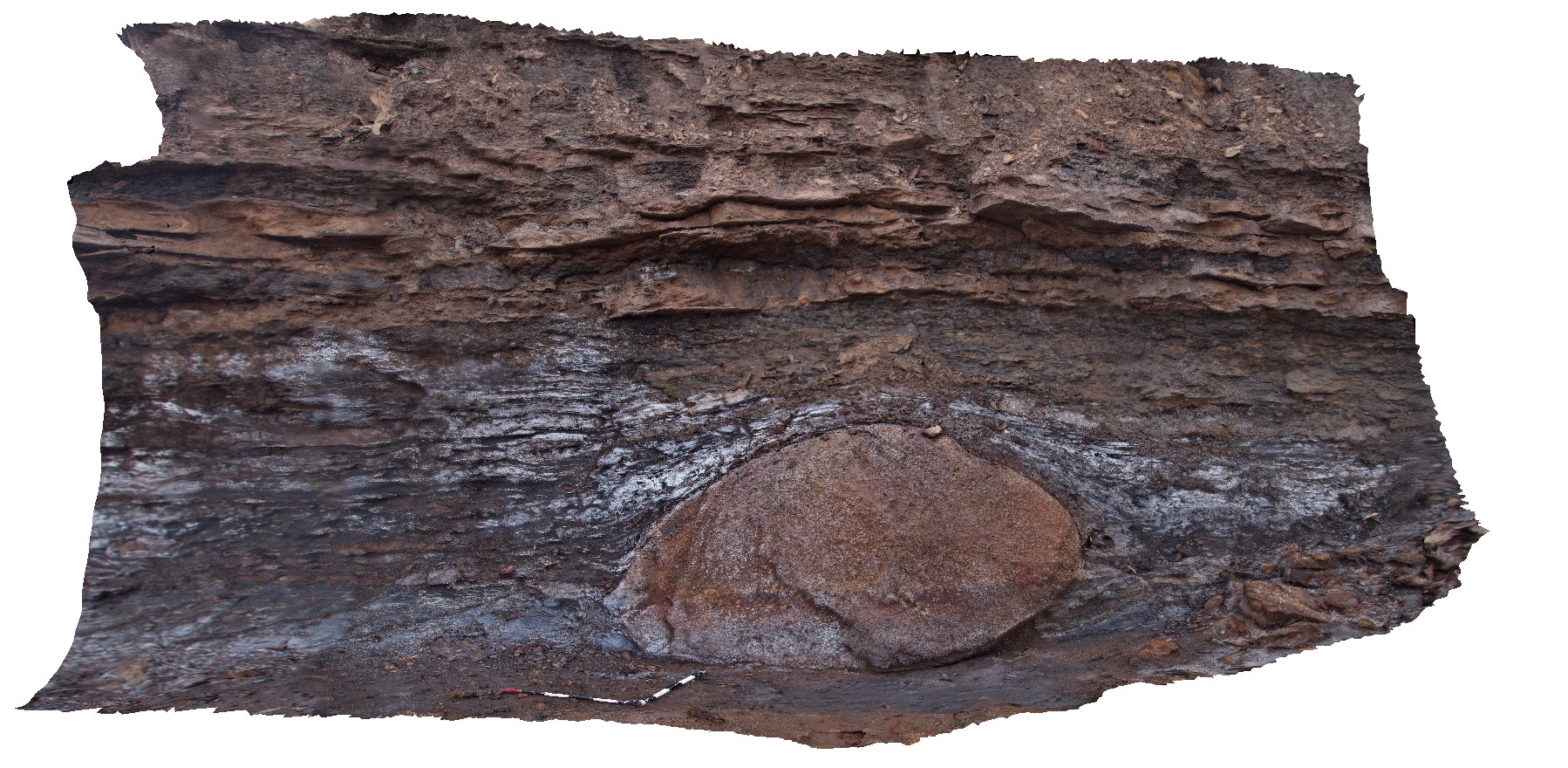
IrwinRiver5 Map
 |
0 |
05/19/2016 noon |
3D |
large granite dropstone in thinly bedded carbonaceous sediments. Coal seam Conservation Park, Irwin River, W.A. |
0.00 |
-28.95977000000 |
115.55698000000 |
-9999.000 |
dropstone, sedimentology |
sandstone |
IrwinRiver6 Map
 |
0 |
05/19/2016 noon |
3D |
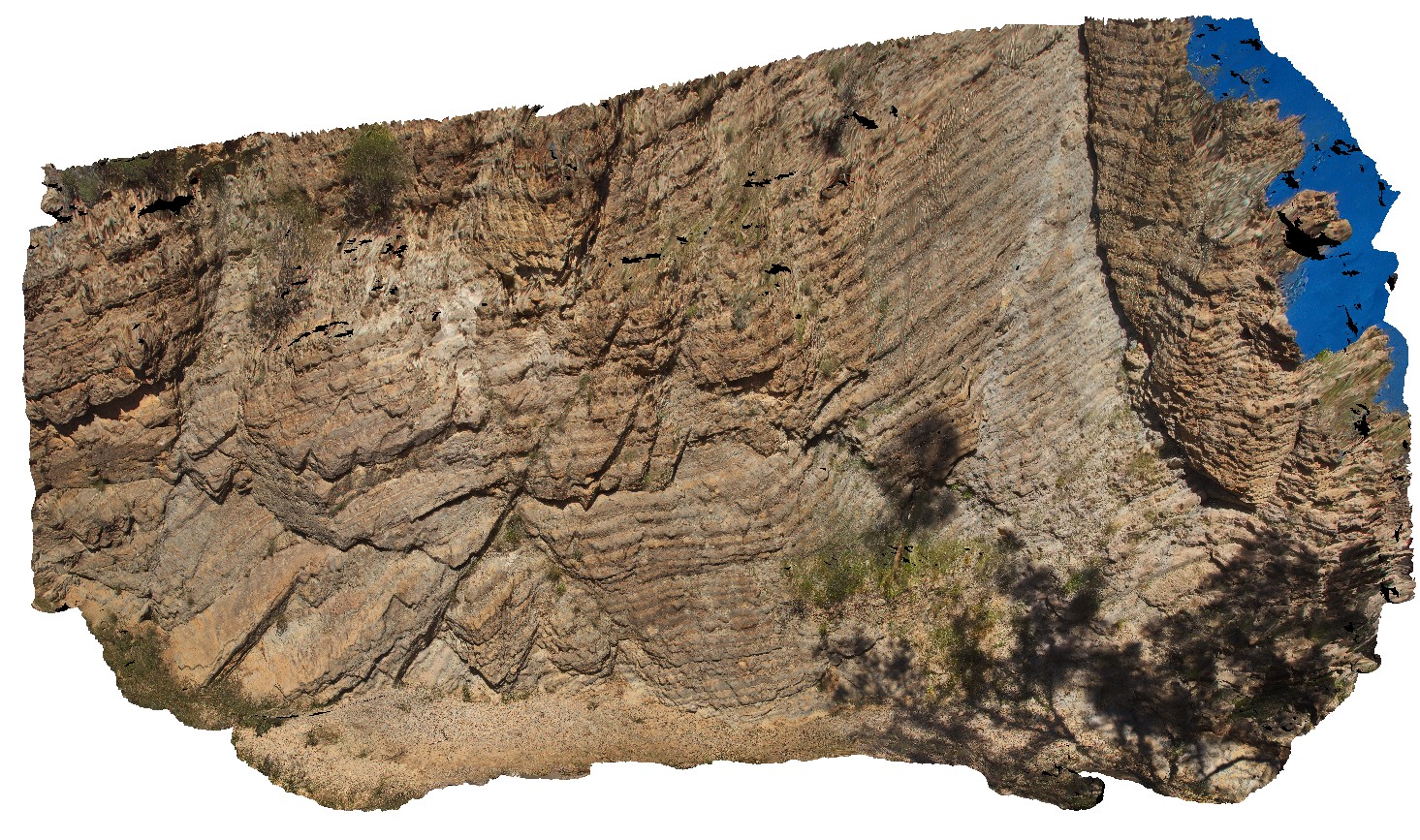
overview of large, gently dipping sandstone outcrop. Coal seam Conservation Park, Irwin River, W.A. |
22.00 |
-28.95955000000 |
115.55677000000 |
-9999.000 |
sandstone, dropstone |
sandstone |
IrwinRiver7 Map
 |
0 |
05/19/2016 noon |
3D |
disrupted sandstone lenses in carbonaceous siltstone. Gravitational instability features and a dropstone. Coal seam Conservation Park, Irwin River, W.A. |
0.80 |
-28.95955000000 |
115.55677000000 |
-9999.000 |
disrupted bedding, siltstone, sedimentology, dropstone |
siltstone |
IrwinRiver8 Map
 |
0 |
05/19/2016 noon |
3D |
soft sediment deformation with disrupted sandstone layers in siltstone. Coal seam Conservation Park, Irwin River, W.A. |
4.00 |
-28.95909000000 |
115.55644000000 |
-9999.000 |
soft sediment deformation, sedimentology |
siltstone |
IrwinRiver9 Map
 |
0 |
05/19/2016 noon |
3D |
detail of site Irwinriver8, showing disaggregated and folded sandstone layers. Coal seam Conservation Park, Irwin River, W.A. |
1.00 |
-28.95909000000 |
115.55644000000 |
-9999.000 |
soft sediment deformation, sedimentology |
siltstone |
IrwinRiverUAV1 Map
 |
0 |
05/19/2016 noon |
UAV |
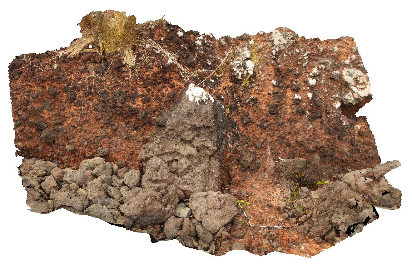
overview of the gently dipping 'High Cliff' exposure. Permian unconformably overlain by Mesozoic, unconformably overlain by Quaternary sediments. Coal seam Conservation Park, Irwin River, W.A. |
50.00 |
-28.94557300000 |
115.54818400000 |
-9999.000 |
Permian unconformity, High Cliff exposure |
sandstone, ferricrete, siltstone |
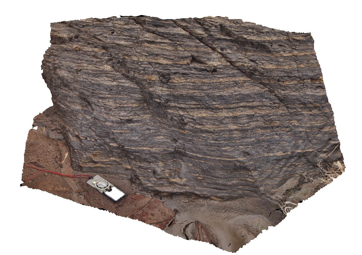
Italowie1 Map
 |
5 |
01/01/9999 midnight |
3D |
detail of carbonate layers with limestone and dolomite. Hematite psuedomorphs after pyrite in light coloured layers. Adelaidean domain, Italowie, S.A. |
1.30 |
-30.59696000000 |
139.05978000000 |
-9999.000 |
carbonate, dolomite, psuedomorph |
limestone |
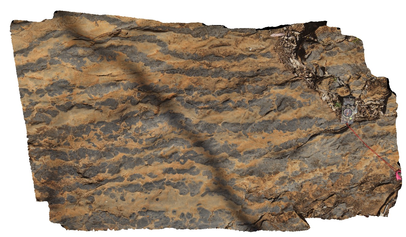
Italowie2 Map
 |
5 |
01/01/9999 midnight |
3D |
general view of layered and dipping carbonate sequence with thinly bedded limestone and dolomite. Adelaidean domain, Italowie, S.A. |
6.00 |
-30.59690000000 |
139.05988000000 |
-9999.000 |
carbonates, Adelaidean domain |
carbonate |
Italowie3 Map
 |
5 |
01/01/9999 midnight |
3D |
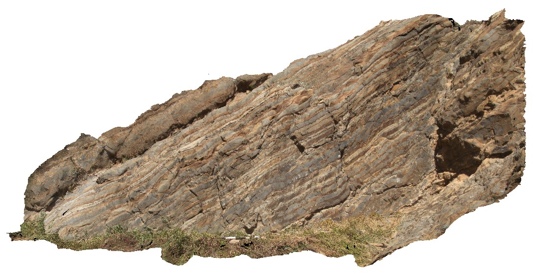
large-scale view of the carbonate outcrop, showing med-thickly bedded limestone and dolomite with open folding. Adelaidean domain, Italowie, S.A. |
20.00 |
-30.59710000000 |
139.05960000000 |
-9999.000 |
fold, structure, carbonates, open fold |
carbonate |
Italowie4 Map
 |
5 |
01/01/9999 midnight |
3D |
dolomite replacement textures in limestone. Adelaidean domain, Italowie, S.A. |
2.00 |
-30.59956000000 |
139.08430000000 |
-9999.000 |
dolomite, replacement textures, limestone, Adelaidean domain |
carbonate |